About this place
Cascade du Ray-Pic is one of Ardèche's signature waterfalls, tumbling over columns of dark basalt deep inside the Monts d'Ardèche Regional Nature Park. It sits within the commune of Péreyres, at an elevation just above 1,000 metres, and has been officially protected as a classified natural site since 1931.
Why is it built from basalt columns?
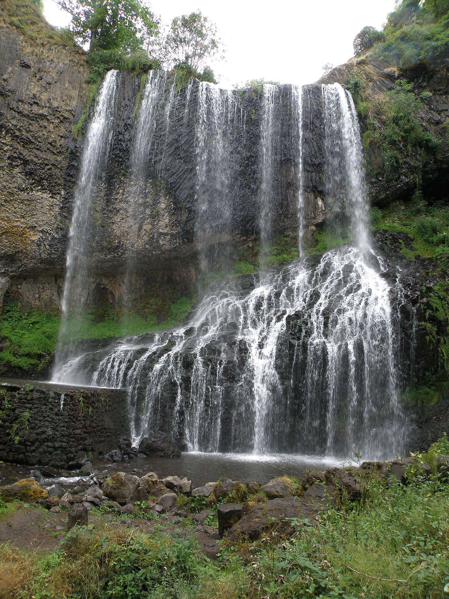
The waterfall owes its striking look to volcanic geology. Ancient lava flows cooled here and cracked into tall, roughly hexagonal basalt pillars — the "orgues basaltiques," or basalt organs, that give the site its name. Water drops alongside and over these columns, creating the illusion of a second, stony cascade running parallel to the water itself. Geologists also note peridotite inclusions within the basalt, fragments of rock carried up from deep within the Earth's mantle, which add extra interest for anyone curious about the region's volcanic past.
How tall is the waterfall?
Ray-Pic is actually formed by two drops. The upper one sits further back and isn't visible from the main viewpoints; it accounts for a significant additional height above the section visitors actually see. The lower and main drop, the one photographed from the viewing terraces, falls roughly 35 metres. Together the two sections make Ray-Pic one of the more dramatic waterfalls in the Ardèche gorges.
How do you get there, and what is the trail like?
The hike starts from a signposted parking area on the D215 road near Péreyres, close to the Ray-Pic bridge, a few kilometres past the village. Parking is free. From there, a well-marked and secured loop trail leads visitors through the site, passing three separate viewpoints (belvédères) that each frame the gorge and the falls differently. The full loop covers about 1.5 km and takes around 45 minutes, with only a modest elevation gain of roughly 50 metres. A shorter branch, about 15 minutes each way, leads to a set of wooden viewing terraces built directly facing the cascade. That shorter path is not accessible to wheelchairs or strollers because of uneven ground and steps. Swimming in the pools below the falls is strictly forbidden, largely due to strong currents and the risk of rockfall.
What should visitors know before going?
Spring and early summer bring the highest water levels and the most dramatic flow; by late summer the cascade can run noticeably thinner. Sturdy walking shoes are worth packing, since sections of the path cross uneven, rocky ground. The site draws large numbers of visitors during the summer holidays, so arriving early in the day is the easiest way to enjoy the gorge without the crowds.
Frequently asked questions
How long does it take to reach the waterfall? The full loop past all three viewpoints takes about 45 minutes; the nearest wooden terraces facing the falls can be reached in around 15 minutes.
Can you swim at Cascade du Ray-Pic? No. Swimming is banned for safety reasons — the current can be strong and the rock underfoot is uneven and slippery.
Is the trail suitable for children? Yes, the loop is easy and well secured, though care is needed near the cliff edges and viewing terraces with young children.
Is the site accessible for visitors with reduced mobility? Not fully — uneven terrain and steps on the path to the viewing terraces rule out wheelchair and stroller access.
Where does the name "basalt organs" come from? It refers to the shape of the rock columns, which resemble organ pipes. They formed as volcanic lava cooled slowly and cracked along regular, roughly hexagonal lines.
Nearby places

Earn badges for the places you visit
Download NextOnTrip, discover new places and check off your trails.