Monuments in Portugal
A guide to 277 Monuments in Portugal — with descriptions, photos and traveler visits from the NextOnTrip community. Locations spread across 138 cities and towns. Most visited by the community: Casa do Curro, Fábrica da Pólvora de Barcarena, Villa Romana de Rio Maior.
-
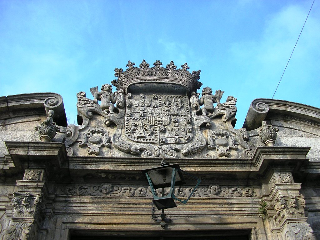
Quinta da Prelada
Quinta da Prelada is a former noble summer estate in Porto, Portugal, in the western part of the city (coordinates 41.174 N, 8.631 W). Today it combines a historic manor, a garden and a cultural space that houses the Historical Archive of the Misericórdia of Porto. What is Quinta da Prelada? In Portugal a "quinta" is a country estate with a residence. The so-called "quintas de recreio" served wealthy families as summer homes and places of leisure. Prelada is regarded as one of the most expressive examples of the type in Porto. For centuries it belonged to the Noronha e Meneses family. Who built it, and when? The manor and gardens are said to have been commissioned by António de Noronha de Mesquita e Melo, a nobleman of the royal household. The design is linked to Nicolau Nasoni (1691–1773), the Italian architect who shaped Porto's baroque look. House and estate were completed around 1758, and the sculptural work in the gardens is dated between 1743 and 1758. What does the garden look like? Nasoni laid out a grand landscape scheme organised along a single axis, blending a formal French garden with romantic garden features. The character of the place comes from: obelisks and pyramids, water cascades, mazes, a large lake, sculpture from the mid-18th century. The estate impresses by its scale, and stands apart from other quintas in the city thanks to this variety of features. How did the estate change over time? Until the early 20th century the property stayed with the Noronha Menezes family. In 1903 the last owner, Francisco de Noronha Menezes, donated it to the Misericórdia of Porto, the city's charitable brotherhood (Santa Casa da Misericórdia). Over the following decades the manor served several social purposes: a convalescent hospital, a rehabilitation centre for people with physical disabilities, and later a care home for the elderly. It is now a cultural space and home to the Misericórdia's historical archive. In 1961 a campsite opened on part of the grounds and operated for 45 years. A portion of the former land, including the Mata da Prelada woodland, became a city park in 1991, designed by Sidónio Pardal. What to know before visiting Visits to the house and garden are sometimes organised as part of events and tours run by city cultural institutions, so check current dates with the Misericórdia of Porto or the city museum before you go. The neighbouring city park, by contrast, is open for walks all year round. Frequently asked questions Who designed Quinta da Prelada? The design is linked to Nicolau Nasoni, and construction was commissioned by António de Noronha de Mesquita e Melo. It was completed around 1758. Who owns the estate today? Since 1903 the Misericórdia of Porto, which received it as a gift from the last private owner. Is there a park on the former estate? Yes. Part of the land, including Mata da Prelada, became a city park in 1991. Was there a campsite here? Yes, from 1961 for 45 years. What is inside the manor today? A cultural space with the Historical Archive of the Misericórdia of Porto.
-
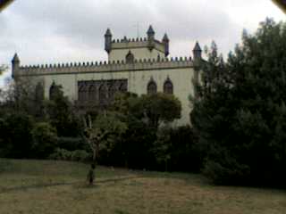
Castelo de Portuzelo
Viana do Castelo
Castelo de Portuzelo is a Romantic-style palacette built to look like a castle, standing in Santa Marta de Portuzelo in the municipality of Viana do Castelo, northern Portugal. It looks medieval but is not: work began in 1853, and the whole thing grew out of one man's fascination with castles he had seen abroad. Where is Castelo de Portuzelo? The castle stands about 500 metres from the Lima river, close to the road linking Viana do Castelo with Ponte de Lima. Its coordinates are roughly 41.702 N, 8.785 W. Set in the river valley, it makes an easy stop on a route between the coast and one of the oldest towns in the country. Who built it, and why? The builder was António Pereira da Cunha. Local tradition says that after a trip to Austria and Germany, where he attended the christening of the first child of Dom Miguel I, he wanted a castle of his own like those he had seen there. He drew the plan himself, which makes the building a rare case of a design shaped by its owner's vision rather than a professional architect's. It was conceived as a residence, not as a fortification. What does the building look like? Castelo de Portuzelo shows Romantic architecture and the eclecticism typical of the 19th century. The plan is square, and the facades have two levels topped by a central tower. Battlements and corner turrets appear on the walls and are repeated on the tower. The windows combine late Gothic Revival and Neo-Manueline forms. Manueline is the Portuguese late Gothic style of the reign of King Manuel I, and the Neo-Manueline version is a 19th-century revival of it. Is the castle protected? Yes. It is classified as an Imóvel de Interesse Público, a Site of Public Interest. The status dates from 1977, and the heritage register was then managed by IGESPAR. The national monuments database lists it as Castelo de Portuzelo / Palacete de António Pereira da Cunha. Can you stay here? Today the building serves tourism: it offers nine suites and a large garden with a swimming pool. Information on visiting without a booking varies, so check the current rules with the property before you go. Even from outside, the silhouette with its tower and battlements is striking. Frequently asked questions When was Castelo de Portuzelo built? Work began in 1853, so it is a 19th-century building. Is it a real defensive castle? No. It is a Romantic palacette styled as a castle, built as a residence. Who designed it? The owner, António Pereira da Cunha, drew the plan himself. How do I get there? It lies on the road from Viana do Castelo to Ponte de Lima, near the Lima river. Is it a protected monument? Yes. It has held Site of Public Interest status since 1977.
-
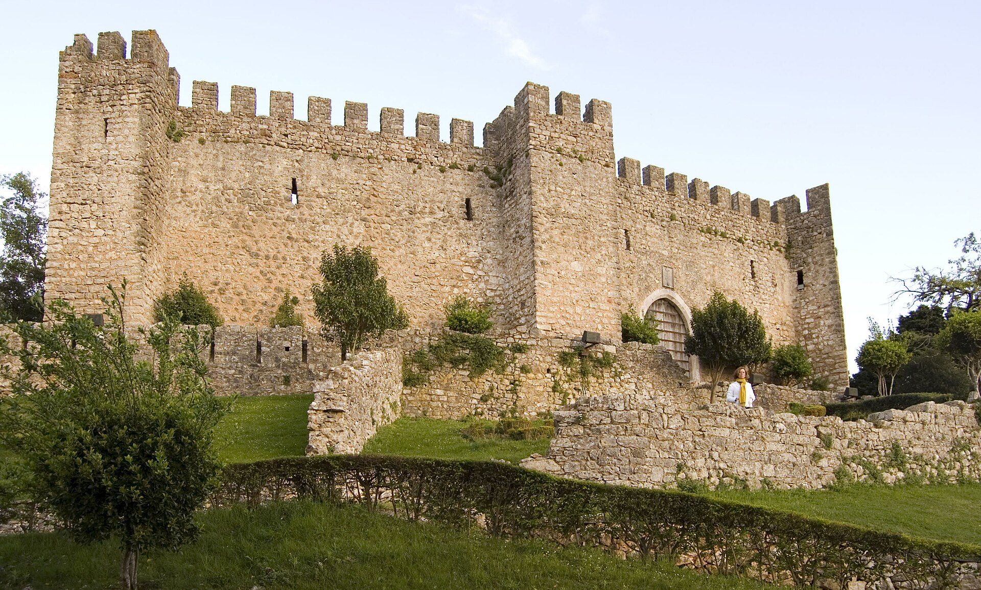
Castle of Pombal
Pombal
Castle of Pombal: a Templar fortress above the Arunca River The Castle of Pombal (Castelo de Pombal) is a medieval castle in the town of Pombal, in the Leiria District of Portugal's Centre region. It stands on a rocky outcrop on the edge of the Arunca River and dominates the town below. It is one of the fortresses linked to the Knights Templar during the formation of the Portuguese kingdom. Why was the castle built here? The hill was a natural defensive spot long before the current fortress. Archaeological finds on the castle hill point to a Roman fortification, later reoccupied by Muslims. The exact date of the Christian rebuilding is unknown, but scholars place it in the 12th century, during the Reconquista and the reign of Afonso I of Portugal (1143-1185). The castle belonged to a chain of Templar strongholds. Their job was to defend and settle the lands south of the Mondego River, which had been entrusted to the Order. Who was Gualdim Pais? Gualdim Pais was the Templar Master in Portugal. In 1174 he granted Pombal a foral, a charter setting out the rights and duties of the settlement. The town grew on the southern slope of the castle hill. There stood the arms gate and two churches: Santa Maria do Castelo and São Pedro. His name is still tied to the town's medieval identity, and Pombal has held events dedicated to him and to the Middle Ages. What happened to it over the centuries? The castle did not take part in any major campaign, but it stayed on alert during the Muslim counter-offensives of 1171, 1179, 1184 and 1190, which struck settlements in the area, including nearby Leiria. After the Pope dissolved the Templar Order in 1311-1312, King Dinis transferred the Order's Portuguese assets to the Order of Christ in 1317. Visiting the castle Where: the historic centre of Pombal, Leiria District. Coordinates: about 39.914 N, 8.625 W. What to look for: the elevated position over the Arunca, and the layout of the hill that once held the medieval settlement, its gate and its churches. Best for: travellers interested in the Templars, the Reconquista and Portugal's early history, or anyone breaking the journey between Lisbon and Porto. Frequently asked questions Where is the Castle of Pombal? In the town of Pombal, Leiria District, in Portugal's Centre region. Who built the castle? The exact date of the medieval reconstruction is not known. It is generally placed in the 12th century, under Afonso I, and the site later became part of the Templar network. What is the link with the Templars? The Templars held the castle as part of their defence of the lands south of the Mondego. Their Master Gualdim Pais granted Pombal its charter in 1174. What was there before the medieval castle? Evidence of a Roman fortification, later reoccupied by Muslims. What happened after the Templars? Following the Order's dissolution, King Dinis passed its Portuguese assets to the Order of Christ in 1317.
-
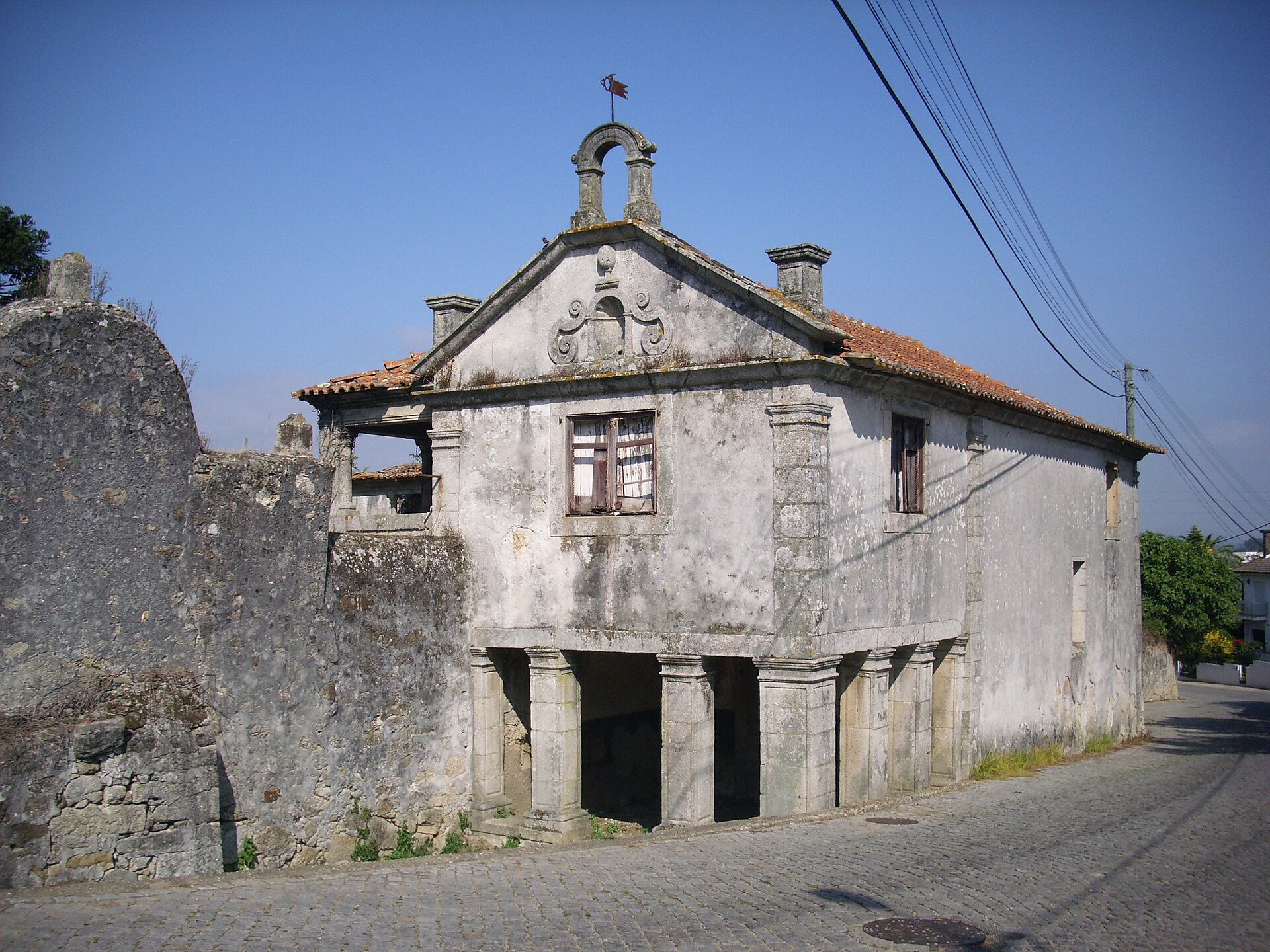
Quinta de Baixo
Vila Nova de Gaia
Quinta de Baixo, also known as the Quinta dos Condes de Paço Vitorino, is a historic estate in the parish of Vilar de Andorinho, in the municipality of Vila Nova de Gaia, Porto district, Portugal. Its manor house and attached chapel show what a noble country residence in northern Portugal looked like in the 18th century, and they offer a different side of Gaia from the famous port wine lodges. Where is Quinta de Baixo? The estate lies in Vilar de Andorinho, one of the parishes of Vila Nova de Gaia, on the south bank of the Douro, across from the city of Porto. This is a residential area rather than a tourist waterfront, so plan your trip ahead and check whether the grounds can be viewed from close by at the time of your visit. What is the history of Quinta de Baixo? The site goes back to the 12th century, when it was known as the Casal de Vilar de Andorinho, a rural holding tied to the local area. In the 16th century the property gained noble status thanks to the Pinto Monteiro family, wealthy merchants of Porto. In 1654 it belonged to João Álvares Monteiro. In the 18th century the Pinto Monteiro line died out and the estate passed to another important family, the Calheiros of Paço Vitorino, near Ponte de Lima. That link explains the name Quinta dos Condes de Paço Vitorino. The family remained the owners through the following centuries. What is there to see at Quinta de Baixo? The complex dates from the mid-18th century. By 1756 it already had a layout very close to today's: a residence, an adjoining chapel and outbuildings. The main house is baroque and U-shaped, and the noble floor is reached by an interior staircase. On the north side the chapel is built into the plan of the house. It sits on a slightly recessed plane, so the side elevation is crossed by a veranda. Having the chapel form part of the house was typical of manor residences in northern Portugal. Why visit Quinta de Baixo? It is an example of a baroque agricultural manor linked to the history of Porto's merchant families. It shows that Vila Nova de Gaia is more than wineries on the Douro: it also has old estates further inland. The surviving house, chapel and service buildings help explain how such estates worked. Archive photographs, including views of the chapel interior, are held by Gaia's municipal archive, which makes it easy to learn the story before you go. Frequently asked questions Is Quinta de Baixo open to visitors? We found no confirmed information about regular opening hours. Before you travel, check current rules with the Vila Nova de Gaia municipality or the local parish. What other names does the place have? It appears as Quinta de Baixo, Quinta dos Condes de Paço Vitorino and Quinta do Paço de Vitorino. What period is the building from? The current arrangement dates from the mid-18th century, though the estate's history begins as early as the 12th century. Where can I find more information? Historical studies, Portugal's heritage registers and Gaia's municipal archive hold documentation and photographs. Can I combine the visit with the centre of Gaia? Yes. Vilar de Andorinho is in the same municipality, so you can pair the visit with a walk along the Douro and a port tasting.
-
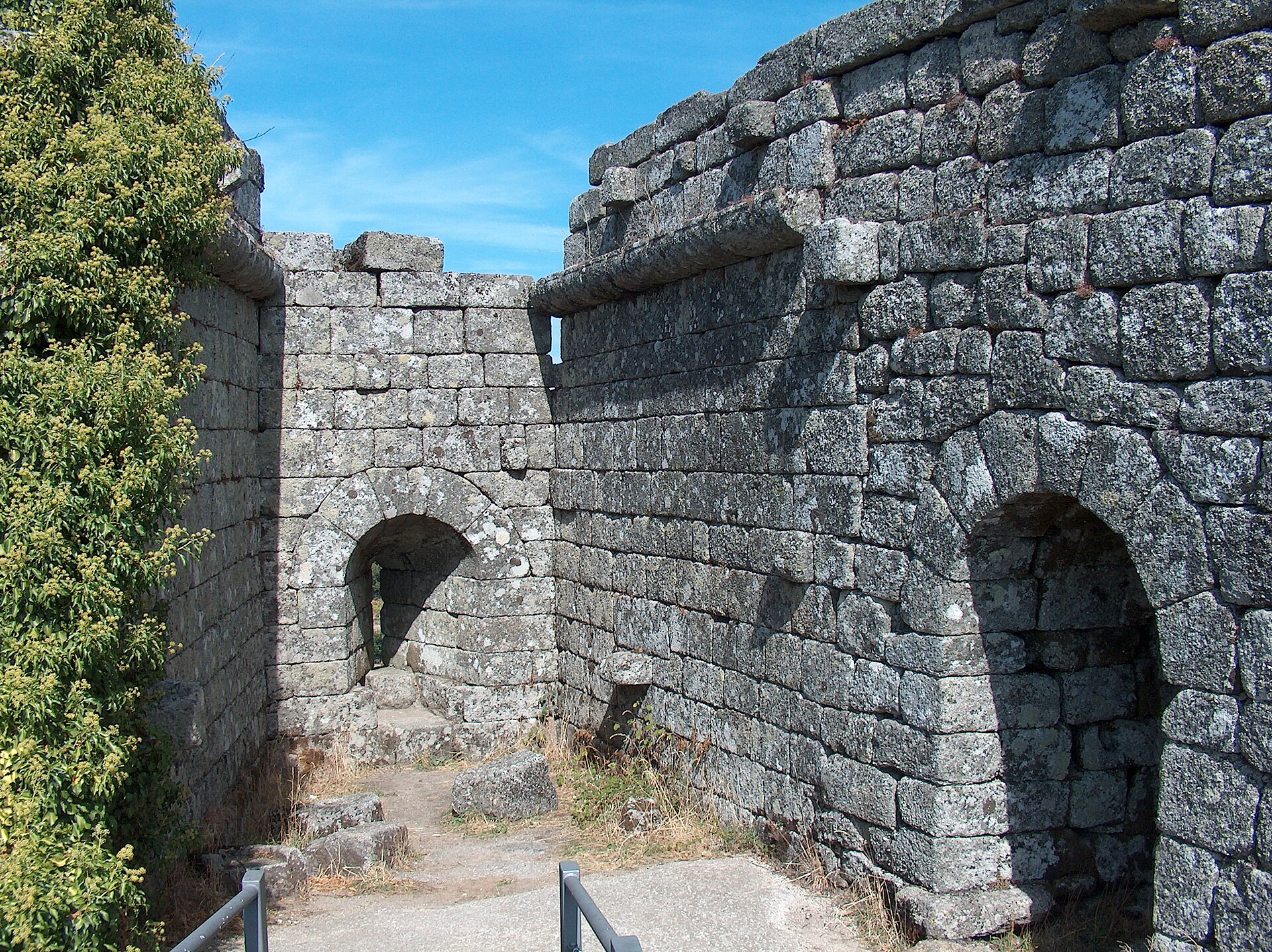
Castle of Pena de Aguiar
Vila Pouca de Aguiar
Castle of Pena de Aguiar (Portuguese: Castelo de Pena de Aguiar, also called Castelo de Aguiar da Pena) is a medieval rock castle in the municipality of Vila Pouca de Aguiar, in northern Portugal's Vila Real district. It stands in the civil parish of Telões, on the eastern flank of the Serra do Alvão, and has been classified a National Monument since 1982. Where is the Castle of Pena de Aguiar? The ruins crown a massive granite outcrop that dominates the surrounding landscape. The site lies in the Alto Tâmega region, close to the villages of Telões and Pontido. A viewpoint at the highest point of the fortification looks out over the Aguiar Valley, so the castle appeals both to history fans and to anyone after mountain views and quiet. What is the history of the castle? The castle predates the Portuguese nation itself. Its origins are traced to the 9th and 10th centuries, and excavations have revealed layers of occupation from several periods: prehistoric, Celtic and Roman. The fortress is tied to the Christian Reconquista of the Iberian Peninsula and served in medieval times as the head of the lands of Aguiar. The royal inquiries of 1220 mention a working fortress, which may also have included a lordly residence. The castle remained in use until the early 16th century and has stood abandoned for roughly five hundred years. What can you see there? It is a Romanesque rock castle shaped around the granite crag. It has three distinct parts: a barbican, a tower (described as an arrow-slit hall) and an acropolis. A line of walls encircles the whole, forming a lower enclosure that is roughly circular in plan. A vaulted structure, probably a cistern, has also survived and hints at daily life in this strategic spot. How to visit the Castle of Pena de Aguiar The castle and its natural surroundings can be explored independently, with no booking needed. The walk up from the village of Telões or Pontido demands a decent level of fitness, so wear sturdy shoes and bring water. The reward is the view from the top of the fortification. Frequently asked questions Is the Castle of Pena de Aguiar a protected monument? Yes. It has been classified a National Monument of Portugal since 1982. How old is the castle? Its origins go back to the 9th and 10th centuries, and it stayed in use until the early 16th century. Traces of earlier prehistoric, Celtic and Roman settlement were found on the hill. Do I need to book a visit? No, the site can be visited independently without prior booking. Is the walk difficult? The climb on foot from Telões or Pontido is demanding and requires good fitness, but the panorama over the Aguiar Valley is the payoff. What survives of the castle? The walls, barbican, arrow-slit tower, acropolis and a vaulted structure, probably a cistern, remain.
-
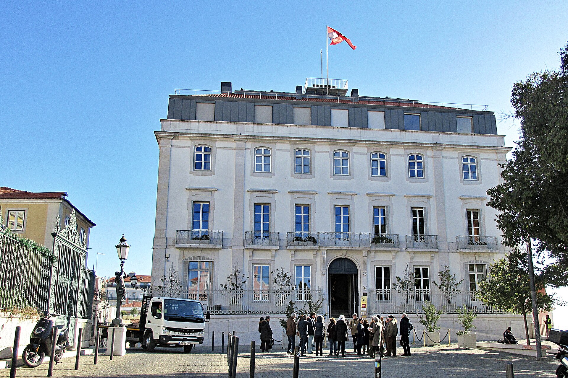
Verride Palace
Lisboa
Verride Palace, also called the Palace of Santa Catarina (Palácio de Santa Catarina), is an 18th-century palace in Lisbon that now works as a boutique hotel with a restaurant and a rooftop bar. It stands in the Santa Catarina parish, close to the Tagus, in an area known for its viewpoints. What is Verride Palace? The building dates to around 1750 and belongs to the group of Lisbon palaces from the period when the city was rebuilding and growing in the 1700s. It is named after its neighbourhood. Wikidata lists it simply as a building in Lisbon, and its coordinates, 38.70964 N, 9.14703 W, place it in the central part of the city. What is the history of the palace? In 2003 the property was bought for its architecture. In 2010 it became the seat of POP UP LISBOA 2010, an urban artistic movement, which for a time turned the historic rooms into a space for contemporary art. The turning point came in December 2017, when the restored palace opened as the hotel Verride Palácio de Santa Catarina. What can you see inside? Architect Teresa Nunes da Ponte led the restoration. Her idea was to set a contrasting line of modern design against the opulence of the old palace. Original features were kept, including wooden ceilings, ornate stucco and historic azulejo tiles, while noble materials and details inspired by Portuguese tradition were added. The result is a heritage building where the modern touches do not drown out the original character. Where can you eat and drink? On site are the restaurant Criatura and a gastropub with a rooftop bar overlooking the Tagus. The OpenStreetMap description praises the cinema-inspired decor and calls it one of the better places for late-evening toasted sandwiches. Guests also have a swimming pool. Is it worth a visit? If you are interested in Lisbon architecture, the palace shows how a historic building can be given a new purpose without erasing its past. Even without a room booking, it is worth checking whether the restaurant or bar is open, as that is the simplest way to see the interiors and the river view. An evening visit works best, for a relaxed dinner or a drink after walking the surrounding streets and viewpoints. Frequently asked questions When was Verride Palace built? The palace dates to around 1750, in the 18th century. Is it still a private residence? No. Since December 2017 it has operated as the boutique hotel Verride Palácio de Santa Catarina. Who designed the new interiors? Architect Teresa Nunes da Ponte handled the restoration and the contemporary touches. Is there a restaurant? Yes, the restaurant Criatura and a gastropub with a rooftop bar. Is there a swimming pool? Yes, the property offers a pool for guests. Where exactly is it? In Lisbon, in the Santa Catarina parish, a little above the Tagus.
-
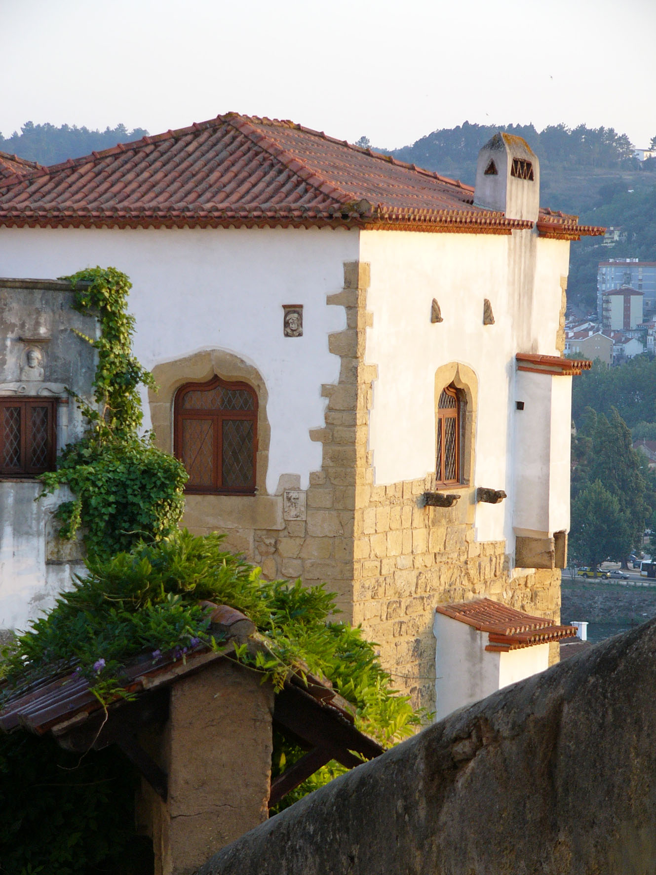
Paço de Sub-Ripas
Coimbra
Paço de Sub-Ripas, also called Paço de Sobre-Ribas, Casa de Sub-Ripas or Palácio de Sobre-Ribas, is a historic pair of houses in the centre of Coimbra, Portugal. A covered arch spanning the narrow street links the two buildings. It is regarded as a rare example of a Manueline-style townhouse in the region. Why does it have several names? The name Sobre-Ribas refers to the site: the house stands on the steep bank of a stream, "sobre a riba" in Portuguese. The form Sub-Ripas came into use as well, and sources use both. The building lies at roughly 40.2094 N, 8.4284 W, in the old part of the city. What is the history of Paço de Sub-Ripas? The lower part of the complex, known as Casa de Baixo or Casa da Torre, grew out of an old defensive tower that belonged to Coimbra's medieval city walls. It was called the Torre da Contenda. In the 16th century the tower was adapted for residential use. João Vaz bought it. In 1514 he built Casa de Cima, also called Casa do Arco, the oldest part of the ensemble and Manueline in style. He then acquired the buildings on the opposite side of the street. An extension carried out between 1542 and 1547 follows Renaissance taste, and the two houses were joined by an arched passage over the road. That arrangement is what makes the building recognisable today. What is worth looking at? Above all, the overall form and the arch seen from the street. It combines late Gothic Manueline decoration with a more restrained Renaissance style, along with the remains of the medieval tower in the lower house. The ensemble is a National Monument, protected since 1910. Can you go inside? Today the complex has two owners. Casa de Baixo belongs to the Institute of Archaeology of the Faculty of Arts at the University of Coimbra. Casa de Cima is privately owned, so visiting its interior should not be taken for granted. Check opening times and access rules for the university part with the institute or the city tourist office before you go. Frequently asked questions Where is Paço de Sub-Ripas? In Coimbra's historic centre, near the line of the former city walls, on a steep slope above a former stream. How old is it? Casa de Cima dates from 1514, and the extension and arch were added between 1542 and 1547. The oldest element, however, is the medieval defensive tower. What style is it? The older part is Manueline, while the mid-16th-century extension is Renaissance. Is it a protected monument? Yes. It has held National Monument status since 1910. Is it open to visitors? One part belongs to the university and the other to a private owner, so access to the interiors can be limited. The arch and facades can be seen from the street.
-
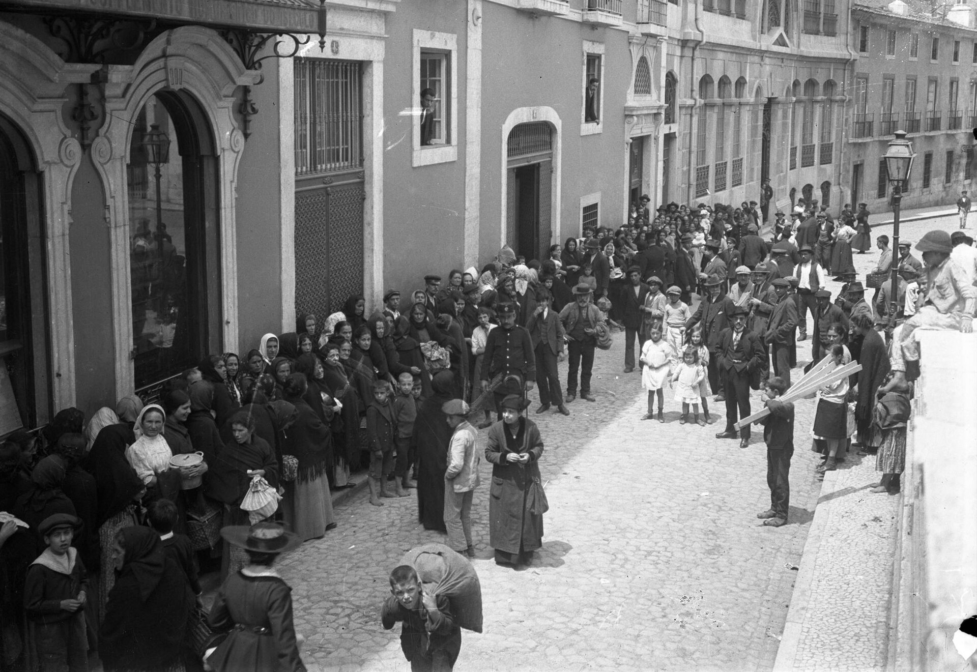
Antigas instalações do jornal O Século
Antigas instalações do jornal O Século (the former premises of the newspaper O Século) is a historic complex on Rua do Século in Lisbon, in the Santa Catarina parish next to the Bairro Alto. It is classified as a building of public interest (imóvel de interesse público), at roughly 38.7123 N, 9.1479 W. What is the building? The complex consists of two neighbouring buildings on Rua do Século: numbers 41–59 and numbers 61–63. The first is the Palácio dos Viscondes de Lançada, an 18th-century palace. The second is a later addition attached to the palace's central body, built in 1913. How did a palace become a newspaper headquarters? In the 18th century the palace belonged to Manuel de Sampaio de Pina e Brederode, grandfather of the Viscount of Lançada. In the 19th century it was a favoured meeting place of romantic Lisbon, with figures such as Almeida Garrett, Júlio de Castilho and Fontes Pereira de Melo among the guests. In 1881 the newspaper "O Século" moved into the palace. In the late 19th and early 20th centuries the building was altered and extended, mostly to suit the needs of the newspaper's operations. The annex at numbers 61–63, added in 1913, belongs to this phase. Why is the street called Rua do Século? The paper left its mark on the city map itself. The street formerly known as Rua Formosa has been called Rua do Século since 1911. It is one example of how the press influenced place names around the Bairro Alto, a district later associated with Lisbon journalism. What to know before visiting Address: Rua do Século 41–63, Lisbon. It is best seen from the street as part of a walk through the Bairro Alto and the Príncipe Real area. The sources we found say nothing about interior visits, so check locally first. It suits anyone interested in press history, 18th to 20th century architecture and old Lisbon. Frequently asked questions Where were the O Século premises? At Rua do Século 41–63 in Lisbon, in the Santa Catarina parish. Since when was the newspaper based in this palace? Since 1881. What is the Palácio dos Viscondes de Lançada? An 18th-century palace forming the main part of the complex, at numbers 41–59. When was the second building added? The part at numbers 61–63 was added in 1913. Where does the street name come from? The former Rua Formosa was renamed Rua do Século in 1911, after the newspaper.
-
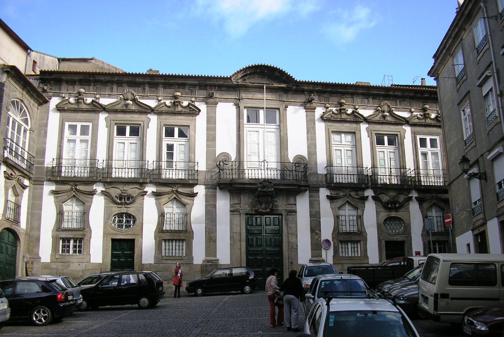
Palace of São João Novo
Porto
The Palace of São João Novo (Palácio de São João Novo) is a Baroque mansion in the historic centre of Porto, built in the late 18th century against the old city wall. It has stood closed for decades, yet it remains one of the city's more interesting examples of Portuguese palace architecture. Where is the Palace of São João Novo? The palace stands in Porto, northern Portugal, within the combined civil parish of Cedofeita, Santo Ildefonso, Sé, Miragaia, São Nicolau e Vitória. Its coordinates are roughly 41.1425° N, 8.6178° W. The building leans against the Fernandine Wall (Muralha Fernandina), the medieval fortification that once marked the extent of the old city. Who designed it, and who lived here? The residence was built in the Baroque style in the late 18th century as the home of a Porto civil servant. After its first owner died, some of the city's most illustrious families lived in it. For years the design was credited to Nicolau Nasoni, the Italian architect who shaped Porto's Baroque look. That attribution dated from the 1960s. The discovery of the original construction contract showed, however, that the architect was António Pereira. What was the building used for? The palace changed function several times: during the Siege of Porto (the Liberal Wars) it served as a military hospital for the liberal troops, it housed the Commercial Typography of Porto (Tipografia Comercial Portuense), in 1945 the Junta da Província do Douro Litoral set up the Museum of Ethnography and History of Douro Litoral here; from 1945 to 1980 it occupied the palace's entrance hall. Why is the palace closed? A fire in 1984 damaged the building, and since 1992 it has been closed to visitors. It had already been classified as a Property of Public Interest (Imóvel de Interesse Público) in 1977. In 2023 the Porto city council and the Portuguese government were weighing its rehabilitation. Frequently asked questions Can you visit the Palace of São João Novo? No. The building has been closed since 1992. You can view it from the outside, near the Fernandine Wall. Did Nasoni design the palace? No. Although it was believed so from the 1960s, the construction contract that came to light points to António Pereira. What architectural style is it? Baroque, built in the 18th century. Was there ever a museum inside? Yes. From 1945 the Museum of Ethnography and History was installed here, and until 1980 it used the entrance hall. Why it is worth knowing The palace brings together the story of Porto's leading families, a dispute over who designed it, and the fate of the city's heritage after a fire. If you are walking the old town along the medieval wall, stop at this façade and remember the military hospital, printing press and museum that once occupied it.
-
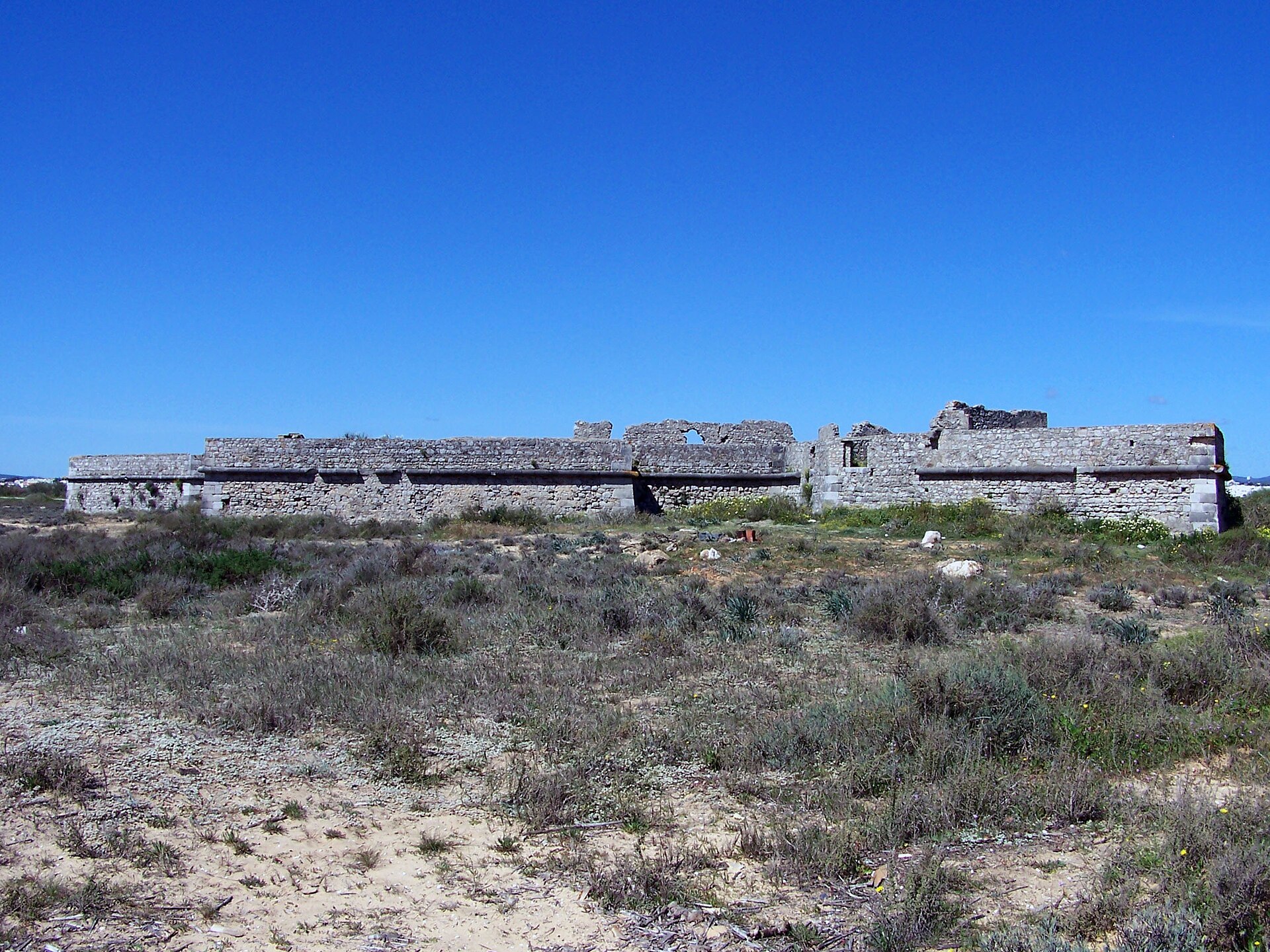
Fortaleza de Santo António de Tavira
Tavira
Fortaleza de Santo António de Tavira is a 16th-century coastal fortress at the mouth of the Gilão River, in the municipality of Tavira in Portugal's Algarve. It is also known as Forte do Rato and Ilha das Lebres, and under every name it had the same job: guarding the entrance to the harbour and the town. Where is the fortress and how do you find it? The fort lies on the Tavira coast, close to where the Gilão meets the sea, at roughly 37.121° N, 7.621° W. It suits a walk with some history attached: the sand, water and low coastal landscape make it easy to see why the spot was considered strategic. Check current access rules and opening times before you go, as they can change. When and why was it built? Construction was ordered in the second half of the 16th century, during the reign of King Sebastian I (1568–1578). Work was still under way in 1573, when the king visited Tavira. The aim was to protect the bar, the channel giving access to the bay, and the town itself from attack by sea. The Algarve coast was exposed to raids at the time, so the crown invested in a network of coastal defences. Who designed it? The project was drawn up by Giovanni Maria Benedetti. He planned a fortress with five bastions: three facing the sea and two facing inland. The layout also included a parade ground (arms square) and a moat with an unusual feature, a paved bottom. The bastion layout is typical of Renaissance military engineering, designed to withstand artillery fire. Why was it never finished? The investment lost its purpose quickly. Even while the fort was being built, the coastline was changing and the entrance to the bay was gradually shifting eastward. Silting and the migration of Tavira's bar left the fort in a spot that no longer mattered strategically. The fortification was never completed, and its defensive value kept shrinking. The Restoration War and the end of service During the War of Restoration of Portuguese independence (after 1640), the structure was remodelled. It was meant to complement the defence provided by the Forte de São João da Barra de Tavira at Gomeira, begun in 1672. The fortress stayed active until 1840. By then it had lost its military function, and it was abandoned on the order of the Governor of the Province of the Algarve. Frequently asked questions Was the fort ever completed? No. Work was never fully finished, mainly because of silting and the eastward shift of the bay entrance. What other names does it go by? Santo António, Rato and Ilha das Lebres. Who designed it? Giovanni Maria Benedetti. What did it protect? The mouth of the Gilão River and the town of Tavira. How long was it in military use? Until 1840, when it was abandoned. Is it worth a visit? Yes, if you are interested in old fortifications, the history of Algarve coastal defence and Tavira's quiet seaside scenery. Plan around the weather and check current access information.
-
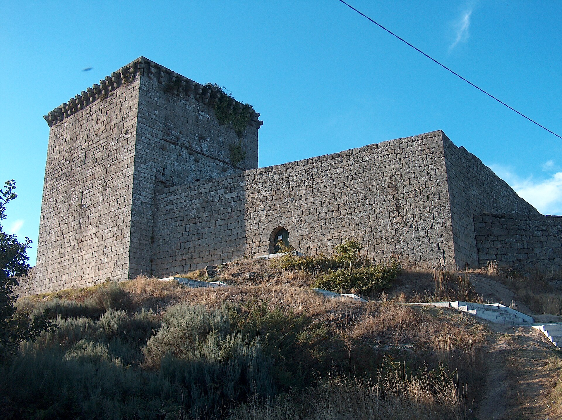
Castle of Monforte (Chaves)
Chaves
Castle of Monforte (Castelo de Monforte de Rio Livre) is a medieval fortress in northern Portugal, in the municipality of Chaves, Vila Real district. It stands in the village of Monforte, in the parish of Águas Frias, at roughly 41.76° N, 7.36° W. It has been classified as a National Monument since 1950. Where is Monforte Castle? The castle lies in the Chaves area, in a region close to the Spanish border. Administratively it belongs to the parish of Águas Frias. Sources also call it Castelo de Monforte de Rio Livre, after the former municipality it once served. How old is the castle? Traces of occupation at the site go back to pre-Roman times. The fortress in its medieval form probably dates to the 12th century. The oldest reference to the castle comes from that same century: a document names a nobleman who held the fortress as its tenant. How was the castle developed in the Middle Ages? In 1273 King Afonso III granted the settlement a foral charter. Reconstruction of the fortified complex began at that time, and much of it survives today. Work continued under his successor, King Denis (1279-1325), and was completed in 1312. By then the castle had a solid keep and walls reinforced by three towers. What role did the castle play locally? The fortress housed the main institutions of the former municipality of Monforte de Rio Livre. That municipality existed from 1273 to 1853, nearly six centuries. The castle was therefore not only a defensive site but also a centre of local government. What historical events are linked to the castle? The castle played an important part in the disputes between Portugal and Castile, especially during the Fernandine Wars and the succession crisis of 1383-1385. In the 17th century it regained prominence during the Restoration War, when Portugal recovered its independence from Spain. Its position in the border zone made it part of the fortifications watching the northern frontier. What is worth seeing here? The main draw is the layout of the medieval stronghold: the walls, towers and keep that came from the building campaigns of the 13th and early 14th centuries. The castle pairs well with a visit to the town of Chaves and nearby villages of northern Portugal. Opening hours and access rules can change, so check them with the Chaves municipality or the local tourist office before you go. Frequently asked questions Is Monforte Castle a National Monument? Yes, it has held National Monument status in Portugal since 1950. When was the medieval work completed? In 1312, during the reign of King Denis. What does the fortress consist of? A keep and walls reinforced by three towers. Which former municipality did the castle belong to? Monforte de Rio Livre, which existed from 1273 to 1853. Was the castle involved in conflicts? Yes. It mattered during the Fernandine Wars, the 1383-1385 crisis and the 17th-century Restoration War.
-
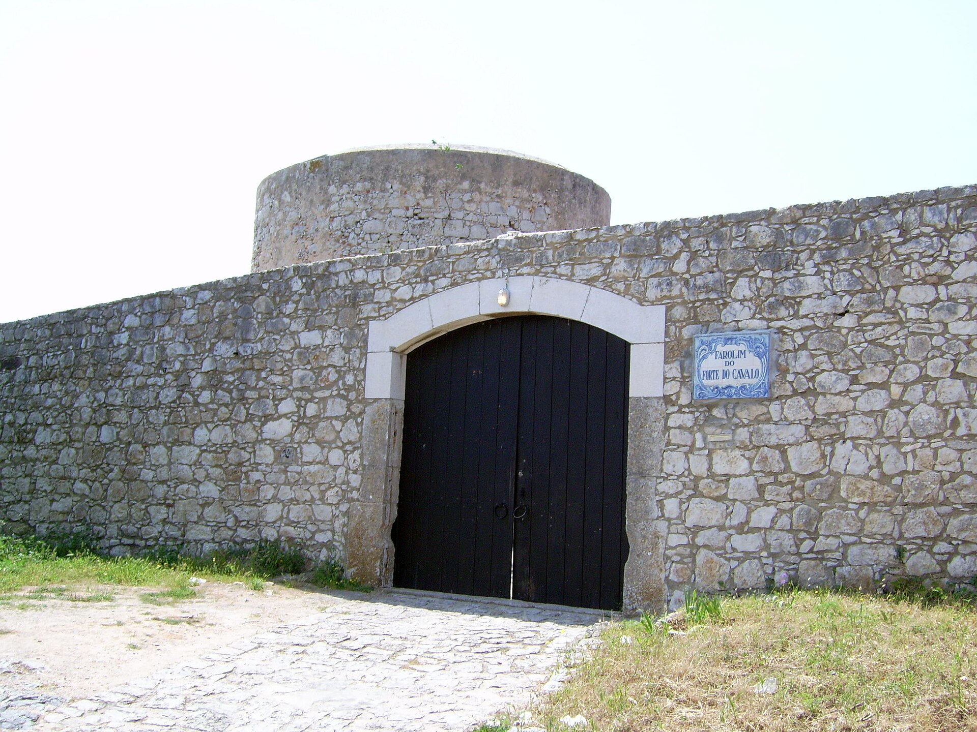
Fort of São Teodósio da Ponta do Cavalo
Sesimbra
Fort of São Teodósio da Ponta do Cavalo is a coastal fort at the western end of the Bay of Sesimbra, in Portugal's Setúbal District. It occupies a commanding position on the shoreline and has watched over the approach to the local port since the seventeenth century. It is also known as Forte da Ponta do Cavalo or simply Forte do Cavalo. When and why was the fort built? The idea of fortifying this point arose during the years of restored Portuguese independence after 1640. Father Simão Falónio proposed defending the port of Sesimbra and envisioned a structure made of rammed earth (taipa). Construction itself ran from 1648 to 1652. The fort belonged to a defensive chain along the stretch of coast now marketed as the Costa Azul. In the seventeenth century that line extended from Albarquel to Sesimbra and complemented the protection of the important maritime settlement of Setúbal. What happened later? The fort was damaged in the 1755 earthquake. In the nineteenth century, during the Peninsular War and the first French invasion under General Junot (1807–1808), it was garrisoned and equipped with artillery. Its garrison abandoned it in 1822, but it was manned again during the Liberal Wars. A lighthouse on the ramparts In mid-November 1895 a lighthouse, with quarters for the keepers, was built on the fort's upper battery. It entered service in September of the following year. A military structure thus went on to serve navigation as well. The light is known as the Farol do Forte do Cavalo. Heritage protection Since 1978 the fort has been classified as an Asset of Public Interest (Imóvel de Interesse Público). Wikidata describes it as a cultural heritage monument in the municipality of Sesimbra. Who is it for? The site suits anyone interested in coastal fortifications, seventeenth-century defensive architecture and the history of the Portuguese coastline. Photographers and view seekers will appreciate the exposed headland the fort occupies and the pairing of a defensive structure with a lighthouse. Its location near Sesimbra makes it easy to combine with a walk through the town and a look at other defences around the bay, such as the Fort of Santiago in Sesimbra. Frequently asked questions When was the fort built? Between 1648 and 1652. Is there a lighthouse at the fort? Yes. It was built on the upper battery in 1895 and began operating in September 1896. Where is it? At the western end of the Bay of Sesimbra, in the Setúbal District. Is it a protected monument? Yes, classified as an Asset of Public Interest since 1978. Did the fort see action? It was garrisoned during the Peninsular War and the Liberal Wars in the nineteenth century; we do not describe specific battles here. Should I check access before visiting? Yes. Check opening hours and entry rules with Sesimbra tourist information or the municipality, as access can change.
-
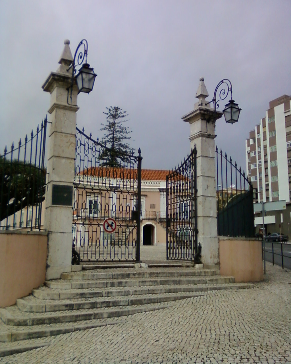
Palácio Ribamar
Oeiras
Palácio Ribamar is an 18th-century palace in Algés, in the municipality of Oeiras on the Tagus, a few kilometres from central Lisbon. Today it houses a library, an art gallery, a tourist information point and a dance centre, so you can visit it as a working cultural venue rather than a closed monument. Who built Palácio Ribamar? The palace was built in 1727 for Francisco de Paula de Portugal e Castro, 8th Count of Vimioso and 2nd Marquis of Valença. It was meant as the family residence of a nobleman. Local institutions describe it as a small court where art and culture mattered, and guests included prominent figures and even members of the government. How did ownership change? The estate reflects the shifting fortunes of Portugal's elite. After the Vimioso line, the palace belonged to, among others, the Marquises of Valença and the Counts of Lumiar. In 1870 it was bought by the 2nd Count of Cabral and later passed by inheritance to the Counts of Foz. The place is also linked with Ernesto Hintze Ribeiro, a well-known Portuguese politician of the late 19th and early 20th centuries. From casino to school The building changed function several times in the 20th century. Between 1920 and 1928 it operated as a casino. Later it served as a secondary school. In 1962 the municipality of Oeiras bought it, and it has been public property ever since, which secured its future and gave it new roles. What is inside today? Palácio Ribamar works as a cultural centre. Inside you will find: the Algés Municipal Library (Biblioteca Municipal de Algés), the headquarters of the Centro de Dança de Oeiras, the local dance centre, a tourist information point, the Palácio Ribamar Municipal Gallery, which hosts exhibitions. Exhibition programmes and opening hours change, so check current details on the Oeiras municipality website before you go. How to get there Algés lies on the railway line from Cais do Sodré in Lisbon to Cascais, so the trip by train is short. From the station the palace is within walking distance. It pairs well with a stroll along the Algés waterfront and nearby parks. Is it worth a visit? If you enjoy the architecture of old noble residences and want a place quieter than the big Lisbon palaces, Palácio Ribamar makes a good stop. The public areas, such as the library and gallery, usually need little planning, and the tourist point can help you shape the rest of your day in Oeiras. Frequently asked questions When was Palácio Ribamar built? In 1727, as the residence of the Count of Vimioso. Where is it? In Algés, municipality of Oeiras, in the Lisbon metropolitan area. Can you see exhibitions there? Yes, the Palácio Ribamar Municipal Gallery is located inside. Is there tourist information? Yes, a tourist information point operates in the building. Is the palace publicly owned? Yes, the municipality of Oeiras bought it in 1962. Is it good for a short visit? Yes. The public areas usually take little time, so it is easy to combine with a walk around Algés or other sights in Oeiras.
-
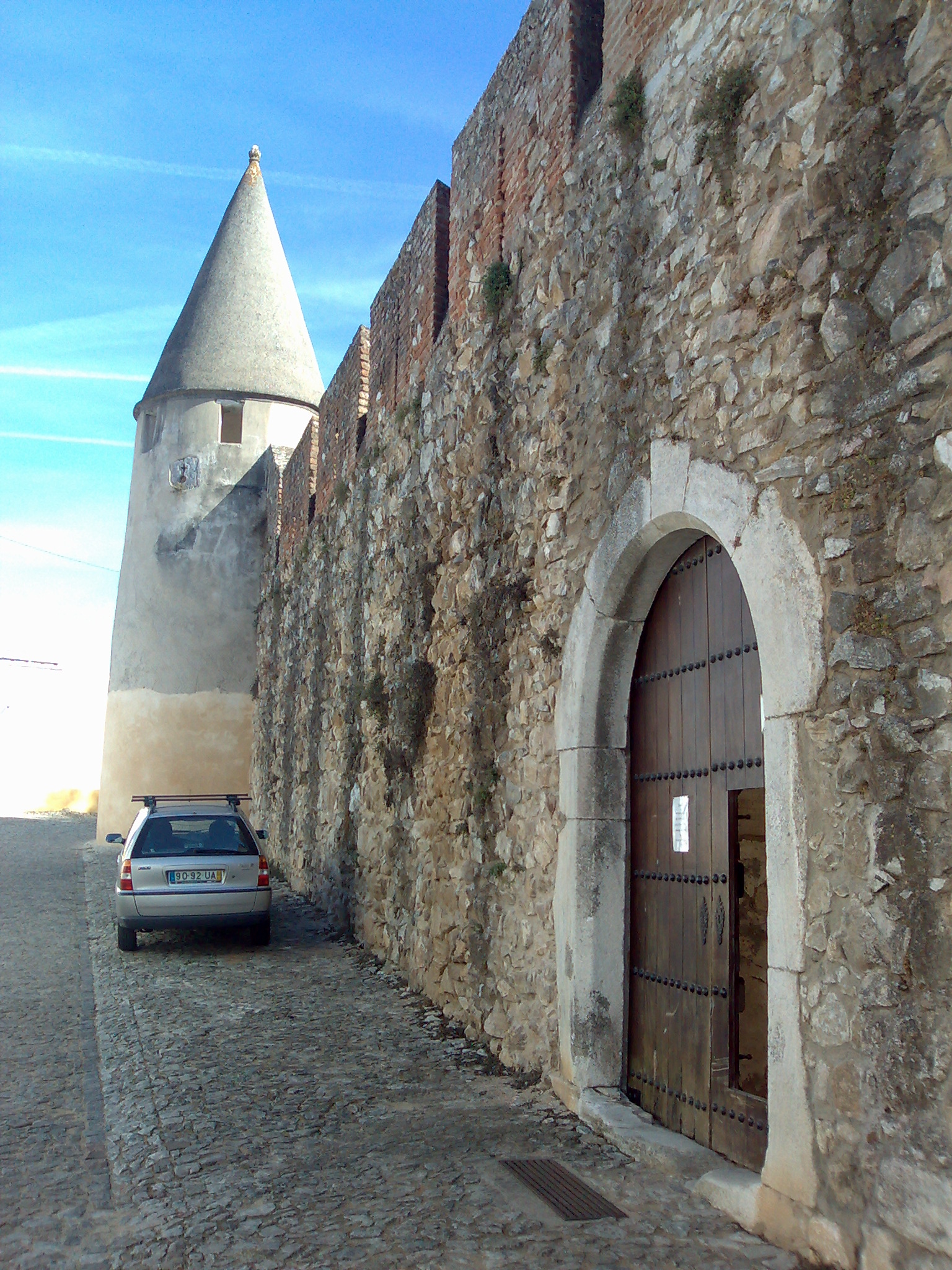
Castle of Viana do Alentejo
Viana do Alentejo
Castle of Viana do Alentejo – a Gothic fortress in the heart of the Alentejo The Castle of Viana do Alentejo (Castelo de Viana do Alentejo) is a Gothic fortress in the centre of the small town of Viana do Alentejo, in Évora District, southern Portugal. It was built during the Reconquista and the settlement of the central Alentejo. Compared with the grander castles of its era it looks modest, yet its story shows well how the Portuguese crown consolidated its authority in the south. How did the castle come about? The origins date to 1313, when King Dinis granted Viana do Alentejo its town charter (foral) and ordered a walled enclosure to be built. The defences were remodelled under John II (1481–1495), and work continued under Manuel I (1495–1521). The architects involved included Martim Lourenço and the brothers Diogo and Francisco de Arruda. What will you see? The castle has an irregular pentagonal plan made up of five curtain walls, each anchored by cylindrical corner towers. The walls enclose an open courtyard (terreiro), and a wall-walk (adarve) runs along the top. The towers are crowned with masonry conical caps (coruchéus). The largest tower was converted into the keep (torre de menagem). It is also known as the "clock tower", because one of the town's earliest clocks was installed there. A parish church within the walls In the 16th century the architect Diogo de Arruda began works at the castle, building the Mother Church (Igreja Matriz) and the Misericórdia church. Construction of the Matriz, dedicated to Our Lady of the Annunciation (Nossa Senhora da Anunciação), probably began around 1519–1521. It is a good reason to step inside, as castle and church form a single heritage ensemble. Who is it for? It suits visitors interested in defensive architecture, the Manueline era and lesser-known corners of the Alentejo. A visit is usually short, so combine it with a stroll through Viana do Alentejo and the surrounding countryside. The castle lies at roughly 38.332° N, 8.002° W. Frequently asked questions Where is the Castle of Viana do Alentejo? In the town of Viana do Alentejo, Évora District, in Portugal's Alentejo region. How old is it? Its origins go back to 1313, with remodelling in the late 15th and early 16th centuries. Why is the tower called the clock tower? The largest tower, converted into the keep, housed one of the town's first clocks. Who worked on it? Architects named include Martim Lourenço and Diogo and Francisco de Arruda. Is there a church at the castle? Yes, the Matriz and Misericórdia churches stand within the walls, both begun in the 16th century.
-
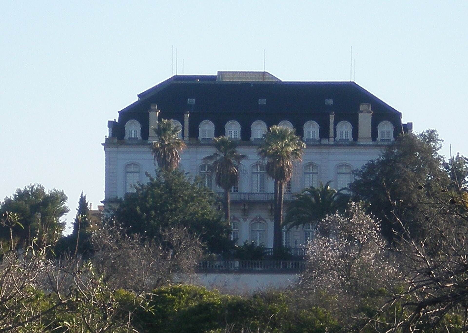
Palácio Fialho
Faro
Palácio Fialho is a historic palace in Faro, the capital of Portugal's Algarve, standing on a hill near the chapel Ermida de Santo António do Alto. It pairs early twentieth-century ambition with a taste for French classicism, and it remains one of the most distinctive residences in the area. Its coordinates are roughly 37.019° N, 7.917° W. Who built Palácio Fialho, and when? The palace was commissioned by the industrialist João Júdice Fialho. The architect Manuel Joaquim Norte Júnior (1878–1962) drew up the project in 1913. Construction ran from 1915 to 1925, about a decade. The design belongs to the revivalist current, drawing on classical French art. What does it look like? It is a two-storey building with an attic, classed in Portuguese heritage records as a notable building. The complex consists of five pavilions with separate functions: the main house, a machinery house, and homes for the estate's employees. The French influence shows in the imposing terraces and in gardens with ponds, fountains and statues. What is inside? The interiors are large, formal spaces decorated with marble, sculpture and murals on allegorical and mythological themes. Some features were modern for the period, including elevators and a kitchen in the basement. What is it used for today? In 1954 the estate was bought by the Diocese of the Algarve. Since then it has housed the school Colégio de Nossa Senhora do Alto, commonly called Colégio do Alto. The palace is also listed under the name Palácio da Quinta de Santo António do Alto. Because a school operates here, the interiors are not a standard museum attraction, and access depends on the school's rules. Is it worth seeing? For architecture lovers, the palace is an interesting example of an early twentieth-century Portuguese architect turning to French models. Even from outside it impresses with its volume, terraces and garden layout. The hill it occupies lets you combine the visit with the neighbouring chapel of Santo António do Alto. Frequently asked questions Where is Palácio Fialho? In Faro, in Portugal's Algarve region, near the chapel Ermida de Santo António do Alto. Who designed it? Manuel Joaquim Norte Júnior, for João Júdice Fialho. When was it built? The project dates from 1913, and construction took place between 1915 and 1925. Who owns it now? Since 1954, the Diocese of the Algarve, which runs the Colégio de Nossa Senhora do Alto here. Can you go inside? As it is a working school, ask the local tourist office or the school about visiting arrangements beforehand.
-
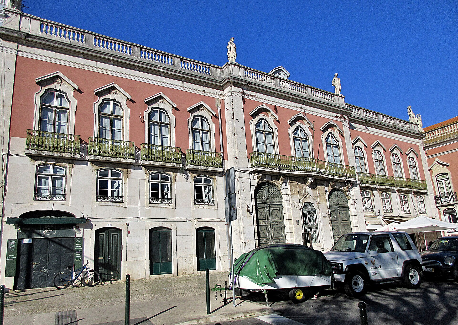
Palácio Sinel de Cordes
Palácio Sinel de Cordes is an eighteenth-century palace in Lisbon, on Campo de Santa Clara, with a spacious courtyard and views over the Tagus and the National Pantheon. It has served as a noble family home, a diplomatic legation and a primary school, and today it hosts architecture and culture. Who built the Sinel de Cordes palace? The palace was built for the Sinel de Cordes family, who came from Flemish nobility. Members of the family included Knights of the Order of Christ and officials of the Holy Office. After the 1755 earthquake the family settled permanently around Campo de Santa Clara, and the palace became their residence. It is a typical example of Lisbon's eighteenth-century palace architecture, from the years when the city was being rebuilt after the disaster. How did the building change in the 19th and 20th centuries? In the nineteenth century the palace was bought by Viscount José Correia Godinho da Costa, a judge of the Supreme Military Court. Under him a balustrade topped with neoclassical statues was added, and the staircase leading to the main floor received neo-Gothic decoration. As a result the building blends several stylistic periods. In the early twentieth century it housed the Italian Legation. During that time a violent fire destroyed much of the interior, which was later rebuilt. The Portuguese State then acquired the building and installed a primary school, which operated until 2007. For decades, local children studied in the former reception rooms. What can you see inside? The noble floor (piano nobile) has several spacious rooms with large windows looking out to the dome of the National Pantheon and, in the distance, the Tagus. The lower floor holds a kitchen and a refectory, with doors opening onto an outdoor courtyard. The neo-Gothic staircase decoration and the neoclassical statues above the roofline are worth looking for. What is the palace used for today? Since March 2012 the palace has been the headquarters of the Lisbon Architecture Triennale (Trienal de Arquitectura de Lisboa). The building was rehabilitated for this purpose, and its rooms host exhibitions, educational programmes and events about architecture and the city. It is also used as a venue for cultural gatherings. How to plan a visit The palace stands in a historic part of Lisbon, next to Campo de Santa Clara, known for the Feira da Ladra flea market and the National Pantheon. It fits neatly into a walk linking several sights of the neighbourhood. Opening hours depend on the current Triennale programme, so check the organiser's website before you go. Frequently asked questions Can you visit the interior of Palácio Sinel de Cordes? Access depends on current Triennale events; check the programme before arriving. What century is the palace from? The eighteenth. The Sinel de Cordes family settled in it permanently after the 1755 earthquake. What was the building used for before? The Italian Legation, and later a primary school that ran until 2007. What is nearby? The National Pantheon and Campo de Santa Clara with its Feira da Ladra market.
-
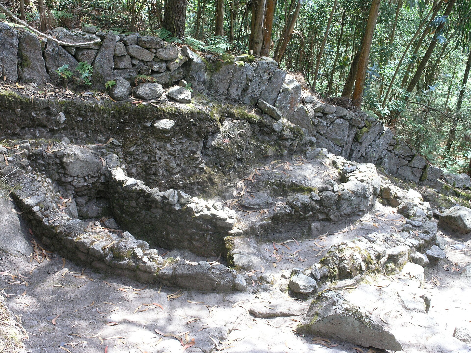
Castro de Moldes
Viana do Castelo
Castro de Moldes is an Iron Age archaeological site on a hilltop in the municipality of Viana do Castelo, in northern Portugal. The fortified settlement, also known as Castro do Monte do Castelo de Neiva, lies in the parish of Castelo do Neiva on the right bank of the Neiva River. It is a good place to picture how people lived in the far northwest of the Iberian Peninsula before and during the arrival of Rome. What is a castro? A castro is a fortified hilltop settlement, typical of the castro culture that dominated the northwest of the Iberian Peninsula during the Iron Age. Communities chose elevated ground with good views and protected themselves with stone walls. Castro de Moldes is one of these sites around Viana do Castelo, and it carries great importance for the parish and its local history. What did the excavations reveal? Excavations in the first half of the 1980s uncovered a settlement of considerable size. Its defences are the highlight: five concentric lines of walls, reinforced by towers on the southern slope. The houses were round, and some had vestibules. Paved streets ran between them, which suggests planned layout rather than random building. The finds point to intensive Romanization. Life on the hill did not stop when Rome arrived; residents took up new customs and goods. History after the Iron Age The hill's strategic position mattered in the Middle Ages too. The first known reference to a castle here dates from the early 12th century. Since 1970 the site has held the status of Property of Public Interest (Imóvel de Interesse Público), meaning it is officially protected as a monument. Visiting The coordinates are roughly 41.614 N, 8.785 W. The castro is part of the municipal archaeological route of Viana do Castelo and is listed among the attractions of the local geopark. You can also reach it on foot: the circular PR13 trail (Trilho do Castro de Moldes) is about 11 km long and rated low difficulty, so it suits a relaxed family outing. Frequently asked questions What period is Castro de Moldes from? The Iron Age, though signs of Romanization and a medieval castle reference show the place mattered for much longer. Where is it? In the parish of Castelo do Neiva, municipality of Viana do Castelo, on the right bank of the Neiva River. What is the most interesting feature? Five concentric wall lines with towers, and round houses separated by paved streets. Can I walk there? Yes, along the PR13 trail, about 11 km with low difficulty. Is the site protected? Yes, it has had Property of Public Interest status since 1970.
-
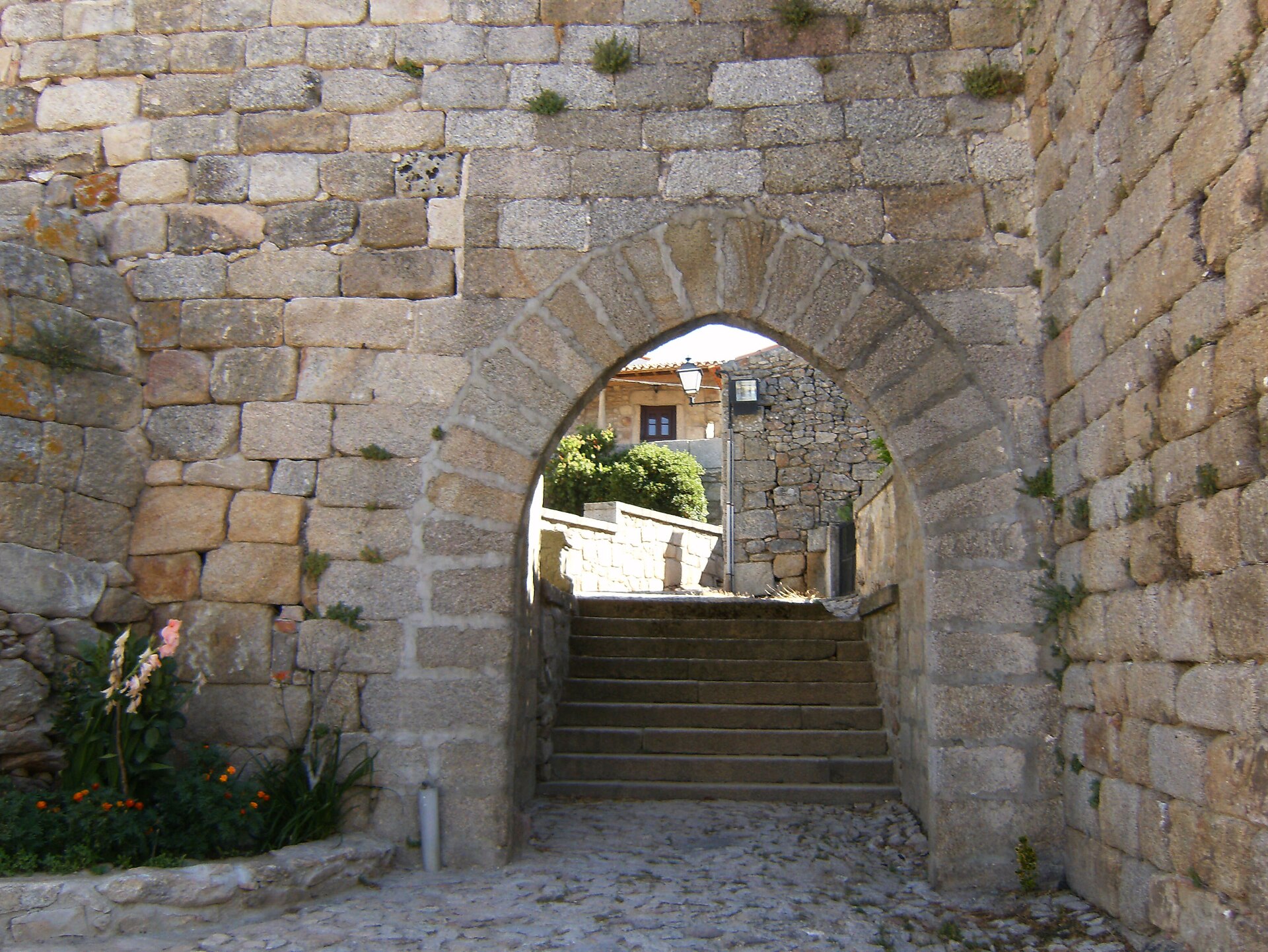
Castle of Castelo Bom
Almeida
The Castle of Castelo Bom (Portuguese: Castelo de Castelo Bom) is a medieval fortress in the municipality of Almeida, Guarda District, in central Portugal. What remains today is a set of ruins inside a small historic village of the same name, close to the Spanish border. It has been a National Monument since 2 January 1946. Where is Castelo Bom? The castle sits on a rocky hill above the Côa River, in the Ribacôa region. Other frontier strongholds, including Almeida and Castelo Rodrigo, are within sight. From here it is easy to see that the whole area formed a defensive belt rather than a scatter of unrelated forts. The coordinates are roughly 40.62° N, 6.90° W. What is the history of the castle? Bronze Age traces on the hill suggest that a fortified settlement (castro) stood here long before the castle. The medieval building went up in the 12th century, in granite and rubble masonry. At that time Ribacôa belonged to the Kingdom of León and was contested by Portugal. King Denis (D. Dinis) took it in 1296, and the Treaty of Alcanices in 1297 settled the region as Portuguese. Afterwards the king worked to consolidate the border and rebuild the castle. Works on the Praça de Armas were still under way in the 14th century, under Ferdinand I. In 1510 Manuel I renewed the town charter (foral) and ordered repairs to the castle and its defences. What did the castle and walls look like? The castle had an irregular plan and was crowned by two smaller towers and a main keep, the torre de menagem. A wall circuit enclosed the village, made up of a main wall and an outer barbican, with the Porta da Vila (Village Gate) as the principal entrance. The keep survived until the mid-20th century, when a private owner pulled it down to build a shelter for his donkey. It is a sobering reminder of how heritage protection in remote places once depended on chance. What can you see today? Surviving elements include: stretches of the defensive walls, the Porta da Vila, a ruined tower, a coat of arms with the village's former shield, a cistern known as the Poço do Rei (the King's Well), an ammunition store, a small guard tower, two wells. A walk through the village lets you combine the ruins with the streets of a former border town. A visit usually takes little time, so it pairs well with other sites in the region. Frequently asked questions Is the Castle of Castelo Bom well preserved? No, it is a ruin. Sections of wall, the gate, one tower and some defensive facilities remain, but the keep is gone. When was it built? In the 12th century, though its later form owes much to rebuilding after the Treaty of Alcanices (1297) and to works under Ferdinand I and Manuel I. Which other castles are nearby? Almeida and Castelo Rodrigo are visible from the site, and Castelo Mendo and Castelo Melhor lie in the same region. Is it a protected monument? Yes, it has been classified as a National Monument since 1946.
-
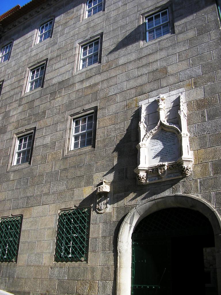
Casa do Infante
Porto
Casa do Infante, also known as the Alfândega Velha (Old Customs House), is a historic house in the old centre of Porto, in northern Portugal. It stands close to the Douro riverfront and is one of the oldest reminders of medieval Porto. Today it hosts a museum and the city's historical archive. What is Casa do Infante? It began as a customs house combined with a mint. King Afonso IV ordered it built in 1325 to oversee the trade arriving in the city along the Douro. Sources say it was raised on top of a Roman villa. The building you see now owes most of its appearance to a remodelling in the 17th century, although its origins reach back to the 14th. Why is it called the "House of the Prince"? The name comes from an oral tradition claiming that Prince Henry the Navigator, a central figure of the Age of Discovery, was born here in 1394. That claim has never been firmly confirmed. Henry was baptised in Porto and may well have been born in the city while the royal couple lived in the old mint. Another suggestion points to the Monastery of Leça do Balio nearby. Life after the customs service Around 1860 the building stopped working as a customs house, and the service moved to Miragaia. The site was later rehabilitated and turned into a cultural venue. Today it offers: a city museum, the Historical Municipal Archive, a library on Porto affairs, a memory room, an exhibition hall and auditorium. What to expect on a visit A visit traces Porto's story from Roman times through medieval river trade to later centuries. It suits anyone curious about the city's past and the beginnings of Portuguese maritime expansion. The building is compact, so a visit is usually short and pairs easily with a walk around the surrounding streets. Where is it? Casa do Infante lies in the united parish of Cedofeita, Santo Ildefonso, Sé, Miragaia, São Nicolau and Vitória, in the heart of Porto's historic quarter near the Douro. Its coordinates are roughly 41.1407 N, 8.6145 W. Many other landmarks are within easy reach. Frequently asked questions Was Henry the Navigator definitely born in Casa do Infante? Nobody can say for sure. It is an oral tradition, and historians also mention the Monastery of Leça do Balio as a possible birthplace. What was the building originally used for? It served as a customs house and mint, built in 1325 under Afonso IV. Is the Old Customs House the same place? Yes, Alfândega Velha is an alternative name for this house. What is inside today? A museum, a historical archive, a library, a memory room, an exhibition hall and an auditorium. When did it stop being a customs house? Around 1860, when customs operations moved to Miragaia. Is it worth visiting? Yes, if you like Porto's history, the Age of Discovery and medieval urban architecture.
-
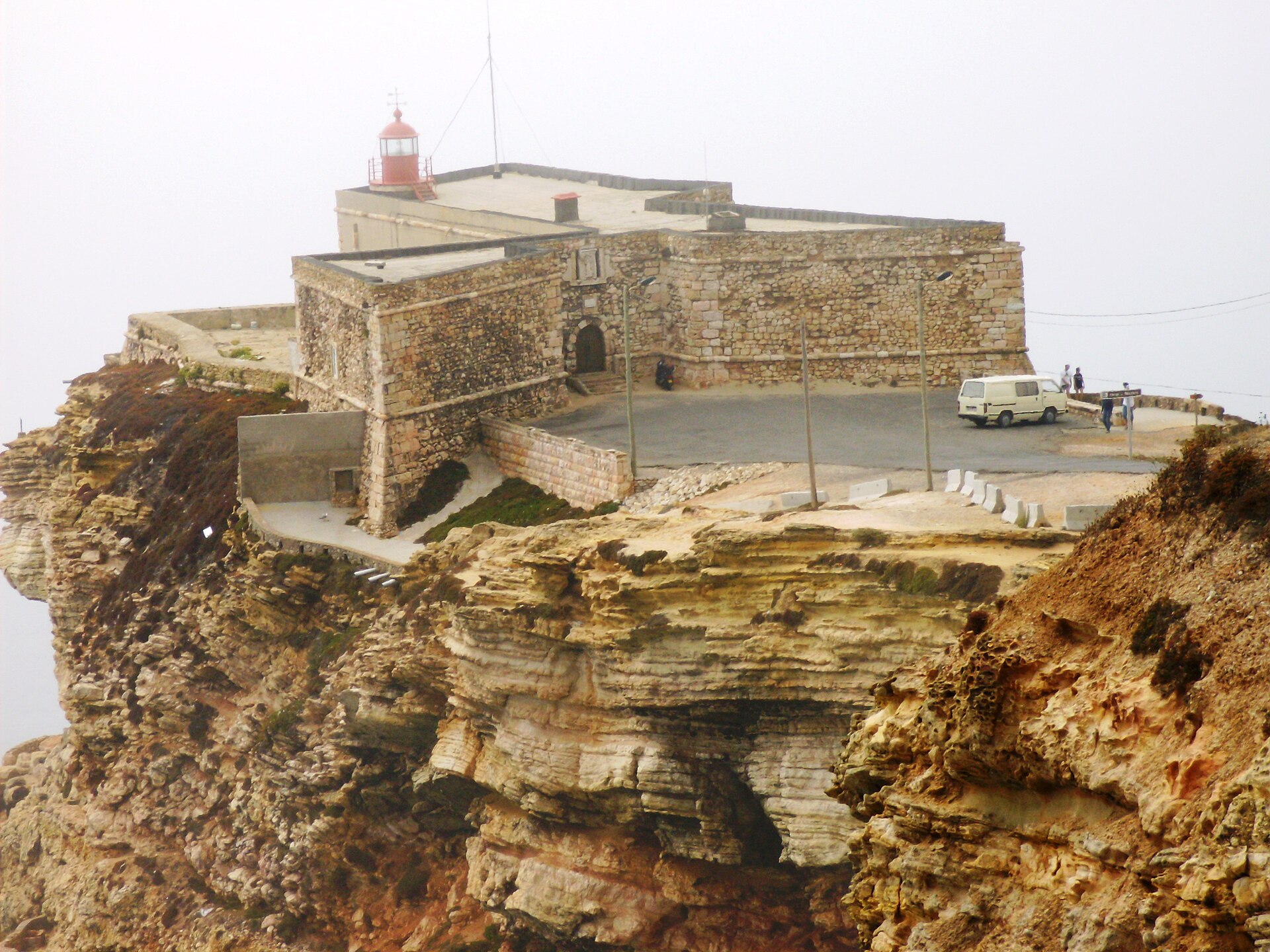
Fort of São Miguel Arcanjo
Nazaré
Fort of São Miguel Arcanjo is a small coastal fortress on the headland of Nazaré, in Portugal's Oeste region. Today it works as both a lighthouse and a museum, and it is one of the best vantage points for watching the giant waves of Praia do Norte. How did the fort come to be? Construction began in 1577. The fortification was meant to protect the local fishing settlement from pirates; sources name Algerian, Moroccan, Dutch and Norman raiders. From 1644 the building was remodeled and enlarged, and further changes followed in later centuries. What you see now is the result of several phases rather than a single design. Why is it also a lighthouse? Since 1 December 1903 a light here has helped ships navigate this stretch of coast. That gave the old defensive structure a second purpose, and it remains an important landmark. The site is recognized as a cultural heritage monument. What can you see inside? The interior houses a museum devoted in large part to surfing. Surfer Wall – a museum project from 2016 displaying boards donated by elite athletes who take on the waves of Praia do Norte, alongside their biographies. Nazaré Canyon Interpretive Center – scientific information about the underwater canyon, a scale model of it, and data from the MONICAN buoys used to monitor and forecast ocean and weather conditions. It also features material on the German submarine U-963, which sank off the Nazaré coast. Temporary exhibitions – these change over the year. Why visit? The fort stands next to a spot famous for the height of its waves, which draw surfers and spectators from many countries. In 2012 it began opening to the public intermittently so people could watch the giant swells, an era linked to the feats of surfer Garrett McNamara. It has been open to visitors every year since 2015 and has been run by the municipality since 2017. More than 650,000 people have already visited. Frequently asked questions Where is the Fort of São Miguel Arcanjo? In Nazaré, in Portugal's Oeste region, on the Atlantic coast. Is the lighthouse still active? A light has operated at this site since 1903. Is there a surfing museum? Yes. Part of the exhibition is devoted to surfing, including the Surfer Wall. When are the big waves visible? The biggest Praia do Norte waves usually arrive outside the summer season, so check forecasts before you go. Opening hours and ticket prices are best confirmed locally or with the municipality. Is it good for a short visit? Yes. The site is compact, and the mix of history, museum and ocean view offers a lot in little time.
-
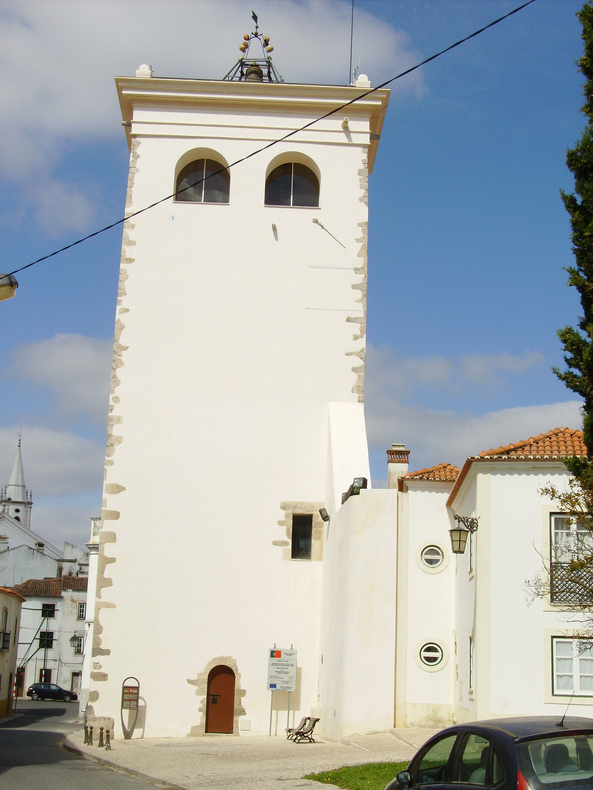
Torre das Cabaças
Santarém
Torre das Cabaças is a historic clock tower in Santarém, central Portugal. Today it houses the Núcleo Museológico do Tempo, a small museum devoted to time, while still serving as the city's clock tower. It stands in the former Marvila parish on Largo Zeferino Sarmento, close to the church of São João de Alporão. Why is it called the "Gourd Tower"? The name literally means "Tower of the Calabashes". It caught on in the late 18th century, when eight clay calabashes were fitted to the iron frame holding a large bronze bell, cast in 1604, to amplify its sound. Locals joked that the hollow vessels resembled the "empty heads" of the town councillors. The calabashes have since been replaced by ceramic pots, but the name stuck. The tower is also known simply as Torre do Relógio, the Clock Tower. How old is the tower? The tower belongs to Santarém's defensive system. It was raised over an earlier defensive structure by the Alporão Gate, in the walls of the castle and town fortifications. Sources date it to the 15th century and the reign of King Manuel I (1495–1521), and describe its style as late Gothic or Mannerist. It has a square plan. It was classified as a Property of Public Interest by a decree of 14 March 1917. What is inside? The interior has been converted into the Núcleo Museológico do Tempo, part of the Santarém Municipal Museum. Across three levels you will find exhibits on the theme of time, including clocks of various kinds. The centrepiece is the tower's own clock mechanism. At the top is a viewpoint with views over the city. Practical tips The tower fits naturally into a walk around Santarém's old town, near other sights around São João de Alporão. It was renovated and reopened to the public in 2025, so check current opening hours with the municipal museum before visiting. Combine the visit with a stroll along the city's viewpoints and terraces. Frequently asked questions Why is it called the Calabash Tower? After eight clay vessels hung by the bell to amplify its sound, which locals likened to their councillors' hollow heads. Does it still work as a clock? Yes, it still functions as the city's clock tower. What is inside? A museum of time with clocks across three levels, the tower's clock mechanism and a viewpoint. When was it built? The current tower is linked to the reign of Manuel I, on an older defensive structure by the Alporão Gate. Is it a protected monument? Yes, classified as a Property of Public Interest since 1917.
-
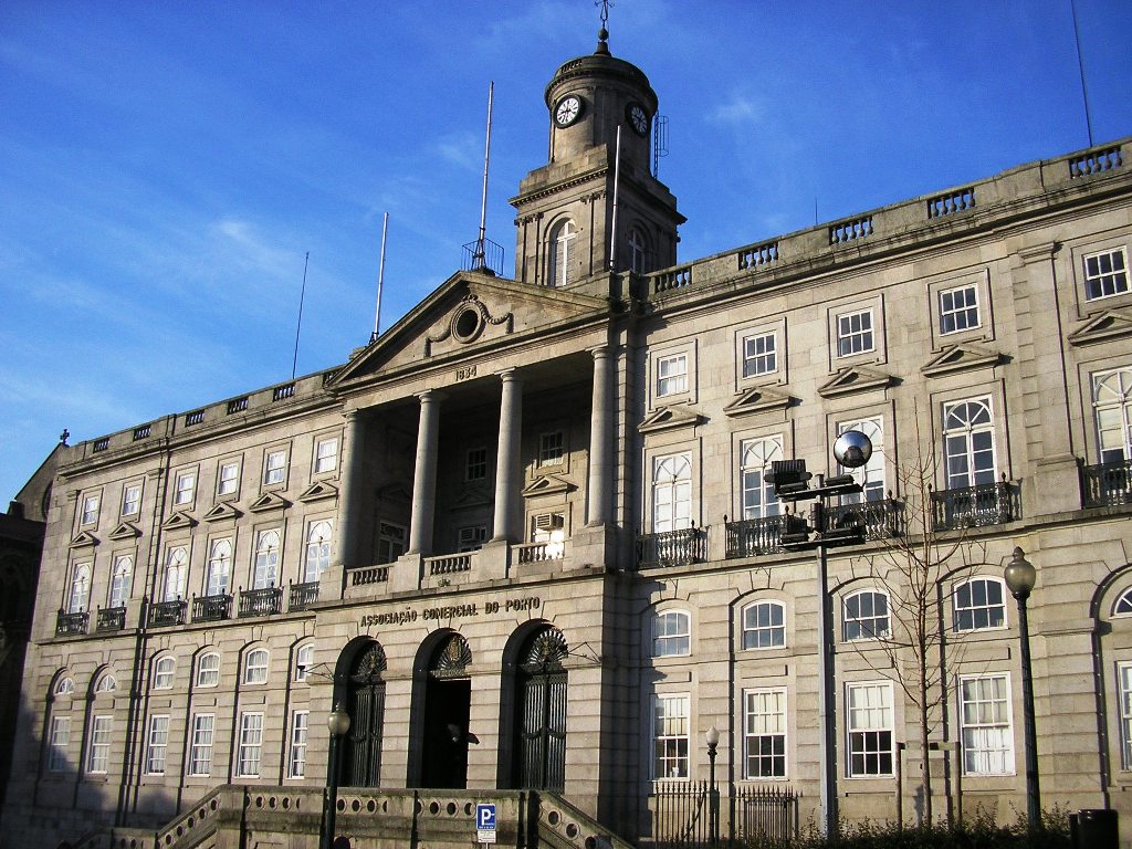
Palácio da Bolsa
Palácio da Bolsa, the Stock Exchange Palace, is a historic building in Porto, Portugal, built in the 19th century for the city's Commercial Association. It stands on Infante D. Henrique Square in the historic centre of Porto, a UNESCO World Heritage Site, and ranks among the most visited sights in the city. What is the Palácio da Bolsa? The palace was commissioned by Porto's merchants, who wanted an impressive home for their trade interests. Construction began in 1842 to a design by architect Joaquim da Costa Lima. The architecture is Neoclassical, with Tuscan and Neo-Palladian influences. In 1982 it was classified as a National Monument of Portugal. What can you see inside? The tour begins in the Hall of Nations, a bright, open space under an iron-and-glass skylight. The coats of arms of the countries Portugal traded with decorate the walls, a nod to Porto's cosmopolitan outlook as a merchant city and port. The best-known room is the Arab Room. It is decorated in the Moorish Revival style that was fashionable in the 19th century, and it is said to have been inspired by the Alhambra in Granada. The room is used for official ceremonies and diplomatic events, and as a reception hall for dignitaries and heads of state visiting Porto. Many visitors consider it one of the most beautiful interiors in Portugal. How does a visit work? Entry is by guided tour only, in groups. Tours run in Portuguese, English, French and Spanish and last about 30 minutes. It is a short visit, yet it covers the building's most impressive rooms. Frequently asked questions Where is the Palácio da Bolsa? On Infante D. Henrique Square in central Porto, inside the UNESCO-listed historic centre. The coordinates are roughly 41.1414 N, 8.6157 W. What are the opening hours? According to OpenStreetMap, from November to March it is open daily 9:00-12:30 and 14:00-17:30. From April to October it is open daily 9:00-18:30. It is closed on 25 December and 1 January. Check current times before you go. Can I visit on my own? No. Visits are guided and organised in groups. How long does the tour take? About 30 minutes. What architectural style is it? The building is Neoclassical, with Tuscan and Neo-Palladian influences, while the Arab Room is Moorish Revival. Who is it for? The Palácio da Bolsa suits anyone interested in 19th-century architecture, the trading history of Porto, or richly decorated interiors. Because it sits right in the centre, it is easy to combine with a walk through the historic district. Since visits happen at set times with a group, it helps to check available tour slots on site or through official sources when planning your day.
-

Alminhas da Ponte
Porto
Alminhas da Ponte is a small memorial shrine on the Ribeira waterfront in Porto, just a short walk from the Dom Luís I Bridge. It commemorates one of the darkest days in the city's history: the collapse of the Ponte das Barcas pontoon bridge on 29 March 1809. What are alminhas? Alminhas are Portuguese wayside shrines dedicated to the souls of the dead. They usually depict souls in purgatory and invite passers-by to pray. The one in Porto is unusual because it joins that folk tradition with the memory of a specific event. What happened in 1809? The bridge of boats, made of about twenty vessels linked by steel cables, opened in August 1806 and served for years as the crossing over the Douro at this point. In March 1809, during the second French invasion led by Marshal Soult, residents fleeing the advancing army rushed onto it in huge numbers. The structure could not bear the weight and gave way. Estimates of the death toll differ, from hundreds to several thousand people. What does the monument look like? The bronze bas-relief was made in 1897 by sculptor António Teixeira Lopes. It combines bronze, marble and wrought iron and is set into a wall beside one of the arches of the quay. The scene shows souls reaching upward, giving the memorial a solemn but not overwhelming feel. Why stop here? It is easy to miss among the crowds strolling through Ribeira, which is exactly why it deserves a pause. Locals still leave lit candles and flowers here, so this is a living place of remembrance rather than a museum piece. You can easily pair the visit with a walk nearby: the Dom Luís I Bridge, the Douro quay and the narrow lanes of Ribeira are all minutes away. Frequently asked questions Where exactly is Alminhas da Ponte? On the Cais da Ribeira quay in Porto, close to the Dom Luís I Bridge. Is there an entrance fee? No. The memorial stands in public space and can be seen at any time. How long does a visit take? A few minutes. It fits well into a longer walk around Ribeira. Is the Ponte das Barcas the same as the Dom Luís I Bridge? No. The bridge of boats collapsed in 1809. The iron Dom Luís I Bridge was built later, between 1881 and 1886, near the old crossing. Who made the monument? António Teixeira Lopes, who created it in 1897. How should visitors behave? This is a place of remembrance, so keep quiet and show respect to people leaving candles or flowers. Alminhas da Ponte is a brief stop that adds depth to a walk through Porto. It reminds visitors that beneath Ribeira's postcard views lies a story of war, panic and mourning, still present in the everyday gestures of local people.
-
Casa e Quinta de Bonjóia
Casa e Quinta de Bonjóia is a historic house with grounds in the eastern part of Porto, Portugal. The 18th-century baroque building has a square floor plan and a tower on one of its facades. It was never finished, which makes it an intriguing stop for anyone interested in the city's architecture and history. Where does the estate come from? The name Bonjóia goes back to the Middle Ages. Records show that by the late 14th century a quinta, a rural country estate, already stood here, owned by the churchman Martim Viegas. His descendants donated it to the cathedral chapter of Porto (Sé do Porto). From the 16th century onwards it was leased to a succession of tenants. Who built the present house? In 1758 the estate was bought by Lourenço Amorim da Gama Lobo, a nobleman attached to the royal household. He had married the daughter of João Antunes Guimarães, a prominent Porto merchant. He commissioned the house we see today. The researcher Robert C. Smith attributed the design to Nicolau Nasoni (1691-1773), the Italian painter and architect who shaped much of Porto's baroque character. Why is the house unfinished? Only the western wing was completed. The planned eastern part was never built. In this respect the building resembles another Porto residence, Casa da Prelada, which also remained a fragment of a larger plan. The 19th and 20th centuries The property passed through several families. In 1935 it was sold to the judge Abílio Augusto Mendes de Carvalho. Over this period the house received ad hoc alterations and slowly deteriorated. In 1995 Porto's municipal council purchased it, ending the years of neglect. What is it like today? Today the quinta is the headquarters of Fundação Porto Social, a non-profit institution. The gardens are part of Porto's municipal green spaces and are listed among gardens linked to the city's museums. Frequently asked questions Where is Casa e Quinta de Bonjóia? In Porto, in northern Portugal, in the eastern part of the city. Who designed the house? The design is attributed to Nicolau Nasoni, though this is a researcher's attribution rather than a documented certainty. What period is the building from? The 18th century, in baroque style. The estate itself is much older, dating back to the late 14th century. Why does the building look incomplete? Only the western wing was finished; the eastern part was never built. Who owns it? Since 1995 it has belonged to the city of Porto, and Fundação Porto Social is based here. Is it worth a visit? Yes, if you enjoy Porto's baroque architecture and lesser-known sights away from the main tourist trail. Check current access rules on the city's official channels before you go.
Earn badges for the places you visit
Download NextOnTrip, discover new places and check off your trails.