Coast in Italy
A guide to 127 Coast in Italy — with descriptions, photos and traveler visits from the NextOnTrip community. Locations spread across 103 cities and towns. Most visited by the community: Capo Granitola lighthouse, Strombolicchio, Grottone.
-
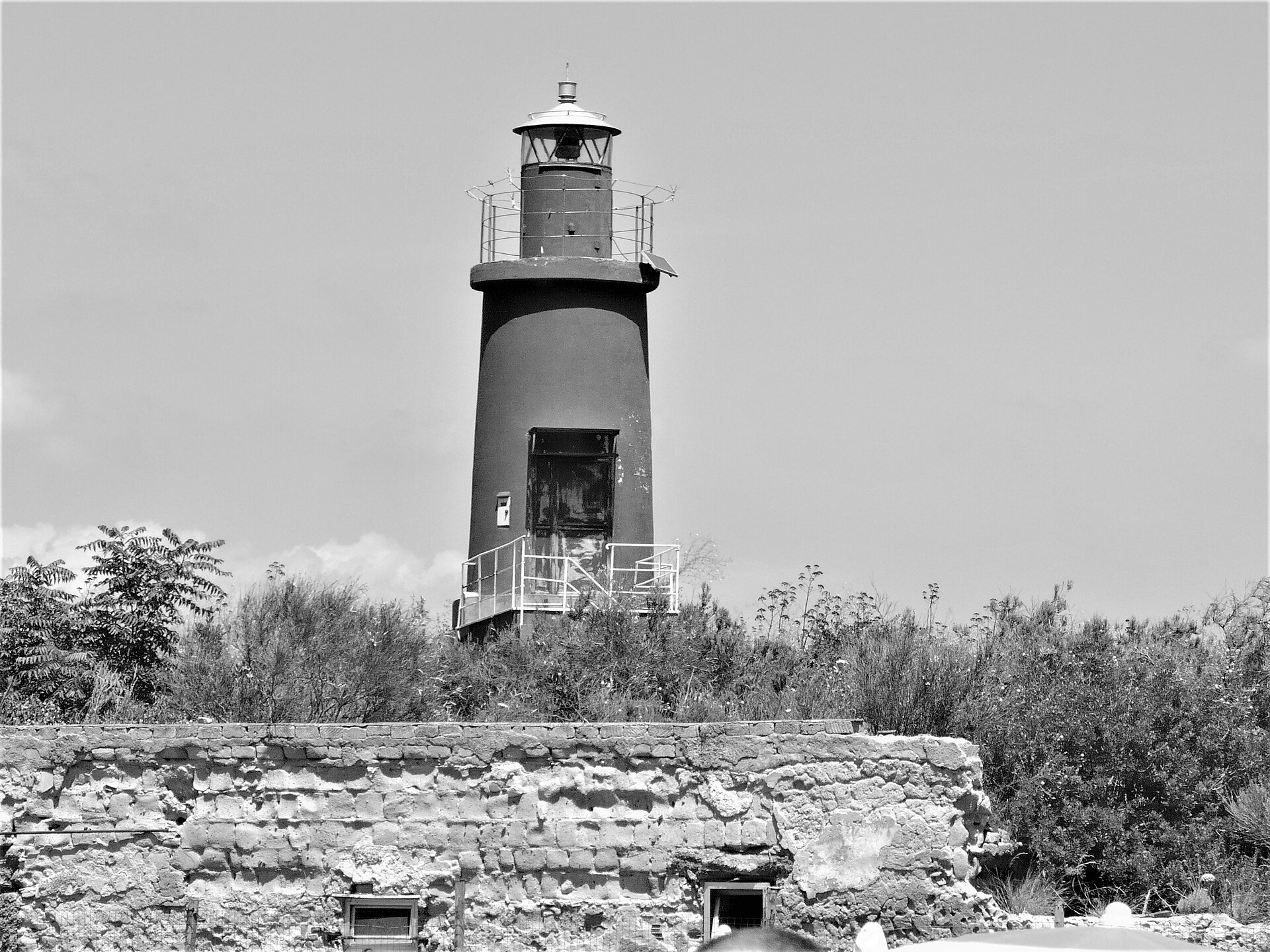
Fortino Tenaglia lighthouse
Bacoli
Fortino Tenaglia Lighthouse stands on a small fort built on a promontory on the western side of the Gulf of Pozzuoli, in the municipality of Bacoli, Campania, on the Tyrrhenian coast. The site sits at the tip of Punta Pennata, one of the rocky headlands typical of the Campi Flegrei (Phlegraean Fields), a coastal region shaped by volcanic activity and dotted with remains of the ancient Roman war fleet's harbor infrastructure. Where exactly is it? The lighthouse occupies a promontory that juts into the sea, marking the boundary between the Gulf of Pozzuoli and the rest of Bacoli's coastline. Its coordinates place it at roughly 40.812°N, 14.082°E, right at Punta Pennata — a vantage point with views across the gulf and out toward the open Tyrrhenian Sea. The surrounding terrain is characteristic of the Bacoli coast: rocky cliffs, small coves, and, on a clear day, sightlines stretching toward Procida and Ischia. What kind of structure is it? Fortino Tenaglia is a small coastal fortification with a working lighthouse mounted on it. The name "tenaglia" (pincers) refers to the distinctive shape of the fortification, a design typical of older coastal defenses built to guard the entrance to a bay. The lighthouse is still active today, its light guiding vessels toward the entrance of the Gulf of Pozzuoli and warning them away from the rocky edge of the promontory. It is a functional navigational installation maintained as part of the coastline's maritime signaling network, not a tourist site with visitor facilities. How do you get there? Fortino Tenaglia sits within the town of Bacoli, on the Phlegraean Peninsula a short distance west of Naples. The fort and lighthouse occupy the promontory itself, reached via local coastal roads; the best views of the structure come from the shoreline or from the water. Given the nature of the site — an active lighthouse built into a fortification — visitors should not expect open access to the interior; it is a restricted-access installation typical of navigational aids managed by maritime authorities. What else is worth seeing nearby? Bacoli and the wider Campi Flegrei area are among the most historically dense corners of Campania. In antiquity, this stretch of coast was home to Portus Julius, the base of the Roman war fleet, and nearby Misenum served as Rome's main naval harbor on the Tyrrhenian Sea. The coastline around Punta Pennata itself is a popular spot for scenic walks along the cliffs. It's worth pairing a visit here with a look at the region's volcanic crater lakes and other ancient remains scattered throughout the area. When to visit? Spring and autumn offer the most comfortable conditions for taking in the promontory and the lighthouse, with milder temperatures and fewer crowds than the height of summer. Sunset seen from the Punta Pennata cliffs looking toward the gulf can be particularly striking, though the rocky terrain calls for caution when moving around uneven ground near the edge. Frequently Asked Questions Can you go inside Fortino Tenaglia Lighthouse? No — it's an active lighthouse built into a coastal fortification, a functional navigational site rather than a tourist attraction open to visitors. Where is Fortino Tenaglia located? On the Punta Pennata promontory, on the western side of the Gulf of Pozzuoli, in the municipality of Bacoli, Campania. Is the lighthouse still operational? Yes, it remains an active lighthouse used to mark the entrance to the gulf for passing vessels. What else can you see around Bacoli? The area is known for the remains of the ancient Roman naval harbor and the volcanic crater lakes typical of the Campi Flegrei, making it a good base for exploring the wider region.
-
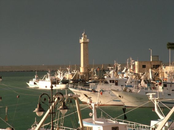
Molfetta Lighthouse
Molfetta
Molfetta Lighthouse stands at the end of the harbour's east pier in Molfetta, a coastal town in Apulia on the Adriatic Sea. It's a working lighthouse that still guides fishing boats and other vessels into the harbour, and it's one of those landmarks that instantly explains why Molfetta has been a maritime town for centuries. Where exactly is the lighthouse located? The lighthouse sits at the elbow of the east pier — the point where the breakwater bends and marks the entrance to the harbour basin. From this position its light is visible both from the open sea and from the seafront promenade, making it a natural point of reference for anyone walking along Molfetta's waterfront. How do you get there? Molfetta sits on the Adriatic coast of Apulia, and its harbour has always been the town's heart — this is where fishing boats moor and where the promenades leading toward the old town begin. The best way to see the lighthouse is on foot, walking along the pier toward the sea; this gives you the clearest view of the structure itself and of the harbour behind it. It's a popular spot for locals on an evening stroll, so it's worth keeping an eye out for signs pointing toward the pier as you approach the waterfront. What will you see once you're there? The lighthouse itself is a fairly modest but clearly visible structure whose main job is marking the harbour entrance — it's not a monumental tower, but a practical, still-operating piece of maritime infrastructure. The real appeal of the spot lies in what surrounds it: from the pier you get a sweeping view of Molfetta's fishing harbour, boats rocking at anchor, the open line of the Adriatic horizon, and, further back, the rooftops of the old town. It's this mix of working lighthouse, harbour activity, and open sea that draws visitors looking for a less obvious, more "local" view of the Apulian coast. Molfetta is above all a port and fishing town, and its old town — with its distinctive cathedral, the Duomo — sits close to the waterfront. If you have the time, it's worth pairing a visit to the lighthouse with a short walk through the old town, adding some historic architecture and atmosphere to the harbour views. When's the best time to visit? The lighthouse is visible around the clock, but it's at its most striking at dusk and after dark, when its light switches on and the harbour lights up along the waterfront. For photographers, or anyone looking for a quiet way to end the day, this is one of the best spots in Molfetta for an evening walk. During daylight hours, on the other hand, you get a clearer view of the harbour's layout and the comings and goings of the fishing fleet. Frequently Asked Questions Is Molfetta Lighthouse still in operation? Yes, it's a working lighthouse that continues to guide boats and ships into Molfetta's harbour. Where exactly is the lighthouse located? It stands at the elbow of the harbour's east pier in Molfetta, Apulia, on the Adriatic coast. Can you go inside the lighthouse? The lighthouse is active port infrastructure, so visits are limited to viewing it from the outside, along the pier and waterfront. What else is worth seeing nearby? Molfetta's fishing harbour and its old town, home to the Duomo cathedral, are both close by and make a good complement to a visit to the lighthouse.
-
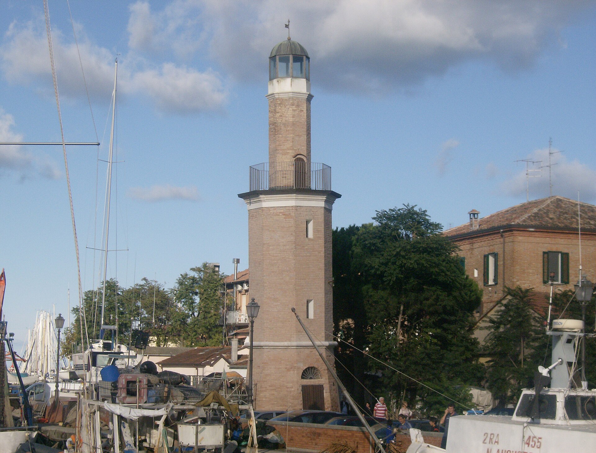
Cervia lighthouse
Cervia
The Cervia Lighthouse (Faro di Cervia) stands right by the beach, next to the canal harbour and the historic centre of this seaside town in the province of Ravenna, Emilia-Romagna. It's one of the most recognisable landmarks of Cervia, even though the tower no longer works as an active navigation light. How do you get there? The lighthouse sits close to the main beach and the harbour, so the easiest way to reach it is on foot from Cervia's old town or along the seafront promenade. It fits naturally into a short walk that also takes in the canal port and the historic centre. What's the history behind it? The earliest known reference to a lighthouse in Cervia goes back to 1708. For about a century the structure appeared in official records under the name "Casino di Sanità". The tower still standing today was built in 1875, designed by engineer Ferdinando Forlivesi, head of the municipal technical office. It stands 16 metres tall, and its light originally reached 14 nautical miles. The lighthouse was raised twice: first in 1918, after taller buildings went up nearby and started blocking the signal, and again after damage suffered during the Second World War. Its light was originally steady white; it was later switched to an intermittent pattern to stand out against the growing amount of city lighting. Eventually the lighthouse was taken out of service, and its role was handed over to two electronic lights placed at the ends of the harbour's breakwaters. What can you see on site? The lighthouse itself is a modest but distinctive tower, well preserved and often photographed against the beach. The surrounding area invites a short walk to the canal port, originally built for loading salt and now one of the better-equipped marinas on the Romagna coast. Across the canal lies Milano Marittima, the town's twin district, reachable by a small ferry that crosses the waterway. How does the lighthouse connect to Cervia's history? Cervia has been known for centuries as the "salt town" — salt has been harvested here since the 10th century. The canal port next to the lighthouse was built precisely to move that salt by boat, linking the salt pans to maritime trade routes. Even though it no longer guides ships, the lighthouse still stands as a marker of the era when the town's life revolved around the harbour and the salt trade. Frequently Asked Questions Is the Cervia lighthouse still an active navigation aid? No. Two electronic lights on the harbour breakwaters now do that job; the old lighthouse remains a historic structure only. Who designed the Cervia lighthouse? The 1875 tower was designed by engineer Ferdinando Forlivesi, head of the municipal technical office at the time. Can you walk to the lighthouse from central Cervia? Yes. It stands close to the beach and the harbour, within easy walking distance of the old town, making it a natural stop on a short seafront walk. Is there anything else to see near the lighthouse? Yes — the canal port with its salt-trade history, and the small ferry crossing to Milano Marittima on the other side of the canal.
-
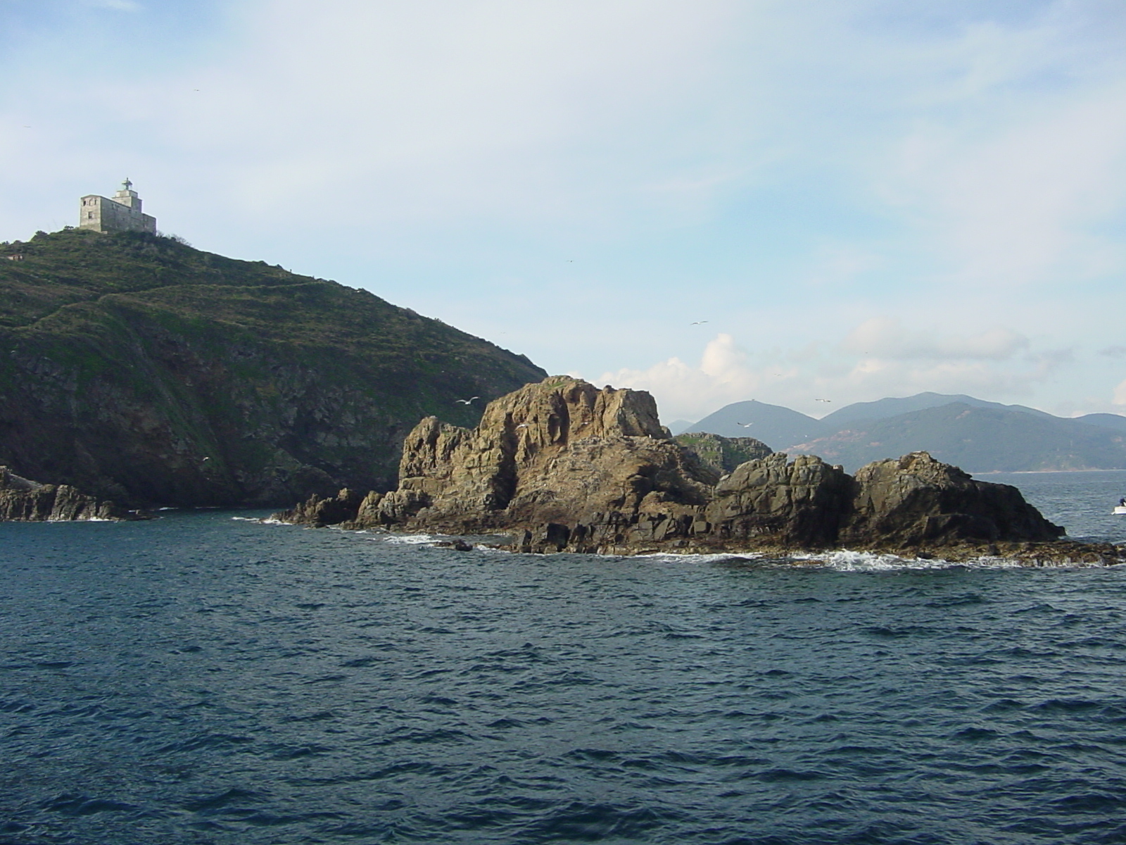
Palmaiola Lighthouse
Rio
Palmaiola Lighthouse stands on the summit of a small, rocky islet of the same name, rising from the channel between Piombino and Elba, within the municipality of Rio on Elba's eastern coast in Tuscany. Where is the Palmaiola islet located? Palmaiola is one of the quiet landmarks of the Tuscan Archipelago — a tiny, uninhabited outcrop of rock sitting in the sea between the mainland port of Piombino and the coast of Elba. It falls administratively under the municipality of Rio, one of Elba's oldest settlements, historically tied to mining. The lighthouse itself occupies the very top of the islet and still functions as an active navigational aid for vessels moving through the channel between the mainland and Elba. How do you get there and see it? There is no dock, no residents, and no visitor infrastructure on the islet — it's a bare rock topped by the lighthouse tower, and the only way to reach it is by sea, whether on a private boat, kayak, or a local boat excursion departing from Elba. The easiest way to spot Palmaiola is from the deck of the ferry running between Piombino and Elba's ports: the islet appears as a distinctive white shape on the horizon, especially clear on routes heading toward Rio Marina. Anyone sailing their own boat through the Elba channel can approach and circle the rock at a safe distance, but the lighthouse remains an active structure and is not set up for visits inside. What is there to see around it? The islet itself is a small, steep sliver of rock surrounded by clear, deep water, which is why the waters around Palmaiola are popular with divers and snorkelers coming out from Elba on boat trips. From the water or a boat deck, you get both the lighthouse up close and a wider view of Elba's eastern coastline along with the outline of the mainland toward Piombino — a view that captures the character of the channel separating the island from the coast better than almost any other spot nearby. This is a stop for people chasing a sea adventure and a good photo rather than a guided walk-through attraction. When is the best time to visit? Late spring through early autumn is the best window for a trip out to Palmaiola, when the sea is calmer and underwater visibility is at its best — conditions that suit both boat excursions and diving around the islet. On days with strong wind or rough seas, getting close to the rock can be difficult, so it's worth checking the marine forecast before heading out. Frequently Asked Questions Can you go ashore on Palmaiola islet? No — the islet is uninhabited and the lighthouse is an active navigational structure, so it isn't set up for visitors; it's best seen from a boat or from the water around the rock. How do you reach Palmaiola? Only by sea — on a private boat or kayak, or by joining a boat excursion or diving trip departing from Elba's coast. Can you see Palmaiola from the Piombino–Elba ferry? Yes, the islet with its distinctive white lighthouse is visible from ferries crossing the channel between Piombino and Elba's ports, particularly on the approach toward Rio Marina. Which municipality does Palmaiola belong to? The islet falls under the municipality of Rio on Elba, in the province of Livorno, in the Tuscany region.
-
Trieste lighthouse
Triest
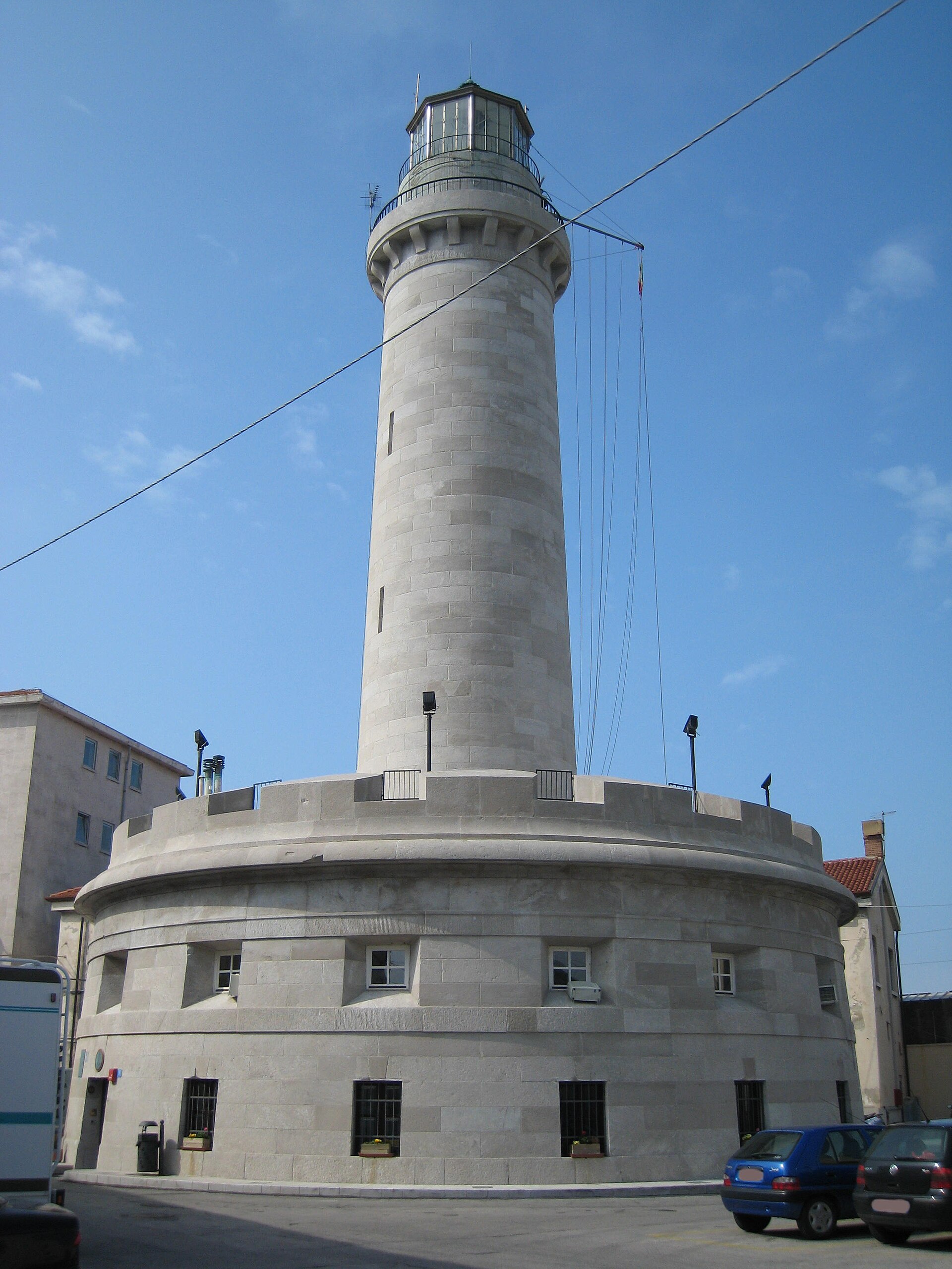
Lanterna di Trieste Lanterna di Trieste is a decommissioned lighthouse standing at the tip of Molo Fratelli Bandiera, on the western edge of Trieste, right at the entrance to the old harbour. The 33-metre tower, shaped like a slightly tapering Doric column, is one of the waterfront's most recognisable landmarks and a favourite spot for evening strolls among locals and visitors alike. How do you get there? Molo Fratelli Bandiera is within easy walking distance of central Trieste and the famous Piazza Unità d'Italia — just a short walk along the waterfront. The pier is open to the public along its full length, so all you need to do is walk to its far end to stand right at the base of the lighthouse. It's one of those Trieste sights that doesn't require a separate trip; it pairs naturally with a walk through the historic centre. What will you see there? The lighthouse takes the form of a slender, gently tapering Doric column and dominates the entrance to the old port. The current structure was commissioned by the city's governor, Carlo Zinzendorf, designed by architect Matteo Pertsch, and entered service on 11 February 1833. It replaced an earlier lighthouse built in the mid-18th century on the orders of Empress Maria Theresa. The maritime history of this particular stretch of coast goes back much further still — the site was already used for signalling ships in Roman times, and the remains of a Roman-era lighthouse on the Zucco rock were reportedly visible until the late 17th century. The lighthouse itself was taken out of active service on 25 November 1969 and is now listed as "inactive" by the Italian Hydrographic Institute. Since 1992, it has housed the Trieste branch of the Lega Navale Italiana (Italian Naval League) — so while it no longer guides ships into port, the building remains a living part of the city's maritime tradition rather than a silent monument. The pier on which the lighthouse stands offers wide views over the Gulf of Trieste, the harbour traffic, and the city rising on the hills behind the waterfront. It's a popular spot for anyone looking for a quiet vantage point over the water, away from the bustle of the centre. When is the best time to visit? The lighthouse and pier are accessible year-round, and a walk along the waterfront works at any time of day. In the evening, around sunset, the view over the gulf and the city lights draws a particularly large number of visitors. Keep in mind that Trieste is known for the bora, a strong wind that hits exposed waterfront piers especially hard — on windy days, a walk out to the tip of the pier can be a genuinely bracing experience. Frequently Asked Questions Is the Lanterna still an active lighthouse? No. It was decommissioned on 25 November 1969 and is currently listed as inactive. What is the building used for today? Since 1992, it has housed the Trieste branch of the Lega Navale Italiana, an Italian sailing organisation. How old is the current lighthouse? The present structure opened on 11 February 1833, replacing an earlier lighthouse from the mid-18th century built under Empress Maria Theresa. Is this the same lighthouse as the Faro della Vittoria? No. The Lanterna is a separate, much older structure on the harbour pier, while the Faro della Vittoria is a large lighthouse-monument on the Gretta hill, built in a different location for a different purpose.
-
Punta Spadillo lighthouse
Khamma
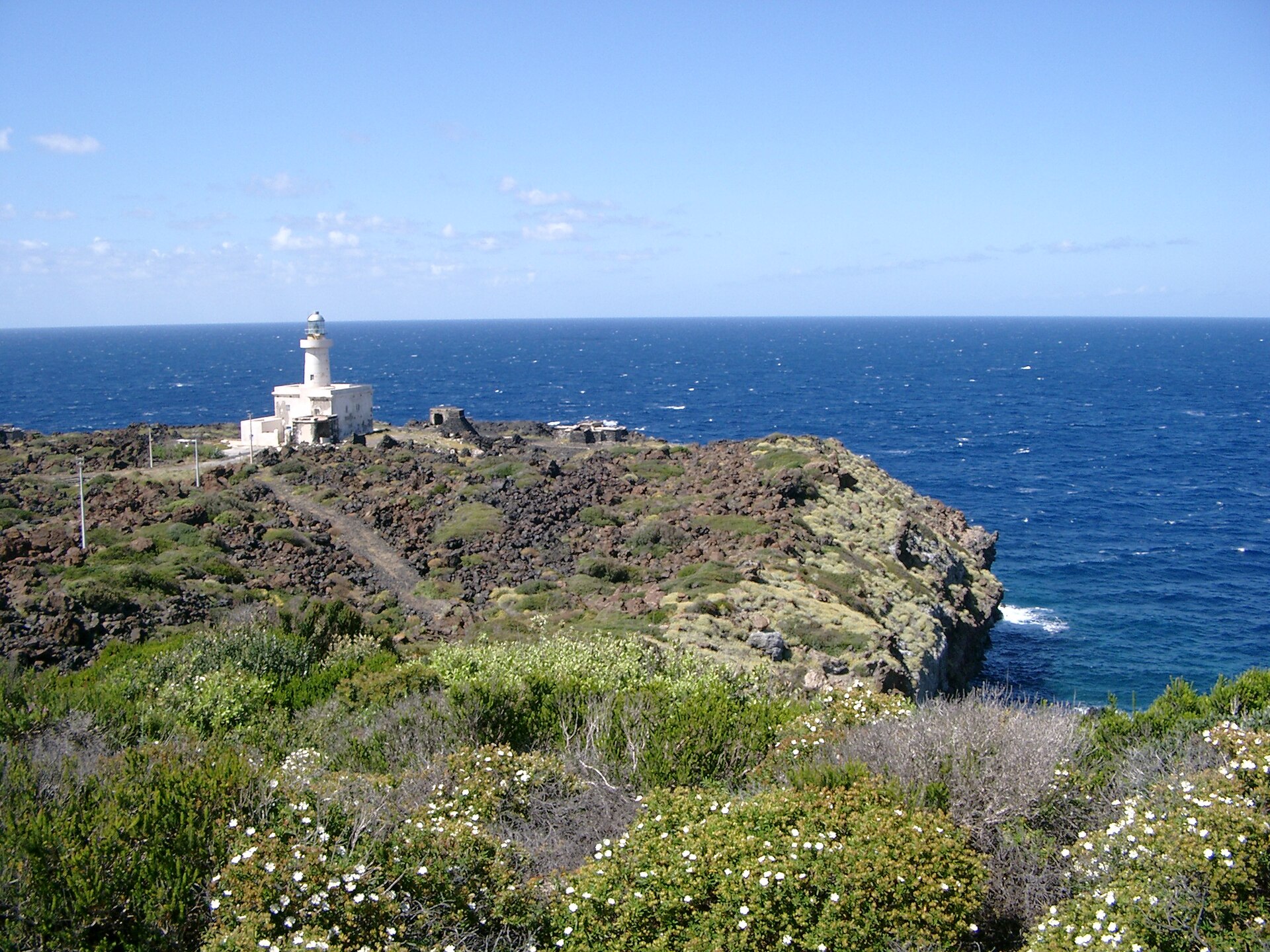
Punta Spadillo lighthouse stands on the northeastern coast of Pantelleria, near Khamma, perched above a steep volcanic cliff that drops straight into the sea. What is this place? The lighthouse was built at the end of the 19th century and has guided ships through the Sicilian Channel ever since — one of the busiest and most strategically important shipping lanes in the Mediterranean. The structure itself is modest in size, but its white tower, visible from a distance, has become a recognizable landmark on this side of the island. Punta Spadillo is a rocky headland where dark volcanic stone breaks off sharply above the water, opening onto an unobstructed view of the open sea. How do you get there? A well-marked walking trail leads out to the lighthouse and continues on to the nearby Laghetto delle Ondine, a small natural rock pool that offers calmer swimming than the open sea beyond it. The area right around Punta Spadillo itself has no direct access to the water from land — anyone wanting to swim right beneath the cliffs needs to arrive by boat. What else is there to see along the way? The paths around the lighthouse hold more than sea views. During the Second World War this stretch of coast held real strategic importance, and hikers can still spot the remains of bunkers, anti-aircraft gun positions, and casemates tucked into the rocky terrain — a quiet reminder of Pantelleria's wartime past woven into the landscape. It's a good stop for anyone who likes pairing a coastal walk with a bit of history. Who is Punta Spadillo for? Divers rate this spot highly — the rocky, coral-covered seabed around the headland draws people looking for a dive rich in marine life, usually arranged as a boat excursion with local operators. For visitors on foot, it works better as a short, scenic outing than a full day trip; it's easy to combine with a visit to Laghetto delle Ondine in a single afternoon. When is the best time to visit? The cliffs and sea look their best in the afternoon light, and again at sunset, when the lighthouse and coastline take on warm colors. Spring and early autumn make for pleasant walking without Pantelleria's summer heat, though the site itself is accessible all year round. Frequently Asked Questions Can you go inside the lighthouse? No — it's an active navigation aid guiding ships through the Sicilian Channel, not a museum. You view it from the outside, along the trail leading to the headland. Can you swim there? Not directly from the shore near the lighthouse, since there's no land access to the water at that point. Swimming nearby is possible at Laghetto delle Ondine, reached via a short separate trail, or by boat right off the headland. What else can you see in the area? The trails around Punta Spadillo still hold remnants of World War II fortifications, including bunkers and anti-aircraft gun positions. Is it a good spot to visit with children? The walk to the lighthouse itself is easy, but the cliff edges are steep and rocky, so keep a close eye on kids and avoid getting too close to the drop.
-
Capo Grosso Lighthouse
Favignana
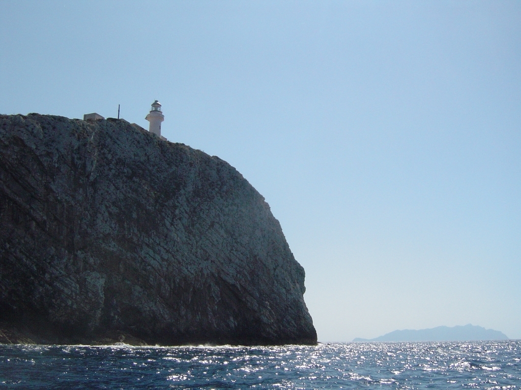
Capo Grosso Lighthouse is an active maritime lighthouse standing at the northernmost tip of Levanzo, the smallest of Sicily's Egadi Islands. Perched on a rocky headland high above the sea, the tower has guided ships along the archipelago's northern shore for decades. Where is Capo Grosso Lighthouse located? The lighthouse sits on Capo Grosso, the northernmost point of Levanzo Island. Levanzo is one of the three main islands of the Egadi archipelago (Isole Egadi), scattered across the Tyrrhenian Sea off the western coast of Sicily, near Trapani and Favignana. The headland rises well above the waterline, making the lighthouse visible from a considerable distance, both from the sea and from higher ground on the island. How do you get there? Levanzo has essentially no car traffic in the conventional sense — most visitors get around on foot, by dinghy, or by small boat. The usual starting point for exploring the Egadi Islands is Favignana, the largest island in the group, from where ferries and fast hydrofoils run to the small harbour of Cala Dogana on Levanzo. From the harbour, a walking trail leads across the rugged, stony landscape of the island's northern section toward Capo Grosso. The path calls for sturdy shoes and sun protection, since it runs largely without shade. What will you see there? The lighthouse itself is a classic white Mediterranean tower standing alone on the rocky spine of the headland. The real draw, however, is the setting around it: open sea views, steep cliffs, and the contrast between turquoise water and the dry, low scrub of the surrounding maquis vegetation. From the area near the cape, the view stretches along the rest of Levanzo's coastline and, on a clear day, toward the neighbouring islands of the archipelago. It's a spot favoured by travellers looking for quiet, less-crowded corners of the Egadi Islands, in contrast to Favignana's busier beaches. When is the best time to visit? Because the terrain around the cape is rocky, exposed, and largely shadeless, the best times to walk out to the lighthouse are early morning or late afternoon, when temperatures are lower and the light is better for photography. Summer sun on the island can be intense, so water and sun protection are worth carrying regardless of the time of day. Frequently Asked Questions Is Capo Grosso Lighthouse still in operation? Yes, it remains an active navigational lighthouse. Which island is the lighthouse on? Levanzo, one of the Egadi Islands — not Favignana, although Favignana is the usual gateway for visiting the archipelago. Can you go inside the lighthouse? As a working navigational structure, the lighthouse is not open for interior visits — the appeal lies in the exterior view and the surrounding headland landscape. Is the walk to the lighthouse difficult? The trail crosses rocky, uneven ground with little shade, so it's best tackled with proper footwear and enough water.
-
Vieste Lighthouse
Vieste
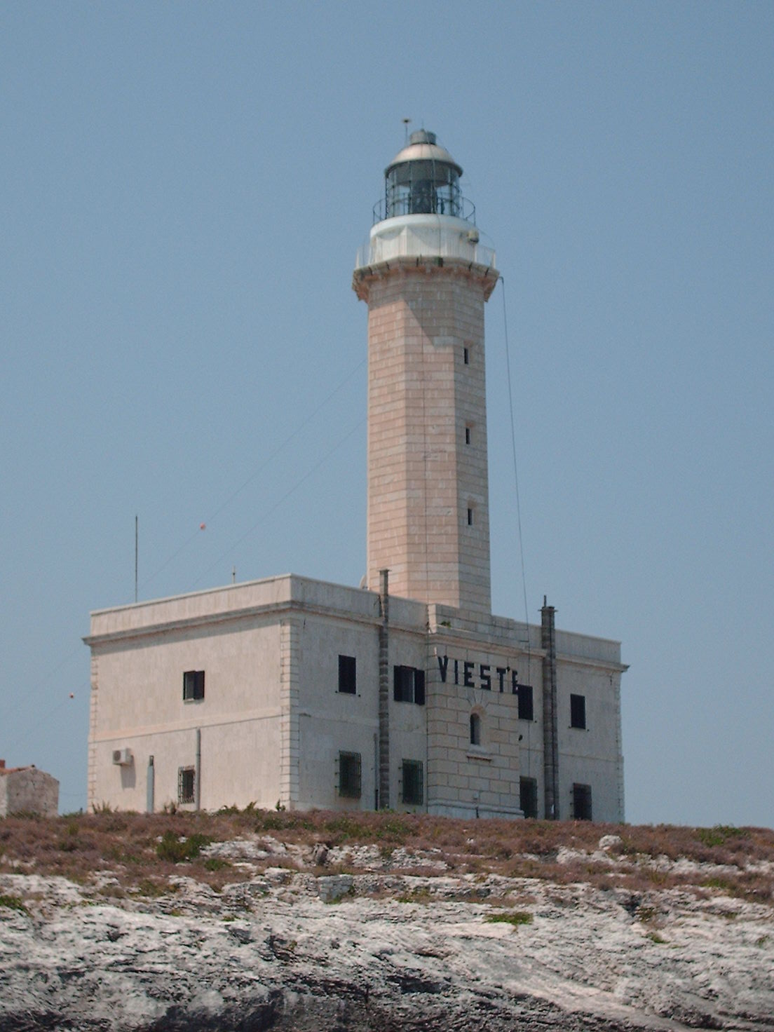
Vieste Lighthouse sits on the tiny islet of Santa Eufemia, right off the town of Vieste on the Gargano peninsula in Apulia, wedged between the rocks of Santa Croce and San Francesco. It is one of those landmarks that catches your eye the moment you look out from the seafront promenade or from the deck of a boat leaving the harbor. What exactly is this place? The lighthouse stands on a small, rocky islet separated from the mainland by a narrow stretch of water. It is not a tourist attraction in the usual sense — it is a working navigational aid, guiding ships through the middle and lower Adriatic Sea. Its position opposite Vieste is no accident: this stretch of the Gargano coast juts far out into the sea, making it a natural reference point for vessels traveling along the coastline. The islet itself, Santa Eufemia, lies between two distinctive rock formations, Santa Croce and San Francesco, and together with the lighthouse they form one of the most recognizable views in Vieste's skyline. How do you get there, and where's the best place to see it? Because the lighthouse sits on its own islet, there is no path or road leading to it — this is a landmark you view from the shore or from the water, not a site you walk up to. The best vantage point is Vieste's old town, where the silhouette of the lighthouse and the surrounding rocks stands out against the sea, especially in the evening when the low sun brings out the texture of the cliffs. The other option is a boat excursion along the Gargano coast, which regularly departs from Vieste's harbor. Many of these trips, usually built around the famous sea caves and coves further along the coast, pass close to the Santa Eufemia islet, giving you a chance to see the lighthouse up close from the water. Seeing it from a boat also makes it easier to appreciate why this spot matters so much for shipping traffic on the Adriatic. What should you know before visiting? Since it's an active navigational lighthouse, don't expect to go inside or join a guided tour — there are no tickets or opening hours to plan around. Its appeal for visitors is really about the view: it's a defining feature of how Vieste looks from the sea, and it's worth pausing for a few minutes to take it in, particularly around sunset when the rocks and the lighthouse pick up warm light. If you're booking a boat trip along the coast, it's worth asking the operator whether the route passes near the Santa Eufemia islet — not every excursion does, but many of the coastal routes naturally go past this stretch of shoreline. Frequently Asked Questions Can you go inside Vieste Lighthouse? No, it stands on a separate islet and functions as an active navigational lighthouse, not a tourist site open to visitors. Where's the best spot to see it from? From Vieste's old town and seafront promenade, where it stands out against the sea, or from a boat during a trip along the Gargano coast. Is it worth a special trip? It's not a standalone destination, but a natural part of Vieste's landscape — worth noticing while exploring the town or during a coastal boat excursion. Why does this lighthouse matter? It marks a strategic point along shipping routes in the middle and lower Adriatic Sea, guiding vessels traveling along the Gargano coastline.
-
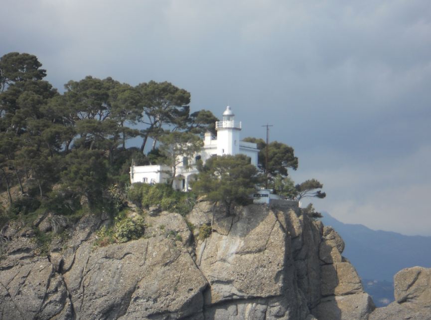
Portofino lighthouse
Portofino
Portofino Lighthouse (Faro di Punta del Capo) stands on the far tip of the rocky headland that closes off the bay of Portofino, on the Gulf of Tigullio, in Liguria. It's one of the most recognisable landmarks of this small but world-famous former fishing village. Where exactly is it? The lighthouse sits at the outermost point of the Portofino promontory, inside the Portofino Natural Park, which protects this stretch of Ligurian coastline — pine trees, Mediterranean scrub, and cliffs that drop straight into the sea. The lighthouse is still active today, guiding ships into the bay and warning them away from the rocky edge of the headland. How do you get there? Every route starts from the centre of Portofino — the small harbour square lined with colourful houses, cafés, and restaurants, from which paths branch out across the whole promontory. From there, a marked footpath follows the coastline. It doesn't require any special preparation, but comfortable shoes help, since parts of the trail climb and run over uneven ground. Along the way, the path passes Castello Brown before turning toward the far end of the headland, where the lighthouse stands. There's no way to drive there — as with most of Portofino's attractions, vehicle access within the old town and along the coastal paths is very limited. The whole stretch to the lighthouse has to be walked. What will you see once you're there? From the terrace by the lighthouse, the view opens onto the whole Gulf of Tigullio and the Ligurian Sea. It's one of the most photographed viewpoints on this coast — from here you can see both the colourful harbour of Portofino below and the coastline stretching toward the nearby seaside towns. The lighthouse itself is a small white tower, still operational and not open for visitors to enter. Its real appeal isn't the structure but the surrounding scenery and the quiet found at the tip of the headland, far from the bustle of the harbour square. Along the trail grows the Mediterranean vegetation typical of this coast — pines, olive trees, and dense scrub — protected as part of the natural park covering the whole Portofino promontory. When's the best time to go? The best time for the walk to the lighthouse is mid-morning or late afternoon, when the sun isn't at its peak and the temperature along the trail is more comfortable. In the middle of summer, it's worth avoiding the middle of the day, when the exposed sections of the path get the most sun. A clear day shows the coastline at its best, and sunset seen from this spot is one of the most highly rated moments visitors experience in Portofino. Frequently Asked Questions Can you go inside the lighthouse? No. It's a working navigational structure and isn't open to visitors. The attraction is the surrounding viewpoint and the coastal walk itself. How do you reach the lighthouse from central Portofino? The route is entirely on foot, following the coastline and passing Castello Brown on the way to the tip of the headland. Can you drive there? No — the final stretch, like most trails within the Portofino Natural Park, is accessible only on foot. Is it worth going on a cloudy day? The views are most striking on a clear day, but the path and surrounding landscape keep their charm regardless of the weather.
-
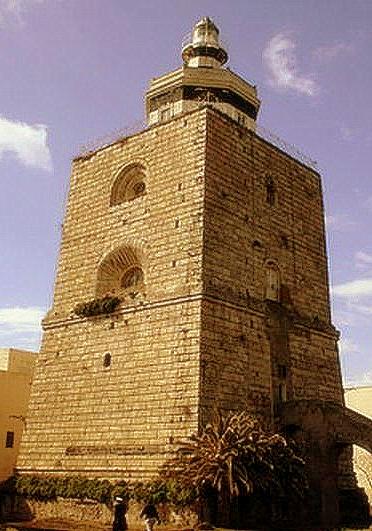
Punta San Raineri Lighthouse
Mesyna
Punta San Raineri Lighthouse marks the northern tip of Messina, right where the Strait of Messina links the Tyrrhenian Sea to the Ionian Sea. It's one of the most recognisable landmarks along this stretch of the Sicilian coast, visible from the seafront, from the ferry, and from ships passing through the strait. Where exactly is the lighthouse? The lighthouse stands on the promontory of Punta San Raineri, at the point where Messina's harbour basin opens onto the strait itself. That spot has never been chosen at random — for centuries it has been the strategic point controlling access to the port and shipping traffic between Sicily and mainland Calabria. You may also see it referred to as Torre della Lanterna Montorsoli, or in Italian simply Faro di San Raineri. How do you get to Punta San Raineri? The lighthouse sits within Messina's port area, so the most practical way to experience it is from the outside: walk the seafront promenade on the northern edge of the city, take the ferry across the strait to Villa San Giovanni or Reggio di Calabria, or view it from a boat trip along the coast. Because it's an active navigational light, don't expect to walk inside — the appeal here is the structure itself and the setting, not an interior visit. What will you actually see? What stands today is a two-storey, octagonal masonry light tower with a lantern and gallery on top, built above a much older, square stone defensive watchtower. The upper octagonal section is painted in black-and-white horizontal bands, the lantern room itself is white with a grey metal dome, while the square base below remains bare, unpainted stone. That contrast — a newer navigational tower rising from an old, rough fortification — tells you a lot about how this lighthouse came to be. The base, in fact, has a much longer history than the light itself. Local tradition links the tower's foundations to a watchtower attributed to the Renaissance sculptor and architect Giovanni Angelo Montorsoli, though no documentary evidence survives to confirm the claim. What is established is that the stone defensive tower dates to the 16th century (commonly cited as 1555) and formed part of a fortification system ordered in 1546 by Charles V, the Holy Roman Emperor, to defend Sicily against Ottoman raids. Today the lighthouse operates as a fully automated, remotely monitored navigational light guiding vessels in and out of Messina's harbour. When is the best time to visit? The Strait of Messina is a striking view in any season, but the lighthouse is at its best in late afternoon or at sunset, when the black-and-white bands stand out sharply against the sky over the strait. Pairing a walk along this part of the city with a ferry crossing is a good way to spend an afternoon — it's also the best way to see the tower from the water, with the Calabrian coast in the background. Frequently Asked Questions Can you go inside the lighthouse? No — it's an active, automated navigational light within Messina's port area, so entering the tower isn't a standard tourist option. You view it from outside: the promenade, the harbour, or the ferry deck. Where's the best spot to see it? The seafront promenade on Messina's northern side and the ferry crossing the strait both give good views — from the water you can see the full structure, including the stone base below the tower. How old is the lighthouse? The stone defensive tower at its base dates to the 16th century and is linked to fortifications ordered in 1546 by Charles V. The upper octagonal section housing the navigational light is more recent. Is the Montorsoli connection historically confirmed? It's a local tradition attributing the tower's base to architect Giovanni Angelo Montorsoli, but no documents confirm it — best treated as a legend rather than an established fact.
-

Lighthouse of Genoa
Genua
Lighthouse of Genoa, better known as La Lanterna, is the main lighthouse for the Port of Genoa in Genoa, the capital of Liguria, Italy. It is both a working aid to night navigation and one of the city’s best-known landmarks. Rebuilt in its present form in 1543 after replacing an earlier lighthouse, it is also the world’s fourth oldest lighthouse, after the Tower of Hercules in A Coruña, Spain, Hook Head Lighthouse in Ireland, and Kõpu Lighthouse on the island of Hiiumaa, Estonia. Na miejscu można liczyć przede wszystkim na: A close look at the tower’s masonry structure, which rises to 76 m (249 ft) and is built in two square sections, each finished with a terrace. The lantern at the top, from which the light is projected, showing how the lighthouse still fulfills its navigation role for the port. A chance to see a historic city symbol that has long served as a clear reference point for Genoa and its harbor area. For a visit, it is worth planning a short outing that combines sightseeing with a bit of local history. Comfortable shoes are a good idea, especially if you want to take in the area around the tower at an easy pace. It is a strong choice for travelers interested in maritime heritage, historic landmarks, and a compact stop in Genoa.
-
Capo dell'Armi Lighthouse
Motta San Giovanni
Capo dell'Armi Lighthouse is an active lighthouse in Reggio Calabria, in southern Italy. Set on the cliffs of the headland in the comune of Motta San Giovanni, it serves as an important point of reference for ships approaching the Strait of Sicily from the south. For visitors, it offers a short outing with coastal views and a clear sense of the area’s maritime character. Na miejscu można liczyć przede wszystkim na: a working lighthouse perched on the headland cliffs, which gives the place its strong seafaring identity views over the shoreline and open water around the southern edge of Calabria, with the Strait of Sicily in the distance a simple stop in Motta San Giovanni for anyone interested in coastal scenery and navigation landmarks If you visit, it is worth checking the weather and wearing comfortable shoes, since the setting is exposed and cliffside. This is a good choice for travelers who enjoy a brief coastal visit, maritime landmarks, and quiet viewpoints rather than a long sightseeing stop.
-
Faro di Goro
Goro
Faro di Goro is an active lighthouse on Isola dell'Amore, set on the Adriatic Sea at the Po River delta. It stands in Goro, in the northernmost part of Emilia-Romagna, right by the border with Veneto. It is a good stop for a short visit and a quiet look at the coastal landscape. Na miejscu można liczyć przede wszystkim na: a working lighthouse in a distinctive delta setting, which gives the spot its main landmark character the location on Isola dell'Amore, with open views over the Adriatic Sea and the Po River delta a borderland atmosphere at the northern edge of Emilia-Romagna, close to Veneto If you plan to visit, it is worth checking the weather and bringing comfortable shoes, especially if you want to combine the lighthouse with a walk in the area. This is a good choice for travelers looking for a brief outing by the sea and a simple stop in a place shaped by water and coastline.
-
Punta Polveraia Lighthouse
Marciana
Punta Polveraia Lighthouse is a coastal beacon in Italy, located in Marciana, and it makes for a scenic stop along the shoreline. Set within a maritime landscape, it also reflects the area’s seafaring heritage and stands out as a clear landmark for photos and sightseeing. It is a good choice for a short coastal outing. Na miejscu można liczyć przede wszystkim na: a lighthouse setting that fits naturally into the seaside scenery, with the tower serving as a recognizable point of reference along the coast views over the maritime landscape, which make this a pleasant spot for photography and for taking in the shoreline atmosphere a stop that suits travelers interested in lighthouses, coastal walks, and wide sea views as part of an Italian seaside itinerary For the best experience, it is worth checking the weather and bringing comfortable shoes if you plan to combine the lighthouse with a walk along the coast. This is a solid option for visitors looking for a calm, scenic stop in Marciana, especially if they enjoy seaside viewpoints and maritime history.
-
Isolotto della Maddalena Lighthouse
Alghero
Isolotto della Maddalena Lighthouse is an active lighthouse on a small islet off Alghero, in the Sea of Sardinia. The islet is 84 metres (276 ft) long and sits 800 metres (2,600 ft) north of the south mole of the Port of Alghero. It is a simple stop for a short look around and a coastal outing. Na miejscu można liczyć przede wszystkim na: a view of the lighthouse set on a very small islet, with the sea all around it and the Port of Alghero nearby a clear sense of the harbor setting, since the islet lies just 800 metres (2,600 ft) north of the south mole a brief coastal stop focused on the maritime landscape of the Sea of Sardinia rather than on long sightseeing For a visit like this, it is worth checking the weather and bringing comfortable shoes if you plan to walk along the harbor area. This is a good choice for travelers who enjoy compact seaside sights and a quiet, short stop by the water.
-
Punta Cavazzi Lighthouse
Ustica
Punta Cavazzi Lighthouse is a coastal beacon in Ustica, Italy, and a small but notable stop for anyone exploring the island’s maritime heritage. Set by the sea, it reflects the practical role lighthouses have long played in guiding navigation along the coast. It makes for a short, scenic stop with views over the water. Na miejscu można liczyć przede wszystkim na: a chance to see a working coastal landmark tied to Ustica’s seafaring past and Italy’s wider lighthouse tradition open seaside surroundings that make the lighthouse a good spot for looking out over the surrounding waters and taking photos a quiet, unhurried pause for travelers interested in maritime history, coastal landscapes, and simple lookout points It is best to visit in calm weather, when the shoreline setting is easiest to enjoy, and comfortable shoes are useful if you plan to walk around the area. This is a good choice for travelers who like low-key sightseeing, sea views, and places with a clear local character.
-
Scilla Lighthouse
Scilla
Scilla Lighthouse is an active lighthouse in Calabria, set on the seaward terrace of the Castello Ruffo di Scilla in the town of Scilla on the Tyrrhenian Sea. It stands directly opposite Capo Peloro Lighthouse on the Sicilian coast, and together the two lighthouses guide ships approaching from the north into the Strait of Messina. It is a good stop for a short walk and a bit of sightseeing. See the lighthouse in its unusual setting, perched on the seaward side terrace of the Castello Ruffo di Scilla rather than standing alone on the shore. Take in the maritime context of the site, with the Tyrrhenian Sea in front of you and the Strait of Messina nearby, where the lighthouse works alongside Capo Peloro Lighthouse across the water. Combine the visit with a look at the castle surroundings in Scilla, making this a compact stop that links coastal views with local history. Bring comfortable shoes if you plan to walk around the castle area, and check the weather if you want the best views over the sea and toward Sicily. This is a good choice for travelers who like small, scenic stops with a clear nautical character.
-
Strombolicchio
Lipari
Strombolicchio is a volcanic sea stack in the Aeolian Islands of Italy, located about 2 km (1.2 mi) northeast of Stromboli. In Sicilian, its name is Struognulicchiu, meaning “Little Stromboli,” and it is the hard basalt remnant of the original volcano that formed the island of Stromboli about 200,000 years ago. It is a place best appreciated from the water or on a short sightseeing stop. It stands as a volcanic plug, or spine, made of extremely hard compacted basalt that has resisted erosion over time. The islet is known for its rare flora and fauna, including endangered species, which is one reason it has been declared a natural reserve. Access is heavily restricted, so the main experience is observing its dramatic profile and protected setting rather than landing and exploring freely. If you are planning a visit, check conditions in advance and be ready for a simple boat-based view rather than a full walk on the islet. It is a good choice for travelers interested in geology, protected nature, and the volcanic landscape around Stromboli.
-
Capo Granitola lighthouse
Campobello di Mazara
Capo Granitola Lighthouse is an active lighthouse on the south-western headland south of Mazzara del Vallo, in the municipality of Campobello di Mazara, Sicily. It stands on the Strait of Sicily and is set near the archaeological park of Cave di Cusa, in an area well known for its Almadraba. It is a good stop for a short outing with a coastal feel. Na miejscu można liczyć przede wszystkim na: a working lighthouse on a prominent headland, giving the place its clear maritime character views over the Strait of Sicily and the surrounding coastal landscape south of Mazzara del Vallo easy pairing with a visit to the nearby archaeological park of Cave di Cusa, especially if you want to combine sea scenery with local history For the best experience, wear comfortable shoes and check the weather, since this is a coastal spot exposed to wind and sun. It works well as a quiet stop for travelers interested in seaside landmarks, archaeology, and a short, low-key visit.
-
Viareggio old lighthouse
Viareggio
The old lighthouse of Viareggio (Vecchio Faro di Viareggio) stands at the mouth of the Burlamacca canal, right where the town's historic harbour meets the sea. It is the older of Viareggio's two light towers — a newer one, on the outer breakwater, has since taken over its navigational role. Where does this lighthouse come from? The tower was built by the Italian Royal Navy in 1863 to light the nearby stretch of coast at night and guide vessels toward the harbour canal entrance. In the early 20th century it was reworked, gaining the appearance it still has today. Once a stronger, more modern lighthouse was raised on the outer breakwater, the older tower lost its role for ships approaching from the open sea — its usefulness was reduced to the inner stretch of the port canal, and eventually it stopped operating altogether. What will you see there? The lighthouse is a round, white masonry tower roughly 14 metres tall, with an internal walkway running around the shaft. At the top, a terrace supports the metal lantern structure. The tower rises from the corner of a square, two-storey building, also finished in white masonry — a layout typical of 19th-century Italian harbour lighthouses, where the tower and the keeper's house form a single architectural block. Because it sits right at the Burlamacca canal mouth, a visit pairs naturally with a walk through the historic harbour area, where fishing boats and small sailboats still moor along the canal, close to the seafront promenade. How do you get there? The old lighthouse stands within the town of Viareggio, close to the canal mouth and right along the shoreline. The easiest approach is on foot or by bike from the seafront promenade (Passeggiata), heading toward the Burlamacca outlet — a walk of well under half an hour from the resort's central stretch. The area is well connected to the rest of Viareggio, a compact Tuscan seaside town that is easy to explore on foot. When should you visit? Since the lighthouse today is a landmark rather than a working navigation aid, it can be visited at any time of year. Spring and early autumn offer a good balance of mild weather and fewer crowds, and the early evening light works well for photos, with the white tower standing out against the sunset sky. In summer the surrounding promenade and beaches get busier, so expect more foot traffic nearby. Frequently Asked Questions Is the old Viareggio lighthouse still in use? No — its function was taken over by the newer lighthouse on the outer breakwater. The old tower remains as part of the historic harbour, but it no longer guides ships on the open sea. How is it different from the new Viareggio lighthouse? The new lighthouse stands at the end of the outer breakwater and is the one that now marks the harbour entrance for incoming vessels. The old lighthouse sits closer to shore, right at the Burlamacca canal mouth, and has an older architectural style — a round tower set into a square base building. Can visitors climb the tower? Available information doesn't confirm regular public access to the lighthouse terrace, so it's worth checking locally whether the site is open to visitors at the time of your trip. How old is the lighthouse? The tower dates back to 1863, with its current look coming from an early 20th-century renovation — making it a structure well over 160 years old, tied closely to the history of Viareggio's harbour.
-
Sciara Biscari lighthouse
Katania
Faro Sciara Biscari is a white, cylindrical lighthouse standing on Via Domenico Tempio in Catania, on Sicily's eastern coast, close to the city's harbour. What is this place? The tower rises 28 metres, with its light positioned 31 metres above sea level. The current structure dates from 1951, built after an earlier tower from 1896 was demolished. The name "Sciara Biscari" refers to the rocky, lava-covered ground typical of this stretch of Catania's coastline — "sciara" is a Sicilian word for a field of hardened lava, a legacy of the many Etna eruptions that have shaped the city's shoreline over the centuries. The lighthouse uses a rotating optical system with a halogen lamp reaching 22 nautical miles (over 40 kilometres), backed by a reserve lamp with a range of 10 nautical miles (about 20 kilometres). Since 1951 it has guided sailors with a light flash every five seconds, serving as a key landmark for ships entering the port of Catania. The site has been formally recognised as a cultural heritage asset, with Sicily's regional department for cultural heritage acknowledging its identity, architectural and urban planning value. How do you get there? The lighthouse sits on Via Domenico Tempio, in the harbour area of Catania, not far from the historic city centre. It's an easy stop to combine with a visit to Catania's baroque old town, a UNESCO World Heritage site, and a walk along the port. What will you see? The lighthouse is not normally open to the public — it's an active facility managed by the Italian Navy. On special occasions, such as the National Day of the Sea, it opens its doors to visitors. On those days you can climb roughly a hundred steps to the top of the tower and take in views of Catania, the harbour and the lava-shaped coastline from the lantern room. Even without going inside, the white tower's silhouette against the sea and the harbour docks makes for a striking sight in this part of the city. When should you visit? The best chance to see the inside of the lighthouse is during events organised by the Italian Navy, such as the National Day of the Sea — one of the few times each year the site opens to residents and visitors. Outside these occasions, the lighthouse can be admired from the outside year-round, with early morning or late afternoon offering calmer light for photos against the harbour backdrop. Frequently Asked Questions Can you go inside the Sciara Biscari lighthouse? Not normally — it's an active Italian Navy facility. The interior opens occasionally, for example during the National Day of the Sea. Where does the name "Sciara Biscari" come from? "Sciara" is a Sicilian term for a field of hardened volcanic lava, and the name refers to the rocky, lava-covered ground in this part of Catania's coast, shaped by Etna's eruptions. How tall is the lighthouse? The tower stands 28 metres high, with its light positioned 31 metres above sea level. Is it an important navigation point? Yes — the lighthouse has operated since 1951, guiding ships into Catania's port with a light flash every five seconds and a range of up to 22 nautical miles.
-
Faro di Cesenatico
Cesenatico
Faro di Cesenatico is a working lighthouse standing at the entrance to the canal port of Cesenatico, a seaside town in Emilia-Romagna on the Adriatic coast. It's one of the town's most recognizable landmarks, visible from the promenade and from boats returning to harbour. Where exactly is the lighthouse? The lighthouse sits on the southwestern side of the canal port entrance, right where the harbour channel meets the open Adriatic. Fishing boats and pleasure craft have passed this point for generations, and the narrow canal port itself is one of Cesenatico's defining features. How do you get there? The easiest way to reach the lighthouse is on foot, walking along the western quay toward the sea. The route runs past moored fishing boats, cafés, and the busy waterfront, ending right where the canal opens into the Adriatic. It's a short, pleasant walk with no need for any transport — just follow the harbour edge to its mouth. What will you see there? The lighthouse building consists of a two-storey keeper's house finished in yellow and white, topped by a roughly three-metre tower carrying the lantern. The light itself sits about 18 metres above sea level and flashes white twice every six seconds — a signal visible from up to 15 nautical miles away, far beyond what's visible to the naked eye from shore. The lighthouse is still fully operational, guiding boats safely into the port entrance, especially after dark. What's the history behind it? The lighthouse was built in 1892 and has guided vessels into Cesenatico's harbour ever since. Its simple, functional design — a white-and-yellow keeper's house with a modest tower — is typical of working port lighthouses along this stretch of the Adriatic, built for practicality rather than show. When's the best time to visit? The lighthouse can be seen year-round, but it's most striking at sunset or in the early evening, when its light switches on and reflects across the canal water. In summer, it's worth pairing a walk to the lighthouse with an evening stroll along the harbour, when the quay fills with tourists and fishermen returning from the day's catch. Frequently Asked Questions Is the Cesenatico lighthouse still working? Yes, it's an active navigational lighthouse that continues to guide boats into the harbour; its light signal is fully functional. How high above sea level is the light? The light sits at about 18 metres above sea level. From how far away can the light be seen? The lighthouse's signal is visible from up to 15 nautical miles offshore. Can you go inside the lighthouse? No, it's an operational navigational structure and isn't open to visitors inside — it can only be viewed from the outside, along the harbour quay.
-
Punta Pezzo lighthouse
Villa San Giovanni
Punta Pezzo Lighthouse marks the narrowest tip of mainland Calabria, the exact point where continental Italy comes closest to Sicily. It's a working lighthouse, still guiding ships through the Strait of Messina today, and its position within the town of Villa San Giovanni makes it a natural landmark for anyone curious about seeing the strait up close. Where exactly is Punta Pezzo? Punta Pezzo is a headland on the coast of Villa San Giovanni, jutting toward Sicily right at the spot where the two shores are separated by the shortest distance along the entire strait. That closeness — not some unrelated attraction nearby — explains why the lighthouse stands here in the first place: vessels entering or leaving the strait need a clear marker exactly at its narrowest, most navigationally sensitive stretch. What can you actually see from here? The view stretches across to the opposite shore, toward Messina and the Sicilian hills, and on a clear day the gap looks strikingly small — smaller than most people expect when they picture Italy on a map. That perspective is the main reason to come: few places in Europe let you take in two different regions and two different coastlines in a single glance so easily. On days with good visibility you'll also notice activity out on the water, since ferries have long connected Calabria and Sicily through this stretch of the strait — a reminder that this is a working shipping route, not just a scenic backdrop. How do you get to Punta Pezzo? The headland sits within Villa San Giovanni, a town best known as a ferry crossing point to Sicily. The lighthouse is visible from the town's seafront, and the point itself makes for a short walk along the coast — a natural stop for anyone already waiting for a ferry or exploring this part of Calabria. It works best as a stop for people already in or passing through Villa San Giovanni rather than a standalone destination worth a long detour. When is the best time to visit? Clear-sky days with good visibility are the best time to come, since that's when the view toward Messina and the Sicilian coast is at its most impressive. Sunset adds an extra layer of atmosphere, with light falling directly across the water of the strait and onto the far shore. The lighthouse operates year-round, so this isn't a seasonal attraction in the usual sense — the weather on the day matters more than the month on the calendar. Why does this spot stand out? Punta Pezzo isn't a grand tourist monument — its value lies in geography. It's the point where continental Europe and Sicily sit closest together, and the working lighthouse is a reminder that this stretch of water is still an active, used shipping lane rather than just a line on a map. Frequently Asked Questions Can you go inside Punta Pezzo Lighthouse? It's an active navigational lighthouse, so plan on viewing it from the outside and enjoying the view it offers rather than going inside. Why was the lighthouse built at this exact spot? Because it marks the narrowest point of the Strait of Messina on the Calabrian side — the place where Calabria comes closest to Sicily — so ships need a clear marker right here. Can you see Sicily from Punta Pezzo? Yes, on a clear day you can see the opposite shore and Messina, which is the main reason the spot is worth a visit. Can you catch a ferry to Sicily from this area? Villa San Giovanni, where Punta Pezzo is located, is known as a ferry crossing point to Sicily, so the area around the headland is naturally tied to the ferry traffic across the strait.
-
Ancona old lighthouse
Ankona
The old lighthouse of Ancona sits on top of Cappuccini hill, inside the city's Cardeto Park, and remains one of the most recognizable viewpoints over the Adriatic in this part of the Marche region. Where is the old lighthouse located? The tower stands on Cappuccini hill, within Parco del Cardeto — Ancona's largest urban park, spread across the summits of Monte Cappuccini and Monte Cardeto right above the sea. The spot sits almost within the historic centre of Ancona, yet it opens onto sweeping views of the open Adriatic and the city's port basin below. What is the history behind this lighthouse? The tower was built in the nineteenth century on the initiative of Pope Pius IX. It began operating on 10 July 1860, sending out a white flash every 45 seconds, preceded by four seconds of dimmer light. For over a century it guided ships toward Ancona, until 1965, when authorities approved a new, fully automated lighthouse roughly 200 metres to the southeast; that replacement entered service in 1972. The newer lighthouse still actively guides vessels into Ancona's harbour today, while the older tower on Cappuccini hill has survived purely as a historic landmark. Can visitors go inside today? Once its navigational role ended, the old lighthouse stayed shut for close to forty years. A restoration in 2000 reopened it to the public, and thanks to Legambiente volunteers, thousands of residents and tourists were able to climb up to its viewing gallery over the following four years. Since 2005, though, access inside has been blocked because of a damaged step on the stairway, so the lighthouse can currently only be admired from outside, along the park's paths. It's worth checking locally, since access conditions can change. What else is there to see in Parco del Cardeto? The lighthouse is only part of the story. Cardeto Park is a sprawling green area above the cliffs, opened as an urban park in 2005, laced with walking paths, lookout points over Ancona's bay, and the remains of old military fortifications scattered across the hills. Walking through the park lets you pair the view of the old lighthouse with a wider panorama that takes in the harbour, the San Ciriaco cathedral, and the Riviera del Conero coastline in the distance. Locals treat it as a favourite spot for evening walks and quiet time above the sea, away from the traffic of the city centre. How do you get there, and when is the best time to visit? Cappuccini hill is within walking distance of Ancona's historic centre, though reaching it means climbing uphill, so it's worth timing the walk for the cooler parts of the day, especially in summer. The best light for photographing the lighthouse and the cliff-lined coast comes in the late afternoon before sunset, and spring and autumn tend to offer more comfortable temperatures for the climb than the height of summer. Frequently Asked Questions Is the old lighthouse in Ancona still used for navigation? No. Since 1972, a new lighthouse built about 200 metres away has taken over the navigational role, and the old tower on Cappuccini hill now stands purely as a historic structure. Can you climb to the top of the old lighthouse? Access inside has been closed since 2005 because of a damaged step. Before that, following a 2000 restoration, the lighthouse could be visited thanks to Legambiente volunteers. What is Parco del Cardeto? It's Ancona's largest urban park, opened in 2005, covering the Cappuccini and Cardeto hills above the sea, with numerous viewpoints and traces of old military fortifications. When is the best time to visit to see the lighthouse? Late afternoon before sunset offers the best light, and spring or autumn bring more comfortable temperatures for the uphill walk than the peak of summer.
Earn badges for the places you visit
Download NextOnTrip, discover new places and check off your trails.