Recreation and entertainment in Portugal
A guide to 94 Recreation and entertainment in Portugal — with descriptions, photos and traveler visits from the NextOnTrip community. Locations spread across 35 cities and towns. Most visited by the community: Aquamuseu, Rotunda da Boavista garden, Parque de Serralves.
-
Parque das Águas
Porto
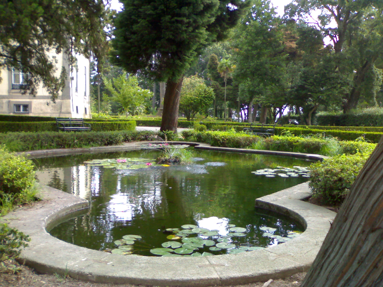
Parque das Águas is a green park in eastern Porto, in the Campanhã area, on the banks of the Douro (coordinates 41.144165, -8.590006). It covers roughly 68,500 m² and works as an open-air museum: among the trees stand fountains, tanks and drinking fountains that once decorated the city's public spaces. What is Parque das Águas? The park sits on the grounds of the headquarters of Águas e Energia do Porto, the city's water company. What makes it special is the way greenery meets the technical and artistic heritage of water. The collection includes pieces of historical value, some of them dating back to the 16th century. Why are there so many fountains here? After the municipal water and sanitation services were created in 1927, the former estate was expropriated to house their headquarters. From 1928, as water supply was strengthened for Porto and its surroundings, fountains, tanks and drinking fountains were gathered from streets, squares, markets and convents and brought here. They come from many parts of the city, including Lordelo do Ouro, Massarelos, Cedofeita, Miragaia, Sé, Santo Ildefonso, Bonfim and Campanhã. The result is a one-of-a-kind collection telling the story of the city through its water. What is the history of the land? The area has long had a leisure character. In the 17th century it belonged to the Quinta do Prado do Bispo, and on neighbouring land, the city's first public cemetery, Prado do Repouso, was built in the 19th century. From the remaining land a mansion with gardens was created, known as Quinta das Oliveiras, or the "Ingleses" estate, after its British owners. Today's park corresponds to the former wild part of that garden: a dense, exotic Romantic-style woodland typical of 19th-century estates of the wealthy bourgeoisie who prospered with Porto's industrial growth. What is worth seeing? Fountains and tanks relocated from across the city. Each has its own form and origin, so a stroll feels like a tour through everyday city life of the past. Romantic greenery, with old trees and paths that echo the 19th-century garden. The Douro setting, which gives the place a calm, riverside feel. Who is it for? The park suits a quiet break from sightseeing, a walk with children, or a visit for anyone interested in city history, water infrastructure and small-scale architecture. Because it lies outside the busiest tourist centre, it tends to be calmer than the riverfront promenades. It pairs well with a day spent exploring eastern Porto around Campanhã. Frequently asked questions Where is Parque das Águas? In eastern Porto, in the Campanhã area on the Douro, on the grounds of the Águas e Energia do Porto headquarters. How big is the park? About 68,500 m² of green space. Why is it called the "Park of Waters"? Because it is an open-air museum about water, gathering fountains, tanks and drinking fountains moved from Porto's public spaces. How old are the exhibits? Some have historical value and date back to the 16th century. Is the park linked to older estates? Yes. It corresponds to the wild garden of Quinta das Oliveiras, a 19th-century mansion owned by a British family.
-
Parque do Fontelo
Viseu
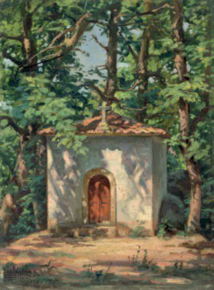
Parque do Fontelo is one of the largest urban parks in Portugal. It covers about 10 hectares of greenery in Viseu, just beyond the Portal do Fontelo gate. A former bishops' estate, it now combines history, walks among old trees, and space for sport and relaxation. How did the park in Viseu come about? The first notable mention of the Fontelo estate dates to 1149, when Bishop Odório bought the land. In 1399 Bishop João Homem supported its development and strengthened its standing. The real golden age came in the 16th century. Bishop D. Miguel da Silva, a powerful and very wealthy churchman with a taste for the Renaissance, returned from Rome in 1525. He began building the episcopal palace and replanting the park. Fontelo became one of the most exotic and opulent leisure estates in the country. What is there to see? The gardens of the Paço Episcopal do Fontelo show Italian influence in their design. In the same century Bishop D. Gonçalo commissioned the chapel of São Jerónimo (1563) and two porticos (1565). The park also holds the former 16th-century Bishop's Palace, which now houses the Welcome Center – Solar do Vinho do Dão, a showcase for the wines of the Dão region. Nearby stands the Paço dos Três Escalões, a granite building originally built as a bishop's palace and now a museum. What is the park like today? Fontelo is the city's main recreational area. Many old trees grow here, and forest trails run through the green space. There are tennis courts, football pitches, a sports hall and a fitness circuit, as well as a campsite. It suits a quiet stroll, a run or a picnic. Viseu is sometimes called Portugal's garden city, and Fontelo is one of its most important green spaces. Frequently asked questions How big is Parque do Fontelo? About 10 hectares. Who created the Fontelo gardens? The Italian-influenced Renaissance gardens are the work of Bishop D. Miguel da Silva in the 16th century. What is inside the former bishop's palace? The Welcome Center – Solar do Vinho do Dão. Can you play sport here? Yes. The park has tennis courts, football pitches, a sports hall and a fitness circuit. Is there somewhere to stay? A campsite operates within the park. Who is it for? Anyone who enjoys history, greenery, family walks and active leisure in the middle of a city. Parque do Fontelo shows how a former bishops' residence became an open space for locals and visitors alike. It is worth a few hours during a stay in Viseu, especially on a warm day when the shade of old trees is welcome. You can combine the walk with a visit to the nearby museum in the Paço dos Três Escalões and a tasting of Dão wines.
-
Quinta dos Loridos
Bombarral
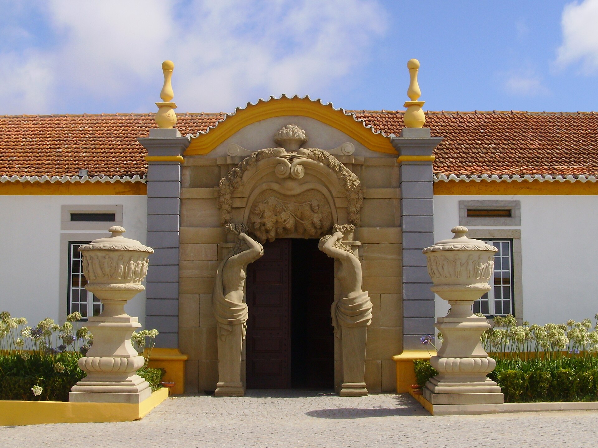
Quinta dos Loridos in Bombarral, better known as Bacalhôa Buddha Eden, is a park and garden complex in central Portugal, described as the largest oriental garden in Europe. The estate is known for its collection of statues and artefacts inspired by Asian cultures, and it also has a long winemaking tradition. What kind of place is it? The garden covers roughly 35 hectares. It is estimated that more than six thousand tons of marble and granite went into building it, which gives a sense of the scale. It is a wide expanse of greenery, lakes and sculpture, and a full walk takes time. Why was the garden created? Buddha Eden was created as a response to the destruction of the Buddhas of Bamiyan, an act of cultural barbarity that erased masterpieces of late-period Gandhara art. The garden therefore works as a symbolic tribute to heritage that was lost. What can you see? The centrepiece is a monumental Buddha statue surrounded by lush greenery and intricate sculptures. The garden is also known for around seven hundred hand-painted terracotta soldiers. Each one is unique, and they are copies of warriors buried some 2,200 years ago. On the central lake you can spot koi, the Japanese ornamental carp. Sculpted dragons rise out of the water and give the scene an oriental character. Wine and vineyards The Quinta dos Loridos estate has a history linked to wine and sparkling wine production going back to the 15th century. Grapes picked from these vineyards are used to make high-quality sparkling wines. A visit therefore combines a stroll among Asian art with a taste of Portuguese wine heritage. Who is it for? The garden suits anyone looking for a quiet break in green surroundings, art and sculpture lovers, families whose children will enjoy the dragons and carp, and photographers. Because of its size, plan a few hours and wear comfortable shoes. Where is it? It lies near Bombarral in the Leiria district of Portugal, and is often visited as an attraction when exploring towns around Óbidos. Frequently asked questions Is it the largest oriental garden in Europe? Yes, Bacalhôa Buddha Eden is described as the largest oriental garden in Europe. How big is the garden? About 35 hectares. Why was it built? As a response to the destruction of the Buddhas of Bamiyan and an expression of concern for cultural heritage. How many terracotta soldiers are there? Around seven hundred, all hand-painted and unique. Is wine produced on the estate? Yes, grapes from the vineyards go into high-quality sparkling wines, and the tradition dates to the 15th century. What lives in the lake? Koi carp, with sculpted dragons rising from the water.
-
Parque Infantil do Alvito
Lizbona
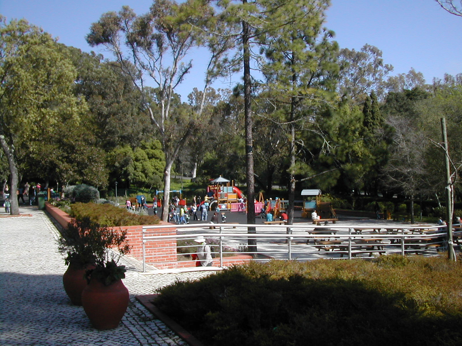
Parque Infantil do Alvito is one of Lisbon's best-known playgrounds, set inside Monsanto Forest Park, the largest green area in the Portuguese capital. It sits on Estrada do Alvito in the southern part of Monsanto and has long been a regular stop for families with children. What is this place? It is not one playground but three, built on different levels of the hillside. Stairs and a ramp connect them, so strollers can get between levels. Each level targets its own age group, and the equipment is sized to match, so older kids do not compete with toddlers for the same swings. The lowest level is for the youngest visitors, with low equipment and basket swings that hold small children safely. The middle level suits children from about three years old. The top level holds the attraction many families return for: a wooden pirate ship and three tents for pretend camps and hide-and-seek. What changed in the renovation? The playground was recently renovated with new, safer equipment, including tents, a miniature caravel and a wooden train. Rubber tiles replaced concrete paving underfoot, which softens falls. A high fence surrounds the grounds, so children cannot slip away into the trees. Facilities for parents Adults find rest areas, plenty of picnic tables, a bar, a gate house and restrooms. You can arrive with sandwiches or a book and settle in for a few hours while the children play. How to get there The easiest approach is from Alcântara, next to the Monsanto Tennis Center. Entry is free. When to visit The playground runs all year, but the hours change with the season, so in winter plan your visit before 18:00. In summer the day is two hours longer, because the gates close at 20:00. Since Monsanto forest surrounds the grounds, you can pair playtime with a walk in the park, and the picnic tables let you eat outdoors instead of hunting for a restaurant in the city. Frequently asked questions How much does it cost? Nothing. Entry to the playground is free. What are the opening hours? From 1 October to 31 March the playground is open 9:00 to 18:00, and from 1 April to 30 September it is open 9:00 to 20:00. Which ages is it for? Children from about one to twelve years old. The three levels split the equipment by age: basket swings for toddlers, the pirate ship and tents for older children. Are there restrooms and picnic spots? Yes. The grounds have restrooms, a bar, picnic tables and rest areas. Can I bring a stroller? A ramp joins the levels alongside the stairs, so moving between them with a stroller works.
-
Jardim de São Pedro de Alcântara
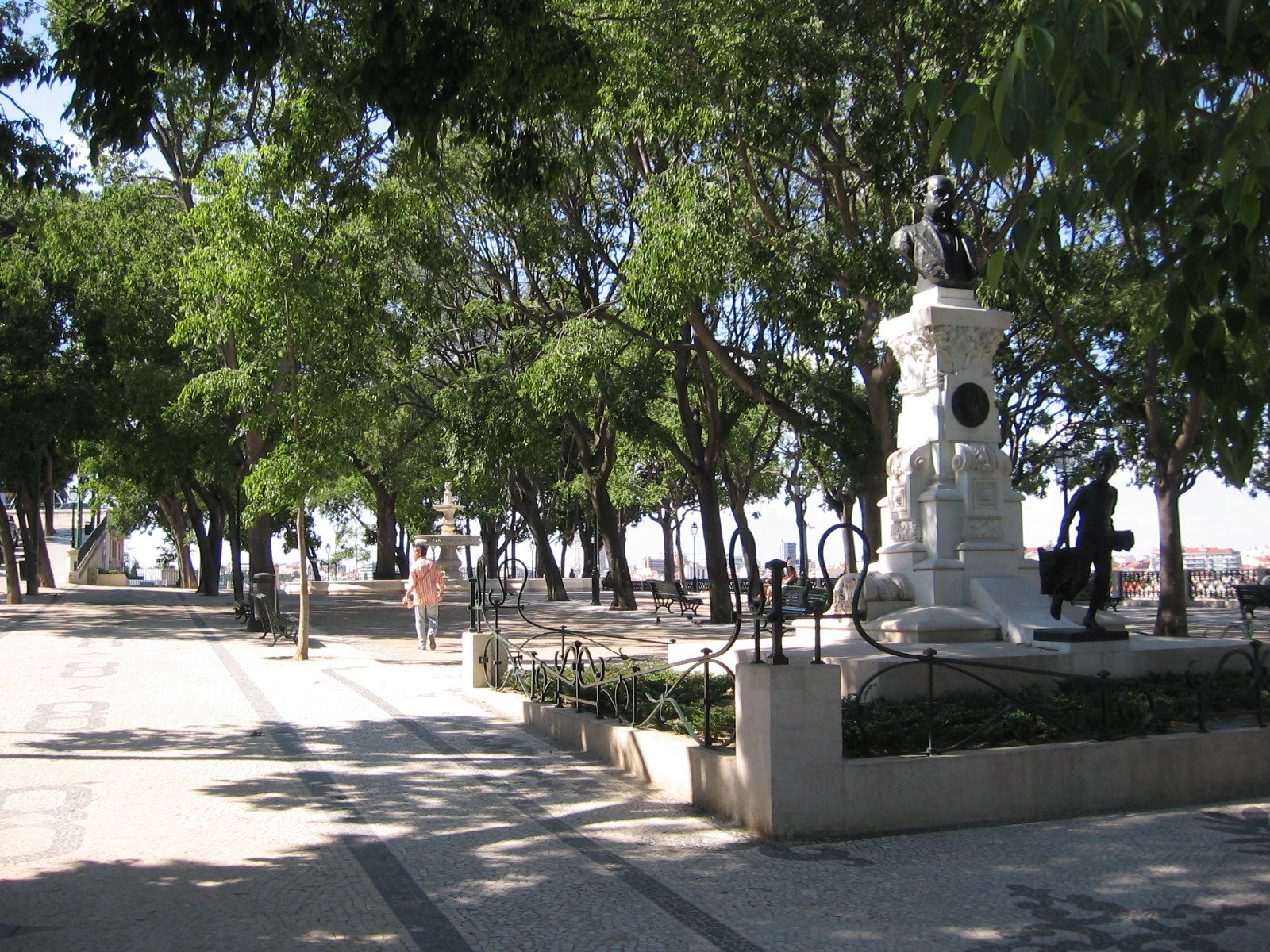
Jardim de São Pedro de Alcântara is one of the best-loved garden viewpoints (miradouro) in central Lisbon. It sits in the Bairro Alto district on the western side of the valley that separates it from Baixa. Also known as Jardim António Nobre, the garden has two terraces linked by stone stairs and is praised for one of the finest panoramas of the city. What can you see here? The upper terrace looks east across Baixa and Mouraria towards the hill crowned by São Jorge Castle. On a clear day you can also pick out part of the Tagus's southern bank. Sunset is the star moment, when the rooftops change colour. A panoramic map painted on azulejo tiles in 1952 stands at the viewpoint. It helps you identify the main landmarks below and is handy on a first visit to Lisbon. History and features The garden was laid out in 1864 on two levels. The upper level is paved in traditional Portuguese cobblestone, with a Baroque fountain in the middle. Accounts say the fountain came from the grounds of the Palácio da Bemposta and was moved here when the palace became a military academy. Statues of figures from Greek mythology, including Minerva and Odysseus, line the space. Another highlight is a 1904 monument to Eduardo Coelho (1835–1889), founder of the newspaper Diário de Notícias. A barefoot boy stands in front of the journalist, representing an old-time newspaper seller. The monument recalls the printing and press heritage of Bairro Alto. Getting there The garden lies right beside the Ascensor da Glória, a historic funicular that opened in 1885 and has run on electric power since 1915. It links Restauradores square in lower Baixa with Bairro Alto, so you can ride up or climb the steep streets on foot. Frequently asked questions Is there an entrance fee? No. The garden is public and free to visit. When is the best time to go? Late afternoon and sunset offer the best light, though they are also the busiest times. For a calmer visit, come in the morning. How long should I plan for? Usually 30 to 60 minutes is enough for the views, the tile map, the fountain and the monuments. Longer if you want to rest in the shade. What else is nearby? Bairro Alto, with its bars and restaurants, and Baixa with Restauradores square are right next door. The garden fits well as a stop on a walk through central Lisbon. Is it a good spot for photos? Yes. Two levels, stone stairs, a fountain and the city panorama give plenty of framing options, and sunset shots are especially striking.
-
Parque Aquilino Ribeiro
Viseu
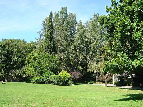
Parque Aquilino Ribeiro is the largest green space in Viseu, a city in north-central Portugal, and it sits right in the centre of town. Covering roughly 3.5 hectares, it has long been a favourite spot for strolls, rest and family outings. It is named after Aquilino Ribeiro, a writer closely tied to the Beira region. How did the park come to be? The land was once part of the Quinta de Maçorim estate. In 1635 the Capuchin convent of Santo António was built here. The friars left in 1834. The following year the town council asked for the walled grounds to be used as a public promenade and cemetery, and in 1838 it was granted the enclosure and the avenue for a tree nursery, a botanical garden and a burial ground. The present layout was designed by architect Viana Barreto, and the park opened in 1955. It has carried the name of Aquilino Ribeiro since 1974, in tribute to the author. What is there to see? The lake – a curving, roughly oval pond around the middle of the park's long axis, partly ringed by trees. A circular island sits near its southern edge, and a café with a terrace overlooks the water. Old trees – oaks and other lush vegetation shade the paths where the Capuchin friars once walked. Lawns and paths – wide walkways with stone benches and well-kept grass suit a picnic or a quiet break. Religious heritage – nearby stand the Baroque Church of the Third Order of St Francis and the 17th-century chapel of Nossa Senhora das Vitórias. Is it good for kids and active visitors? Yes. The park has a modern playground, a children's library, a roller-skating rink with an area for extreme sports, and a cycle path. Ducks live on the lake, which children enjoy, and you can buy ice cream at the terrace by the water. Getting there and accessibility The park lies on Avenida 25 de Abril in central Viseu, an easy walk from the old town. It is listed as wheelchair accessible and no ticket is needed. When to visit Thanks to the tree cover, the park stays pleasant even on hot summer days. Spring and autumn are equally good for a walk, and an evening visit pairs well with dinner nearby. It makes a relaxing pause during a day of sightseeing. Frequently asked questions How big is the park? About 3.5 hectares. When was it created? Viana Barreto designed it and it opened in 1955; before that a Capuchin convent from 1635 stood here. Is admission charged? No, it is a public park. Is it suitable for families? Yes, with a playground, a children's library and a skating rink. Who is it named after? The writer Aquilino Ribeiro, since 1974.
-
Parque de Santa Cruz
Coimbra
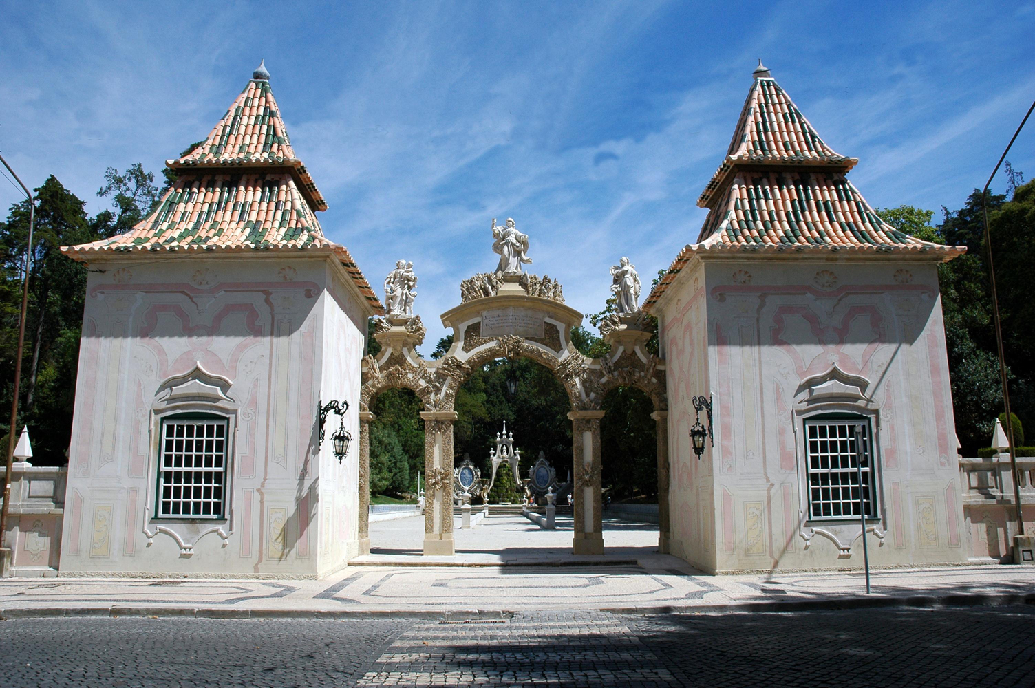
Parque de Santa Cruz in Coimbra, popularly known as the Jardim da Sereia ("Mermaid Garden"), is a historic park in the heart of the city, right by Praça da República. It began as a monastic garden and is now one of the calmest places in town for a break between the university hill and the lower city. How did the park begin? In 1131 the land was handed to the Augustinian canons regular, who set up a farming estate tied to the Santa Cruz monastery. Its biggest transformation came in the 18th century. Between 1723 and 1752, on the initiative of prior Gaspar da Encarnação, the former Quinta da Ribela was reshaped into a leisure garden. It gained a court for pela, an old ball game, and a Baroque garden meant for rest and contemplation. What happened after the religious orders were dissolved? After the orders were suppressed in 1834, the estate passed through several owners. The last private one was Commander José António L. Ribeiro. In 1885 Coimbra's city council bought it and opened it to residents as a public park for strolling and relaxing. Since 1970 the park has held Imóvel de Interesse Público status, a level of heritage protection in Portugal. What is there to see? The entrance from Praça da República passes three statues representing Faith, Charity and Hope, and the path ends at a cascade. Climbing the steps brings you to the Fonte da Nogueira, decorated with a triton sculpture whose mouth pours water into the fountain. That figure gave rise to the popular "mermaid" name. Why visit? It sits in the centre, so it pairs easily with a visit to the nearby Santa Cruz monastery. The Baroque layout and water features feel like another era. It offers green space without leaving the historic core. Frequently asked questions Are Parque de Santa Cruz and Jardim da Sereia the same place? Yes. Jardim da Sereia is the popular name, tied to the fountain figure. Where is the entrance? The main entrance is from Praça da República. Is the park a protected monument? Yes, it has been classed as Imóvel de Interesse Público since 1970. Who created the garden in its present form? The Baroque layout dates from the 18th century, driven by prior Gaspar da Encarnação. Since when has it been public? Since 1885, when Coimbra's council bought the estate. Check current opening hours with the city tourist information before you go, as they may vary by season.
-
Jardim de Arca d'Água
Porto
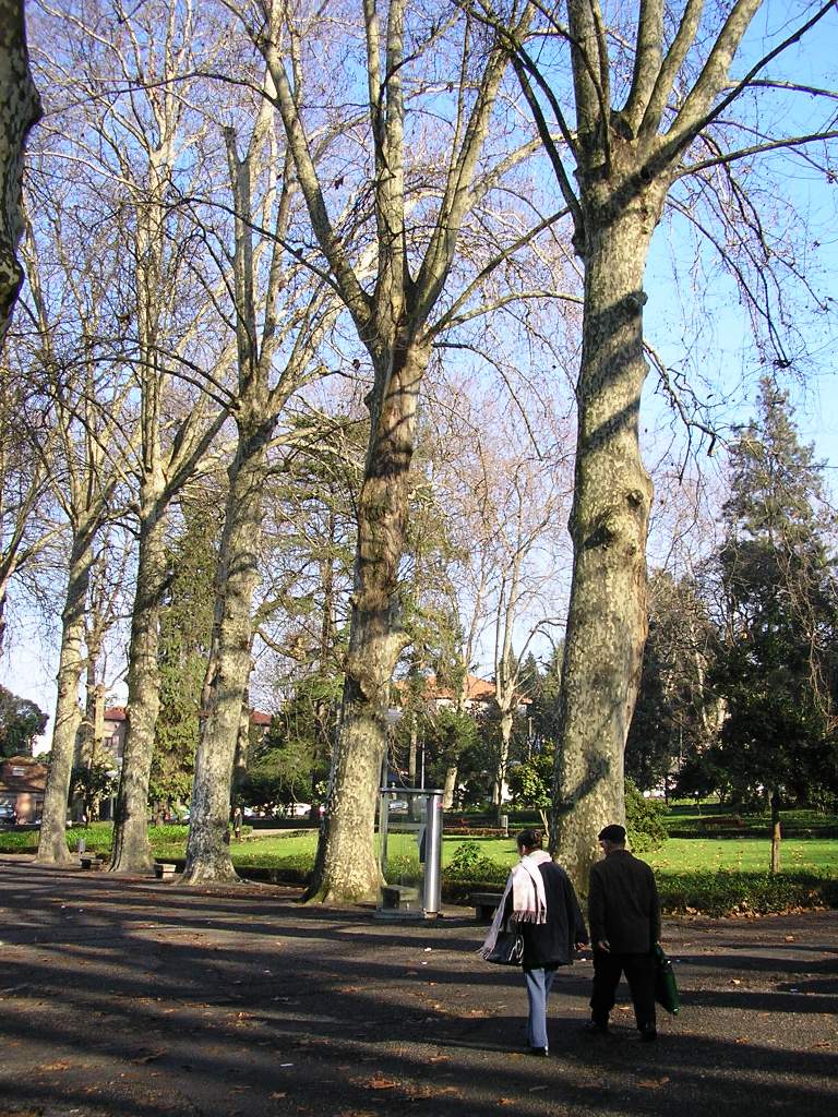
Jardim de Arca d'Água is a public garden in the Paranhos parish of eastern Porto. It looks like an ordinary neighbourhood park, yet beneath its paths lies one of the oldest water sources that supplied the city for centuries. Why visit? The garden blends greenery, urban infrastructure history and a genuinely local mood. You will not find tourist crowds here, only shade, benches and a calm that is hard to come by in the historic centre. It suits travellers who want to see Porto as its residents live it. Where does the name come from? The name roughly means "water chest" and refers to three springs in the Paranhos area. The oldest surviving records of these waters date to 1120, in the document by which Countess Theresa granted the Couto do Porto to Bishop Hugo. By the middle of the 15th century three fountains stood on the site, which explains the name. As the city grew and water ran short, a plan emerged to bring it from Paranhos into the centre. The authorisation was issued on 20 November 1597 under Philip I. The oldest stretch of the underground supply network, dated 1607, starts in this very garden and runs about 3.5 km to Praça dos Leões, feeding dozens of fountains along the way. Who designed the garden? The present garden was designed by Jerónimo Monteiro da Costa and opened in 1928. A later addition is the sculpture "A Família" (The Family) by Charters de Almeida, unveiled in 1972. A literary footnote In 1866 a duel between the writers Antero de Quental and Ramalho Ortigão took place near the springs, one of the more colourful episodes in Portuguese literary history tied to this corner of the city. Frequently asked questions Where is Jardim de Arca d'Água? In the Paranhos parish, in the eastern part of Porto. Is it linked to the city's water supply? Yes. The oldest section of Porto's underground water network, from the early 17th century, begins here and leads to Praça dos Leões. When was the garden created? It was designed by Jerónimo Monteiro da Costa and inaugurated in 1928. Are there sculptures? Yes, "A Família" by Charters de Almeida, from 1972. Is it worth a special trip? If you enjoy city history and a quieter side of Porto, yes. Treat it as a complement to exploring Paranhos rather than a headline sight. Practical tips The garden is public and sits in an everyday residential district, so it pairs well with a stroll through the surrounding streets. Allow time to read any information boards about the springs and to rest in the shade. Getting there by public transport is easy, as Paranhos is well connected to central Porto.
-
Rotunda da Boavista garden
Porto
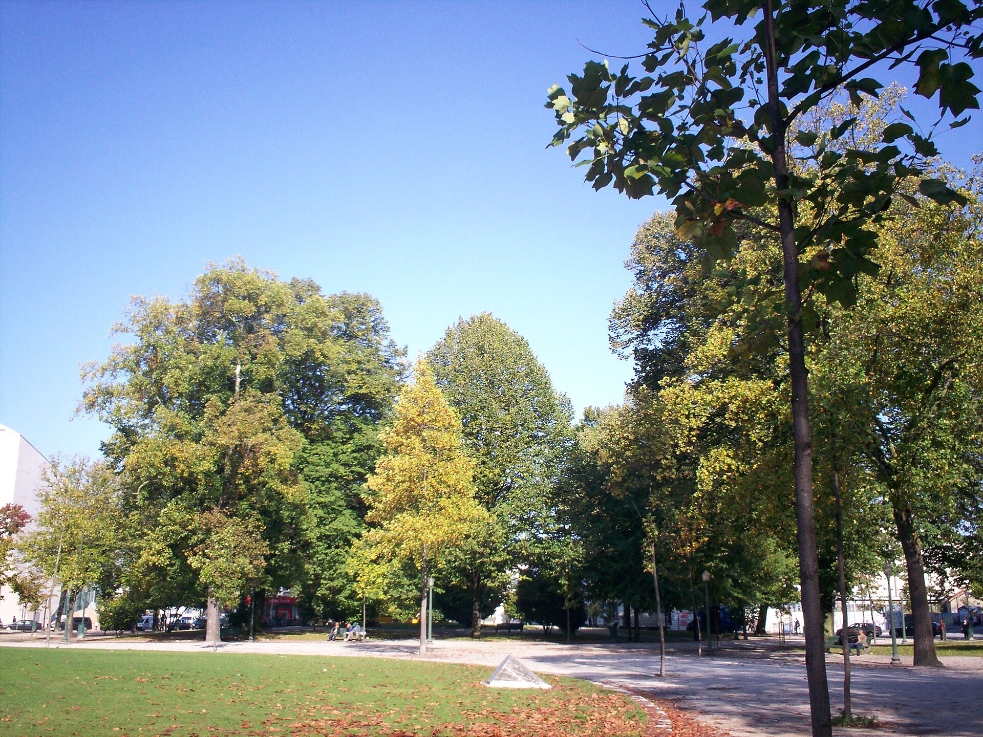
Rotunda da Boavista garden is the green centre of a large roundabout in the Boavista district of Porto, Portugal. At its heart stands one of the city's most recognisable monuments. The site lies at roughly 41.1579 N, 8.6291 W, within the united parish of Cedofeita, Santo Ildefonso, Sé, Miragaia, São Nicolau e Vitória. What is this place? The rotunda is a traffic roundabout with a public garden inside it, working at once as a small park, a landmark and a place of remembrance. City traffic circles around it, but the garden itself offers a short pause among the trees. Winding paths cross the island from one side of the roundabout to the other, and wooden benches line them. What was the square called in the past? The square was built in the late 1700s and was first named Praça de Boavista. In 1903 it was renamed Praça de Mouzinho de Albuquerque, honouring a Portuguese soldier who fought in Africa in the 19th century. In everyday speech, locals and visitors simply say Rotunda da Boavista. What does the column at the centre commemorate? The main feature of the garden is the Monument to the Heroes of the Peninsular War (Monumento aos Heróis da Guerra Peninsular). It is a column about 45 metres (148 ft) tall, built to celebrate the victory of Portuguese and British forces over the French troops who invaded Portugal between 1807 and 1814. Construction was unusually slow, running from 1909 to 1951. The design came from the well-known Porto architect José Marques da Silva, working with the sculptor Alves de Sousa. The column is crowned by a lion, the symbol of the joint Portuguese and British victory. The lion is shown bringing down the French imperial eagle, a clear image of the invaders' defeat. How to visit No ticket or booking is needed. The best approach is to stroll the paths around the column, look at it from several angles and rest on one of the benches. Because the garden sits inside a roundabout, you reach it via the pedestrian crossings around the square, so take care with traffic. A visit usually takes a quarter of an hour or so, and the spot fits well as a stop on a walk through Boavista. Why stop here? The column is one of Porto's characteristic landmarks. The monument tells a story of early 19th-century Europe and the Portuguese-British alliance. It was made by creators tied to Porto, and its construction spanned more than forty years. The green centre offers a break from city traffic. Frequently asked questions Is the garden free to enter? Yes, it is an open public garden. How tall is the column? About 45 metres (148 ft). What does the lion on top represent? It symbolises the Portuguese and British victory, and it brings down the French imperial eagle. When was the monument built? Work ran from 1909 to 1951. Is there somewhere to sit? Yes, wooden benches stand along the garden paths. What was the square formerly called? First Praça de Boavista, and from 1903 Praça de Mouzinho de Albuquerque. Who designed the monument? Architect José Marques da Silva and sculptor Alves de Sousa. Rotunda da Boavista is a simple but meaningful stop: a few minutes among greenery and a compact history lesson in the middle of the city's traffic.
-

Parque Oriental da Cidade do Porto
Porto
Parque Oriental da Cidade do Porto is an urban landscape park in the eastern part of Porto, in the Campanhã district. It is the city's second largest park after Parque da Cidade, yet quite different in character: instead of broad open lawns, it has a narrow, elongated layout that follows a river. Where is the park and how is it laid out? The park was built along the final stretch of the Rio Tinto, next to Alameda de Azevedo. It is a linear park running from the Freixo area to Pego Negro. Official descriptions give a total green area of roughly 17 to 18 hectares, split into two adjoining sections. The design is the work of landscape architect Sidónio Pardal. Numerous footpaths and cycle routes cross the park, used by walkers, runners and cyclists alike. Because the layout is linear, it is easy to plan a walk of almost any length, and the Rio Tinto accompanies you for much of the way. When was it built? The first phase opened in mid-2010, with further phases planned over the following decade. The second phase was inaugurated in October 2019. The expansion went hand in hand with the rehabilitation of the Rio Tinto, which added several hectares of new green space. What grows in the park? The park has a naturalistic feel. Trees include stone pine and maritime pine, cork oak and pedunculate oak, plus beeches, willows and Leyland cypress. Newer plantings add azaleas, camellias and rhododendrons that emphasise the linear line of the paths, so the park offers something to see in different seasons. What is the park used for? Mostly it is an everyday recreation space for residents of the eastern neighbourhoods: walking, jogging and cycling. It also hosts environmental education activities, since it shows how greenery and a restored river ecosystem can work inside a densely built city. The municipality counts it among its nature-based solutions. Frequently asked questions Is entry to the park paid? No, it is a public city park. Can I cycle here? Yes, cycle paths shared with pedestrians run through the park. Is Parque Oriental bigger than Parque da Cidade? No. It is Porto's second largest park, after Parque da Cidade. Who is this area for? Anyone who wants to see the less touristy eastern side of the city and take a riverside walk among greenery. Who designed the park? Landscape architect Sidónio Pardal.
-
Jardim António Feijó
Jardim António Feijó, commonly known in Lisbon as the Jardim dos Anjos (Garden of the Angels), is a small public garden on Avenida Almirante Reis in the Arroios district. It surrounds the Igreja de Nossa Senhora dos Anjos and dates from the same period as the church: it was laid out at the start of the twentieth century and inaugurated in 1911. The city of Lisbon manages it. Why two names? The official name honours António Feijó, while locals simply say "Jardim dos Anjos" because of the neighbouring church dedicated to Our Lady of the Angels. If you are searching a map or asking a Lisboeta for directions, it helps to know both. A short history The first Anjos church was built in this area in 1563, in the old parish of Santa Justa, where Avenida Almirante Reis now meets Rua dos Anjos. The 1755 earthquake destroyed it, and it was rebuilt in 1758 on the same spot. The present neoclassical church was designed by architect José Luís Monteiro, and the garden was created around it as a green forecourt. What to see This is a small garden, so do not plan a full day here. Nature lovers can look for two Phytolacca dioica trees (the ombu), listed in Portugal as trees of public interest and protected since 1947. Their broad crowns give shade on hot days, and the garden makes a handy resting place in a busy part of town. The renovation In recent years the garden underwent a thorough renovation, with new flowerbeds, better lighting, refurbished paving, an irrigation system and public toilets. It is now closed at night for greater security. Check the current opening hours with the city or the parish before your visit, as they may change. Getting there The garden sits on Avenida Almirante Reis, one of Lisbon's main avenues, in the Anjos area. The easiest way to arrive is by metro: Anjos station is right next to it. It combines well with a walk through Arroios and Intendente. Frequently asked questions Is entry free? Yes, it is a public city garden. How long does a visit take? Usually 15 to 30 minutes, longer if you also stop at the church. Is it open around the clock? No. Since the renovation it closes at night, so check hours beforehand. Are there toilets? Yes, public toilets were added during the renovation. What else is nearby? The Nossa Senhora dos Anjos church itself and the surrounding streets of Arroios, where older townhouses mix with newer cafes and shops. Who is it for? Anyone wanting a quiet break in the city, fans of neoclassical architecture, and travellers curious about everyday Lisbon away from the big monuments. It also works as a short stop with children.
-
Parque Recreativo dos Moinhos de Santana
Parque Recreativo dos Moinhos de Santana is a recreational green space in western Lisbon, close to Monsanto Forest Park. It takes its name from two old windmills standing on the highest ground in the park, which look out over the city and the Tagus River. The park has been open to the public since 1997 and covers roughly five hectares. What is there to see in the park? The two windmills are the landmark of the place, and are described as about three centuries old. They sit on a rise beside a circular viewpoint. From here you can take in a wide panorama: the Tagus, the 25 de Abril Bridge, the Christ the King statue across the water, and neighbourhoods such as Belém, Algés, Restelo and Ajuda. The rest of the park is a calm space for relaxing. Broad lawns, plenty of trees and shrubs offer shade on hot days, and a small lake with a little waterfall adds to the scenery. Paths run through the grounds, so it works equally well for an easy stroll or a jog. What can you do at Moinhos de Santana? Walk or run – there is a route for walking and running, plus outdoor exercise stations. Picnic – a dedicated picnic area and open lawns make it easy to settle in for a few hours. Play with children – the playground has slides, swings and climbing nets, which makes the park popular with families. Skate – the lower part of the park has a skate area and a skating rink. Photography and sunset – the terrace by the windmills is one of the nicer viewpoints in this part of the city. How do you get there? The park lies between Estrada de Caselas and Rua Tristão Vaz. The address is Rua Tristão Vaz 22, 1400-052 Lisbon. You can reach it from the centre by public transport or by car; check current bus and tram routes in a journey planner, as timetables change. When is the best time to visit? Spring and early autumn are the most pleasant, when temperatures suit walking and the lawns are green. In summer, choose the morning or late afternoon, since the hilltop can be sunny. There is no entrance ticket, so the park fits well as a free stop in a Lisbon itinerary, for example after visiting Belém. Frequently asked questions Is admission free? Yes, the park is public and open to visitors. Only extra services, if any, might cost money. Is it suitable for children? Yes. There is a playground, lots of space to run around and a peaceful green setting. Can you go inside the windmills? The windmills are mainly a landscape feature and viewpoint. Check on site or with the city's information services whether entry is possible. How long should you plan for a visit? One to two hours is usually enough, depending on whether you plan a picnic, playtime with children or a longer walk. Are there city views? Yes, that is one of its main strengths: the panorama includes the Tagus, the 25 de Abril Bridge and surrounding Lisbon districts.
-
Parque de Monserrate
Sintra (Santa Maria e São Miguel, São Martinho e São Pedro de Penaferrim)
Parque de Monserrate is a Romantic landscape park on a hillside in Sintra, surrounding the Monserrate Palace. Regarded as one of the most beautiful gardens in Portugal, it lies within the Sintra cultural landscape listed by UNESCO and holds more than 3,000 exotic plant species gathered from around the world. How did the park come about? The story starts in 1540, when a chapel dedicated to Our Lady of Montserrat was built on the hilltop. In 1746 the English merchant Gerard de Visme raised a neo-Gothic mansion on the site. William Beckford rented the estate in 1793, reworked the house and began shaping a landscaped garden. The park's present character comes mainly from Sir Francis Cook, later Viscount of Monserrate. Around 1858 he commissioned a new palace on the ruins of the earlier mansion, designed by the architects Thomas James Knowles, father and son. It served as the Cook family's summer residence. The painter William Stockdale and head gardener Francis Burt contributed to the garden's design. The Portuguese state bought the estate in 1949. What is there to see? Cook laid out roughly thirty hectares of gardens and planted them with specimens shipped in from distant places. Plants are grouped by geographic origin, so walking the paths takes you through one landscape after another. Along the way you pass picturesque ruins, shady corners, small lakes and waterfalls. The hill's microclimate favours lush growth. Camellias, azaleas, rhododendrons and Japanese bamboo all thrive here. Spring is especially striking, when the shrubs bloom. Should you visit the palace too? Yes. The palace, with its blend of neo-Gothic and Oriental-inspired forms, stands at the heart of the park, and the ticket normally covers both the interior and the botanical garden. Many visitors consider Monserrate a calmer alternative to Sintra's busier monuments. Frequently asked questions How long should I allow? A relaxed walk through the park plus the palace takes a few hours. Is it open every day? The park generally opens in the morning and closes in the evening, with the palace closing somewhat earlier. Check the Parques de Sintra website for current hours and prices, as they change. Does the ticket include the palace? Normally yes, it covers the palace interior and the botanical park. What should I wear? Comfortable shoes, since paths run over steep terrain and some are uneven. When is the best time to go? Spring, when camellias, azaleas and rhododendrons flower, though the park is rewarding all year. Parque de Monserrate suits anyone who enjoys gardens, botany and quiet walks among greenery, away from Sintra's biggest crowds. Plan at least half a day to see both the palace and the garden's best corners, from lakes and waterfalls to plant collections from several continents. With so many species, each part of the park has its own character, and a stroll feels like a journey around the world in miniature.
-
Parque da Quinta das Conchas e dos Lilases
Lisboa
Parque da Quinta das Conchas e dos Lilases is one of Lisbon's largest parks, set in the Lumiar district in the north of the city. It covers roughly 26 hectares and ranks as the third largest green space in the Portuguese capital, after Monsanto and Bela Vista. For travellers who want a break from the crowded streets of the centre, it offers calm and plenty of room to walk. How did the park come about? The park stands on the land of two former 16th-century estates: Quinta das Conchas and Quinta dos Lilases. The first is linked to a figure named Afonso Torres. After passing through several families, the estate was bought on 25 February 1899 by Francisco Mantero. In the early 20th century a small mansion and a fountain were built in the wooded part of Quinta das Conchas; the fountain carries an inscription dated 1916, though today it is dry and out of use. Part of the estate also housed a Tobis Portuguesa film studio, where "A Canção de Lisboa", a well-known musical comedy, was shot in 1933. In 1966 Mantero's descendants handed the management and preservation of the estate to the Lisbon City Council. After renovation works, the park opened to the public on 12 May 2005. What is there to see? The park is divided into three distinct zones: Quinta das Conchas, the Mata (woodland) and Quinta dos Lilases. Quinta das Conchas is the largest part. It has a big central lawn, and a group of olive trees grows at its higher end. The Mata is the wooded area, with remains of the old estate such as the fountain mentioned above. The Cupressus lusitanica trees here are over a hundred years old and form one of only four such ancient stands in Portugal. Quinta dos Lilases is the third zone, named after the lilacs that gave the estate its name. Practical information According to OpenStreetMap the park is open from 06:00 to 01:00, so it suits an early walk or run as well as an evening outing. Coordinates are about 38.770 N, 9.155 W. Entry to the park is open to everyone. Frequently asked questions Where is the park? In the Lumiar district, in northern Lisbon. How big is it? About 26 hectares, so allow at least a few hours if you want to see all three zones. Is there anything historic? Yes: an early 20th-century mansion, a fountain dated 1916, and a layout that grew out of 16th-century estates. The old cypresses are a natural curiosity. When can I visit? From 06:00 to 01:00 per OSM. It is worth checking the current hours on the City of Lisbon website before you go. Who is it for? Anyone looking for greenery, quiet, a family stroll or a picnic on a large lawn, as well as fans of Portuguese film history and old estates. The park is a good choice for visitors who have already seen Lisbon's famous landmarks and want to see how locals spend their free time away from the tourist centre. Its size means that even on a sunny weekend you can find a quiet corner, and the three zones differ in character, from open meadow to shady woodland.
-
Jardim Ducla Soares
Jardim Ducla Soares is a public park in Lisbon's Belém parish. It covers roughly 2.9 hectares on the sloping São Jerónimo hill, between Avenida do Restelo and Rua Pêro da Covilhã. A chapel dedicated to Saint Jerome crowns the top, and a viewpoint beside it looks over the Tagus and the Belém Tower. Where is Jardim Ducla Soares? The park sits on the São Jerónimo hill, in the part of Lisbon tied to the Age of Discoveries. Some of Portugal's most representative national monuments from that era stand nearby: the Ermida de São Jerónimo, the Torre de Belém and the Jerónimos Monastery. A visit to the park fits naturally into a day exploring Belém. Who is the park named after? According to a municipal notice dated 7 September 1987, the park honours Armando José Ducla de Sousa Soares, a Lisbon-born physician and researcher. He lived and worked in the city and died at his home on Largo da Princesa. Who designed the garden? The design is credited to Gonçalo Ribeiro Telles, the Portuguese landscape architect. The layout works with the natural slope: paths and grassy terraces climb toward the chapel and the lookout at the top of the hill. What is there to see? The chapel of Saint Jerome at the summit, part of the historic Belém ensemble. A viewpoint with a panorama of the Torre de Belém and the Tagus. A statue of D. Nuno Álvares Pereira, unveiled in the park on 6 November 2016 by President Marcelo Rebelo de Sousa. Is it a good spot for photos? Yes. One of the best-known photographs of the Torre de Belém is taken from Jardim Ducla Soares. The elevated angle, with the river behind, differs from the usual shots taken beside the tower, so the park appeals to photographers and to anyone looking for a calmer vantage point. Frequently asked questions How big is the park? About 2.9 hectares. Can you see the Torre de Belém from the park? Yes, the viewpoint by the chapel looks down on the tower and the Tagus. Is it close to other sights? Yes. It lies in the historic part of Belém, near the Jerónimos Monastery and the Belém Tower, so it is easy to add to a walking route through the district. Who is the park named after? Physician and researcher Armando José Ducla de Sousa Soares, honoured by a 1987 notice. How long should a visit take? A relaxed walk up the hill and some time at the viewpoint make for a short visit that pairs well with other Belém attractions. Check local sources for opening hours and access before you go.
-
Parque Tejo
Lizbona
Parque Tejo is a large urban riverside park on the Tagus in Lisbon's Parque das Nações district, at the north-eastern edge of the city. It was created after the 1998 International Exhibition (Expo '98) with the aim of restoring the environmental quality of the Tagus waterfront. Today it is one of the most open green spaces in this part of Lisbon, used for walking, cycling and picnics. Where does the park come from? Until the late 1980s the Parque das Nações area was an industrial zone of warehouses, slaughterhouses and polluting plants. Expo '98, themed around the oceans and held on the 500th anniversary of Vasco da Gama's voyage to India, triggered a complete rebuild of roughly five kilometres of shoreline. Parque Tejo belongs to that transformation. It occupies land that combines a former landfill, now sealed, with the site of a water treatment plant. What is it like? The park is a wide, open space right by the Tagus estuary. Its landscape relies on a system of artificial hills that break up the flat ground and open broad views over the river. Do not expect formal ornamental gardens; this is recreational green space with plenty of room to spread out. Big events In August 2023 the grounds of the former Tejo and Trancão Urban Park were prepared for World Youth Day in Lisbon. Since then Parque Tejo has served as a venue for large-scale events and festivals. On ordinary days it is simply a quiet park, but check the event calendar first, as parts of it can be fenced off during major shows. Planning your visit Getting there: the park is in Parque das Nações, served by metro and rail. The easiest approach is to reach the Oriente station area and then walk or cycle along the river. Best time: morning or late afternoon, when the sun is lower and the riverside is pleasant. Combine with: the district has a waterfront promenade, Expo-era architecture and the Oceanarium, so the park fits well into a full-day stroll. Comfort: the terrain is open with little shade, so bring water and a hat in summer. Frequently asked questions Is Parque Tejo free to enter? As an open city park it needs no ticket. Admission to events held there depends on the organiser. When was the park created? After Expo '98, as part of the redevelopment of the Tagus waterfront in Parque das Nações. Its current role as a large-event space dates from 2023. Is it good for a family outing? Yes. The open space, the hills and the nearby river suit a relaxed walk with children, although facilities can be simpler than in the busier centre of the district. How does it differ from the rest of Parque das Nações? The district is densely built and packed with Expo attractions, while Parque Tejo is its more natural, open stretch by the water. Parque Tejo suits anyone who wants a breather after Lisbon's historic centre, with river views and a look at how the city reclaimed former industrial land.
-
Jardim Garcia d'Orta
Jardim Garcia de Orta is a riverside tropical garden in Lisbon's Parque das Nações district, on the Tagus estuary. It opened in 1998 during Expo 98 and is now managed by Lisbon City Council. The garden covers roughly 13,000 square meters and is divided into five plots. Where is Jardim Garcia de Orta? The garden sits on Rua da Pimenta in eastern Lisbon, on the former Expo 98 grounds. Because it lies right by the water, it pairs easily with a stroll along the Parque das Nações waterfront, close to the Oceanarium, Oriente station and the Vasco da Gama shopping centre. Its coordinates are about 38.772 N, 9.092 W. Who designed it? Landscape architect João Gomes da Silva designed the garden. The idea is to tell the story of Portuguese voyages and contact with distant lands through plants rather than monuments or plaques. Why is it named after Garcia de Orta? The namesake is Garcia de Orta, a 16th-century Portuguese physician and naturalist regarded as a pioneer of tropical medicine. He lived and worked in Goa, where he studied the medicinal plants and spices of the East. The garden pays tribute to his work, and its planting themes echo places tied to Portugal's maritime history. What can you see? The main draw is a collection of exotic and tropical vegetation from other continents. The layout works like a set of small ecosystems, each referring to a different region along the old Portuguese routes: Goa, Africa, Macau and Coloane island, the Azores, Madeira, Cape Verde, São Tomé. A single walk therefore moves from greenery associated with India, through African flora, to the feel of the Atlantic islands. Who is it for? The garden is a calm break from exploring modern Lisbon. It suits plant lovers, garden photographers, or anyone who simply wants shade by the river. Since it is a public city garden rather than a ticketed botanical garden, it is easy to drop in, though opening hours and access are worth checking before you go. Frequently asked questions When was Jardim Garcia de Orta created? It opened in 1998, tied to Expo 98. How big is it? About 13,000 square meters, in five plots. Who was Garcia de Orta? A 16th-century Portuguese physician and naturalist, a pioneer of tropical medicine who worked in Goa. What grows there? Exotic and tropical plants arranged in collections referring to Goa, Africa, Macau, the Azores, Madeira, Cape Verde and São Tomé. Is it worth a stop during a visit to Parque das Nações? Yes. It lies in the heart of the district, near the river and main sights, so it fits easily into a route.
-
Jardim Olavo Bilac
Jardim Olavo Bilac is a small historic garden in Lisbon's Estrela parish, right next to the Necessidades Palace. It is also known as Jardim do Largo das Necessidades, the garden of Necessidades Square. For visitors it is a quiet stop with a view over the Tagus, away from the busiest parts of Lisbon. Where is Jardim Olavo Bilac? The garden lies in Lisbon, in the Estrela parish, on Largo das Necessidades. It sits beside the Necessidades Palace, in front of the entrance to the palace chapel. That position gives the place its character: it is not an isolated square but part of a wider setting tied to the palace and the nearby Tapada das Necessidades park. Why is it named after Olavo Bilac? The current name honours Olavo Bilac, a Brazilian writer and one of the most popular poets of his country. The garden was named in his tribute, which is why descriptions of the site use two names: the first is the poet's, the second points to the square where the garden stands. It is worth searching for both on maps and in guidebooks. What is the history of the garden? The garden dates from the mid-18th century. According to available sources, its design is attributed to the architect Manuel Caetano de Sousa and the construction date is given as 1747; some accounts mention an order from King John V as early as 1745. The leisure space came into being together with the Necessidades Palace and served from the start as a viewpoint over the Tagus. What is there to see? Chafariz das Necessidades – a baroque ornamental lake built on the orders of John V in the 18th century. Sources link it to a royal vow made to the Virgin Mary, born of the king's devotion. A view of the Tagus – the garden works as a miradouro, a viewpoint over the river. Playground – there is a children's playground, so the spot suits a walk with a family. The chapel and Necessidades Palace – the garden sits directly in front of the palace chapel entrance, so a visit is easy to combine with looking around the area. Is it worth visiting? Jardim Olavo Bilac is small, so it does not need much time. It suits a short break while exploring Estrela: sit down, look at the baroque lake, glance at the river and move on, for example to the neighbouring Tapada das Necessidades park. The place combines 18th-century history, a Portuguese-Brazilian link in its name and the everyday life of the neighbourhood. Frequently asked questions Are Jardim Olavo Bilac and Jardim do Largo das Necessidades the same place? Yes. They are two names for the same garden: one honours the poet, the other refers to Necessidades Square. Who is the garden named after? Olavo Bilac, a Brazilian writer and poet, among the most popular in his country. When was the garden created? Sources point to the mid-18th century; the project is dated 1747 and attributed to Manuel Caetano de Sousa. Is there a playground? Yes, the garden has a children's playground. What is the Chafariz das Necessidades? A baroque ornamental lake from the time of John V, linked to a royal vow made to the Virgin Mary.
-
Tapada das Necessidades
Tapada das Necessidades is a walled park in Lisbon covering roughly 10 hectares, most of it covered in woodland. It is one of the city's major green spaces and falls under the forestry regime (Regime Florestal), which sets it apart from the typical manicured city garden. How did Tapada das Necessidades begin? The story goes back to 1742. King John V (D. João V) ordered a larger hermitage, a convent and a palace to be built here as his residence, assembling the grounds by purchasing surrounding land. The convent belonged to the Congregation of the Oratory. At that time the garden was much smaller than it is today and was laid out in the Baroque manner by Italian architects. How did the garden change? In 1841, at the request of D. Fernando, the garden was remodelled in the English landscape style. The work was entrusted to the master gardener Jean Bonnard. Strict symmetrical geometry gave way to more freely flowing paths and naturalistic planting. Queen Maria II and King Ferdinand II chose the palace and its garden as a favourite residence. The place became a secondary court, more intimate and secluded, away from the official life of the capital. What is there to see? Lago da Estrela (Star Lake) – a body of water inspired by Italian models and decorated with sculptures. It was once the setting for royal strolls and social gatherings. Estufa Real (Royal Greenhouse) – inaugurated in the 19th century, it housed rare collections of cacti and succulents from the Americas. It became a European reference for the study of these plants. Diverse plant life – species from different continents were brought together here, carried on voyages across the oceans. They reflect the reach of the Portuguese presence in the world. Wooded areas – much of the grounds feels more like a forest than an ornamental park, offering relief from city noise. Opening hours According to OpenStreetMap data, seasonal hours apply: April to September: Monday to Friday 8:00-20:00, Saturdays, Sundays and public holidays 10:00-19:00, October to March: Monday to Friday 8:00-19:00, Saturdays, Sundays and public holidays 10:00-18:00. Check current information before your visit, as hours can change. Frequently asked questions Is Tapada das Necessidades a Baroque garden? It began as one, but its present character comes from the 1841 remodelling in the English landscape style. How large is the park? About 10 hectares, entirely enclosed by a wall. Who founded it? King John V, who in 1742 ordered a hermitage, convent and palace to be built here. Is it an ordinary city park? Not quite. The grounds are largely wooded and subject to the forestry regime, so it feels closer to a forest enclave in the middle of the city than to a classic public garden. Why was the greenhouse important? The Estufa Real gathered rare cacti and succulents from the Americas and, in the 19th century, was a European reference point for studying them. Tapada das Necessidades suits visitors who want to combine the history of a royal residence with a quiet walk among the trees, away from the tourist crowds of central Lisbon.
-
Mário Soares Garden
Mário Soares Garden (Jardim Mário Soares) is a long, narrow public park in Lisbon's Alvalade district. Until 2018 it was known as the Jardim do Campo Grande; the current name honours Mário Soares, the former Portuguese president. It is one of the capital's larger green spaces and a good place to slow down between sights. Where is it and how is it laid out? The park covers roughly 13.4 hectares. It is a strip up to about 150 metres wide that runs northwest for around 1.2 kilometres, squeezed between the two carriageways of Campo Grande avenue. It begins close to the Campo Grande metro station, so getting there from central Lisbon is easy without a car. Avenida do Brasil crosses the garden and splits it into a northern and a southern section. That gives a walk a natural rhythm: explore one half, cross the busy road, then continue through the other. Where does the name come from, and what is its history? The garden was laid out in the 19th century and for a long time was simply the Jardim do Campo Grande. The Mário Soares name was adopted in 2018. Many local guides and residents still use the old name, so it helps to know both when searching maps or reading reviews. Portuguese sources describe the Campo Grande area as historically significant going back to the Middle Ages. In 1869, under King Luís I, work began on the main lake, which became a spot for rowing-boat outings popular with nobles and the royal family. What is there to see? The lake. The centrepiece of the garden. Rowing boats are available, and paths run along the water. Sculptures and monuments. Statues of kings Afonso Henriques and John I, busts of figures from Portuguese cultural life, and a monument to the caricaturist Rafael Bordalo Pinheiro. Shade. Tree-lined paths offer relief on hot days, which matters in Lisbon summers. Recreation. Playgrounds and sports areas nearby, plus plenty of space for a picnic. The kiosk. A distinctive red kiosk that may serve as an open-air cafe. Who is it for? The garden suits travellers who want a rest after monuments and museums, families with children, and joggers or casual walkers. The long, straight layout makes it easy to choose your distance: a short stroll by the lake, or the full walk from one end to the other, over a kilometre. The park can be combined with other plans in Alvalade. Entry is open, as in most public city parks. Frequently asked questions Is Mário Soares Garden the same as Jardim do Campo Grande? Yes. Jardim do Campo Grande is the earlier name, changed in 2018. Both are still in use. How do I get there? The simplest way is the metro to Campo Grande station, next to where the park begins. How long does it take to walk the whole park? It is about 1.2 km long, so end to end is a matter of minutes. With stops at the lake and monuments, allow an hour or two. Is the park divided? Yes. Avenida do Brasil separates the northern and southern sections. Can I go boating? Rowing boats are available on the lake, but check hours and prices on site.
-
Garden Irmã Lúcia
Lizbona
Jardim Irmã Lúcia is a public garden in Lisbon's Areeiro district, a green pocket for locals and visitors who want a break away from the main tourist routes. It is also known as Largo da Igreja de São João de Deus, because it wraps around the church of that name. Where is Jardim Irmã Lúcia? The garden sits in the Areeiro parish in northern Lisbon, at roughly 38.7397 N, 9.1378 W. Rua Brás Pacheco bounds it on the west, Avenida do México on the south, Praça de Londres on the east and Avenida Marconi on the north. The greenery lies on both the northern and southern sides of the São João de Deus church, so the church building divides the layout. Is it free, and when is it open? Yes, it is free. This is an open city park with no tickets and no set opening hours, so you can walk in at any time of day, though after dark the usual big-city common sense applies. What is there to see? The most distinctive features are the stone sculptures by the artists Euclides Vaz and Anjos Teixeira. Beyond them you will find lawns with trees and flowers, and paths paved in traditional Portuguese stone, the calçada portuguesa familiar from pavements across Lisbon. There is also a children's playground, which makes the garden a good stop on a family walk. A typical Portuguese kiosk with a café and terrace operates in the park, a convenient place to sit down for a coffee while exploring the neighbourhood. Dog park In January 2021 a dedicated dog area opened in the garden, next to Praça de Londres. Dogs can run off the lead there, which makes the garden welcoming for pet owners. Where does the name come from? The garden is named after Sister Lúcia (Irmã Lúcia), one of the three shepherd children of Fátima. The name commemorates a figure of great importance in Portuguese Catholicism. Who is it for? Jardim Irmã Lúcia is not among Lisbon's headline monuments, but it works well as a short stop. It suits people who enjoy quiet city parks, families with children, dog owners and anyone interested in sculpture in public space. Thanks to its position by Praça de Londres, a visit combines easily with a stroll through the surrounding streets of Areeiro. Frequently asked questions Is the garden free? Yes, entry is free and there are no opening hours. Can I bring my dog? Yes, there is a designated area by Praça de Londres where dogs can run without a lead, opened in January 2021. Is there anything for children? Yes, the garden has a playground. Where can I get a coffee? At the kiosk with a café and terrace inside the park. Who is the garden named after? Sister Lúcia, one of the shepherd children of Fátima.
-
Jardim Botto Machado
Jardim Botto Machado is a small municipal garden in Lisbon, also known as Jardim de Santa Clara. It lies in the São Vicente de Fora parish, on Campo de Santa Clara, and pairs quiet greenery with one of the nicer views over the Tagus. What is Jardim Botto Machado? It is a small public park of roughly half a hectare. It is fenced, has paved paths and a well-developed layer of shrubs and trees that give shade on hot days. The garden was inaugurated in 1862 and follows a romantic style, similar to Lisbon's Passeio Público, today's Avenida da Liberdade, which was reopened around 1852. Where does the name come from? The original name, Jardim de Santa Clara, refers to Clare of Assisi (1194-1253), founder of the female branch of the Franciscan Order. The later name honours Pedro Amaral Botto Machado (1865-1924), a Portuguese diplomat and republican politician. Where exactly is it? The garden sits in the parish of São Vicente de Fora, near the National Pantheon, the former Church of Santa Engrácia, and the Monastery of São Vicente de Fora. The ground slopes down from the Santa Clara market to Rua do Paraíso. From the eastern top of the garden you get a view of the Tagus River. What to see and do Stroll the paths among trees and shrubs. Rest on a bench away from the busiest tourist routes. Enjoy the river panorama from the eastern end of the park. Combine the visit with the nearby National Pantheon and the Monastery of São Vicente de Fora. Frequently asked questions Is Jardim Botto Machado a large park? No, it is a small space of about 0.5 hectares. It works well as a short stop while exploring the area. Are Jardim de Santa Clara and Jardim Botto Machado the same place? Yes. The first name is older; the second honours a republican politician and diplomat. When was the garden opened? It was inaugurated in 1862. Is there a view of the river? Yes, the Tagus can be seen from the eastern top of the garden. What is worth seeing nearby? The National Pantheon in the Church of Santa Engrácia and the Monastery of São Vicente de Fora are right next door, in the same part of Lisbon. How should I plan a visit? Fit the garden into a walk through the eastern side of the old town. Bring something to drink and pause in the shade before moving on toward the river or the nearby monuments. Because the ground slopes toward Rua do Paraíso, it is easier to start at the upper part, where the view opens up, and walk down. Who is it for? It suits visitors who want to slow down between sights, enjoy a modest city garden and appreciate a river view without crowds. It is not an all-day attraction, but a pleasant addition to a route around São Vicente de Fora and Campo de Santa Clara.
-
Parque Urbano da Quinta Conde dos Arcos
Lizbona
Parque Urbano da Quinta Conde dos Arcos is a nine-hectare city park in Lisbon's Olivais district, set on the grounds of a former aristocratic country estate. It mixes greenery, a community vegetable garden, a children's playground and working vocational schools, so it feels more like a living corner of the city than a plain promenade park. What is the history of the place? The quinta already existed when it passed to the Noronha family in the 17th century, later the Counts of Arcos. Olivais was then an outlying area of Lisbon, and the estate served as a retreat from the capital's bustle. It included a manor house, a courtyard, an olive oil press, olive groves, a vineyard and orchards. In 1940 Lisbon's municipal council expropriated the quinta from the counts' heirs, and a small part of the land was lost to the road linking the airport with Moscavide. What is there to see? The park's emblem is a huge, centuries-old dragon tree (Dracaena draco), said to have stood here since the 17th century. Beyond it, a marked trail leads past 28 notable trees. You can walk it on your own with a map and QR codes, or join a guided tour run by the School of Gardening. There is also a small, intimate lake. The old estate now hosts the municipal plant nursery, the School of Gardening and the School of Pavers (Calceteiros), which train the people who look after Lisbon's green spaces and pavements. The newer part is a horticultural park where residents grow vegetables and herbs, supporting urban biodiversity. Families will appreciate the playground, and tired walkers the cafeteria. How to visit The park is public and open all year. It has three entrances, and the address is usually given as Av. Dr. Francisco Luís Gomes in Olivais. Opening hours vary by season: 6:30 am to 10 pm in summer and 6:30 am to 8 pm in winter. Walking in is free; organised tours are run by the School of Gardening, so check current dates before you go. Allow an hour or two if you want to follow the tree trail and look around the garden areas. Spring and early summer bring the lushest greenery, while mornings and evenings offer the softest light and less heat. Frequently asked questions Is the park free? Yes, it is a public city park open all year. What are the opening hours? Summer 6:30 am to 10 pm, winter 6:30 am to 8 pm. Where is it? In the Olivais district of Lisbon, on Av. Dr. Francisco Luís Gomes. Is it good for children? Yes, there is a playground, and a cafeteria on site. What is the main highlight? The centuries-old dragon tree and the trail of 28 remarkable trees with a map and QR codes. Can I take a guided tour? Yes, the School of Gardening organises them. Who is it for? The park makes a calm break from sightseeing in Lisbon, especially for anyone interested in botany, the history of old estates or urban gardening. It lies outside the strict centre, so it is less a stop for a first short visit and more a rewarding addition for those who want to see a less touristy side of Portugal's capital.
-
Parque dos Dinossauros da Lourinhã
Lourinhã
Parque dos Dinossauros da Lourinhã, known as Dino Parque, is Portugal's largest open-air museum and one of the biggest dinosaur-themed parks in Europe. It opened in February 2018 in Abelheira, about five minutes by car from the centre of Lourinhã. Why dinosaurs in Lourinhã? The area around Lourinhã is among Europe's most important sites for Jurassic fossils. The region is well known for dinosaur discoveries, and one of its emblems is Lourinhanosaurus antunesi, a carnivorous Jurassic dinosaur that grew up to eight metres long. The park builds on this heritage and presents it in a form that appeals to children and adults alike. What can you see? The exhibition consists of 203 life-size models of dinosaurs and other animals. The visit follows five themed trails through successive eras: Paleozoic and Triassic, Jurassic, Cretaceous, Sea Monsters, Cenozoic and the Ice Age. More recently, two new life-size arrivals joined the Cretaceous trail: Giganotosaurus and Gigantoraptor. The observation tower One stop worth planning is the Jurassic observation tower, about six metres high. From the top you get a 360-degree view of the main dinosaur models and the layout of the Jurassic section, which shows the scale of these animals well. Practical information The park opens daily at 10:00. Closing time depends on the season: 17:00 in winter, 18:00 in spring and 19:00 in summer. Tickets cost 15 euros for adults and 11 euros for children. Check dinoparque.pt for current prices and hours before you go. Frequently asked questions Is Dino Parque a good choice for families with children? Yes. Life-size models, themed trails and the viewing tower make it family-friendly, and the layout lets you explore at your own pace. How much time should I plan? Five outdoor trails call for several hours of relaxed walking, so half a day is a sensible allowance. How do I get there? The park is in Abelheira, a few minutes from central Lourinhã. Driving from Lourinhã or nearby towns on the Silver Coast is the most convenient option. When is the best time to visit? Because the visit is outdoors, spring or early summer works best, when days are long and opening hours are longest. On warm days bring a hat and water. Is it only about dinosaurs? No. Besides dinosaurs it covers earlier and later chapters of life on Earth, from the Triassic to the Ice Age, including marine reptiles and Pleistocene mammals. Dino Parque fits well into a trip along Portugal's west coast, combining entertainment with an accessible introduction to the prehistory of a region where fossils have actually been found.
Earn badges for the places you visit
Download NextOnTrip, discover new places and check off your trails.