Nature in Norway
A guide to 26 Nature in Norway — with descriptions, photos and traveler visits from the NextOnTrip community. Locations spread across 23 cities and towns. Most visited by the community: Gutulia National Park, Valursfossen, Rafossen.
-
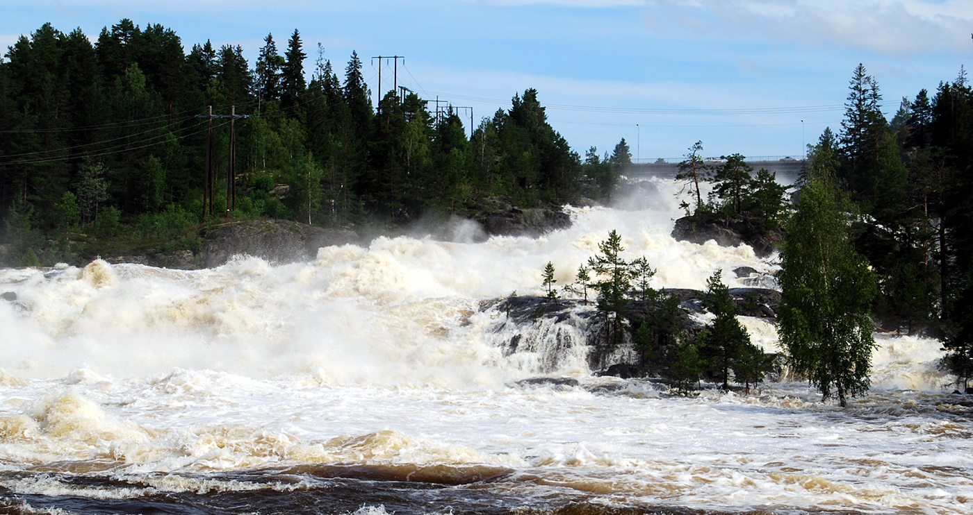
Labrofossen
Kongsberg
Labrofossen is a waterfall in Kongsberg municipality in southern Norway, on the Numedalslågen river about five kilometres south of the town centre. The Norwegian encyclopedia gives its height as roughly 41 metres. It is a spot where nature, the industrial history of the valley and national romantic painting meet within a small area. Where is Labrofossen and how do you find it? The falls lie in Kongsberg, a former mining town in Buskerud county, in the Numedalslågen valley, one of the larger rivers of eastern Norway. They sit about five kilometres downstream from the centre, so a visit is easy to combine with a stay in town. Sources use two spellings, Labrofossen and Labrufoss. Both refer to the same waterfall, and the first is more common in museum catalogues and on tourist maps. Where does the name come from? The Norwegian encyclopedia suggests that the first part of the name may derive from an Old Norse word for a place where cargo was loaded onto boats. This is a hypothesis rather than a certainty. The river was an important transport route for centuries, so the interpretation fits the character of the area. How is the waterfall tied to hydropower? The river's drop here was harnessed to generate electricity. The Labro power station began operating in 1910. In 1983 it was replaced by the Skollenborg power plant, which combines the drop at Labrufoss with the nearby Gravenfoss waterfall. That makes Labrofossen a good example of how Norwegian hydropower shaped both the landscape and the economy of the valley. Why did painters love it? The waterfall was a frequent subject for artists of the national romantic era. J. C. Dahl, Thomas Fearnley and Hans Gude all painted it, and their works are held by the Nasjonalmuseet in Oslo. Fearnley's oil painting from 1837 is catalogued by the museum as "Labrofossen at Kongsberg." For art lovers it is a rewarding pairing: see the paintings in a gallery, then compare them with the real view. What else is nearby? The Labro museum complex stands at the falls: Norsk Vassdragsmuseum (the Norwegian water management museum), Numedalslågens Fløtingsmuseum (the log floating museum) and Norsk Vegmuseum (the road museum). Together they tell how Norwegians used rivers, forests and transport routes. They make a good addition to a short walk by the water, especially for anyone interested in the history of technology. Frequently asked questions How tall is Labrofossen? The Norwegian encyclopedia gives about 41 metres. Are Labrofossen and Labrufoss the same place? Yes, they are two spellings of the same waterfall in Kongsberg. Is the waterfall connected to a power station? Yes. The Labro power station operated here from 1910 and was replaced by Skollenborg in 1983. Who painted Labrofossen? Among others J. C. Dahl, Thomas Fearnley and Hans Gude. Where can you see paintings of the falls? In the collection of the Nasjonalmuseet in Oslo. What can you visit next to the waterfall? The Labro museums, devoted to water management, log floating and roads.
-
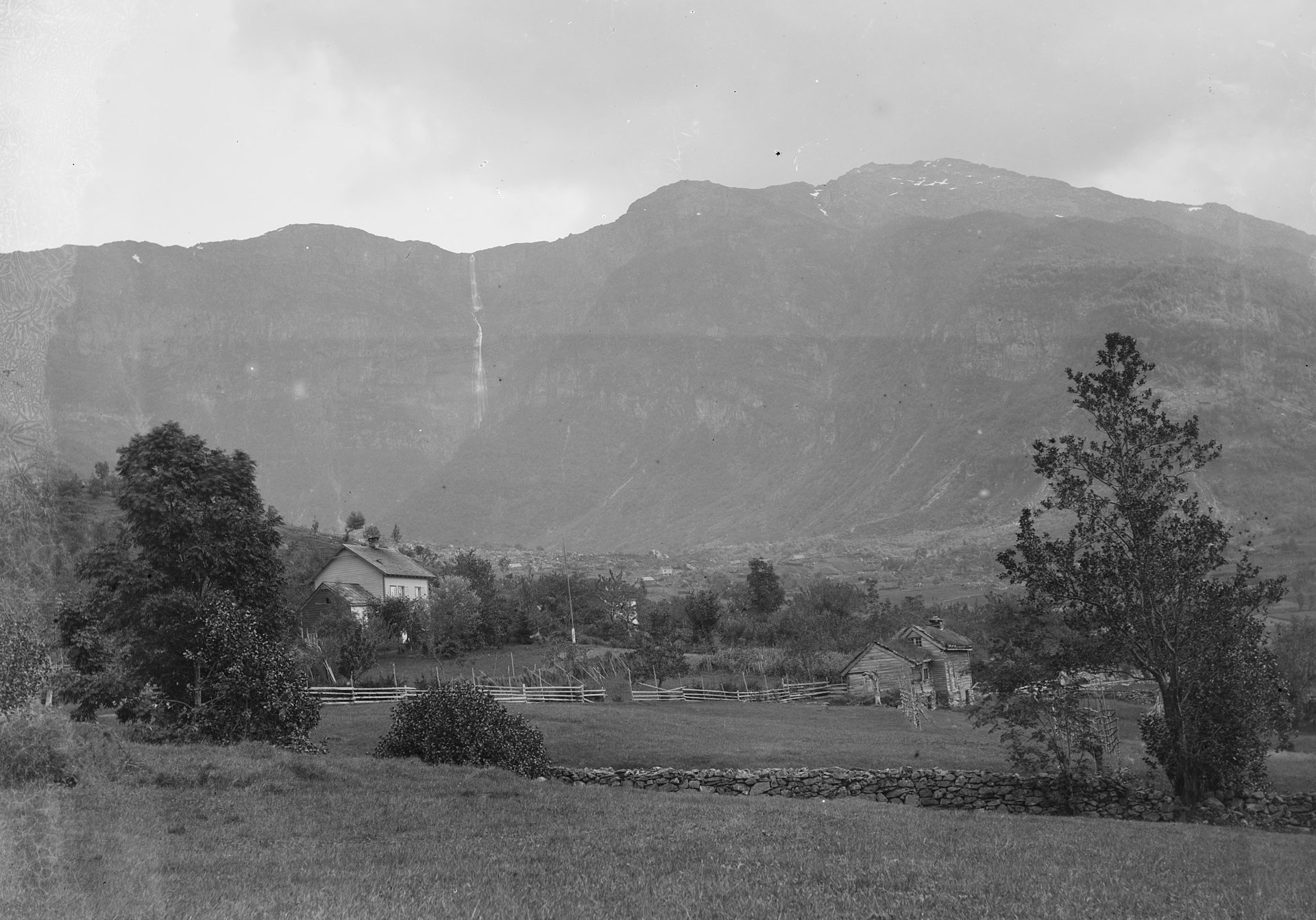
Skrikjofossen
Lofthus
Skrikjofossen is a waterfall in Ullensvang Municipality, Vestland county, western Norway. It drops from the edge of the Hardanger Plateau toward the fjord, roughly 3.5 kilometres southeast of the village of Lofthus. Its total height is about 455 metres (1,493 ft), with the tallest single drop measuring around 260 metres (850 ft). It ranks among the highest and most dramatic falls in this part of Hardanger. Where is Skrikjofossen? The falls sit above Lofthus, a small village on the eastern shore of the Sørfjord, an arm of the Hardangerfjord. The region is known for its apple and cherry orchards, and steep mountain walls rise directly behind the village. The water comes down those walls. Reaching Lofthus is easy; getting closer to the falls means walking. How tall is it? The water descends from the plateau in several steps. A combined height of about 455 metres is striking, and the tallest single drop of roughly 260 metres is impressive even by Norwegian standards. Different publications give slightly different figures depending on how the cascades are measured. The name is sometimes spelled Krikjofossen. Does the waterfall run all year? Not with the same force. The drainage area above the falls is small, so for most of the year the flow is modest. The best time to visit is spring and early summer, when snowmelt from the plateau feeds the stream and the falls look their best. How do you get up there? Trails climb the slope from Lofthus. The best known is the historic route to the plateau, called the Monk's Steps. From the campsite in Lofthus, a path marked with a red T leads up to the top of the falls and on toward Nosi, at about 950 metres. The round trip takes around five hours, so bring sturdy shoes, water and an extra layer for changing weather. A gentler option is the river valley route, Elvedalen, about 5.6 km long with roughly 214 metres of elevation gain, taking 1.5 to 2 hours. Check current conditions before setting out: the bridge over the river has been closed after a landslide, though part of the route remained open. What else is nearby? The neighbouring waterfall Opofossen lies next to Skrikjofossen, and visitors usually see both on the same outing. In Lofthus itself, the orchards and the fjord shore are worth a stop, and the village is a good base for further trips around Hardanger. Frequently asked questions Where is Skrikjofossen? In Ullensvang Municipality, Vestland, about 3.5 km southeast of Lofthus. How tall is it? About 455 m in total, with a tallest single drop of around 260 m. When should I go? Spring and early summer, when the flow is strongest. How long is the hike? The full route from Lofthus toward Nosi takes about five hours round trip; the river valley route takes 1.5 to 2 hours.
-
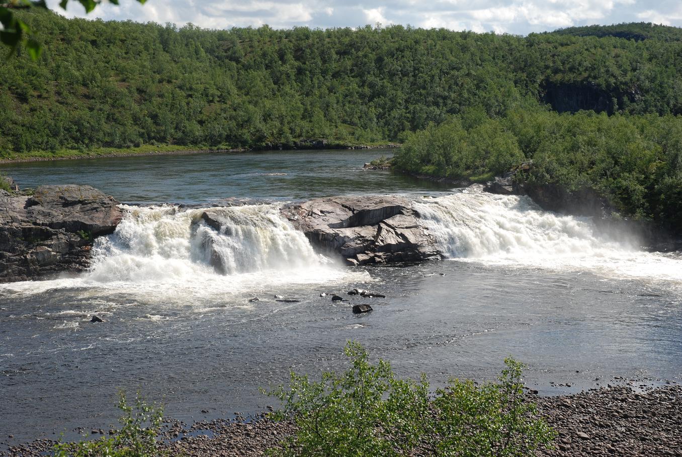
Pikefossen
Kautokeino
Pikefossen is a waterfall on the Kautokeino-Alta River in Norway's Finnmark region, a few dozen kilometres northeast of the town of Kautokeino. It drops about 8 metres but spans roughly 75 to 100 metres across, so it looks more like a broad curtain of water than a tall fall. It sits right beside the road, making it one of the easiest stops between Kautokeino and Alta. Where is Pikefossen and how do you get there? The falls lie on the Finnmarksvidda plateau, in the heart of Sami country, just north of Kautokeino. A parking area serves the site, and a short path leads down towards the riverbed. The walk takes a few minutes and needs no hiking experience. It combines naturally with a drive on towards Alta and the Alta canyon. What is the legend behind the name? In Sami the waterfall is called Nieidagorzi. The place is tied to a story about a young reindeer herder who lost her entire herd when the animals drowned. In one version the reindeer crossed unsafe ice above the falls. According to the tale, her employer, in anger, threw her into the waterfall. Another version says she was sealed in a barrel that floated all the way down to Alta. Details vary, and the name of the place is often linked to this story. What should you know before visiting? There is a picnic area with toilets, so a longer break is easy. Summer is the best time to go. In winter, snow can make access and parking tricky. The wide ledge of water photographs well from the riverbank, especially in low sun. The surroundings are open tundra, so bring a windproof layer even on warm days. Frequently asked questions How tall is Pikefossen? About 8 metres, with a width of 75 to 100 metres. Is the walk difficult? No. A short path leads from the car park to the riverbed. Are there facilities? Yes, a picnic area and toilets. When should I go? In summer. Winter snow can make parking awkward. What does the Sami name mean? Nieidagorzi is the Sami name of the falls, linked to the local legend of the reindeer herder. Pikefossen is a good short stop for anyone travelling through Finnmark who wants a taste of Lapland scenery and a local story. A visit rarely takes more than an hour and offers a break from driving across the open, austere landscape of northern Norway. It works best as part of a longer route across the plateau, together with other stops around Kautokeino and Alta, such as Sami cultural sites or a pause at the Alta canyon. That way a brief visit to the falls fits into a fuller picture of the region.
-
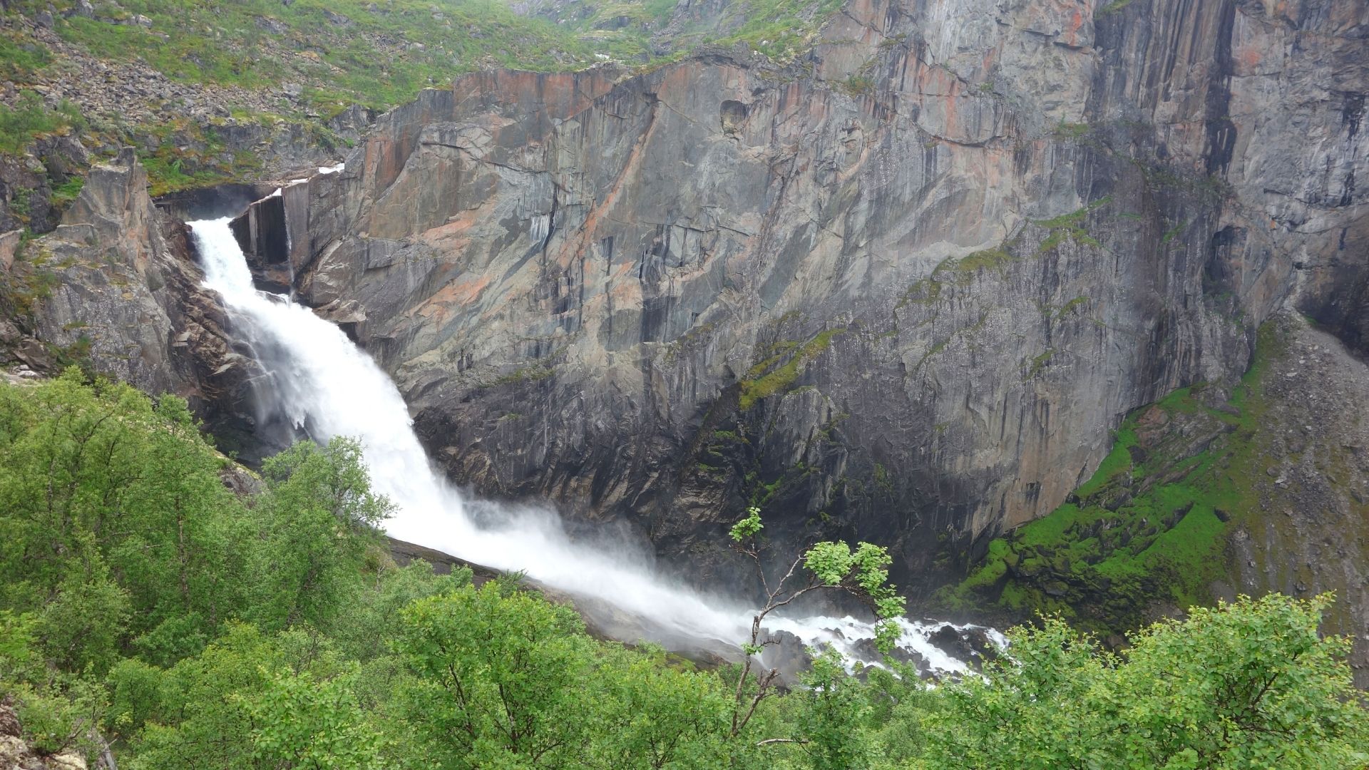
Valursfossen
Eidfjord
Valursfossen is a waterfall in Eidfjord Municipality, Vestland county, in western Norway. Here the river Veig leaves the great Hardangervidda mountain plateau and drops into the Valursdalen valley. It is a lesser-known but striking waterfall in the Eidfjord area, close to a branch of the Hardangerfjord. Where is Valursfossen? The falls lie deep inside Eidfjord Municipality, at the edge of Hardangervidda, the largest mountain plateau in Europe. The Veig comes off the high ground and tumbles into Valursdalen. The coordinates are roughly 60.36° N, 7.15° E. The waterfall sits at the end of the Hjølmodalen valley, away from the main roads, so reaching it takes a walk. How tall is Valursfossen? The figure most often quoted is a total descent of 272 m, which appears in Wikipedia and in local tourism guides. Sources do not agree, though. Some describe a single sheer drop of about 70 m. The World Waterfall Database estimates the waterfall itself at around 110 m, explaining that the older 270+ m figure also counted steep cascades below the bedrock ledge. According to that database, the upper half is a clear plunge, while the lower part fans out over the rock in a horsetail style. The number you see depends on what is counted as part of the falls. How do you get there? The approach starts near Øvre Eidfjord and the Hjølmodalen valley. One local source estimates about an hour on foot from Hjølmoberget. Another describes a route of around 5.2 km that is muddy and rough in places. Bring sturdy hiking boots and allow plenty of time. One guide says the route ends at a parking area in Berastøldalen, so check access before you set out, since signage and road conditions can vary by season. When should you visit? Early summer and summer are best, when meltwater from the plateau feeds the river and the falls carry the most water. The World Waterfall Database notes that flow continues all year but stays low in volume. Summer is also the safest time on the trail; the area around the falls lies at roughly 800 m above sea level, so snow can linger. Frequently asked questions Where is Valursfossen? In Eidfjord Municipality, Vestland county, Norway, at the edge of the Hardangervidda plateau. Which river feeds it? The Veig, flowing from Hardangervidda into the Valursdalen valley. Can you drive to the waterfall? Not all the way. The last stretch is on foot, and the trail can be muddy. How high is it? The most commonly cited figure is a 272 m total descent, although some sources give 70 m, or about 110 m for the falls proper. When is the best time to see it? Early summer and summer, when snowmelt gives the strongest flow. Valursfossen suits hikers who enjoy mountain walks away from the crowds and want to see a river leave the vast Hardangervidda plateau. Pair it with a visit to Eidfjord and the nearby valleys, which show off the fjord-and-mountain landscape of western Norway.
-

Femundsmarka National Park
Røros
Femundsmarka National Park is one of Norway's oldest national parks, set in the east of the country right next to the Swedish border. It is a wide landscape of lakes, marshes and thin forest, best known as a canoeing and hiking destination far from the crowds. Where is the park and how big is it? The park was established on 9 July 1971 and covers 573 km². It straddles two regions: one part lies in Engerdal municipality (Innlandet county), the other in Røros municipality (Trøndelag county). For many visitors, Røros, the old mining town, is the natural base. The park centre sits at roughly 62.22° N, 12.12° E. Why was it protected? The aim was to preserve Lake Femunden, Norway's second-largest natural lake, together with the forests and wilderness stretching east toward Sweden. Information from the park describes it as an area saved from hydropower development. Today it remains one of the largest wild refuges in eastern Norway. What is the landscape like? Mostly lakes and wetlands, with sparse pine and birch woodland. Several summits reach around 1,500 m, and the highest, Storviglen, rises to 1,561 m in the northeast. Femunden itself lies at about 662 m above sea level, and the park borders its northeastern shore. What can you do here? Femundsmarka is often called Norway's great canoe wilderness. Paddling routes are popular, especially along the Røa river system, though some stretches require portaging. Walkers have a network of trails, and in winter there are ski routes. A boat, MS Fæmund II, runs day trips on the lake. What wildlife lives here? Wetlands attract waterfowl, the surrounding forests hold woodpeckers and owls, and the lakes and rivers hold Arctic char and trout. With almost no settlements inside, you can expect real quiet and dark night skies. Frequently asked questions Is the park crowded? No. It is one of the more remote places in southern Norway, which makes it ideal for anyone after solitude. How do I get there? Røros on the Trøndelag side is the most convenient base; from there you head toward Lake Femunden and the trailheads. When is the best time to visit? Summer for hiking and canoe trips, winter for cross-country skiing. Check current conditions and trail maps before you go. Should I prepare for changing weather? Yes. In open terrain around the lakes the weather can turn quickly, so bring suitable clothing, a map and enough food, as there are no shops along the routes. Can I paddle independently? Yes, but expect portages between lakes and rivers, and plan your overnight stops in advance. Femundsmarka National Park is a strong choice for travellers who want raw northern nature without commercial bustle.
-
Presterødkilen
Tønsberg
Presterødkilen is a wetland nature reserve just east of central Tønsberg in Vestfold, Norway. This shallow, brackish bay at the mouth of the Vellebekken stream counts among the most important wetlands in the county, and its birdlife is the main draw. What is this place? Presterødkilen lies almost within the town, yet it protects a valuable water-and-marsh ecosystem. Under the 1985 regulation the reserve covers about 867 decares (roughly 0.87 km²), of which around 701 decares are water. The purpose of the protection is to preserve an important wetland together with its birds and plant communities. Why visit? Birds feed in the shallow brackish water near the Vellebekken outlet, which is why the site is known among birdwatchers and listed in European guides to birding places. For walkers it offers a quick escape from urban bustle without leaving Tønsberg. Is it part of something bigger? Yes. Together with the neighbouring Ilene reserve, Presterødkilen forms a wetland system that has held Ramsar status, as an internationally important wetland, since 1985. How to explore it A walking path runs along the western and northern sides of the bay. A bird tower stands at the headland of Træleborgodden. Protection rules apply: cycling is not allowed and dogs must be kept on a leash all year round. A project in 2016–2018 worked on a path across the reed belt, so check the current state of the trails before you go. Boundary changes The Norwegian nature authority proposed enlarging the reserve by a total of 399 decares, which would bring it to about 1,087 decares. For the current boundaries, consult the Naturbase register. Frequently asked questions Where is Presterødkilen? Directly east of central Tønsberg, in Vestfold. Can I watch birds here? Yes. It is one of the region's main wetlands for birds, with an observation tower at Træleborgodden. Can I bring a dog? Yes, but it must be on a leash throughout the year. Is cycling allowed? No, cycling is prohibited in the reserve. Is there an entrance fee? The sources we have mention no fee for using the path.
-
Hanshelleren Cave
Flatanger
Hanshelleren Cave is a huge sea-coast cave at Strøm in the municipality of Flatanger, in the Namdalen region of Trøndelag, Norway. Among climbers it is one of the most famous crags in the world, yet the short walk to reach it also makes it a rewarding stop for anyone exploring this quiet part of the Norwegian coast. Where is Hanshelleren? The cave sits at Strøm, on the coast of Flatanger municipality. The administrative centre of the municipality is Lauvsnes, and the drive from Trondheim takes roughly three hours. The area is remote, so plan your transport ahead, especially if you are not travelling by car. How do you get to the cave? Park at the signposted parking area. From there a gravel trail of about 1.1 km leads to the cave. The path is short and straightforward, so most visitors can manage it even without climbing gear. At the end you reach a vast rock opening and a wall that impresses even people who have never held a rope. Why is Hanshelleren so famous? It is a massive hillside cave known for some of the hardest sport climbs on the planet. Czech climber Adam Ondra made the first ascents of two of them: Change, with a proposed grade of 9b+, and Silence, graded 9c, a level once considered almost out of reach. Thanks to these ascents, over roughly the past 15 years Hanshelleren has gone from a remotely located cave with enormous potential to one of the best-known climbing destinations anywhere. Is it only for elite climbers? No. The routes span a wide range, from about grade 4 up to 9c, so beginners to sport climbing and top-level athletes can both find something suitable. There are around 40 routes in the cave itself, with more bolting planned, and the regional tourism site counts about 150 routes in the wider Strøm area. Rock and conditions The cave walls are granite. The steep overhang keeps the climbing area dry, a real advantage in Norway's changeable weather. Even so, the coast can turn wet and windy quickly and the approach is outdoors, so sturdy shoes and a rain layer are sensible. Frequently asked questions Do I need to climb to visit? No. The gravel trail is short, and you can come simply to see the cave and watch climbers at work. How long is the walk from the parking area? The trail is about 1.1 km, so expect a relaxed walk in each direction, with extra time for photos. How far is it from Trondheim? About a three-hour drive to Flatanger. Are there easier routes? Yes. Grades start around 4, so it is not a place for experts alone. What kind of rock is it? Granite. Who is it for? Climbers looking for routes in a legendary setting, fans of sport climbing history, and travellers who enjoy wild, little-visited corners of Norway. If you are touring Trøndelag, Hanshelleren pairs well with exploring other places in Flatanger municipality such as Lauvsnes and Jøssund.
-
Troll Wall
Rauma
Troll Wall (Norwegian: Trollveggen) is one of the best-known rock faces in Europe, rising above the Romsdalen valley in Rauma Municipality, in Norway's Møre og Romsdal county. It forms part of the Trolltindene massif and lies inside Reinheimen National Park, south of the towns of Åndalsnes and Molde. Why is Troll Wall so famous? The wall is regarded as the tallest vertical rock face in Europe. Commonly cited figures put the height from base to highest point at about 1,100 metres, with the summit at roughly 1,700 metres above sea level. Some sources give slightly different numbers because the measurement starting point varies, but all describe an exceptionally steep and tall face. Parts of it overhang, which is striking when seen from the valley floor. What is its climbing history? The first ascent took place in 1965 by a Norwegian team, while a British team was active on the wall at the same time and established the popular Rimmon Route. Since then Troll Wall has been a major objective for climbers seeking big, demanding routes. One of them, the Arch Wall, is cited at around 1,200 metres. Climbing here is a serious undertaking for experienced teams, often taking several days and dependent on the weather. What about BASE jumping? Troll Wall played a part in the early days of European BASE jumping. In 1980 Finnish jumper Jorma Öster made the first parachute jump here. In 1984 Carl Boenish, a pioneer of the sport, died on the wall. After further fatalities, Norwegian authorities banned jumping from the wall on 25 July 1986. The ban remains in place, although illegal jumps are reported to still happen. How can a visitor see Troll Wall? You do not need to climb to appreciate it. The easiest way is to view it from the Romsdalen valley near Åndalsnes, where its rock face towers above the road. Clear weather without low cloud is best, since mist can hide the summits completely. The surrounding Reinheimen National Park region offers many other routes and views, so the wall pairs well with a longer stay. Frequently asked questions Where is Troll Wall? In the Romsdalen valley, Rauma Municipality, Møre og Romsdal county, Norway, within Reinheimen National Park. How tall is it? About 1,100 metres from base to highest point. Some sources give other values depending on how it is measured. Who first climbed Troll Wall? A Norwegian team made the first ascent in 1965. A British team was active at the same time and opened the Rimmon Route. Can you BASE jump here? No. BASE jumping has been banned since 1986. Is the climbing hard? Yes, the routes are long and demanding, intended for experienced teams.
-
Preikestolen
Strand
Preikestolen (also spelled Prekestolen, and known locally as Hyvlatonnå) is one of Norway's most famous cliffs. This rock shelf rises 604 metres above Lysefjorden in Strand Municipality, Rogaland county, in the Ryfylke region. Its English name, Pulpit Rock, fits its shape well. What does Preikestolen look like? The top of the cliff is an almost flat platform of about 25 by 25 metres. From the edge you look straight down to the water and along the long, narrow stretch of Lysefjorden. The rock sits in the western part of the fjord, on its north side. The platform ranks among the biggest tourist attractions in Norway and has become a symbol of the whole region. How did the cliff form? Geologists say the shelf formed around 10,000 years ago, when frost cracked the rock. Glacial landscape shaping gave the area its steep character. The fracture visible near the edge is a reminder that this is a natural formation. How do you hike to Preikestolen? A popular trail leads to the top from the car park at Preikestolen Fjellstue (formerly Preikestolhytta, now Preikestolen Basecamp). The round trip is about 8 km and usually takes 2.5 to 4 hours, depending on pace and conditions. The hike is rated moderate: a rocky path with climbs, so sturdy footwear is needed. When to go May to October is the best season. In winter the trail calls for crampons and experience, and fjord weather changes quickly. Bring a warm layer, water and snacks, as there are no shops along the route. Early morning is the quietest time, with fewer people on the platform. Getting there from Stavanger By car it takes about 90 minutes through a subsea tunnel. By public transport, take the ferry to Tau (about 40 minutes), then a bus to the car park (about 30 minutes). The ferry runs year-round, but buses are less frequent outside the peak season, so check timetables in advance. What else is nearby? Across Lysefjorden rises Kjerag, another very popular summit in the region, known for a boulder wedged in a rock crevice. Many visitors combine the two, though each needs its own day of hiking. Stavanger makes a good base, and the fjord can also be explored from a sightseeing boat. Frequently asked questions How high is Preikestolen? The cliff rises 604 metres above Lysefjorden. How big is the viewing platform? About 25 by 25 metres, and almost flat. How long does the hike take? The round trip is about 8 km and usually takes 2.5 to 4 hours. Where is Preikestolen? In Strand Municipality, Rogaland county, in south-western Norway, above Lysefjorden. Is the edge fenced? The sources we have do not indicate a safety barrier at the edge, so take care and keep back from it in wind.
-
Marmorslottet
Rana
Marmorslottet ("The Marble Castle") is a natural rock formation in Rana municipality, near the town of Mo i Rana in Nordland, northern Norway. A river has carved the stone into smooth, winding shapes here, making it one of the more unusual landscapes in Helgeland. What is Marmorslottet? It is a stretch of the Glomåga river where water has spent thousands of years sculpting the rock into gentle arcs, steps, potholes and narrow channels. The result looks like a carved castle, hence the name. The site lies inside the Fisktjønna Nature Reserve at roughly 134 m above sea level. Sources disagree on the rock itself: some call it marble, others limestone. What they share is the description of polished, sinuous forms along the current. The river is fed by meltwater from the Svartisen glacier, so it runs cold and can be very powerful. How do you get to Marmorslottet? From Mo i Rana you drive into the valley, which takes around 45 minutes. The road ends at a parking area at the end of a gravel track. From there a trail of about 1.2 km one way leads to the formation. The official description rates it as difficult, and the walk typically takes 20 to 40 minutes. Much of the route follows boardwalk, but some sections are steep and become slippery in the wet, so sturdy footwear is a good idea. What does it cost and what should you know? A daily parking fee applies; Visit Helgeland lists it at NOK 70. Before stepping onto the formation, visitors are asked to take off their shoes, which limits wear on the polished stone and helps prevent slips. A towel or sandals for the way back are useful. Keep away from the strong current, especially during high water when the river is at its fiercest. When is the best time to visit? Summer and early autumn are the most comfortable, with a dry trail and long days. Near the Arctic Circle the summer sun stays up for many hours, leaving plenty of time for an unhurried walk and photos. In winter access can be harder and the path may be icy. Frequently asked questions Is Marmorslottet really marble? Sources describe it differently, some as marble and some as limestone. Either way, the formation is the work of the river. Is the walk difficult? It is short, but officially rated difficult because of steep and slippery sections. How much time do I need? The walk takes 20 to 40 minutes one way, plus about 45 minutes of driving from Mo i Rana. Do I have to pay? Yes, parking carries a daily fee of NOK 70. Can I walk on the formation in shoes? Visitors are asked to remove their shoes to protect the rock and stay safe.
-
Trolltunga
Ullensvang
Trolltunga, "the Troll's Tongue", is one of Norway's best-known rock formations. A thin ledge of rock juts out horizontally over a drop on the edge of the Hardangervidda plateau, about 1,100 m above sea level and roughly 700 m above Lake Ringedalsvatnet. From a distance it looks like a stuck-out tongue, hence the name. It lies in Ullensvang municipality in the Hardanger region. Where is Trolltunga? The formation is in western Norway, about 17 km from the town of Odda. Most visitors stay in Odda or nearby Tyssedal and travel from there to the trailhead. The surroundings are high-mountain terrain with lakes, deep valleys and a broad plateau. How do you hike to Trolltunga? The classic trail starts at Skjeggedal. The round trip is usually given as 27-28 km, and the elevation gain is quoted anywhere from about 800 m to over 1,100 m depending on the source. Most hikers need 10-12 hours including breaks; fit walkers finish in about 9-10 hours. Since 2017 a toll road has led up to Mågelitopp, which shortens the outing to about 20 km. Parking there is limited, with guides mentioning around 30 cars per day. When should you go? Independent hiking is recommended in the summer season, roughly from early June to the end of August. Outside it, winter conditions can apply and a guide is required. Exact dates depend on the year and snow cover, so check current rules with local tourism organisations before you travel. What should you bring? sturdy hiking boots and clothing for any weather, water and food for the whole day, a headlamp and a charged phone with an offline map, protective layers against wind and rain. Frequently asked questions Is Trolltunga hard to reach? It is a long, demanding route but not a technical one. The difficulty comes mainly from distance and elevation gain. How much time do you need? Plan a full day, typically 10-12 hours with breaks. Where should you stay? Odda or Tyssedal are the most convenient bases. Can the route be shortened? Yes, by using the toll road to Mågelitopp, which brings the hike to about 20 km round trip. What is the view like? From the ledge you see Lake Ringedalsvatnet about 700 m below and the slopes of the surrounding plateau. Trolltunga suits anyone who enjoys long mountain days and views worth the effort. With good preparation and a checked forecast, the hike stays with you, and the photo on the rock ledge has become a symbol of Norway's fjords and mountains.
-
Trollpikken
Eigersund
Trollpikken is a rock formation in Eigersund Municipality, Rogaland county, on Norway's southwestern coast. A boulder juts out of a sheer cliff face to a height of almost 12 metres, and its shape explains the name, which literally means "troll's penis". Some see it as nature's joke, others as a must-see stop on a trip through the region. Where is Trollpikken? The formation stands between the settlements of Kjervall and Veshovda, in the municipality whose main town is the harbour of Egersund. The area lies within Magma Geopark, a region valued for its geology. The rocks of Rogaland offer a clear lesson in Earth's history, and Trollpikken is among the most visited sights nearby. How did the rock form? Trollpikken is made of anorthosite, a deep-seated rock that crystallised from magma roughly a billion years ago, deep inside an ancient mountain range. Erosion exposed it much later. Its present position comes from the last ice age, which ended about 10,000 years ago. A glacier shifted the block but carried it only a short distance. It lodged in a gap and stayed there when the ice retreated. That is why the formation looks as if it grows out of the wall, although it is really an erratic boulder left by ice. What happened in 2017? The site became internationally famous in June 2017. Unknown vandals cut the rock away from its base with power tools, and news of the act spread through media around the world. Locals reacted at once. Enthusiasts and businesses organised a fundraising campaign, and the formation was fixed back in its old place in July of the same year. The episode shows how attached the community is to its unusual landmark. Is Trollpikken worth visiting? It is, if you enjoy unusual rock formations, Norwegian humour and the landscapes of southern Rogaland. Reaching the rock means a walk, so bring sturdy footwear and clothing for the changeable weather of the North Sea coast. It makes a good half-day outing from Egersund, and you can combine it with other stops in Magma Geopark. Frequently asked questions Where is Trollpikken? In Eigersund Municipality, Rogaland county, Norway, between Kjervall and Veshovda. How tall is it? The rock sticks out of the cliff to almost 12 metres. What is it made of? Anorthosite, a rock formed from magma about a billion years ago. Is it a natural formation? Yes. The last ice age shaped it, when a glacier moved the boulder and left it in its current position. What happened in 2017? In June the rock was cut off with power tools. After a public fundraising campaign it was reattached in July of the same year.
-
Grønligrotta
Rana
Grønligrotta is a marble karst cave in Rana Municipality, Nordland county, Norway, opened to visitors with artificial lighting and a guided route. It lies in the Røvassdalen valley, a short drive north of the town of Mo i Rana, and is one of the most accessible underground attractions in northern Norway. What is Grønligrotta? The cave formed in marble and limestone, carved over millennia by water running off the surrounding mountains. It was first explored in 1914. It reaches a depth of 107 metres and has an explored length of about 2 kilometres. Cavers consider it probable that the system connects to the nearby Setergrotta, which suggests the known passages may be only part of a much larger network. Only a section is prepared for visitors. The passages are fitted with artificial lights, so no caving gear or experience is needed. What will you see on the tour? The route passes glacial potholes worn by meltwater, stalactites, an underground stream and a small waterfall hidden below ground. It is a good chance to see up close how water has shaped rock over thousands of years. Visits are guided only, and the guide explains the story of the cave's exploration and how its formations developed. How long does a visit take? Sources give anywhere from about 30 to 60 minutes. Tours leave at set times during the summer season with no advance booking: buy a ticket and join the next group. When should you go and what should you bring? The cave is open mainly in summer, roughly June to August. Hours and prices change from year to year, so check current details with the operator before travelling. Inside it is cold, usually 4–8°C (39–47°F), so bring a sweater even on a hot day, plus sturdy closed shoes. The ground can be wet. Frequently asked questions Can I enter the cave on my own? No. Visits are only possible in a guided group. Do I need to book? In season usually not. Tickets are sold on site and you join the first available tour. Is it suitable for children? Yes, the route is lit and set up for tourists, but children should dress warmly. Are there facilities nearby? There is a café close by and camping is available in the area, which makes it easy to combine the cave with a full day out around Rana. How do I get there? Most visitors drive from Mo i Rana, heading north toward the Røvassdalen valley. The trip takes roughly half an hour. Why visit? Grønligrotta combines easy access with a genuinely northern, mountain atmosphere. It is a short, rewarding stop for anyone travelling through Helgeland, especially on a rainy day when clouds hide the views outside. Afterwards, stay in the area and explore more of Rana municipality, which sits close to the Arctic Circle.
-
Jordbrugrotta
Rana
Jordbrugrotta is a cave system in the upper part of the Plurdalen valley, in Rana Municipality, Nordland county, northern Norway. It is better known among cavers than among ordinary visitors, and it is one of the longer caves in the region. Where is Jordbrugrotta? The cave lies in upper Plurdalen, beside the river, in Rana Municipality. It sits roughly two kilometres south of the dam at Kallvatnet lake. The area is in the north of Norway, where marble bedrock hosts extensive underground passages. The coordinates are about 66.22° N, 14.77° E. Where does the name come from? The name comes from Jordbrua, a farm further down the valley. "Grotta" simply means "the cave" in Norwegian. Be careful not to confuse it with another cave of the same name in Beiarn Municipality, which is a completely different place. How big is it? Norwegian sources describe Jordbrugrotta as a system more than three kilometres long. It has at least three entrances and large passages. It is also a demanding cave: water-filled, with steep drops that call for rope ladders. Several giant's kettles are found inside, most of them half full of water and shallow enough to wade through. What is the cave made of? It has formed in marble banded in grey and white. The age and exact origin of the system are poorly understood, so the cave still holds open questions for researchers. How was it explored? The cave was found during the Second World War. Attempts to enter it from the Sprutfossen waterfall began in 1949. A British school caving club explored the system in 1962 and 1964, and those expeditions produced some of the earliest descriptions of its layout. Is it the same as Pluragrotta? Sources explicitly warn against mixing the two up. Pluragrotta is a separate cave about 3.5 km to the north. It is a flooded cave and the deepest in Northern Europe. Jordbrugrotta is its own system, even though it lies in the same part of Rana. Frequently asked questions Can tourists visit Jordbrugrotta? It is a cave for experienced cavers. It is wet, needs rope ladders and equipment, and is not suited to an unprepared walk. We found no current information on access rules or permits. Where exactly is Jordbrugrotta? In upper Plurdalen in Rana Municipality, about two kilometres south of the Kallvatnet dam. How long is the cave? More than three kilometres according to Norwegian sources, with at least three entrances. Where does the name come from? From the farm Jordbrua, further down the valley. Is it the same as Pluragrotta? No. Pluragrotta is a different cave about 3.5 km to the north, the deepest in Northern Europe.
-
Svarthola
Randaberg
Svarthola, also known as Vistehola, is a cave and archaeological site in Randaberg Municipality, Rogaland county, in southwestern Norway. It is one of the most interesting spots near Stavanger for anyone who wants to see where prehistoric people once lived. Where is Svarthola? The cave sits on the Viste farm, about 10 km northwest of Stavanger. It lies close to the shore of Visteviga bay, at the mouth of the Hafrsfjord. That makes it easy to combine with a trip along the Randaberg coast and the area around Stavanger. What does the cave look like? It is a small cavern, roughly 9 m deep, 5 m wide and 3 m high. It was probably formed during the last ice age. The name Svarthola comes from the local dialect form "Svartehålå", which reflects how dark and deep the opening looks from a distance. The name Vistehola came into use later, once archaeological finds began to emerge. Why does it matter to archaeologists? Numerous Stone Age artifacts have been found in and around the cave. The cultural layer is more than a metre thick and divided into four strata. The oldest belongs to the Early Stone Age, later ones to the Late Stone Age, and the uppermost to the Iron Age. People used the cave from around 6000 BC, on and off, until the Migration Period around 500 AD. Excavations produced bones, antlers and flint tools, plus the remains of about 50 species of animals and birds. Hunting was central to the diet, and wild boar was the main prey; elk and seal bones were found too. According to Wikipedia, the cave sheltered a group of around 25 people during the Neolithic. The Viste boy The best-known find is the skeleton called Vistegutten, "the Viste boy". It was discovered during excavations in 1907 and belonged to a boy of about 15. It is estimated to be around 8,200 years old and is now on display at the Archaeological Museum in Stavanger. Research history The cave was investigated in 1907 and 1910, with further work in 1939 and 1941. A Norwegian local-history source says a local resident had already found flint, animal bones and charcoal there in 1900. Frequently asked questions Can I see the original finds in the cave? The excavations are finished and the finds went to museums. The Vistegutten skeleton is exhibited at the Archaeological Museum in Stavanger. How far is it from Stavanger? About 10 km northwest of the city. How big is the cave? About 9 m deep, 5 m wide and 3 m high: a small cavern, not an extensive cave system. What period do the traces of human use cover? From around 6000 BC to the Migration Period, around 500 AD. What is the site called? Both names are used: Svarthola and Vistehola. Who is it for? Svarthola suits archaeology and Scandinavian history enthusiasts, and anyone exploring the Rogaland coast. Pair the visit with the Archaeological Museum in Stavanger, where finds from this site, including the Viste boy, are displayed. The cave shows that the shore by the Hafrsfjord was inhabited for thousands of years by people living off hunting and what the sea and forest provided.
-
Rjukanfossen
Tinn
Rjukanfossen (Rjukan Falls) is a waterfall in the western part of the Vestfjorddalen valley, in Tinn municipality, Telemark, Norway. It drops on the river Måna roughly five kilometres west of the town of Rjukan. The usual quoted height is 104 metres, though other sources give different figures because the result depends on where the drop of the river is measured. More than a scenic stop, it is the place where the industrial story of the whole area began. Why is Rjukanfossen usually so quiet today? In the early twentieth century, entrepreneur Sam Eyde and the company Norsk Hydro harnessed the river to generate electricity for fertiliser production. Most of the water was diverted to the Vemork power station, finished in the autumn of 1911 and then among the largest in the world. As a result, the falls themselves run strongly only now and then, and in summer they can be close to dry. Keep that in mind when planning a visit: you will not see a roaring cascade every day. What else is connected to this place? When the flow was full, the falls were a tourist draw and one of the first waterfalls lit by floodlights powered by electricity from its own water. Nearby Vemork also earned a place in Second World War history. The Germans ran heavy water production there, and in 1943 British and Norwegian saboteurs, dropped into the mountains, destroyed the installation with explosives. Today the former power station houses the Norwegian Industrial Workers Museum, which covers hydropower development and the industrial heritage of Rjukan. The industrial landscape of Rjukan and Notodden has been a UNESCO World Heritage Site since 2015. How do you get there and where is the best view? The best view comes from driving Route Rv37 west out of town. Park just before the tunnel, about 9.5 km from the centre of Rjukan, and walk roughly 200 metres to a viewpoint. For a longer outing, a loop route from Våer links the first Norsk Hydro power plant with the falls: about 3.2 km with around 120 m of climbing, rated moderate. When should you go? In summer the falls can carry very little water, especially when everything is going to the power station. In winter the frozen drop attracts ice climbers and the surroundings turn into classic Norwegian mountain scenery. If a dramatic view matters to you, check current conditions before you set out. Frequently asked questions Where is Rjukanfossen? In the Vestfjorddalen valley, Tinn municipality, Telemark, about 5 km west of Rjukan. How tall is the waterfall? Usually given as 104 metres, although other sources estimate it differently depending on how it is measured. Does the waterfall always flow? No. Most of the water goes to the Vemork power station, so the flow is often small, particularly in summer. Is there a trail? Yes. A short walk from Rv37 leads to the viewpoint, and a longer loop starting in Våer is about 3.2 km. What is worth seeing nearby? The former Vemork power station with its museum and other UNESCO-listed industrial sites around Rjukan.
-
Vøringfossen
Eidfjord
Vøringfossen (also spelled Vøringsfossen) is one of Norway's best-known waterfalls, in Eidfjord Municipality, Vestland county, at the head of the Måbødalen valley. Water tumbles from the Hardangervidda plateau into a deep canyon, and the view from the platforms is a highlight of the road between Oslo and Bergen. How tall is Vøringfossen? The total drop is 182 metres (597 ft), with a main vertical plunge of about 163 metres (535 ft). By total height it ranks 83rd in Norway, yet in terms of fame it is often considered the country's number one. The stream drops into a narrow, steep gorge, and the roar carries a long way, especially during snowmelt. Where is it and how do you get there? The falls sit at the top of Måbødalen, right beside National Road 7, which links Oslo with Bergen. It is a natural stop for anyone driving down from the Hardangervidda plateau toward the Hardangerfjord. The nearest village is Eidfjord, at the bottom of the valley. Driving here is easy, and parking near the viewpoints is free in the summer season (check current rules before you go). Where are the best viewpoints? The classic view is from around the historic Fossli Hotel, founded in 1891, which stands on the rim of the valley and faces the cascade. The area has been upgraded in recent years: a first stage finished in 2018 added viewing platforms, paths, parking and a service building below the hotel. In August 2020 a stepped bridge over the canyon opened, with a 47-metre span and 99 steps, offering a close-up perspective on the falls. Can you hike here? Yes. The Måbødalen valley runs from Eidfjord up to Hardangervidda. Part of it can be walked on the old road, completed in 1916, which is open to pedestrians and cyclists. From the main road it takes roughly half an hour on foot to reach the falls. The trails are not demanding, but descents can be steep and wet, so sturdy footwear helps. When is the best time to visit? The flow is strongest in spring and early summer when snow melts on the plateau. In summer the waterfall remains impressive and the long days make it easy to combine with other stops around the Hardangerfjord. Outside the season, some facilities such as toilets and parking may be unavailable. Frequently asked questions How tall is Vøringfossen? The total drop is 182 metres, including a main plunge of about 163 metres. Where is the waterfall? In Eidfjord Municipality, Vestland county, at the top of the Måbødalen valley beside National Road 7. Is there a viewing bridge? Yes, a stepped bridge with a 47-metre span and 99 steps opened in August 2020. Can I eat nearby? Fossli Hotel has a café and a restaurant. Is there an entrance fee? Viewing the falls from the main viewpoints needs no ticket, but check parking rules on site.
-
Storforsen
Älvsbyns kommun
Storforsen is a nature reserve in northern Sweden that protects one of the most powerful sets of rapids in Europe. It lies on the Pite River in Älvsbyn Municipality, Norrbotten County, roughly 38 to 40 km northwest of the town of Älvsbyn. What is Storforsen? Over a stretch of about 5 km, the Pite drops 82 metres, and 60 of those metres come in a single waterfall. By volume, these are among the largest mountain rapids on the continent. Average flow is put at a few hundred cubic metres per second, and the spring flood can multiply that several times over. Published figures differ because of different measurement periods, so treat the numbers as approximate. The area was protected in 1971 and is part of the EU Natura 2000 network. About 150,000 people visit each year, which makes it one of the region's key natural attractions. What can you do here? Trails with boardwalks and viewpoints run alongside the rapids. Some paths and fireplaces are adapted for wheelchair users. In summer a cafe and an outdoor stage are open, and in winter there are torch-lit walks and guided snowmobile tours outside the reserve boundary. One curiosity is the so-called Dead Falls, a former river channel that has run dry. You can walk across its smooth rocks and see how the water shaped them. How do you get there? The turnoff is on road 374, just under 40 km north of Älvsbyn and about 6 km from the village of Vidsel. There is a large car park. Hotell Storforsen stands just outside the reserve, with a footbridge leading straight into the protected area. Rules and safety Snowmobiling is banned throughout the reserve. Fires and tents are allowed only at prepared sites. The water is extremely powerful and there is a drowning risk near the edge. Stay on the paths and behind barriers. Parts of the trail along the rapids are sometimes closed because of the condition of boardwalks and stone structures. Check current information from the site managers before you go. Frequently asked questions Where is Storforsen? In Älvsbyn Municipality, Norrbotten, on the Pite River, about 40 km northwest of Älvsbyn. Is Storforsen a single waterfall? No. It is a long set of rapids about 5 km in length, and one section forms a 60-metre waterfall. Is there an entrance fee? Nothing in the available information suggests a fee for entering the reserve, and the car park is large. Services such as the cafe or guided tours set their own prices. When is the best time to visit? In spring for the biggest flow from snowmelt, in summer for full facilities, and in winter for torch-lit walks. Is it accessible for people with disabilities? Some paths and fireplaces are adapted for wheelchairs, but check the current trail status before visiting.
-
Brekkefossen
Flåm
Brekkefossen is a waterfall above the village of Flåm in Norway, reached by a short but steep trail that rewards you with views over the valley and the fjord. It is one of the most popular short hikes in the area, ideal if you have a few hours between a ferry or train arrival and your next connection. Where is Brekkefossen and how do you get there? The waterfall sits right next to Flåm, at the head of the Aurlandsfjord, a branch of the Sognefjord. The trail begins in the village itself, so you need no car or extra transport. From the centre you first follow an asphalt road along the Flåm river, and after roughly 1.5 kilometres the real climb begins. What is the trail like? The round trip is about 5 kilometres, with a total ascent of around 150 metres. The first stretch is flat and easy, passing farms and meadows. Then the path turns uphill and becomes steep and rocky. The climb usually takes about 30 minutes. At the top you reach a grassy ledge with a view over the Flåm valley and the village below. At a relaxed pace, the whole outing including photo stops takes from just under two to about three hours. Some visitors walk on their own, others join a guided hike that departs from the Flåm harbour. How should you prepare? Wear sturdy hiking shoes, because the rocky section can be slippery, especially after rain. Bring water and a rain layer, since fjord weather changes quickly. The area lies within the Nærøyfjord protected landscape, part of a UNESCO World Heritage site, so nature protection rules apply: take your litter with you and stay on the path. Children can manage the route if they are used to walking in hills. Tour operators recommend it from around age 6. When is the best time to visit? The flow is usually strongest in late spring and early summer, when mountain snow melts. Summer brings pleasant walking weather and long days. In winter the trail can be slippery and unwelcoming, so take extra care or choose another route. Frequently asked questions Is Brekkefossen difficult? The route is short, but the ascent is steep and rocky. People of average fitness will manage, though you should expect some effort. How long does it take? Usually around two to three hours round trip, including rests and photos. Can I walk it without a guide? Yes, the trail starts in the village and is easy to reach. A guided hike is just a convenient option for those who prefer a group. Is it worth it if I have little time in Flåm? Yes. It is one of the shortest hikes that still gives a wide view over the valley, the river and the fjord, and lets you see Norwegian nature up close. Brekkefossen combines easy access, a modest distance and a scenic payoff. It makes a good first walk in the fjord landscape before heading out on longer trails around Flåm, Aurland and Gudvangen.
-
Elgåfossen
Vassbotten
Älgafallet is a waterfall with a total drop of 46 metres, set right on the Swedish-Norwegian border. On the Swedish side it belongs to Tanum municipality in Bohuslän, and on the Norwegian side to Østfold county. In Norwegian it is called Elgåfossen. The nearest settlement is Vassbotten, close to the border line. Where is Älgafallet and what makes it special? The falls sit on a small tributary of the Enningdalsälven river, and the watercourse itself marks part of the boundary between the two countries. That makes it one of those places where a walk ends at the frontier and the water literally tumbles between nations. At 46 metres it is regarded as the highest waterfall in Bohuslän, the historic province on Sweden's west coast. Some visitor accounts also rank it among the largest in Sweden as a whole, though the safest claim is that it has no rival within its own region. How do you get to the waterfall? Driving is the easiest option. From the E6, take road 163 towards Bullarebygden, then near the village of Östad turn onto road 165 towards Halden. At Vassbotten, after crossing the border, continue for about one kilometre to reach the car park. Directions vary slightly between sources, so check a current map and local signage before you set off. Can you reach it on foot? Yes. The waterfall lies along the Bohusleden, the long-distance hiking trail of Bohuslän. Stage 23, running from Nornäs to Vassbotten, is about 13 kilometres long and ends near Älgafallet. If you do not plan the whole stage, the falls also make a shorter walk from the car park. A footbridge above the top of the falls is described in trail notes as the official border crossing, so you can step from one country into the other. When should you visit for the most water? The flow changes through the year, and it shapes the whole experience. Spring and autumn are the best seasons, as are the days after heavy rain, when the water is powerful and loud. In a dry summer the stream can shrink to a modest trickle. It is still a pretty spot, but not a dramatic cascade. If the spectacle matters to you, time your visit after rainfall. Practical tips Wear sturdy shoes, since paths near the falls and along the Bohusleden can be wet and rocky. Carry photo ID in case you cross the border while driving. Allow extra time if you want to combine the visit with a section of the Bohusleden or a walk over the footbridge to the Norwegian side. Check the forecast and recent rainfall to know how much water to expect. Frequently asked questions How tall is Älgafallet? The total drop is 46 metres. Which country is the waterfall in? It lies on the Sweden-Norway border: in Tanum municipality on the Swedish side and in Østfold county on the Norwegian side. Does the waterfall have another name? Yes, in Norwegian it is Elgåfossen. Is it just as impressive in summer? Not necessarily. In a dry summer the flow can be very small, so spring, autumn or the period after rain is a better choice. Can you hike here? Yes, the falls are along stage 23 of the Bohusleden trail, between Nornäs and Vassbotten.
-
Sarp Falls
Sarpsborg
Sarp Falls (Norwegian: Sarpsfossen) is a waterfall on the Glomma River in Sarpsborg, in Norway's Østfold county. By discharge it is the second largest waterfall in Europe, behind only the Rhine Falls. It makes an easy stop for anyone travelling from Oslo toward the Swedish border who wants to see raw natural power right at the edge of a town. Why is Sarpsfossen so powerful? The falls sit at the end of the Glomma, Norway's longest river. The catchment above Sarpsborg covers more than 41,000 km², so water from a huge part of eastern Norway funnels over this single drop. Average flow is about 577 cubic metres per second, and during spring snowmelt or floods it can be many times higher. It is the last waterfall on the Glomma before the river reaches the Oslofjord. How tall is it? Sources give different figures, generally between about 19.5 and 23 metres of drop. It is not a record-setter for height, but the volume of water is striking: you hear the roar from a distance and feel spray in the air. History and hydropower Local tradition links the area to King Olav Haraldsson, who is said to have founded the settlement of Borg here in 1016. The name Sarpsborg derives from the old name of the falls (Sarpr) and the word "borg". For centuries the falling water drove mills and sawmills, and from the late 19th century it became an important energy source for industry. Three power stations still use the falls today: Borregaard, Hafslund and Sarp. The scene is therefore not purely wild; alongside nature you see traces of the town's industrial past. What to see nearby A bridge crosses the river above the falls; the first was built in 1854 and the current one dates from 1942. From the bridge and the riverbanks you can view the cascades from several vantage points. Walking paths run nearby, and central Sarpsborg offers cafes and reminders of its medieval history. Frequently asked questions Is Sarp Falls the biggest waterfall in Europe? Not by height, but by discharge it ranks second in Europe after the Rhine Falls. How much water flows over it? About 577 cubic metres per second on average, and much more in flood conditions. When is the best time to visit? Spring, during snowmelt, when the flow is strongest and the view most dramatic. In summer it is calmer but still impressive. Is the waterfall used to generate electricity? Yes. Three power stations, Borregaard, Hafslund and Sarp, harness its energy. Where is it? In central Sarpsborg, Østfold, in south-eastern Norway, a little over an hour's drive from Oslo.
-
Tvindefossen
Voss
Tvindefossen is a waterfall in Voss Municipality, in Norway's Vestland county, right beside the E16 road toward Flåm. It lies about 12 kilometres north of the village of Vossevangen, which makes it an easy stop on the drive between Voss and the fjords. Where is Tvindefossen and how do you get there? The falls sit directly by the E16, roughly 12 km (7.5 mi) north of Vossevangen. The road links the Voss area with Flåm, one of the best-known villages on the Sognefjord, so a stop here fits naturally into a trip through western Norway. Getting there by car is simple, and tour buses sometimes pull in during the season. How tall is it? Many guides quote 152 metres, but that figure is overstated. Wikipedia lists a total height of 116 metres (381 ft), and a laser measurement by one visitor put the main drop at about 109 metres. Adding the lower section, where the water tumbles in smaller cascades, brings the total to roughly 116 metres. Some tourism sites repeat a figure of 110 metres. The differences come down to where you decide the fall begins and ends. What does it look like? Tvindefossen is a many-stranded waterfall. The stream Kroelvi runs over a rock edge and splits into several threads on the way down. After heavy rain or during spring melt the view is especially impressive, with plenty of water visible from road level. What is there on site? Next to the falls you will find a car park, a campsite, a kiosk and a souvenir shop, and the walk from the parking area to the base of the falls is short. It works well as a stop of fifteen minutes or so: enough for photos, a brief stroll and a small purchase. Good to know The waterfall has a reputation as a fountain of youth. In the late 1990s, as many as 200,000 people a year, mostly from the United States, Japan and Russia, reportedly came to fill containers with its water. Tvindefossen also appears in art: Norwegian painter Johan Christian Dahl painted it in 1830. Frequently asked questions Is Tvindefossen 152 metres high? No. The better-supported figure is about 116 metres in total, with a main drop of around 109 metres. Is there an entrance fee? There is no gate, and the falls can be seen from beside the road. Charges for parking or on-site services may vary, so check current information before you go. How long does a visit take? A short stop is usually enough, since the falls are close to the parking area. Is it a good stop on the way to Flåm? Yes. It lies right on the E16, about 12 km from Vossevangen, so no detour is needed.
-
Leirfossen
Oslo
Leirfossen is a waterfall on the Alna river in the Grorud district of north-eastern Oslo. It brings together a patch of urban nature, traces of industrial history and an important episode in Norwegian skiing. Where is Leirfossen and what does it look like? The falls lie on the upper Alna, roughly one and a half kilometres downstream from the centre of Grorud, near Grorudveien. The water drops towards Hølaløkka. Sources disagree on the height: some say 16 metres, others around 20. Either way, it is among the tallest waterfalls in the Norwegian capital and the highest on the upper stretch of the Alna. What is the history of the falls? For a long time the falling water powered local industry. The best-known business was Grorud Textilfabrik, a textile mill operating here from 1867. The river helped a working-class community grow into today's district. In the 1970s, because of pollution, the falls and part of the river were buried in pipes. That changed after 1985, when the city council decided that Oslo's rivers should no longer be piped. Leirfossen returned to its natural course, and in 2011 the area was opened to visitors and set up for public use. Why does Leirfossen matter for ski history? On 16 February 1862, a competition known as Skiløbermøtet på Grorud took place on the frozen falls. It was a combined downhill and jumping contest. Today it is regarded as the first organised modern ski race in the Oslo area, years ahead of the better-known Husebyrennet of 1879. A report appeared in the magazine Illustrert Nyhedsblad on 30 March 1862; the article was signed "I", and sources note that Henrik Ibsen may have written it, though this is uncertain. The 150th anniversary was marked on 16 February 2012 with city officials and figures from the skiing world present. Who is it for? Leirfossen suits a short, quiet outing for anyone interested in local history, industrial heritage, or simply greenery and the sound of water away from central Oslo's tourist trail. It pairs well with a walk along the Alna and a look around Grorudparken. Frequently asked questions Is there an entrance fee? The area was prepared for public access in 2011 as an open urban space, and we found no mention of charges. Is this the same Leirfossen as the one in Trondheim? No. Trondheim has separate falls with a similar name on the Nidelva, with hydropower stations. This one is on the Alna in Oslo. Why was the waterfall hidden for years? In the 1970s it was routed through pipes because of pollution. After the city changed its policy in 1985, the river was gradually uncovered, and Leirfossen reopened in 2011. What happened here in 1862? A ski competition took place that is considered the first organised modern ski race in the Oslo region.
-
Reiårsfossen
Ose
Reiårsfossen is a waterfall in the Setesdal valley of southern Norway, in Bygland Municipality, Agder county. It sits just south of the village of Ose, right beside Norwegian National Road 9, which makes it one of those sights that is hard to miss when driving through the valley. How tall is Reiårsfossen? Wikipedia lists the waterfall at about 230 metres (750 ft), which puts it among the more impressive cascades in the region. Sources do vary: some guides quote a drop of around 180 metres, others say it is over 200 metres. The gap usually comes down to how the total fall of the water is measured. Whatever the number, the character of the place is clear: water tumbles down a steep valley wall rather than over a small ledge. Where is it? The falls lie in Setesdal, a long river valley in Agder, south of the village of Ose, at roughly 58.941° N, 7.685° E. The water runs down a short stream and empties into the northern end of the Åraksfjorden. Access is easy because the waterfall is visible from Road 9, the main route through the valley. How to see it A roadside car park lets you admire the waterfall without leaving the pavement, although trees can block the view of the lower section. To get closer, a path starts on the south side of the car park, climbs briefly to an informal junction and leads toward the base of the falls. It is a short outing, but the ground can be uneven and damp, so sturdy footwear helps. When to visit Water volume changes with the seasons. Spring and early summer, when snowmelt feeds the streams, usually give the most dramatic display. In summer, mosquitoes can be numerous in places, so bring repellent. Protected landscape The surrounding area, which contains several creeks and rivers, was protected by law in 1973. It is a good reason to tread lightly: take your litter with you, stay on the paths and leave the vegetation around the falls undisturbed. Frequently asked questions Can you see Reiårsfossen from the road? Yes. The falls are right beside National Road 9, and the roadside car park offers a view, though trees may partly hide the lower part. How high is it? Wikipedia gives about 230 metres. Other sources mention figures from roughly 180 to over 200 metres, depending on how it is measured. Where does the water end up? A short stream carries it to the northern end of the Åraksfjorden. When is the best time to go? Spring or early summer, when the flow is strongest. In summer, carry insect repellent. What else is nearby? Setesdal is a valley of river and mountain scenery, and the village of Ose is a natural stop along Road 9. Another waterfall often mentioned in the valley is Gloppefossen, about 48 km north on the same road.
Earn badges for the places you visit
Download NextOnTrip, discover new places and check off your trails.