About this place
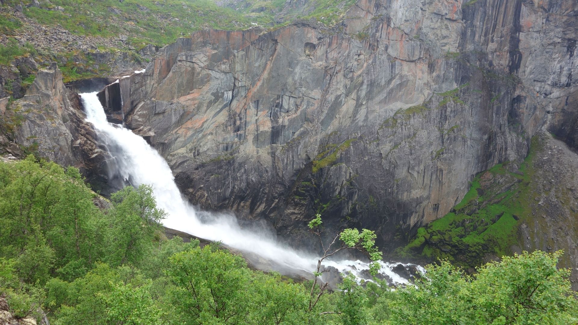
Valursfossen is a waterfall in Eidfjord Municipality, Vestland county, in western Norway. Here the river Veig leaves the great Hardangervidda mountain plateau and drops into the Valursdalen valley. It is a lesser-known but striking waterfall in the Eidfjord area, close to a branch of the Hardangerfjord.
Where is Valursfossen?
The falls lie deep inside Eidfjord Municipality, at the edge of Hardangervidda, the largest mountain plateau in Europe. The Veig comes off the high ground and tumbles into Valursdalen. The coordinates are roughly 60.36° N, 7.15° E. The waterfall sits at the end of the Hjølmodalen valley, away from the main roads, so reaching it takes a walk.
How tall is Valursfossen?
The figure most often quoted is a total descent of 272 m, which appears in Wikipedia and in local tourism guides. Sources do not agree, though. Some describe a single sheer drop of about 70 m. The World Waterfall Database estimates the waterfall itself at around 110 m, explaining that the older 270+ m figure also counted steep cascades below the bedrock ledge. According to that database, the upper half is a clear plunge, while the lower part fans out over the rock in a horsetail style. The number you see depends on what is counted as part of the falls.
How do you get there?
The approach starts near Øvre Eidfjord and the Hjølmodalen valley. One local source estimates about an hour on foot from Hjølmoberget. Another describes a route of around 5.2 km that is muddy and rough in places. Bring sturdy hiking boots and allow plenty of time. One guide says the route ends at a parking area in Berastøldalen, so check access before you set out, since signage and road conditions can vary by season.
When should you visit?
Early summer and summer are best, when meltwater from the plateau feeds the river and the falls carry the most water. The World Waterfall Database notes that flow continues all year but stays low in volume. Summer is also the safest time on the trail; the area around the falls lies at roughly 800 m above sea level, so snow can linger.
Frequently asked questions
Where is Valursfossen? In Eidfjord Municipality, Vestland county, Norway, at the edge of the Hardangervidda plateau.
Which river feeds it? The Veig, flowing from Hardangervidda into the Valursdalen valley.
Can you drive to the waterfall? Not all the way. The last stretch is on foot, and the trail can be muddy.
How high is it? The most commonly cited figure is a 272 m total descent, although some sources give 70 m, or about 110 m for the falls proper.
When is the best time to see it? Early summer and summer, when snowmelt gives the strongest flow.
Valursfossen suits hikers who enjoy mountain walks away from the crowds and want to see a river leave the vast Hardangervidda plateau. Pair it with a visit to Eidfjord and the nearby valleys, which show off the fjord-and-mountain landscape of western Norway.
Nearby places

Earn badges for the places you visit
Download NextOnTrip, discover new places and check off your trails.