Mountains and trails in Spain
A guide to 72 Mountains and trails in Spain — with descriptions, photos and traveler visits from the NextOnTrip community. Locations spread across 67 cities and towns. Most visited by the community: Parque Forestal Monte San Antón, Sierra Mágina, Parque forestal de San Miguel de Oya.
-
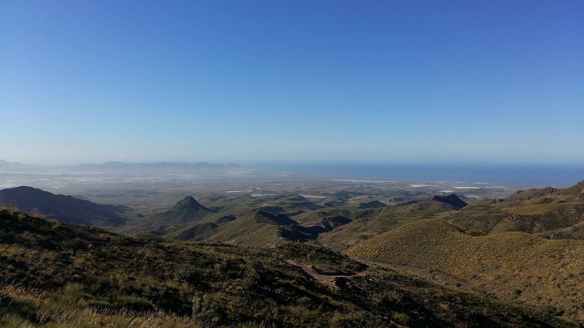
Sierra Alhamilla
Tabernas
Sierra Alhamilla is a mountain range in the province of Almería, rising northeast of the provincial capital between the arid badlands of the Tabernas Desert and the Bay of Almería. Designated a protected natural area in 1989, this roughly 8,500-hectare range forms a green counterpoint to the parched landscapes around it, acting as a kind of forest oasis between Europe's driest region and the coast. How high does Sierra Alhamilla rise? The range's highest point is Colativí peak, reaching 1,387 metres above sea level. Belonging to the Betic Cordillera, the mountains are marked by steep slopes cut by deep gullies, especially on their southern flanks. From the ridgelines, views extend across much of Almería province — the terrain has long served as a natural vantage point over the surrounding land. Who lives here and what does the landscape look like? The area is sparsely populated, with only around 50 residents within the protected zone. The landscape is dotted with abandoned cortijos, traditional rural farmsteads, some of which — such as Cortijo del Marchal — still preserve what is considered one of the best-kept mills in the province, complete with its stone wheel, turbine, and water channelling system. Other notable farmsteads in the vicinity include Las Palmas and Las Palmillas. Many of these buildings now stand empty, drawing hikers and mountain bikers keen to explore the region's rural past. What thermal and historical attractions are found here? Sierra Alhamilla is known for its thermal waters, used since Roman times and later by the Arabs, who left a lasting mark on the region's architecture and traditions. In 1777, a significant refurbishment expanded the infrastructure built to make use of these springs, reflecting a long, continuous history of spa use at the site. The Baños de Sierra Alhamilla still operate today, reached via the route of an old railway built at the start of the 20th century. What hiking trails are worth exploring? The range is drawing a growing number of Almería residents and visitors keen to explore its landscapes on foot. Among the best-known routes is the SL-A 162 trail, which follows the old railway line to the Baños de Sierra Alhamilla. Near Lucainena de las Torres, the Senda Minera (Mining Trail) offers a green route from the town centre to remnants of 19th-century mining activity, including old mines and ore-roasting furnaces. Together, these trails combine natural scenery with traces of the region's industrial past. Where can visitors stay nearby? The closest town offering accommodation is Tabernas, though a wider choice of places to stay can be found in Níjar. A track heading toward Tabernas enters the northeastern part of Sierra Alhamilla and crosses the entire range as far as the village of Turrillas, making it a convenient starting point for exploring the mountains. Why is Sierra Alhamilla worth visiting? The range combines several elements rarely found together in one place: a stark, semi-desert landscape bordering a surprisingly green enclave, a centuries-long history of thermal water use, and traces of mining and farming life preserved in its abandoned buildings. For travellers seeking quiet hiking away from crowds and a close look at the rugged yet varied nature of southern Spain, Sierra Alhamilla is a worthwhile alternative to Andalusia's better-known trails. Frequently asked questions How high is the range's highest peak? Colativí, at 1,387 metres above sea level. Is it possible to stay overnight in Sierra Alhamilla itself? There is little accommodation infrastructure directly in the mountains — the nearest lodging is in Tabernas, with a broader selection available in Níjar. What is there to see besides hiking trails? Abandoned cortijos, including Cortijo del Marchal with its preserved mill, and the historic Baños de Sierra Alhamilla thermal baths.
-
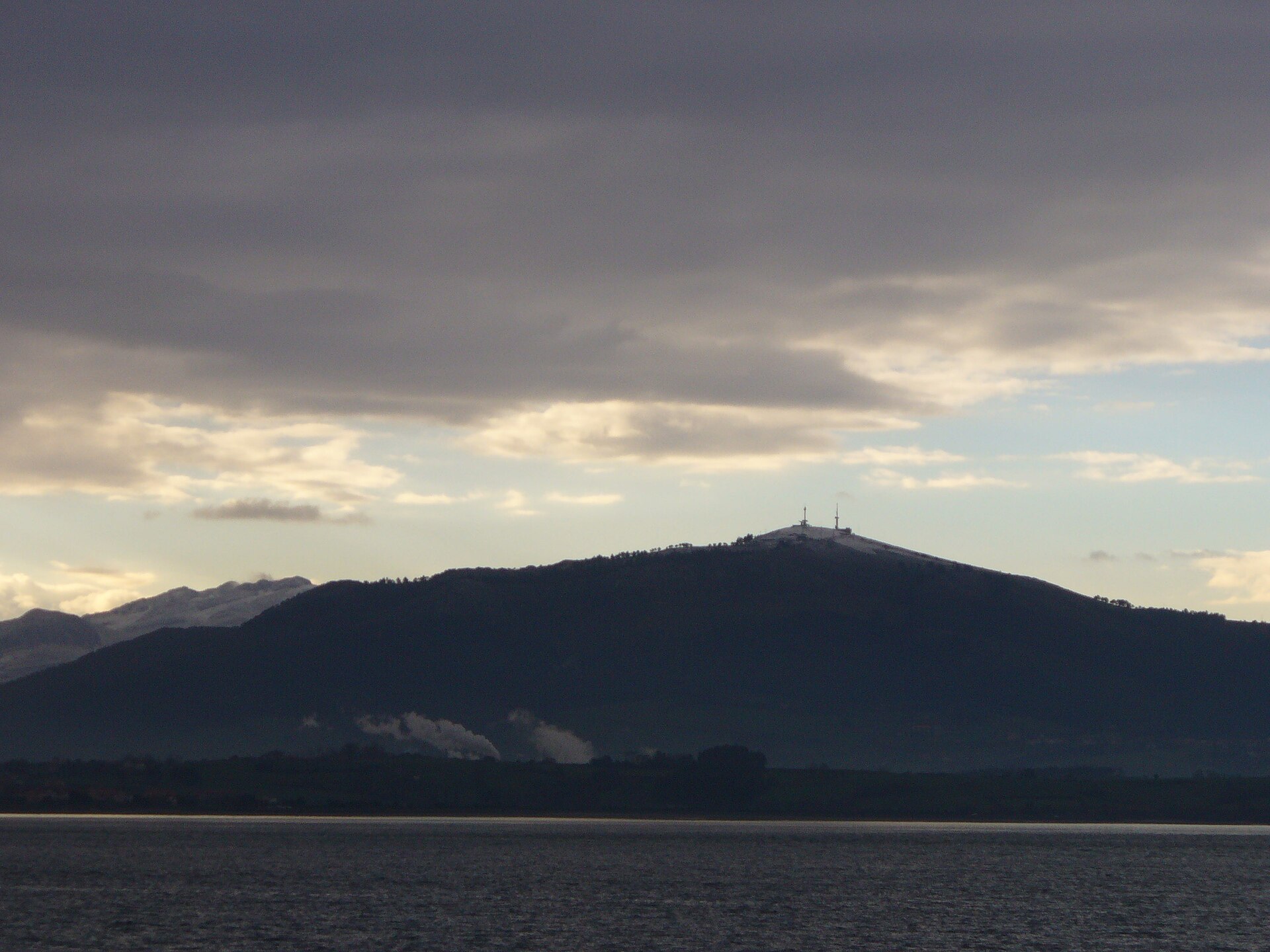
Parque natural Macizo de Peña Cabarga
Liérganes
Macizo de Peña Cabarga is a mountain range in Cantabria, rising just south of Santander Bay within the Sierra de la Gándara. The massif spreads across four municipalities — Liérganes, Medio Cudeyo, Penagos and Villaescusa — covering nearly 2,600 hectares of limestone highlands. Although the area was declared a natural park in 1989, a court ruling in 2005 annulled that status because the required management and resource planning documents had never been adopted. Since then the massif has existed in a kind of legal limbo, while regional authorities work toward protecting it under a new "protected landscape" designation. What is there to see at the summit? The highest point of the range, the Peña Cabarga peak itself, reaches 569 metres. Standing at the top is a distinctive tower known as the Monumento al Indiano, unveiled in 1968 as a tribute to the people of Cantabria who emigrated to the Americas in search of a better future — many of whom later returned home and left a lasting mark on the region's architecture and economy. In the summer of 2025 the tower underwent an extensive restoration and reopened as a modern viewpoint offering multimedia experiences. Visitors can now explore immersive rooms, flight simulators and exhibitions on the history of Cantabrian emigrants, presented through virtual reality technology. This blend of historical heritage and modern technology makes a visit to the summit more than just a scenic stop. What views does Peña Cabarga offer? From the viewing platform beside the tower stretches one of the finest panoramas in all of Cantabria. On a clear day, visitors can take in almost the entire regional coastline, the city of Santander with its bay, and, in the distance, the silhouette of the Picos de Europa. The spot is popular among photographers and landscape lovers, especially at sunset. What else is found within the massif? Within the eastern part of the range lies a karst formation known as the Cabárceno karst — a geological landscape with a distinctive reddish colour, shaped over thousands of years by the dissolution of limestone rock. Owing to its unique character, the area has been recognised as a Point of Geological Interest. It was on the site of former mining pits in this same area that the well-known Cabárceno Nature Park later developed, although today it functions as a separate attraction. Frequently asked questions Is it difficult to reach the summit of Peña Cabarga? The peak stands at 569 metres and is accessible by a local road, making it a relatively easy destination even for visitors who prefer not to undertake long mountain hikes. What is the Monumento al Indiano? It is a viewpoint tower built in 1968 to honour Cantabrian emigrants to the Americas, restored and reopened in the summer of 2025 with new multimedia attractions. Is the Peña Cabarga massif currently a natural park? Not formally — that status was annulled by a court ruling in 2005 for procedural reasons, and the region is awaiting new legislation to protect the area. Which municipalities does the massif span? Peña Cabarga extends across the municipalities of Liérganes, Medio Cudeyo, Penagos and Villaescusa.
-
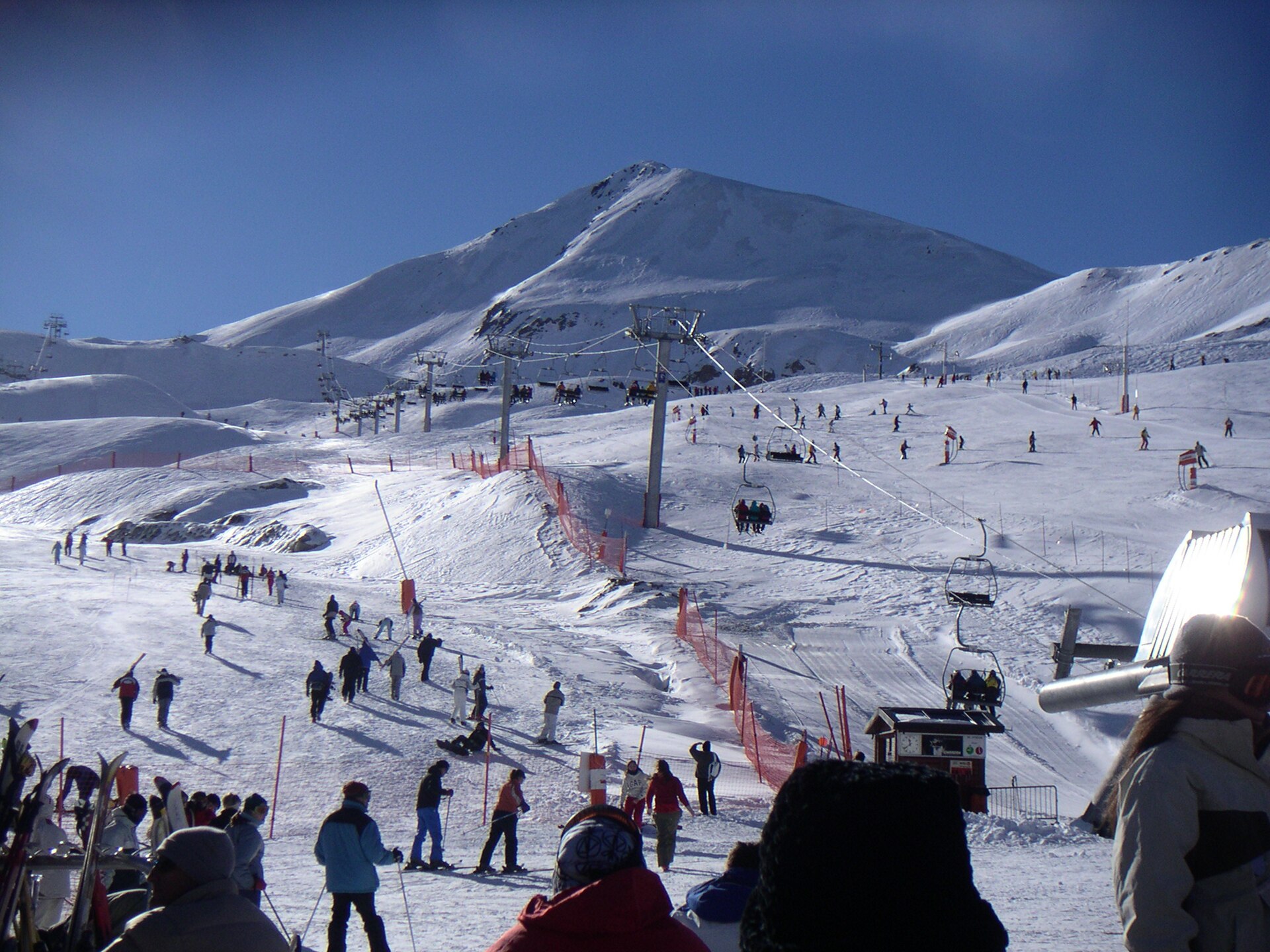
Boí Taüll Resort
la Vall de Boí
Boí Taüll Resort is a ski area in the municipality of la Vall de Boí, set deep in the Catalan Pyrenees. It opened in 1988 and has since become known as one of the highest-altitude ski resorts in the entire Pyrenean range. Where exactly is the resort located? Boí Taüll Resort sits in the Vall de Boí, a side valley of the Catalan Pyrenees in Lleida province. Its approximate coordinates are 42.478°N, 0.869°E, placing it close to the border with Aragon and near the Aigüestortes i Estany de Sant Maurici National Park. The valley itself is well known for its Romanesque churches, listed as UNESCO World Heritage sites, so a ski trip here can easily be combined with cultural sightseeing. How high does the ski area reach? The slopes run from 2,020 up to 2,751 metres above sea level. That range puts Boí Taüll among the highest ski resorts in the Pyrenees, which directly affects both the length of the season and snow quality — the upper sections of the mountain tend to hold good conditions longer than lower-altitude resorts in the region. When did the resort open? Boí Taüll Resort has been operating since 1988. Since then it has grown into a reference point for skiing in western Catalonia, building its reputation on the valley's remote setting and the sheer altitude of its terrain. Who is this resort suited for? The elevation gap between the base and the top station — more than 700 metres — points to a varied terrain profile, from gentler runs near the base to more demanding, high-mountain sections closer to the summit. That layout means the resort attracts families looking for calmer slopes as well as skiers who value a high-altitude atmosphere and open views across the Pyrenees. What should visitors know before travelling there? The Vall de Boí is a clearly mountainous, somewhat isolated valley, reached via local mountain roads — worth factoring into travel plans, especially in winter. Its proximity to the Aigüestortes i Estany de Sant Maurici National Park makes the area worthwhile beyond the ski season too, drawing hikers and nature lovers once the snow melts. Frequently asked questions Where is Boí Taüll Resort located? In the Vall de Boí, in the Catalan Pyrenees, Lleida province, at approximately 42.478°N, 0.869°E. How high do the ski runs go? The ski area extends from 2,020 to 2,751 metres above sea level, making it one of the highest resorts in the Pyrenees. When did the resort open? Boí Taüll Resort has been in operation since 1988. Is there anything to see beyond skiing? Yes — the valley borders the Aigüestortes i Estany de Sant Maurici National Park, and the Vall de Boí itself is known for its UNESCO-listed Romanesque churches.
-
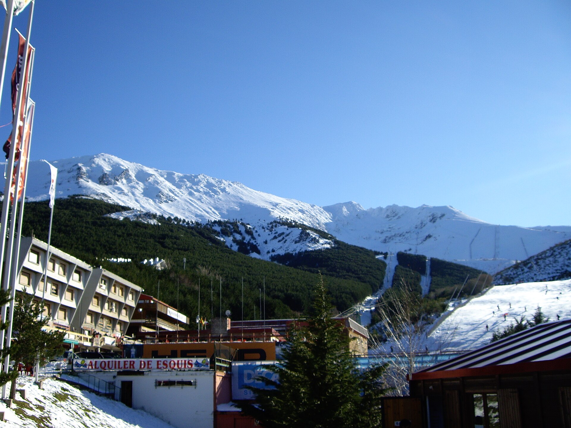
La Pinilla
La Pinilla
La Pinilla is a ski resort in the Sierra de Ayllón, in the province of Segovia, right next to the town of Riaza, roughly 100 kilometres from Madrid. Where exactly is La Pinilla located? The resort sits in the Sierra de Ayllón, part of the Sistema Central mountain range that splits central Spain into a northern and a southern half. Its coordinates place it at around 41.20°N, 3.47°W, with Riaza — a small town in Segovia province — as the nearest landmark, just a short drive from the slopes. Being under 100 km from the Spanish capital makes La Pinilla one of the most accessible ski areas for anyone based in Madrid. Why do visitors choose this resort? Proximity to a major city is the main draw. For many people living in central Spain, La Pinilla offers a realistic day trip to the mountains without the logistics of a longer ski holiday or an overnight stay far from home. The Sierra de Ayllón itself has a different character from Spain's better-known ranges like the Pyrenees or Sierra Nevada — it's a quieter, less crowded stretch of central Spanish mountains, appealing to those looking for an alternative to the country's more famous ski destinations. How do you get to La Pinilla? Driving from Madrid is the most common way to reach the resort, heading north toward Segovia province with Riaza as the last stop before the mountain. Because the route climbs into higher terrain than the surrounding valleys, it's worth checking road conditions before setting off in winter, especially after snowfall. What should you know before a winter visit? The resort operates seasonally, opening during the winter months whenever snow conditions in the Sierra de Ayllón allow for skiing. Since the mountains of central Spain sit at more moderate elevations than the Pyrenees, both the length and quality of the season depend heavily on the weather in any given year, so checking current slope conditions shortly before travelling is a sensible step. Riaza, at the foot of the range, can serve as a base for accommodation and supplies for anyone planning a longer stay in the area. Is there anything to do beyond skiing? The Sierra de Ayllón also has appeal outside the winter season — its mountainous terrain and closeness to Madrid make it a draw for hikers and day-trippers once the weather warms up. Riaza itself keeps the feel of a traditional Castilian provincial town and works well as a starting point for exploring the wider Segovia countryside. Frequently asked questions How far is La Pinilla from Madrid? The resort is about 100 kilometres from Madrid, making it one of the closer ski options for residents of the capital. Which province is La Pinilla in? It lies in the province of Segovia, within the Sierra de Ayllón mountain range. What's the nearest town to the resort? Riaza is the closest town, sitting at the foot of the mountains just a short drive from the slopes. Does La Pinilla only operate in winter? Yes, it's a seasonal ski resort that opens during the winter months, depending on snow conditions in the Sierra de Ayllón.
-

Kodes mountain range
Genevilla
Sierra de Kodes (Kodesko mendilerroa in Basque) is a mountain range in western Navarre, Spain, classified as part of the Basque Mountains. The range stretches near the village of Genevilla and marks the westernmost edge of Navarre, right against the border of the province of Álava. Its approximate central coordinates are 42.63°N, 2.29°W. Where exactly is the Sierra de Kodes located? The range sits in western Navarre, in the border area with Álava, one of the provinces of the Basque Country. This border position turns Kodes into something of a geographic and cultural hinge between Navarre and the Basque Country, since both regions share the broader mountain heritage of the Basque Mountains, to which Kodes formally belongs. What is the highest peak of the range? The highest point of the Sierra de Kodes is Ioar, rising to 1,418 metres above sea level. The peak lies between the villages of Santa Cruz de Campezo and Aguilar de Codés, two settlements on opposite sides of the provincial border, which neatly illustrates the range's position at the junction of two regions. While 1,418 metres does not make Ioar a giant by Pyrenean standards or even within the wider Basque Mountains, locally it is a clear high point, visible from many spots in the surrounding valleys. What are the Basque Mountains, and how does Kodes fit in? The Basque Mountains are a system of ranges covering the hills and highlands along the border of the Basque Country, Navarre, and neighboring areas of northern Spain. It is not a single continuous chain but a mosaic of smaller ranges, among which Kodes is the westernmost within Navarre's borders. To its north lie the Andia and Urbasa ranges — together, these three form a belt of terrain that regularly gathers snow in winter, setting them apart climatically from the lowland parts of the region. What does the range look like in winter? The elevation of the Sierra de Kodes, while moderate, is enough for snow cover to build up during winter. The same happens on the neighboring Andia and Urbasa ranges, so the three together create a recognizable ridge that turns white each winter and is visible from the lower parts of Navarre. This is typical of inland ranges of this height in northern Spain, where moist Atlantic air masses meet higher terrain and produce more persistent snowfall than in the surrounding lowlands. Why does Kodes matter to people traveling through the region? The area around Genevilla and the Sierra de Kodes lies along the Camino Ignaciano, a walking route that commemorates the journey of Ignatius of Loyola, founder of the Jesuit order. One of the route's stages ends precisely in Genevilla, after which the path continues southwest across Navarre, passing between the Sierra Cantabria and the Sierra de Kodes. This means the range acts as a natural landmark and boundary marker for pilgrims and hikers crossing this stretch of northern Spain — the two ranges effectively frame the corridor through which the historic route runs. Frequently asked questions How high is the tallest peak of the Sierra de Kodes? The highest point, Ioar, reaches 1,418 metres above sea level. Where exactly is that peak located? Between the villages of Santa Cruz de Campezo and Aguilar de Codés, on the border of Navarre and Álava. What larger mountain system does the Sierra de Kodes belong to? The Basque Mountains, which cover ranges along the border of Navarre and the Basque Country. Which ranges border Kodes? Andia and Urbasa, lying further north — together they form terrain that gets snow-covered in winter. Does a well-known hiking route pass through this area? Yes, the Camino Ignaciano, which ends a stage in Genevilla and continues between the Sierra Cantabria and the Sierra de Kodes.
-
Lokiz mountain range
Lana
Lokiz (Sierra de Lóquiz in Spanish) is a mountain range in the Basque Country, located in the west-central part of Navarre. It stretches roughly 22 km, from near the Álava town of Santa Cruz de Campezo to Barindano, and covers an area of nearly 140 square kilometers along the southern slope of the Améscoa valley. Its highest point reaches 1,255 meters above sea level. Where exactly is the Lokiz range? The range sits at the meeting point of several historic valleys: Lana, Améscoa Alta, Améscoa Baja, Allín, and Valdega. Around the sierra are settled 25 towns belonging to these five valleys, with the Valle de Lana lying almost at the heart of the massif. It's from these villages that most of the hiking routes onto the Lokiz ridgeline begin. What does the landscape look like? Lokiz is a karst massif with an elongated shape and a rugged, weathered character. Its slopes are cut by deep ravines and gorges, and the varied terrain supports a rich mix of fauna and flora. Vegetation changes with elevation: oak and holm oak, along with strawberry trees (madroño), dominate the lower zones, while beech forests take over higher up. The limestone, karst nature of the range also means caves, sinkholes, and other typical formations of this kind of mountain terrain. What is the history behind managing the sierra? For centuries, the use of the mountain — grazing, timber, access to pastures — was governed by unwritten custom among the residents of the surrounding valleys. Disputes between towns over boundaries and resource rights eventually grew serious enough that, in 1357, a document known as "El Apeo de Lóquiz" was drawn up, formally settling the legal and social terms for using the sierra. This medieval charter remains a key reference point for understanding the traditional management of shared mountain commons in this part of Navarre. What should visitors know before heading there? The Sierra de Lokiz is above all a destination for hikers and nature lovers: steep ravines such as the barranco de Zologorri, along with peaks in the Montesanto and Arnaba area, are among the most popular routes in this part of Navarre. Given the karst terrain and significant elevation changes, sturdy hiking boots and a trail map are recommended, since some paths cross remote, poorly marked ground. The surrounding villages of the Lana and Améscoa valleys serve as trailheads and have kept the rural, traditional character typical of Navarre's interior. Frequently asked questions Where is the Sierra de Lokiz located? In west-central Navarre, on the border with Álava, between Santa Cruz de Campezo and Barindano. How high is the range's highest peak? The highest point of the range reaches 1,255 meters above sea level. How many towns surround the sierra? Twenty-five towns, spread across five valleys: Lana, Améscoa Alta, Améscoa Baja, Allín, and Valdega. What is "El Apeo de Lóquiz"? A 1357 document that formally regulated the legal and social rules for using the mountain among the surrounding communities, drawn up to settle disputes between towns.
-
Sierra de Caldereros
Castellar de la Muela
Sierra de Caldereros is a mountain range in the province of Guadalajara, Spain, part of the western Iberian System. It stretches roughly 16 kilometers from northwest to southeast, covering land within the municipalities of Castellar de la Muela and neighboring Campillo de Dueñas, in the area known as Señorío de Molina-Alto Tajo. Why is this area protected? In December 2005, the regional government of Castilla-La Mancha placed 2,368 hectares of the sierra under protection, designating it a Natural Monument. The declaration recognized the ecological, geological, scenic, educational, and scientific value of the range. Limestone rock formations, shaped by erosion over thousands of years, give the sierra a jagged, distinctive profile that sets it apart from the gentler hills surrounding it. What is the highest point of the range? The highest peak in Sierra de Caldereros is Lituero, rising to 1,457 meters above sea level. From its slopes, views extend over the valleys and small villages of the Molina de Aragón area, and the terrain is well suited to hiking among rocky outcrops and the Mediterranean scrubland typical of Spain's eastern highlands. What lies at the heart of the sierra? At the center of the range, on a steep rocky outcrop, stands Zafra Castle, a fortress whose isolated and dramatic setting has made it one of the region's best-known landmarks. Its remote location and stark architecture have drawn the attention of film and television productions, including crews filming scenes for well-known series set against Spain's wild, mountainous landscapes. For visitors, Zafra Castle is a natural focal point for trails running through the sierra. What does the landscape of Sierra de Caldereros look like? The range is defined by rocky ridges, ravines, and numerous erosional formations that give the area a raw, at times almost lunar character. The contrast between pale limestone rock and darker scrub vegetation creates scenery valued by photographers and geology enthusiasts alike. The area lies far from major cities, which helps preserve its quiet and largely untouched natural surroundings. Who is this destination for? Sierra de Caldereros suits travelers looking for contact with the raw, uncrowded nature of central Spain. Hiking along rocky trails, observing geological formations, and visiting Zafra Castle are the main draws of the area. It is also of interest to film and television fans wanting to see filming locations known from the screen in their real, mountainous setting. Frequently asked questions Where is Sierra de Caldereros located? In the province of Guadalajara, eastern Spain, within the municipalities of Castellar de la Muela and Campillo de Dueñas, in the Señorío de Molina-Alto Tajo region. What protection status does the area have? Since 2005, 2,368 hectares of the sierra have held Natural Monument status, protecting its ecological, geological, and scenic values. What is the highest peak? Lituero, at 1,457 meters above sea level. What is worth seeing in the area? Zafra Castle, built on a rocky outcrop at the heart of the sierra, along with the distinctive rock formations visible along the hiking trails. Has the sierra been used as a filming location? Yes, the wild, rocky surroundings of Zafra Castle have attracted television productions searching for dramatic mountain landscapes.
-
Ancares-Courel
Pedrafita do Cebreiro
Ancares-Courel is one of Galicia's largest wild landscapes, a rugged mountain range straddling the border between the provinces of Lugo and León. It is protected as a Special Area of Conservation (SAC) within the Natura 2000 network, and it sits alongside a wider territory that UNESCO recognized as a Biosphere Reserve in 2006. The area spans tens of thousands of hectares across two neighboring ranges, Os Ancares and O Courel, each with its own local identity but a shared, dramatic character. Why is this place so significant? The terrain's sheer ruggedness — steep slopes, deep river valleys and high ridgelines separating Galicia from Castile and León — kept the region isolated for centuries. That isolation left behind one of the best-preserved pockets of wilderness on the Iberian Peninsula, with largely intact deciduous forests and populations of large predators that have vanished from most of Western Europe. What kind of vegetation grows here? Lower slopes are covered by forests of sweet chestnut, oak, beech and birch, occasionally giving way to holm oak groves. In damp hollows and peat bogs, rare and threatened species survive, including the marsh clubmoss (Lycopodiella inundata) and the moss Zygodon conoideus, while spring brings blooms of endemic daffodils such as Narcissus pseudonarcissus subsp. nobilis. This botanical diversity is one of the main reasons the range was brought under Natura 2000 protection. What wildlife can you find in these mountains? Ancares-Courel is one of Spain's last strongholds for the Cantabrian brown bear (Ursus arctos) and the Iberian wolf (Canis lupus signatus), species that have all but disappeared elsewhere in Western Europe. Small numbers of capercaillie (Tetrao urogallus), among the continent's most endangered birds, still survive in its forests. Overhead, golden eagles, peregrine falcons, goshawks and Egyptian vultures patrol the ridgelines, while grey partridges move through the undergrowth below. How should you plan a hike here? The range draws hikers through traditional slate-built mountain villages such as Piornedo. A popular route starts at the village chapel and winds through Os Penedois and Campo Redondo before climbing to the peaks of Peña Longa and Pico del Mostallar, with views over the ridgeline dividing Galicia from León. Because mountain weather here can shift quickly, spring and autumn are the most reliable seasons to visit, and sturdy trekking footwear is recommended. Frequently asked questions Is Ancares-Courel a national park? No — it is a Special Area of Conservation (SAC) within the Natura 2000 network, linked to the neighboring Os Ancares Natural Park and to a UNESCO Biosphere Reserve covering part of the same range. Can you encounter wild animals on the trails? Direct encounters with bears or wolves are rare, since both species avoid people, but signs of their presence — tracks and droppings — are a common part of hiking in these mountains. What is the best time of year to visit? Late spring and early autumn offer the most stable weather and the best chances to see the endemic daffodils in bloom and birds of prey circling above the ridges. Where exactly is Ancares-Courel located? In northwestern Spain, along the border between Galicia (Lugo province) and Castile and León, near towns such as Pedrafita do Cebreiro.
-
Macizo Central ourensán
Manzaneda
Macizo Central ourensán is a vast mountain complex in the province of Ourense, in Spain's Galicia region, designated as a special area of conservation. The range stretches across an area of roughly 30 by 40 kilometers, covering tens of thousands of hectares of largely uninhabited highland terrain that lies between the Chandrexa de Queixa and Portas reservoirs. What makes up this mountain massif? Rather than a single peak, Macizo Central ourensán is a group of several sierras belonging to the wider Galician massif: Serra de Queixa, Serra de San Mamede, and the Fial das Corzas range, which borders the O Invernadeiro Natural Park. Elevations within the massif range from around 300 meters in the valleys up to the region's highest point, Cabeza de Manzaneda (also known as A Cabeza Grande), which rises to nearly 1,780 meters. What can you find in the municipality of Manzaneda? The municipality of Manzaneda sits right at the heart of the massif, and it's here that Galicia's only ski resort operates — the Cabeza de Manzaneda ski station. That makes the region a winter draw in a part of Spain more commonly associated with Atlantic coastline than mountain snow. Outside the ski season, the area is a destination for hiking and cycling, with trails crossing terrain of significant elevation changes and varied landscapes. What kind of nature does this mountain range hold? The massif is known for its near-untouched ecosystems. Within its boundaries lie the O Invernadeiro Natural Park, the valley of the Návea River, and Souto de Rozavales, a forest of centuries-old chestnut trees. Higher up, the mountains host birch and holly forests that are distinctive for this region and uncommon elsewhere on the Iberian Peninsula. The terrain is home to wildlife typical of the mountains of northwestern Spain, including wolves, wild boar, and deer. Why is this area worth visiting? Macizo Central ourensán combines several features that are rare by Galician standards: a high-mountain landscape, a working ski resort, extensive nature reserves, and terrain that remains sparsely populated and largely untouched by development. It appeals to travelers looking for active outdoor pursuits — skiing on the slopes in winter, or hiking through forests and river valleys in summer and autumn. The proximity of the Chandrexa de Queixa and Portas reservoirs adds further scenic appeal and offers opportunities for nature photography. Frequently asked questions Where exactly is Macizo Central ourensán located? It is a mountain range in the province of Ourense, in the region of Galicia, in northwestern Spain, encompassing the municipality of Manzaneda among others. What is the highest peak of the massif? The highest point is Cabeza de Manzaneda, reaching about 1,780 meters above sea level, also known locally as A Cabeza Grande. Can you ski here? Yes, the municipality of Manzaneda is home to the only ski resort in all of Galicia, making the region unique within the autonomous community. What natural attractions are worth seeing in the area? The O Invernadeiro Natural Park, the Návea River valley, and Souto de Rozavales — a historic forest of old chestnut trees — along with birch and holly forests in the higher elevations. What wildlife lives in this area? The region is home to wolves, wild boar, and deer, species typical of the mountains of northwestern Spain.
-
Serra do Cando
Cerdedo
Serra do Cando is a mountain range in the province of Pontevedra, in Galicia, covering an area of around 5,458 hectares. The range is shared among four municipalities — Cerdedo-Cotobade, Forcarei, A Lama and Beariz — making it one of the largest natural areas in the Terras de Pontevedra region. It belongs to the central section of the Dorsal Galega, the main mountain backbone of Galicia, and runs north to south with rounded summits reaching between 600 and 1,000 metres, at an average altitude of around 712 metres. What does the landscape of Serra do Cando look like? The range is built on granite bedrock that has been shaped over thousands of years by water and frost. This slow erosion has produced rounded boulders and rock formations with striking, almost sculptural shapes, rising among heather and gorse scrub on the higher slopes. This mineral, rugged landscape contrasts with the lush vegetation lower down, where deciduous forests dominated by oak give way to chestnut and birch stands. What role does Serra do Cando play for the surrounding rivers? The slopes of the range act as a source area for several important watercourses in the region. The Verdugo river rises here, along with tributaries of the Lérez, Castro and Seixo rivers. Riparian woodlands of ash, birch and alder develop along these streams, forming habitats of significant value for the biodiversity of the whole area. What wildlife can be found in these mountains? Serra do Cando is a refuge for numerous wildlife species typical of Galicia's mountainous terrain. Iberian wolf, roe deer, wild boar, fox and stone marten all inhabit the range. The presence of these animals, particularly the wolf, points to the good conservation state of the ecosystem and the relatively low human pressure on the area. What protection status does the area hold? Because of its natural value, the range has been included in the Natura 2000 network as a Site of Community Importance (SCI) and a Special Conservation Zone (ZEC). This status aims to protect both the distinctive rock formations and the forest habitats and animal species associated with the range, recognized as one of the more significant natural areas in Galicia. What draws visitors to Serra do Cando? The range is a popular destination for hikers thanks to its well-marked trails, which pass through areas of particular ecological and scenic interest. Routes cross both the heather-covered ridges and the shaded deciduous forests in the valleys, offering views of the characteristic granite rock formations as well as panoramas stretching toward the fertile Rías Baixas valleys on one side and the rougher, mountainous terrain of the Ourense province on the other. Why is Serra do Cando worth visiting? The region combines several qualities at once — largely untouched nature, interesting geology, and a sense of quiet away from crowded tourist routes. For anyone looking to connect with nature, spot wildlife, or simply enjoy the silence among granite boulders and heathland, Serra do Cando is one of the more rewarding destinations in the interior of Pontevedra province. Frequently asked questions Where is Serra do Cando located? In the province of Pontevedra, Galicia, across the municipalities of Cerdedo-Cotobade, Forcarei, A Lama and Beariz. How large is the range? It covers roughly 5,458 hectares. What animals can be seen there? Among others, the Iberian wolf, roe deer, wild boar, fox and stone marten. What protection status does the area have? It is part of the Natura 2000 network as a Site of Community Importance (SCI) and Special Conservation Zone (ZEC).
-
Trevinca
A Veiga
Trevinca Trevinca (Peña Trevinca) is the highest mountain in Galicia and also the highest point in the province of Zamora, rising to 2,127 meters above sea level. It sits right on the boundary between Galicia and Castile and León, at the point where the Montes de León range meets the Macizo Galaico. For hikers exploring western Spain, it functions almost as a landmark — often described as the "roof of Galicia," visible from far across the surrounding valleys. Where exactly is it located? The Trevinca massif straddles a border area, and one of the main starting points for climbing it is A Veiga, on the Galician side. Alternative approaches begin from Sobradelo, also in Galicia, and from Puebla de Sanabria on the León side. This cross-border position makes Trevinca a natural reference point for travelers planning routes that connect the two autonomous communities. What can you see at the summit and around it? The upper slopes of the massif are snow-covered in winter, and lower down, in glacial basins, several lakes sit tucked between the rocks — the best known are O Celo and Lagoa da Serpe, described as having exceptionally pure, crystal-clear water. These glacial lakes are one of the main draws for visitors interested in mountain landscapes: the contrast between bare, rocky peaks and still, clear water is striking in any season. Is this an important natural area? Yes — the area around Trevinca has been designated a Special Protection Area for birds covering 22,510 hectares. The rocky summit hosts the only breeding population of the alpine accentor found anywhere in Galicia, a species tied closely to high-mountain habitat. The trails also pass through habitat of the Leonese lizard, a species endemic to this specific mountain range and found nowhere else in the wild. What routes lead to the summit and around the area? From A Veiga, several marked trails (PR-G routes) allow hikers to reach the summit of Trevinca or loop around the nearby glacial lakes. These include the route via Maluro to Pena Trevinca and its variant, an approach via Sestil Alto, and a separate loop connecting the glacial lakes. The municipality of A Veiga maintains several mountain trails of varying difficulty in total, some of them also adapted for mountain biking, alongside a network of river beaches in the valleys below. Who is this route suited for? Reaching the summit is best suited to hikers prepared for high-mountain terrain — the ground is rocky and exposed, with little shelter from wind, and snow-covered in winter. Those looking for a gentler way to experience this landscape can instead choose the trails around the glacial lakes, which don't require summiting the peak itself but still showcase the terrain shaped by past glacial activity. Frequently asked questions How high is Trevinca? 2,127 meters above sea level — the highest point in both Galicia and the province of Zamora. What's the easiest way to reach the summit? Via A Veiga or Sobradelo on the Galician side, or from Puebla de Sanabria on the León side. What else is worth seeing besides the peak itself? The glacial lakes O Celo and Lagoa da Serpe, plus the protected area for mountain birds, including the alpine accentor. Are there marked trails in the area? Yes, several PR-G routes lead both to the summit and around the glacial lakes, with some sections also suitable for mountain biking.
-
Sierra de Candelario
Candelario
Sierra de Candelario is a mountain range in the province of Salamanca, in western Spain, often described as the "roof" of the region thanks to peaks approaching 2,400 meters. It forms part of the Sistema Central, the broad mountain chain that runs across the middle of the Iberian Peninsula, and takes its name from the village of Candelario nestled at its foot. Covering more than 10,000 hectares, the range is designated as a protected natural area, which has helped preserve its largely untouched, high-mountain character. What does the landscape of Sierra de Candelario look like? The terrain here was shaped mainly by ancient glaciers and rivers, leaving behind a mosaic of ridges, glacial valleys, and cirques — the bowl-shaped hollows carved out by long-vanished ice sheets. Granite is the dominant rock, giving the surrounding formations a stark, grey tone that contrasts with the surrounding greenery. Small lakes and streams fed by meltwater from higher up the range appear throughout the area. Where are the highest points of the range? The highest point of Sierra de Candelario is Canchal de la Ceja, rising to 2,429 meters above sea level. Close behind it stands the second-highest summit in the region, Pico Calvitero, at 2,399 meters. Both peaks are popular destinations for mountain hikers and serve as viewpoints offering sweeping views across much of Salamanca province and the neighboring Sierra de Béjar. What kind of vegetation grows in these mountains? The slopes of the range support varied plant communities, ranging from oak and pine forests to chestnut groves lower down, and stands of gorse covering the more open, higher terrain. Rock crevices and stony slopes host plant species adapted to harsh mountain conditions, able to withstand strong winds and wide temperature swings. What can visitors do in Sierra de Candelario? The area attracts hikers, climbers, and mountain bikers alike. Trails lead to the glacial lakes known as the Lagunas del Trampal, up to the summit of Pico Calvitero, and through the scenic chestnut forests surrounding Candelario. Circular routes linking Candelario with the nearby town of Béjar are also popular, allowing visitors to take in the diversity of this stretch of the Sistema Central in a single day. Frequently Asked Questions Where is Sierra de Candelario located? In the southeastern part of Salamanca province, western Spain, within the Sierra de Béjar region. What is the highest peak? Canchal de la Ceja, at 2,429 meters above sea level. Can you go hiking there? Yes, the area offers numerous hiking trails leading to glacial lakes, summits, and chestnut forests, with popular circular routes around Candelario and Béjar. How large is the protected area? The Sierra de Candelario protected natural area covers more than 10,700 hectares.
-
Serra do Candán
Forcarei
Serra do Candán is one of the most extensive mountain ranges in Galicia, part of the area known as Terra de Montes. Covering more than 10,000 hectares along the so-called Galician dorsal, the massif stretches across the municipalities of Forcarei, Lalín and Silleda on the Pontevedra side, and Beariz and O Irixo on the Ourense side. Its peaks barely rise above 1,000 metres, yet the range plays an outsized ecological role: it is the source of the Lérez and Umia rivers along with several tributaries of the Deza, making it a vital water catchment for the surrounding valleys. Which peaks define Serra do Candán? The ridge is shaped by a series of distinct summits. The highest is Alto de San Bieito at 1,017 metres, followed by O Coco (969 m), Seixiños Brancos (905 m), Chamor (815 m) and Alto de San Sebastián (750 m). Their rounded, weathered profiles are typical of Galicia's ancient, eroded mountains, and the modest elevation gain means the ridgeline trails are accessible without technical climbing skill while still rewarding hikers with wide views over the neighbouring valleys. Why is this range ecologically significant? Serra do Candán is protected as a Special Area of Conservation (ZEC) within the Natura 2000 network precisely because of the richness of its habitats. Researchers have catalogued 18 distinct habitat types here, dominated by natural and semi-natural grasslands, rocky terrain with caves, and varied woodland. Lower slopes and river valleys host gallery and riverside forests, while higher ground gives way to scrubland typical of heath landscapes — gorse, heather, rockrose and broom. What wildlife lives in Serra do Candán? This habitat diversity supports a notable range of fauna. Among the species at risk of extinction, researchers highlight the golden eagle and the eagle owl, both indicators of a well-preserved ecosystem. They share the range with goshawks, sparrowhawks, owls, wolves, wildcats, stoats and foxes. This mix of raptors and larger predators draws nature watchers to the area, though actually spotting the rarest species in the wild remains a matter of patience and preparation rather than a guarantee. How can visitors plan a trip to Serra do Candán? The municipality of Forcarei serves as a natural starting point, with trails leading up to the main ridgelines of the range. Thanks to its moderate elevations and gentle gradients, the terrain suits both short walks and full-day hikes linking several summits. Because the area falls under nature protection, staying on marked paths and respecting local flora and fauna is essential for responsible visits. The range also borders the neighbouring Serra do Cando, a separate mountain formation in another part of Terra de Montes that is sometimes confused with Candán due to the similarity in name. Frequently asked questions How high is Serra do Candán? Its highest peak, Alto de San Bieito, reaches 1,017 metres above sea level. Where exactly is the range located? On the border between the provinces of Pontevedra and Ourense, spanning the municipalities of Forcarei, Lalín, Silleda, Beariz and O Irixo. Which rivers originate here? The Lérez and Umia rivers, along with tributaries of the Deza. Is the area protected? Yes, it is designated a Special Area of Conservation (ZEC) within the Natura 2000 network.
-
Monte Faro
Rodeiro
Monte Faro – the peak that overlooks four Galician provinces Monte Faro rises to 1,181 metres on the boundary between the municipalities of Rodeiro (Pontevedra province) and Chantada (Lugo province). It forms part of the Dorsal Galega, the mountainous backbone running through the interior of Galicia, and ranks among its highest points. The mountain carries three layers of significance at once — scenic, spiritual and archaeological — which together make it one of the region's most distinctive landmarks. What the summit reveals Alto do Faro is regarded as one of the finest viewpoints in inland Galicia. From its top, the panorama stretches across all four Galician provinces at once, with the neighbouring municipalities of Rodeiro, Chantada, Taboada, Dozón and Monterroso all visible in the distance. The view mixes mountain ridges, valleys and the green farmland typical of the region. It is precisely this sweeping visibility that has long drawn both pilgrims and hikers to the summit. A shrine at the top Crowning Monte Faro is the Ermida da Nosa Señora do Faro, a hermitage built in the seventeenth century on top of the remains of earlier temples. The fact that successive generations built places of worship one over another here points to the enduring religious importance of this summit across the centuries. Today the hermitage remains an active pilgrimage site: two major romerías take place here each year, in August and September, drawing the faithful from across Galicia. The pilgrimage held on 8 September holds particular weight, when thousands climb the mountain to pray for health before the Nosa Señora do Faro. Traces from earlier ages The western slopes of the mountain hold mámoas — burial mounds belonging to megalithic culture. Communities of that era buried their dead at the outer edges of the territory they considered their own, and the Faro range formed a natural boundary between neighbouring groups. The presence of these structures on the mountain's flanks confirms that it has served as a landmark and territorial marker in the Galician landscape for thousands of years. A pilgrim route and a hiking destination The natural divide that Monte Faro forms between the provinces of Lugo and Pontevedra also carries a stretch of the Camino de Invierno, the winter route of the Camino de Santiago leading to Santiago de Compostela. The section of the path that crosses the area around the summit therefore combines a pilgrimage function with recreational hiking, attracting both those walking the Camino and local visitors coming up for a day trip to enjoy the view. A protected landscape Monte Faro is designated as a special area of conservation (ZEC), reflecting the natural value of this stretch of the Galician mountains. The combination of protected-landscape status with a long religious and archaeological history gives Monte Faro a significance that goes well beyond the view from its summit. Frequently asked questions Where exactly is Monte Faro located? On the border between the municipalities of Rodeiro (Pontevedra) and Chantada (Lugo), within the Dorsal Galega range. How high is the summit? 1,181 metres above sea level. What can you see from the top? A panorama covering four Galician provinces and the neighbouring municipalities of Rodeiro, Chantada, Taboada, Dozón and Monterroso. What is the religious significance of the site? The seventeenth-century Ermida da Nosa Señora do Faro sits at the summit and is the destination of two annual romerías, including one held on 8 September. Are there archaeological remains nearby? Yes — the western slopes contain mámoas, megalithic burial mounds. Does a pilgrimage route pass through Monte Faro? Yes, the area forms part of the Camino de Invierno on the way to Santiago de Compostela.
-
Serra do Xistral
Serra do Xistral is a mountain range in northern Lugo province, Galicia, forming a natural divide between the inland Terra Chá plain and the coast of the Bay of Biscay. Its highest point, Alto do Cadramón, reaches 1,062 metres above sea level. The elevation itself isn't dramatic by European standards, but the climate here makes this range genuinely unusual within Spain. Why is it always foggy here? Serra do Xistral sits directly in the path of moist air masses rolling in from the Bay of Biscay. Wind and clouds sweeping off the Atlantic bring near-constant rainfall and thick fog, and this area is considered one of the least sunny spots in all of Galicia. Rain falls steadily throughout the year, shaping a landscape permanently wrapped in dampness that feels quite different from the valleys just a short distance away. What makes the ecosystem here so distinctive? That same cool, wet climate has allowed a highly specialized plant community to develop. Across the slopes and plateaus of Xistral grow both wet and dry heathlands, alongside sundew — an insect-eating plant typical of waterlogged terrain — and sphagnum moss. Ash, willow and alder woodlands also thrive in pockets throughout the range. The true natural treasure of the massif is its blanket bog habitat (turberas de cobertor), a habitat of community interest that, within Spain, exists exclusively in Galicia. This rare ecosystem shelters numerous rare, endemic or threatened species, including mountain arnica and several protected wild daffodil species. What wildlife lives in these mountains? The waterlogged terrain of Xistral supports a remarkably rich population of reptiles and amphibians. The bog lizard reaches the western limit of its Iberian Peninsula range right here. Other notable herpetofauna includes the fire salamander and several species of forest and mountain lizards found across the range. Griffon vultures circle overhead almost year-round, and black vultures are occasionally spotted as well. Across the open pastures surrounding the bogs, herds of semi-wild horses roam freely, adding to the raw, untamed feel of the landscape. How is Xistral different from a typical mountain destination? This isn't a range of dramatic peaks to summit on a clear day — Xistral is defined instead by rolling plateaus and heathland, where the real draw is the ecosystem itself and the sense of remoteness. Fog, wind and rain are the norm rather than the exception, so visitors should come prepared with proper clothing and an appetite for raw Atlantic nature rather than classic mountain vistas. Frequently asked questions How high is Serra do Xistral? Its highest point, Alto do Cadramón, stands at 1,062 metres above sea level. Where exactly is this region located? In the northern part of Lugo province, Galicia, between the Terra Chá plain and the Bay of Biscay coastline. What's the weather like? The area has one of the lowest amounts of sunshine in all of Galicia, dominated by clouds, fog and frequent rain throughout the year. What's worth seeing in Serra do Xistral? Its unique blanket bogs, endemic wetland plant life, free-roaming horses on open pastures, and a strong resident population of griffon vultures soaring over the ridgelines.
-
Monte Maior
Viveiro
Monte Maior is a mountain range stretching across the municipalities of Viveiro and Xove, in the A Mariña Lucense region of Lugo province, Galicia. The area is protected under the EU Natura 2000 network as a Zone of Special Conservation (ZEC) and Special Area of Conservation (SAC), covering roughly 1,243 hectares. What defines the Monte Maior landscape? The range extends from the coastline inland to the Montes de Buio, offering sweeping views over both the Atlantic shore and the interior of the A Mariña region from its higher points. The terrain is marked by frequent outcrops of weathered granite, giving the landscape a rugged, distinctive character. Several tributaries of the Landro river basin originate here. The Loureiro river stands out in particular, carving through the terrain to create striking features along its course, including the waterfall known as O Pozo da Ferida — one of the most notable natural landmarks in the range. What is the highest point in the area? The highest peak surrounding Viveiro is Penedo do Galo, rising to 550 meters above sea level. It serves as one of the best vantage points in the region, offering panoramic views that take in both the coastline and the folded inland terrain of A Mariña Lucense. What hiking routes cross Monte Maior? A circular walking route departs from Viveiro and leads to the Penedo do Galo viewpoint, giving visitors a chance to experience the area's nature and take in its panoramic scenery. The combination of granite rock formations and numerous watercourses means that hikes through Monte Maior blend mountain scenery with proximity to the Atlantic coast. Why is Monte Maior a protected area? The area was included in the EU's Natura 2000 network because of its natural value — both geological, in its granite formations, and hydrological, as the source of several tributaries feeding the Landro river. Its ZEC/SAC status means the land is subject to specific habitat and species protection rules, aimed at preserving its natural character while still allowing for sustainable hiking tourism. Frequently asked questions Where is Monte Maior located? In Lugo province, Galicia, spanning the municipalities of Viveiro and Xove within the A Mariña Lucense region. How large is the protected area? Approximately 1,243 hectares. What is the highest peak in the area? Penedo do Galo, at 550 meters above sea level, considered the highest point surrounding Viveiro. What are the main things to see? The O Pozo da Ferida waterfall on the Loureiro river, granite rock outcrops, and panoramic views from Penedo do Galo over the coast and inland region. Can you hike there? Yes, a marked circular route starts in Viveiro and leads to the Penedo do Galo viewpoint.
-
Macizo de Amurga
San Bartolomé de Tirajana
Macizo de Amurga is a mountainous massif in the southern part of Gran Canaria, stretching between the Barranco de Tirajana and Barranco de Fataga ravines, within the municipality of San Bartolomé de Tirajana. Its highest point reaches 1,131 metres above sea level, and the massif covers roughly 8,700 hectares. How did this landscape form? Amurga took shape during the so-called post-Roque Nublo volcanic cycle, which began around 3.2 million years ago — one of the later stages in Gran Canaria's volcanic history, following the eruptions that built the island's famous central landmark, Roque Nublo. The rocks forming the massif are mainly phonolites and ignimbrites belonging to the Fataga formation, dated to between 10 and 11 million years old. The result of these processes is a landscape of jagged ridges, deep ravines and steep slopes descending toward the coast. What links Amurga to the island's earliest inhabitants? The massif holds traces of the indigenous population that lived on Gran Canaria before the Spanish conquest — archaeologists have documented funerary tumuli and remains of constructions attributed to this pre-conquest community. For those early inhabitants, and later for the conquistadors, the name Tirajana referred specifically to the area known today as Amurga, in its coastal stretch. Some researchers also associate the site with Montaña de Las Tabaibas, identified as a location of sacred significance to the ancient Canarians. Why is the area ecologically significant? Macizo de Amurga is one of the most ecologically valuable corners of the island's south. It has been designated a Special Area of Conservation and is included within Gran Canaria's biosphere reserve. Species richness here is remarkable for such a compact area — researchers have identified at least 83 species of flora and fauna, 34 of which are endemic to Gran Canaria alone. The harsh, semi-arid climate of the island's south favoured the development of vegetation adapted to drought and intense sun exposure, making the site a notable spot for nature observation. What should visitors know before heading out? Amurga is a wild, largely undeveloped mountain area without extensive tourist infrastructure, making it appealing to hikers looking to get away from the crowded resorts of Gran Canaria's southern coast, such as Maspalomas or Playa del Inglés. The terrain — steep slopes, deep ravines and rocky ridges — means it's best explored with someone familiar with the local trails or by sticking to marked routes. Visitors should carry enough water and sun protection, since much of the vegetation offers little shade. Frequently asked questions How high is Macizo de Amurga? The massif's highest point reaches 1,131 metres above sea level. Can you see traces of the island's early inhabitants in Amurga? Yes, the massif contains funerary tumuli and remains of constructions attributed to the population that lived on Gran Canaria before the Spanish conquest. Why is Amurga under environmental protection? Because of its exceptional species richness — at least 83 species, including 34 endemic to Gran Canaria — the area forms part of the island's biosphere reserve and is a designated Special Area of Conservation. Where exactly is Macizo de Amurga located? In the southern part of Gran Canaria, within the municipality of San Bartolomé de Tirajana, between the Tirajana and Fataga ravines.
-
Sierra Espuña
Totana
Sierra Espuña is a mountain range in the Region of Murcia, Spain, forming part of the Penibaetic System. It stretches across the municipalities of Alhama de Murcia, Totana and Mula, centered around geographic coordinates of roughly 37.86°N, -1.51°W. What is Sierra Espuña? At the heart of this area lies the Sierra Espuña Regional Park, which protects 17,804 hectares of the mountain range. The park was established to safeguard this section of the mountains from urban and agricultural pressure, preserving a landscape that is characteristic of the wider Murcia region. What is the highest peak? The highest point of the range is the peak also known as Espuña, reaching an elevation of 1,583 metres above sea level. The summit itself is designated as a military area — it is not an ordinary unrestricted viewpoint, but a site of strategic significance for national defence. What is located at the summit? The summit of Espuña hosts a radar station operated by the 13th Air Surveillance Squadron, part of the Spanish Air and Space Force. This installation carries out airspace surveillance and monitoring functions, which explains the access restrictions on the peak itself. Where exactly is Sierra Espuña located? The range extends across three municipalities of the Region of Murcia: Alhama de Murcia, Totana and Mula. This location makes Sierra Espuña a natural landmark and reference point for residents of this part of south-eastern Spain, standing as one of the defining features of the regional landscape. What mountain system does it belong to? Sierra Espuña is part of the Penibaetic System, one of the major mountain chains of southern Spain, running along the Mediterranean coastline. Its membership in this system links the range to the broader geological and geographical structure of the Andalusia and Murcia regions. Why does this place matter? Sierra Espuña combines two identities at once: it is both a protected natural area of considerable size and a site of strategic military importance because of the radar station at its summit. This combination makes the range a significant reference point both for nature conservation in the Murcia region and for Spain's defence infrastructure. The coordinates at the heart of the park (37.86°N, -1.51°W) place it in the south-eastern part of the Iberian Peninsula, close to the Mediterranean coast. Frequently asked questions How high is Sierra Espuña? The highest peak of the range, Espuña, reaches an elevation of 1,583 metres above sea level. Can visitors reach the summit itself? The summit of Espuña is a military area housing a radar station operated by the 13th Air Surveillance Squadron of the Spanish Air and Space Force, which means access to the very top is restricted. How large is the regional park covering this range? The Sierra Espuña Regional Park protects 17,804 hectares of the mountain range. Which municipalities does Sierra Espuña span? The range lies across three municipalities: Alhama de Murcia, Totana and Mula, in the Region of Murcia. What mountain system is Sierra Espuña part of? It belongs to the Penibaetic System, one of the major mountain chains of southern Spain.
-
Monte Arabí
Yecla
Monte Arabí is a mountain located in the municipality of Yecla, within the Region of Murcia, Spain. It rises to an altitude of 1,068 metres above sea level, and its area is relatively small — small enough that it does not qualify as a mountain range in the strict geographical sense of the term. Where exactly is Monte Arabí located? The mountain lies within the municipal boundaries of Yecla, part of the Region of Murcia in southeastern Spain. Its summit sits at approximately 38.697222° north latitude and -1.2825° west longitude, placing it in the inland, interior portion of the region, away from the coast, amid the highland terrain typical of this part of the country. Why isn't Monte Arabí considered a mountain range? Despite its name evoking associations with a larger mountain system, Monte Arabí is a formation of limited territorial extent. Its area is too small to be classified as a mountain range in geographic terms — it is best understood as a single, distinct elevation, standing out on its own rather than forming part of an extended chain. What lies immediately next to the mountain? On its eastern side, Monte Arabí is separated by a ravine from a neighbouring hill known by two names: Cerro de los Moros and Arabilejo. This natural divide, carved by erosion over time, means that despite their close proximity, the two formations remain distinct features of the landscape. Such a configuration — a ravine clearly separating two adjacent elevations — is characteristic of the highland terrain found across this part of Mediterranean Spain. What makes this mountain a notable landmark? Monte Arabí stands out against the surrounding terrain thanks to its altitude of over a thousand metres, making it a recognisable point of reference for anyone travelling through the municipality of Yecla. Its relatively modest but clearly delineated footprint means its silhouette reads in the landscape as a self-contained, easily identifiable landform rather than a fragment of a sprawling mountain chain. Frequently asked questions How high is Monte Arabí? The summit reaches 1,068 metres above sea level. Which municipality is Monte Arabí part of? It lies within the municipality of Yecla, in the Region of Murcia, Spain. Is Monte Arabí part of a mountain range? No — its area is too small to be considered a mountain range. It stands as a single, self-contained elevation. What is next to Monte Arabí? To the east, across a separating ravine, lies a hill known as Cerro de los Moros or Arabilejo. Where exactly is the summit located on the map? Its coordinates are approximately 38.697222°N, -1.2825°W, placing it in the inland part of the Region of Murcia.
-
Sierra de las Moreras
Mazarrón
Sierra de las Moreras is a mountain range on the western edge of the municipality of Mazarrón, in the Region of Murcia, southeastern Spain. It rises above the Mazarrón basin, a horseshoe-shaped valley open to the north and sloping gently south toward the Mediterranean coast. The range sits at approximately 37.58468, -1.39989. What is Sierra de las Moreras? It is a modest, dry mountain range typical of Spain's southeastern Mediterranean coastline — rocky, sparsely vegetated, with a gentle yet clearly defined profile. The sierra acts as a natural boundary separating the Mazarrón valley from the surrounding land, and its slopes have been a site of human settlement and mining activity for centuries. What historical significance does the area hold? At the foot of Sierra de las Moreras lies one of the region's most important archaeological sites, Cabezo del Plomo, a Chalcolithic (Eneolithic) settlement dated to the fourth and third millennia BC. This shows the land was inhabited and used by people for thousands of years, long before the mining industry that would later make Mazarrón famous. How is the sierra connected to Mazarrón's mining history? The Mazarrón area, whose western fringe includes Sierra de las Moreras, holds one of the oldest and most significant mining histories on the Mediterranean coast. Exploitation of lead, zinc and silver deposits began as early as the 2nd century BC, during the expansion of the Roman Empire, when Mazarrón grew in importance precisely because of the mineral wealth of its surrounding hills. Mining in the region continued for centuries, but it was the 19th century, with the arrival of the Industrial Revolution, that brought a true boom in extraction, reaching its peak at the turn of the 19th and 20th centuries. While the mining works themselves are concentrated mainly in other parts of the Mazarrón basin, the sierra forms the geographic and geological backbone of that story, shaping the landscape in which the region's entire mining activity developed. What should visitors know before coming? Sierra de las Moreras appeals to those interested in the dry, mountainous hinterland typical of the Murcia coast, as well as in the region's history — both its earliest layers, reaching back to the Chalcolithic period, and its centuries-long mining tradition around Mazarrón. From its slopes, views open out over the Mazarrón basin and toward the Mediterranean coastline. Frequently asked questions Where exactly is Sierra de las Moreras located? On the western side of the municipality of Mazarrón, in the Region of Murcia, southeastern Spain, at approximately 37.58468, -1.39989. Are there traces of ancient settlement nearby? Yes — the Cabezo del Plomo site, a Chalcolithic settlement several thousand years old, lies at the foot of the sierra. How does the sierra relate to Mazarrón's mining history? The sierra defines the basin where lead, zinc and silver were mined from Roman times (2nd century BC) through the 19th and 20th centuries, one of the Mediterranean region's notable mining traditions. Is it a popular tourist destination? Sierra de las Moreras is known mainly at a local level, as part of the landscape and history of Mazarrón, rather than as a standalone, heavily visited attraction.
-
Bec de l'Àguila
Mutxamel
Bec de l'Àguila is the highest peak of the Llofriu mountain range, rising to 475 metres at the point where the municipalities of Mutxamel, San Vicente del Raspeig, and Alicante meet. Its Valencian name literally translates as "Eagle's Beak," a reference to the sharp, pointed silhouette the summit presents when viewed from the surrounding valleys. Geologically part of the Prebetic system that runs through eastern Spain, the peak is one of the most recognisable landmarks on the outskirts of Alicante, despite its modest elevation. Why is this area protected? The land surrounding Bec de l'Àguila has held the status of a flora micro-reserve since 1999, and since 2022 it has additionally been designated a Municipal Natural Site (Paraje Natural Municipal) of Mutxamel. The area also falls within the Special Protection Area for Birds (ZEPA) of the Montnegre river valley, underlining its importance for local birdlife. The rocky, sparsely wooded slopes and distinctive microclimate have turned the range into a refuge for a number of endemic and protected plant species. What makes the flora here so significant? The area's most notable botanical feature is Vella lucentina, a plant species whose entire known world distribution stretches from the Bec de l'Àguila micro-reserve to the municipality of Monforte del Cid. The presence of such a rare endemic makes this unassuming massif disproportionately important for biodiversity conservation in the Alicante region, even though the mountain itself is neither tall nor extensive. What historical traces remain in the area? Within the Barranco de los Cocons ravine, at the foot of the range, the remains of old ochre mines can still be found. This reddish clay pigment was extracted here in the past and used as a natural dye. These mining remnants add a cultural-historical layer to a landscape otherwise defined by its natural values. Who is this place suited for? Bec de l'Àguila appeals mainly to hikers and nature enthusiasts looking for an alternative to the busier trails along the Costa Blanca coastline. The peak's modest height makes it accessible to walkers of varying fitness levels, while the views from its slopes take in both the Llofriu range and the wider Alicante area. Anyone interested in Mediterranean geology and flora will also find extra appeal here, given the presence of a plant found nowhere else on Earth outside this small stretch of land. Frequently asked questions How high is Bec de l'Àguila? The summit reaches 475 metres and is the highest point in the Llofriu mountain range. Which municipalities share the area around the peak? The territory is shared by Mutxamel, San Vicente del Raspeig, and Alicante. Is the surrounding area protected? Yes — it has been a flora micro-reserve since 1999, and since 2022 it has held the status of a Municipal Natural Site of Mutxamel; it also lies within the ZEPA protected bird area of the Montnegre valley. What else is there to see besides the summit itself? The remains of old ochre mines in the Barranco de los Cocons ravine, and the habitat of the rare endemic plant Vella lucentina.
-
Pena Corneira
Carballeda de Avia
Pena Corneira is a mountain range in northwestern Spain, in the province of Ourense, in the region of Galicia. It spans three municipalities – Carballeda de Avia, Leiro and Avión – within the historic O Ribeiro area, sitting between the river basins of the Avia and the Miño. It forms the northeastern extension of the Serra do Suído range and covers an area of roughly 998 hectares. How high is Pena Corneira? The range reaches a maximum elevation of 675 metres. Its most recognisable feature is a tall, vertically standing rock crest that can be spotted from a considerable distance – in the Galician language, "pena" means rock or crag, which is where the range gets its name. Where do the rock formations come from? The massif is made of granite of magmatic origin. The rock formed around 300 million years ago as magma from an ancient volcano solidified underground. Millions of years of subsequent erosion sculpted the granite into the rounded, sometimes strikingly shaped boulders that now scatter across the slopes. What kind of vegetation covers the range? The rocky formations are wrapped in a dense forest dominated by oak and chestnut trees. The combination of old-growth woodland, moss-covered stones and jagged granite blocks gives the landscape an almost fairy-tale, "medieval" atmosphere that draws hikers and nature photographers alike. Why is Pena Corneira a protected area? In 2007, the Xunta de Galicia (the regional government of Galicia) granted the area the status of Monumento Natural (Natural Monument), adding it to the Galician Network of Protected Areas. Pena Corneira is now the largest natural monument of its kind in the whole of Galicia, underlining the exceptional character of both its rock formations and the surrounding forest ecosystem. What is there to see on site? The main attraction is the rock crest crowning the summit, visible from afar and acting as a natural landmark for the surrounding countryside. Around it lie numerous granite blocks in unusual shapes, carved by centuries of weathering. Hiking trails cross the range connecting the different municipalities, including routes that pass through Carballeda de Avia, making Pena Corneira accessible both to experienced trekkers and to those looking for a gentler walk through nature. How do you get to Pena Corneira? The range sits at the heart of the O Ribeiro region, also known for its winemaking tradition – the surrounding slopes are covered by a mix of forest and the terraced vineyards typical of this part of Galicia. Good starting points for a visit are the villages within the municipalities of Carballeda de Avia, Leiro or Avión, from where marked paths lead up toward the rocky ridge. Frequently asked questions Is Pena Corneira suitable for a family outing? The lower sections of the trails, running through oak and chestnut woodland, are relatively gentle and manageable for hikers of different fitness levels, though reaching the rock crest itself requires a bit more effort. What sets Pena Corneira apart from other ranges in Galicia? The unique combination of volcanic-origin granite formations with dense, old-growth forest, plus its status as the region's largest natural monument of this kind. Are there vineyards nearby? Yes – the range lies within O Ribeiro, one of Spain's oldest wine-producing regions, so access routes often pass through terraced vineyards. Since when has the area been protected? It was granted Natural Monument status in 2007 by a decision of the Galician regional government.
-
Camino del Socorro
Güímar
Camino del Socorro is a historic route connecting the town centre of Güímar, on Tenerife, with the coastal settlement of El Socorro. The path runs roughly 4.6 km one way in an east-west direction, with a width that varies between 15 and 35 metres. It follows ancient transhumance tracks once used by the island's indigenous population to move between the interior and the coast, long before the Spanish conquest. Because of this historical value, the Camino del Socorro has been declared a Bien de Interés Cultural under the category of Sitio Histórico. Where does the name come from? The name refers to the image of Our Lady of El Socorro, venerated in a small church in the coastal settlement of El Socorro, within the municipality of Güímar. The route links this shrine with the parish church of San Pedro Apóstol in the town centre, and it is along this exact path that an annual procession travels between the two. What role does it play in the Romería del Socorro? The Camino del Socorro is the route of the oldest romería (traditional pilgrimage festival) in the Canary Islands. It is celebrated every year on 7 and 8 September. On the first day, the image of the patroness is carried down the path from Güímar to El Socorro (the "bajada"); on the following day, it returns along the same route to the town (the "subida"). The celebrations open with a pilgrims' mass at the church of San Pedro, and on the afternoon of 7 September a reenactment takes place in El Socorro recalling the image's legendary appearance to the Guanche population on the beach of Chimisay. The festival has long held the status of an event of regional tourist interest and draws thousands of participants each year. How old is the route? The track between Güímar and the coast predates the pilgrimage itself, tracing back to pre-Hispanic pastoral routes used for seasonal livestock movement. Its continuous use as part of the annual pilgrimage is documented from around the mid-17th century onward, making it one of the longest uninterrupted processional routes in the region. What can be seen along the way? Part of the trail runs alongside the protected natural area of the Malpaís de Güímar, a volcanic landscape formed by an eruption roughly 10,000 years ago. The route therefore combines evidence of the island's volcanic past with the settlement and religious history of the Güímar valley. It is considered a moderately demanding hike: covering the full round trip of about 10.6 km takes an average of just under three hours, with roughly 265 metres of cumulative elevation gain. Frequently asked questions How long is the Camino del Socorro? The one-way stretch between Güímar and El Socorro is about 4.6 km; the full round trip covers roughly 10.6 km. When does the associated romería take place? Every year on 7 and 8 September — the procession descends to El Socorro on the first day and returns to Güímar on the second. Is the route officially protected as heritage? Yes, the Camino del Socorro is listed as a Bien de Interés Cultural under the Sitio Histórico category, recognising its importance to Güímar's heritage. Can the route be walked outside the pilgrimage dates? Yes, it is open year-round as a moderately challenging hiking trail that passes through the volcanic terrain of the Malpaís de Güímar.
-
Cabezo Gordo
Torre Pacheco
Cabezo Gordo is a solitary hill rising out of the flat Campo de Cartagena plain in the Murcia region, within the municipality of Torre Pacheco. Reaching 312 metres above sea level and stretching roughly 3 kilometres in length, it is the only natural elevation in the entire municipality. Beneath its unassuming surface lies one of Europe's most significant paleontological sites, alongside centuries of mining history. How did this hill form? Geologically, Cabezo Gordo belongs to the Nevado-Filábride complex, whose rocks date back to the Triassic period. The uplift of the massif came much later, during the Alpine orogeny, triggered by the collision of the African and Eurasian tectonic plates. This process produced low-grade metamorphic marbles that make up the hill's core — a resource that has drawn people to the site for millennia. Why did miners take an interest in this place? The marble deposits of Cabezo Gordo were already being quarried in Roman times, and extraction continued for centuries afterward. In the late 19th century, the massif also attracted prospectors searching for magnetite, who carved vertical shafts and galleries into the rock. Once mining activity ceased, some of the abandoned workings found a new purpose: in the 1970s, the naturally humid tunnels were repurposed for growing mushrooms, a practical way of making use of the leftover industrial infrastructure. What was discovered at Sima de las Palomas? Cabezo Gordo owes much of its fame to a discovery made in 1991. Inside a cave known as Sima de las Palomas, researchers uncovered Neanderthal remains of major scientific importance for the study of this human species in Europe. The site is considered the second most important Neanderthal location in Spain, surpassed only by the renowned Atapuerca complex. The paleontological and archaeological findings from this cave remain the subject of ongoing scientific research, offering insight into life and environmental conditions tens of thousands of years ago. What protection status does Cabezo Gordo hold today? Given its outstanding natural, scenic, cultural, and paleontological value, the area was granted protected status in 1998 under the Natural Resource Management Plan for the open spaces and islands of the Mar Menor and Cabezo Gordo. The hill was designated a Protected Landscape (Paisaje Protegido), a measure intended to prevent further degradation of the site and preserve its unique features for both scientific study and future generations of local residents. Frequently asked questions Can Cabezo Gordo be visited? Yes, the area is open to visitors as a protected landscape, although some of the old mining excavations and the paleontological site require particular care due to their scientific value. Why is this site important to scientists? Because of the Neanderthal remains discovered at Sima de las Palomas, which offer valuable insight into the life of this human species in Europe and rank among the continent's key sites of this kind. What sets Cabezo Gordo apart from the surrounding landscape? It is the only natural elevation in the entire municipality of Torre Pacheco, rising clearly above the flat Campo de Cartagena plain and serving as an easily recognisable landmark in the region.
Earn badges for the places you visit
Download NextOnTrip, discover new places and check off your trails.