Mountains and trails in Spain
A guide to 52 Mountains and trails in Spain — with descriptions, photos and traveler visits from the NextOnTrip community. Locations spread across 48 cities and towns. Most visited by the community: Parque Forestal Monte San Antón, Sierra Mágina, Parque Forestal de San Miguel de Oia.
-
Macizo de Peña Cabarga
Liérganes
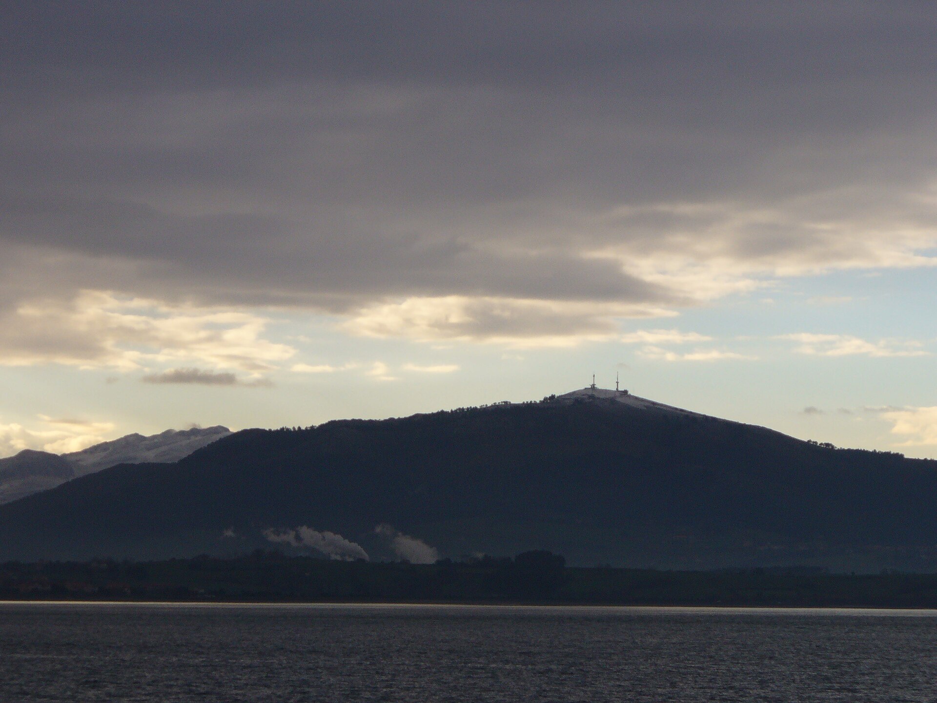
Macizo de Peña Cabarga is a mountain range in Cantabria, rising just south of Santander Bay within the Sierra de la Gándara. The massif spreads across four municipalities — Liérganes, Medio Cudeyo, Penagos and Villaescusa — covering nearly 2,600 hectares of limestone highlands. Although the area was declared a natural park in 1989, a court ruling in 2005 annulled that status because the required management and resource planning documents had never been adopted. Since then the massif has existed in a kind of legal limbo, while regional authorities work toward protecting it under a new "protected landscape" designation. What is there to see at the summit? The highest point of the range, the Peña Cabarga peak itself, reaches 569 metres. Standing at the top is a distinctive tower known as the Monumento al Indiano, unveiled in 1968 as a tribute to the people of Cantabria who emigrated to the Americas in search of a better future — many of whom later returned home and left a lasting mark on the region's architecture and economy. In the summer of 2025 the tower underwent an extensive restoration and reopened as a modern viewpoint offering multimedia experiences. Visitors can now explore immersive rooms, flight simulators and exhibitions on the history of Cantabrian emigrants, presented through virtual reality technology. This blend of historical heritage and modern technology makes a visit to the summit more than just a scenic stop. What views does Peña Cabarga offer? From the viewing platform beside the tower stretches one of the finest panoramas in all of Cantabria. On a clear day, visitors can take in almost the entire regional coastline, the city of Santander with its bay, and, in the distance, the silhouette of the Picos de Europa. The spot is popular among photographers and landscape lovers, especially at sunset. What else is found within the massif? Within the eastern part of the range lies a karst formation known as the Cabárceno karst — a geological landscape with a distinctive reddish colour, shaped over thousands of years by the dissolution of limestone rock. Owing to its unique character, the area has been recognised as a Point of Geological Interest. It was on the site of former mining pits in this same area that the well-known Cabárceno Nature Park later developed, although today it functions as a separate attraction. Frequently asked questions Is it difficult to reach the summit of Peña Cabarga? The peak stands at 569 metres and is accessible by a local road, making it a relatively easy destination even for visitors who prefer not to undertake long mountain hikes. What is the Monumento al Indiano? It is a viewpoint tower built in 1968 to honour Cantabrian emigrants to the Americas, restored and reopened in the summer of 2025 with new multimedia attractions. Is the Peña Cabarga massif currently a natural park? Not formally — that status was annulled by a court ruling in 2005 for procedural reasons, and the region is awaiting new legislation to protect the area. Which municipalities does the massif span? Peña Cabarga extends across the municipalities of Liérganes, Medio Cudeyo, Penagos and Villaescusa.
-
Boí Taüll Resort
la Vall de Boí
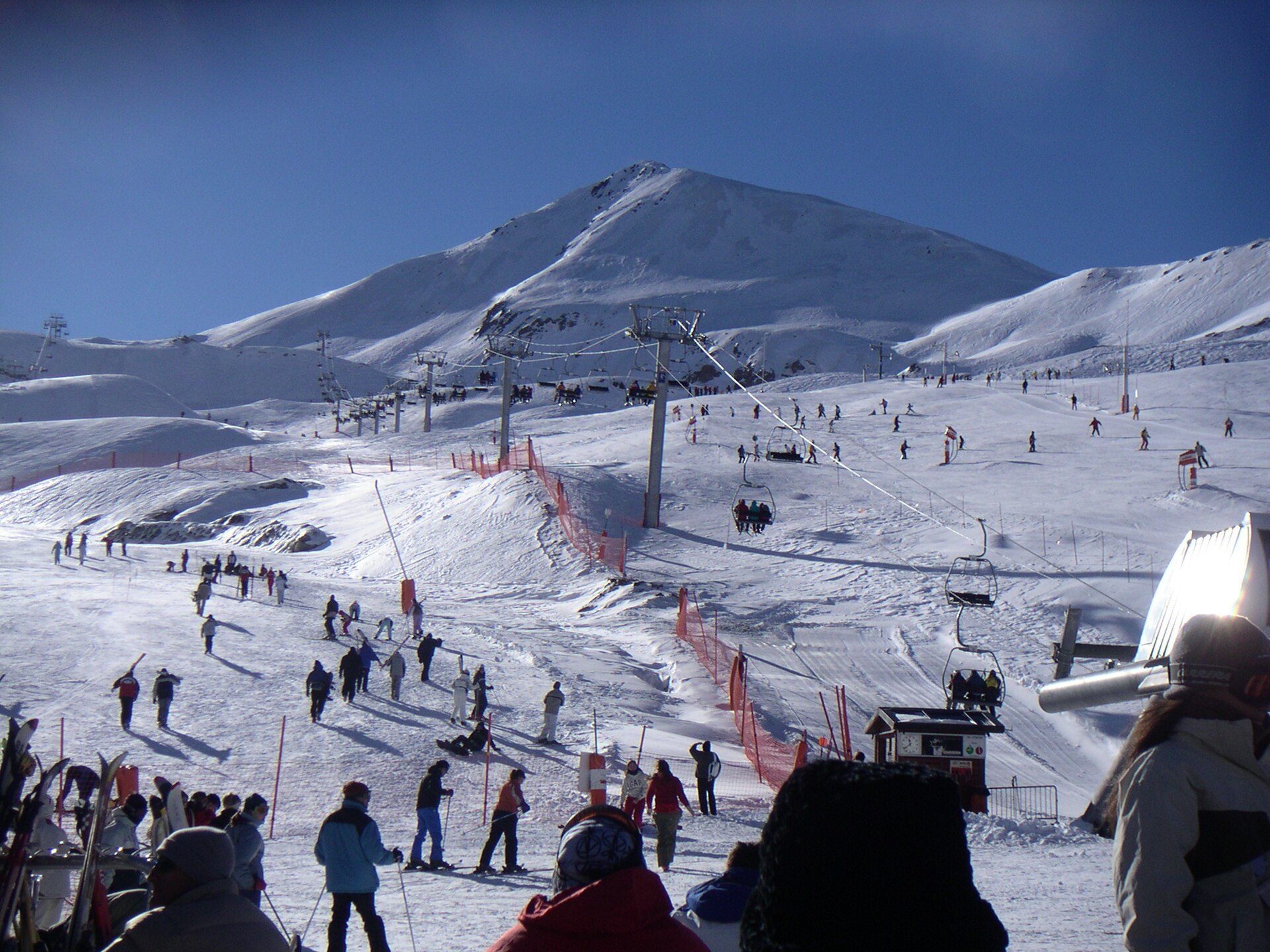
Boí Taüll Resort is a ski area in the municipality of la Vall de Boí, set deep in the Catalan Pyrenees. It opened in 1988 and has since become known as one of the highest-altitude ski resorts in the entire Pyrenean range. Where exactly is the resort located? Boí Taüll Resort sits in the Vall de Boí, a side valley of the Catalan Pyrenees in Lleida province. Its approximate coordinates are 42.478°N, 0.869°E, placing it close to the border with Aragon and near the Aigüestortes i Estany de Sant Maurici National Park. The valley itself is well known for its Romanesque churches, listed as UNESCO World Heritage sites, so a ski trip here can easily be combined with cultural sightseeing. How high does the ski area reach? The slopes run from 2,020 up to 2,751 metres above sea level. That range puts Boí Taüll among the highest ski resorts in the Pyrenees, which directly affects both the length of the season and snow quality — the upper sections of the mountain tend to hold good conditions longer than lower-altitude resorts in the region. When did the resort open? Boí Taüll Resort has been operating since 1988. Since then it has grown into a reference point for skiing in western Catalonia, building its reputation on the valley's remote setting and the sheer altitude of its terrain. Who is this resort suited for? The elevation gap between the base and the top station — more than 700 metres — points to a varied terrain profile, from gentler runs near the base to more demanding, high-mountain sections closer to the summit. That layout means the resort attracts families looking for calmer slopes as well as skiers who value a high-altitude atmosphere and open views across the Pyrenees. What should visitors know before travelling there? The Vall de Boí is a clearly mountainous, somewhat isolated valley, reached via local mountain roads — worth factoring into travel plans, especially in winter. Its proximity to the Aigüestortes i Estany de Sant Maurici National Park makes the area worthwhile beyond the ski season too, drawing hikers and nature lovers once the snow melts. Frequently asked questions Where is Boí Taüll Resort located? In the Vall de Boí, in the Catalan Pyrenees, Lleida province, at approximately 42.478°N, 0.869°E. How high do the ski runs go? The ski area extends from 2,020 to 2,751 metres above sea level, making it one of the highest resorts in the Pyrenees. When did the resort open? Boí Taüll Resort has been in operation since 1988. Is there anything to see beyond skiing? Yes — the valley borders the Aigüestortes i Estany de Sant Maurici National Park, and the Vall de Boí itself is known for its UNESCO-listed Romanesque churches.
-
La Pinilla
La Pinilla
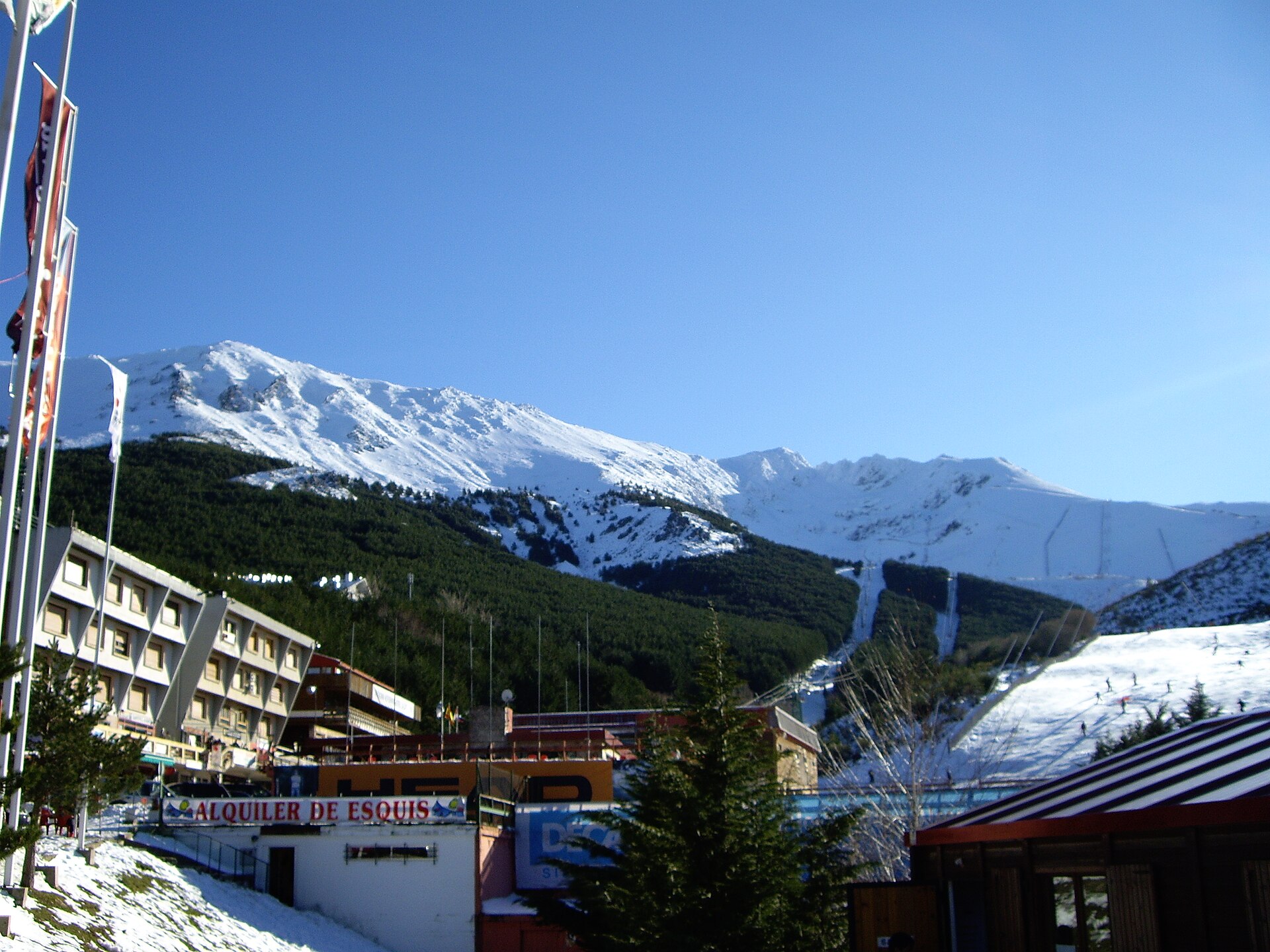
La Pinilla is a ski resort in the Sierra de Ayllón, in the province of Segovia, right next to the town of Riaza, roughly 100 kilometres from Madrid. Where exactly is La Pinilla located? The resort sits in the Sierra de Ayllón, part of the Sistema Central mountain range that splits central Spain into a northern and a southern half. Its coordinates place it at around 41.20°N, 3.47°W, with Riaza — a small town in Segovia province — as the nearest landmark, just a short drive from the slopes. Being under 100 km from the Spanish capital makes La Pinilla one of the most accessible ski areas for anyone based in Madrid. Why do visitors choose this resort? Proximity to a major city is the main draw. For many people living in central Spain, La Pinilla offers a realistic day trip to the mountains without the logistics of a longer ski holiday or an overnight stay far from home. The Sierra de Ayllón itself has a different character from Spain's better-known ranges like the Pyrenees or Sierra Nevada — it's a quieter, less crowded stretch of central Spanish mountains, appealing to those looking for an alternative to the country's more famous ski destinations. How do you get to La Pinilla? Driving from Madrid is the most common way to reach the resort, heading north toward Segovia province with Riaza as the last stop before the mountain. Because the route climbs into higher terrain than the surrounding valleys, it's worth checking road conditions before setting off in winter, especially after snowfall. What should you know before a winter visit? The resort operates seasonally, opening during the winter months whenever snow conditions in the Sierra de Ayllón allow for skiing. Since the mountains of central Spain sit at more moderate elevations than the Pyrenees, both the length and quality of the season depend heavily on the weather in any given year, so checking current slope conditions shortly before travelling is a sensible step. Riaza, at the foot of the range, can serve as a base for accommodation and supplies for anyone planning a longer stay in the area. Is there anything to do beyond skiing? The Sierra de Ayllón also has appeal outside the winter season — its mountainous terrain and closeness to Madrid make it a draw for hikers and day-trippers once the weather warms up. Riaza itself keeps the feel of a traditional Castilian provincial town and works well as a starting point for exploring the wider Segovia countryside. Frequently asked questions How far is La Pinilla from Madrid? The resort is about 100 kilometres from Madrid, making it one of the closer ski options for residents of the capital. Which province is La Pinilla in? It lies in the province of Segovia, within the Sierra de Ayllón mountain range. What's the nearest town to the resort? Riaza is the closest town, sitting at the foot of the mountains just a short drive from the slopes. Does La Pinilla only operate in winter? Yes, it's a seasonal ski resort that opens during the winter months, depending on snow conditions in the Sierra de Ayllón.
-

Cabezo Gordo
Torre Pacheco
Cabezo Gordo is a solitary hill rising out of the flat Campo de Cartagena plain in the Murcia region, within the municipality of Torre Pacheco. Reaching 312 metres above sea level and stretching roughly 3 kilometres in length, it is the only natural elevation in the entire municipality. Beneath its unassuming surface lies one of Europe's most significant paleontological sites, alongside centuries of mining history. How did this hill form? Geologically, Cabezo Gordo belongs to the Nevado-Filábride complex, whose rocks date back to the Triassic period. The uplift of the massif came much later, during the Alpine orogeny, triggered by the collision of the African and Eurasian tectonic plates. This process produced low-grade metamorphic marbles that make up the hill's core — a resource that has drawn people to the site for millennia. Why did miners take an interest in this place? The marble deposits of Cabezo Gordo were already being quarried in Roman times, and extraction continued for centuries afterward. In the late 19th century, the massif also attracted prospectors searching for magnetite, who carved vertical shafts and galleries into the rock. Once mining activity ceased, some of the abandoned workings found a new purpose: in the 1970s, the naturally humid tunnels were repurposed for growing mushrooms, a practical way of making use of the leftover industrial infrastructure. What was discovered at Sima de las Palomas? Cabezo Gordo owes much of its fame to a discovery made in 1991. Inside a cave known as Sima de las Palomas, researchers uncovered Neanderthal remains of major scientific importance for the study of this human species in Europe. The site is considered the second most important Neanderthal location in Spain, surpassed only by the renowned Atapuerca complex. The paleontological and archaeological findings from this cave remain the subject of ongoing scientific research, offering insight into life and environmental conditions tens of thousands of years ago. What protection status does Cabezo Gordo hold today? Given its outstanding natural, scenic, cultural, and paleontological value, the area was granted protected status in 1998 under the Natural Resource Management Plan for the open spaces and islands of the Mar Menor and Cabezo Gordo. The hill was designated a Protected Landscape (Paisaje Protegido), a measure intended to prevent further degradation of the site and preserve its unique features for both scientific study and future generations of local residents. Frequently asked questions Can Cabezo Gordo be visited? Yes, the area is open to visitors as a protected landscape, although some of the old mining excavations and the paleontological site require particular care due to their scientific value. Why is this site important to scientists? Because of the Neanderthal remains discovered at Sima de las Palomas, which offer valuable insight into the life of this human species in Europe and rank among the continent's key sites of this kind. What sets Cabezo Gordo apart from the surrounding landscape? It is the only natural elevation in the entire municipality of Torre Pacheco, rising clearly above the flat Campo de Cartagena plain and serving as an easily recognisable landmark in the region.
-
Paratge Natural d'Interès Nacional del Massís del Pedraforca
Saldes
Paratge Natural d'Interès Nacional del Massís del Pedraforca is a protected mountain area in Catalonia, in the province of Barcelona, centered on one of the most recognizable rock massifs in the Spanish Pyrenees. The village of Saldes, sitting right at the foot of the mountain, serves as the main gateway for most trails heading toward the summit. What makes Pedraforca distinctive? The massif's name comes directly from its silhouette: in Catalan, "pedra" means stone and "forca" means pitchfork, describing the mountain's twin-peaked shape that resembles a fork stuck into the ground. This unmistakable form, the result of geological processes dating back roughly 25 million years, makes Pedraforca visible and identifiable from many points across the surrounding region. Why does this area have protected status? Because of its outstanding natural and scenic value, the Parliament of Catalonia declared the area a reserve of national interest in 1982. The site borders the Cadí-Moixeró Natural Park, together forming one of the larger protected mountain complexes in the region. Both the area's biological richness and its complex geology were central reasons behind granting it protected status. What kind of nature can visitors expect? The slopes of the massif are covered by extensive black pine forests, giving way higher up to alpine meadows above the tree line. From these upper areas, visitors get sweeping views of the neighboring Serra del Cadí range. The variety of habitats, from forest to bare rock and high-mountain terrain, supports a wide range of plant and animal species typical of the Catalan Pre-Pyrenees. What is the area's history with visitors? Pedraforca is considered the most climbed mountain in Catalonia, although some of its sections are technically demanding and suited only to experienced mountaineers. The trails leading up the massif largely follow old paths once used by muleteers and miners, reflecting the area's long history of coal and mineral extraction. The mountain's distinctive shape, the legends surrounding it, and its long-standing climbing and hiking tradition have turned it into a landmark of Catalan mountaineering and a fixture of local popular culture. How do you get there and where do you start? Saldes, positioned directly beneath the massif, functions as the main base for exploring the area. It is the starting point for the most popular walking routes toward the peaks, and the village offers accommodation and trailheads catering to hikes of varying difficulty. Frequently asked questions Is climbing Pedraforca difficult? It depends on the route: some trails are accessible to reasonably fit hikers, while the summit sections require climbing experience and proper technical preparation. Where is the best place to start a hike? Saldes is the most common starting point, with marked trails leading from the village toward the massif. When is the best time to visit? Given the high-mountain terrain and demanding rocky sections, summer and early autumn tend to offer the most stable conditions. Are there other natural attractions nearby? Yes, the area borders the Cadí-Moixeró Natural Park, making it possible to combine a visit to Pedraforca with exploring a wider stretch of protected mountain landscape.
-
Sierra del Carche
Jumilla
Sierra del Carche is a mountain range in the northeastern part of the Region of Murcia, Spain, straddling the boundary between the municipalities of Jumilla and Yecla in the Altiplano comarca. Part of the Prebaetic mountain system, it covers more than 5,900 hectares of protected land, designated a Regional Park by a 2003 law. The range's highest point, La Madama, reaches just under 1,400 metres above sea level and stands next to a 17th-century snow well (pozo de nieve), a remnant of the historic trade in collecting and storing ice. What shapes the landscape here? The massif is built mainly from limestone, sculpted by erosion and tectonic activity into distinctive overthrusts and fault lines. The range also includes the Sierra de las Pansas and the Cabezo de la Sal, a salt diapir formed by the upward movement of older salt layers — an unusual geological feature for this part of Spain. The varied terrain, with exposed rock faces and ravines, is part of why the area draws attention from geologists and paleontologists alike. What plant and animal life lives in Sierra del Carche? The regional park holds notably rich Mediterranean flora, with 611 recorded plant species, including Iberian endemics and species found only along the Murcia–Almería border region. This diversity earned the area a place on the Natura 2000 network as a Site of Community Importance, recognizing eleven habitat types of community interest, four of which are classified as priority habitats. The rocky slopes and wooded areas of the sierra shelter birds of prey such as the golden eagle, eagle owl, peregrine falcon, kestrel, goshawk, and barn owl. Mammals recorded in the park include badger, wild boar, wildcat, fox, and smaller species like the garden dormouse and shrew. What routes cross Sierra del Carche? A network of marked hiking and cycling trails runs through the park, reachable from both Jumilla and Yecla, which are connected by the N-344 road. Among the most popular routes are the ascent to La Madama and the Senda de los Leñadores (Woodcutters' Path). From the higher stretches of the range, views open onto extensive plains planted with vines and cereal crops — the surrounding Jumilla area is known for its vineyards, though the sierra itself remains primarily a natural, uncultivated space. Small settlements near the park, including El Carche, Raspay, and La Alberquilla, serve as starting points for walkers heading into the hills. Frequently asked questions Where exactly is Sierra del Carche located? In the northeastern Region of Murcia, spanning the municipalities of Jumilla and Yecla within the Altiplano comarca. What is the highest peak? La Madama, at just under 1,400 metres above sea level. Is the area protected? Yes, it has been a Regional Park since 2003 and is also listed under Natura 2000 as a Site of Community Importance. Is there anything besides nature to see? A 17th-century snow well near the La Madama summit, and the Cabezo de la Sal salt diapir. Can you hike or cycle there? Yes, marked trails cross the park and are accessible from both Jumilla and Yecla via the N-344 road.
-
Sierra de la Pila
Blanca
Sierra de la Pila is a mountain range and regional park in the northeastern part of the Region of Murcia, Spain, spanning land within the municipalities of Abarán, Blanca, Fortuna and Molina de Segura. Declared a protected area by the Spanish government in 1992, the park stretches across nearly 8,840 hectares at the southern edge of the Murcia altiplano. What does the landscape look like? The range splits into two distinct sectors, separated by the Barranco del Mulo ravine. The eastern sector holds the park's highest peaks — La Pila, rising to roughly 1,264–1,265 metres, and Los Cenajos, at around 1,200–1,229 metres depending on the source. The western sector is dominated by the Caramucel summit, reaching about 1,023–1,025 metres. The steep, rugged slopes are built mainly from limestone and dolomite, shaped over more than 20 million years of geological activity — the result is visible in numerous folds, faults, thrust zones, gullies, caves and chasms across the terrain. Why is it ecologically significant? Sierra de la Pila carries substantial environmental and biological value and remains in a good state of conservation, which has earned it protection at several levels. Beyond its status as a regional park, the area is recognised under European frameworks as a Special Protection Area for Birds (SPA), thanks to an important colony of red-billed choughs, and as a Site of Community Importance (SCI), covering thirteen habitat types of EU community interest — four of which are classified as priority habitats. Plant life and wildlife The most widespread vegetation in the park consists of pine forests and holm oak stands, concentrated mainly at higher elevations. Sun-exposed slopes support dwarf palm (palmito) and esparto grass, while shaded, wooded areas host strawberry trees, juniper, hawthorn, rosemary and thyme. Birdlife is the park's standout feature, both in number and variety of species. Birds of prey are particularly well represented, with sightings of golden eagle, Bonelli's eagle, goshawk, peregrine falcon, tawny owl and eagle owl. What can visitors do here? The park is a popular destination for hikers and mountain bikers. Among cycling routes, the section from La Garapacha to Fuente de la Higuera is considered one of the best. For hiking, the ascent to the park's summit starting from the Cabezo de Turra refuge is a standout route, frequently recommended to visitors exploring the area. Frequently asked questions Where exactly is Sierra de la Pila located? The range lies in the northeastern Region of Murcia, Spain, across the municipalities of Abarán, Blanca, Fortuna and Molina de Segura. What is the highest peak? The highest point is La Pila, reaching approximately 1,264–1,265 metres above sea level. Since when has the area been protected? The regional park was established in 1992 and covers an area of almost 8,840 hectares. What wildlife can be seen here? The park is known for its birds of prey — golden eagles, Bonelli's eagles, peregrine falcons and eagle owls — as well as a colony of red-billed choughs that helped earn it European bird-protection status. What activities are available? Visitors can hike or mountain bike, with the ascent from the Cabezo de Turra refuge and the cycling route between La Garapacha and Fuente de la Higuera among the most recommended options.
-
Natural Park of Serra d'Irta
Peníscola
Parque Natural de la Sierra de Irta is a coastal mountain range stretching along the Castellón shoreline east of Peníscola, covering nearly 7,700 hectares of land plus an adjoining marine reserve in the Mediterranean. Declared a protected natural park in 2002, it preserves one of the last stretches of the Costa del Azahar coast that has escaped large-scale tourist development. What does the landscape of Sierra de Irta look like? The range runs parallel to the sea for roughly 15 kilometres, crossing the municipalities of Peníscola, Santa Magdalena de Pulpis and Alcalà de Xivert-Alcossebre. Its highest point is Campanilles peak at 572 metres above sea level. The park is defined by steep cliffs plunging toward the water, among them Torre Badum, one of the tallest cliffs on the entire Valencian Community coastline. Between the rocky stretches lie small beaches and coves reachable mainly on foot or by bike, which is a big part of why they still feel untouched. What wildlife lives in the park? Vegetation across Sierra de Irta is classic Mediterranean scrub and woodland, forming dense plant communities of real ecological value. Mammals present include the red squirrel, badger, genet, fox and wild boar, while birds of prey patrol the skies above the cliffs and gulls and cormorants populate the shoreline. The underwater section, protected as a marine reserve, retains a largely intact coastal ecosystem that supports species of commercial fishing interest. What can visitors do here? The park is primarily a destination for hiking and cycling along marked trails that trace the clifftops and cut through the interior of the range. These routes lead to isolated beaches and sea-facing viewpoints unreachable by car. Annual visitor numbers sit around 70,000 to 80,000 — a relatively modest figure for a protected area of this scenic scale, which helps the park keep its quiet, low-key character. What historical traces remain in Sierra de Irta? The area has been inhabited since ancient times, and two ruined hilltop fortresses stand as evidence: the castle of Xivert and the castle of Polpis. Both have Arab-era origins and were later occupied and expanded by the Order of the Templars. Rising above the park's slopes, their remains give visitors a way to combine a nature hike with a stop at genuine medieval ruins. Frequently asked questions Where exactly is the park located? Along the Castellón coast between Peníscola and Alcossebre, covering about 15 km of coastline and hills. What is the highest point in the park? Campanilles peak, at 572 metres above sea level. Can you drive to the beaches inside the park? Most beaches and coves are reachable only on foot or by bicycle via the park's trails, which helps protect their natural state. Are there historical monuments in the park? Yes — the ruins of the Xivert and Polpis castles, of Arab origin and later used by the Templars, lie within or right next to the park. Does the protected area include the sea as well? Yes, the coastal waters around Sierra de Irta hold marine reserve status, protecting the cliff and reef ecosystem offshore.
-
Valgrande-Pajares
Lena
Valgrande-Pajares is a ski resort in the municipality of Lena, Asturias, spread across the slopes surrounding Puerto de Pajares — the mountain pass in the Cantabrian Mountains that separates Asturias from Castile and León. It ranks among the oldest winter sports areas in northern Spain and serves as the closest snow destination for residents of Oviedo or Gijón who don't want to travel as far as the Pyrenees or Sierra Nevada. Where exactly is the resort located? The ski area runs along the ridge of the Pajares pass, with slopes sitting between roughly 1,450 and nearly 1,890 metres above sea level, a vertical drop of about 440 metres. Because the terrain spans such a wide altitude range, snow conditions can differ noticeably between the lower and upper sections, which is worth factoring in when planning a trip outside peak season. How long has this resort been operating? Valgrande-Pajares has been running since 1954, making it one of the pioneering ski resorts in Spain. More than seventy years of operation have brought repeated upgrades to lifts and facilities, yet the resort has kept its character as a compact, family-oriented area closely tied to the local community of Lena. How many runs are there and who are they suited for? The resort offers around 30 kilometres of marked runs across a full range of difficulty, from green and blue through red to black. Most of the terrain is aimed at beginners and intermediate skiers, which makes Valgrande-Pajares a solid choice for a first attempt at skiing or snowboarding. Those looking for more of a challenge will find steeper, more technical sections in areas known locally as Cuitu Negru, Valle del Sol and El Tubo. What lifts are available to reach the slopes? The lift network includes a gondola, several four-seat chairlifts, drag lifts, and moving carpets designed for children and first-time skiers. This combination allows quick access to the upper part of the mountain while keeping the beginner learning area clearly separated from runs used by more experienced skiers. Is this a good destination for a family trip? Yes — the predominance of easy and intermediate runs, the presence of carpet lifts, and the resort's compact scale make Valgrande-Pajares a frequent recommendation for families with children and anyone just starting out on skis. Its proximity to Asturias's main cities also means a day on the slopes can easily be done as a day trip, without needing to stay overnight. Frequently asked questions How high up is the Valgrande-Pajares ski resort? The runs span roughly 1,450 to 1,890 metres above sea level, giving a vertical drop of close to 440 metres. Since when has this ski resort been open? It opened in 1954, making it one of the oldest ski resorts in Spain. How many kilometres of runs are available? Skiers have access to around 30 kilometres of marked runs, ranging from green to black difficulty. Is the resort suitable for beginners? Yes, a large share of the runs are rated easy or intermediate, and moving carpet lifts make it easier for children and first-timers to learn.
-
Centro de esquí nórdico Navafría
Aldealengua de Pedraza
Centro de esquí nórdico Navafría is a cross-country ski centre in the Sierra de Guadarrama, in the municipality of Aldealengua de Pedraza (Segovia province), close to the border with the Madrid region. The centre sits around the Navafría mountain pass at 1,773 m, at the foot of the El Nevero peak (2,209 m), surrounded by extensive pine woodland. Where exactly is it located? The station lies along the SG-612 road, a few kilometres from the village of Navafría, postcode 40161. It's one of the few Nordic skiing venues on the Segovia side of the Sierra de Guadarrama — similar stations operate on the Madrid side of the range, but Navafría stands out for running through dense pine forest, which shelters skiers from wind and offers shade on sunny days. What trails does it offer? Skiers have around 25 km of groomed cross-country trails at their disposal, split into one green route, three blue routes, one red route and one black route. Six circuits of varying length and difficulty have been laid out in total, catering to both first-timers and experienced racers. The trails wind through the pinares — the pine forests characteristic of this part of Segovia — which sets Navafría apart from more open, high-altitude ski resorts. What activities can you do here? Beyond classic cross-country skiing, the centre offers routes for snowshoeing and Nordic walking, plus roller-ski training during snow-free periods. A ski school with a team of professional instructors runs lessons for both children and adults, from complete beginners through to racing technique. What facilities are available on site? A refuge building at the start of the trails rents out cross-country skis and snowshoes. Visitors also have access to changing rooms, restrooms, a first-aid kit and a rescue service that covers the trail network. A separate picnic area gives skiers somewhere to rest after time on the snow, and the whole site maintains contact with emergency services in case of incidents. Has the centre always operated without interruption? No — the station first opened on 1 December 2007, but it closed on 25 November 2020 for organisational reasons. After more than two years shut, it reopened on 20 January 2023 under new management and a new operating concession. That history matters for anyone planning a trip: it's worth checking the current seasonal schedule before setting off, since opening dates depend on snow cover and ongoing management. When is the best time to visit? The ski season at Navafría depends on snowfall and typically runs from December to March, though the exact dates shift from year to year. Outside the winter season, the trails can still be used for Nordic walking and roller-skiing, making the centre a year-round destination for people who enjoy mountain outdoor activity. Frequently asked questions Do you need your own equipment? No, an equipment rental point at the start of the trails hires out cross-country skis and snowshoes, so you can turn up without gear of your own. Is the centre suitable for beginners? Yes, one of the six circuits is a green route designed for people trying cross-country skiing for the first time, and the ski school offers lessons from scratch. Is there anywhere to eat or rest at Navafría? There's a picnic area on site, and the refuge building has changing rooms and restrooms — but there's no restaurant, so bring your own food. How do you get to the centro de esquí nórdico? The centre lies on the SG-612 road near the village of Navafría, a short drive from Pedraza — the easiest way to arrive is by car, heading toward the Puerto de Navafría pass.
-
Estación de Esquí Valle del Sol
Pineda de la Sierra
Estación de Esquí Valle del Sol is a now-defunct ski resort in the municipality of Pineda de la Sierra, in the province of Burgos, Castile and León. It sits on the slopes of Mencilla Peak, in the Sierra de la Demanda range, roughly 50 km northeast of the city of Burgos. Where exactly is Valle del Sol located? The resort spans an altitude range of 1,500 to 1,800 meters, across a skiable area of around 15 km². It was one of several small ski stations built in the mountains around Burgos in the second half of the 20th century, giving locals a nearby alternative to the longer trips required to reach the Pyrenees or the Cantabrian Mountains. What is the history behind the resort? Valle del Sol opened in 1975 and for a quarter of a century served as the go-to ski spot for people from Burgos and the surrounding area. It offered six runs served by three lifts. Regular operation continued until 1999, and it was here that many locals learned to ski for the first time. After 1999 the station only opened sporadically, depending on snowfall and visitor demand, before closing for good in 2005. Two factors drove the shutdown: unreliable snow cover and aging lift infrastructure that was no longer economical to maintain. What can visitors see there today? Although the lifts have been idle for two decades, their structures still stand and remain visible on the slopes — a physical reminder of the era when Burgos had its own, modest ski station. The terrain is no longer groomed for skiing, but it still draws snow lovers every winter. Visitors slide down the old slope on plastic sleds or simply in snow boots, while others explore the surrounding hillsides on snowshoes. What happens at the Valle del Sol lodge? Even though the ski runs no longer operate, the lodge at the base of the resort is still active and now works as a recreational and educational center. It hosts youth camps, school programs, and environmental education activities. In practice, the site has kept a tourism function, just a very different one from its original purpose — instead of downhill runs, it now offers hiking, snowshoe routes, and outdoor activities year-round. Who should consider visiting Valle del Sol? The site appeals to anyone looking for an unusual destination that blends industrial history with time outdoors. Fans of abandoned infrastructure will appreciate seeing the old lifts set against the landscape of the Sierra de la Demanda, while families with children can enjoy simpler winter activities like sledding, without the crowds and lift lines typical of an operating ski resort. Frequently asked questions Is the Valle del Sol ski resort still operating? No. Regular operation ended in 1999, sporadic openings continued until 2005, when the station closed permanently due to unreliable snow and outdated lift equipment. Can you still ski there? Organized downhill skiing is no longer possible since the lifts don't run. In winter, though, sledding on plastic sleds and snowshoe routes are popular ways to enjoy the site. How far is Valle del Sol from Burgos? The resort lies about 50 km from the city of Burgos, within the municipality of Pineda de la Sierra in the Sierra de la Demanda range. Is there any tourist infrastructure still running? Yes, the lodge at the site continues to operate as a base for youth camps, school programs, and environmental education activities, even though the ski runs themselves are closed.
-
Alto Campoo
Hermandad de Campoo de Suso
Alto Campoo is a ski resort in the Cantabrian Mountains, in the comarca of Campoo, within Hermandad de Campoo de Suso in northern Spain. Where exactly is Alto Campoo located? The resort sits in the mountainous inland stretch of Cantabria, within the comarca of Campoo, in the municipality of Hermandad de Campoo de Suso. This is where the rugged Cantabrian range gives way to the high plateaus of central Spain, roughly at coordinates 43.04°N, 4.37°W. It's a landscape shaped by altitude rather than coastline, which sets the area apart from the beaches most visitors associate with Cantabria. What makes Alto Campoo stand out among Cantabria's ski areas? It's one of only a handful of ski resorts in this part of northern Spain, making it a natural destination for anyone in the region looking for snow sports without heading all the way to the Pyrenees or Sierra Nevada. The surrounding Cantabrian Mountains give the place a raw, unpolished character — this is still very much working mountain terrain, with the resort infrastructure layered onto a landscape that matters ecologically as much as recreationally. What is the connection between Alto Campoo and the Ebro river? Just nearby, in the small town of Fontibre, lies the source of the Ebro — one of the most significant rivers on the Iberian Peninsula, running the length of northern Spain before reaching the Mediterranean. Having the birthplace of the Ebro so close gives the Alto Campoo area a significance that goes beyond skiing: this is literally where one of Spain's longest rivers begins its journey. Who is Alto Campoo suited for? Set at the heart of the Campoo comarca, Alto Campoo appeals mostly to travelers seeking the mountain side of Cantabria rather than the coastal one that dominates most itineraries. It's a good pick for anyone wanting to see the region's interior — its highlands, river valleys, and a noticeably slower pace than the busier Cantabrian coast. How do you get to the Alto Campoo area? The resort lies inland, within the Hermandad de Campoo de Suso municipality, well away from the coastal routes most tourists follow. Fontibre, the nearby town where the Ebro rises, is a useful reference point when planning a visit — it's a popular stop for people exploring the Campoo region and is often paired with a trip up to the resort itself. Frequently asked questions Where is Alto Campoo located? In the Cantabrian Mountains, within the comarca of Campoo, in the municipality of Hermandad de Campoo de Suso in northern Spain. What is Alto Campoo? A ski resort in the mountainous inland part of Cantabria, one of the few of its kind in this part of Spain. What landmark is near Alto Campoo? The town of Fontibre, home to the source of the Ebro river, one of Spain's major rivers. Is Alto Campoo close to the coast? No — the resort is inland, in the mountainous Campoo comarca, well away from the Cantabrian coastline.
-
Candanchú ski resort
Aísa
Candanchú is a ski resort near the town of Canfranc, in the High Aragon region of the western Pyrenees, in the province of Huesca, Spain. Where exactly is Candanchú located? The resort sits right against the Spanish-French border, just 1 km from the Puerto del Somport pass. That makes Candanchú one of the most literally "border-hugging" ski resorts in Spain — from several runs, skiers can look straight across into the French side of the Pyrenees. The area belongs to what's known as High Aragon, with Jaca being the nearest larger town. Nearby lies the Astún ski resort, located 27 km north of Jaca; the two resorts are independent but are often combined into a single Pyrenean ski trip. Where does the name Candanchú come from? The name has French roots. It's an adaptation of "Camp d'Anjou," which originally referred to a military camp belonging to the French Angevin dynasty. Over time the French term was gradually Hispanicized into the current form. It's a somewhat unusual case among Pyrenean ski resorts, where the name traces back to a military encampment rather than a tourism-driven origin. What's the connection between Candanchú and the Camino de Santiago? The road running through this area follows the historical route of the Camino de Santiago — specifically its Aragonese branch, used by pilgrims crossing the Pyrenees toward Santiago de Compostela since the Middle Ages. That history is still visible today: on the right bank of the Aragón river, near the Santa Cristina bridge, stand the ruins of the Hospital of Santa Cristina de Somport. This was a hospice where pilgrims could rest, receive care, and shelter before tackling the demanding mountain stretch of the route ahead. The ruins are a reminder of how important this corner of the Pyrenees was as a transit point long before any ski lifts arrived. What should visitors know before planning a stay nearby? Candanchú sits in a classic high-Pyrenean landscape of steep slopes and mountain ridges, and its proximity to the French border gives it a distinctly different feel from resorts further south in Spain. Its coordinates, roughly 42.788°N, -0.528°W, place it right along the line of the Somport pass, historically one of the main crossing points through the western Pyrenees. The nearby town of Canfranc — also known for its former grand railway station linking Spain and France — underscores how this region has long served as a connecting point between the two countries, both for trade and for pilgrim traffic. Frequently asked questions How close is Candanchú to the French border? Very close — the Puerto del Somport pass, right on the Spanish-French border, is just 1 km from the resort. Does the name Candanchú have Spanish origins? No, it comes from French — an adaptation of "Camp d'Anjou," referring to a former military camp of the French Angevin dynasty. What can be found near the Santa Cristina bridge? On the right bank of the Aragón river, close to this bridge, are the ruins of the historic Hospital of Santa Cristina de Somport, once a hospice for pilgrims on the Camino de Santiago. Are there other ski resorts near Candanchú? Yes, the Astún ski resort lies 27 km north of Jaca and is often visited alongside Candanchú during the same Pyrenean ski trip.
-
Ordino-Arcalís
Ordino
Ordino-Arcalís is a ski resort in the parish of Ordino, Andorra, forming the northernmost sector of the wider Vallnord ski area. Where is Ordino-Arcalís located? The resort sits high above the town of Ordino, in the far north of Andorra near the French border, at roughly 42.632°N, 1.499°E. Its slopes face north, an orientation that keeps snow conditions reliable well into the season, often outlasting the softer, sun-exposed runs found elsewhere in the Pyrenees. What kind of terrain does it offer? The pistes add up to around 30 kilometres, spread across easy blue runs, intermediate reds and a handful of demanding black sections. One blue run alone stretches roughly 8 kilometres, making it a favourite for skiers who want a long, steady descent rather than short, sharp pitches. Elevation on the mountain ranges from just under 2,000 metres to above 2,600 metres, giving close to 700 metres of vertical drop from top to bottom. A network of lifts, including a modern cable car introduced toward the end of the last decade, moves large numbers of skiers efficiently even during busy periods. Is it a good spot for off-piste skiing? It has that reputation, yes. Ordino-Arcalís is widely regarded as one of the more serious off-piste destinations in the Pyrenees, with terrain outside the marked pistes broken down into numerous zones graded by difficulty. That range means both cautious first-timers exploring untracked snow and experienced ski tourers hunting steep, technical lines can find something suited to their level, all within the same resort. How does it compare to the rest of Vallnord? Vallnord itself spans several valleys and lift systems on both sides of Andorra, and Arcalís stands out as the quieter, more rugged corner of that network. Compared with the busier, more built-up sectors, it keeps a low-key feel while still offering full-scale infrastructure and terrain. The high-mountain scenery and proximity to the French frontier give it a wilder character than many of Andorra's more commercialised ski areas. When is the best time to visit? The ski season typically runs from December through April, though exact dates shift with snow conditions each year. Thanks to its north-facing slopes, snow quality tends to hold up longer here than at many neighbouring resorts, which makes late season visits, into March and even early April, a good option for skiers who want solid snow without peak-season crowds. Frequently asked questions Is Ordino-Arcalís suitable for beginners? Yes. The resort has easy blue runs, including a notably long, gentle descent of around 8 kilometres, well suited to skiers still building confidence. What is the vertical drop on the mountain? Terrain spans roughly 1,940 to 2,625 metres above sea level, for close to 700 metres of vertical between the base and the top lift station. Is this resort part of a larger ski area? Yes, Ordino-Arcalís is one of the sectors of Vallnord, Andorra's largest ski area, which covers several valleys across the country. Is it worth visiting for off-piste terrain? Absolutely. The off-piste zones here are divided into multiple graded areas, making this sector one of the more notable off-piste destinations in the Pyrenees.
-
Javalambre
Camarena de la Sierra
Javalambre is the highest peak of the Sierra de Javalambre mountain range in Spain's Iberian System, and also the name of the ski resort built on its slopes in the municipality of Camarena de la Sierra, Teruel province. Where does the name Javalambre come from? The peak's name has Arabic roots, translating roughly to "Mountain of Amr" — Amr being a common Moorish-era male name. This etymology points to centuries of settlement history in the area, long predating today's ski infrastructure. Where exactly is Javalambre located? The Sierra de Javalambre range stretches for about 29 km, spanning the Gúdar-Javalambre comarca in Aragon as well as the Rincón de Ademuz and Serranía comarcas in the Valencian Community. The peak itself and the adjoining ski resort sit within the municipality of Camarena de la Sierra, south of the city of Teruel. That places the area at the meeting point of two distinct regional identities, Aragonese and Valencian, within a single mountain range. What does the Javalambre ski resort offer? The resort has operated since the 1995/96 season and remains one of the main winter attractions in Teruel province. Its runs sit between 1,650 m (the Lapiaz sector) and 2,002 m of altitude, with the highest point known as "Cota 2000" in the La Chaparrosa area. The resort is split into two sectors: Lapiaz, aimed at beginners, and Sabina, which offers more varied terrain. Skiers have access to 15 km of runs spread across 18 slopes — five green, nine blue and one red — plus a freestyle zone with rails and a jump for snowboarders, a Funny Track course and a snow park. The terrain is served by 9 lifts: two carpet lifts, four drag lifts and three chairlifts (two four-seaters and one six-seater). Is snow reliable at Javalambre? The resort runs a snowmaking system with 166 cannons, which keeps the slopes in good condition even given the unpredictable weather typical of moderate-altitude Mediterranean mountains. As a result, the ski season generally runs from December to March, though exact dates depend on natural snowfall. Who is Javalambre suited for? Given its predominance of green and blue runs, the resort is particularly well suited to families and first-time skiers. The gentle profile and dedicated beginner infrastructure of the Lapiaz sector complement the more demanding terrain found in Sabina. Its proximity to Teruel and its location in a quieter corner of Aragon make Javalambre a calmer alternative to the larger, better-known resorts of the Pyrenees. Frequently asked questions How high up does the Javalambre ski resort go? Runs sit between 1,650 m and 2,002 m of altitude, with the highest point being "Cota 2000" in the La Chaparrosa area. How many runs does Javalambre have? The resort offers 15 km of runs across 18 slopes: five green, nine blue, one red, plus a freestyle zone and a snow park. Since when has the Javalambre ski resort been operating? It opened for the 1995/96 season and has been one of the main winter destinations in Teruel province ever since. Where does the name Javalambre come from? The name has Arabic origins meaning "Mountain of Amr," Amr being a common male name during the Moorish period in Spain.
-
Valdezcaray
Ezcaray
Valdezcaray Valdezcaray is a ski area near the town of Ezcaray, set in the upper Oja Valley within the Sierra de la Demanda, part of Spain's Iberian System. It lies in the La Rioja region of northern Spain and is one of the few places in this part of the country where winter sports are practiced. Where exactly is Valdezcaray located? The ski area sits in the mountains surrounding Ezcaray, the town that serves as the natural base for visitors heading up into the hills. The site sits at roughly 42.25°N, -2.97°E. The rugged terrain of the Sierra de la Demanda gives the area a distinctly Iberian character, quite different from Spain's better-known Alpine-style resorts in the Pyrenees or the Sierra Nevada. What is the Sierra de la Demanda, and why does it matter for skiers? The Sierra de la Demanda is part of the larger Iberian System, a mountain chain running through central and eastern Spain. Its elevation and terrain allow snow conditions reliable enough to support a working ski area, even though La Rioja is usually associated with vineyards and a milder lowland climate. Valdezcaray therefore offers a striking contrast: a genuine winter mountain destination inside a region best known for wine. How do you get to Valdezcaray from Ezcaray? Ezcaray is the starting point for most visitors heading to the ski area. The town sits in the upper Oja Valley, with the road up to the slopes continuing further into the higher ground of the Sierra de la Demanda. Because Ezcaray is so close, accommodation and dining options for skiers are concentrated nearby, a typical setup for smaller, regional ski areas in Spain. Why visit the area around Valdezcaray outside the ski season? The upper Oja Valley and the surrounding Sierra de la Demanda are worth a visit beyond winter. The terrain, characteristic of the Iberian System, is well suited to hiking and exploring the mountain landscape of La Rioja, a region usually known for entirely different attractions — vineyards and historic towns. The proximity of Ezcaray also makes it easy to combine a mountain trip with the region's local culture. Frequently asked questions Where is Valdezcaray located? In the upper Oja Valley, within the Sierra de la Demanda (Iberian System), near the town of Ezcaray, in Spain's La Rioja region. Is Valdezcaray a ski resort? Yes, it is a ski area serving the surrounding region, located in the mountains above Ezcaray. Which town is closest to Valdezcaray? Ezcaray — most visitors set off from here toward the ski area. Which region of Spain is Valdezcaray part of? La Rioja, a region best known for winemaking but also home to mountainous terrain in the Sierra de la Demanda.
-
Sierra Nevada Ski Station
Monachil
Sierra Nevada is a ski resort in the municipality of Monachil, in the province of Granada, Andalusia, Spain. Where exactly is the resort located? The resort sits inside Sierra Nevada National Park, just a short drive above the city of Granada. Its base village, Pradollano, lies at roughly 2,100 metres above sea level, while the upper runs climb toward the slopes of Pico Veleta, one of the highest peaks on the Iberian Peninsula. This combination of a major city nearby and genuinely high-mountain terrain is what sets Sierra Nevada apart on the European ski map. How large is the skiable area? Sierra Nevada is Spain's largest ski area, with more than 100 kilometres of marked runs spread across over 130 pistes covering every difficulty level, from gentle green slopes to demanding black runs. Around a dozen lifts and cable cars move skiers across the domain, and the vertical drop between the lowest and highest points is among the biggest in the country, allowing for long, varied descents. One of the resort's longest runs stretches beyond six kilometres, giving skiers a rare chance at a continuous run lasting several minutes. Why is it called Europe's southernmost ski resort? Because of its position in Andalusia, Sierra Nevada is regarded as the southernmost major ski resort on the continent. That geography brings a distinctly Iberian amount of sunshine to the slopes, with clear, bright days more typical here than in the Alps. Altitude compensates for the southern latitude, keeping snow reliable, and the resort also relies on snowmaking to extend the season when needed. When does the ski season run? The season typically opens in late November or early December and runs through April, though exact dates shift each year depending on snowfall. At the start of the season, the Borreguiles area in the middle of the resort is usually the first to open, with more runs coming online progressively as conditions allow, until the full domain is accessible. What can you combine a visit with? Proximity to Granada is one of the resort's biggest draws: it is possible to ski in the morning and spend the afternoon exploring the Alhambra or wandering the old town below. The resort itself sits inside a protected national park, surrounded by the wild high-mountain landscape of the Sierra Nevada range, home to Mulhacén, mainland Spain's highest peak, standing alongside its neighbour Pico Veleta. Frequently asked questions How high up is the Sierra Nevada ski resort? The base village, Pradollano, sits at around 2,100 metres, while the highest runs reach above 3,300 metres near Pico Veleta. How many kilometres of ski runs does Sierra Nevada have? The resort offers more than 100 kilometres of marked pistes across over 130 runs, making it the largest ski area in Spain. How far is Sierra Nevada from Granada? The drive from Granada usually takes about 30 to 45 minutes, making it easy to pair a day of skiing with sightseeing in the city. When is the best time to ski at Sierra Nevada? Mid-season, typically January and February, offers the most reliable snow cover, though the resort can be open from late November through April.
-
La Molina
Alp
La Molina is a mountain settlement and ski resort located in the municipality of Alp, in Catalonia, Spain. Where is La Molina located? La Molina sits in the province of Lleida, within the Cerdanya region, deep in the Pyrenees and close to the French border. It lies roughly 110 km north of Barcelona, which makes it one of the more accessible mountain destinations from the Catalan capital. Its coordinates are approximately 42.33°N, 1.93°E. Cerdanya itself is a high-altitude valley ringed by mountain ranges, known for unusually sunny weather even in winter, a factor that has long supported the area's ski tourism. What makes La Molina worth visiting? La Molina is one of the oldest and most established ski resorts in Spain. Decades of investment in lifts and slopes have turned it into one of the country's best-known winter sports destinations, and it is directly linked to the neighboring Masella resort, together forming one of the larger skiable areas in the Pyrenees. The appeal isn't limited to winter, though: the surrounding area is dotted with viewpoints, trails, and recreational spots that draw visitors throughout the year, not only skiers during the snow season. What should travelers know about the Cerdanya region? Cerdanya is a historic valley that straddles the Spanish-French border, a quirk that makes it an interesting stop in its own right — part of the valley belongs to Spain, part to France, and one small town, Llívia, is a Spanish enclave entirely surrounded by French territory. Because the border runs right through the region, Cerdanya sees visitors from both countries, and road connections link it both to Barcelona and to the French side of the Pyrenees. How do you get to La Molina? Given its mountain location, driving is the most practical option. The route from Barcelona runs through the mountain roads of Lleida province and typically takes around two hours, depending on traffic and weather. In winter, snow chains or winter tires may be required due to the altitude and possible snowfall, so it's worth checking road conditions before setting off. Frequently asked questions Where exactly is La Molina? La Molina is located in the municipality of Alp, province of Lleida, Catalonia, within the Cerdanya region of the Pyrenees, about 110 km north of Barcelona and close to the French border. Is La Molina a large town? No — it's a small settlement best known as a ski resort rather than as a major urban center. Its importance comes from its tourism and sports infrastructure, not its population size. Is there anything to do around La Molina besides skiing? Yes. The surrounding area has numerous tourist attractions and recreational spots that can be enjoyed outside the ski season as well, and the mountain setting is well suited to hiking and outdoor relaxation. How close is it to France? Very close. The Cerdanya region, where La Molina is located, borders the French side of the Pyrenees directly, with the frontier just a short drive from the resort.
-
Manzaneda ski resort
A Pobra de Trives
Manzaneda ski resort is Galicia's only winter sports station, tucked into the mountains above the small town of A Pobra de Trives, in the province of Ourense. Where exactly is the resort? Manzaneda sits in the Serra de Queixa range, in the Terra de Trives district, at altitudes reaching close to 1,800 metres. This is the highest corner of Galicia, near the Trevinca massif, the region's tallest mountain area. A Pobra de Trives itself lies in the valley below, a short drive from the slopes, while the trip up from Ourense city typically takes around an hour and a half to two hours by car. For skiers from northwestern Spain, it's the only chance to hit the slopes without a longer journey to the Pyrenees or Sierra Nevada. What can skiers expect on the slopes? The resort's runs are spread across roughly 1,500 to 1,800 metres of elevation, adding up to around 15 kilometres of skiable terrain. The mix of difficulty levels suits a wide range of abilities: green runs for absolute beginners, blue runs for those building confidence, red runs for more capable skiers, and a handful of black runs for the most demanding descents. Several lifts serve different sections of the mountain, and a snowpark adds freestyle features for boarders and skiers looking for jumps and rails. There's also a roughly 5-kilometre cross-country loop, left ungroomed, for those who prefer touring over downhill runs. Is there anything to do here outside ski season? Yes — the surrounding terrain doesn't sit idle once the snow melts. Hiking trails and mountain biking routes wind through the pine forests and rocky ridges of the Serra de Queixa, drawing visitors even in the warmer months. The landscape itself, with its exposed granite outcrops and sweeping mountain views, gives the area appeal well beyond the ski season, making Manzaneda a worthwhile stop for outdoor activities year-round. Who is this resort best suited for? Manzaneda has a reputation as a compact, family-friendly station — smaller than Spain's major ski destinations, but noticeably less crowded as a result. It works well as an introduction to skiing for children and first-timers, though the black runs give more experienced skiers something to work with too. Because of its moderate altitude and Galician location, snow conditions vary considerably from year to year, and the season here tends to be shorter and less predictable than in the higher Pyrenees. Frequently asked questions Is Manzaneda the only ski resort in Galicia? Yes, it's the sole operating ski station in the entire Galicia region, making it a unique fixture on the winter sports map of northwestern Spain. At what altitude are the ski runs located? The runs stretch from about 1,500 metres up to nearly 1,800 metres above sea level, within the Serra de Queixa mountain range. How many runs are available for skiers? The resort offers runs across all difficulty levels — green, blue, red and black — adding up to around 15 kilometres, complemented by a snowpark and a cross-country skiing loop. How long does it take to drive there from Ourense? The drive from Ourense to Manzaneda usually takes around an hour and a half to two hours, depending on road and mountain weather conditions.
-
Port Ainé
Rialp
Port Ainé is a ski resort in the municipality of Rialp, set in the Catalan Pyrenees. Open since 1986, it remains one of the quieter ski destinations in the Lleida region, which is exactly what draws many visitors away from the busier Alpine crowds. Where exactly is the resort located? Port Ainé sits in the province of Lleida, Catalonia, within the Pyrenees mountain range. The nearest town of reference is Rialp, connected to the resort by a local access road. The area lies in the Pallars Sobirà valley, a district known for its mountain scenery and noticeably lighter tourist traffic compared to the larger resorts of the French or Austrian Alps. How big is the ski area? The ski area spans an altitude range from 1,650 to 2,440 meters. That difference of nearly 800 vertical meters means snow conditions can vary noticeably across the season — the upper slopes tend to hold snow cover longer than the lower runs. The elevation spread also shapes the character of the terrain, with gentler sections lower down and steeper ground higher up the massif. When did the resort open? Port Ainé was inaugurated in 1986. Since then it has operated as a ski station serving winter tourism in this part of the Catalan Pyrenees, forming part of the broader network of winter destinations in the Lleida region. Who is this resort best suited for? Given the near-800-meter spread between the lowest and highest points, the terrain can suit a range of skiing levels, from those looking for an easier introduction to skiing to those who prefer steeper approaches higher on the mountain. Its location in a less crowded corner of the Pyrenees is often cited as a reason to choose it over the biggest, more commercialized Alpine resorts. How do you get to Rialp and Port Ainé? Rialp is a small town in the Pallars Sobirà valley, from where the road leads up to the resort. The area is reached via routes through inland Catalonia, well away from the coast, so visitors should plan extra time for mountain driving, particularly in winter conditions. Frequently asked questions Where is Port Ainé located? Port Ainé is a ski resort in the municipality of Rialp, in the Catalan Pyrenees, in the province of Lleida. What altitude does the ski area cover? The ski area extends from 1,650 to 2,440 meters above sea level. When did the resort open? It opened in 1986. Is Port Ainé a large resort? Compared to the biggest Alpine resorts, Port Ainé is a smaller, quieter option, which is part of its appeal for visitors seeking a calmer atmosphere in the Pyrenees.
-
Espot Esquí
Espot
Espot Esquí is a ski resort serving the town of Espot, tucked into the Catalan Pyrenees. Where is the resort located? Espot Esquí sits above the village of Espot, in the Pallars Sobirà region of northwestern Catalonia, close to the borders with France and Andorra. Its approximate coordinates, 42.5506°N, 1.08083°E, place it right in the middle of the Pyrenean mountain range. That setting means the area draws not only skiers but also hikers and nature lovers, thanks to its proximity to the Aigüestortes National Park. How long has the resort been operating? The ski resort in Espot has been running since 1967, when it first opened its slopes to visitors. Since then it has grown into one of the established ski destinations of the Catalan Pyrenees, expanding its runs and facilities as interest in skiing across the region increased over the decades. What altitude do the slopes cover? The skiable terrain stretches from 1,500 metres up to 2,500 metres above sea level. That thousand-metre span gives the resort a reasonably long snow season and a mix of conditions across the mountain — lower runs tend to be gentler, while the higher sections near the summits offer steeper terrain and more reliable snow cover for much of the winter. Who is this resort suited for? Because the vertical drop covers roughly a thousand metres, the slopes can accommodate skiers at different levels — from those looking for easier, lower-altitude runs to those who prefer steeper, more demanding terrain closer to the top of the ski area. The surrounding Pyrenean landscape also makes the area worth a visit outside the winter months, functioning as a base for mountain excursions. How do you get to Espot? Espot sits in a valley within the Pallars Sobirà region, part of the province of Lleida. It's a genuinely mountainous area, reached via the winding access roads typical of Pyrenean valleys. Given how close it lies to both the French and Andorran borders, the town often sees travellers passing through between the three countries. What should you know before visiting? Visitors should keep in mind that this is mountain terrain through and through, so weather and snow conditions can shift depending on the time of season and the altitude of the particular slope. The 1,500–2,500 metre range is a useful guide to what to expect on different parts of the mountain, rather than a fixed condition across the whole resort. Frequently asked questions When was Espot Esquí founded? The resort opened in 1967 and has operated continuously since as a ski destination in the Catalan Pyrenees. What altitude range do the ski runs cover? The skiable area spans from 1,500 to 2,500 metres above sea level, a vertical drop of about a thousand metres. Where exactly is Espot Esquí located? The resort is set above the town of Espot, in the Pallars Sobirà region of the Catalan Pyrenees, at approximately 42.55°N, 1.08°E. Is the area only worth visiting for skiing? Given its Pyrenean mountain setting, the region also appeals to visitors exploring the surrounding peaks outside the winter season, although the resort itself is primarily geared toward skiing.
-
La Covatilla
Navacarros
La Covatilla is a ski resort near Navacarros, in the province of Salamanca, in the Castile and León region of Spain. Set in the Central System mountain range that stretches across the middle of the country, it is one of the few places in this part of Spain where downhill skiing is genuinely possible. Where is La Covatilla located? The resort sits in the mountainous part of Salamanca province, in an area linked to nearby villages including Navacarros. Its coordinates place it at roughly 40.354 degrees north and -5.690 degrees west, high up in the Central System range, well away from any major city. Why is there a ski resort here at all? The Central System doesn't reach Alpine altitudes, but its peaks climb high enough to hold snow through the winter months. La Covatilla makes the most of that, functioning as one of the few operating ski areas in this stretch of Spain. That makes it a natural draw for skiers from Salamanca and the surrounding region, who would otherwise face a much longer trip to the Pyrenees or the Sierra Nevada. What should visitors know before heading up? Like most ski resorts outside the high mountain ranges, La Covatilla runs on a season shaped by snowfall and temperature, so conditions can vary from year to year and it's worth checking current status before setting out. Getting there means driving into mountain terrain, which is worth factoring into travel time from Salamanca or other towns in the region. Who is this resort best suited for? La Covatilla works best for people who want to ski without traveling to Spain's larger Alpine-style resorts in the north or south. It's a practical choice for a day trip during the winter season for residents of Castile and León and neighboring areas who want snow sports closer to home. Frequently asked questions Where exactly is La Covatilla? It lies in Salamanca province, in the Castile and León region, within the Central System mountain range that runs through central Spain. Is La Covatilla a large ski resort? It's one of the few ski resorts operating in this part of Spain, relying on the snow conditions that build up in the higher elevations of the Central System. When does the ski season run at La Covatilla? The season depends on snowfall and weather conditions, so it's worth checking current trail and opening status before planning a visit. What's the best way to reach La Covatilla? Salamanca is the nearest major city, and the route from there heads into the Central System's mountain terrain toward Navacarros.
-
Leitariegos
Villablino
Leitariegos is a small ski resort spread across the Puerto de Leitariegos mountain pass, right on the border between Asturias and the province of León, within the municipality of Villablino in the Laciana valley. It is a family-friendly resort known for its relaxed atmosphere and close ties to the surrounding Cantabrian Mountains. Where exactly is the resort located? The ski area sits roughly 15 km from the center of Villablino, at the foot of Cueto Arbás, the westernmost peak in the Cantabrian range to rise above 2,000 metres. The runs themselves span an altitude range of about 1,513–1,520 m up to 1,800 m, which helps keep snow conditions fairly reliable through much of the winter season. Because it straddles a mountain pass, the resort acts as a natural meeting point between skiers coming from the Asturian coast and those arriving from inland León. What kind of runs can skiers expect? Leitariegos offers 17 to 18 marked runs totaling close to 9 km (8.76 km) of skiable terrain, spread across difficulty levels: several red runs for more advanced skiers, a larger number of blue runs for intermediates, and green runs for beginners. There is also a snowpark and off-piste routes for those looking to venture beyond the groomed slopes. The resort operates eight lift installations — chairlifts, drag lifts, and conveyor belts in the beginner area — making it a solid choice for anyone taking their first turns on skis or a snowboard. Does the resort rely on natural snowfall alone? No — Leitariegos is equipped with 68 snow cannons positioned across its entire vertical drop, covering roughly half of the skiable area. This snowmaking capacity makes the season noticeably less dependent on natural snowfall than many comparable resorts in the region, keeping conditions consistent even during drier spells. How do you get to Leitariegos? From León, the most direct route runs via the AP-66 motorway or the CL-623 road toward La Magdalena and on to Villablino, a trip of around 1 hour 47 minutes. Coming from Asturias, the AS-15 road connects Cangas del Narcea directly to the Puerto de Leitariegos pass, a journey of about 129 km and roughly 2 hours. This position makes the resort equally accessible from the Asturian coast and from inland Castile and León. What sets Leitariegos apart from other resorts? The Laciana valley, home to the resort, holds Biosphere Reserve status, reflecting the exceptional natural surroundings — dense forests, mountain valleys, and the varied wildlife of the Cantabrian range. The resort itself is valued for its calm character and personal service, standing in contrast to larger, busier ski destinations. It draws families with children learning to ski, as well as skiers who prefer a quieter setting away from the crowds typical of bigger resorts. Frequently asked questions At what altitude are the slopes in Leitariegos? The runs span from about 1,513–1,520 m up to 1,800 m above sea level, at the foot of the Cueto Arbás peak. How many ski runs does the resort have? The resort has 17 to 18 marked runs totaling 8.76 km, including green, blue, and red runs, plus a snowpark and off-piste routes. Does the resort have artificial snowmaking? Yes, it operates 68 snow cannons covering roughly half of the ski area and its full vertical drop. What is the best way to reach Leitariegos? From León via the AP-66/CL-623 through La Magdalena to Villablino (about 1h47min), or from Asturias via the AS-15 from Cangas del Narcea (about 129 km, 2 hours).
-
Estación de Esquí del Morredero
Ponferrada
Estación de Esquí del Morredero is a former ski station near Ponferrada, in the Bierzo district of León province, Spain, set in the Montes Aquilianos mountain range. It is no longer a place to hit the slopes, but it remains an interesting stop for anyone drawn to mountain scenery and the story of a small-scale tourism project that didn't survive. Where exactly is it located? The station sat in the Montes Aquilianos range, at altitudes between 1,750 and 2,140 meters, a short distance from Ponferrada. It was never a large commercial resort - the runs covered only around 4 kilometers in total, served by drag lifts, and the whole operation was closer to a community-run facility aimed at locals and nearby towns than a major destination. Can visitors still ski here? No. The station has been closed since February 2008, when its main lift broke down and neither the operators nor local authorities had the funds to replace it. The lifts and facilities sat unused for over a decade. In 2020, Ponferrada's city council decided to fully dismantle what remained of the station, though the process dragged on for years. In the summer of 2025, a wildfire swept through the surrounding hills, further damaging what was left of the old installations and effectively sealing the fate of the original ski infrastructure. What can visitors do here today? Despite the closure, the Morredero area hasn't lost its tourism potential. The Ponferrada municipality has plans to turn the former ski grounds into a recreational area geared toward hiking, with a network of trails and an environmental education point. Earlier proposals also floated the idea of a stargazing observation area, taking advantage of the clear skies at this altitude, far from city light pollution. For visitors, that means Morredero today is best approached as a hiking destination and viewpoint in the Montes Aquilianos, not as an active winter sports center. What is the history behind this place? The station was built in the late 1980s by local enthusiasts who spent nearly two decades constructing and maintaining the facilities themselves, drawing thousands of skiers from the Bierzo region and beyond over the years. It never had major institutional backing, so its survival depended on a small group of committed people. Once the main lift failed and no funds were found to fix it, the station stopped operating - and despite repeated talk of reopening, it has never returned to service as a ski resort. Is it worth visiting? If you're looking for an active ski resort, Morredero is not the answer - León province and the wider Bierzo area have other operating stations for that. But for hikers, stargazers, or anyone curious about what abandoned mountain sports infrastructure looks like against a dramatic backdrop, it holds real appeal. It's a place that combines the story of a regional tourism ambition with the everyday difficulty of keeping small, niche ski stations running in Spain. Frequently asked questions Is the Morredero ski station still operating? No, it has been closed since February 2008, after its main lift broke down and funds to repair it were never secured. At what altitude was the station located? The runs sat between 1,750 and 2,140 meters above sea level, in the Montes Aquilianos range. What are the future plans for the site? Ponferrada intends to convert the area into a recreational space with hiking trails and an environmental education point, especially after a 2025 wildfire damaged part of the site. How many ski runs did the station have? It was a small operation with roughly 4 kilometers of runs in total, served by two drag lifts.
Earn badges for the places you visit
Download NextOnTrip, discover new places and check off your trails.