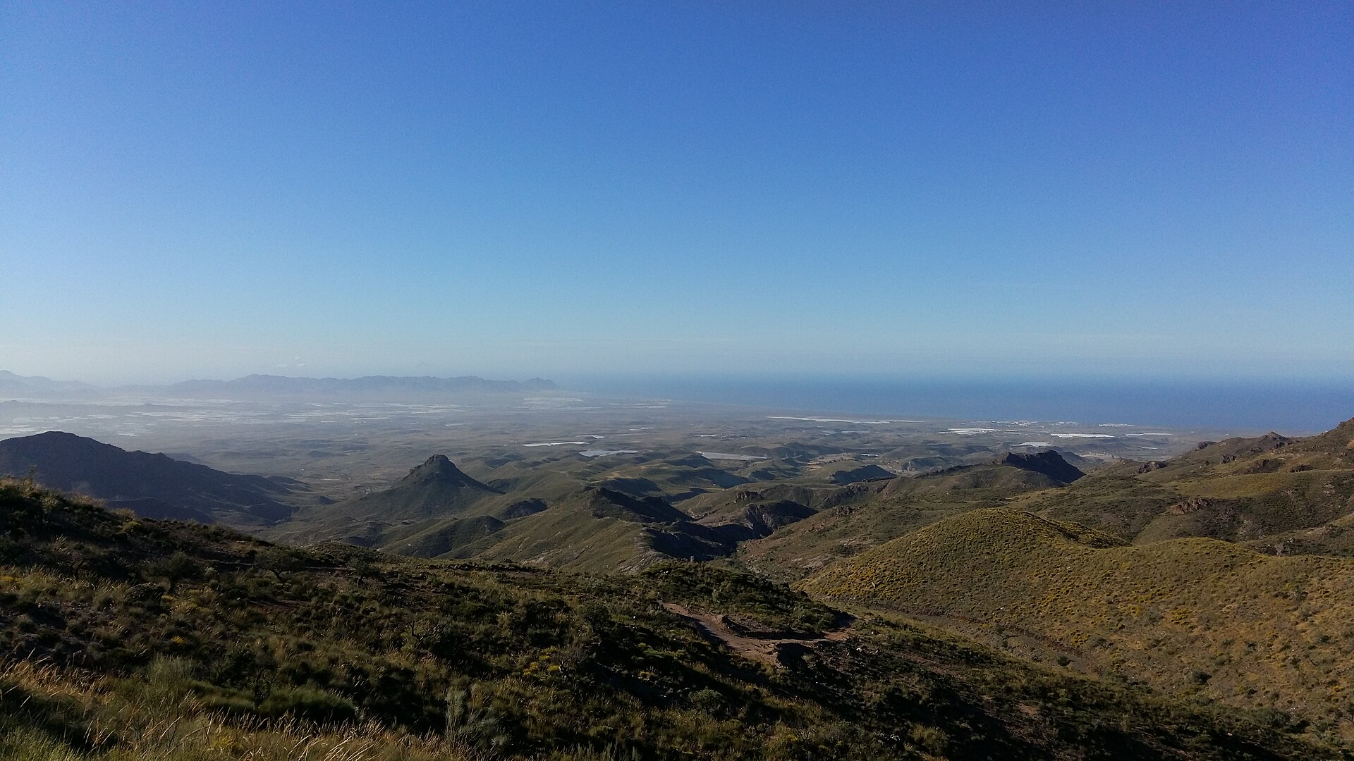
About this place
Sierra Alhamilla is a mountain range in the province of Almería, rising northeast of the provincial capital between the arid badlands of the Tabernas Desert and the Bay of Almería. Designated a protected natural area in 1989, this roughly 8,500-hectare range forms a green counterpoint to the parched landscapes around it, acting as a kind of forest oasis between Europe's driest region and the coast.
How high does Sierra Alhamilla rise?
The range's highest point is Colativí peak, reaching 1,387 metres above sea level. Belonging to the Betic Cordillera, the mountains are marked by steep slopes cut by deep gullies, especially on their southern flanks. From the ridgelines, views extend across much of Almería province — the terrain has long served as a natural vantage point over the surrounding land.
Who lives here and what does the landscape look like?
The area is sparsely populated, with only around 50 residents within the protected zone. The landscape is dotted with abandoned cortijos, traditional rural farmsteads, some of which — such as Cortijo del Marchal — still preserve what is considered one of the best-kept mills in the province, complete with its stone wheel, turbine, and water channelling system. Other notable farmsteads in the vicinity include Las Palmas and Las Palmillas. Many of these buildings now stand empty, drawing hikers and mountain bikers keen to explore the region's rural past.
What thermal and historical attractions are found here?
Sierra Alhamilla is known for its thermal waters, used since Roman times and later by the Arabs, who left a lasting mark on the region's architecture and traditions. In 1777, a significant refurbishment expanded the infrastructure built to make use of these springs, reflecting a long, continuous history of spa use at the site. The Baños de Sierra Alhamilla still operate today, reached via the route of an old railway built at the start of the 20th century.
What hiking trails are worth exploring?
The range is drawing a growing number of Almería residents and visitors keen to explore its landscapes on foot. Among the best-known routes is the SL-A 162 trail, which follows the old railway line to the Baños de Sierra Alhamilla. Near Lucainena de las Torres, the Senda Minera (Mining Trail) offers a green route from the town centre to remnants of 19th-century mining activity, including old mines and ore-roasting furnaces. Together, these trails combine natural scenery with traces of the region's industrial past.
Where can visitors stay nearby?
The closest town offering accommodation is Tabernas, though a wider choice of places to stay can be found in Níjar. A track heading toward Tabernas enters the northeastern part of Sierra Alhamilla and crosses the entire range as far as the village of Turrillas, making it a convenient starting point for exploring the mountains.
Why is Sierra Alhamilla worth visiting?
The range combines several elements rarely found together in one place: a stark, semi-desert landscape bordering a surprisingly green enclave, a centuries-long history of thermal water use, and traces of mining and farming life preserved in its abandoned buildings. For travellers seeking quiet hiking away from crowds and a close look at the rugged yet varied nature of southern Spain, Sierra Alhamilla is a worthwhile alternative to Andalusia's better-known trails.
Frequently asked questions
How high is the range's highest peak? Colativí, at 1,387 metres above sea level.
Is it possible to stay overnight in Sierra Alhamilla itself? There is little accommodation infrastructure directly in the mountains — the nearest lodging is in Tabernas, with a broader selection available in Níjar.
What is there to see besides hiking trails? Abandoned cortijos, including Cortijo del Marchal with its preserved mill, and the historic Baños de Sierra Alhamilla thermal baths.
Earn badges for the places you visit
Download NextOnTrip, discover new places and check off your trails.