About this place
Želízky is a small yet striking nature reserve tucked into the northern part of the Zimořský důl valley, between the villages of Dolní Zimoř and Sitné in the Mělník district of the Central Bohemian Region. The protected area covers only about 1.1 hectares, but its ecological significance far outweighs its modest size.
What makes this place worth protecting?
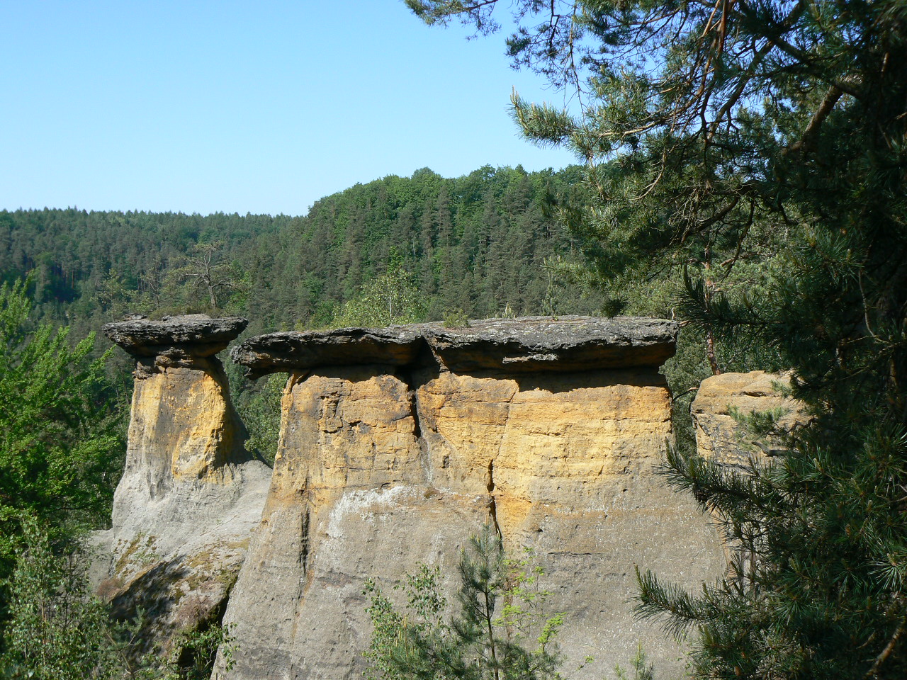
The reserve was officially declared on 19 March 2001. Its defining landscape feature is a long line of sandstone cliffs stretching roughly 400 metres and facing south. The rock faces sit at an elevation of 248 to 265 metres above sea level, forming a distinctive, steep wall that stands out against the valley floor below.
Conservation efforts here focus on maintaining the open character of xerothermic habitats — the warm, dry conditions typical of south-facing rock exposures. These conditions support vegetation adapted to harsh circumstances: limited water, intense sun exposure, and thin, sandy soil. Several species tied to this specific habitat type are subject to special legal protection, which is why preventing the area from becoming overgrown with shrubs and trees remains a central management priority for the reserve.
The rocks and the landscape
The sandstone formations at Želízky are characteristic of the wider Kokořínsko region, an area famous for its rocky labyrinths and narrow ravines. Because the cliffs face south, they absorb heat throughout the day, reinforcing the xerothermic microclimate that defines the site. The rock line, visible from the valley below, serves as a clear landmark and one of the visual highlights of this corner of Kokořínsko.
Part of a larger protected landscape
Želízky lies within the Kokořínsko – Máchův kraj Protected Landscape Area, one of the larger and better-known nature areas in central Bohemia, renowned for its sandstone rock formations, gorges, and forests. The reserve is therefore a small but valuable piece within this much larger mosaic of protected land.
How to get to Želízky
A yellow-marked hiking trail passes through and around the reserve, along with cycling route number 0010. This makes the site easy to reach for anyone exploring the region on foot or by bike — no special expedition is needed, as Želízky can simply be added as a stop along a longer route through Kokořínsko.
Frequently asked questions
Where is Želízky located? The reserve lies in the northern part of the Zimořský důl valley, between the villages of Dolní Zimoř and Sitné, in the Mělník district of the Central Bohemian Region.
How large is the protected area? It covers 1.1015 hectares.
What exactly is protected here? Primarily the open xerothermic habitats on the sandstone cliffs and the specially protected plant species associated with them.
When was the reserve established? It was formally declared on 19 March 2001.
How can visitors reach the site? A yellow hiking trail and cycling route number 0010 run through the area, making it easy to include as part of a wider trip through the Kokořínsko region.
Nearby places

Earn badges for the places you visit
Download NextOnTrip, discover new places and check off your trails.