About this place
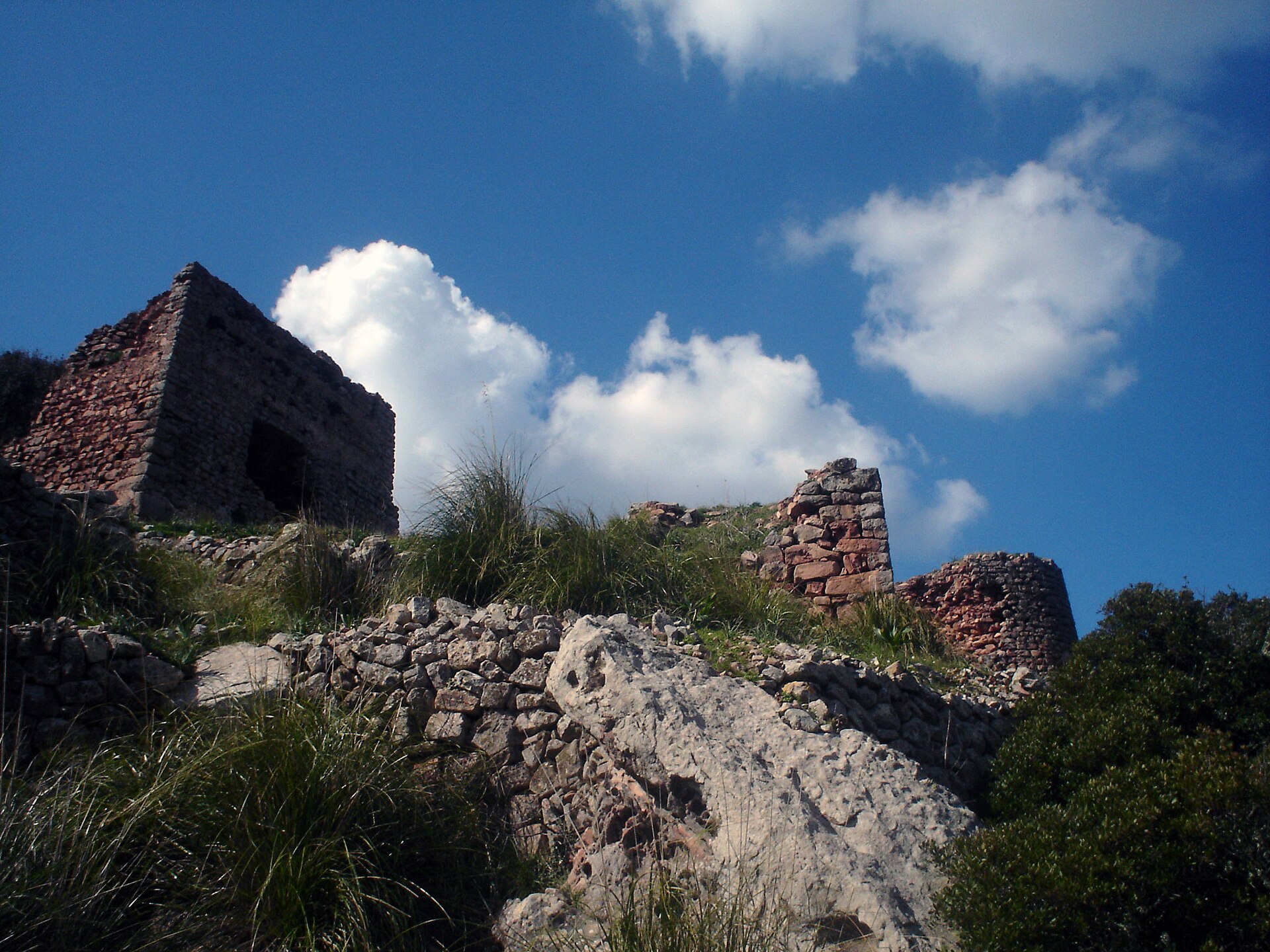
Talaia de s'Enclusa is an 18th-century watchtower crowning the summit of s'Enclusa (275 metres), the second-highest hill on Menorca, in the municipality of Ferreries. The site brings together the island's coastal defense history, sweeping views over western Menorca, and the remains of a Cold War-era military base now being turned into a nature interpretation centre.
What is the Talaia de s'Enclusa?
The talaia is a rectangular stone tower raised in the second half of the 18th century, one of the last two towers of this design built on the island, alongside the tower at Binissarmenya. Watchtowers were erected across Menorca following destructive corsair raids in the 16th century, meant to spot approaching ships and warn nearby settlements. The tower standing today is badly weathered, though in the early 2000s it still served as a forest-fire lookout point.
Why was the hill once called "Dalt Sa Torre"?
Before the name s'Enclusa became common, locals in Ferreries referred to the hill simply as "Dalt Sa Torre" — "up by the tower." The name "Enclusa" itself means "anvil," and it ties into one theory about the origin of the town name Ferreries, linked by some researchers to the Catalan word for blacksmith, "ferrer." The hill also appears in the municipal anthem of Ferreries, sung as the peak that shields the town from the "great Tramuntanada," the strong northerly wind typical of the Balearics.
What can you see from the summit?
Thin vegetation on the summit means the views open up in every direction. On a clear day, visitors can pick out the villages of Es Mercadal, Es Migjorn Gran and Alaior, the southern coastline, and the ridge of hills running from Ses Fonts Rodones toward Santa Àgueda. A geodetic marker and an ADF radio antenna also stand near the top. Four separate viewpoints ring the s'Enclusa massif, though the paths leading to them have traditionally been hard to access, since much of the surrounding land is private and the area is protected as a Zone of Special Natural Interest (ANEI).
What happened here during the Cold War?
Between 1964 and 1993, the hill hosted a United States military base that formed part of a communications network supporting American forces stationed in the Middle East. The complex covered more than 43,000 square metres and comprised twelve separate buildings totalling around 2,193 square metres of built space. It closed in 1993 as the Cold War ended and newer communications technology made the installation obsolete.
What is happening at the old base today?
After nearly three decades of abandonment, Menorca's island council is now rehabilitating the former base into a Biosphere Reserve Interpretation Centre. The plans include a small museum on the history of the base, preservation of its American-style canteen, a picnic area, a stargazing spot, and accommodation for school groups. The project's first phase is expected to open the summit viewpoints to the public.
Frequently asked questions
How high is s'Enclusa? The summit reaches 275 metres above sea level, making it Menorca's second-highest hill after El Toro.
Can visitors go inside the Talaia de s'Enclusa tower? The tower survives only in ruined form, and access to nearby paths and viewpoints can be limited, since parts of the land are private or protected for nature conservation.
Where does the name "s'Enclusa" come from? It means "anvil" and connects to the region's blacksmithing tradition, an association also linked to the name of the nearby town of Ferreries.
What was the old military base on the hill used for? From 1964 to 1993 it operated as a United States military communications station; the site is now being converted into a nature and heritage centre tied to the Menorca Biosphere Reserve.
Nearby places

Earn badges for the places you visit
Download NextOnTrip, discover new places and check off your trails.