About this place
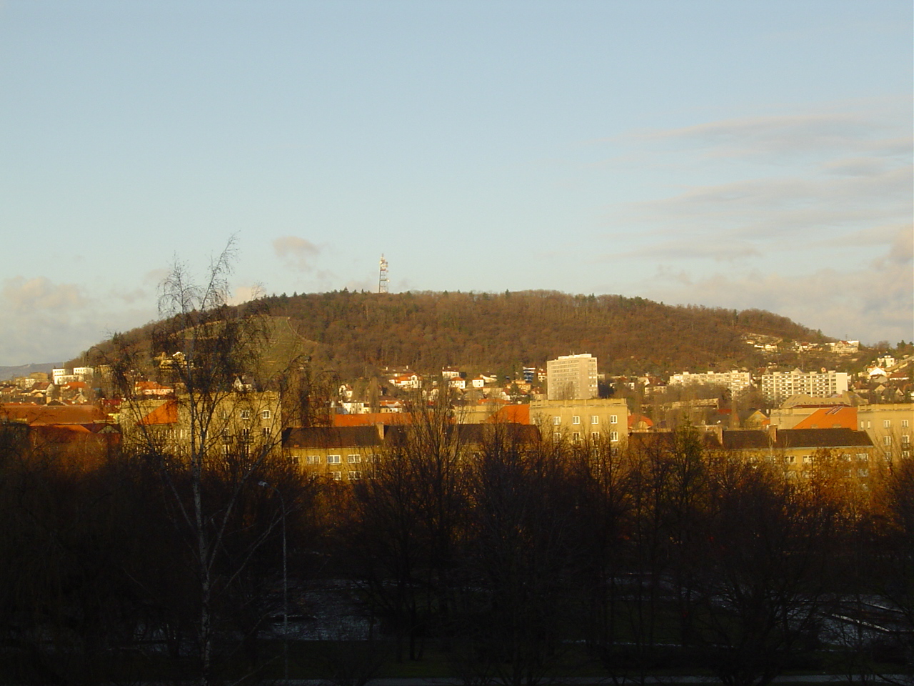
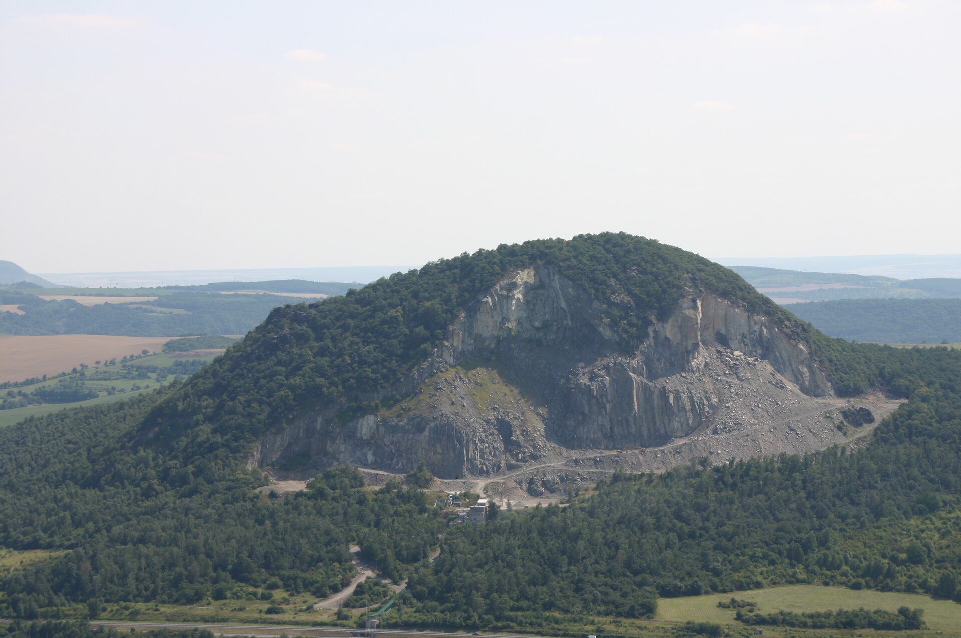
Široký vrch is a forested hill on the northwestern edge of Most, in the Czech Republic, rising to 387 meters above sea level. Together with the neighboring Hněvín, it separates the center of Most from the Souš district, forming a green natural boundary visible from much of the city.
Where exactly is Široký vrch located?
The hill sits roughly two kilometers from the center of Most, in the Ústí nad Labem Region, and geologically belongs to the České středohoří range — a chain of volcanic-origin hills running through northern Bohemia. Široký vrch itself is a phonolite laccolith: a body of magma that never broke through to the surface but instead pushed up and domed the rock layers above it, giving the hill its characteristic rounded shape.
What's on the summit?
The summit carries a radio and television transmitter serving the wider Most region, along with a hotel locals call Širák, reachable by a paved access road — making the top easy to reach even without a long hike. From up there, the view stretches over the Most basin and the further ridges of the České středohoří.
What does the vegetation look like on the slopes?
The slopes are almost entirely covered by mixed forest typical of the region — beech, oak, and a scattering of conifers. The exception is the south-facing slope, where vineyards replace the tree cover. It's an unusual combination for this part of the Czech Republic, but the Most area, despite its industrial reputation, has a tradition of grape-growing on sun-facing volcanic slopes, shared with several neighboring hills in the same range.
Can you hike up on foot?
A network of forest trails and paths runs around Široký vrch, allowing an approach from several directions — from central Most or from the Souš district. None of the routes are technically demanding; they're closer to leisurely walking trails, and the elevation gain from town is moderate. It's a popular short afternoon destination for people living in Most.
Why is it worth a visit?
Široký vrch isn't a peak that draws visitors from far away — it functions more as a local landmark and recreation spot for residents of Most. Its appeal lies in proximity: within minutes you can leave the built-up city behind and stand in forest overlooking the whole basin. For anyone exploring Most and its surroundings, it's a natural, low-effort viewpoint that doesn't require a long excursion or special preparation.
It's also worth remembering that the Most region, despite associations with open-cast mining and heavy industry, has a surprisingly wild and green side just beyond the city limits — and hills like Široký vrch and its neighbor Hněvín are the clearest evidence of that.
Frequently asked questions
How high is Široký vrch? The hill rises to 387 meters above sea level.
Where is it relative to central Most? On the northwestern edge of the city, about two kilometers from the center.
What's on top of the hill? A radio and television transmitter and a hotel reachable by a paved road.
Are there vineyards on the slopes? Yes, on the south-facing slope — the rest of the hill is covered in mixed forest.
What geological range does it belong to? The České středohoří range; the hill itself is a phonolite laccolith.
Does it border other hills? Yes, together with Hněvín it separates Most from the Souš district.
Nearby places

Earn badges for the places you visit
Download NextOnTrip, discover new places and check off your trails.