Save this place and discover nearby attractions with NextOnTrip
In the app you can add it to your favorites, see what else is worth visiting nearby on the map, and earn a badge for your visit.
The app is available for iPhone and Android.
About this place
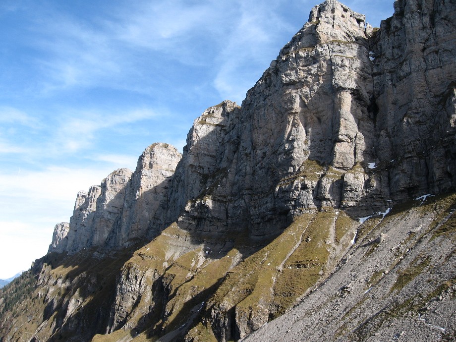
Sigriswiler Rothorn is a 2,051 m summit above the village of Sigriswil in the canton of Bern, Switzerland. It crowns the Sigriswilergrat ridge, part of the Bernese Pre-Alps rising on the northern shore of Lake Thun. It suits experienced hikers who enjoy a long day on a narrow, partly exposed crest.
Where is the Sigriswiler Rothorn?
The peak lies north of Sigriswil in the Emmental Alps, east of the city of Thun. One flank drops towards the lake, the other bounds the deep Justistal valley. Across that valley stand Niederhorn and the Güggisgrat, so the two ridges are often combined in one outing or simply admired from each other.
How do you hike it?
The classic route is a loop from the centre of Sigriswil along the Sigriswilergrat. Bergwelten lists it at roughly 18 km, about 1,500 m of ascent and around 7 hours 15 minutes. A variant from Interlaken starting at the Säge bus stop is about 11.6 km and 5.5 hours. Figures differ between sources, so check a current route description and trail conditions before you set off.
The summit section calls for sure footing and a head for heights, as the path is exposed in places. If you would rather skip the top, the gentler stretches of the ridge still deliver much of the scenery.
What can you see?
Lake Thun lies below and the Bernese High Alps fill the background. From neighbouring Niederhorn, Interlaken Tourismus describes a panorama taking in the Brienzer Rothorn, Eiger, Mönch and Jungfrau, the Kander, Engstligen and Simmental valleys, Thun and Bern, and the Jura range. The Sigriswiler Rothorn itself looks best from Niederhorn, as the wall closing off the north side of the Justistal.
When should you go?
The Sigriswilergrat is normally walkable from June to October. Outside that window snow can linger on the upper sections and the exposed stretches become harder. Start early to stay ahead of afternoon cloud and keep a time reserve for the descent.
An easier day out
If you do not plan the full ridge, take the simpler route from Niederhorn over the Güggisgrat to Burgfeldstand. The loop is about 4.8 km and takes roughly two hours, with views of the Sigriswiler Rothorn and the Justistal. In winter, a prepared walking trail leads from Niederhorn to Beatenberg/Waldegg.
Frequently asked questions
How high is the Sigriswiler Rothorn? 2,051 m above sea level, the highest point of the Sigriswilergrat.
Is the hike difficult? It is meant for people with mountain experience. You need stamina for about 1,500 m of climbing, steady footing and comfort with exposure.
Where should I start? In the centre of Sigriswil or, for the Interlaken variant, at the Säge stop. Public transport makes a loop route easy without returning to a car.
Is there an easier way to see the mountain? Yes. The Niederhorn, Güggisgrat and Burgfeldstand loop shows the Sigriswiler Rothorn and Justistal without the demanding ridge.
Nearby places

Earn badges for the places you visit
Download NextOnTrip, discover new places and check off your trails.