Save this place and discover nearby attractions with NextOnTrip
In the app you can add it to your favorites, see what else is worth visiting nearby on the map, and earn a badge for your visit.
The app is available for iPhone and Android.
About this place
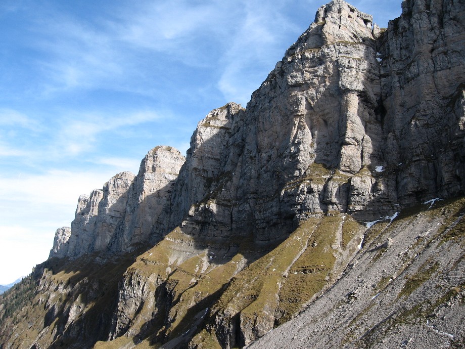
Gemmenalphorn is a 2,061 m summit in the Emmental Alps of the canton of Bern, rising above Beatenberg and Lake Thun. It lies north-east of the Niederhorn and forms part of the Güggisgrat ridge, one of the best-known panorama walks around Interlaken.
Where is Gemmenalphorn?
The peak stands in the Bernese Oberland on the northern side of Lake Thun. Looking east you see the Sieben Hengste, the Hohgant and the Seefeld area; other directions open onto the Justistal valley and the Sigriswilergrat. The highest point of the same ridge is the neighbouring Burgfeldstand at 2,063 m, just two metres taller.
How do you get to the top?
Most people start at the Niederhorn (1,933 m). A gondola runs up from Beatenberg, and another route climbs from Beatenbucht on the lake, changing from the funicular on the way. From the top station, the panorama trail follows the ridge to Gemmenalphorn, mostly above the tree line. Interlaken Tourism notes that the Niederhorn to Gemmenalphorn stretch won a gold medal as Switzerland's most beautiful hiking trail.
Typical routes:
- Niederhorn – Gemmenalphorn – Beatenberg Waldegg: about 10.6 km, roughly 3 h 25 min, grade T2, around 350 m of ascent and over 1,000 m of descent. The finish at Waldegg sits near 1,200 m.
- From Habkern via Bäreney: about 4.5 hours to the summit, with the option to continue along the ridge to the Niederhorn.
- Loop from Grön through the Justistal: about 18.5 km and 6.5 hours, taking in both Gemmenalphorn and Niederhorn.
The ridge has steep, exposed sections protected by steel cables, so sure footing and a head for heights help.
What will you see?
The views take in the Eiger, Mönch and Jungfrau, with Lake Thun spread out far below. Because the path stays above the tree line, the panorama accompanies you for most of the walk. Strong walkers can link Gemmenalphorn, Burgfeldstand and the Niederhorn into one long day.
When should you go?
The summer route is usually walkable from June to October. In winter, a ski tour climbs from Beatenberg Waldegg; the SAC portal rates it PD, with about 450 m of ascent. Pick a day with settled weather: the ridge is open to the wind, and the views are the whole point.
What should you bring?
Sturdy hiking boots, a windproof jacket, water, and enough time to catch the last lift if you return to the valley from the Niederhorn. There are no huts on the ridge, so carry food or buy it at the top station.
Frequently asked questions
How high is Gemmenalphorn? It reaches 2,061 m above sea level. The neighbouring Burgfeldstand is 2 m higher.
Do I need climbing gear? Not in summer. It is a regular mountain trail, but a few exposed passages are secured with steel cables, so be comfortable on steep ground.
Where is the easiest place to start? At the Niederhorn top station, reached from Beatenberg or Beatenbucht. From there you follow the ridge towards Gemmenalphorn.
Can I climb it in winter? Yes, as a ski tour from Beatenberg Waldegg, graded PD by the SAC. It requires snow assessment and ski-touring skills.
Nearby places

Earn badges for the places you visit
Download NextOnTrip, discover new places and check off your trails.