About this place
Montaña de Guaza
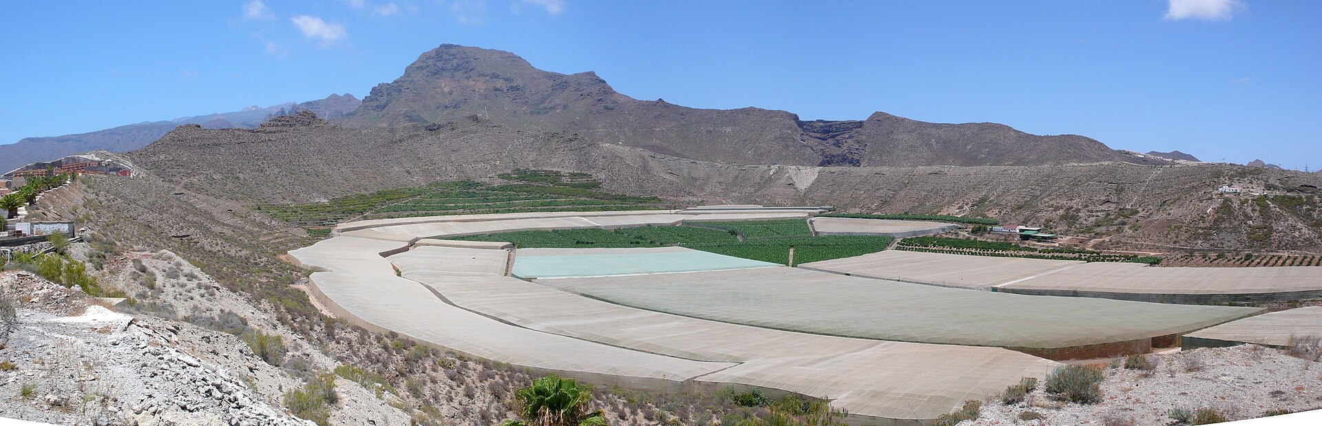
Montaña de Guaza is an extinct volcanic cone and protected natural monument rising above the southern coast of Tenerife, right behind Los Cristianos and Las Américas, within the municipality of Arona. It reaches 428 metres above sea level and is one of the most recognisable landmarks of the island's south — visible from almost every resort in the area, yet remaining a surprisingly wild pocket of land next to a densely built tourist coastline.
How did the mountain form?
Guaza is an old volcanic cone with two concentric craters, shaped during an eruption in which thick, viscous lava seeped out from beneath the surface and flowed toward the ocean. That process carved out the broad plateaus known as the Mesas de Guaza and a small cliff facing the sea. The area was declared a Site of National Interest in 1987 and reclassified as a Natural Monument in 1994, granting it lasting legal protection.
What does the landscape look like?
The terrain is made up of dry volcanic plateaus and rugged slopes with views stretching along the entire coastline from Los Cristianos to Costa del Silencio. Despite its proximity to the resorts, parts of the mountain still hold onto native vegetation typical of the island's arid south, including spurge and cardón shrubs, while the most inaccessible corners shelter rare plant species found only in the Canary Islands.
What historical traces remain here?
The mountain preserves evidence of pre-Hispanic Guanche presence, including caves, the remains of huts and burial sites. This makes Guaza more than a scenic hike — it's also a place of archaeological value, documenting how the island's first inhabitants lived before the Spanish conquest.
What wildlife lives on the mountain?
The plateaus and cliffs of Guaza serve as an important habitat for birds, including seabirds that nest on the cliffs as well as steppe-dwelling species that have become increasingly rare on Tenerife. The area is also home to reptiles endemic to the island, including large lizards characteristic of Canarian fauna.
How to plan a visit
Access to the natural monument is free and open to everyone, with a network of marked trails ranging from easy to moderate difficulty crossing the mountain. A popular loop trail runs roughly 9 kilometres and takes a little over 3 hours on average, following dirt paths past caves, geological formations and sites tied to Guanche history. The best time to hike is between November and April, when temperatures on the southern coast are milder than in summer. Bring water and sun protection — the trail offers little shade and is fully exposed to the sun.
Frequently asked questions
Is there an entrance fee for Montaña de Guaza? No, access to the natural monument is free.
How long does the loop hike take? The popular circular route takes a little over 3 hours on average.
When is the best time to hike here? Between November and April, when temperatures are more comfortable for hiking.
Is it worth visiting from Los Cristianos or Las Américas? Yes — it's the nearest natural escape from those resorts, offering panoramic coastal views and traces of the island's pre-Hispanic past.
Nearby places

Earn badges for the places you visit
Download NextOnTrip, discover new places and check off your trails.