Save this place and discover nearby attractions with NextOnTrip
In the app you can add it to your favorites, see what else is worth visiting nearby on the map, and earn a badge for your visit.
The app is available for iPhone and Android.
About this place
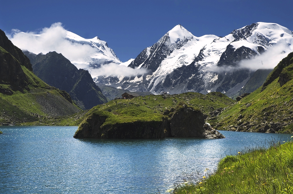
Le Ritord is a 3,556 m summit in the Pennine Alps, rising above the village of Bourg-Saint-Pierre in the Swiss canton of Valais. It belongs to the Grand Combin massif, one of the most heavily glaciated groups in this part of the Alps. The peak sits at roughly 45.963° N, 7.256° E.
Where is Le Ritord?
The mountain stands on the Swiss side of the range, above the Val d'Entremont, the valley whose road climbs towards the Great St Bernard Pass. The nearest village, Bourg-Saint-Pierre, is the traditional starting point for the Grand Combin massif and several high mountain huts. Neighbouring summits include Combin de Boveire (3,663 m), only about 1.2 km away, and Grand Combin de Valsorey (4,184 m). The col tied to Le Ritord lies east of the summit at 3,495 m.
Is it a hike for ordinary visitors?
No. Despite its modest fame, this is a high-alpine objective above the permanent snowline, surrounded by glaciers. A walking trail does not reach the top. The ascent calls for mountaineering experience, glacier gear (crampons, rope, ice axe) and ideally a licensed mountain guide. Italian route listings mention a line up a south-west couloir but give no grade, so ask local guides or the Swiss Alpine Club about current conditions.
What can you see nearby?
For most travellers Le Ritord is a view rather than a destination. From the valley above Bourg-Saint-Pierre you look up at the glaciated flanks of the Grand Combin massif, and walks in its shadow are among the finest in Valais. The Tour des Combins, a multi-day loop that begins in Bourg-Saint-Pierre and circles the massif through Switzerland, Italy and France, is the classic choice. Its high point is the Col des Otanes (2,870 m), reached by a steep climb along the Corbassière glacier moraine. A path from Bourg-Saint-Pierre also leads to the Valsorey Hut at 3,030 m, set beneath the highest peaks of the massif, including Grand Combin (4,312 m) and Mont Vélan (3,727 m).
When should you go?
Trails in the area are generally open in summer and early autumn, once snow has left the lower slopes. Alpine climbs are planned for the core of the mountain season, and glacier conditions change from year to year, so check them with guides and huts shortly before setting out.
How do you get to Bourg-Saint-Pierre?
The village lies on the road from Martigny through Orsières and Liddes towards the Great St Bernard. You can drive there; if you plan to use public transport, check current bus connections in the valley.
Frequently asked questions
How high is Le Ritord? The summit stands at 3,556 m above sea level.
Which massif does it belong to? The Grand Combin massif in the Pennine Alps, canton of Valais.
Can you climb Le Ritord without a guide? The route crosses glacier terrain, so only people with the right experience and equipment should go alone. Everyone else should book a guide.
What is an easier outing nearby? A section of the Tour des Combins, or the walk up to the Valsorey Hut from Bourg-Saint-Pierre.
Nearby places

Earn badges for the places you visit
Download NextOnTrip, discover new places and check off your trails.