Save this place and discover nearby attractions with NextOnTrip
In the app you can add it to your favorites, see what else is worth visiting nearby on the map, and earn a badge for your visit.
The app is available for iPhone and Android.
About this place
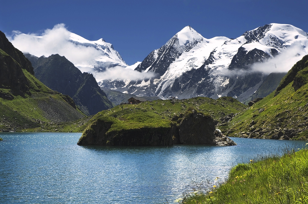
Grand Combin is a heavily glaciated mountain massif in the western Pennine Alps, in Switzerland's canton of Valais, rising above the Val de Bagnes. Its summit, Combin de Grafeneire, stands at 4,309 m (14,137 ft), making it one of the highest peaks in the entire Alps. The massif has several ice-covered summits, and three of them top 4,000 m.
Where is the Grand Combin?
The massif sits south of Verbier, between the Val d'Entremont and the Val de Bagnes. Its highest section lies entirely on the Swiss side, while the Italian border runs a few kilometres to the south. Combin de Grafeneire ranks second in the Pennine Alps for prominence. The centre of the massif lies at roughly 45.94° N, 7.30° E.
How do you get to the area?
The easiest way into the Val de Bagnes is by train to Martigny, a regional train on to Le Châble, then a bus to Fionnay. That village is the trailhead for the Cabane de Panossière hut. By car, the valley road passes through Sembrancher and ends at Fionnay.
What can you see and do here?
For most visitors the Grand Combin is first of all a view: a vast wall of glaciers that dominates the valley. The hike up to Cabane de Panossière (2,669 m) takes you into the glacier scenery of the Corbassière valley and brings you beneath the northern slopes without any climbing gear. Loop trails also start from Fionnay and cross nearby passes, and the massif forms one stage of the classic multi-day Tour des Combins.
What does a summit attempt involve?
This is an objective for experienced mountaineers who have glacier equipment, have acclimatised and are going on a good-conditions day. The normal route begins at the Panossière hut on the north side. The route forks at the Plateau du Déjeuner, around 3,500 m. The older line, known as the Corridor, passes under a long band of seracs where ice avalanches fall regularly. The standard route today is the Couloir du Gardien, which goes straight up the northwest flank of Combin de Grafeneire. It is steeper and technically harder, but less exposed to icefall. A second approach starts at the Cabane de Valsorey and crosses the Col du Meitin (3,611 m) to reach the same plateau. Many climbers warm up on the neighbouring Combin de Corbassière first.
When should you go?
Valley hiking trails are open in summer, roughly June to September. High-mountain ascents are planned for settled weather in summer and early autumn, and it is wise to ask at the hut or a local guide about glacier conditions.
Frequently asked questions
How high is the Grand Combin? Its highest summit, Combin de Grafeneire, reaches 4,309 m (14,137 ft).
Can you visit the Grand Combin without climbing? You cannot reach the summit that way, but the hiking trail from Fionnay to Cabane de Panossière gets you close to the massif and needs no mountaineering gear.
Where do you start from? From Fionnay in the Val de Bagnes. A bus runs there from Le Châble, which is served by a train from Martigny.
Is the Grand Combin in Italy? No. The highest part of the massif is entirely in Switzerland, and the Italian border lies a few kilometres to the south.
Nearby places

Earn badges for the places you visit
Download NextOnTrip, discover new places and check off your trails.