Save this place and discover nearby attractions with NextOnTrip
In the app you can add it to your favorites, see what else is worth visiting nearby on the map, and earn a badge for your visit.
The app is available for iPhone and Android.
About this place
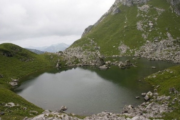
Lac de Lovenex is a small alpine lake in the municipality of Saint-Gingolph, in the Swiss canton of Valais, right by the French border. It sits at 1,632 m above sea level beneath Mont Gardy and covers just 4.7 hectares. There is no lift or road to the shore, so reaching it takes a proper mountain walk.
Where is Lac de Lovenex?
The lake is officially Swiss, yet the practical approach starts on the French side, in Haute-Savoie. Its coordinates are roughly 46.353° N, 6.790° E. Mont Gardy (about 2,201 m) rises above it, with the Grande Jumelle also in view. Do not confuse it with Lake Geneva, which lies far below at the foot of these mountains.
How do you get there?
Most hikers begin at the large car park beyond the hamlet of La Planche, where the road climbing from the village of Novel ends. Route descriptions give a loop of about 7.7 to 8 km, a walking time of 4 h 25 min to 4 h 30 min and 760 to 800 m of ascent. The La Planche version is rated difficult. The path is waymarked, and its high point, the Pas de Lovenex, reaches about 1,850 m.
What will you see?
From the Pas de Lovenex pass the lake appears to hang above the Lake Geneva basin. Rocky slopes surround the water, and the area is known for ibex, so bring binoculars. It suits walkers who want an alpine setting without tourist infrastructure: there are no cafes or rentals on the shore.
When should you go?
June to September is the best window, when the trail is clear of snow. Outside that period access depends on conditions, so check trail status with a local tourist office before setting out. Pack sturdy boots, water, sun protection and a warm layer, since weather at this altitude can turn quickly.
What should you know before you start?
- Plan a full day, including stops for rest and photos.
- Phone coverage can be patchy, so download an offline map.
- The lake is small and high, so it is a hiking goal rather than a swimming spot.
- The route crosses between France and Switzerland, so carry photo ID.
Frequently asked questions
How high is Lac de Lovenex? It lies at 1,632 m, below the summit of Mont Gardy.
How big is it? About 4.7 hectares, making it a small mountain lake.
How long is the hike? Around 4.5 hours round trip from the car park past La Planche, with roughly 760 to 800 m of climbing.
Is it an easy walk? No. Route guides rate it as difficult, mainly because of the distance and the ascent.
Nearby places

Earn badges for the places you visit
Download NextOnTrip, discover new places and check off your trails.