About this place
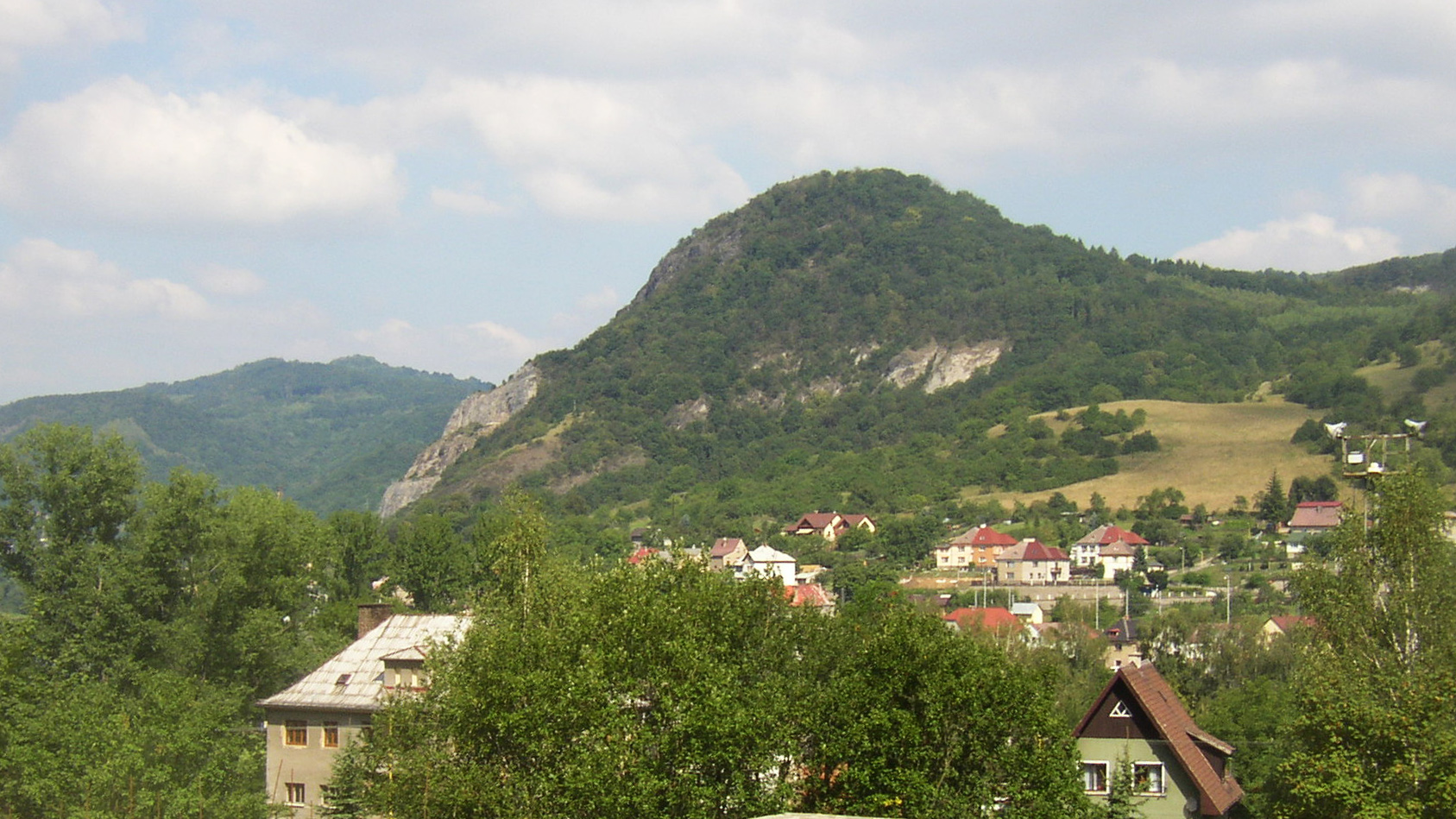
Kozí vrch is a rocky peak in the České Středohoří range, rising above the Elbe (Labe) valley near the village of Mašovice, close to Povrly in the Ústí nad Labem district of the Czech Republic. The summit reaches an elevation of 379–380 metres above sea level and belongs to the region's distinctive cone-shaped hills, which owe their form to ancient volcanic activity. The original volcanic cone was later exposed by strong river erosion, giving the hill the sharp, striking silhouette it has today.
How was Kozí vrch formed?
Geomorphologically, Kozí vrch is part of the České Středohoří uplands, a range whose landscape was largely shaped by Tertiary-period volcanic activity. The rock that makes up the summit originally formed beneath the surface, and it was only through prolonged erosion by water that the characteristic, dome-like shape visible today was gradually uncovered. Hills of this kind are typical throughout the range and give the surrounding countryside its recognisable, dramatic character.
Nature protection
Because of its notable natural and scenic value, the area around Kozí vrch was first placed under protection in 1983, when it was declared a natural monument. In 1993, the level of protection was raised and the site became a nature reserve. The protected area covers 36.9 hectares, with elevations within its boundaries ranging from roughly 147 to 380 metres. This considerable difference in altitude over a relatively small area supports a variety of habitats and rock formations.
What can you see from the summit?
Kozí vrch is best known for its views: from the top, a wide panorama opens over the Elbe valley, visible in any season and weather. These scenic qualities are the main draw for hikers who follow the trail leading up from the nearby village of Mašovice. The area also offers access to the ruins of Blansko Castle, allowing visitors to combine the ascent with a visit to a historic site.
Via ferrata on Kozí vrch
For more adventurous visitors, Kozí vrch features a via ferrata rated difficulty C and around 50 metres long. The route runs across the rocky sections of the summit and is a popular choice for those looking for a short but demanding climbing challenge in this part of the Czech Republic.
How to get to Kozí vrch
The easiest approach is by car from Ústí nad Labem or Děčín towards the village of Povrly, and from there onward to Mašovice. Just past the village, about one kilometre from the summit, there is a parking area from which only a short walk remains to reach the top. This makes Kozí vrch an achievable destination for a short, half-day trip.
Frequently asked questions
How high is Kozí vrch? The summit reaches 379–380 metres above sea level.
Where exactly is Kozí vrch located? It lies in the České Středohoří range, in the Ústí nad Labem district, above the Elbe valley, near the villages of Mašovice and Povrly.
Is there a via ferrata on Kozí vrch? Yes, a via ferrata rated difficulty C and about 50 metres long crosses the rocky part of the summit.
Since when has Kozí vrch been protected? The area was declared a natural monument in 1983 and upgraded to a nature reserve of 36.9 hectares in 1993.
What else is worth seeing nearby? The ruins of Blansko Castle are close by, and the summit offers views over the Elbe valley.
Nearby places

Earn badges for the places you visit
Download NextOnTrip, discover new places and check off your trails.