About this place
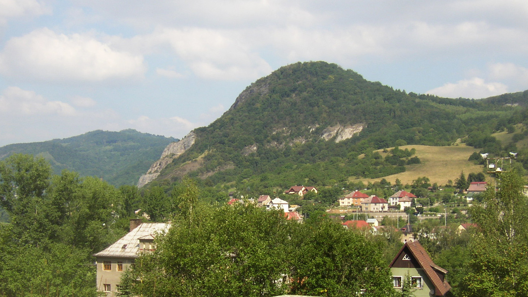
Javorský vrch is a 617-metre hill rising above the village of Javory, from which it takes its name. Located in the České středohoří (Czech Midlands) range, in the hilly belt between Děčín and Ústí nad Labem, it is the highest point of this part of the Ústecké středohoří and counts among the ten most prominent peaks in the entire České středohoří range.
Where is Javorský vrch located?
The hill sits on the border between the Děčín and Ústí nad Labem districts, between the villages of Jílové and Dobkovice. The nearest access point, the village of Javory at its foot, lies along the road connecting Ústí nad Labem and Děčín — roughly 9 km from the former and 8 km from the latter. That makes Javorský vrch an easy day-trip target from either city.
How do you get to the summit?
A yellow-marked trail branches off the road leading from Javory towards Ústí nad Labem and climbs to the top. It starts as a field track; after about 70 metres a footpath splits off, running past a small copse before crossing a meadow and reaching the summit. From the turn-off to the top it's only 0.8 km, with roughly 100 metres of elevation gain — a short, moderate climb that doesn't require serious hiking fitness.
What will you see at the top?
The summit of Javorský vrch is flat and covered in meadows and pastures, which is exactly why it offers such a wide, open panorama. From the bare hilltop you can pick out distinctive ranges in nearly every direction: the Děčín Highlands, the Lužické hory (Lusatian Mountains), the České středohoří itself, and the ridge of the Krušné hory (Ore Mountains) further out. It's this panorama — not any built attraction — that makes the climb worthwhile: there is no lookout tower or other structure on top, just open grassland and a view.
When is the best time to visit?
Spring and summer are the best seasons, when the meadows covering the slopes and summit are green and visibility across the typical Czech hill-country landscape is at its sharpest, especially right after rain when the air is clear. Autumn adds colour from the surrounding forests, while in winter the short but steepish final stretch can turn slippery if the trail ices or snows over, so proper footwear is worth packing.
Who is this hike suited for?
The short distance — just 0.8 km from the trail junction — and moderate elevation gain make this route suitable for families with children as well as anyone after a quick but rewarding view. It's a solid choice for travellers based in Ústí nad Labem or Děčín who only have a few free hours and want to take in a panorama of the České středohoří without committing to a full day in the higher mountains.
Frequently asked questions
How high is Javorský vrch? The summit reaches 617 m above sea level and is the highest point in this part of the Ústecké středohoří.
Where does the trail to the summit start? A yellow-marked trail branches off the road between the village of Javory and Ústí nad Labem; from there it's 0.8 km to the top, with about 100 m of elevation gain.
Is there a lookout tower at the summit? No, the top is an open, grassy dome with no buildings — the views come directly from the meadow itself.
What can you see from the top? On a clear day you can make out the Děčín Highlands, the Lužické hory, the České středohoří range itself, and the Krušné hory in the distance.
Nearby places

Earn badges for the places you visit
Download NextOnTrip, discover new places and check off your trails.