About this place
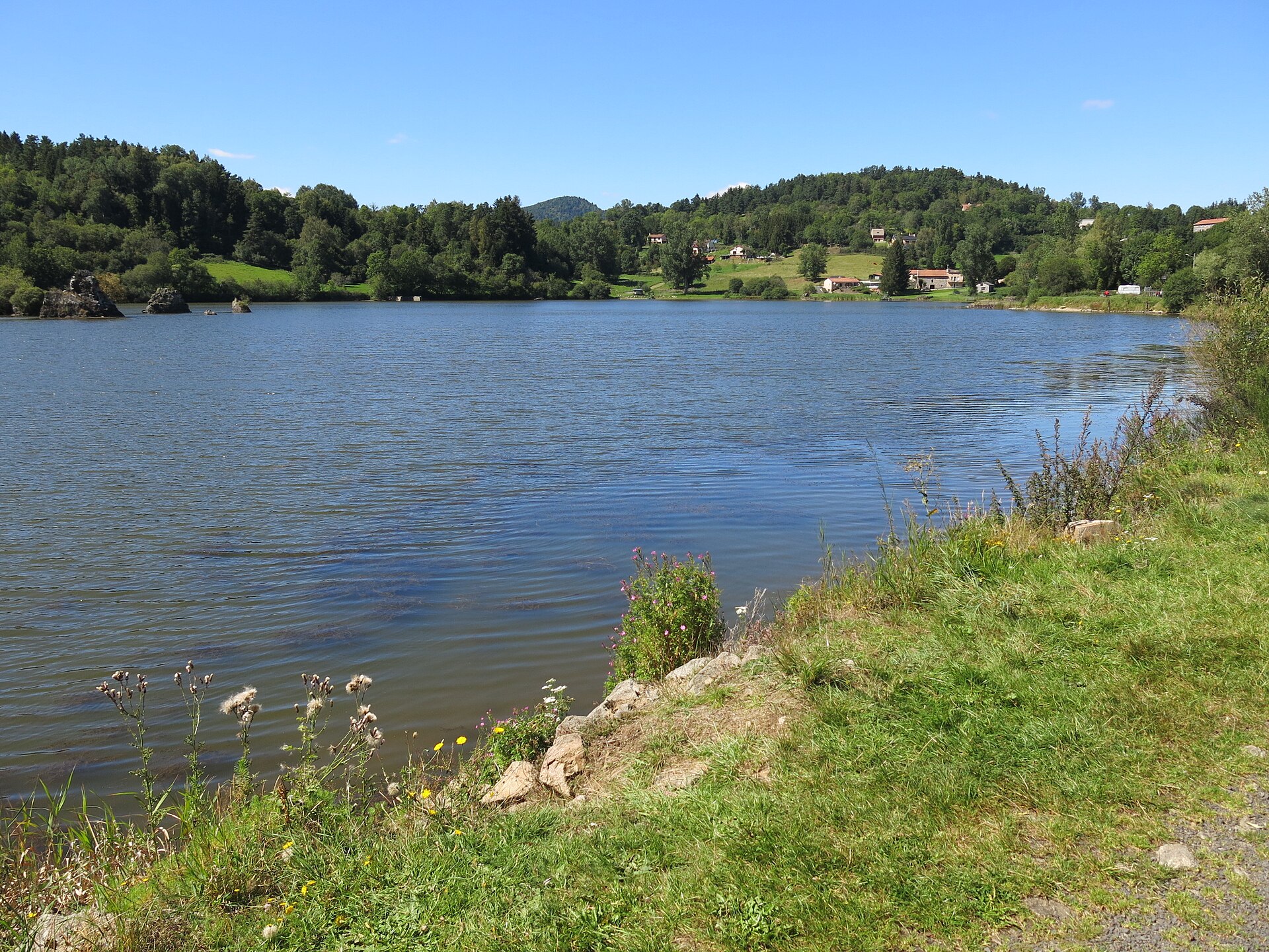
Gour de Tazenat is a near-perfectly circular volcanic lake in the commune of Charbonnières-les-Vieilles, in the Puy-de-Dôme department of the Auvergne region in France. It sits close to the village of Manzat and marks the northern edge of the Chaîne des Puys volcanic range.
How did this lake form?
Gour de Tazenat is a maar, a crater created by a phreatomagmatic eruption — a violent reaction that occurs when rising magma meets groundwater. This eruption took place roughly 29,000 years ago. The blast left behind an almost perfectly round depression measuring about 700 meters across, now filled with water to a depth of around 66 meters. Such geometric regularity is unusual among volcanic lakes, and it is precisely this feature that draws attention from visitors viewing the lake from nearby high ground or aerial photographs.
Where exactly is Gour de Tazenat located?
The lake sits at coordinates 45.98°N, 2.991°E, in the northwestern part of Puy-de-Dôme. This corner of Auvergne belongs to the Chaîne des Puys, a chain of volcanic cones and domes running through central France. Gour de Tazenat lies right at the northern tip of this chain, making it somewhat set apart from the more famous puys further south while still clearly sharing their volcanic origin.
What can visitors do at the lake?
A footpath circles the entire lake, covering roughly 7 kilometers. It is an easygoing route that lets walkers take in the lake from every angle and appreciate the scale of its circular shape. Two unsupervised swimming spots are also available along the shore: one near a local crêperie, reached by a wooden staircase leading down to the water, and another accessible via a quieter path along the bank. The water is clear, but there are no lifeguards on duty, so swimmers use the lake at their own risk.
Does Gour de Tazenat have any cultural significance?
The lake has a place in French literature — writer Guy de Maupassant referred to it in one of his short stories, a sign that this spot has long caught the attention of both local residents and visiting observers of the countryside. Today it remains a reference point for anyone learning about the volcanic history of Auvergne, offering tangible evidence of how intense volcanic activity shaped this part of France during the Pleistocene.
Why visit Gour de Tazenat?
The site combines educational and recreational value. On one hand, it is a clear, easy-to-grasp example of a maar landscape — no geology background needed, since the regularity of the shape speaks for itself. On the other hand, it is a quiet spot for a walk, a swim, or simply time by the water, away from the heavier tourist traffic found at the better-known sites of the Chaîne des Puys. It suits travelers looking for a less obvious but equally genuine encounter with volcanic Auvergne.
FAQ
What is Gour de Tazenat? It is a volcanic maar lake located in the commune of Charbonnières-les-Vieilles, in the Puy-de-Dôme department, at the northern end of the Chaîne des Puys.
How was the lake formed? It formed through a phreatomagmatic eruption about 29,000 years ago, when groundwater met magma and produced a circular crater.
How large and how deep is the lake? It is nearly perfectly circular, roughly 700 meters in diameter, with a depth of about 66 meters.
Can you swim in the lake? Yes, there are two unsupervised swimming areas — one near a crêperie with wooden stairs, and another reached by a path along the shore.
Is there a walking trail around the lake? Yes, a footpath of about 7 kilometers circles the entire lake.
Where exactly is Gour de Tazenat? Near the village of Manzat, in the commune of Charbonnières-les-Vieilles, at coordinates 45.98°N, 2.991°E.
Nearby places

Earn badges for the places you visit
Download NextOnTrip, discover new places and check off your trails.