About this place
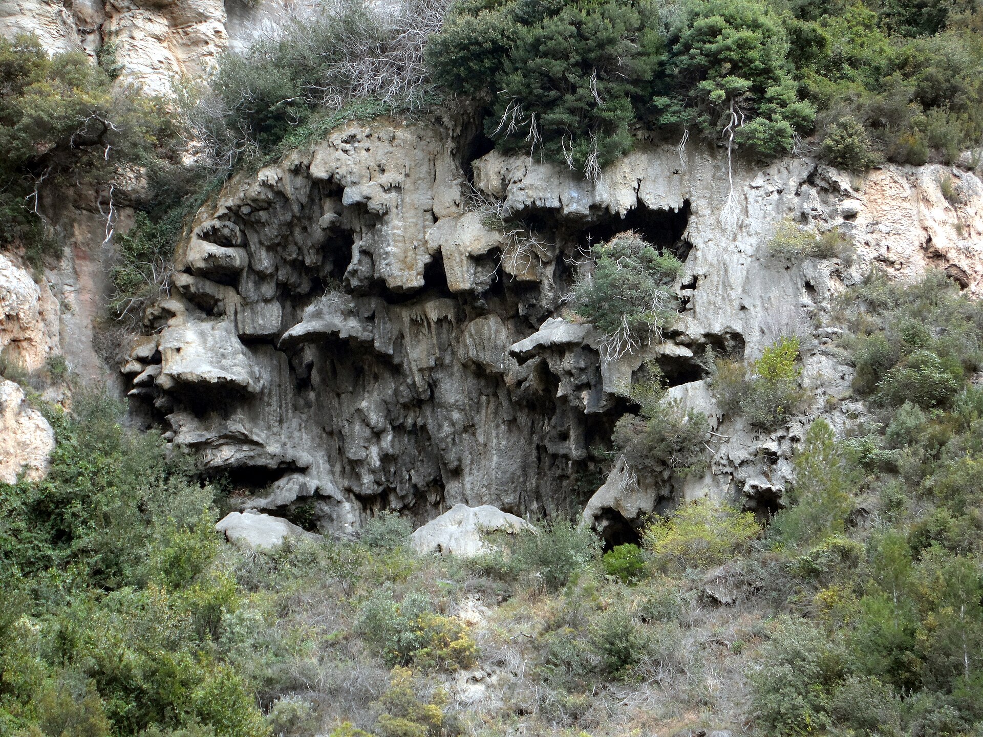
Cingles de Sant Sadurní (also known as the Cingles de Gallifa) is a line of rocky cliffs rising above the municipality of Gallifa, in the Vallès Occidental comarca, right on the border with Moianès. This stretch of the Serralada Prelitoral separates the Moianès plateau from the Vallès depression and forms one of the most recognizable landscape features in this part of Catalonia.
Where exactly are the Cingles de Sant Sadurní?
The ridge runs west to east, bounded by Serrat de Caramella on its western end and Serrat Punxegut on its eastern end. The whole crest lies within the small municipality of Gallifa, in Barcelona province, a village known for its stone architecture and mountainous setting.
How do you get to the trail?
Most routes start from the village of Gallifa itself or from nearby Sant Feliu de Codines. From either starting point, footpaths follow the ridgeline, linking up the landmarks described below. No climbing gear is required, but sturdy trekking shoes are recommended because of the rocky sections and steep approaches along the crest.
What will you see along the way?
Walking the ridge from west to east, hikers pass a sequence of named features: Roques de Caramella, Morral del Puig, the Coll Llober pass, the Turó de la Pinassa hill, Serrat Alt, the Collet de Sant Sadurní pass, and Roc de les Planes. The route culminates at a summit called la Mola, home to the small Romanesque church of Sant Sadurní de Gallifa, which lends its name to the entire massif. Further east, the ridge drops toward Llista Blava. From the upper cliff sections the view opens onto both the Vallès depression and the Moianès plateau, making this stretch one of the most scenic in the area.
The hermitage of Sant Sadurní de Gallifa
The church standing on the summit of la Mola has an unusually long history. The estate bearing the same name has been documented in written sources since the year 939, and the building itself combines a pre-Romanesque 10th-century body with an apse added at the end of the 11th century. Sitting at 942.3 metres above sea level, it is one of the best-preserved religious monuments in this part of the Serralada Prelitoral.
Who is this route for?
The Cingles de Sant Sadurní suit hikers looking for a demanding but not overly technical ridge walk, rewarded with sweeping views and a historic destination at the end. Because the terrain is rocky and largely unshaded along the exposed crest, spring and autumn are the best seasons, avoiding the midday heat of summer.
Frequently asked questions
How long is the hike across the Cingles de Sant Sadurní? It depends on the chosen route and starting point. The most common loop, starting from Gallifa or Sant Feliu de Codines, typically takes half a day and includes the full ridge walk plus the climb to the hermitage on la Mola.
Is the trail suitable for children? Sections of the ridge are rocky and exposed, so the route suits older children used to mountain trails better than very young ones.
What does the name Cingles de Gallifa mean? It's an alternative, commonly used name for the same ridge, taken from the municipality of Gallifa, within which the whole massif lies.
When is the best time to hike here? Spring and autumn offer the best conditions. In summer the exposed rocky sections of the ridge heat up considerably, while icy patches can appear on exposed stretches in winter.
Nearby places

Earn badges for the places you visit
Download NextOnTrip, discover new places and check off your trails.