About this place
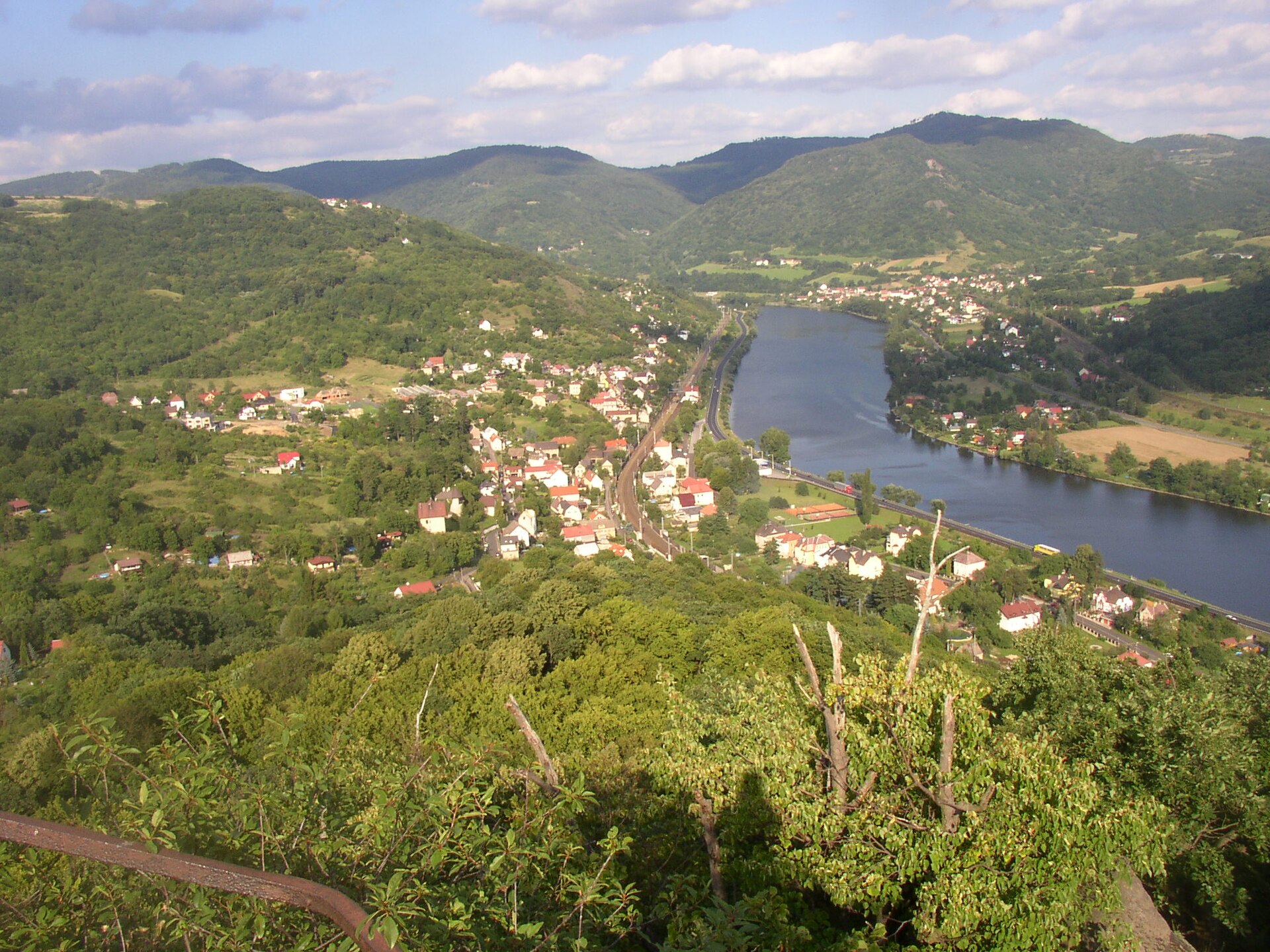
České středohoří Protected Landscape Area is one of the largest protected landscapes in the Czech Republic, stretching across the northwestern part of the country close to the border with Saxony, Germany. The village of Hlinná sits right at the heart of this territory, nestled at the foot of the Hradiště and Holý vrch hills, making it a quiet base for exploring the uplands away from the busier trailheads found elsewhere in the region.
What is the České středohoří protected area?
The area was declared a protected landscape in 1976 and has remained one of the cornerstones of nature conservation in the Czech Republic ever since. Its terrain was shaped by volcanic activity millions of years ago, leaving behind the cone-shaped hills and rocky ridges that give the Central Bohemian Uplands their distinctive silhouette. The highest point of the entire area is Milešovka, rising to 837 metres above sea level — a peak known both for its sweeping views and for the meteorological observatory perched on its summit.
What can visitors see around Hlinná?
Right next to the village stand two characteristic hills, Hradiště and Holý vrch — literally the "Bare Hill." These are modest but steep volcanic elevations, typical of the landscape found throughout the uplands: single, sharply defined cones rising above surrounding fields and woodland. For travelers looking for a calmer walking route, the area around Hlinná offers views across the rolling, undulating panorama of the region without requiring a climb up the most crowded summits.
What kind of landscape does the region offer?
České středohoří is essentially a mosaic — deciduous and mixed forests alternate with dry grassland slopes, orchards, and small villages that have relied on farming and livestock for centuries. It is precisely this contrast between rugged, rocky hills and a gentler, agricultural valley landscape that gives the region its distinctive character among Central European volcanic terrains. Proximity to the Saxon border has also left its mark on the history and architecture of the surrounding settlements.
Who is this area suited for?
Hlinná and its surrounding hills appeal to travelers who value quiet contact with nature over crowded trails. The area is not among the most heavily visited parts of the uplands, even though it offers views just as striking as the region's better-known peaks. It makes for a good destination for a relaxed walk, birdwatching, or simply escaping the noise of more popular sites.
Frequently asked questions
When was the České středohoří Protected Landscape Area established? The area was declared protected in 1976 and has been under special nature conservation ever since.
What is the highest peak in the region? The highest point of the entire uplands is Milešovka, standing at 837 metres above sea level.
What is located near the village of Hlinná? The Hradiště and Holý vrch hills lie right next to the village, both typical examples of the region's volcanic landscape.
Is the area around Hlinná good for hiking? Yes — it offers moderately easy routes with views over the uplands' characteristic rolling terrain, while seeing considerably less foot traffic than the most popular parts of the protected area.
Nearby places

Earn badges for the places you visit
Download NextOnTrip, discover new places and check off your trails.