About this place
Cascade du Pain de Sucre is a small but distinctive waterfall in the commune of Champagne-en-Valromey, in the Ain department, straddling the Bugey and Valromey areas of the French Alps foothills. The site sits near the hamlet of Poisieu, on the boundary between Champagne-en-Valromey and the neighbouring commune of Arvière-en-Valromey, and it draws visitors less for its drop height than for the unusual rock formation the water falls onto.
What makes this waterfall different from a typical cascade?
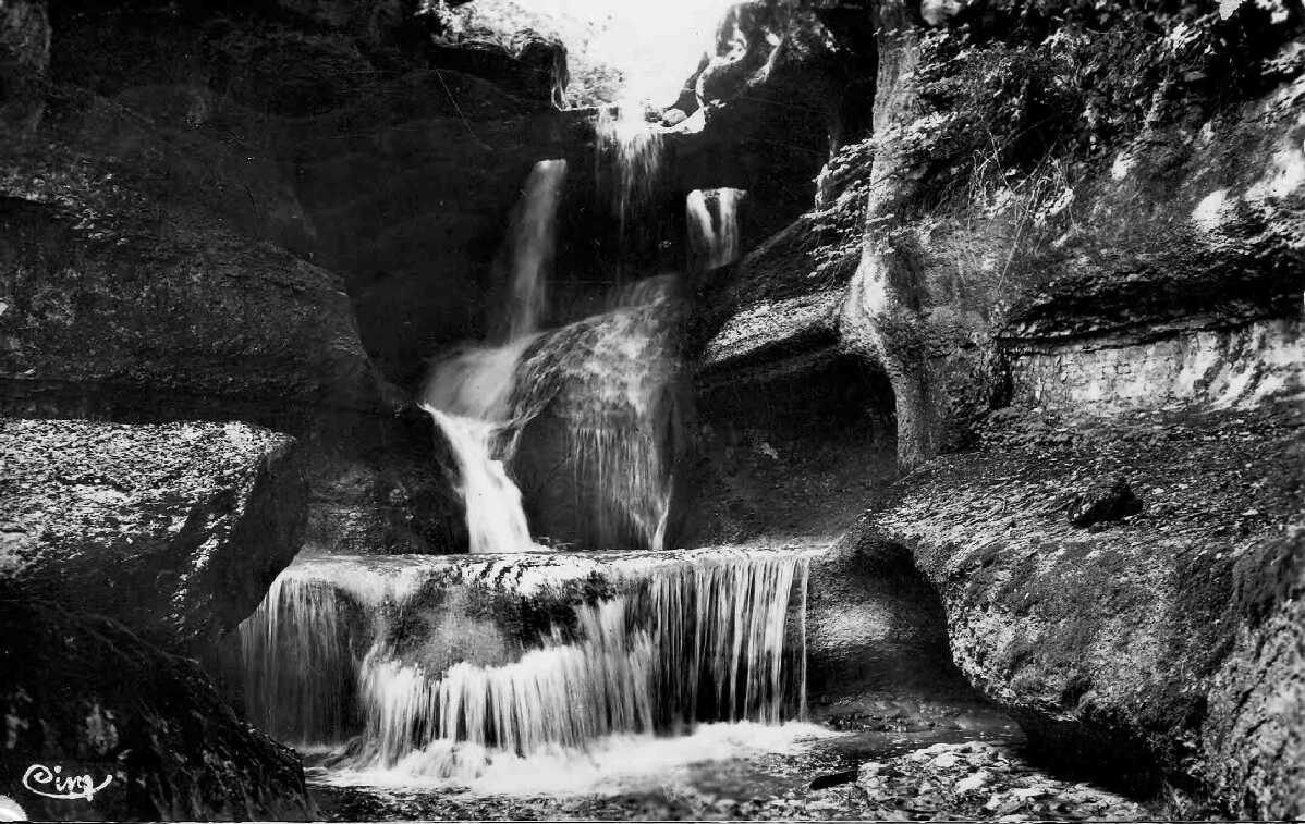
The waterfall is fed by the Brize, a small local river. It flows through a natural limestone cirque and lands on a distinctive cone-shaped mineral formation, from which the site takes its name — "pain de sucre," meaning "sugarloaf." This natural cone stands roughly six metres tall and was built up over thousands of years from calcium carbonate deposited by the Brize's mineral-rich water, a process known as tufa (or travertine) formation. As it falls, the water spreads across crescent-shaped tufa ledges before collecting in a deep, circular natural pool at the base of the formation.
The effect is more dramatic when the Brize carries more water — the best time to visit is spring, or the days following sustained rainfall, when flow is noticeably stronger. In drier summer periods the cascade can look considerably more modest.
How do you get to the waterfall?
Reaching the site requires no serious hiking effort. Coming from Champagne-en-Valromey and heading toward Brénaz, visitors leave their car at a small parking area on the right-hand side of the road. From there, a short path leads down to the waterfall — only about 150 metres long with roughly 20 metres of elevation change. Wooden steps and a metal staircase have been installed along the descent to make the approach to the viewing point beside the water easier and safer.
Is swimming or picnicking allowed on site?
No. Swimming in the pool at the foot of the formation is prohibited, as is picnicking anywhere on the site. These restrictions have been in place since 2015, when the Ain department classified the area as a Sensitive Natural Area (Espace Naturel Sensible) — a status intended to protect the fragile tufa formation and surrounding vegetation from damage caused by heavy visitor traffic.
Frequently asked questions
Where exactly is the Cascade du Pain de Sucre located?
The waterfall lies within the commune of Champagne-en-Valromey in the Ain department, near the hamlet of Poisieu, close to the border with the commune of Arvière-en-Valromey, in the historic Valromey area of the Bugey region.
Why is it called "Pain de Sucre"?
The name comes from the roughly six-metre-tall, cone-shaped mineral formation built from tufa deposits, whose shape resembles a traditional sugarloaf.
How long does it take to walk to the waterfall?
The walk is short: about 150 metres and 20 metres of elevation gain from the parking area, following wooden and metal steps down to the water.
When is the best time to visit?
The cascade is most impressive in spring or after several days of rain, when the Brize river carries more water.
Can you swim there?
No. Swimming and picnicking are both forbidden on site because of its protected status as a Sensitive Natural Area, granted in 2015.
How do you get there by car?
The easiest approach is from Champagne-en-Valromey heading toward Brénaz; a small parking area right beside the road marks the start of the path down to the waterfall.
Nearby places

Earn badges for the places you visit
Download NextOnTrip, discover new places and check off your trails.