About this place
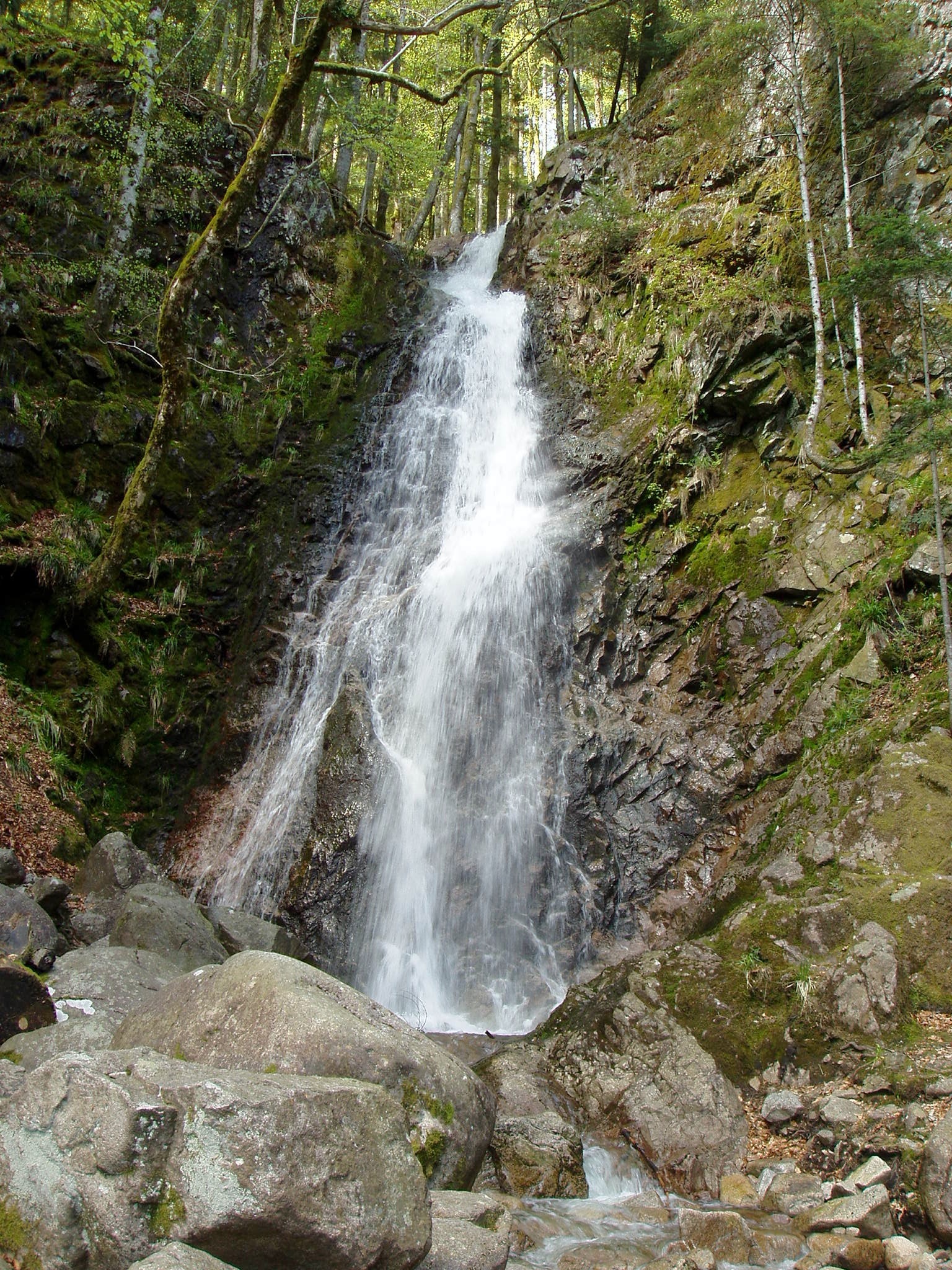
Cascade du Bruscher is a small waterfall in the commune of Ranspach, set in the Thur valley in the Haut-Rhin department of Alsace, France. It sits at an altitude of roughly 690 metres, within the Parc Naturel Régional des Ballons des Vosges, right in the heart of the Vosges mountains. The site is popular mainly with hikers who combine a short walk to the falls with a scenic botanical trail running through mixed deciduous and coniferous woodland.
Where exactly is the waterfall?
The waterfall lies within the commune of Ranspach, a small village in the Thur valley between Cernay and the Grand Ballon, the highest summit of the Vosges. Ranspach serves as a starting point for several marked hiking trails heading into the higher parts of the massif, including routes toward the Markstein pass. The paths in this area are laid out and maintained by the Club Vosgien, the hiking association responsible for waymarking much of the Vosges.
How do you get to the waterfall?
The shortest route begins at the church in Ranspach: head north along Rue du Général de Gaulle and follow the red disc waymarks. Reaching the falls takes about an hour, so allowing for the return by the same path, the round trip adds up to roughly two hours over a distance of about 3.5 kilometres. This shorter option suits families and visitors not looking for a demanding mountain outing.
Those who want to see more can extend the outing by adding the botanical trail. The full loop then covers around 5 kilometres, involves about 450 metres of elevation gain, and takes roughly three hours, rated as moderate in difficulty. A longer option continues on to the Amis de la Nature refuge in the neighbouring commune of Fellering; this loop takes about five and a half hours and includes some 900 metres of elevation gain.
What is there to see along the way?
Besides the waterfall itself, the main attraction is the botanical trail, which winds through mixed forest where broadleaf and evergreen trees grow side by side, giving the landscape a varied character throughout the year. Information panels are placed along the path, describing the tree and shrub species found in the area — in total, close to ninety different species are labelled along the route. The trail also passes a fishing pond, where additional information panels have been set up.
From the trails around the waterfall there are views over the Thur valley and the village of Ranspach itself, which makes the walk worthwhile not only for the cascade but also for the surrounding mountain scenery.
Who is this hike suited for?
The short route to the waterfall is easy and works well for most visitors, including families with children, since it requires no particular hiking experience. The longer options — especially the botanical trail loop or the extension toward Fellering — call for a reasonable level of fitness and proper hiking footwear, given the added elevation gain and distance.
Frequently asked questions
How long does it take to reach Cascade du Bruscher? The one-way walk takes about an hour; returning by the same path brings the round trip to roughly two hours.
Is the trail suitable for children? The short route straight to the waterfall is easy and suitable for families with children. The longer loops are more demanding because of the added elevation gain.
Where is the best place to start the hike? At the church in Ranspach, following Rue du Général de Gaulle northward and then the red disc waymarks set up by the Club Vosgien.
What else is there to see besides the waterfall? A botanical trail with panels describing local tree species, a fishing pond, and viewpoints over the Thur valley and the surrounding Vosges hills.
Where is Ranspach located? In the Haut-Rhin department of Alsace, in the Thur valley, within the Parc Naturel Régional des Ballons des Vosges.
Nearby places

Earn badges for the places you visit
Download NextOnTrip, discover new places and check off your trails.