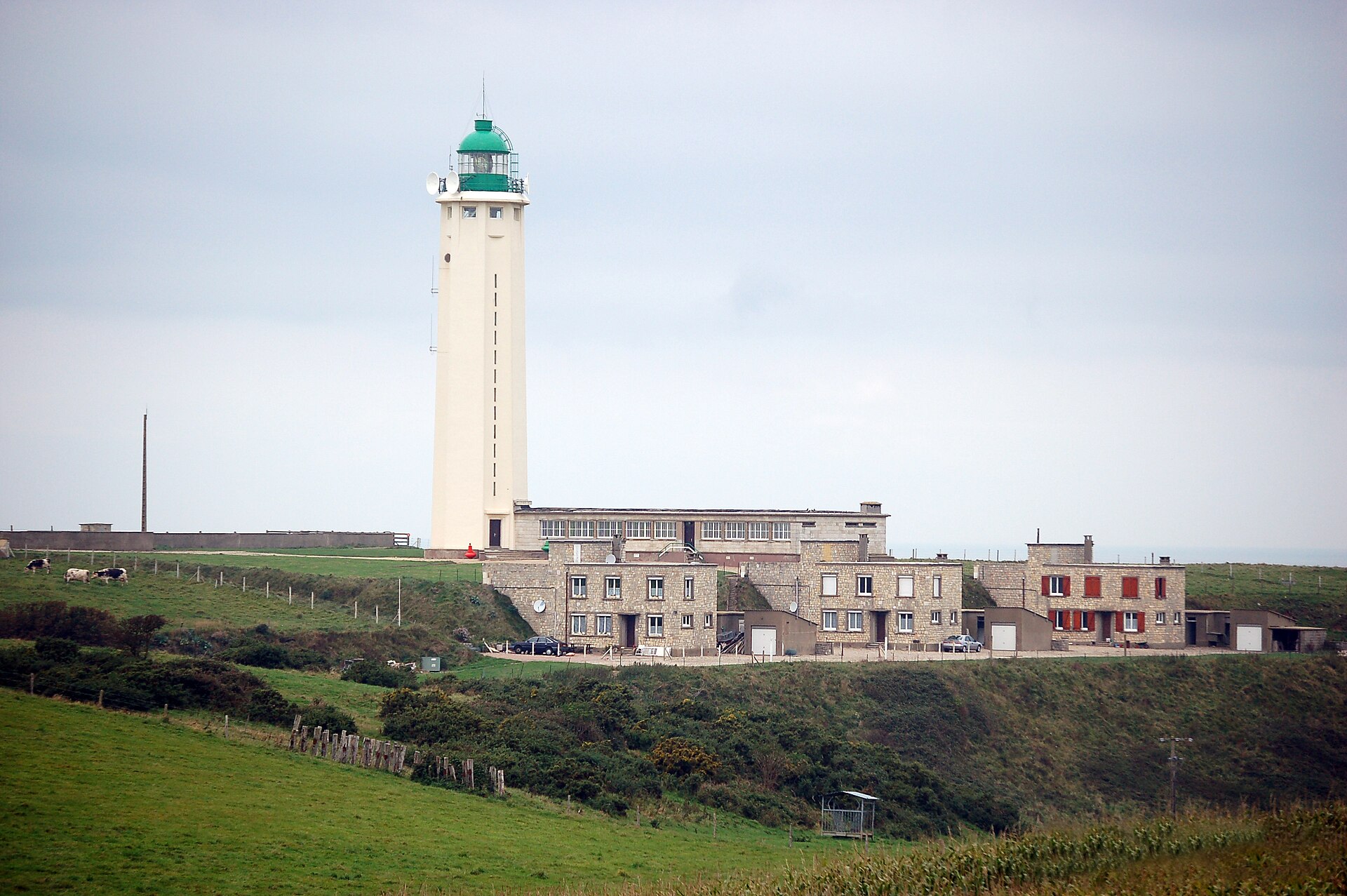
About this place
Cap d'Antifer Lighthouse stands on the cliffs of La Poterie-Cap-d'Antifer, along the Côte d'Albâtre on the English Channel, in the Seine-Maritime department of Normandy. It's a working aid to navigation, guiding ships toward the Port of Le Havre — one of France's largest ports, a short distance south along the coast.
Where is it and why here?
Cap d'Antifer sits at a strategic point for vessels approaching the mouth of the Seine and the port of Le Havre, a stretch of water that has carried heavy shipping traffic for decades, from container ships to tankers heading for oil terminals. A light placed right on the cliff edge is visible far out over the open Channel, well before ships reach the busier approach to the port itself.
The surrounding landscape is classic Côte d'Albâtre: pale chalk cliffs dropping sharply to the sea, running in an unbroken line from Étretat to Le Havre. La Poterie-Cap-d'Antifer itself is a small, quiet commune that sees far fewer visitors than nearby Étretat, which makes it a good choice for anyone looking for the same coastline without the crowds.
How do you get there?
Driving is the easiest way in — from Le Havre it's a trip of a quarter of an hour or so, and even shorter from Étretat. Local roads cross the farmland typical of the Pays de Caux plateau before the terrain starts dropping toward the cliffs. It's worth parking nearby and continuing on foot: the lighthouse compound itself is closed to vehicle traffic, but the coastal paths around it are open to walk.
Walkers and cyclists can also reach the cape via the coastal trail that runs the length of the Côte d'Albâtre, a well-used route linking the seaside towns along this stretch, with the cliffs and the Channel on one side the whole way.
What will you see?
The lighthouse itself is best appreciated from outside and at a distance — it's a working navigation structure, not a museum you walk into. The real draw is the setting around it: sweeping views over the English Channel, the cliff line stretching in both directions, and shipping traffic heading toward Le Havre, with large vessels sometimes clearly visible as they make for the Seine estuary.
It's a spot that resonates especially with anyone interested in maritime history and navigation — watching a working light doing its job for traffic bound for one of Europe's key ports carries some weight, even without going inside.
When should you visit?
Clear-weather days give the best views — spring and summer tend to bring calmer seas and longer daylight, making it easier to take in the cliffs and the passing ships. In autumn and winter the cape is heavily exposed to wind off the Channel, which has its own stark appeal but calls for warmer clothing and care on the cliff-top paths.
It's worth avoiding days with heavy fog, which this coast gets fairly often — the lighthouse itself can be hard to make out then, though that's exactly the condition where its practical purpose becomes obvious.
Frequently asked questions
Can you go inside Cap d'Antifer Lighthouse? No — it's an active navigation aid serving traffic bound for Le Havre, not a tourist site open to visitors. You view it from outside, from the paths along the cliff top.
How far is it from Le Havre? Le Havre lies to the south of the cape, roughly a fifteen- to thirty-minute drive away — which is exactly why the lighthouse was built here: to guide ships into that port.
Is it worth combining with a visit to Étretat? Yes. Étretat sits nearby on the same Côte d'Albâtre and draws far more visitors — Cap d'Antifer makes a quieter counterpoint for anyone who wants the same cliff scenery without the crowds.
Is the light meant to be seen from land or from the sea? Primarily the sea — the lighthouse exists to be visible to ships crossing the Channel and approaching Le Havre. The view from the cliff top on land is really a bonus for visitors, not its main purpose.
Nearby places

Earn badges for the places you visit
Download NextOnTrip, discover new places and check off your trails.