Town in Spain
A guide to 130 Town in Spain — with descriptions, photos and traveler visits from the NextOnTrip community. Locations spread across 111 cities and towns. Most visited by the community: Rello, Castle of Bendinat, L'Albiol.
-
Esperan
el Pont de Suert
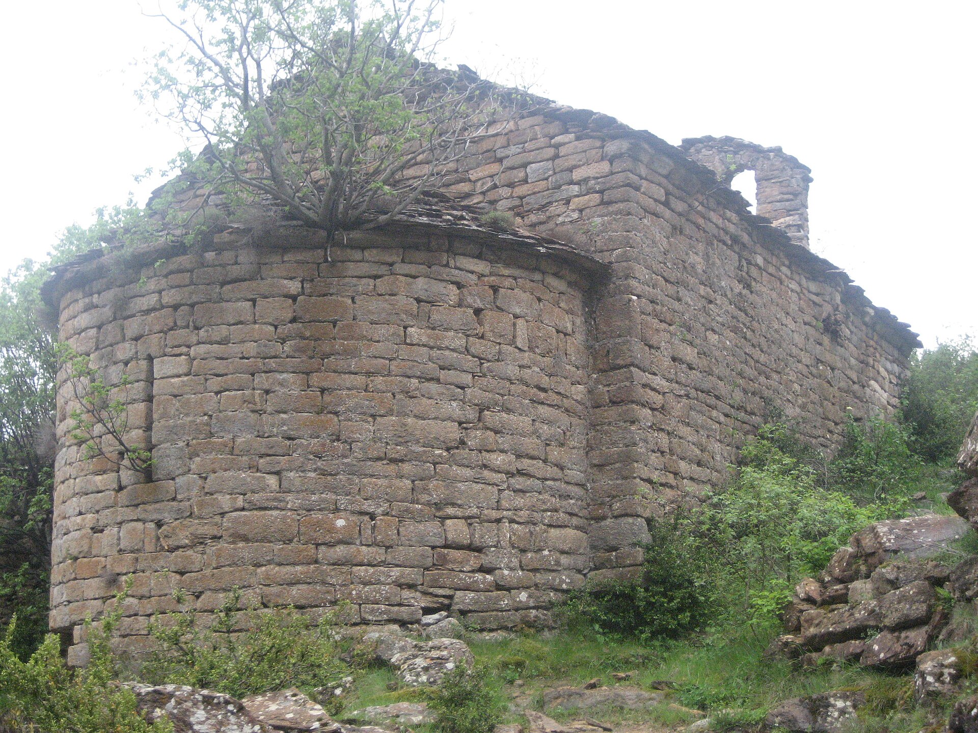
Esperan is a small village belonging to the municipality of el Pont de Suert, in the Catalan comarca of Alta Ribagorça, province of Lleida. Where is Esperan located? Esperan sits in northwestern Catalonia, within Alta Ribagorça — one of the region's most mountainous and sparsely populated comarcas, wedged between Aragón and the French border. Administratively it belongs to the municipality of el Pont de Suert, the comarca's capital and main service hub for the surrounding villages. This is a familiar pattern in this part of the Pyrenees: small hamlets scattered around a larger town that concentrates shops, schools, and transport links. What is the surrounding landscape like? Alta Ribagorça is a high-mountain comarca, shaped by valleys draining from Pyrenean peaks toward the Noguera Ribagorçana river, which for centuries marked the border between Catalonia and Aragón. The scenery is one of steep slopes, conifer and deciduous forests, stone villages set into the terrain, and pastures that generations of local herders have worked. Tourism here revolves around the mountains themselves — hiking, wildlife watching, and quiet, well away from the crowded coastal routes. Why does this region stand out? Alta Ribagorça borders some of the most important attractions in the Catalan Pyrenees. Nearby Vall de Boí holds a group of Romanesque churches inscribed on the UNESCO World Heritage List — one of Europe's best-preserved ensembles of Romanesque architecture, known for its distinctive stone bell towers and frescoes. Part of Aigüestortes i Estany de Sant Maurici National Park, one of the most valuable natural areas in the Pyrenees, also lies within the comarca, famed for its glacial lakes and alpine scenery. As part of the municipality of el Pont de Suert, Esperan sits right at the heart of this mountain region — away from mass tourism, yet surrounded by places that draw mountain lovers from across Europe. When is the best time to visit? Given the comarca's mountainous character, spring, summer, and early autumn are the best times to visit, when trails are accessible and weather favors hiking and sightseeing at the nearby heritage sites. In winter, the high ground of Alta Ribagorça is covered in snow, which shifts the region's appeal toward winter sports but limits access to some hiking routes. Frequently Asked Questions Where exactly is Esperan located? Esperan is a village in the Alta Ribagorça comarca, Lleida province, administratively part of the municipality of el Pont de Suert in northwestern Catalonia. What is the nearest larger town? El Pont de Suert, the capital of the Alta Ribagorça comarca, serves as the main service and transport hub for villages such as Esperan. What is worth seeing in the area? The region is known for the Romanesque churches of Vall de Boí, a UNESCO World Heritage site, and for Aigüestortes i Estany de Sant Maurici National Park, one of the most important natural areas in the Pyrenees. Is this a good destination for mountain lovers? Yes — Alta Ribagorça is a high-mountain comarca with landscapes typical of the Pyrenees, including river valleys, forests, and pastures, making it appealing for those seeking hiking and nature away from crowds.
-
Abejar
Abejar
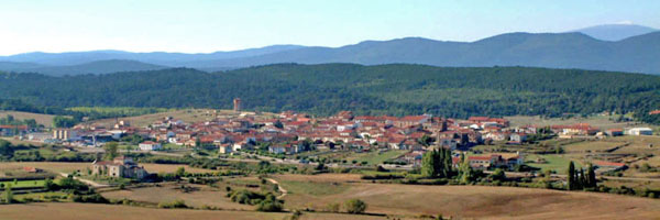
Abejar is a small municipality in Spain's Soria province, in the northeastern part of the autonomous community of Castilla y León. The municipality covers 23.43 km², and its population has been shrinking steadily, from 367 residents in 2011 to 302 in 2018 — a pattern common across much of rural Soria. Where is Abejar located? Abejar sits in the northern half of Soria province, on the high plains typical of this part of the Iberian interior, at an elevation above 900 metres. Its coordinates are roughly 41.81°N, 2.79°W. The surrounding countryside is made up of gentle hills, open fields and scattered woodland — a landscape that turns harsh under the summer sun and cold in winter, but softens into some of its best colours during spring and autumn. How do you get to Abejar? The easiest starting point is the city of Soria, the provincial capital, from which a regional road runs north toward the village. The drive takes under an hour on local roads. Public transport in this part of Castilla y León is limited, and bus schedules can be sparse outside peak season, so travellers without their own car should check current timetables in advance or plan on renting a vehicle in Soria. What is there to see in the village? Abejar isn't a place built around a checklist of sights — it's a destination for travellers who want a genuine, quiet slice of rural Spain. The village itself keeps the look of a traditional Castilian settlement: stone houses, narrow streets and the unhurried pace of a small community. It's a good spot for an aimless walk, a chance to watch everyday village life unfold, and a break from the busier tourist circuits further south. Who is this destination suited for? Given its modest size and limited tourist infrastructure, Abejar works best as a stop along a wider route through Soria province rather than as a standalone day-trip destination. It suits travellers who value a slower pace, quiet surroundings and the open landscapes of central Spain over entertainment options or a wide restaurant scene. When is the best time to visit? The climate here is markedly continental: hot, dry summers and cold winters that can bring snow. The most comfortable months for visiting are spring (April to June) and autumn (September to October), when temperatures are milder and the countryside takes on richer colour. Travellers looking for maximum quiet can also visit outside the summer peak, when regional tourist traffic is at its lowest. Frequently asked questions Is there much to see in Abejar itself? The village doesn't offer a developed tourist itinerary — it's better suited to a short stop, a walk through its streets and a taste of everyday Castilian village life than to a list of must-see sights. How big is the municipality of Abejar? It covers 23.43 km² and has around 300 residents, making it one of the smaller municipalities in Soria province. Is it easy to reach Abejar? Driving from Soria is the most straightforward option; public transport in the area is limited, so having your own vehicle gives you far more flexibility. Should I stay overnight in Abejar or base myself in Soria? Given the village's limited accommodation options, most visitors find it easier to stay in Soria and treat Abejar as part of a day trip through the region.
-
Calzadilla
Calzadilla
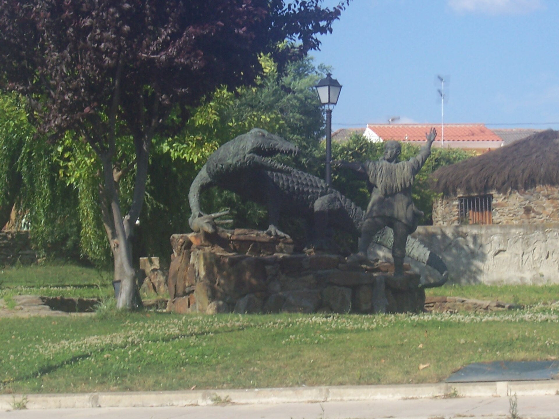
Calzadilla is a small municipality in the province of Cáceres, in the Extremadura region of western Spain, not far from the Portuguese border. Covering just over 76 km² and home to fewer than 500 residents, it is a quiet, rural community typical of the inland Extremaduran countryside. Where is Calzadilla located? The municipality sits in the northwestern part of Cáceres province, within a landscape typical of inland Extremadura: open plains and gentle hills given over largely to grazing land and cropland. The wider region is known for its dehesa — vast tracts dotted with cork and holm oaks that have supported livestock farming, including Spain's famous Iberian pigs, for centuries. This kind of scenery forms the backdrop to most of the countryside around Calzadilla. What is life like in such a small municipality? With a population only slightly above 490, Calzadilla shares the character of many inland Extremaduran towns, where daily life follows the seasons, farm work, and local tradition. It is a place for travelers who want a genuine, unpolished slice of rural Spain, far from mass tourism, where visitors are more likely to meet farmers and residents going about their everyday routines than crowds of tourists. What should visitors know before coming here? Given its modest size, Calzadilla is best visited as part of a longer route through Cáceres province, combined with stops in larger towns that offer more developed tourist infrastructure, accommodation, and dining options. Calzadilla itself works better as a stop along a rural Extremadura itinerary than as a standalone multi-day destination. What is the climate like in this part of Extremadura? The region has a continental Mediterranean climate, with hot, dry summers and cooler, wetter winters. Spring and autumn offer the most comfortable conditions for visiting, with moderate temperatures and, especially in spring, a greener landscape after the winter rains. How do you get to Calzadilla? The municipality lies inland within Cáceres province, and the most practical way to reach it is by car, using the local road network that connects the area to the region's main routes. The larger towns of Extremadura serve as natural gateways for travelers heading further into the province, from where local roads lead on to smaller municipalities such as Calzadilla. Frequently asked questions How big is Calzadilla? The municipality covers just over 76 km² and has a population of fewer than 500, making it one of the smaller administrative units in Cáceres province. What region of Spain is Calzadilla in? It lies in Extremadura, in the province of Cáceres, in western Spain, close to the border with Portugal. Is Calzadilla a good place to visit? It suits travelers looking for an authentic, rural side of Spain rather than conventional tourist attractions, and works best as a stop on a wider regional route. What kind of scenery surrounds the area? The countryside is dominated by typical Extremaduran dehesa — open land scattered with oaks used for grazing — along with farmland and low, rolling hills. When is the best time to visit? Spring and autumn are the most favorable seasons, thanks to milder temperatures, since summers in Extremadura can be very hot and dry.
-
Benicàssim
Benicàssim
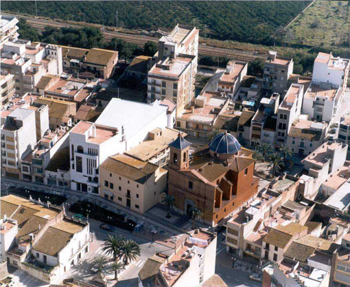
Benicàssim is a coastal town in the province of Castellón, part of the Valencian Community on Spain's Costa del Azahar. Where exactly is Benicàssim? The town sits on the Mediterranean shoreline in the northern stretch of the Valencian Community, within the Plana Alta district. Inland, the Desert de les Palmes mountain range rises behind the town, shielding it from cold northern winds and giving the local climate a noticeably mild character for much of the year. That inland barrier is a big part of why the area draws visitors looking for steady, comfortable weather rather than an exposed coastal climate. Why do travelers know Benicàssim? More than anything, Benicàssim is associated with the Festival Internacional de Benicàssim (FIB), a major summer music festival that pulls in crowds from across Europe every year. Outside the festival dates, though, the town runs on a different rhythm — it operates as a conventional beach resort, with its economy and infrastructure geared toward summer visitors rather than festival crowds alone. What's the town like once the festival crowds leave? Once the FIB dates pass, Benicàssim settles into a quieter resort pace. The proximity of the Desert de les Palmes range means visitors have an inland option beyond the beach — a mountainous backdrop that sets Benicàssim apart from stretches of coast that are flat and purely maritime. That combination of sea on one side and hills on the other is typical of the Plana Alta district as a whole. How is Benicàssim organized administratively? Benicàssim is a municipality within the province of Castellón (Castelló in Catalan/Valencian), one of three provinces making up the Valencian Community. Castellón is the northernmost of the three, and Plana Alta — the district Benicàssim belongs to — is one of its coastal areas. What's nearby and how does the location work for travelers? Sitting on the Costa del Azahar puts Benicàssim within reach of the main routes linking the north of the Valencian Community to the rest of the region. Its position near the larger towns of Castellón province makes it a workable base both for a straightforward beach stay and for short inland trips, with the Desert de les Palmes range as the obvious nearby detour. Frequently Asked Questions Where is Benicàssim located? Benicàssim lies in the province of Castellón, within Spain's Valencian Community, in the Plana Alta district on the Costa del Azahar coastline. What is Benicàssim best known for? It's best known for the Festival Internacional de Benicàssim (FIB), an annual music festival that draws attendees from across Europe; outside that event, it functions as a coastal resort town. Are there mountains near Benicàssim? Yes — the Desert de les Palmes range sits inland from the town, sheltering it from northern winds and giving the area a hilly backdrop beyond the beach itself. Is Benicàssim a large city? No. It's a resort-scale municipality whose character is shaped by seasonal tourism and its festival, rather than by any role as a major urban center in the region.
-
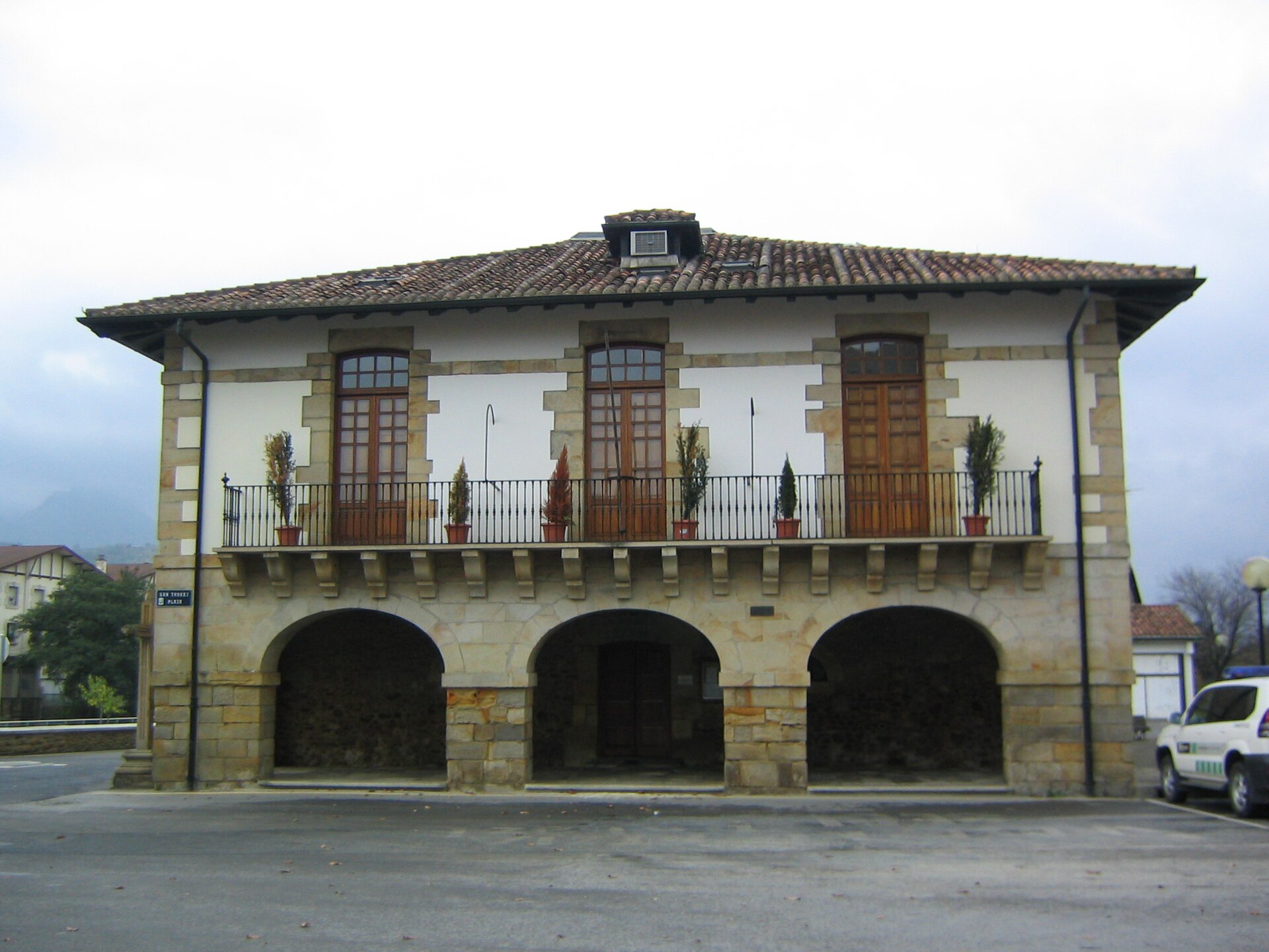
Abadiño elizateko udala
Abadiño
Abadiño is a municipality in Biscay, in the Basque Country, part of the Durangaldea district. Its administrative and historic core is Zelaieta, the neighbourhood where the town hall and parish church stand and where local life has traditionally centred. Where is Abadiño and how is it laid out? The municipality spreads across varied terrain, from the floor of the Arratia river valley up to the slopes bordering the Urkiola range. Rather than one compact town, Abadiño is made up of Zelaieta plus several smaller settlements and scattered farmsteads, a pattern common across this part of Biscay. What are the main sights in Abadiño? The municipality has a notable architectural heritage. Several grand manor houses stand within its boundaries, including Palacio Urbarrena, Palacio Uribarren, Palacio Ibaigoiti and Palacio Traña-Jauregi. In Zelaieta itself stands Palacio Zelatabe, also known as Palacio Galíndez, built in 1913 and now used as a municipal children's facility. A defining feature of the local landscape is the Basque caserío — sturdy farmhouses built from limestone and timber. Abadiño is home to a large number of these, some of them among the most striking examples found anywhere in Biscay. Another notable landmark is the Muntsaratz tower, regarded as one of the most significant defensive towers of its kind in the area. What can visitors see beyond the town centre? Outside the built-up area lies the Sanctuary of San Antonio, set among oak woods and hills that form part of Urkiola Natural Park. In the same mountain range, at the foot of the Anboto massif, stands the Urkiola sanctuary, home to the image of the Virgin of Urkiola, venerated as the patron saint of Biscay and drawing pilgrims from across the wider region. Visitors interested in prehistory can also find several caves within the municipality: Bolinkoba, Oyalkoba (which has yielded Bronze Age finds), Hastakoba and Albiztey. What walking routes are there in Abadiño? The Ruta de los Molinos follows the Arratia river through the municipality, passing small waterfalls and the remains of old water mills that once powered the local economy. A shorter option links Zelaieta with Gaztelua along a path that runs past trenches dug during the Carlist Wars, now maintained as a walking trail. Frequently Asked Questions Where is the administrative centre of Abadiño? The administrative and historic centre is Zelaieta, home to the town hall and the parish church. What are the must-see landmarks in Abadiño? Highlights include the Muntsaratz tower, the manor houses of Urbarrena, Uribarren, Ibaigoiti, Traña-Jauregi and Zelatabe, and the traditional Basque caserío farmhouses scattered across the municipality. Are there caves to visit in Abadiño? Yes, the municipality has several caves — Bolinkoba, Oyalkoba, Hastakoba and Albiztey — some containing finds dating back to the Bronze Age. Which hiking routes are recommended in Abadiño? The Ruta de los Molinos along the Arratia river is the best known, along with a shorter walk between Zelaieta and Gaztelua that follows old Carlist War trenches. What is kept at the Urkiola sanctuary? The sanctuary, located in the Urkiola mountain range near Abadiño, holds the image of the Virgin of Urkiola, honoured as the patron saint of Biscay.
-
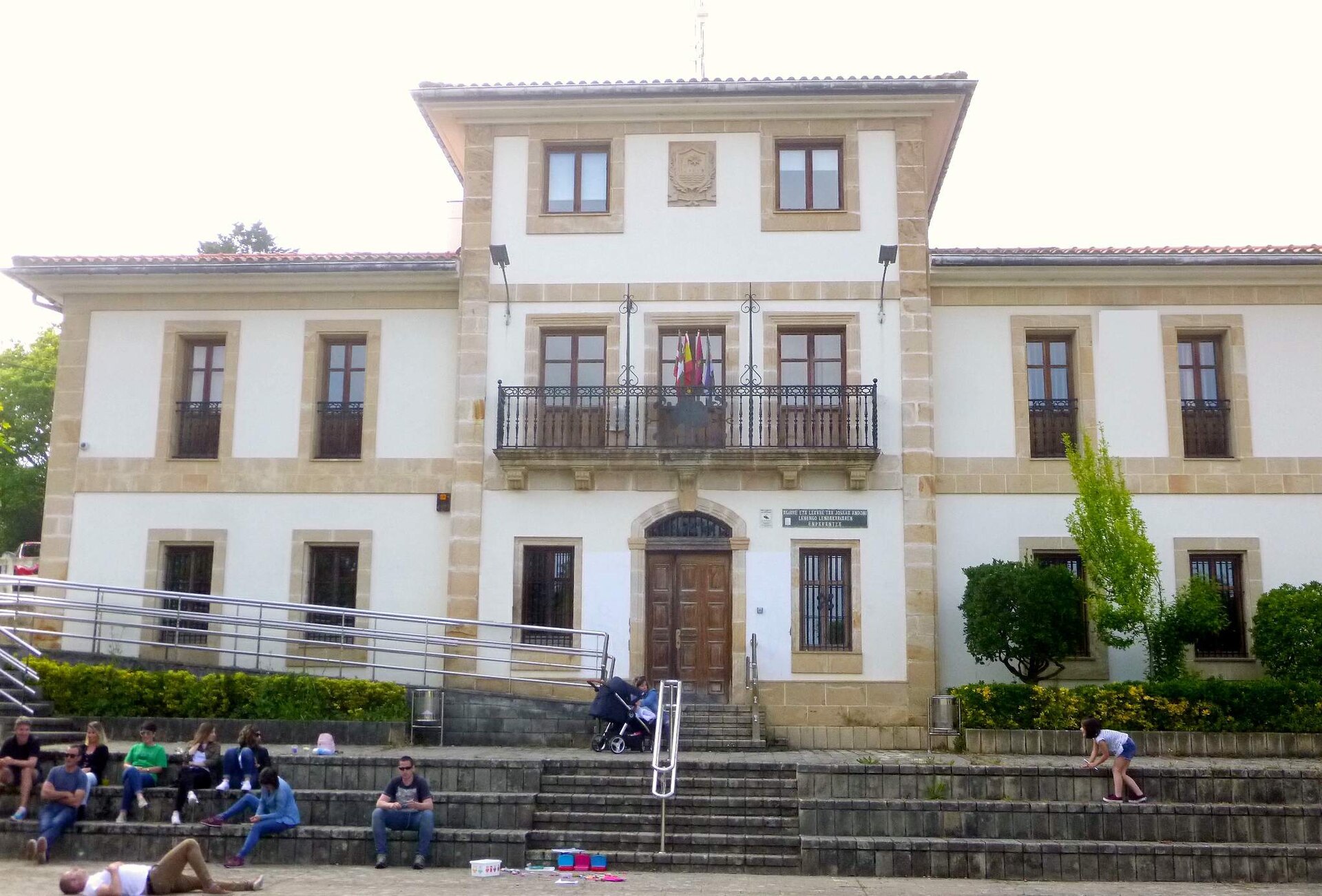
Ayuntamiento de Barrika
Barrika
Barrika is a small coastal municipality in Bizkaia, in the Basque Country, sitting between the towns of Sopela and Plentzia, roughly 25 km from Bilbao. With a population just over 1,500, it punches well above its size on the traveler map thanks to a rugged shoreline of steep cliffs, a wild beach, and a wave that has made it a fixture on the regional surf circuit. What to see and do in Barrika The beach: wild, tide-dependent, and framed by cliffs Barrika's main beach stretches about 600 meters, boxed in by tall cliffs on either side. A staircase cut into the slope is the only practical way down to the sand-and-pebble shore. Timing matters here: the beach is largely swallowed by the incoming tide, so checking tide tables before heading down is not optional if you want dry sand to sit on. Being fully exposed to the open sea, it also tends to draw a livelier swell than more sheltered spots along the coast. A serious surf spot Among Basque surfers, Barrika is a known name. The sandy-and-rocky seabed produces medium-quality waves overall, but the left-hand break stands out for its length and rideability, attracting surfers well beyond the immediate area. Surf schools and surf-camp accommodation have grown up around this reputation, hosting visitors from across Europe who come specifically to ride this stretch of coast. Cliffs and the Basque Coast Geopark The cliffs framing Barrika belong to the Basque Coast Geopark, a UNESCO-recognized site. Exposed in the rock face are layers laid down tens of millions of years ago — a visible cross-section of geological time that requires no visitor center to appreciate, just a walk along the shore. A coastal trail linking Getxo and Armintza runs through this stretch, letting hikers study the rock formations up close without having to descend all the way to the beach itself. Neighboring beaches: Meñakoz and Muriola Barrika sits alongside two other wild beaches, Meñakoz and Muriola, each with its own character but sharing the same undeveloped, cliff-backed setting. Together the three beaches form roughly 6 kilometers of coastline that rewards both surfers chasing waves and walkers after a long, scenic stretch of undeveloped shore. Beyond surfing: diving and paragliding The same steep cliffs that define the coastline also draw divers and paragliders — the terrain offers a natural launch point for flying straight out over the water. That combination of mountain-edge cliffs meeting open sea in a single location is one of the traits that sets this part of the Bizkaia coast apart. Frequently Asked Questions Is Barrika's beach safe for swimming? It calls for caution — the beach faces the open sea and largely disappears at high tide. Check sea conditions and tide times before going in, especially with children. Is Barrika a good place to learn to surf? Yes, several surf schools operate locally, and the left-hand wave is considered one of the better breaks in the region. Conditions can shift quickly, so beginners are better off going with an instructor. How far is Barrika from Bilbao? The town is about 25 km from Bilbao, roughly a half-hour drive along the coast. What else is there to do besides going to the beach? Walk a section of the Getxo-Armintza cliff trail, take in the rock formations of the Basque Coast Geopark, and check out the neighboring beaches of Meñakoz and Muriola.
-
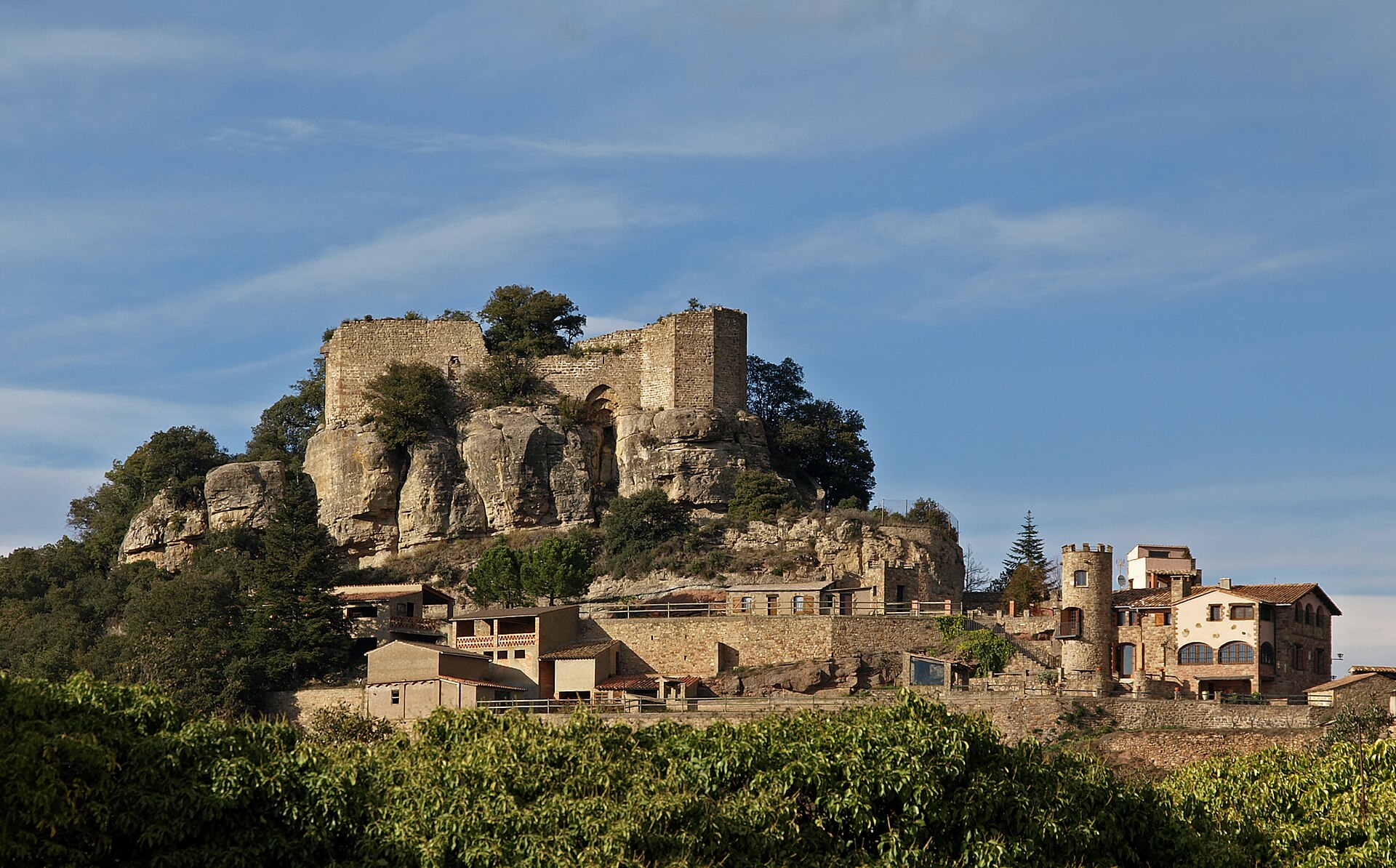
Granera
Granera
Granera is a small municipality in the province of Barcelona, Catalonia, located in the comarca of Moianès (it belonged to the comarca of Vallès Oriental until 24 May 2015). It is one of the smaller administrative units in the region — in 2011 it counted just 83 inhabitants across an area of 23.86 km². That modest scale keeps Granera quiet and largely rural, appealing to travelers who want to experience the Catalan countryside away from the main tourist routes. Where is Granera located? The municipality sits in northeastern Catalonia, in the province of Barcelona, within the Moianès comarca — a region known for its rolling, agricultural landscape between the larger urban centers of central Catalonia. Granera's coordinates are roughly 41.73°N, 2.06°E, placing it in the belt of hills that separates Barcelona from the interior of the country. How to get to Granera? Given its small size, the most practical way to reach Granera is by car — the municipality does not have the kind of transport infrastructure typically found in larger towns of this scale in Catalonia. Most visits start from Barcelona or from the bigger towns of the Moianès comarca, from where local roads lead into the rural heart of the region. It is worth planning the route in advance, since public transport in this part of Catalonia is limited and schedules can vary by day of the week. What should you know before visiting? Granera has a distinctly rural character — its small population and modest surface area (23.86 km²) mean visitors will not find the developed tourist infrastructure typical of larger resorts. That is precisely the appeal for those seeking an authentic, unhurried corner of Catalonia, but it also calls for some preparation: bring your own transport, stock up on supplies in bigger towns along the way, and do not expect an extensive local accommodation offer. When is the best time to visit? Like most of central Catalonia, the Moianès region has a Mediterranean climate with continental influences, meaning warmer summers and generally mild winters. For anyone planning to explore the surrounding countryside, spring and autumn are the best choices, offering moderate temperatures and the greenest look of the rural landscape. Frequently asked questions Which province and comarca does Granera belong to? Granera is located in the province of Barcelona, in the Moianès comarca. Until 24 May 2015 it was administratively part of the Vallès Oriental comarca. How big is Granera? The municipality covers 23.86 km² and had 83 inhabitants in 2011 — making it one of the least populated municipalities in the region. Does Granera have developed tourist infrastructure? No, given its small scale, tourist infrastructure is limited. It suits travelers looking for a quiet, authentic taste of rural Catalonia rather than a full range of visitor services. What is the best way to travel to Granera? The most convenient option is to drive from Barcelona or from the larger towns of the Moianès comarca, since local public transport is limited.
-
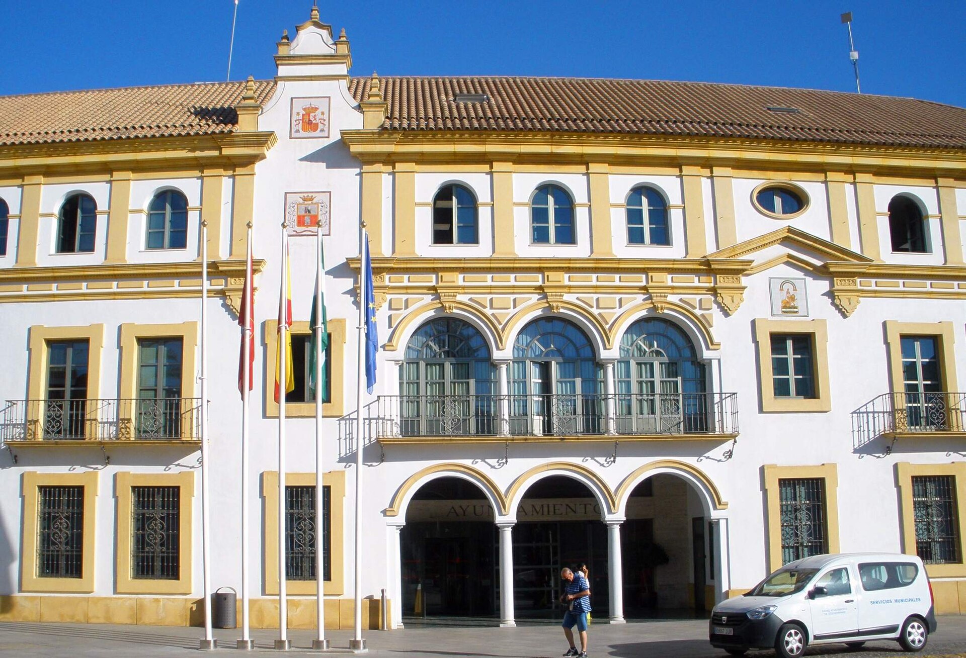
Dos Hermanas
Dos Hermanas
Dos Hermanas Dos Hermanas is a city in Andalusia, in the province of Seville, sitting roughly 15 km south of the regional capital. With a population above 140,000, it ranks as the second-largest municipality in the province of Seville and one of the larger cities in Andalusia overall — yet it lives somewhat in the shadow of its famous neighbor, often treated as a stopover on the way to Seville rather than a destination in its own right, despite having a distinct character and history. How do you get to Dos Hermanas? Its closeness to Seville makes access straightforward. From central Seville, a car ride along the A-4 or SE-30 takes about fifteen minutes. The Cercanías regional train also connects Dos Hermanas with downtown Seville and San Pablo Airport, with journeys typically lasting 15 to 20 minutes. Local buses run as well, making the city a practical base for travelers who want to skip Seville's higher accommodation prices while still keeping quick access to its main sights. What is there to see in the city itself? Dos Hermanas isn't a classic sightseeing checklist destination — it's a city that runs on its own rhythm, with Andalusian character visible in its central architecture, local squares, and traditional tapas bars. A walk through the old town reveals churches and buildings carrying traces of the region's centuries-long history. The city also has a notable reputation in the chess world: it has hosted international chess tournaments featuring some of the world's top players for years, drawing enthusiasts of the game from across Europe. One notable biographical fact is that Felipe González Márquez, Spain's long-serving prime minister and one of the most significant figures in Spanish politics of the late 20th century, was born in Dos Hermanas. That gives the city a certain historical weight, even though it doesn't have an extensive museum infrastructure dedicated to him. When is the best time to visit? Andalusia's climate means hot summers, so spring (March–May) and autumn (September–November) are the best windows for a visit, offering pleasant temperatures and long daylight hours. Summer can be brutally hot, with temperatures regularly topping 35°C, which makes midday sightseeing uncomfortable. Winter is mild but comes with shorter days and cooler evenings that limit outdoor activity time. If your trip is tied to a chess event, it's worth checking the tournament calendar ahead of time, since dates are set on a year-by-year basis. What else should you know? In practice, Dos Hermanas functions as part of the greater Seville metropolitan area, sharing transport links and cultural influence with the city. That makes it easy to combine a stay here with a day trip into central Seville — the cathedral, the Alcázar, or the Triana district — while returning to a quieter, less touristy base for the night. Local food follows classic Andalusian tradition: gazpacho, jamón, and fresh fish and seafood sourced from the nearby coast. Frequently asked questions Is Dos Hermanas a good base for visiting Seville? Yes. Thanks to its proximity and solid rail and road connections, many travelers choose Dos Hermanas as a more affordable lodging alternative to staying in central Seville. How long does it take to reach central Seville from Dos Hermanas? By car or regional train, the trip usually takes 15 to 20 minutes, depending on the time of day and traffic conditions. What is the city best known for? Beyond its typical Andalusian atmosphere, Dos Hermanas is mainly known for hosting international chess tournaments and as the birthplace of Felipe González. Does Dos Hermanas have easy airport access? Yes. Seville-San Pablo Airport is nearby and well connected to the city, which makes flight logistics easy to plan around.
-
L'Albiol
l'Albiol
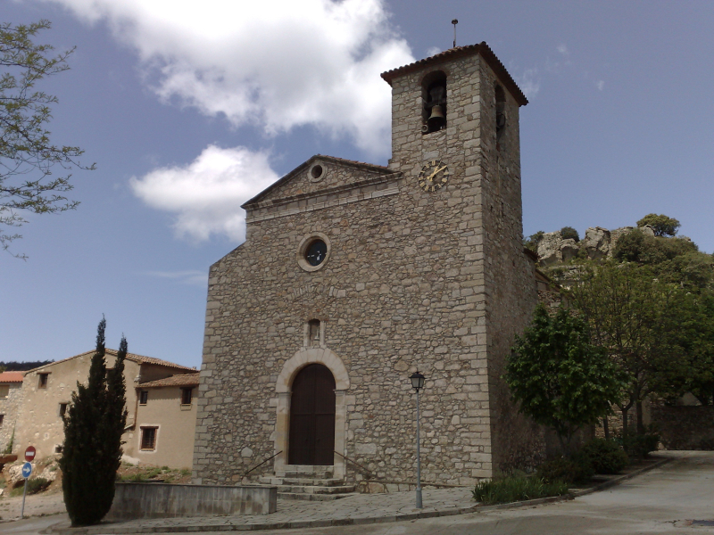
L'Albiol is a small municipality in Spain, located in Catalonia, in the province of Tarragona. Administratively it belongs to the comarca of Baix Camp and covers an area of 20.38 km². According to 2011 data, it had 459 inhabitants, making it one of the less populated municipalities in the region. Where is L'Albiol located? The municipality lies in the province of Tarragona, in eastern Catalonia, within the comarca of Baix Camp, whose capital is Reus. L'Albiol's geographic coordinates are 41.251823, 1.089617 — placing it inland, away from the Costa Daurada coastline. This inland position gives the area a distinctly rural character, quite different from the coastal resorts elsewhere in the province of Tarragona. How do you get to L'Albiol? Reus, the capital of the Baix Camp comarca, is the natural reference point for reaching L'Albiol, with local roads connecting the city to smaller inland municipalities in the region. Reus has its own airport and rail connections to Barcelona and Tarragona, making it a convenient starting point for anyone planning a visit to the surrounding villages. Travelling by car is in practice the most convenient way to reach a municipality of this size, since public transport to smaller settlements in inland Catalonia can be limited. What should you know about L'Albiol? L'Albiol's small population and modest land area reflect a settlement pattern typical of the Baix Camp comarca, a region where a handful of larger towns like Reus coexist with numerous small rural municipalities. With fewer than 500 residents spread across just over 20 km², L'Albiol shows the scattered, low-density character common to inland Catalan villages, in contrast to the busier tourist areas closer to the coast. Who is L'Albiol for? Given its rural setting inland from Tarragona province, L'Albiol suits travellers looking for quiet away from Catalonia's main tourist routes, and who see a visit as a stop on the way through the Baix Camp countryside rather than a destination with developed tourist infrastructure. It fits visitors who value inland calm over the attractions typical of coastal resorts. Frequently asked questions Which province and region is L'Albiol in? L'Albiol is located in the province of Tarragona, in Catalonia, within the comarca of Baix Camp. How many people live in L'Albiol? According to 2011 data, the municipality had 459 inhabitants. What is the size of the municipality? L'Albiol covers an area of 20.38 km². What is the nearest larger city? Reus is the capital of the Baix Camp comarca where L'Albiol is located, and the most practical base for planning a visit further into the region.
-
Rello
Rello
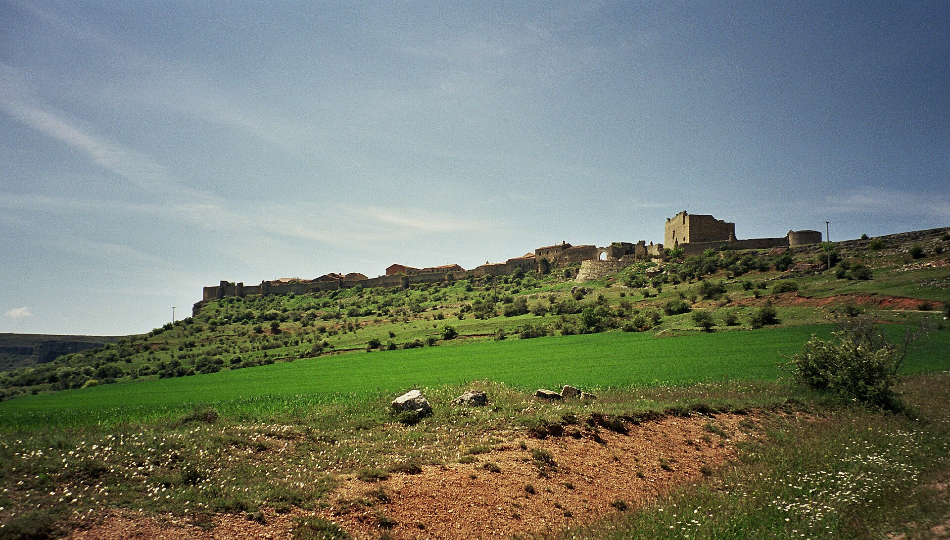
Rello is a small municipality in the province of Soria, in the region of Castile and León, in northeastern Spain. It covers an area of 24.39 km² and is home to only a few dozen residents, making it one of the least populated municipalities in this part of the country. Where is Rello located? Rello sits on the high inland plateau of Castile and León, within the province of Soria, at roughly 41.33°N, 2.75°W. This is deep interior Spain, far from the coast and major cities, characterized by wide open landscapes and very low population density — part of what is sometimes called "emptied Spain" (España vaciada). How do you get to Rello? Since Rello is located in Soria province, the city of Soria itself is the natural gateway for exploring the surrounding countryside. Given the village's tiny population and remote setting, driving is by far the most practical way to arrive — public transport links to small rural municipalities in this area are limited and infrequent. It's worth checking current bus schedules in advance or simply renting a car in Soria for full flexibility. What can you expect to see around Rello? Like many municipalities of similar size in Soria province, Rello is a destination for travelers seeking quiet and open countryside rather than crowded landmarks. The low population means an unhurried, authentic rhythm of rural life, with none of the crowds found in larger tourist centers. The surrounding area of Soria province is known for its expansive, sparsely populated highland scenery, which appeals to hikers, landscape photographers, and slow-travel visitors who prioritize genuine local atmosphere over packed itineraries. When is the best time to visit Rello? The interior of Castile and León has a continental climate, with hot summers and cold, sometimes harsh winters typical of Spain's high inland plateaus. Spring (April–June) and autumn (September–October) offer the most comfortable conditions for exploring, with moderate temperatures and richer landscape colors. Summers can be quite hot, while winters bring cold spells and occasional frost, both worth factoring into any trip through Soria's rural interior. Frequently asked questions Which province is Rello in? Rello belongs administratively to the province of Soria, in the region of Castile and León. How big is the municipality of Rello? The municipality covers an area of 24.39 km². Is Rello densely populated? No — it is one of the smaller municipalities in the region by population, with only a few dozen residents, which is typical of many rural areas in Soria province. What's the best way to reach Rello? Because public transport is limited, driving — ideally with a car rented in Soria or another larger regional city — is the most practical option.
-

Caldes de Boí
la Vall de Boí
Caldes de Boí is a small settlement belonging to the municipality of La Vall de Boí, in the Alta Ribagorça comarca, Lleida province, Catalonia, Spain. Its name gives away its character: "caldes" is the Catalan word for warm mineral waters, and it is precisely this connection to natural hot springs that has shaped the place for generations. Where exactly is Caldes de Boí located? The settlement sits deep in the Catalan Pyrenees, in the northwestern corner of Catalonia, within the administrative boundaries of La Vall de Boí. Its coordinates (roughly 42.56°N, 0.84°E) place it in a mountain valley typical of this part of Lleida province, marked by steep slopes, streams fed by higher peaks, and the kind of stone-built hamlets scattered across the valley floor that define Pyrenean settlement patterns. The municipality's own name, Vall de Boí, simply means "the valley of Boí," which sums up the geography of the wider area the village belongs to. Why is this place associated with thermal waters? Several villages scattered across the Pyrenees owe their identity to naturally occurring mineral and thermal springs, and Caldes de Boí is one of them. Water rising from deep within the mountain massif has long drawn visitors looking for rest and recovery, and in many Pyrenean valleys this gave rise to a lasting tradition of spa tourism. In Caldes de Boí's case, it was exactly this presence of warm springs that set the settlement apart from the other hamlets within the same municipality. What is the administrative structure around the village? Caldes de Boí falls under the municipality of La Vall de Boí, which brings together several settlements spread across the valley. The whole area lies within the Alta Ribagorça comarca, one of Catalonia's smaller and more mountainous administrative units, bordering other Pyrenean comarcas of Lleida province. This pattern is common in the region: small villages, often separated by several kilometres of mountain roads, are administered jointly as a single municipality covering the entire valley. What should visitors know before heading to the area? Caldes de Boí lies at the heart of the Pyrenees, surrounded by the steep slopes, high-altitude meadows and mountain streams typical of the region. Being part of La Vall de Boí municipality, it makes a natural base for exploring the other settlements dotted along the same valley. Given the mountainous terrain, travel to and around the village should account for weather conditions, particularly in winter, when the upper reaches of the valley can see significant snowfall. Frequently asked questions Which province is Caldes de Boí in? It lies in Lleida province, Catalonia, Spain. Which municipality does Caldes de Boí belong to? It is part of the municipality of La Vall de Boí. Which comarca is the village located in? Caldes de Boí sits within the Alta Ribagorça comarca. What makes this village stand out from others in the valley? Above all, its natural thermal springs, which have long given it a distinct identity compared with neighbouring settlements in the same municipality.
-
La Torresaviñán
Torremocha del Campo
La Torresaviñán is a small locality (a pedanía, or dependent settlement) that forms part of the municipality of Torremocha del Campo, in the province of Guadalajara, Castile-La Mancha. It sits on a low hill in the quiet farmland of the Alcarria area, in northeastern Guadalajara, with views over the surrounding fields and the road heading toward Madrid. Where is it and how do you get there? Torresaviñán lies right next to Torremocha del Campo, the main village of the municipality it has belonged to since 1970. In that year, the once-independent municipality of Torresaviñán was merged, along with the neighbouring villages of Navalpotro, Laranueva, La Fuensaviñán, Renales and Torrecuadrada de los Valles, into a single enlarged municipality centred on Torremocha del Campo. The settlement's hilltop position was originally chosen for defensive reasons, and it still offers a clear view over the fields and the highway that runs toward the Spanish capital. Where does the name come from? The village takes its name from a castle built in the 12th century by Manrique de Lara, lord of Molina, who controlled these lands at the time. The fortress was raised on what was known as the "field of Saviñán," at the very edge of his domain, to guard the frontier of territory that had recently been taken from the Muslim taifa kingdom of Molina. Builders reused an existing Arab watchtower as the foundation for the new stronghold, which sped up construction considerably. During the same century, Manrique de Lara brought in settlers from his own family lands in Alfoz de Lara, in the province of Burgos, repopulating this contested border region. A church dedicated to Saint John — locally known as San Illán — was later built beside the castle, and the growing settlement came to be called Torre San Illán. Over time, the name gradually shifted into its present form, Torresaviñán. What can visitors see today? The most notable surviving structure is the castle's keep, a tower roughly 15 metres tall that remains standing as the clearest trace of the old fortress. Ownership of the castle passed through several hands over the centuries: it belonged at one point to the bishopric of Sigüenza, and for a period it was held by the Infante Don Juan Manuel, one of medieval Castile's best-known noblemen and writers. The building suffered serious damage in 1710, during the War of the Spanish Succession, when retreating Habsburg troops fired on its walls and tower — an event that permanently altered its appearance. The area around Torresaviñán also holds archaeological interest. Near Renales and a site known as La Cabezada, Celtiberian cremation cemeteries dating to the Second Iron Age have been identified, pointing to settlement here well before Roman times. When is the best time to visit? Given its quiet, rural character, spring and early autumn are the most pleasant times to visit, when temperatures on the Guadalajara plateau are mild and the hillside setting of the old castle ruins is at its most scenic. Torresaviñán makes a worthwhile stop when exploring Torremocha del Campo and the string of small villages that now share its municipal boundary. Frequently Asked Questions What is La Torresaviñán? It is a small locality (pedanía) within the municipality of Torremocha del Campo, in Guadalajara province, formerly an independent municipality that was absorbed into Torremocha del Campo in 1970. Where does the name Torresaviñán come from? It derives from a 12th-century castle built by Manrique de Lara on the "field of Saviñán," combined with the name of the church of San Illán, which together gave rise to "Torre San Illán" and later "Torresaviñán." What remains of the castle? Mainly its keep, a tower about 15 metres high, which was heavily damaged in 1710 during the War of the Spanish Succession. Who owned the castle historically? It belonged to the bishopric of Sigüenza and, for a time, to the Infante Don Juan Manuel.
-
Cadiñanos
Trespaderne
Cadiñanos is a small village administered as a pedanía of the municipality of Trespaderne, in the province of Burgos, in the Castile and León region of Spain. Where is Cadiñanos? The village sits in the westernmost stretch of the Tobalina valley, on the banks of the Jerea river, at an elevation of roughly 576 meters. It lies about 80 kilometers from Burgos, the provincial capital, within the historic Las Merindades area and the Villarcayo judicial district. Drivers coming from Bilbao typically take the BU-550 through the Angulo pass, while those coming from Burgos head toward Briviesca and then through Oña to reach Trespaderne. What can you see there? The village's main religious landmark is the Church of San Pelayo, which holds a painted altarpiece dating to the early 16th century. Together with the surrounding vernacular houses, the church was declared a Bien de Interés Cultural, a Spanish heritage-protection category, on December 19, 1991. Just as notable is the Palacio de las Torres, a Renaissance manor built in the second third of the 16th century for the Medina Rosales family. The original design followed a square layout around a central courtyard, with a tower at each corner, and the facade carried an elaborate Plateresque décor — some details echo the workshop style associated with Diego de Siloé, one of the leading architects of the Spanish Renaissance. Like the church, the palace received heritage protection on the same day in 1991. Only one wing and two of the four original towers still stand today, but the ruin remains one of the most striking sights in the valley. What is village life like today? Spain's national statistics institute, the INE, recorded 46 permanent residents in Cadiñanos in 2025, down from 56 in 2010, with a brief rebound to 54 in 2020. Farming remains the backbone of the local economy, and the population swells noticeably in summer and on weekends as families with roots in the village return to their houses. Cadiñanos itself is thought to date back to the 10th century, making it one of the older settlements in the Tobalina valley. When to visit? The village calendar revolves around two dates: June 26, the feast of its patron saint, San Pelayo, and the last weekend of July, when the main annual festivities take place — both are good moments to see Cadiñanos at its liveliest. Travelers after a quieter visit should aim for spring or early autumn instead. Nearby, within Trespaderne itself, the San Pedro hermitage and the Cueva de los Portugueses cave are worth a stop, and the El Peñón waterfall lies a short drive away in Pedrosa de Tobalina. Frequently asked questions Where exactly is Cadiñanos located? It sits in the western part of the Tobalina valley, on the Jerea river, within the municipality of Trespaderne, Burgos province, about 80 km from the provincial capital. What is the most important landmark in Cadiñanos? Besides the Church of San Pelayo with its 16th-century altarpiece, the standout site is the Palacio de las Torres, a Renaissance manor of the Medina Rosales family, now partly in ruins. How many people live in Cadiñanos? The INE recorded 46 permanent residents in 2025, though the number rises in summer and on weekends. When is the best time to visit? Come for the patron saint's feast on June 26 or the festivities during the last weekend of July; for a quieter trip, choose spring or early autumn.
-
Hoz de Valdivielso
Merindad de Valdivielso
Hoz de Valdivielso is a small village in the municipality of Merindad de Valdivielso, in the province of Burgos, Castile and León, Spain. It sits in the heart of the Valdivielso Valley, part of the Las Merindades region in the north of the province, where the Ebro River cuts between the hills to form one of the area's most distinctive landscapes. Where is Hoz de Valdivielso? The village lies at the foot of the Sierra de la Tesla, right at the mouth of a narrow rocky gorge that leads toward the neighboring village of Tártales de los Montes. That gorge — "hoz" in Spanish — gives the settlement its name. The Valdivielso Valley, followed by the Ebro, is one of the most scenic corners of Las Merindades and includes several other small villages belonging to the same municipality, among them Quecedo, the administrative seat, along with Puente Arenas and Panizares. How did the village come about? Settlement in the Valdivielso Valley is closely tied to religious institutions. Hermits are recorded living in the area as early as the 9th century, and monks from the nearby monastery of San Pedro de Tejada later established parishes and organized small farming communities, helping the valley become permanently populated. By the 13th century, much of the valley had come under the authority of the powerful monastery of San Salvador de Oña, which shaped land ownership in the area for centuries. A trace of this older administrative order survives in the 1787 census commissioned by the Count of Floridablanca, where the settlement appears as "Lugar llamado La Hoz," holding royal jurisdiction (realengo) and its own local magistrate, as part of one of the districts making up the historic Merindad de Valdivielso. Once that old administrative system was dismantled in the 19th century, the village became part of the new constitutional municipality of Valdivielso, within the judicial district of Villarcayo. What can you see there? Hoz de Valdivielso today is a quiet, small village, but it still holds a few notable traces of its past. The Palacio de los Ruiz de Valdivielso is built in the Herrerian style, the austere, geometric architectural tradition associated with Spanish noble residences of the late 16th and early 17th centuries. Another point of interest is the parish church dedicated to Saints Cornelius and Cyprian, whose origins go back to the Middle Ages, though its current form largely reflects rebuilding carried out in the 15th and 16th centuries. The village itself also preserves traditional stone houses typical of the Las Merindades region. Why is the village so small today? Like many settlements in the mountain valleys of northern Spain, Hoz de Valdivielso went through a sharp population decline in the second half of the 20th century. During the 1960s and 1970s, younger generations left in large numbers for the industrial cities of the Basque Country in search of work, leaving behind a small, aging population. By the mid-2000s, only a handful of people still lived there year-round. When is the best time to visit? Given the valley's mountainous setting, spring and summer are the best times to visit, when the weather favors walking along the gorge and the surrounding hills, and the Ebro valley is at its greenest. Autumn can be just as rewarding visually, and appeals especially to visitors who prefer quieter surroundings with fewer tourists around. Frequently Asked Questions Where exactly is Hoz de Valdivielso located? In the municipality of Merindad de Valdivielso, Burgos province, in the Las Merindades region of northern Castile and León. Where does the village's name come from? From "hoz," the Spanish word for a narrow rocky gorge, at the mouth of which the village sits. What is there to see in the village? The Herrerian-style Palacio de los Ruiz de Valdivielso and the parish church of Saints Cornelius and Cyprian, of medieval origin and rebuilt in the 15th-16th centuries. Does anyone still live in Hoz de Valdivielso? Yes, but very few — after mass emigration in the 1960s and 70s, the permanent population fell to only a handful of residents.
-
Bóveda
Bóveda
Bóveda is a small municipality in the province of Lugo, in Spain's Galicia region, part of the Terra de Lemos comarca. It has a population of under 1,700, scattered across a number of villages and parishes in the hills above the Cabe river valley, a few kilometres north of Monforte de Lemos, the comarca's main town. Where is Bóveda, and how do you get there? The municipality sits well inland, roughly halfway between the cities of Lugo and Ourense, in the rolling countryside typical of interior Galicia. Driving is the easiest option: it's under an hour south of Lugo, a similar distance north of Ourense, and barely fifteen minutes from Monforte de Lemos itself. Bóveda also has its own railway station on the line connecting Lugo with the south of Galicia, so a regional train with a change at Monforte is a workable alternative. Travellers without a car are generally better off basing themselves in Monforte, which has local bus links to the surrounding municipalities. What's the wider area like? Terra de Lemos is one of Galicia's historic comarcas, known for its fertile valleys, orchards and vineyards. It borders the area collectively known as Ribeira Sacra, where the Sil and Miño rivers have carved deep canyons lined with terraced vineyards. Bóveda itself sits away from the main tourist routes through the region, which makes it a quiet base for travellers after an unhurried, less-visited side of Galicia — stone hamlets, traditional raised granaries called hórreos, and small chapels tucked into the hillsides, rather than crowds. What is there to see in and around Bóveda? The municipality itself is mostly scattered hill villages, pasture and oak-and-chestnut woodland — best explored slowly, on foot or by car, stopping at roadside chapels and viewpoints over the valley. Monforte de Lemos is a short drive away and worth the detour: its skyline is marked by the keep of the old castle (Torre del Homenaje) and by the large monastic complex of the Colegio de Nuestra Señora de la Antigua, sometimes nicknamed Galicia's own Escorial. Monforte also makes the most convenient starting point for trips further into the Ribeira Sacra canyons and its wine country. When is the best time to visit? Inland Galicia has a milder but still damp climate compared with the coast. Late spring (May–June) and early autumn (September–October) are the most comfortable seasons, with moderate temperatures and the hillsides turning colour. Summers can get hot and dry by Galician standards, while winters bring frequent fog and cold, wet days — better suited to a quiet stay than long hikes. Frequently asked questions Is there much to see in Bóveda itself? The municipality is mainly rural — scattered villages and countryside. The bigger sights, like the castle and monastery, are a short drive away in Monforte de Lemos. What's the best way to get there without a car? Take a train or bus to Monforte de Lemos, then continue to Bóveda by local transport or taxi — there's no direct long-distance service straight into the municipality. Is it worth staying for more than a day? Bóveda works better as a short stop or a base than a multi-day destination — it's most rewarding when combined with exploring Terra de Lemos and Ribeira Sacra more broadly. How many people live in Bóveda? According to the 2008 municipal register, the population was 1,719 — a typical figure for a small rural municipality in inland Galicia.
-
Albereda
Querol
Albereda is a small rural settlement in the municipality of Querol, in the Alt Camp comarca, Tarragona province, Catalonia. It is one of several scattered hamlets that make up this hilly, agricultural municipality inland from the Costa Daurada. Where is Albereda located? Albereda lies in the northeastern part of Alt Camp, within the municipality of Querol, just south of the village of Esblada. The hamlet sits at the head of a small valley drained by the Esblada stream, and it is this landscape — a narrow valley closed in by hills — that gives the place its quiet, secluded character. The surroundings are typical of inland Tarragona: rolling terrain, small villages spaced several kilometres apart, and farmland interspersed with woodland. What does Albereda look like? Albereda's character comes from its scattered masies — traditional Catalan stone farmhouses common across inland Catalonia. Rather than a compact village centre, it consists of loosely spread-out farmsteads surrounded by fields and pasture. This settlement pattern, individual farmhouses dotted across a valley, is typical of many small nuclis that make up the municipalities of Alt Camp and the neighbouring comarques. What is the municipality of Querol like? Querol has around six hundred residents and covers more than seventy square kilometres, making it one of the larger yet more sparsely populated municipalities in the area. Besides Albereda, its territory includes the village of Esblada, the once-depopulated hamlets of Bonany and Montagut, and the old stable and church of Valldossera. The municipality's best-known landmark is Querol Castle, a medieval fortification visible from the surrounding hills and a reminder of the area's long history. Querol borders the municipalities of Pontils, Santa Maria de Miralles, La Llacuna, El Pont d'Armentera, Pontons and Aiguamúrcia, sitting at the meeting point of the Alt Camp, Alt Penedès and Conca de Barberà comarques. Alt Camp as a whole, with its capital in Valls, is best known for two traditions deeply rooted in Catalan culture: the calçotada, a communal feast built around grilled calçot onions, and the castells, human towers raised during local festivals. Unlike the coastal Costa Daurada, the interior of the comarca has kept a largely agricultural, low-key character — vineyards, orchards and grain fields define the landscape around Querol and Albereda. When is the best time to visit? Inland Tarragona is most pleasant to explore in spring and early autumn, when temperatures are milder than in summer and the valley around the Esblada stream looks at its greenest. Summers here are hot and dry, typical of the continental-influenced Mediterranean climate found away from the coast. For travellers looking for an authentic, rural side of Catalonia away from the crowds of the Costa Daurada, the countryside around Querol and Albereda offers a quiet base for exploring further inland. Frequently Asked Questions What is Albereda? Albereda is a small rural settlement belonging to the municipality of Querol, made up mainly of scattered traditional farmhouses (masies), located in the valley of the Esblada stream. Which region is Albereda in? Albereda lies in the Alt Camp comarca, Tarragona province, Catalonia, in northeastern Spain. What other settlements belong to the municipality of Querol? Besides Albereda, the municipality includes the village of Esblada, the former hamlets of Bonany and Montagut, and the old stable and church of Valldossera; its landmark is Querol Castle. How does the Querol area differ from the Costa Daurada coast? It belongs to inland Tarragona — a hilly, agricultural landscape of vineyards and fields, far quieter and less touristy than the coastal resorts of the Costa Daurada.
-
Santisteban del Puerto
Santisteban del Puerto
Santisteban del Puerto is a small town and municipality in the province of Jaén, in Andalusia, Spain, home to roughly 4,800 people and spread across an area of almost 373 km². It's one of those corners of southern Spain that sits well off the main tourist trail, which is exactly why it has kept the unhurried, genuine feel of a typical Andalusian farming town. Where is Santisteban del Puerto located? The town lies in the northern part of Jaén province, where the flat farmland begins to rise toward the Sierra Morena mountain range. This range has historically marked the boundary between Andalusia and the Castilian plateau, and the area around Santisteban del Puerto has long sat along routes connecting the two regions. Jaén province is widely recognized as the heartland of Spanish olive oil production — endless groves of olive trees stretch to the horizon here, forming one of the most distinctive agricultural landscapes in all of Europe. Santisteban del Puerto shares this same rhythm: the municipality is surrounded by farmland and olive groves, and agriculture has underpinned the local economy for generations. How big is the municipality, and what stands out? With an area of nearly 373 km², Santisteban del Puerto is a relatively large municipality by land area, even though its population density remains low, at fewer than 5,000 residents. That combination means plenty of open countryside and a landscape that has stayed largely rural, well suited to unhurried drives or cycling along the local roads. The built-up area is concentrated around the historic town centre, with the narrow streets and intimate scale typical of towns in this part of Andalusia. What is the atmosphere like in Santisteban del Puerto? This is a destination for travelers looking for an unpolished, working version of Andalusia rather than one shaped for tourism. Life here follows the agricultural calendar, especially the autumn olive harvest that drives the economy across the whole Jaén region. The proximity of the Sierra Morena makes the area appealing to anyone who enjoys mid-altitude mountain scenery, cut through with valleys and dry Mediterranean scrubland. Summers bring the strong continental heat typical of inland Andalusia, so spring and autumn are the most comfortable seasons for exploring the area. Who should consider a stop here? Santisteban del Puerto works well as a stop for travelers crossing Jaén province who want to see Andalusia away from the crowds, surrounded instead by endless olive groves and the foothills of the Sierra Morena. It also makes a sensible waypoint for anyone travelling between Andalusia and Castilla-La Mancha, a route that has connected the two regions for centuries. Frequently Asked Questions Which province is Santisteban del Puerto in? It is located in the province of Jaén, in the autonomous community of Andalusia, in southern Spain. How many people live in Santisteban del Puerto? The municipality has a population of just under 5,000, giving it a small, quiet, rural character. What should visitors know about the surrounding area? The region is known for its olive groves and its proximity to the Sierra Morena mountains, so expect an authentic, agricultural Andalusian landscape rather than conventional tourist attractions. When is the best time to visit Santisteban del Puerto? Because summers in Jaén province get very hot, spring and autumn offer the most pleasant conditions for visiting and exploring the area.
-
Puente la Reina
Puente la Reina / Gares
Puente la Reina (Gares in Basque) is a small town in Navarre, northern Spain, best known as one of the most symbolic waypoints on the Camino de Santiago. The municipality covers 39.71 km² and is home to just over two and a half thousand residents, yet its significance to pilgrims and travelers far outweighs its modest size. Why is this town so important to pilgrims? Puente la Reina sits at the point where the two main French routes of the Way of St. James converge — the path crossing the Roncesvalles pass and the Aragonese route coming over the Somport pass. From here, pilgrims continue on a single, shared path, known as the Camino Francés, on their way toward Santiago de Compostela. It is precisely this role as a meeting point that has made the small town one of the most photographed and written-about spots along the entire route. Where does the town's name come from? The name Puente la Reina, literally "the Queen's Bridge," refers to the distinctive stone bridge spanning the Arga River. Built in the Middle Ages to ease the crossing for pilgrims heading toward the tomb of St. James, the bridge has remained the town's calling card for centuries — its multi-arched, Romanesque form is one of the most recognizable images of the entire Way of St. James in Spain. The bridge still serves pedestrians today and forms a natural gateway into the town's historic quarter. What is there to see in the town itself? The layout of Puente la Reina follows a pattern typical of towns that grew up along pilgrimage routes — a single main street runs through the old town, leading directly to the bridge, flanked on both sides by stone, often historic townhouses. This part of town also holds churches historically linked to the care of pilgrims, including buildings once connected to the military-religious orders present along the route. Walking through the old town gives a sense of a place that has lived to the rhythm of westbound travelers for centuries. How do you get to Puente la Reina? The town lies in the Navarre region, a short distance from Pamplona, which makes it an easy destination for both walking pilgrims and travelers arriving by car. For those completing the Camino Francés, it is a natural stage along the route, while for independent travelers it makes a convenient stop to see one of the most distinctive spots on the Navarrese section of the Way. When is the best time to visit? Because of the town's pilgrimage character, tourist activity closely follows the Camino de Santiago walking season, which runs at its busiest from spring through early autumn. During this period the town is lively, with local restaurants and accommodation geared toward welcoming travelers on foot. Outside the season, Puente la Reina takes on a quieter, more intimate character, which can be an advantage for visitors looking for fewer crowds and a calmer pace. Frequently Asked Questions Why is Puente la Reina such an important point on the Camino de Santiago? It marks the spot where the two main French pilgrimage routes — via Roncesvalles and via Somport — merge into a single path, the Camino Francés, which continues on to Santiago de Compostela. Where does the town's name come from? The name refers to the medieval stone bridge over the Arga River, built to serve pilgrims and still standing today as the town's most recognizable landmark. How big is Puente la Reina? The municipality covers 39.71 km² and has a population of just over two and a half thousand, making it a small but historically significant town in Navarre. Is Puente la Reina worth visiting if you're not walking the Camino? Yes — the historic old town, the bridge over the Arga, and the town's picturesque setting in Navarre make it an appealing stop for independent travelers as well as pilgrims.
-
Alcalá del Río
Alcalá del Río
Alcalá del Río is a small municipality in the province of Seville, in the Andalusia region, located just 13 kilometers from the provincial capital. It works well as a base for travelers who want to explore the area around Seville without the crowds typical of the region's headline attractions. Where is Alcalá del Río located? The municipality covers an area of roughly 82 square kilometers and sits at an altitude of about 30 meters above sea level. Its proximity to Seville — the region's most important city — means Alcalá del Río lives somewhat in the shadow of the metropolis, while still keeping the calm character typical of an Andalusian town. How do you get to Alcalá del Río? From central Seville, the journey usually takes around 20–25 minutes by car or regional bus. That's one of the town's main advantages: it can be visited as a day trip without needing to book an overnight stay. Travelers driving their own car will find good road connections to the network surrounding Seville, making Alcalá del Río a practical stop on a wider route through the province. How many people live in Alcalá del Río? Over recent decades, the population of the municipality has ranged from around 9,300 to over 11,500 residents, depending on the census period. That puts it in the typical size range for satellite towns around large Andalusian cities — big enough to have its own infrastructure and local life, yet still compact and manageable for a visitor. What should you know before visiting? Alcalá del Río is best approached as part of a broader plan to explore the area surrounding Seville. The municipality sits in a densely populated stretch of the province, where distances between towns are short, making it easy to combine several stops in a single day. For travelers interested in the everyday rhythm of Andalusian provincial life rather than just major landmarks, this is a good opportunity to see the region from a different angle than the usual tourist trail. When is the best time to visit? As with most of Andalusia, the most comfortable conditions for exploring fall in spring (March–May) and autumn (September–October), when temperatures are moderate. Summers in this part of Spain can get very hot, which is worth keeping in mind when planning longer walks or sightseeing without air-conditioned transport. Frequently asked questions How far is Alcalá del Río from Seville? The town lies about 13 kilometers from central Seville, meaning a drive of under half an hour under normal traffic conditions. Is Alcalá del Río suitable for a day trip from Seville? Yes, its proximity to the provincial capital makes it a convenient destination that doesn't require an overnight stay. How big is the municipality of Alcalá del Río? The municipality covers about 82 square kilometers, with a population that has ranged from roughly 9,300 to over 11,500 people over recent decades. What's the best way to get there? The most convenient options are driving or taking a regional bus from Seville — the route is short and well connected to the road network around the city.
-
Granja de Torrehermosa
Granja de Torrehermosa
Granja de Torrehermosa is a small municipality in the province of Badajoz, in the Extremadura region of Spain, sitting at the southern edge of the province near its administrative border with Andalusia. The municipality has around 2,200 residents and covers just under 152 km², making it a typical example of a rural community in southern Extremadura. Where is Granja de Torrehermosa located? The municipality lies in the southern part of Badajoz province, close to the border with the province of Córdoba. Its coordinates (38.31°N, 5.60°W) place it at the foothills of the Sierra Morena, a mountain range running along the boundary between southern Extremadura and northern Andalusia. The surrounding landscape is characterized by rolling hills and open land used for farming and livestock grazing. How do you get there? Granja de Torrehermosa is connected by a network of local and regional roads linking southern Extremadura with the province of Córdoba. The most practical starting points for a visit are the larger regional centers — Badajoz, the provincial capital, and Mérida, the regional capital of Extremadura — from where roads run south toward the municipality. Traveling by car also makes it easy to combine a visit with other towns in the Campiña Sur comarca, to which the municipality belongs. Travelers without a car should expect the limited bus service typical of small rural municipalities in this part of Spain. What is there to see? Granja de Torrehermosa is a village-scale destination, and its modest size is itself part of the appeal for travelers looking for a quiet, rural corner of Extremadura. The surrounding terrain — hilly land bordering the Sierra Morena — is well suited to walking and to observing the Mediterranean vegetation typical of the region, including the cork oak and holm oak groves found throughout Extremadura. As in most municipalities of this size in the region, the town's layout centers on a main square, which serves as a natural starting point for exploring on foot. When is the best time to visit? Extremadura has a Mediterranean climate, with hot summers and mild, rainy winters. Spring (March to May) and early autumn (September to October) are the most comfortable seasons to visit, with moderate temperatures and a greener landscape following seasonal rains. Summer can get very hot, which makes longer walks around the area less comfortable. Frequently asked questions Which province does Granja de Torrehermosa belong to? The municipality is part of the province of Badajoz, in the Extremadura region of southwestern Spain. How many people live in Granja de Torrehermosa? According to census figures, the municipality has around 2,200 inhabitants. How large is the municipality? It covers an area of 151.69 km². Is Granja de Torrehermosa close to Andalusia? Yes. The municipality sits in the southern part of Badajoz province, near the border with the province of Córdoba in Andalusia, at the foot of the Sierra Morena mountain range.
-
El Burgo
El Burgo
El Burgo is a small town and municipality in the province of Málaga, in the autonomous community of Andalusia, southern Spain. Home to fewer than 2,000 residents and spread across an area of more than 118 km², it sits right inside the Sierra de las Nieves National Park. Where is El Burgo located? The town lies in the mountainous inland stretch of Málaga province, at the heart of the Sierra de las Nieves range. This mountain range has been designated a UNESCO Biosphere Reserve, a recognition of its outstanding natural value. For travelers based along the Costa del Sol, El Burgo works as a natural gateway into the mountains — far enough from the coastal resorts to feel like a different Andalusia, yet close enough for a day trip. What is there to see around El Burgo? The main draw is the surrounding Sierra de las Nieves National Park itself, a limestone mountain landscape known across the region for its rich mountain flora and fauna, typical of inland Andalusia. It appeals to travelers looking for nature, hiking trails, and scenery quite different from the beaches further south. The village architecture follows the whitewashed style common to Andalusian mountain towns — the same tradition seen in the region's inland "white villages", distinct from the more tourist-oriented towns on the coast. How do you get to El Burgo? The municipality sits in the inland, mountainous part of Málaga province. Getting there means driving local roads that wind into the Sierra de las Nieves, and the route itself is part of the experience — it passes through classic Andalusian mountain scenery. This is a destination best suited to travelers with their own car and some time to explore beyond the main coastal circuit. Who is El Burgo for? El Burgo suits travelers looking for a quieter, more authentic side of Andalusia, away from the crowds of the coastal resorts. It makes a solid base for hiking in the Sierra de las Nieves and gives visitors a chance to see the rural, mountain side of Málaga province, in contrast to its better-known seaside image. Frequently Asked Questions Where is El Burgo located? El Burgo is a municipality in the province of Málaga, Andalusia, set within the Sierra de las Nieves mountains in the inland part of the region, away from the coast. What is the Sierra de las Nieves? It's the mountain range surrounding El Burgo, recognized by UNESCO as a Biosphere Reserve for its natural value and today protected as a national park. How many people live in El Burgo? According to 2011 data, the municipality had just under 2,000 residents, making it a small and quiet town. Is El Burgo easy to visit without a car? Given its inland, mountainous setting, the area is best explored with your own transport, which makes it much easier to reach and to access the surrounding Sierra de las Nieves trails.
-
Talavera la Real
Talavera la Real
Talavera la Real is a town and municipality in the province of Badajoz, in Extremadura, western Spain, with a population of over 5,500. Where is Talavera la Real located? The municipality sits in the Vegas Bajas del Guadiana region, close to Badajoz, the provincial capital, and near the border with Portugal. It covers an area of 61.5 km² and stretches across the fertile valley of the Guadiana river, which has shaped the landscape and economy of this part of Extremadura for centuries. This location makes Talavera la Real a natural reference point for anyone travelling between western Spain and the Alentejo region of Portugal. What is the town best known for? Talavera la Real is best known as the site of Badajoz Airport, the main air gateway serving the region. Although the municipality itself is small, the airport gives it real transport significance for the whole province and the wider Spanish-Portuguese border area. Beyond that, the surrounding countryside carries the traditional agricultural character typical of Extremadura, with farmland, orchards and pasture surrounding the compact town centre. What is the character of the Extremadura region? Extremadura is one of Spain's least crowded regions, valued by travellers for its authenticity, tranquility and close connection to nature. The Guadiana valley, where Talavera la Real lies, has a mild Mediterranean-continental climate, with hot, dry summers and cooler winters typical of the Iberian interior. The region is known for a cuisine built on local produce — Ibérico ham, sheep's cheeses and wines from the surrounding countryside — available in restaurants and bars in nearby Badajoz and other towns in the area. The proximity of Badajoz, a city with a long history stretching back to Roman and Moorish times and home to a preserved old town and fortifications, makes Talavera la Real a convenient base for exploring this part of Extremadura. How do you get to Talavera la Real? Thanks to the airport located within the municipality, Talavera la Real is easy to reach by air — it is the closest airport for the whole of western Extremadura and the neighbouring Portuguese border area. The town also lies on the roads connecting Badajoz with the rest of the Vegas Bajas del Guadiana region, making it a convenient starting point for onward travel by car to nearby towns or deeper into the province. For travellers landing in Badajoz, Talavera la Real is typically the first stop on the way into the city or further east and south through Extremadura. Frequently Asked Questions Where is Talavera la Real located? In the province of Badajoz, Extremadura, western Spain, near the Portuguese border, in the valley of the Guadiana river. What is Talavera la Real known for? Mainly for Badajoz Airport, which serves the whole region, and for its agricultural character typical of the Guadiana valley. How big is the municipality? Talavera la Real covers 61.5 km² and has a population of over 5,500. Is it worth stopping in Talavera la Real? It makes a good base thanks to its proximity to the airport and the city of Badajoz, from where it's easy to explore western Extremadura, even though the region's main attractions are concentrated in Badajoz itself and nearby towns.
-
Almoharín
Almoharín
Almoharín is a small municipality in the province of Cáceres, in the Extremadura region of Spain, home to roughly 1,800–2,000 residents and covering an area of just under 94 km². Set in a quiet, rural stretch of Extremadura far from the usual tourist trail, it's an appealing stop for travellers looking for a genuine taste of provincial Spain. What is Almoharín known for? Within the region, Almoharín is best known as one of Extremadura's traditional fig-growing centres. The dry climate and long-standing orchard tradition around the town have made fig cultivation and drying part of local life for generations, and this heritage still shows up in local food and in seasonal celebrations tied to the fruit. For visitors, that means a chance to try fig-based specialities — from dried figs to homemade sweets — especially if a trip falls in the summer or early autumn harvest season. What is the town itself like? Almoharín follows the layout typical of Extremaduran villages: narrow streets, low whitewashed houses, and an unhurried pace of life centred on the plaza mayor. It's the kind of place best enjoyed without a strict itinerary — sitting at a local bar, watching everyday village life unfold, and soaking up the atmosphere of rural Extremadura before continuing on toward the region's bigger sights. What's nearby? Almoharín sits in the heart of Extremadura, within easy reach of Trujillo and Cáceres, two UNESCO-listed towns famous for their historic architecture and monumental squares. The wider region is also known for walking and cycling routes through dry hills and oak-dotted dehesa countryside, as well as birdwatching, since Extremadura is one of Europe's most significant destinations for bird enthusiasts. That makes Almoharín a viable base for exploring the area, offering quiet surroundings and lower costs than the region's main tourist hubs. When is the best time to visit? Extremadura has hot, dry summers and mild winters, so spring (March–May) and autumn (September–November) offer the most comfortable conditions for sightseeing, with pleasant temperatures and, in spring, particularly scenic countryside. Summers can be very hot, which is worth factoring in when planning longer walks or outdoor activities. Frequently Asked Questions Are there major sights to see in Almoharín? Almoharín is primarily a peaceful rural town, and its main appeal lies in its atmosphere and fig-growing traditions rather than large-scale monuments. It works well as a short stop on a wider Extremadura itinerary. Is it worth combining a visit to Almoharín with other places in the region? Yes — its proximity to Trujillo and Cáceres, both rich in historic architecture, makes Almoharín easy to fit into a broader route through Extremadura's landmarks and landscapes. When do local fig-related traditions and festivities take place? Fig-growing and drying traditions are most visible in summer and early autumn, during the harvest, which is also the best time to try local fig products. Is Almoharín a good spot for nature and birdwatching? The surrounding dehesa countryside typical of Extremadura attracts nature lovers and birdwatchers, though it's worth checking specific trails and observation points in nearby protected areas.
-
Escurial
Escurial
Escurial is a small municipality in the province of Cáceres, in Spain's Extremadura region. Covering just over 100 square kilometres and home to a little more than 800 residents, it's a classic Extremaduran village where daily life follows the rhythm of the seasons rather than a tourist calendar. Where is Escurial located? The village sits in the northern part of Cáceres province, in a landscape historically shaped by transhumance — the seasonal movement of sheep flocks between highland and lowland pastures. Its coordinates (roughly 39.17°N, -5.89°W) place Escurial right in the heart of Extremadura, a region bordering Portugal and famous for its vast dehesa — open oak woodland pastures where the region's celebrated Iberian pigs graze freely. What does the countryside around Escurial look like? Extremadura is one of Spain's largest yet least densely populated regions, and the area around Escurial fits that pattern closely. Expect open farmland and the distinctive dehesa ecosystem, where holm and cork oaks share space with grazing livestock. This landscape has shaped the local economy for centuries: farming and pastoral land use matter far more here than industry or services. Is there much to see in Escurial itself? Escurial works best as a gateway into rural Extremadura rather than a destination with a built-out tourist infrastructure. Its value lies in authenticity — a chance to experience the everyday rhythm of a small Spanish municipality, well away from the crowds drawn to Cáceres or Trujillo. For travellers seeking quiet, genuine contact with local culture and open countryside, villages like Escurial add real texture to a regional trip. What is the climate like in Escurial? Extremadura has a Mediterranean climate with continental traits: hot, dry summers and cooler, damper winters. The best time to visit is spring (April to June) or early autumn (September to October), when temperatures are far more comfortable than in midsummer and the countryside — especially after rain — turns noticeably greener. How do you get to Escurial? Since the municipality lies within Cáceres province, the provincial capital, Cáceres — a UNESCO World Heritage city famed for its medieval old town — makes a natural reference point for planning a visit. Travelling by car, it's easy to combine a stop in Escurial with visits to larger Extremaduran towns such as Cáceres, Trujillo, or Plasencia. Frequently Asked Questions Where is Escurial located? Escurial is a municipality in the province of Cáceres, in the Extremadura region of western Spain, not far from the border with Portugal. How many people live in Escurial? According to 2011 data, the municipality had 876 inhabitants, making it a small, distinctly rural community. How large is the municipality of Escurial? The municipality covers 100.71 square kilometres, which, combined with its small population, means very low population density. Is Escurial worth visiting? Yes, for travellers looking for an authentic, unhurried side of Extremadura and interested in experiencing rural village life away from the busier tourist routes.
Earn badges for the places you visit
Download NextOnTrip, discover new places and check off your trails.