Mountains and trails in Belgium
A guide to 35 Mountains and trails in Belgium — with descriptions, photos and traveler visits from the NextOnTrip community. Locations spread across 30 cities and towns. Most visited by the community: Heistse Berg, Flotsenberg, Groeselenberg.
-
Cannerberg
Maastricht
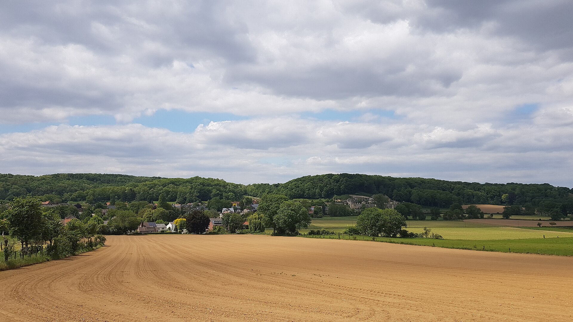
Cannerberg is a hill on the southern edge of Maastricht, straddling the border between the Netherlands and Belgium, in the Jeker valley opposite the Sint-Pietersberg. The hill takes its name from Kanne, a Belgian village lying just across the border. It rises to roughly 125 metres above sea level with a prominence of about 40 metres — not an imposing peak in terms of height, but a distinctive feature of the landscape right at the meeting point of two countries. How was the Cannerberg formed? Geologically, the hill is made of marl, a soft sedimentary rock typical of the Limburg region. The ridge is essentially an offshoot of the Haspengouw Plateau, which extends further into Belgium. Centuries of marl quarrying left behind an underground network of tunnels, shafts, and water channels, traces of historic mining that still shape the hill's interior today. Why was the hill cut in two? Between 1930 and 1939, part of the Cannerberg was excavated for the construction of the Albert Canal, which connects Liège with Antwerp. This work severed the ridge from the larger plateau, giving the hill its present, more isolated shape. The canal now marks the border at this point between Dutch and Belgian territory. What did the Cannerberg hide during the Cold War? The hill gained particular significance in the 20th century when a secret NATO headquarters was built inside it: the Joint Operations Centre (JOC), also known as NATO Headquarters Cannerberg. Covering around 25,000 square metres and hidden behind the Château Neercanne, the complex operated from 1958 to 1992 as a communications and command centre. It housed the war headquarters of the Northern Army Group and the Second Allied Tactical Air Force, key NATO structures responsible for the defence of central Europe. NATO left the site in 1992 after the Cold War ended, and the underground tunnels have since been remediated and restored. Today the complex is open for guided tours, making it a unique testimony to the region's military history. What traces of early settlement have been found on the hill? The Cannerberg is also archaeologically significant. In the summer of 2013, a major excavation campaign uncovered the layout of a late Bandkeramik settlement, along with traces of Iron Age occupation. These findings show the area was inhabited thousands of years before modern Maastricht existed, its gentle slopes long attracting people in search of fertile land and access to water. What can visitors see on the hill today? Today the eastern slope of the Cannerberg is covered by the Cannerbos forest, while since 2000 the Millenniumbos, planted to mark the new millennium, has been growing on the southern slope. The hill thus layers several eras of history: from prehistoric settlement, through industrial marl quarrying and canal construction, to secret military tunnels and a present-day green recreational space right on the border of two countries. Frequently asked questions Where exactly is the Cannerberg located? South of Maastricht city centre, on the border of the Netherlands and Belgium, opposite the Sint-Pietersberg. Can visitors tour the former NATO headquarters inside the hill? Yes, the former Cannerberg complex is open to the public through guided tours. What is on the surface of the hill today? The Cannerbos and Millenniumbos forests, forming a walking and recreational area.
-

Flotsenberg
Forest - Vorst
Flotsenberg is the highest point of the municipality of Forest (Dutch: Vorst) in the Brussels-Capital Region, rising to an elevation of around 100 metres (330 feet) above sea level. The hill sits just east of Duden Park, and its height is the source of the name given to the surrounding neighbourhood: Altitude Cent, also known by its Dutch name Hoogte Honderd — literally "Height One Hundred." Where does the name come from? The story of this hill goes back to the Middle Ages. The plateau around what is now Altitude Cent was once part of Heegde, an outlying section of the Sonian Forest (Forêt de Soignes) belonging to Forest Abbey. Woods here were known as the Galgeheyde Bosch and the Galge Veld. Starting in the 13th century, Benedictine nuns gradually cleared the slopes, and tenants farmed grain, raised sheep, and supplied timber from the land. An abbey farm once stood on the hill — the Hof te Spilotsenberg, also called Hoff van Vorst. Over the centuries the name evolved: it was recorded as Splotsberghe in the 14th century and as Flotsenberghe in the 16th century. The modern name Flotsenberg descends directly from that later form. What does the neighbourhood look like today? The wider area was laid out at the beginning of the 20th century, with its centre built between 1932 and 1935. At the heart of this part of Forest stands the Saint-Augustin church, designed by architects Guiannotte and Watteyne in the Art Deco style. The Altitude Cent district, spread across the top of the hill, has kept the feel of a quiet, residential corner of Brussels, with a square that still serves as a local social hub. The hill itself, though largely built over today, remains linked in people's minds to the greenery of neighbouring Duden Park and to a short, scenic walking route through the wooded pockets of this part of Forest. The route is family-friendly and combines varied nature with traces of the area's abbey-era history. Why is it worth a visit? Flotsenberg is a place where monastic history meets 20th-century urban planning. Visitors can trace how the former farmland and pastures of the Benedictine nuns turned into a stately residential district anchored by Art Deco religious architecture. It also makes a good starting point for a walk toward Duden Park, one of the larger green spaces in southern Brussels. Frequently asked questions What is Flotsenberg? It is a hill in the municipality of Forest (Vorst) in Brussels, the highest point of that municipality at around 100 metres above sea level. Where does the name Flotsenberg come from? It derives from the medieval abbey farm Hof te Spilotsenberg, whose name evolved over the centuries into Flotsenberghe by the 16th century. What can be found near the hill today? The Altitude Cent district, whose centre was built in the 1930s and includes the Art Deco Saint-Augustin church, along with the nearby Duden Park. Is it possible to walk there? Yes, a short, family-friendly walking route runs through the wooded parts of the hill, combining nature and local history.
-
Groeselenberg
Uccle - Ukkel
Groeselenberg is a modest hill in Uccle, one of the southern municipalities of Brussels, Belgium. At first glance it looks like an ordinary steep street climbing between houses, yet the place carries more history than its size suggests, and its name has shifted shape many times over the centuries. Where does the name come from? The name Groeselenberg belongs to the local toponymy of Uccle and refers to a rise once covered with thorny scrub. Over the centuries it has been recorded under several different spellings — a 1742 document refers to it as Hoogstraete, while other sources use the variants Roeselberg, Drooselenbergh and Croeselenberg. These shifting forms reflect how much the local name evolved before settling into the version used today. What used to stand on the hill? The area around Groeselenberg has been used by people for a very long time — archaeologists have recovered objects dating back to the Neolithic period, evidence of settlement stretching back thousands of years. By the mid-19th century, a small hamlet of about twenty dwellings had grown up on and around the slope. Several houses clustered halfway up, on the right-hand side of the path leading from the center of Uccle. Contemporary descriptions place the hamlet between a sandy, heather-covered hill and a small wooded area of beech trees belonging to the Paridant castle, with a small stream running through the area — often dry in summer — where watercress grew along its banks. Does the place have any significance today? Yes — Groeselenberg is known today mainly for two things. First, a well-known medical facility, the Clinique des Deux Alice, was founded at the top of the slope. Second, the hill's name has been carried into astronomy: asteroid 16908 Groeselenberg is named after it, a nod to the fact that the area is home to an astronomical observatory — Uccle hosts the Royal Observatory of Belgium, one of the country's leading scientific institutions of its kind. Is it popular among cyclists? Groeselenberg is also known to local road cyclists as a short but demanding climb within Uccle. The steep, winding streets of this part of the municipality have long attracted cyclists looking for training climbs close to central Brussels, and the ascent is occasionally listed among the notable short climbs in the area. Why is it worth a visit? Groeselenberg is a good example of a place that doesn't announce itself, yet hides several layers of history — from traces of Neolithic settlers, through a 19th-century rural hamlet, to a present-day medical institution and a scientific connection that reaches all the way to asteroid naming. Walking or cycling up the slope offers a glimpse of a quieter, more intimate side of Uccle, a district otherwise known for its green, villa-lined streets and calm suburban character within the heart of the Brussels metropolitan area. Frequently asked questions Where exactly is Groeselenberg located? It is a hill in the municipality of Uccle, in the southern part of Brussels, Belgium. Is there anything to see on Groeselenberg? The place is known mainly for its settlement history and for being the site of the Clinique des Deux Alice, rather than for classic sightseeing attractions — it appeals more to local-history enthusiasts and cyclists. Where does the hill's name come from? The name refers to the thorny scrub that once covered the slope, and has been recorded under several historical spellings over the centuries. Does Groeselenberg have any connection to astronomy? Indirectly, yes — the Royal Observatory of Belgium is located nearby in Uccle, and the hill's name was used for asteroid 16908 Groeselenberg.
-
Nellekensberg
Meerbeke
Nellekensberg is a small hill in Meerbeke, a sub-municipality of the city of Ninove in East Flanders, right on the border with the municipality of Gooik in Flemish Brabant. The spot is well known among cyclists and fans of cycling history, while also offering a rewarding walking destination for anyone looking for views over the Dender valley and the rolling hills of the Pajottenland. Where does the name come from? The hill takes its name from the adjoining Nellekensstraat, while "Nellekensberg" itself refers to a side road connecting Nellekensstraat with Natteschoot. The element "nelleken" points to an outlying, peripheral position relative to the center of Meerbeke — in other words, a spot lying on the fringes of the main settlement. A small hamlet of the same name lies at the foot of the hill. Why is this place linked to cycling? Nellekensberg owes much of its recognition to road cycling. The hill sits close to the former finish line of the Tour of Flanders (Ronde van Vlaanderen) in Meerbeke, where for many years riders in one of the world's most prestigious classic races crossed the finish line. In 1981, because of roadworks, race organizers included Nellekensberg as a one-off measure in the local finishing circuit — the climb was added to the route right after two other well-known ascents, the Muur (Kapelmuur) and the Bosberg. Although this was only a temporary arrangement, the episode permanently secured Nellekensberg a place in the history of Belgian classic cycling. What can be seen in the surrounding area? The land around Nellekensberg and the neighboring hamlet forms part of a protected historical landscape, meaning it has kept its traditional, rural character — fields, small patches of woodland, and winding lanes. From the higher stretches of the hill, views open up over two distinct landscapes: the low-lying valley of the river Dender and the characteristic rolling terrain of the Pajottenland. This combination has made the area appreciated as a destination for easy, day-long hikes that let visitors experience both the natural and cultural heritage of the Denderstreek region. How to get there and what to know before visiting Nellekensberg lies within Meerbeke, one of the sub-municipalities of Ninove, a city situated on the river Dender in East Flanders. Its proximity to the border with Gooik makes the area a useful starting point for longer cycling routes linking the Denderstreek with the Pajottenland — a region famous for its cobbled climbs used in classic cycling races. Visitors planning a trip should keep in mind that Nellekensberg is primarily a landscape and historical site rather than a location with extensive tourist infrastructure — its main appeal remains the authentic, largely unchanged character of this part of Flanders. Frequently asked questions Is Nellekensberg a mountain? No, it is a small hill typical of the rolling landscape found around Ninove and the Pajottenland, not a mountain in the geographical sense. Can you cycle there? Yes, the area is popular with cyclists, partly because of its connection to the history of the Tour of Flanders and its proximity to other well-known climbs in the region. Is the area protected? Yes, the landscape around Nellekensberg and the neighboring hamlet holds the status of a protected historical landscape.
-
Côte de Hallembaye
Visé
Côte de Hallembaye is a hill in the province of Liège, Belgium, best known as a demanding cycling climb crossing the plateau between the Meuse valley and the Jeker (Geer) valley. It lies near Loën, a small locality within the municipality of Visé, close to the Dutch border. Where does the name come from? The hill takes its name from Hallembaye, a village a few kilometers to the south, in the municipality of Oupeye. Although the climb itself sits within Visé, the historical link to Hallembaye survives in its name — a pattern common across the Pays de Herve region, where hill names often trace back to nearby settlements rather than the exact spot on the map. Why does it matter to cyclists? Côte de Hallembaye is one of the more challenging short climbs in this part of Belgium. The ascent runs about 767 meters, with an average gradient of roughly 7.7% and pitches reaching up to 11.2% at the steepest points. That profile makes it a compact but intense effort — the kind of short, sharp climb that defines many Belgian "côtes" and separates riders quickly despite the modest distance. The road follows route N671 and runs along the western edge of the former CBR cement works at Lixhe. This industrial backdrop, typical of the Meuse valley borderlands, gives the climb a raw, working-landscape character quite different from the greener climbs found deeper in the Ardennes. What role has it played in major cycling races? Côte de Hallembaye holds a place in professional cycling history as part of the route of the Amstel Gold Race, one of the classic spring one-day races. The hill featured in the race route between 1993 and 2000, during the years when the finish line was still located across the border in Maastricht. Climbs like Hallembaye, unassuming as they may look on a map, could shape the outcome of the race by splitting the peloton on short, steep sections. Beyond the Amstel Gold Race, the hill has also appeared in the routes of other multi-stage races, including the Eneco Tour and the Tour of Wallonia, confirming its standing as a recognizable landmark in the region's cycling geography. What should visitors know before heading there? For cycling enthusiasts, Côte de Hallembaye is a popular destination for testing legs against a climb once tackled by professional racers. The surrounding area also marks a transition from the Meuse valley toward the more undulating terrain of the Eben-Emael plateau, making the route interesting for its scenery as well as its sporting pedigree. Frequently asked questions How long is the Côte de Hallembaye climb? The ascent is approximately 767 meters long. How steep is the hill? The average gradient is around 7.7%, with maximum pitches of up to 11.2%. Was Côte de Hallembaye part of well-known cycling races? Yes, it featured in the Amstel Gold Race route between 1993 and 2000, and has also appeared in the Eneco Tour and the Tour of Wallonia. Where exactly is the hill located? Near the locality of Loën, part of the municipality of Visé, in the province of Liège, next to the former CBR Lixhe cement works site.
-
Heistse Berg
Heist-op-den-Berg
Heistse Berg is a modest hill that forms the village center of Heist-op-den-Berg, a municipality in the Belgian province of Antwerp, within the Rivierenland region. Despite its measured height being in the tens rather than hundreds of meters, it ranks as the second-highest point in the entire province of Antwerp, making it a landmark that has shaped settlement patterns in the area for a long time. Where does the hill come from? The story of Heistse Berg reaches deep into the region's geological past. The layers of sand and clay that make up the hill were deposited more than 6 million years ago, when the surrounding area was still covered by the sea. For a long time it was assumed that the upper layers of the hill belonged to the so-called Diest Sand formation, but recent research by geologist Jasper Verhaegen revealed that the top 10 meters actually belong to the younger Kasterlee Formation. This finding reshaped the understanding of the hill's geological structure and shows that even a small, seemingly well-studied elevation can still hold scientific surprises. What sits at the top? At the summit of Heistse Berg stands the Sint-Lambertuskerk church, surrounded by the Kerkplein square — this church-topped hill is the very spot around which the historic center of Heist-op-den-Berg developed. This arrangement is typical of many Flemish towns, where the parish church was built on the highest available ground, both for symbolic and practical reasons. How do you reach the top? Several routes lead to the summit. From the Oude Godtstraat side, a staircase climbs the hill, offering the most direct way up on foot. An alternative is the street called Bergop, which provides a relatively steep but walkable and rideable path to the top — its name, literally meaning "uphill," reflects the character of the route itself. Why does the hill attract cyclists? Heistse Berg is known among cyclists as a typical Flemish cobblestone climb, ending at the picturesque church in the village center. Because of its character — a short but steep stretch over uneven cobbled surface — the hill is regularly included in regional cycling routes. Riders can approach the summit via several different streets, including Herentalsesteenweg (via the Bergop section), Kerkhofstraat, Palmbosstraat, and Grotstraat — each offering a slightly different ascent profile, but all converging on the same high point by the church. Frequently asked questions How high is Heistse Berg? The hill rises to roughly 45–48 meters and ranks as the second-highest point in the province of Antwerp. What is located at the top of the hill? The Sint-Lambertuskerk church stands at the summit, together with the surrounding Kerkplein square, forming the historic heart of Heist-op-den-Berg. What is the easiest way to walk to the top? The most direct route is the staircase from Oude Godtstraat; a steeper but shorter alternative runs along the street Bergop. Is Heistse Berg significant for cyclists? Yes, it is a well-known short, steep cobblestone climb in the region, popular with road cyclists and featured on several local cycling routes. What does the hill's geology reveal? The hill is built from sand and clay deposits laid down more than 6 million years ago, and research by geologist Jasper Verhaegen showed its upper layers belong to the younger Kasterlee Formation rather than the previously assumed Diest Sand formation.
-
Beninksberg
Rotselaar
Beninksberg is a hill and nature reserve in Wezemaal, part of the municipality of Rotselaar, in the Belgian Hageland region. The hill rises more than fifty meters above the surrounding land and is a fine example of the iron sandstone hills — also known as Diestian hills — typical of this part of Flanders, sitting close to the nearby Wijngaardberg. What is the history behind this hill? The southern slope of the Beninksberg carries a long agricultural history. During the Middle Ages, the sunny, gravelly southern slope was used for wine growing. This use of the land as farmland continued for centuries: until the middle of the 20th century, the most fertile parts of the slope remained arable fields, and for a short period after World War II they were converted into peach orchards. Recognizing the historical value of this agricultural landscape, authorities placed it under protection as a cultural-historical landscape in 1977. The decisive step toward the site's current form came in 1991, when the Flemish government purchased most of the surrounding land. Two years later, in 1993, this acquisition led to the creation of the fifty-hectare Flemish nature reserve now known as Beninksberg. What makes the nature on Beninksberg distinctive? The sun-exposed southern slope of the hill supports characteristic heathland vegetation. In summer, with its peak in August, the slope turns into a striking purple carpet as the bell heather comes into bloom. Maintaining this habitat is not left to machinery alone: Norwegian fjord horses graze the reserve year-round, and their grazing helps keep the heath and grassland open by limiting the encroachment of shrubs and trees, echoing the extensive land use that shaped this landscape in the past. The reserve is managed by the Agentschap Natuur en Bos (Agency for Nature and Forests), the Flemish body responsible for nature conservation in the region. Why is Beninksberg worth a visit? The Beninksberg nature reserve appeals to visitors looking for a quiet encounter with nature and the distinctive scenery of the Hageland region. Rising more than fifty meters above its surroundings, the hill offers views that stand out in an area of Flanders not typically associated with such pronounced relief. The combination of geology (iron-rich sandstone), agricultural history (former vineyards and orchards), and active conservation management (grazing fjord horses) makes it a rewarding destination both for nature lovers and for those interested in the region's cultural landscape. Frequently asked questions Where exactly is Beninksberg located? The hill and nature reserve are located in Wezemaal, a village within the municipality of Rotselaar, in the province of Flemish Brabant, in the Hageland region. How large is the Beninksberg nature reserve? The Flemish nature reserve, established in 1993, covers approximately fifty hectares. When is the best time to visit to see the heather in bloom? The bell heather on the southern slope reaches peak bloom in August, when the slope turns a distinctive purple color. Why are horses grazing in the reserve? Fjord horses graze the reserve year-round to naturally maintain the open character of the heath and grasslands, preventing them from being overtaken by shrubs and trees. Since when has the site been protected? The agricultural cultural-historical landscape of the southern slope has been formally protected since 1977, and the nature reserve itself was established in 1993, following the Flemish government's purchase of the land in 1991.
-
Heikantberg
Rotselaar
Heikantberg is a hill in the municipality of Rotselaar, in the province of Flemish Brabant, Belgium, situated within the sub-municipality of Wezemaal, near the hamlet of Vlasselaar. It rises to roughly 60 metres, making it one of the distinctive "witness hills" of the Hageland region, an area famous for its rolling, hilly terrain shaped by harder, iron-rich sandstone layers that resisted erosion better than the surrounding land. Where exactly is Heikantberg located? The hill lies just east of the settlement of Heikant, close to several similar elevations — Middelberg, Eikelberg, Wijngaardberg and Beninksberg — which run roughly parallel to one another across Rotselaar and Wezemaal. Together, this cluster of hills forms a noticeable ridge along the valley of the river Demer, a landmark feature in this part of Flanders. What can be found on top of the hill? A large part of the summit area has historically been subdivided into building plots for villas, but a section of old, ecologically valuable woodland has survived. This roughly four-hectare forest already appears on the oldest detailed maps available for the region, the Ferraris maps from 1778, suggesting the land has likely remained continuously forested for more than two centuries. The woodland has been classified as biologically very valuable, giving it real significance within the local ecological network. Why did the forest on Heikantberg become a point of conflict? In 2020, a subdivision request was submitted covering 4.1 hectares of forest land on Heikantberg, proposing nine residential units. The plan triggered a wave of protest from local residents and nature organisations, leading to the formation of a local action group called Semper Ferraris, dedicated to protecting this stretch of forest. The dispute became a symbolic case of the tension between development pressure and the preservation of historic green space in the Rotselaar area. Is Heikantberg popular with cyclists? Yes — the hill is well known among cyclists as one of the characteristic climbs of the Hageland region. Several approach routes lead up it, including via Wilgenlaan and Wandeldreef, and via Olmendreef, with the ascent typically starting from the Heirbaan road near Wezemaal or Rotselaar. The climb rises gently through scenic, wooded and rural surroundings, making it appealing both to road cyclists chasing a classic Hageland climb and to those simply looking for a quiet, picturesque route. What can visitors do in the surrounding area? The area around Heikantberg also offers opportunities for walking. A loop trail connects Rotselaar with the neighbouring village of Gelrode, running for over a dozen kilometres through terrain with noticeable elevation gain, typical of this hilly corner of Flemish Brabant. Mountain-biking trails are also present nearby, confirming that the wider Heikantberg area functions as a popular outdoor destination for both local residents and visitors passing through the region. Frequently asked questions How high is Heikantberg? The hill reaches an elevation of approximately 60 metres. Has any natural woodland survived on the hill? Yes, part of the summit is covered by an old, biologically valuable forest that already appears on 18th-century maps. Is Heikantberg a popular cycling climb? Yes, it is a recognised climb within the Hageland region, with several possible approach routes. Is the area suitable for hiking? Yes, marked walking and cycling routes in the vicinity connect Rotselaar with nearby villages.
-
Krekelenberg
Halle
Krekelenberg is a modest but demanding rise on the outskirts of Halle, in the Belgian province of Flemish Brabant, right on the edge of the Pajottenland region. To locals it's simply a residential street climbing a hillside; to road cyclists, it's one of the thousand toughest climbs in Belgium as catalogued by the Cotacol encyclopedia. Where exactly is Krekelenberg located? The rise sits in the rolling countryside south of Brussels, part of the belt of low hills separating the Zenne river valley from the farmland of Pajottenland. This landscape is typical of this corner of Flanders: gentle but relentless slopes weaving between fields, orchards and scattered farmhouses, terrain that has drawn both local recreational cyclists and professional peloton climbers for decades, thanks to the region's long association with Belgium's cobbled and hilly one-day classics. What does the climb actually look like? The most commonly ridden approach comes via Trompstraat, covering roughly 1.8 km with 85 metres of elevation gain and an average gradient of 4.6%. The summit sits at 121 metres above sea level. On paper, those numbers look unremarkable, but the climb's reputation comes from its character rather than its statistics: uneven road surface, irregular pitches of steeper gradient, and a layout that makes it hard to settle into a steady rhythm. A separate, narrower approach exists via Dokter Spitaelslaan, which local cyclists generally regard as a steeper and more technical way up the same hill, though its precise length and gradient are less consistently documented than the main Trompstraat route. One distinctive feature of Krekelenberg is that the street itself ends in a dead end — it doesn't connect directly to a major road. Cyclists can, however, continue along a narrow strip of asphalt that links up with the N28 national road, making it possible to fold the climb into a longer training loop without having to turn back. Why is this climb known among cyclists? Krekelenberg's inclusion in the Cotacol encyclopedia — an extensive, cycling-enthusiast-compiled register of Belgium's thousand hardest climbs — is what carried its name beyond the residents of Halle and turned it into a reference point for amateur riders seeking demanding routes in the Pajottenland and Zenne valley area. Though less famous with tourists than the Ardennes, this region has long served as informal training ground for riders preparing for the cobbled classics and hilly one-day races that define Belgian professional cycling. What can you see along the way? The climb offers views typical of Pajottenland: open, undulating fields, orchards, and small clusters of rural buildings, with the Zenne valley visible in the distance. It's an intimate rather than dramatic landscape, but that quietly agricultural scenery is part of the appeal of the cycling and walking routes that crisscross the area around Krekelenberg. Frequently asked questions Is Krekelenberg the name of a street or the official name of the climb? It functions as both — the street name and the informal name of the climb itself, a pattern common to many Belgian "hellingen" used in both amateur and professional cycling. Can you ride straight through Krekelenberg? The street itself is a dead end, but a narrow paved strip continues through to the N28, so in practice the route doesn't require doubling back. Who is this climb suited for? With an average gradient of 4.6% over less than 2 km, it's approachable for intermediate-level cyclists, though the uneven surface and uneven pitch make it feel tougher than the raw numbers suggest.
-
Mont aux Potences - Galgenberg
Bruksela
Mont aux Potences (Galgenberg) is a modest hill in the Marolles district of Brussels, rising to roughly 81 meters above sea level. Few visitors recognize the name today, yet this rise once played a dark role in the city's history — and it still dominates the surrounding skyline thanks to a monumental building erected on its summit. What does the name mean? The hill's name, rendered both in French as "Mont aux Potences" and in Dutch as "Galgenberg", translates literally to "Gallows Hill". This is no coincidence: during the Middle Ages, the site served as a place of public execution, where condemned criminals were hanged in view of Brussels' residents. Hills located just outside city walls were a common choice for such purposes across medieval Europe — visible from a distance, they acted as a stark warning to travelers approaching the city. From grim history to monumental architecture For centuries the area around the hill remained a densely populated, working-class part of Brussels, adjoining the Marolles neighborhood known for its street markets and popular character. Everything changed dramatically in the 19th century, when city authorities decided to build a new home for the judiciary. To make room for the planned monumental structure, large sections of the existing housing on the hill were demolished — a decision still debated by local historians, since it displaced many residents and erased much of the district's older fabric. At the summit rose the Palace of Justice (Palais de Justice), designed by architect Joseph Poelaert. Construction began in 1866 and was completed in 1883, an undertaking that stretched across nearly two decades and ranked among the largest architectural projects in 19th-century Europe. Built in a monumental, eclectic style blending classical elements with baroque grandeur, the building came to dominate the city skyline and remains one of Brussels' most recognizable landmarks, visible from numerous vantage points across the center. A trace of a great anatomist The hill's history is also tied to Andreas Vesalius, the renowned 16th-century anatomist and physician who grew up in Brussels near this very rise. According to some historical accounts, the young Vesalius visited Mont aux Potences in search of the bodies of executed criminals, which he used for his pioneering anatomical studies. While medical historians treat this episode with some caution, it vividly illustrates how closely science, execution, and urban topography were intertwined in that era. What to know when visiting the area Today the hill functions chiefly as a landmark associated with the Palace of Justice — at the time of its completion, one of the largest court buildings in the world by footprint. Walking through the Marolles district, it's worth remembering the site's grim past, a stark contrast to the neighborhood's present-day character, alive with flea markets and local bars. The hill's name endures as a lasting trace of an era when justice was carried out publicly, without the judicial process we recognize today. Frequently asked questions What does the name Mont aux Potences mean? Literally "Gallows Hill" — a reference to its former use as a site of public executions in the Middle Ages. What stands on the hill today? The monumental Palace of Justice, built between 1866 and 1883 to a design by architect Joseph Poelaert. What is the hill's connection to Andreas Vesalius? Historical accounts suggest the young anatomist, who grew up nearby, visited the hill to obtain bodies for his anatomical research.
-
Croix Scaille
Bourseigne-Neuve
Croix Scaille is the highest point of the southern Ardennes, a forested plateau rising to 504 metres above sea level and sitting exactly on the Franco-Belgian border. On the Belgian side it borders the province of Namur, on the French side the département of Ardennes, and the wider massif stretches between the valley of the Semois to the north and the valley of the Meuse to the east. Where exactly is Croix Scaille located? The site sits at the meeting point of two countries, deep in the Ardennes uplands, within the municipality of Bourseigne-Neuve on the Belgian side. This cross-border position makes Croix Scaille something of a reference point for anyone exploring the Ardennes from both sides of the frontier at once — a few steps are enough to cross into the other country, even though the landscape stays consistent: the same rolling, densely forested hills that define this part of Europe. Why is it the highest point of the southern Ardennes? At 504 metres above sea level, Croix Scaille marks the culmination of the southern section of the Ardennes range. In practice, this means the surrounding land drops away from this plateau in every direction — toward the Semois valley to the north and toward the Meuse valley to the east. That kind of relief is typical of the Ardennes as a whole: these are not sharp, dramatic peaks but broad, rounded, forest-covered rises, where "highest point" status is defined by elevation relative to the surrounding valleys rather than by a striking rocky silhouette. What does the Croix Scaille massif's landscape look like? The massif has the classic Ardennes character — a forested plateau rather than an exposed rocky summit. The woodland covering this terrain forms part of a larger forest complex running along the Franco-Belgian border, spanning the Namur-Ardennes frontier zone. The terrain's shape — clearly bounded by the Semois and Meuse river valleys — makes the area a natural hydrological and topographical hinge for the region, one where administrative boundaries (the national border, and the provincial and departmental lines) align with natural ones. What should you know about its coordinates and location? Croix Scaille's geographic point is set at approximately 49.95° north latitude and 4.85° east longitude. This places it in the rural interior of the Ardennes, away from major towns, in an area of low population density where forest cover and extensive agriculture dominate — a pattern typical of this mountain range as it runs through Belgium, France, and Luxembourg. Frequently asked questions Is Croix Scaille a mountain or a hill? Sources classify it as a mountain — the highest point of the southern Ardennes — though at 504 metres above sea level, it falls into the category of modest elevations typical of this part of Western Europe. Which side of the border is Croix Scaille on? Its summit sits exactly on the Franco-Belgian border, on the edge of the French département of Ardennes and the Belgian province of Namur — one of the few spots in the region where an administrative boundary coincides with a natural high point. Which valleys surround the massif? To the north, the terrain is bounded by the valley of the Semois; to the east, by the valley of the Meuse — both among the most significant waterways of the Ardennes region. Is it a popular viewpoint? Given its status as the highest point of the southern Ardennes, the site is a natural reference for anyone studying the region's topography, though its character as a plateau rather than an exposed peak means visibility depends on the specific spot and the surrounding tree cover.
-
Wijngaardberg
Rotselaar
Wijngaardberg is a 72-metre hill near Wezemaal, in the municipality of Rotselaar, in the Belgian Hageland region. It belongs to the so-called Diestian witness hills — remnants of ancient sand ridges left behind from a time when the area was covered by sea, millions of years ago. Today it is regarded as one of the last well-preserved examples of this type of landscape in the region. Why visit Wijngaardberg? The hill combines natural and historical value. Its south-facing slope was used for winemaking at various points over the centuries, a tradition that returned to the site periodically throughout history. A visible trace of that past is the so-called wine wall (wijnmuur), built in the 19th century to shelter the vineyards from wind and harsh conditions. After the Second World War, most of the plateau at the top was cleared for peach cultivation, and low-stem fruit trees now grow there instead. What can you find in the nature reserve? The hill today forms a nature reserve made up of several plots purchased and managed by the conservation organisation Natuurpunt. The slopes are grazed by Hebridean sheep, a practice that helps maintain a natural mosaic of open ground, heathland and shrubs. This variety of habitats supports numerous plant and animal species that would otherwise struggle to find shelter and food in a more uniform landscape. How to explore Wijngaardberg The hill is a popular destination for walkers around Rotselaar and Wezemaal. Marked walking routes cross the reserve and its surroundings, including a loop of roughly 7.3 kilometres that takes in both the hill itself and the wider Hageland countryside. A walk along the slopes offers views of the grazing sheep, the remains of the old wine wall, and the distinctive terrain typical of the region's witness hills. What to know before visiting Visitors should keep in mind that the area is a managed nature reserve, so rules protecting the flora, fauna and grazing animals apply. The village of Wezemaal is the most convenient starting point, with local footpaths leading directly to the hill. Frequently asked questions How high is Wijngaardberg? The hill reaches a height of 72 metres and is classified as one of the Hageland region's witness hills. Is wine still grown on Wijngaardberg? Historically, yes — the south slope was periodically used for viticulture, as shown by the surviving 19th-century wine wall. Today the site mainly serves a nature conservation role. Who manages the hill? The area is managed by Natuurpunt, which has purchased individual plots on the slopes and maintains the site through conservation measures, including grazing by Hebridean sheep. What walking routes cross Wijngaardberg? Marked footpaths run through the area, including a route of around 7.3 kilometres that passes over the hill and through the surrounding countryside of Rotselaar.
-
Weißer Stein
Udenbreth
Weißer Stein is a recreation and winter-sports area located by the village of Udenbreth, part of the municipality of Hellenthal, right on the German-Belgian border in a district known as Zitterwald. For decades it has drawn both winter-sports enthusiasts and visitors seeking scenic viewpoints and family-friendly attractions. Where exactly is Weißer Stein? The hill sits in the southwestern corner of North Rhine-Westphalia, directly against the Belgian border. It reaches an elevation of 690 metres, making it the highest summit on the left bank of the Rhine within all of North Rhine-Westphalia. It also happens to be the second-highest point in Belgium, surpassed only by Signal de Botrange. Because the surrounding terrain — including Udenbreth itself — sits only slightly lower, the summit itself is barely noticeable; it feels less like a distinct peak and more like a broad, gently rolling upland plateau. What is there to do here in summer? Outside the winter season, Weißer Stein functions as a general recreation area for visitors of all ages. It offers a sports field and an extensive children's playground fitted with new, sturdy play equipment. A lookout tower was built here at the end of 2014, offering an "Eifel view" from a height of 720 metres, reached via 147 steps. At the base of the tower stands a climbing wall measuring 16 metres in length and 3 metres in height, open to anyone wanting to test their climbing skills. Why is it a popular winter destination? Weißer Stein has been a favourite spot for active winter-sports fans in the Eifel region for many decades. Its main draw is a toboggan run up to 350 metres long, equipped with a toboggan lift that lets visitors ride down repeatedly without hiking back up on foot. When snow conditions allow, cross-country skiing trails are also laid out in the surrounding area, rounding out the site's appeal as an all-season winter destination. Who is it best suited for? The combination of year-round infrastructure — playground, sports field, lookout tower, climbing wall — with seasonal winter offerings like tobogganing and cross-country skiing makes Weißer Stein equally suited to a family day trip or as a base for anyone planning an active stay in the Eifel. The view from the tower over the surrounding hills and border forests is an added bonus for landscape photography enthusiasts. Frequently asked questions How high is Weißer Stein? The hill reaches 690 metres above sea level, making it the highest point on the left bank of the Rhine in North Rhine-Westphalia and the second-highest point in Belgium. Is there a lookout tower on site? Yes. The tower was built at the end of 2014, is reached via 147 steps, and offers views over the Eifel landscape from a height of 720 metres. What winter activities does Weißer Stein offer? A toboggan run up to 350 metres long with a lift, plus cross-country skiing trails when snow conditions permit. Is it suitable for children? Yes, the area has an extensive playground with new equipment and a sports field, and there is also a climbing wall next to the lookout tower. Where exactly is this place located? Near Udenbreth, in the municipality of Hellenthal, in the Zitterwald area, right on the German-Belgian border.
-
Oedelemberg
Beernem
Oedelemberg is a modest hill in the municipality of Beernem, in the Belgian province of West Flanders, named after the nearby village of Oedelem. At roughly 23 metres above sea level, it isn't a dramatic elevation — but in the otherwise flat landscape of this part of Flanders, it stands out as a noticeable rise and a familiar local landmark. How did the hill form? The Oedelemberg took shape through a long process of sedimentation and erosion, with the small Bergbeek stream playing a central role. Over centuries, flowing water reshaped the surrounding terrain, gradually carving out the gentle slope that defines the hill's profile today. A history rooted in clay Beneath the surface, the Oedelemberg held deposits of clay that were extracted for generations. The raw material was used to supply brickworks scattered across the region, tying the hill directly to the area's traditional building industry. Once the clay extraction ceased, the site gradually shifted from an economic resource into a recreational destination. A favourite for cyclists and hikers Today, the Oedelemberg is best known as a target for cycling and walking trips. Its slope has been incorporated into the Ronde van Beernem, a local initiative connected to Beernem's role as the so-called "Village of the Tour" for the Tour of Flanders in 2023, 2025 and 2027. For road cyclists, the climb is more than just a bump in the road — it's a small piece of a route associated with one of the region's most prestigious cycling events. Walkers can explore the hill via a signposted 11.3 km walking route that starts in Beernem and leads through the surrounding countryside toward the Oedelemberg. The trail showcases the quiet, rural character of this corner of West Flanders: open fields, small watercourses, and gently rolling ground. Frequently asked questions Where exactly is the Oedelemberg located? It lies in the municipality of Beernem, in the West Flanders province of Belgium, close to the village of Oedelem, from which it takes its name. How high is the Oedelemberg? The hill rises to about 23 metres above sea level — modest in absolute terms, but enough to serve as a clear landmark in the flat surrounding landscape. Can it be reached on foot or by bike? Yes. The hill is part of a signposted 11.3 km walking route starting in Beernem, and its slope is also used in local cycling routes, including the Ronde van Beernem tied to the Tour of Flanders. Does the Oedelemberg have any historical significance? Yes, though not in the sense of monuments or architecture — its historical importance comes from clay extraction, which for centuries supplied nearby brickworks and formed part of the local economy. Why is the hill popular with cyclists? Because of its connection to the Tour of Flanders. Beernem served as the "Village of the Tour" in 2023, 2025 and 2027, and the Oedelemberg became part of a symbolic local cycling route referencing that event.
-
Tweelingsterril
Lanklaar
Tweelingsterril, meaning "twin spoil tip," is a distinctive landscape feature near Lanklaar, part of the municipality of Dilsen-Stokkem in the Belgian province of Limburg. It consists of a pair of artificial hills built up from waste rock extracted during decades of coal mining in the region. Where did this hill come from? Tweelingsterril is a byproduct of coal mining carried out in Central Limburg, associated with the former Eisden-Lanklaar colliery. Spoil, the rock material with no commercial use, was hauled and piled up near the mine over decades of extraction activity. After the mines in this part of Belgium closed in the second half of the 20th century, these tips remained in the landscape as a lasting trace of the region's industrial past. Today they form some of the few natural-looking elevations in this otherwise flat part of Flanders, making them visible from a considerable distance. Why visit? The mining spoil tips of Central Limburg, including Tweelingsterril, have undergone a transformation in recent decades from industrial wasteland into recreational and natural areas. The region forms part of a wider area known as Terhills, where former mining infrastructure now sits alongside forests, lakes, and hiking trails. Vegetation that has taken root on the slopes of the tips over the years has created a distinctive habitat, appreciated by nature lovers and birdwatchers alike. Tweelingsterril lies along walking routes connecting the surrounding spoil tips — one popular circuit in the area links Triphills and Tweelingsterril, allowing visitors to explore several tips in a single outing. From the top, there are views over the surrounding forests and the former mining basin, as well as toward the boundary between the municipalities of Dilsen-Stokkem and Maasmechelen, which runs through this area. How to get there and what's nearby Lanklaar lies in Central Limburg, close to larger towns in the region such as Maasmechelen and Dilsen-Stokkem. The surrounding area offers an extensive network of marked walking and cycling routes through the rolling terrain of the former coal-mining basin. For visitors interested in the region's industrial heritage, Tweelingsterril is a tangible example of how former mining sites can be given a new purpose as recreational space. Frequently asked questions What is Tweelingsterril? It is a pair of artificial hills (spoil tips) formed from mining waste near Lanklaar, in the municipality of Dilsen-Stokkem, in Belgian Limburg. Where does the material forming the tip come from? From coal mining in the Central Limburg region, linked to the former Eisden-Lanklaar colliery. Can you hike there? Yes, Tweelingsterril lies along popular hiking routes, including a circuit connecting it with the nearby Triphills spoil tips. Is it part of a larger tourist area? Yes, the site is part of the wider Terhills area, where former mining infrastructure now coexists with forests, lakes, and recreational trails across Central Limburg.
-
Baraque de Fraiture
Bihain
Baraque de Fraiture is the highest point in the province of Luxembourg, located in the region of Wallonia, Belgium. Situated within the municipality of Vielsalm, it rises to 652 metres above sea level. The site combines a natural landmark status with a small-scale winter sports offering, making it a distinctive stop in the Ardennes. Where exactly is it located? Baraque de Fraiture sits in the heart of the Ardennes, within the province of Luxembourg, and falls administratively under the municipality of Vielsalm. Its coordinates are approximately 50.249 latitude and 5.739 longitude. Because of its elevation, the spot serves as a recognisable landmark in the surrounding countryside and is commonly referenced as the highest ground in the entire province. Why does the elevation matter? At 652 metres above sea level, Baraque de Fraiture holds the distinction of being the highest point in the province of Luxembourg. On a national scale this is a modest elevation, but within the gently rolling terrain typical of the Ardennes, it is enough to set the area apart from its surroundings. This elevation is also what allows the location to support a small ski area, something uncommon in this part of Belgium. What does the ski area offer? The site hosts a ski area made up of three pistes. It is a modest setup compared to major alpine resorts, but within the context of the Belgian Ardennes it stands out as a local rarity and a notable attraction. The ski season here is limited, typically running for fewer than 20 days a year due to the unpredictable snow conditions at this altitude. Has the ski season been changing? In recent years, the period during which the ski area has remained operational has extended, reaching as many as 60 days in some years. This suggests that snow conditions in the area can, at times, be more favourable than the historical average would suggest, although the season remains short and irregular compared to larger mountain resorts elsewhere in Europe. Who is this place suited for? Baraque de Fraiture is of particular interest to visitors exploring the Ardennes who want to combine outdoor activity with a visit to the highest point in the province of Luxembourg. Given the modest scale of its ski infrastructure, it works better as an addition to a longer stay in the region than as a standalone ski destination. Frequently asked questions How high is Baraque de Fraiture? It stands at 652 metres above sea level. Which municipality does it belong to? It falls under the municipality of Vielsalm, in the province of Luxembourg, Wallonia. How many ski pistes are available on site? The ski area includes three pistes. How long does the ski season typically last? Usually fewer than 20 days a year, though recent years have seen it extend to as many as 60 days. Is Baraque de Fraiture the highest point in all of Belgium? No — it is the highest point in the province of Luxembourg, not the country as a whole.
-
Pottelberg
Flobecq
Pottelberg, sometimes referred to as Mont Potel, is a hill in the municipality of Flobecq, in the province of Hainaut, in the Belgian region of Wallonia. It is generally considered the highest point of the Pays des Collines, a distinctively hilly area straddling the border between Hainaut and East Flanders. Its elevation is usually given as somewhere between 157 and 159 metres above sea level — a modest figure in absolute terms, but one that stands out clearly in an otherwise largely flat Belgian landscape. Where exactly is Pottelberg located? The hill lies within the municipality of Flobecq, which borders the municipalities of Ellezelles and Lessines within the same province, and Brakel across the language border, in the province of East Flanders. This position, right at the meeting point of two provinces and two linguistic communities, means the surrounding area is often described in sources using both French and Dutch place names for the same features. What makes the terrain of the hill distinctive? Pottelberg is known for its densely wooded relief and rolling profile, features that have made it a recognisable landmark for a long time. The hill already appeared on the Ferraris map of 1776, one of the earliest systematic cartographic surveys of the former Austrian Netherlands, which indicates that its characteristic silhouette was a notable feature of the landscape long before modern times. What is Pottelberg used for today? Today, Pottelberg is primarily a destination for outdoor recreation. The hill and its surroundings appear on hiking and cycling platforms as a stop along walking trails and mountain-bike routes, and its steep approaches are sometimes catalogued as a categorised climb in cycling route databases, drawing riders looking for a demanding, hilly stretch within the Pays des Collines. The wider Flobecq area, including Pottelberg itself, is also listed among the more notable natural viewpoints and summits within a short distance of the town. Why is the Pays des Collines region considered unusual for Belgium? The Pays des Collines, of which Pottelberg forms the symbolic high point, stands out against the largely flat terrain typical of both Wallonia and Flanders. Its undulating fields, patches of woodland and scattered small villages give the area a character often likened to a miniature range of hills — which is, in fact, the literal meaning of its name, "the land of hills." As the highest point of this area, Pottelberg serves as a natural reference point for both local residents and visitors mapping out walking or cycling routes through the region. Frequently asked questions How high is Pottelberg? Sources give slightly varying figures, typically between 157 and 159 metres above sea level. Is Pottelberg the highest point in the region? Yes, it is generally regarded as the highest elevation in the Pays des Collines, within the province of Hainaut. Which municipality is Pottelberg part of? It lies in the municipality of Flobecq, which borders Ellezelles, Lessines and Brakel. Can it be reached on foot or by bike? Yes, the area forms part of a network of hiking trails and cycling/mountain-bike routes across the Pays des Collines. Since when has Pottelberg been documented on maps? Its distinctive, wooded profile was already recorded on the Ferraris map dating from 1776.
-
Signal de Botrange
Ovifat
Signal de Botrange is the highest point in Belgium and in the entire Ardennes mountain range, located on the broad plateau of the High Fens (Hautes Fagnes) in the eastern part of the country, near the village of Ovifat. It holds a special place among European hiking destinations: it's part of the Seven Summits of Europe-style "Country High Points" lists, which draws peak-baggers and casual walkers alike who want to tick off the highest spot in each European country. Why is the summit's height partly artificial? The natural elevation of the terrain here falls just short of the symbolic 700-metre mark. To close that gap, a six-metre observation tower was built on the summit in 1923, effectively raising the highest point of Belgium to an even 700 metres above sea level. It's an unusual solution: instead of nature providing the round number, engineering did — and visitors can literally climb a short staircase to stand at that symbolic elevation. A second structure followed in 1934, when a communications tower was erected at the site. Its top reaches 718 metres above sea level, making it the tallest structure in this part of Belgium. The tower still serves a telecommunications function today, but it has also become a landmark visible from a considerable distance across the open plateau, helping hikers orient themselves in the surrounding moorland. What does the High Fens plateau actually look like? Signal de Botrange isn't a dramatic, sharply rising peak in the classic mountain sense — it's the highest point of a wide, open plateau covered in heathland and peat bogs. A road actually crosses the summit, and next to it sits a café, a natural stopping point for hikers and cyclists exploring the surrounding trails. The stark, open landscape of the High Fens is quite different from typical alpine scenery: instead of rocky ridgelines, visitors find sweeping moorland that can turn foggy and challenging in autumn and winter, despite the relatively modest absolute altitude. The area belongs to the Ardennes, a range stretching across eastern Belgium, Luxembourg, and northern France, known for dense forests and rolling terrain. Signal de Botrange is also the highest point in the European part of the Benelux countries, underlining just how significant this single spot is on the regional map, despite its unassuming height compared to true alpine mountains. Frequently asked questions What is the exact height of Signal de Botrange? The natural terrain elevation is 694 metres. Thanks to the six-metre observation tower built in 1923, the symbolic summit point reaches an even 700 metres above sea level, while the communications tower built in 1934 tops out at 718 metres. Where exactly is Signal de Botrange located? It sits in the High Fens range in eastern Belgium, near the village of Ovifat, at coordinates 50.5017 N, 6.0931 E. Is Signal de Botrange really the highest point in Belgium? Yes — it is the highest point in both Belgium as a whole and the region of Wallonia, as well as the highest summit in the Ardennes and the highest point in the European part of the Benelux countries. Can you drive to the summit? Yes, a road crosses directly over the summit, making the site easy to reach without a long climb, unlike many other country high points around Europe.
-
Terril de Ciply
Mons
Terril de Ciply is a 6.6-hectare spoil tip located in Ciply, part of the municipality of Mons in Hainaut province, roughly 4 km south of the city centre. The mound is a legacy of the last coal mining concession of Agrappe Escouffiaux and Hornu-Wasmes. Where did the spoil tip come from? The site's history goes back to the 19th century. In 1865 the concession took the name of the Anonymous Society of Coal Mining of Ciply, and in 1873 it became the Coal Mining Company of the South of Mons. The mine that produced this particular tip operated between 1900 and 1920 — the waste rock extracted alongside the coal piled up over those two decades into the cone-shaped hill still visible in the Mons-Borinage landscape today. What happens on the tip today? For close to 70 years, Terril de Ciply has served a sporting purpose: it is used by the Royal Mons Auto Moto Club for tournaments and training. The southern section, open and notably rocky with steep slopes, is prized for motorcycle and bicycle trial riding, and competitions and training sessions have taken place here for decades, carried out with respect for the site's natural character. The wider Mons-Borinage region is dotted with similar former spoil tips, and initiatives such as Destination Terrils promote exploring them both for their industrial heritage and their recreational value. Why does this site matter for nature? Despite its industrial origin, Terril de Ciply is considered an area of significant biological value. The nutrient-poor mining substrate favours dry grasslands featuring the maiden pink (Dianthus deltoides), a habitat that has become rare in present-day Wallonia. Spoil tips like this one, originally waste heaps from coal extraction, have over time turned into micro-habitats with unusual conditions of sun exposure, drainage and soil poverty that are hard to find elsewhere in the region. Can you walk or cycle there? Yes — the site combines recreational and sporting uses. It hosts events such as the Trial du Mons Panisel, held annually in November, drawing motorcycle and bicycle riders from across the region. The steep, rocky terrain makes Terril de Ciply a natural obstacle course, while also offering a vantage point over the surrounding Mons and Borinage countryside. Frequently asked questions How large is Terril de Ciply? The spoil tip covers 6.6 hectares. When did the mine that created the tip operate? Between 1900 and 1920, under a concession that from 1873 operated as the Coal Mining Company of the South of Mons. What is the site used for today? Mainly motorcycle and bicycle trial sports, run by the Royal Mons Auto Moto Club, alongside its role as a nature area with rare sandy grassland habitats. Where exactly is Terril de Ciply located? In Ciply, part of the municipality of Mons, Hainaut province, about 4 km south of the Mons city centre.
-
Vidaigneberg
Westouter
Vidaigneberg is a hill roughly 136–138 metres high, located in the municipality of Heuvelland near the village of Westouter, in the province of West Flanders, Belgium. The name "Heuvelland" literally means "hill country" in Dutch, referring to the gently rolling landscape known as the West Flemish Hills, a chain of low elevations running close to the French border. Vidaigneberg is the second-highest point in Heuvelland, surpassed only by the nearby Kemmelberg, which reaches 154 metres. Why is Vidaigneberg famous among cyclists? Despite its modest elevation, Vidaigneberg is one of the better-known climbs in Belgian road cycling, thanks to a short but noticeably steep slope typical of the "hellingen" found throughout Flanders. The hill has repeatedly featured in the route of Gent–Wevelgem, one of the most prestigious Belgian classic races, where its climb adds a technical challenge to an otherwise largely flat course. Vidaigneberg has also appeared in other regional races, including the Driedaagse van De Panne-Koksijde and the Great War Remembrance Race, an event whose name recalls the area's history during the First World War. For amateur cyclists visiting West Flanders, tackling the same climb seen in televised races is a common goal, and the hill draws a steady stream of recreational riders exploring the region's network of cycling routes. What else can be found on the hill? The slopes of Vidaigneberg are home to the Vidaigne wine estate (Wijngoed Vidaigne), one of the few vineyards operating in this part of Belgium. The estate grows four grape varieties — three white (Phoenix, Solaris and Johanniter) and one red (Régent) — used to produce locally made wine. A working vineyard at such a low elevation is unusual for the climate of northern Europe, making it a notable stop for visitors interested in regional food and drink. How to visit Vidaigneberg and what to combine it with? The Heuvelland area is crossed by a dense network of marked walking and cycling routes, making it a popular destination for day trips from nearby towns such as Ypres (Ieper) or Poperinge. Hikers and cyclists often combine a visit to Vidaigneberg with the neighbouring Kemmelberg and other hills of the same range, forming a longer route through the West Flemish Hills. The surrounding countryside offers views over the flat farmland that surrounds the hill chain, along with the quiet, rural atmosphere typical of this part of West Flanders. Frequently asked questions How high is Vidaigneberg? The hill rises to approximately 136–138 metres above sea level. Is Vidaigneberg the highest hill in Heuvelland? No, it is the second-highest — the highest is the nearby Kemmelberg at 154 metres. Why is Vidaigneberg well known in cycling? Because of its steep climb, regularly used in the routes of races such as Gent–Wevelgem, the Driedaagse van De Panne-Koksijde, and the Great War Remembrance Race. What else is worth seeing nearby? The Vidaigne wine estate on the hillside, and the neighbouring hills of the Heuvelland region, including the Kemmelberg.
-
Volkegemberg
Oudenaarde
Volkegemberg is a hill in the Vlaamse Ardennen (Flemish Ardennes) region, located in Volkegem, a sub-municipality of Oudenaarde in the East Flanders province of Belgium. The name refers both to the hill itself and to the main street of Volkegem village that climbs its slope — a common pattern in this region, where road and hill share one name. Where does the name Volkegem come from? Settlement here likely dates back to the 7th century. The name Volkegem is a contraction of "Fulko's heim" — meaning "Fulko's home" — a typical Old Frankish naming pattern combining a personal name with the root "heim" (home, dwelling). For centuries Volkegem existed as its own municipality, and among the families who held the lordship over the village was the de la Kethulle family in the 16th century. In 1965, Volkegem was merged into the municipality of Oudenaarde. How high is the hill and what does the road look like? The climb starts at roughly 30 meters above sea level, in a small valley, and reaches a summit of 84 meters. Just to the north of Volkegemberg, rising from the same valley up the same slope, lies the neighboring Wolvenberg — the two hills share a common geological origin and a similar profile. Until 1982, the entire road up the hill was paved with cobblestones — about 1,200 meters of gently rising cobbled surface. After 1982, most of the route was asphalted, leaving only around 200 meters of cobblestones near the summit as a reminder of the road's earlier character. Why is Volkegemberg known among cyclists? The hill is one of the distinctive, if not particularly demanding, climbs of the Flemish Ardennes, regularly featured in the route profiles of the region's classic cycling races, such as Dwars door Vlaanderen. The climb runs for about one kilometer with an average gradient of roughly 4.8–5.1% and a maximum gradient reaching 10% — a profile local cycling guides describe as relatively gentle compared with the steeper "bergs" found elsewhere in Flanders, and the remaining cobbled section is reported to be in good condition. Hills like Volkegemberg and neighboring Wolvenberg shape the characteristic rolling landscape of the Vlaamse Ardennen — a region that draws thousands of amateur cyclists each year retracing the routes of the professional classics, as well as hikers and cycle tourists drawn to the views over the surrounding valleys and villages. Frequently asked questions How high is Volkegemberg? The climb rises from about 30 to 84 meters above sea level. Is Volkegemberg still cobbled? Yes, about 200 meters near the summit retain the original cobbled surface; the rest of the road, once fully cobbled, is now asphalted. Is Volkegemberg part of famous cycling races? Yes, the hill features in the routes of Flemish Ardennes classics, including Dwars door Vlaanderen. Where exactly is Volkegemberg located? In Volkegem, a sub-municipality of Oudenaarde in East Flanders, Belgium, within the region known as the Vlaamse Ardennen.
-
Kluisberg
Amougies
Kluisberg is a hill situated right on the border between two Belgian regions — Flanders and Wallonia — close to the village of Amougies. The hill forms part of the range known as the Flemish Ardennes (Vlaamse Ardennen), a modest but distinctive chain of elevations running through the southern part of East Flanders along the valley of the Scheldt river. Its summit lies at approximately 50.7686°N, 3.5011°E. Where exactly is Kluisberg located? The hill sits at the meeting point of two municipalities. On the Flemish side, it borders the municipality of Kluisbergen, located in the province of East Flanders, along the Scheldt river. Kluisbergen was formed in 1971 through the merger of the towns of Berchem, Kwaremont, Ruien and Zulzeke. Ruien is the largest of the four and offers outdoor recreational facilities for visitors to the area. As of 2021, Kluisbergen had a total population of 6,682 across an area of 30.38 km². On the Walloon side, directly adjacent to Amougies, lies the municipality of Mont-de-l'Enclus, part of the Walloon Region, in the province of Hainaut, within the Tournai-Mouscron district. As of 1 January 2024, this municipality had a population of 3,879. This closeness of two linguistically and administratively distinct regions gives the area around Kluisberg a distinctly borderland character — part Flemish, part Walloon. What else is notable in the surrounding area? Directly adjoining Kluisberg is the Kluisbos forest, home to two ancient standing stones dating back to Roman times. This makes Kluisbos one of the few places in this part of Flanders where such distant history is still physically visible, adding a layer of historical interest to what is otherwise primarily a scenic, wooded landscape. The hill itself and its surrounding forests are typical of the Flemish Ardennes: a gently rolling terrain with shallow valleys and dense tree cover, standing in contrast to the flat topography found across most of Flanders. Why is this region well known? The Flemish Ardennes, of which Kluisberg forms a part, are known for their hilly relief — a rarity in a country as generally flat as Belgium. The proximity of the Scheldt river adds further variety to the landscape, and the regional border running almost literally across these hills means that, within a very short distance, travellers pass between places of markedly different linguistic and administrative character — Dutch-speaking Kluisbergen on one side, French-speaking Mont-de-l'Enclus and Amougies on the other. Frequently asked questions Is Kluisberg in Flanders or Wallonia? The hill lies exactly on the boundary between the two regions, bordering both the Flemish municipality of Kluisbergen and the Walloon municipality of Mont-de-l'Enclus, which includes Amougies. How large is the municipality of Kluisbergen? Kluisbergen covers an area of 30.38 km² and had a population of 6,682 in 2021. It comprises the towns of Berchem, Kwaremont, Ruien and Zulzeke, administratively merged in 1971. What can be found in the Kluisbos forest? The Kluisbos forest, adjoining the hill, contains two ancient standing stones dating from Roman times — a rare physical trace of that period in this part of Belgium. Which river runs near Kluisberg? The Scheldt river, one of the major rivers of Belgium and northern France, flows close by, along the territory of the Kluisbergen municipality. What is the population of the neighbouring Mont-de-l'Enclus municipality? As of 1 January 2024, Mont-de-l'Enclus, which includes Amougies, had a population of 3,879.
-
Rekelberg
Rozebeke
Rekelberg is a modest hill in the Flemish Ardennes (Vlaamse Ardennen), in East Flanders, straddling the boundary between Michelbeke (part of the municipality of Brakel) and Sint-Blasius-Boekel. The nearest village associated with its best-known approach is Rozebeke, part of the municipality of Zwalm. Like most hills in this rolling Belgian countryside, Rekelberg is not tall in absolute terms, but it has earned a solid reputation through road cycling. Why is Rekelberg well known? The hill has featured several times in the route of the Tour of Flanders (Ronde van Vlaanderen), one of cycling's most prestigious one-day classics. Race organizers included the Rekelberg climb four times: in 2004, and again in 2011, 2012, and 2013. Since then it has become something of a checkpoint for amateur cyclists and cyclotourists mapping out routes through the region, alongside the more famous Flemish climbs. What does the climb look like? Rekelberg can be approached from ten different directions, making it a flexible building block for self-designed cycling routes. Two of the most frequently documented variants are: The climb from Rozebeke — about 1.9 km long, with 69 m of elevation gain and an average gradient of 3.6%. The top sits at 95 m above sea level. This is the gentler, longer option, well suited for warming up or riding in a group. A shorter, steeper variant — 0.9 km long, with 50 m of elevation gain and an average gradient of 5.7%, cresting at 96 m above sea level. Despite the shorter distance, this stretch is noticeably more demanding per meter covered. The road surface is a narrow strip of asphalt, typical of the rural lanes of the Flemish Ardennes — no shoulder, running through open fields with scattered farmhouses along the way. What should visitors know before going? Rekelberg has no tourist infrastructure in the form of viewpoints or marked parking areas — it exists primarily as a destination for road cyclists planning routes through East Flanders. Locally, in Brakel, there is even a holiday cottage named after the hill, which says something about how closely the name Rekelberg is tied to the area's identity. Cyclists planning a day out often combine Rekelberg with other climbs of the Flemish Ardennes into a single loop. The region is known for its dense network of similarly short but demanding hills, many of which regularly appear in professional road racing. Frequently asked questions Is Rekelberg difficult for beginner cyclists? The approach from Rozebeke, with an average gradient of 3.6%, is relatively gentle and manageable even for less experienced riders. The shorter variant, at 5.7%, is noticeably tougher. How many times has Rekelberg featured in the Tour of Flanders? Four times: in 2004, and in the 2011, 2012, and 2013 editions. Where exactly is Rekelberg located? On the border between Michelbeke (municipality of Brakel) and Sint-Blasius-Boekel, in East Flanders, within the Flemish Ardennes, close to Rozebeke (municipality of Zwalm).
-
Congoberg
Vollezele
Congoberg is a small but distinctive hill in Vollezele, a village belonging to the municipality of Galmaarden in the province of Flemish Brabant. It sits in the heart of the Pajottenland, a hilly region southwest of Brussels known for its winding lanes, orchards and traditional farmsteads. Where does the name come from? The name Congoberg refers to the history of local residents who used to commute to work at coal mines in Hainaut, in Wallonia. Returning home, they were often covered head to toe in coal dust — which locals jokingly compared to the Belgian Congo, the country's colony in Africa at the time, and the dark complexion of its inhabitants as seen by the local community. Over time the nickname stuck to the hill itself and has remained in use ever since. Why visit? Congoberg is one of the so-called "witness hills" of the Flemish Hilly Region — elevations that survived erosion and now rise above the surrounding, flatter terrain, standing as evidence of how this landscape once looked. Views from its slopes take in the typical Pajottenland scenery: gentle hills, fields and scattered rural buildings. Vollezele is the birthplace of the Belgian draft horse (the Brabant horse), a breed once famous worldwide as a working and pulling horse. The meadows around Congoberg still host grazing draft horses today — a living piece of local agricultural heritage rather than just a historical footnote. Who is it for? Congoberg is a well-known stop among road cyclists exploring the Pajottenland, a region closely tied to Belgium's classic cycling races. The climb from Vollezele runs about 1.8 km with 48 meters of elevation gain, at an average gradient of roughly 2.6%. That profile is gentle enough that it doesn't qualify for any mountain category, meaning even untrained cyclists can ride it without much difficulty — making it a pleasant link in a longer recreational route rather than a destination climb in its own right. The area is also popular with walkers. Marked footpaths nearby connect Congoberg with other points of interest in Vollezele and Galmaarden, offering a closer look at the hill and a feel for the quiet, rural character of this part of the Pajottenland. A camper stop (camperstop) operates in the vicinity as well, making Congoberg a convenient overnight or rest point for motorhome travelers touring the region. Frequently asked questions Is Congoberg a mountain in the literal sense? No — it's a modest hill with an elevation gain measured in tens of meters, typical of the Pajottenland's rolling countryside, not a true mountain. Why does the name reference the Congo? It comes from a joking nickname given to local coal miners, who returned from work at mines in Hainaut covered in black coal dust. Can you get there without a car? The Pajottenland is best explored by car or bicycle, though marked walking trails also link Vollezele with neighboring villages. What else is worth seeing nearby? Vollezele and Galmaarden offer the classic Pajottenland countryside, orchards, and sites tied to the breeding of the Belgian (Brabant) draft horse.
Earn badges for the places you visit
Download NextOnTrip, discover new places and check off your trails.