About this place
Terasy Ještědu (the Ještěd Terraces) is a natural monument on the northern slope of Mount Ještěd in the Liberec District, lying within the Ještěd Protected Landscape Area. It protects an unusually dense cluster of landforms shaped by frost weathering — a phenomenon rarely preserved in such concentration elsewhere in the Czech Republic.
What exactly are these terraces?
The site consists of so-called cryoplanation terraces: stepped landforms carved into the quartzite slopes of Ještěd during the Ice Age. They formed over thousands of years as water repeatedly froze and thawed inside cracks in the rock, gradually splitting the stone apart and pushing the resulting debris downslope. The result is a series of horizontal terraces stacked one above another along the mountainside.
How many terraces are there, and what do they look like?
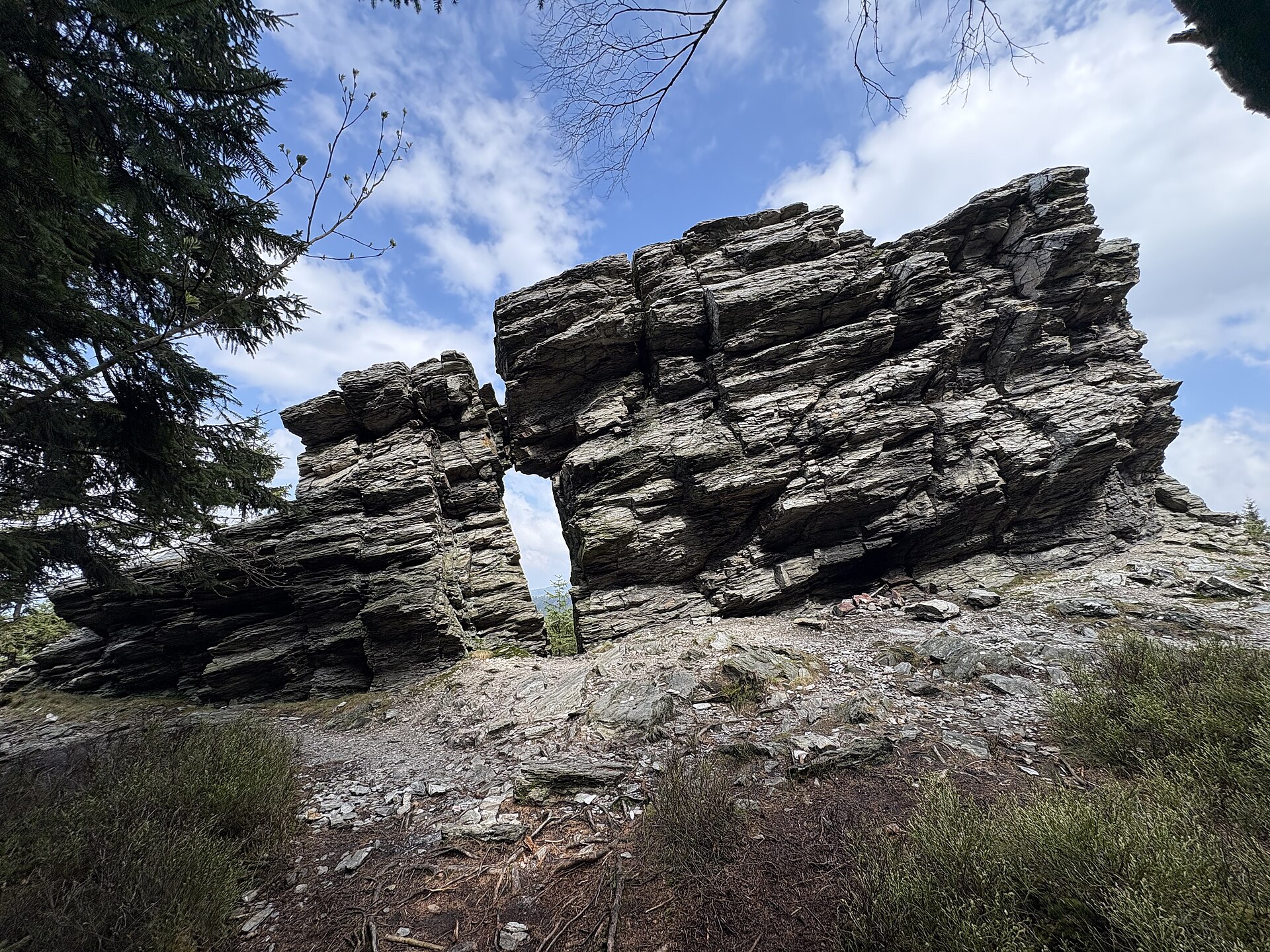
Ten distinct terrace levels have been identified on the slope, each between roughly 20 and 70 metres wide. Alongside the terraces themselves, the protected area also contains isolated rock formations sculpted by frost action, as well as extensive fields of quartzite rubble — known locally as felsenmeer or "stone seas" — created as fragments broke off the slopes over millennia of weathering.
Why is the area protected?
The site was granted protected status in 1995, with the aim of preserving this unique complex of geomorphological features from damage caused by erosion, tourism pressure, or potential development. The rubble fields also serve an important ecological role: the gaps between the stones and the cool microclimate they create form a habitat for rare invertebrate species that are otherwise hard to find at this elevation.
How can you visit the Ještěd Terraces?
The area is served by an educational nature trail, the Naučná stezka Terasy Ještědu, roughly 10 kilometres long. It starts and ends near the Tetřívčí sedlo saddle, at a spot called Výpřež close to a bus stop. Along the way, information panels introduce key points of interest, including Kamenná vrata (Stone Gate), Červený kámen (Red Rock), and the summit rubble fields just below the top of Ještěd. The trail gives visitors a chance to see both the terraces themselves and individual rock formations produced by frost weathering.
The route crosses varied and at times rocky terrain, so sturdy hiking footwear and enough time are worth planning for — a full loop makes for a several-hour outing.
Frequently asked questions
Where exactly are the Ještěd Terraces located? On the northern slope of Mount Ještěd, in the municipality of Světlá pod Ještědem in the Liberec District, within the Ještěd Protected Landscape Area.
When did the cryoplanation terraces form? During the Ice Age, through long-term frost weathering of the quartzite rock that makes up the mountainside.
How many terrace levels are there? Ten levels, each between 20 and 70 metres wide.
Since when has the area been protected? It was designated a natural monument in 1995.
How long is the educational trail? The Naučná stezka Terasy Ještědu is about 10 km long and starts near the Tetřívčí sedlo saddle (Výpřež).
Nearby places

Earn badges for the places you visit
Download NextOnTrip, discover new places and check off your trails.