About this place
Struhadlo is a small peak in the Giant Mountains (Krkonoše), located in the municipality of Špindlerův Mlýn within the Krkonoše National Park (KRNAP). It rises to roughly 1,007 metres above sea level and marks a distinctive point along the ridge overlooking the Elbe valley.
What kind of place is this?
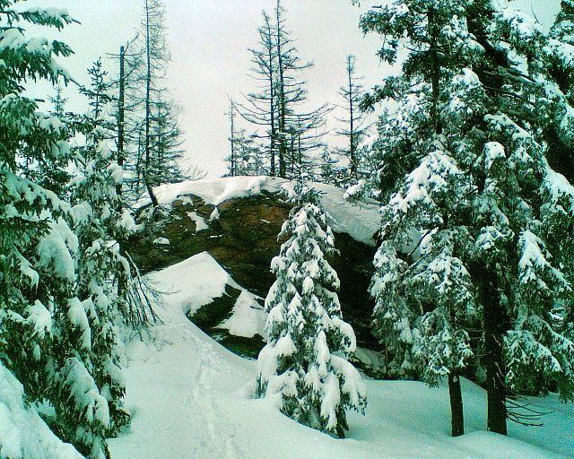
Struhadlo is a modest rise at the end of a mountain ridge, topped by a rock outcrop. It's not a summit that draws crowds the way nearby Sněžka does — it's a quieter waypoint for visitors who want a taste of high-mountain scenery without the foot traffic. The rocky top offers partial views over the surrounding Krkonoše ridgelines, and the whole area combines the raw character of a high-altitude ridge with easy access to the tourist infrastructure of Špindlerův Mlýn down in the valley.
Struhadlo sits directly on the route of the famous Krkonošská magistrála — the main ridge trail that runs through the highest parts of the Czech side of the Giant Mountains. That makes it a natural stopping point both for hikers on foot and, in winter, for cross-country skiers.
How do you get to Struhadlo?
The most popular way to reach the Struhadlo area is via the loop connecting Svatý Petr, Struhadlo and Pláň. The route runs about 13 km, following the Krkonošská magistrála through waypoints marked TK 816 and TK 805, circling the Struhadlo rise, then passing the Krásná pláň junction and the U srubu checkpoint before finishing at the upper station of the Pláň cable car.
The route starts in the trail area around Svatý Petr — an easily accessible part of Špindlerův Mlýn — and climbs gradually: total ascent over the full loop is around 538 metres, with only about 97 metres of descent, reflecting a route that runs mostly along the ridge before dropping to the cable car station at the end. Covering the full loop takes roughly 2 hours and 42 minutes on average, though actual time depends on fitness and snow conditions.
What will you see at the top?
Struhadlo itself is a small rise with a rocky ridge at its end — there's no built-up viewing infrastructure here, but the rock outcrop allows partial views down into the valley and across neighbouring parts of the Krkonoše range. It's a spot best appreciated by visitors who value the quiet of the ridge over crowded viewpoints.
When is the best time to visit?
The route across Struhadlo functions primarily as a winter cross-country skiing loop — technically easy, but demanding in terms of fitness given its length and total elevation gain. It's a good choice for skiers who want an active way to experience the winter landscape of the Giant Mountains without tackling the ridge's more technical sections. In winter, it's worth checking current snow conditions before setting out, since the route runs through open, high-altitude terrain.
After finishing the loop, at the upper station of the Pláň cable car, you can rest at the Na Pláni restaurant — a natural stop for a warm meal after the effort on the trail.
Frequently asked questions
How high is Struhadlo? The peak rises to approximately 1,007 metres above sea level.
Is the route across Struhadlo difficult? The Svatý Petr – Struhadlo – Pláň route is rated easy, though over its 13 km length it involves a total ascent of about 538 metres.
How long does the loop take? The average time to complete the loop is around 2 hours and 42 minutes, depending on fitness and trail conditions.
Where can you rest after the route? At the upper station of the Pláň cable car, the Na Pláni restaurant offers a place to warm up with a meal.
Nearby places

Earn badges for the places you visit
Download NextOnTrip, discover new places and check off your trails.