About this place
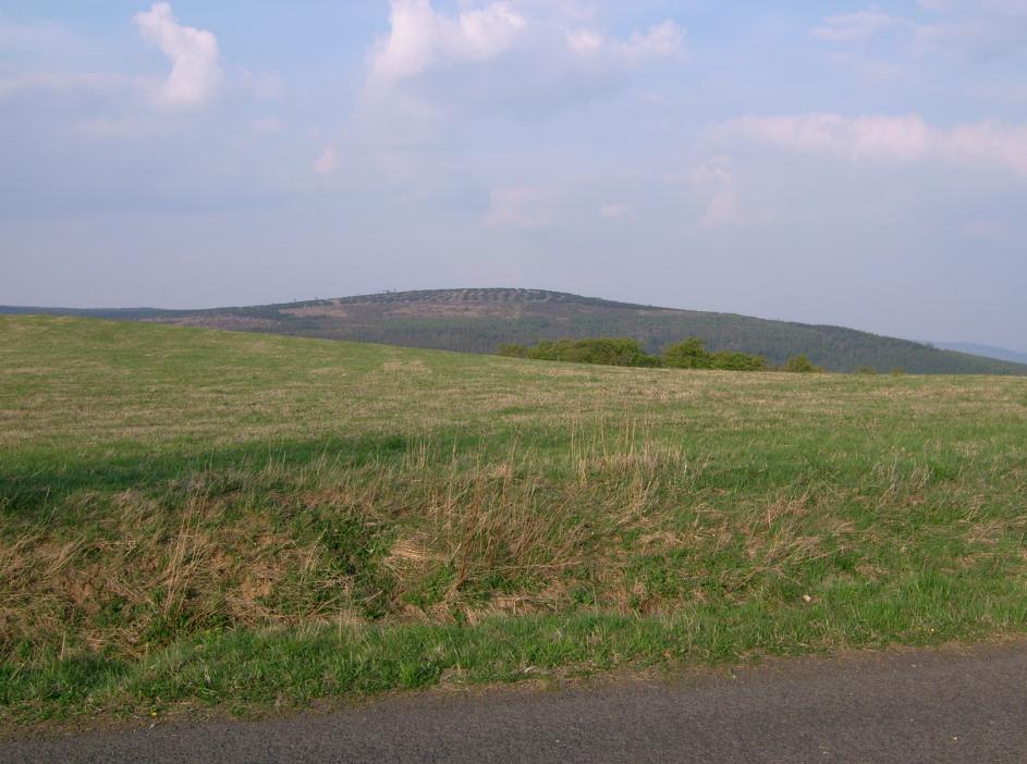
Rudný vrch is a twin-peaked mountain rising 796 metres above sea level, the highest point in the Ústí nad Labem district, overlooking the village of Zadní Telnice in the Krušné hory (Ore Mountains). Its name — literally "Ore Hill" — is no coincidence: the area was shaped for centuries by medieval-era metal mining, a history that still defines this part of the Telnice municipality.
Where is Rudný vrch located?
The mountain sits in the central part of the Ore Mountains, directly above Zadní Telnice, a small village belonging to the municipality of Telnice in the Ústí nad Labem district. This is Czech-German borderland, where the gentle, forested ridges of the Krušné hory have drawn miners for centuries and now draw hikers and winter-sports visitors looking for quiet trails and open views away from the crowds.
What's the history behind the mountain?
The first written mention of Telnice itself dates back to 1371, and it is directly tied to mining activity on Rudný vrch. For generations, ore was extracted from these slopes, giving the mountain its name and leaving traces still visible in the landscape today — old adits, spoil heaps, and paths that now serve as hiking routes. It was mining, not tourism, that first brought settlers into this remote, mountainous terrain.
How do you get to the summit?
Rudný vrch is freely accessible — reaching the top requires no special equipment or climbing experience, just sturdy walking shoes. The mountain has two summits roughly 300 metres apart, separated by a shallow saddle, both reaching close to 796 metres depending on the map used. The usual starting point is the village of Zadní Telnice, from where marked hiking trails climb through forest to the ridge. In summer, a cable car serving the ski resort on the slopes also offers a way up.
What will you see there?
From the top of Rudný vrch, views open out over the surrounding Ore Mountains ridgeline and the lowlands toward Ústí nad Labem, stretching well beyond the nearest peaks on clear days. The slopes are covered in mixed forest typical of the Krušné hory, and the lower sections still hold remnants of past mining activity worth a look along the way. In winter, the mountain takes on a different character: the Zadní Telnice ski resort operates on its slopes, with a lift network handling around 3,500 skiers per hour and roughly 4,250 metres of runs, all covered by artificial snowmaking.
When is the best time to visit?
Summer and autumn make Rudný vrch a good destination for an easy, scenic hike — trails run through forest, and temperatures above 700 metres are typically a few degrees cooler than in the valleys below. In winter, the area becomes one of the more popular ski destinations in the Ore Mountains; thanks to artificial snowmaking, the season runs reliably even in years with modest natural snowfall. In spring, aim for a calm, clear day, when visibility from the summit is at its best.
Frequently asked questions
How high is Rudný vrch? The mountain reaches 796 metres above sea level and is the highest point in the Ústí nad Labem district.
Is the hike to the summit difficult? No — the summit is freely accessible on foot without special equipment, and in summer a cable car offers an alternative way up.
Where does the mountain's name come from? The name refers to the area's ore-mining past — the first record of Telnice, from 1371, is directly linked to mining activity on this mountain.
What can you do on Rudný vrch in winter? The slopes host the Zadní Telnice ski resort, with several lifts and about 4,250 metres of runs, all covered by artificial snowmaking.
Nearby places

Earn badges for the places you visit
Download NextOnTrip, discover new places and check off your trails.