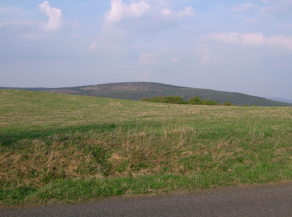
About this place
Pramenáč is a peak in the Ore Mountains (Krušné hory) whose summit falls administratively under the city of Košťany, even though geographically it sits roughly 2 km northeast of the village of Mikulov. At close to 910 metres above sea level, it is the highest point of the Cínovecká hornatina, a small sub-range that belongs to the wider Loučenská hornatina — one of the ridgelines running along the Czech-German border. Older German-language sources list the peak under the name Bornhauberg.
Where exactly is Pramenáč?
The mountain sits on a broad, asymmetrical watershed ridge typical of this stretch of the Ore Mountains. Geologically it's built from rhyolitic ignimbrite, a volcanic rock that shaped the entire Cínovecká hornatina massif. That gives the area a raw, rugged character, with rock outcrops scattered mostly along the steeper southeastern slope of the mountain.
What will you find on the summit?
The top of Pramenáč is flat and largely wooded, which means — somewhat counterintuitively for a named peak — there's no sweeping panoramic view to be had here. The terrain simply doesn't offer an open vantage point. What you will find is a large wooden cross, anchored with ropes, which has become something of a landmark for hikers crossing the ridge.
It's worth clearing up a common mix-up here: a historic wooden observation tower sometimes mentioned in connection with this range did not actually stand on Pramenáč, but on the neighbouring Warteck mountain. The first structure stood there from 1889 to 1906, and a second replaced it from 1906 to 1915. That distinction matters if you're planning a route specifically to see a lookout tower.
On the steeper southeastern flank of Pramenáč, hikers can spot scattered rock formations — a leftover from the volcanic history of the region and a small draw for anyone interested in field geology.
How do you get there?
Pramenáč lies within the Ore Mountains, in an area with a dense network of hiking trails linking towns and villages such as Košťany, Mikulov, and Cínovec. The most practical way to reach it is on foot or by bike, following trails through the Loučenská hornatina — a region popular for ridge-hopping routes that string several summits together in a single outing. A good starting point is either Košťany, the town the summit administratively belongs to, or the nearby village of Mikulov.
When is the best time to visit?
Because the summit is flat and forested, spring and autumn tend to be the best windows to visit Pramenáč — the tree canopy is thinner then, making it easier to spot the rock formations on the slope and to navigate the ridge. Summer suits longer, multi-hour ridge hikes across the whole Loučenská hornatina, while winter visits call for proper preparation given the elevation and the typically raw mountain microclimate of the Krušné hory.
Frequently asked questions
How high is Pramenáč? The summit reaches close to 910 metres above sea level, making it the highest point of the Cínovecká hornatina.
Is there a view from the top of Pramenáč? No — the summit is flat and wooded, so there's no classic scenic viewpoint up there.
Is there an observation tower on the summit? No. The historic wooden lookout tower sometimes mentioned for this area actually stood on the nearby Warteck mountain, not on Pramenáč itself.
Which town does the summit belong to administratively? Even though it sits geographically closer to the village of Mikulov, the summit area itself falls under the city of Košťany.
Nearby places

Earn badges for the places you visit
Download NextOnTrip, discover new places and check off your trails.