Save this place and discover nearby attractions with NextOnTrip
In the app you can add it to your favorites, see what else is worth visiting nearby on the map, and earn a badge for your visit.
The app is available for iPhone and Android.
About this place
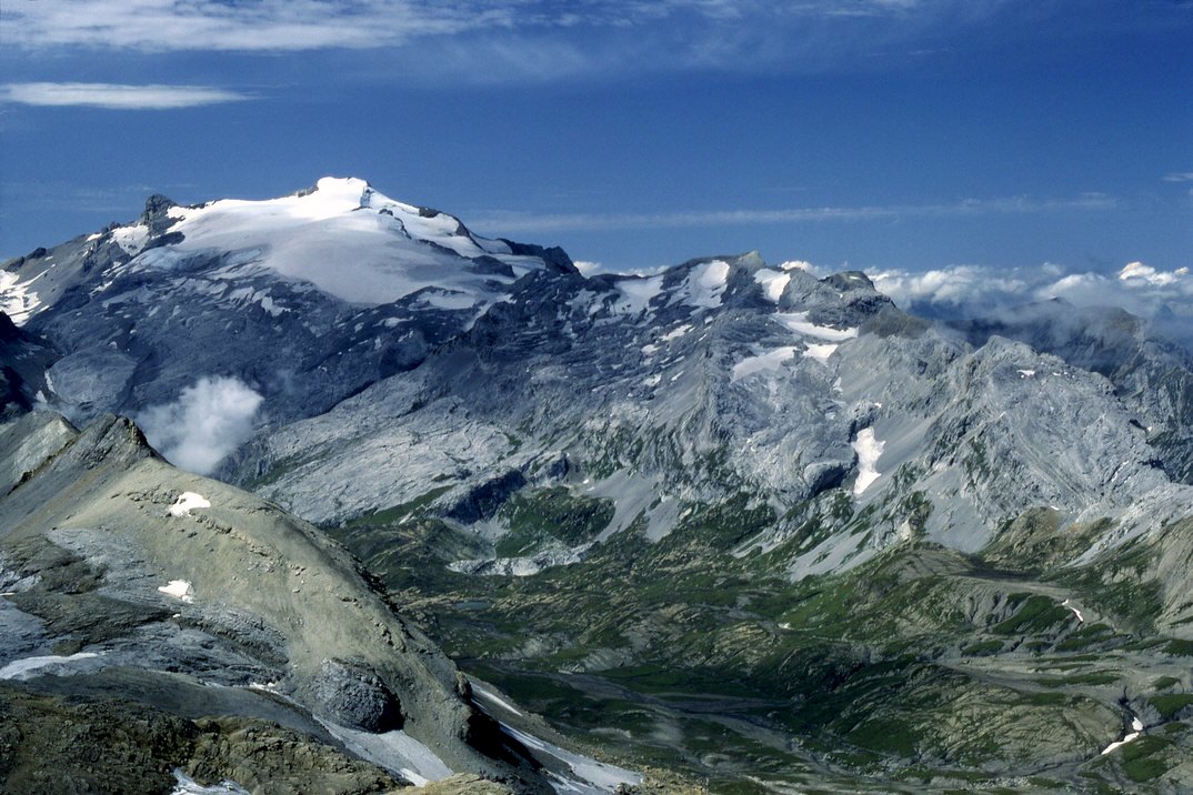
Rothorn (Lauener Rothorn) is a 2,275 m summit above the village of Lauenen in the Gstaad region, canton of Bern, Switzerland. It sits in the Obersimmental-Saanen administrative district at roughly 46.40 N, 7.37 E. Switzerland has many peaks called Rothorn, so the village name matters: Lauenen is the starting point for this one.
Where is this Rothorn and what makes it stand out?
The peak rises above the Lauenental valley, among slopes that the Gstaad holiday region uses for both winter and summer outdoor activity. The local tourist board lists it as the Lauener Rothorn and presents it as a demanding outing rather than a beginner walk. The climb takes you from the valley floor at 1,237 m to a ridge well above 2,000 m.
How do you get up the Lauener Rothorn?
The route begins in Lauenen at 1,237 m. Destination Gstaad gives it as about 7 km with around 1,028 m of ascent and roughly 3 hours up. The way passes Uf der Flue and Schönebode, and the last stretch follows the steep Blatti ridge to the top.
You can come back the way you went, or descend via Gubihubel, Gschwend, Sulz and Inneri Tüffi. The official write-up rates the route as difficult and was published as a ski tour, so check current conditions before setting out, and avalanche risk in winter.
When should you go?
The route description from the region mainly covers the ski-touring season, from winter into early spring when snow lies on the slopes. In summer the same line of ascent may be an option, but the steep ridge calls for good fitness and an on-site assessment of the terrain. Pick a settled weather day and start early so that the ascent and descent fit comfortably into daylight.
What else is there to do nearby?
Lauenen is a quiet village with easier trails starting from it. One popular option is the 14 km, four-hour ridge walk from Höhi Wispile down to the Lauenensee nature reserve, which makes a good alternative if the Rothorn feels like too much. A post bus links the lake with Gstaad.
Frequently asked questions
How high is the Rothorn near Lauenen? The Lauener Rothorn stands at 2,275 m above sea level.
Where does the climb start? In Lauenen village at 1,237 m, which leaves about 1,028 m of ascent.
How long does it take? About 3 hours on a route of roughly 7 km, according to the official description.
Is it an easy trip? No. It is graded difficult, and the final section follows the demanding Blatti ridge. In winter you need ski-touring gear and avalanche awareness.
Is it the same mountain as the Brienzer Rothorn? No. This is a separate peak in the Gstaad area of the Bernese Alps, unrelated to the other mountains with the same name.
Nearby places

Earn badges for the places you visit
Download NextOnTrip, discover new places and check off your trails.