- Monuments
- Historical Sites
Place de Jamblinne de Meux - de Jamblinne de Meuxplein
About this place
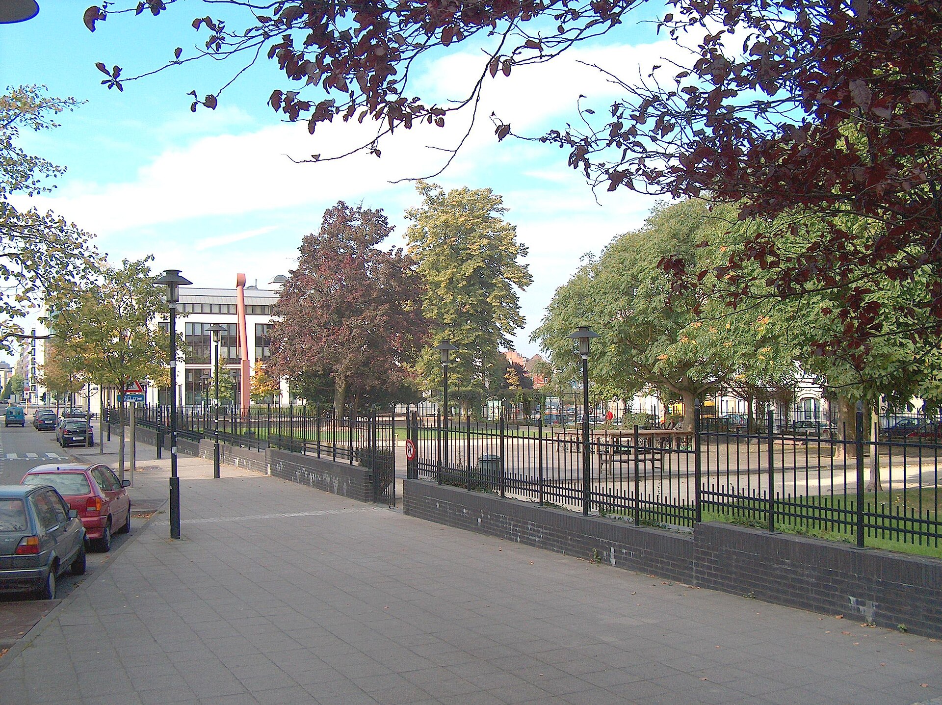
Place de Jamblinne de Meux – de Jamblinne de Meuxplein is a square in Schaerbeek, one of the nineteen municipalities of the Brussels-Capital Region, sitting right on the boundary between the city and the Linthout neighborhood. It functions as a major crossroads: seven streets and avenues converge here — Avenue de Cortenbergh, Rue des Patriotes, Rue du Noyer, Rue de Linthout, and Avenues Eugène Plasky, de l'Opale and de Roodebeek. That convergence turns the square into a hub linking the north-eastern part of the city with the Linthout district, and makes it one of the more recognisable landmarks in this corner of Schaerbeek.
Where does the Linthout neighborhood come from?
The street plan for the Linthout neighborhood, where the square is located, was drawn up in 1903-1904 by municipal engineer Octave Houssa. It was first approved by royal decree on 24 June 1904, and finally confirmed — together with the plans for three other new Schaerbeek neighborhoods — by royal decree on 21 April 1906. The idea behind developing this north-eastern part of the city actually goes back further still: as early as 1870, a preliminary layout proposal for the area was put forward by Baron Théophile de Jamblinne de Meux, then chief engineer of the City of Brussels.
Where does the square's name come from?
The square itself was named on 16 May 1905 by decision of the Schaerbeek municipal council, in honour of Baron Théophile de Jamblinne de Meux (1820-1912) — the very engineer whose earlier conceptual work on the layout of the north-eastern district led to the network of streets that still meet on this square today. The naming came almost in parallel with the final approval of the neighborhood's plans, closing the loop in a fitting way: the person behind the original urban concept was commemorated in the very space his ideas had helped shape decades earlier.
What used to stand on the square?
The square's history is not purely about urban planning. It once held a monument to Philippe Baucq, an architect executed by the Germans in 1915, during the First World War. That monument did not survive, however — it was destroyed in 1940, at the outset of the next conflict to hit Belgium. No trace of it remains on the square today, but the fact that it stood there at all shows the space has long carried symbolic weight beyond its role as a traffic junction.
What stands out about the square today?
Today, one of the square's most distinctive features is its greenery: it is surrounded by 27 trees classified as remarkable trees. That is a notable number for a square whose primary function is traffic circulation, making Place de Jamblinne de Meux something of a green landmark in this part of Schaerbeek as well. The square sits at coordinates 50.847377, 4.394636, close to Boulevard du Jardin botanique and other major routes connecting central Brussels with its north-eastern districts.
Frequently asked questions
Where exactly is Place de Jamblinne de Meux located? On the edge of the Linthout neighborhood in the municipality of Schaerbeek, at the junction of seven streets and avenues, in the north-eastern part of the Brussels-Capital Region.
Who was the square named after? After Baron Théophile de Jamblinne de Meux (1820-1912), chief engineer of the City of Brussels, who drafted a preliminary layout proposal for this part of the city back in 1870.
Are there any monuments on the square? Historically, it held a monument to Philippe Baucq, destroyed in 1940. Today the square is notable mainly for its mature trees — 27 of them classified as remarkable trees.
When was the neighborhood around the square developed? The Linthout street plan was approved by royal decrees in 1904 and finally in 1906, while the square itself was named in 1905.
Nearby places

Earn badges for the places you visit
Download NextOnTrip, discover new places and check off your trails.