About this place
Pilancones Natural Park is one of the wildest and least visited corners of Gran Canaria — a large protected area within the municipality of San Bartolomé de Tirajana, on the island's southern side. Covering nearly 5,800 hectares of mountainous volcanic terrain, it preserves a landscape that has remained largely untouched by the mass tourism found on the coast just a short drive away.
How did this landscape form?
The Pilancones massif was shaped by volcanic eruptions that took place more than 12 million years ago, making it one of the oldest parts of Gran Canaria. From a geological standpoint, the park is exceptionally valuable, since it allows scientists and visitors alike to trace the formation and evolution of the island, which as a whole is roughly 14.5 million years old. That long geological history left behind deep ravines, narrow plateaus and steep slopes that give the park its rugged, dramatic profile.
What can visitors see inside the park?
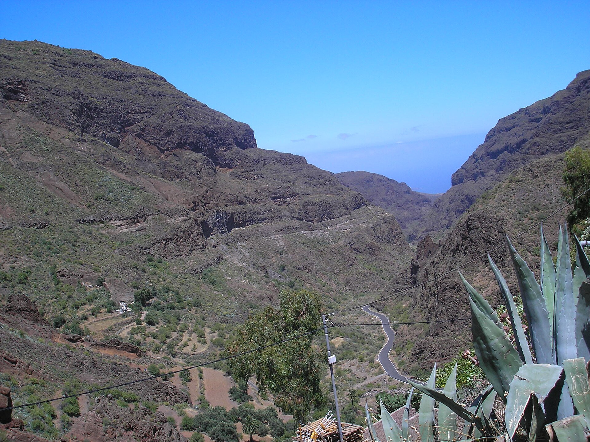
The core of Pilancones is a succession of scenic ravines, valued both for their beauty and for their geological interest. Lower elevations are covered in vegetation typical of the island's drier southern climate, while higher, cooler and more humid slopes support forests of Canary Island pine. This variation in altitude means that a single park contains several distinct vegetation zones within a relatively compact area.
Pilancones is not an isolated pocket of nature — it borders Roque Nublo Rural Park to the north and the Fataga Protected Landscape to the east, together forming one large, connected natural unit across the central and southern parts of Gran Canaria. This connection allows the park to act as an ecological corridor, linking different habitats across the island.
What wildlife lives in Pilancones?
The pine forests and ravines of the park support a notably rich bird population. Species commonly recorded here include the Canary Islands linnet, the great spotted woodpecker, the European robin, various tits, owls, the blue chaffinch — a bird endemic to the Canary Islands — and several warbler species. Most of these birds concentrate in the pine forest areas, where they find both food and shelter.
How do you get there?
The most common way to reach Pilancones is via the GC-60 road, which connects Maspalomas with San Bartolomé de Tirajana and crosses the Fataga ravine along the way. This route offers striking views of the park from the car, though truly experiencing the area means leaving the road for the hiking trails that descend into the ravines themselves.
Frequently asked questions
Where is Pilancones Natural Park located? It lies in the south of Gran Canaria, within the municipality of San Bartolomé de Tirajana, close to the popular resorts of Maspalomas and Playa del Inglés, even though the park's interior has an entirely different, mountainous character.
How old is this landscape? The rocks forming the Pilancones massif date back to volcanic eruptions more than 12 million years ago, making it one of the oldest areas on the island.
Which other protected areas border the park? Roque Nublo Rural Park to the north and the Fataga Protected Landscape to the east — together they form one large, continuous natural area.
What's the easiest road to reach the area? The GC-60, which links Maspalomas with San Bartolomé de Tirajana and crosses the Fataga ravine.
What animals can be seen in the park? Mainly birds associated with the pine forests: the Canary Islands linnet, great spotted woodpecker, European robin, tits, owls, blue chaffinches and warblers.
Nearby places

Earn badges for the places you visit
Download NextOnTrip, discover new places and check off your trails.