About this place
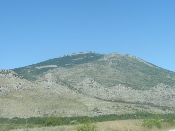
Orlovača is a 494-metre peak on the Trtar massif near Šibenik, rising right above the canyon of the Krka River. It isn't the highest point of Trtar, but locals consider it the most rewarding one to visit, and it's a favourite short trekking destination for people from the Šibenik area.
How do you get to the top?
The hike starts at the entrance ramp of the Trtar wind farm. From there, a gravel road runs from pole to pole between the wind turbines all the way to the summit. Walking from the car park to the top takes roughly an hour and a half. No climbing gear is needed, but the surface is rocky and occasionally steep, so proper hiking shoes are worth packing.
The trailhead sits close enough to Šibenik that the walk works well as a half-day outing, and Orlovača also shows up as a stop on several cycling routes around the Šibenik region — so cyclists reach the same viewpoint by bike rather than on foot.
What will you see at the top?
The summit plateau is crowned by 14 large turbines of the Trtar–Krtolin wind farm, which supplies electricity to Šibenik and the surrounding towns. The turbines against the backdrop of sea and hinterland are a sight in themselves, but the real reward is the panorama from the ridge.
On a clear day, the view from Orlovača stretches to the Velebit mountain range, peaks inside Bosnia and Herzegovina, the Kornati archipelago, and the island of Svetac. Few spots in the area let you take in both the Adriatic coastline and the inland mountains in a single glance. A mountain shelter named after Zlatko Prgin stands close to the peak, offering hikers a place to rest.
Where does the name come from?
The name Orlovača comes from a local legend. According to the story, the hill wasn't named for eagles in general, but for the so-called "King of Eagles" — a bird said to have kept its nest at the very summit for centuries, watching over and protecting the surrounding land. Local mountain guides and hiking clubs from the Šibenik region still pass the legend on to visitors today.
When is the best time to visit?
Spring and autumn are the best seasons: temperatures are milder and visibility tends to be clearer. In summer, the mostly shadeless, rocky track can get tiring under direct sun, so an early start is worth planning for. Mornings also mean less exposure to the strong winds that regularly sweep the open Trtar ridge and keep its turbines turning.
Frequently asked questions
How high is Orlovača? The peak stands at 494 metres above sea level, on the Trtar massif above the Krka canyon.
How long does the hike to the top take? Around 1.5 hours one way from the trailhead at the wind farm entrance.
Is there anything to see at the summit besides the view? Yes — the summit area holds 14 turbines of the Trtar–Krtolin wind farm, and the Zlatko Prgin mountain shelter is nearby.
Is the trail suitable for beginners? Yes, the route mostly follows a gravel road and needs no climbing gear, though comfortable hiking shoes and water are recommended since the path is largely exposed to the sun.
Nearby places

Earn badges for the places you visit
Download NextOnTrip, discover new places and check off your trails.