About this place
Montes Obarenes-San Zadornil Natural Park stretches across the northeastern corner of Burgos province in the Spanish region of Castile and León, reaching all the way to the border with Álava province in the Basque Country. The mountain range forms the last, southernmost foothills of the Cantabrian Mountains, rising like a natural wall above the flat lowlands of La Bureba and creating a landscape contrast visible from a considerable distance.
When was the park established?
The area was granted natural park status in 2006, placing more than 33,000 hectares under protection. The designation aimed to safeguard not just the scenery but also the region's geological and biological richness, which had long remained overshadowed by Spain's more famous national parks.
What does the landscape look like?
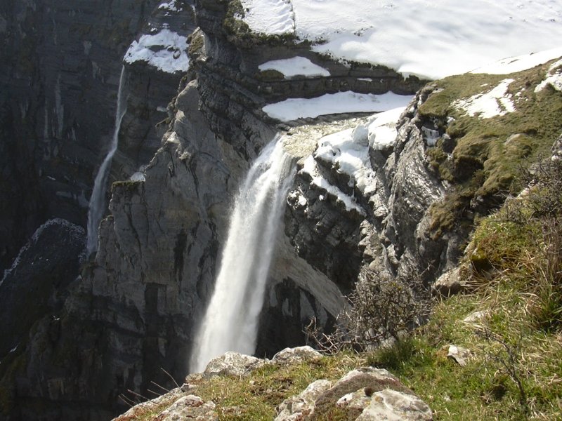
A defining feature of the Obarenes mountains is their Jurassic-era structural relief — rock layers folded and uplifted during that geological period now form steep, jagged ridges and rock faces. The range's highest point is Pico Humión, reaching 1,437 metres above sea level. The limestone bedrock has carved deep gorges and valleys, through which rivers cut their way toward the Ebro valley.
Why is the park so biologically diverse?
Sitting at the crossroads of two biogeographic regions — Atlantic and Mediterranean — Montes Obarenes-San Zadornil boasts an unusually rich variety of tree and shrub species. The damper, north-facing slopes support beech and oak forests typical of an Atlantic climate, while the sunnier southern slopes host Mediterranean species adapted to drier conditions. This mosaic of habitats supports an equally rich fauna: researchers have catalogued 128 vertebrate species within the park's boundaries. Mammals include wild boar and roe deer, alongside the far more elusive European wildcat. Overhead, golden eagles patrol the skies, while the eagle owl — one of Europe's largest birds of prey — hunts under cover of night.
What can visitors do here?
The natural park has been developed with a range of outdoor activities in mind. An extensive network of hiking trails lets visitors explore the gorges, ridgelines, and lookout points at their own pace, while cycling routes wind through the range's gentler terrain. Horseback riders will find dedicated trails, and birdwatchers can expect sightings of raptors circling above the rock faces. Designated recreational areas are also scattered throughout the park, offering places to rest during a longer outing.
Frequently asked questions
Where exactly is the park located? In the northeastern part of Burgos province (Castile and León), bordering Álava province in the Basque Country.
How large is the protected area? The park covers more than 33,000 hectares.
What is the highest peak? Pico Humión, at 1,437 metres above sea level.
When was the park created? It was declared a natural park in 2006.
What wildlife can be seen here? Among others, wild boar, roe deer, European wildcats, golden eagles, and eagle owls — 128 vertebrate species have been catalogued in total.
Nearby places

Earn badges for the places you visit
Download NextOnTrip, discover new places and check off your trails.