Save this place and discover nearby attractions with NextOnTrip
In the app you can add it to your favorites, see what else is worth visiting nearby on the map, and earn a badge for your visit.
The app is available for iPhone and Android.
About this place
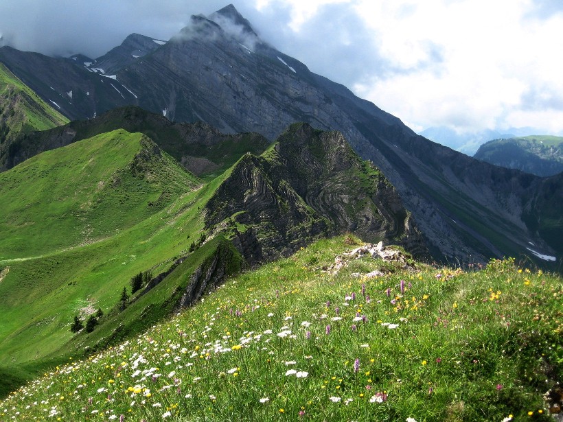
Mittaggüpfi is a summit of roughly 1,917 m near Alpnach in central Switzerland. It rises west of the main Pilatus ridge, right on the border between the cantons of Lucerne and Obwalden, in the range grouped with the Emmental Alps. Locals also call it Gnepfstein. It is a quieter hiking goal than the busy summit station of Pilatus.
Where is Mittaggüpfi and what should you know about it?
The peak belongs to the Pilatus massif but is not its high point. That title goes to the Tomlishorn at about 2,128 m. Mittaggüpfi sits further west above the Sarner Aa valley. Sources quote its height anywhere from 1,911 to 1,917 m, so signs and guidebooks may disagree. The name is thought to refer to the sun's position at midday as seen from the Schwarzenberg side. During the Second World War the hill served as a lookout far across the Swiss Plateau.
How do you get to Mittaggüpfi?
The most popular option is a loop from the alp of Lütholdsmatt. It covers about 11 km, takes around 4 hours and involves roughly 766 m of climbing. On the way you pass the Tripolihütte, a hut built in 1972 by the Pro Pilatus association. The descent runs past Rote Dossen and Feldalp, then follows the alp road back to the start. Trail portals rate the route as moderate.
The alternative is a multi-day walk from Pilatus Kulm to Sörenberg over the Tomlishorn and Mittaggüpfi. To reach Pilatus Kulm, take the cog railway from Alpnachstad, which you can reach by boat from Lucerne. The shorter stretch from Pilatus Kulm to Gfellen is around 13 km and about 6 hours. You can also approach the summit from the bus stops at Eigenthal or from the lower station of the Kriens gondola.
What can you see from the top?
The summit offers a full 360-degree panorama from the Swiss Plateau to the Jura. From the Tripoli hut area you look across the Sarner Aa valley to the Melchtal mountains and the Bernese Alps. The path crosses pastures and rocky ridges, so wear proper hiking boots.
When should you go?
July to October is the best window, when the trails are free of snow. Start early for clear views and a time buffer on the way down. Carry water and a windproof layer, because weather at almost 1,900 m changes fast.
Frequently asked questions
Is Mittaggüpfi the highest point of Pilatus? No. The Tomlishorn, at about 2,128 m, is higher. Mittaggüpfi lies west of the main part of the massif.
How long is the loop from Lütholdsmatt? About 4 hours for roughly 11 km and 766 m of ascent.
Do I need a railway to reach the summit? No. You can hike the Lütholdsmatt loop or approach from Eigenthal. The Alpnachstad cog railway is only needed for the Pilatus Kulm variant.
Why do sources give different heights? Maps and databases list between 1,911 and 1,917 m. The figure of about 1,917 m appears most often.
Nearby places

Earn badges for the places you visit
Download NextOnTrip, discover new places and check off your trails.