About this place
Lac de Nielluccio is a small mountain lake in Corsica, sitting within the commune of Ghisoni in the Haute-Corse department. It lies in the Monte Renoso massif, between the peak itself and the Ventosa ridge, at an elevation of 1,919 metres. The lake is one of five lakes scattered around Monte Renoso within the Fiumorbo watershed, and it draws mainly hikers looking for a quiet, high-altitude corner of the island away from the coastal crowds.
Where exactly is the lake?
Lac de Nielluccio sits deep in Corsica's interior, in the commune of Ghisoni, on the high ground of the Monte Renoso massif (2,352 m). Its better-known neighbour, Lac de Bastani, lies less than a kilometre away, closer to the summit itself. The two lakes share the same glacial origin and are often visited on the same outing, but they are separate bodies of water with distinct settings — Bastani sits higher and nearer the peak, while Nielluccio lies a little further down, on the valley side.
What does the lake look like?
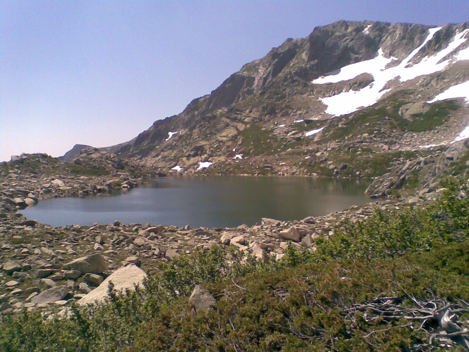
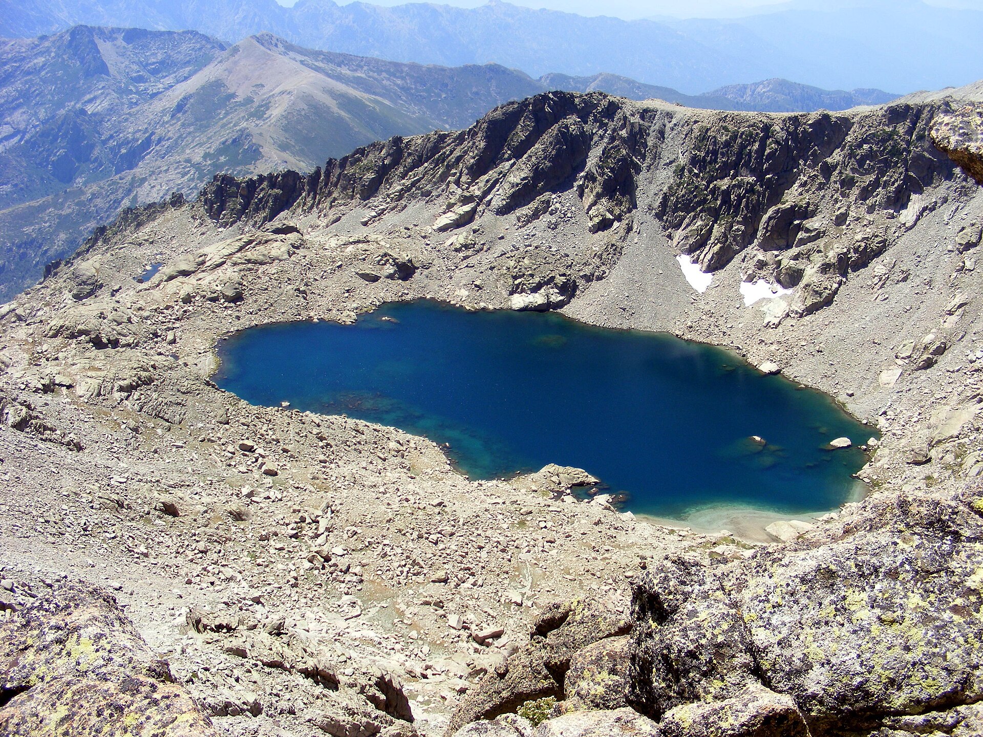
The lake is modest in size, covering roughly 1.2 hectares, with a maximum depth of about 15 metres. It occupies a rocky glacial basin typical of Corsica's high interior, ringed by bare granite slopes rather than forest. The water is usually still and dark, standing out against the pale rock around it. Levels can drop noticeably in the warmer months, exposing a stony shoreline.
How do you get there?
Access is on foot, from trails rising out of the Fiumorbo valley. One common approach starts at the Casaccie bridge and follows a stretch of the GR20 long-distance trail upward, passing the former Traggette sheepfolds before reaching the lake. Another route links up with the nearby Lacs de Rina, returning via the same section of the GR20. Neither route is technically extreme, but both demand a reasonable level of fitness: expect steep, rocky stretches, especially on the final approach to the water. The path is marked with cairns, though in fog or poor visibility it can be difficult to follow, so carrying a map or GPS is a sensible precaution.
Who is this hike suited for?
This is a destination for prepared hikers rather than casual visitors — there are no lifts, access roads, or facilities anywhere near the lake itself. The payoff is solitude and views over the bare rock of the Renoso massif that are hard to find in Corsica's more accessible spots. Plan for a full day out, wear proper hiking boots, and carry enough water and sun protection, since there is little to no shade once you're above the treeline.
Frequently asked questions
How high up is Lac de Nielluccio? The lake sits at 1,919 metres above sea level, within the Monte Renoso massif.
Is it a large lake? No. It covers about 1.2 hectares and reaches a maximum depth of roughly 15 metres, making it a small, intimate mountain lake.
Is Lac de Nielluccio the same as Lac de Bastani? No. They are two separate lakes close to each other in the same massif. Bastani sits higher, nearer the summit of Monte Renoso, while Nielluccio lies somewhat lower, toward the valley.
How do you reach the lake? Most visitors walk in from the Casaccie bridge, following part of the GR20 past the former Traggette sheepfolds, or approach via the nearby Lacs de Rina. The hike requires decent fitness and care on the steep, rocky sections.
Is the trail well marked? Partly. Cairns guide the way, but in fog or low visibility the route can be hard to follow, particularly on the final, more demanding stretch — a map or GPS device is worth carrying.
Nearby places

Earn badges for the places you visit
Download NextOnTrip, discover new places and check off your trails.