About this place
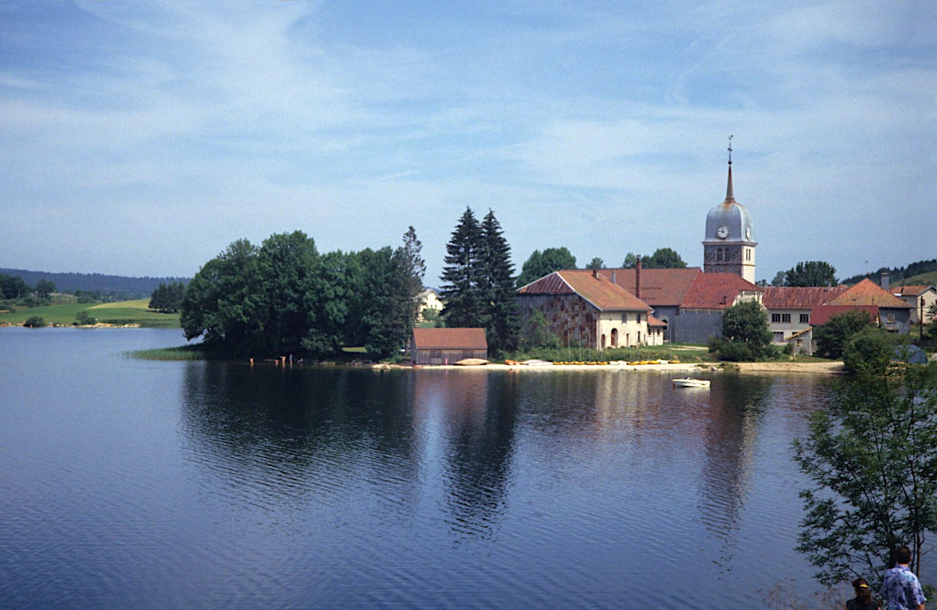
Lac de Lamoura is the highest lake in the Jura department, sitting at 1,156 metres above sea level in the commune of Lamoura, deep in the Haut-Jura region of eastern France. Bordered by the Forêt du Massacre, one of the best-known forest tracts in the French Jura, the lake occupies a quiet basin where mountain scenery meets peat bogs and damp upland meadows typical of the high plateaus along the Swiss border. It draws local families for a swim in summer and snowshoers and cross-country skiers once the snow settles in.
Where exactly is the lake located?
Lac de Lamoura sits at coordinates 46.3953 N, 5.9819 E, right next to the village of Lamoura and a short drive from the well-known Les Rousses ski resort. The surrounding Haut-Jura area is known for its high pastures, fir and spruce forests, and a scattering of glacial lakes strung along the French-Swiss frontier. Because of the elevation, the climate around the lake stays noticeably cooler than in the lower parts of the department, which means a longer snow season and a shorter, more intense summer.
Can you swim in Lac de Lamoura?
Yes. The lake has a supervised bathing area that operates during the summer holidays, typically from the beginning of July to the end of August, with a lifeguard on duty in the afternoon hours. Access to the beach is free, as is the nearby parking. It is one of the few lakeside swimming spots in this part of the Jura sitting at such an altitude, so the water tends to stay bracingly cool even at the height of summer.
Is fishing allowed on the lake?
Fishing is permitted during a set season, generally running from the first Saturday of June through the last Sunday of November. Local rules limit anglers to two rods each and set specific restrictions on catch limits and permitted techniques, so it is worth checking the current regulations from the local fishing association before heading out.
What walking routes circle the lake?
A loop of roughly two kilometres runs around Lac de Lamoura, and most visitors cover it in under an hour. Much of the path is accessible to visitors with reduced mobility and crosses peat bog terrain, where the marshy vegetation and traces of the Jura plateau's geology are on display. Information panels along the way explain how the peat bogs formed and describe the local flora.
What is there to do in winter?
In winter, the lake becomes a destination for snowshoe routes that start in the village of Lamoura and lead down to the frozen shoreline. This ties in naturally with the offerings of the nearby Les Rousses resort, a well-known base for cross-country skiing and winter tourism in the Haut-Jura.
What else is available on site?
A children's playground and a picnic area with barbecue facilities sit right by the water, making the lake an easy target for a family day trip. Free parking makes access straightforward, and the adjoining Forêt du Massacre invites a longer walk for anyone wanting to extend the visit into the woods.
FAQ
How high up is Lac de Lamoura? The lake sits at 1,156 metres above sea level, making it the highest lake in the Jura department.
Is there a supervised beach at the lake? Yes, a supervised swimming area operates during the summer season (July–August) with free access.
How long does it take to walk around the lake? The full loop is about 2 km and takes roughly an hour; most of it is accessible for visitors with reduced mobility.
Can you fish at Lac de Lamoura? Yes, during the fishing season that runs from the first Saturday of June to the last Sunday of November, limited to two rods per angler.
How do you get to Lac de Lamoura? The lake is located next to the village of Lamoura in the Haut-Jura region, close to the Les Rousses ski resort, with free parking available on site.
Nearby places

Earn badges for the places you visit
Download NextOnTrip, discover new places and check off your trails.