About this place
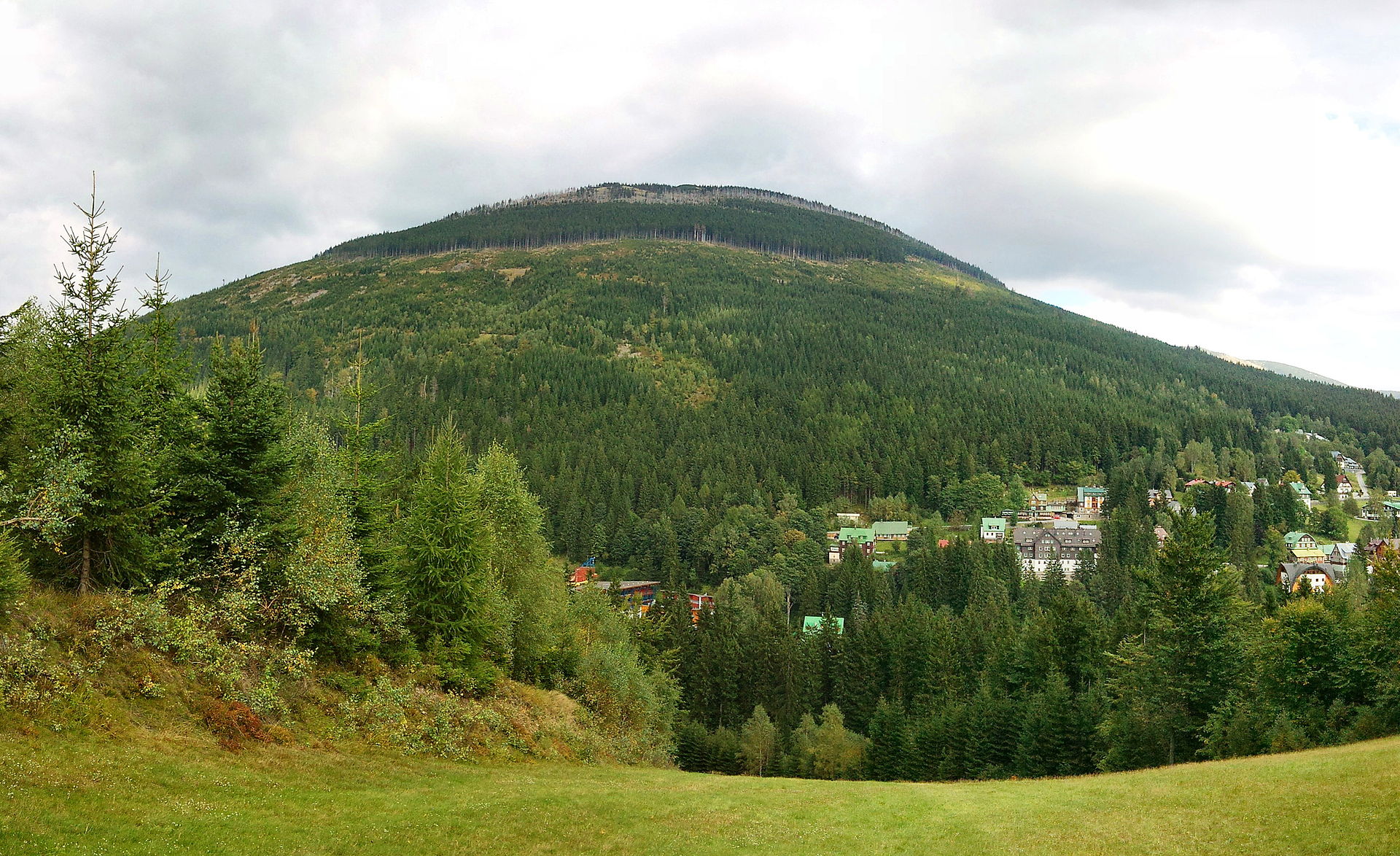
Kozie Grzbiety (Kozí hřbety) is a rocky mountain ridge rising above Špindlerův Mlýn on the Czech side of the Karkonosze (Krkonoše) Mountains. It stands out as the only stretch of the entire Karkonosze range with a genuinely alpine character — a sharp, rocky crest that looks nothing like the smooth, grass-covered slopes of the neighbouring Śląski Grzbiet (Silesian Ridge) running parallel across the valley.
Where exactly is it?
The ridge stretches for about 3 kilometres, at elevations between 1,317 and 1,422 metres above sea level, just northeast of Špindlerův Mlýn. Its highest point is the summit of Krakonoš (1,422 m), which opens up views across the western Krkonoše range and the Sedmidolí valley below. The whole area sits within the Krkonoše National Park, on the Czech side of the border.
What makes it stand out?
Jagged, rocky crests are unusual in the Karkonosze — most ridges here were smoothed by glaciers into rounded, gentle forms. Kozie Grzbiety is the exception: its steep flanks are covered in patches of scree, dwarf pine and stunted spruce typical of the subalpine zone, giving the whole ridge a distinctly wilder, more mountainous feel than anywhere else nearby.
There's also a mining history worth knowing: in the 16th and 17th centuries, copper, silver and arsenic ores were extracted from this area. Nothing of that industry is visible on the trail today, but it adds an extra layer to the story of the place.
How do you get there?
Crossing the full ridge on foot is prohibited for nature conservation reasons — only its eastern section is open to hikers. A red-marked trail from Špindlerův Mlýn leads up towards Luční bouda, passing close to the Krakonoš summit along the way. It's one of the more dramatic routes in the whole Karkonosze range, combining a forested approach with an exposed, rocky crest and wide panoramic views.
Ambitious hikers sometimes use this route as the starting point for a longer ridge walk toward Sněžka, the highest peak in the Karkonosze — a full-day undertaking for well-prepared visitors.
When should you visit?
Summer and early autumn offer the best access and the clearest views, though mountain weather here can change quickly, so proper footwear and layers are essential. In winter, the trail along the slopes of Kozie Grzbiety is often closed due to avalanche risk — check current Krkonoše National Park advisories before setting out.
What will you see along the way?
Beyond the ridge itself and the view from Krakonoš, the route passes through classic high-mountain scenery: boulder fields, dwarf pine thickets and pockets of old spruce forest. It's one of the few places in the Karkonosze where the landscape feels closer to the high Tatras than to the typical rounded ridgelines of the Sudetes.
Frequently asked questions
Can you hike the entire Kozie Grzbiety ridge? No. For nature protection reasons, only the eastern section is accessible, leading toward the Krakonoš summit and on to Luční bouda.
How long is the trail? The ridge itself is about 3 km long, but a typical round trip from Špindlerův Mlýn usually takes several hours, depending on the return route chosen.
Is the hike difficult? The ridge section is more demanding than most Karkonosze trails — rocky terrain and steep climbs call for reasonable fitness and sturdy hiking boots.
Can this route be combined with climbing Sněžka? Yes, experienced hikers often extend the ridge walk from Kozie Grzbiety toward Sněžka, the highest peak in the Karkonosze — but that requires a full day and stable weather.
Nearby places

Earn badges for the places you visit
Download NextOnTrip, discover new places and check off your trails.