About this place
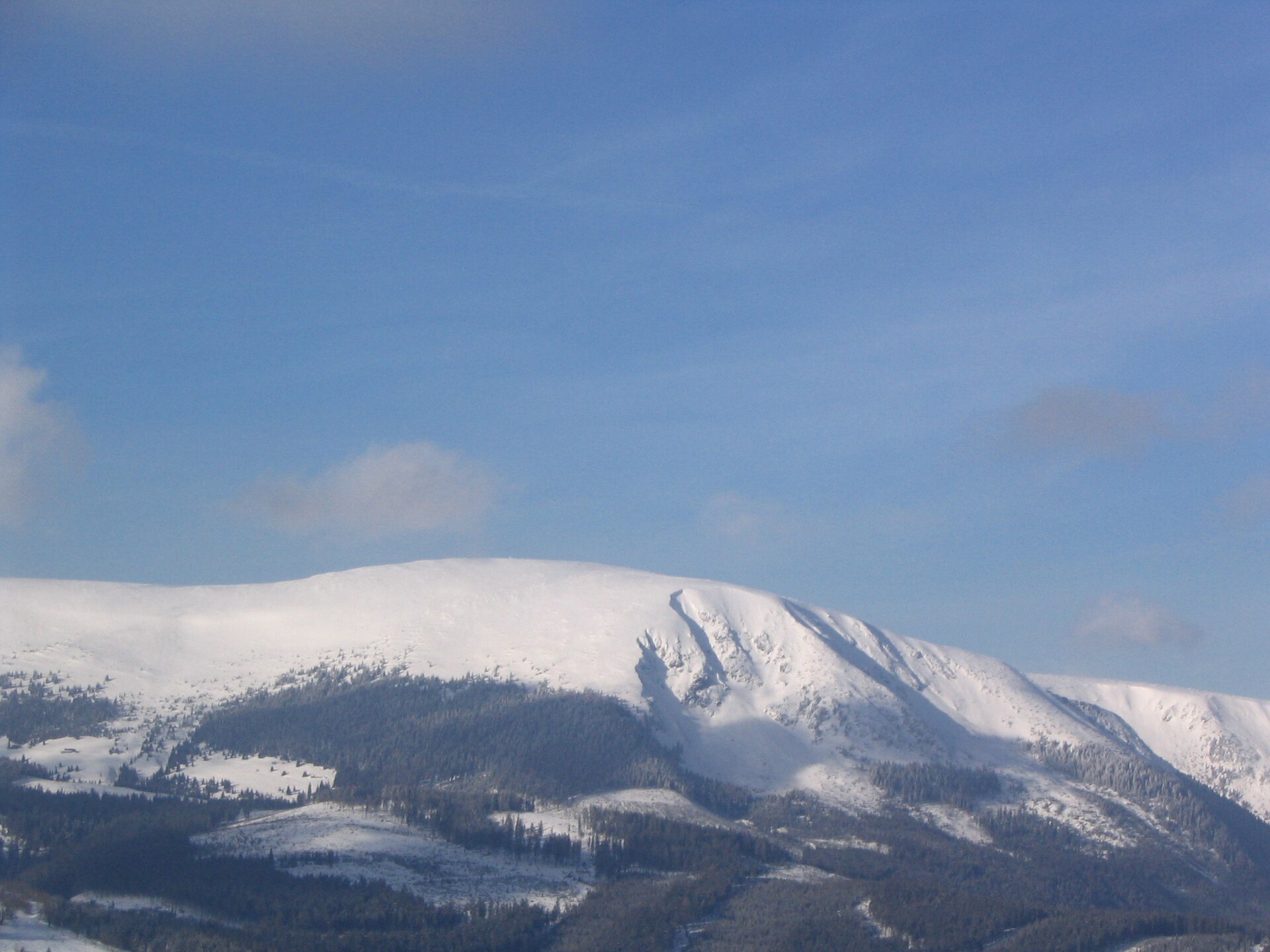
Zadní Planina is a peak in the central Krkonoše Mountains (Giant Mountains), roughly 4.5 km east of Špindlerův Mlýn and just under 6 km southwest of Sněžka, the highest summit of the entire range. The mountain's older German name, Plattenberg, still shows up on some maps and in historical guidebooks of the region. The whole massif lies within the Krkonoše National Park (KRNAP), which means both nature-protection rules and a well-marked network of trails and tourist infrastructure nearby.
How do you get to Zadní Planina?
Špindlerův Mlýn is the natural starting point for almost every route in this direction. Hiking trails head east from town into the central Krkonoše, climbing toward Zadní Planina and, further on, toward Sněžka. The path crosses classic Krkonoše terrain — mixed forest lower down giving way to dwarf mountain pine and open alpine meadows higher up. It's worth planning this as a full-day outing, since the area offers several return options: loop back on a different trail, or push on toward Sněžka if time and stamina allow.
What will you see along the way?
The Zadní Planina massif doesn't have one sharp, dominant summit — it's really a broad complex of ridges, hummocks, and shallow valleys, which is why it doesn't stand out dramatically from neighboring elevations at a distance. The exception is its northern flank, a noticeably steeper slope dropping toward the deeply cut Dlouhý důl valley — this is where the most striking views over the surrounding ridgelines open up. Several streams rise on the slopes of Zadní Planina and fan out in different directions: Zelený potok to the east, Svatopetrský potok to the north, and Klínový potok to the southwest. It's a good spot to notice how a mountain watershed shapes the river network of an entire region.
When should you visit?
Late spring through early autumn (May–October) is the best window for hiking this part of the Krkonoše, when trails are clear and views over the valleys and ridges are at their sharpest. In winter the terrain demands proper preparation — weather in the higher parts of the Krkonoše can shift quickly, and sections of trail are often snowed in. Špindlerův Mlýn itself operates year-round as a base — hikers in summer, skiers in winter — so a trip can be planned in any season.
Who is this route for?
Given the massif's generally gentle, sprawling character (apart from the steep stretch above Dlouhý důl), the area around Zadní Planina suits hikers with average fitness who are used to longer, full-day mountain outings. It's a solid pick for anyone looking for something beyond the crowded trails leading straight to Sněžka — the surroundings of Zadní Planina are noticeably quieter.
Frequently asked questions
Is Zadní Planina inside a national park? Yes, the entire massif lies within Krkonoše National Park (KRNAP), so nature-protection rules apply — stay on marked trails and respect the local flora and fauna.
How far is it from here to Sněžka? About 6 km in a straight line to the northeast — a realistic add-on if the goal is to also reach the highest peak of the Krkonoše.
Does the summit have one clear high point visible from far away? No — Zadní Planina is a broad massif made up of many ridges and hummocks rather than a single dominant peak. Its most distinctive feature is the steep section facing the Dlouhý důl valley.
What is the mountain's German name and where does it come from? Plattenberg — the name dates back to when the region was largely German-speaking, and it still appears in some historical maps and regional guidebooks of the Krkonoše.
Nearby places

Earn badges for the places you visit
Download NextOnTrip, discover new places and check off your trails.