About this place
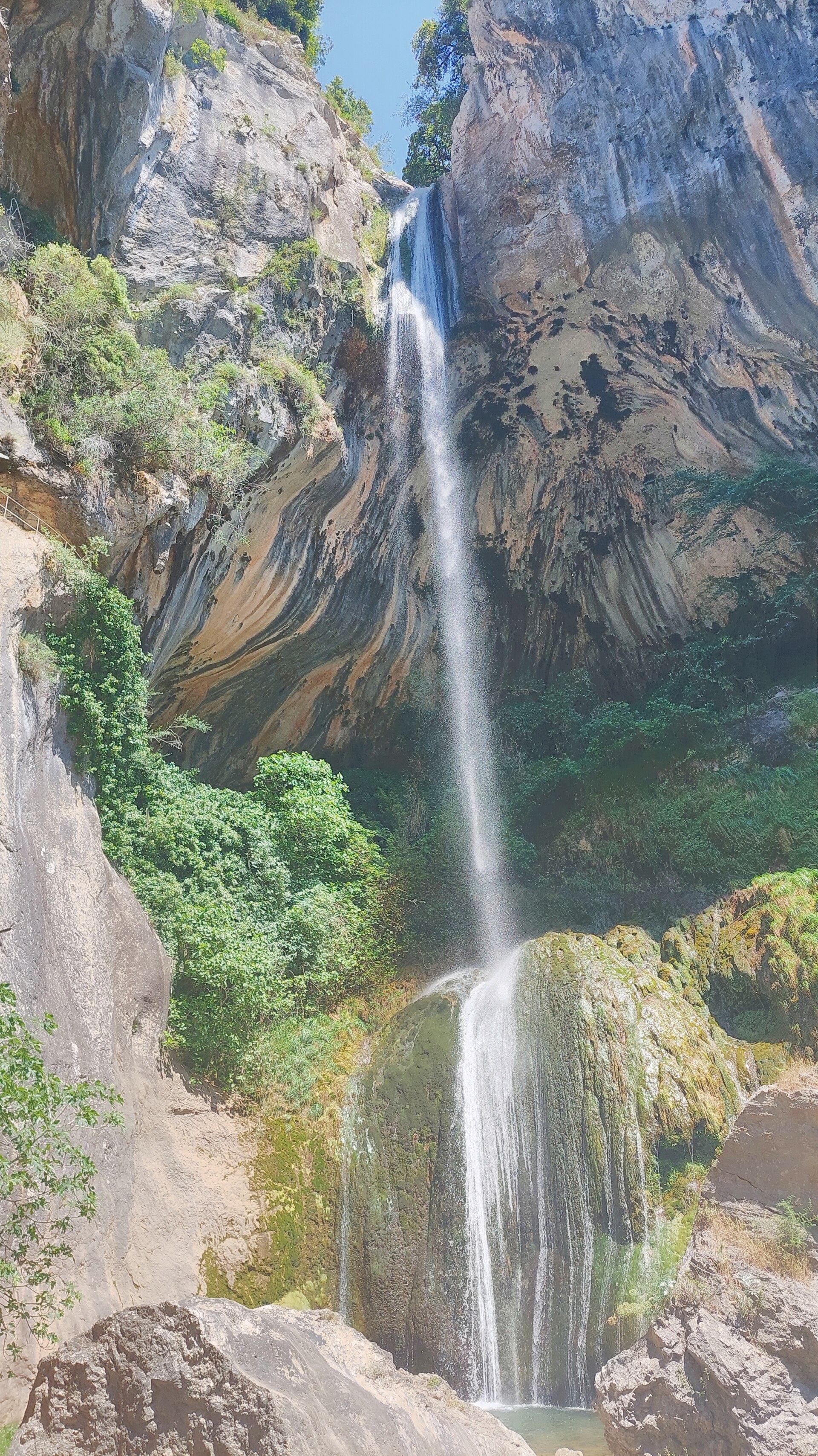
Cascade du Végay is a waterfall tucked into a wooded ravine near the village of Aiglun, in the Alpes-Maritimes department of southeastern France. Falling in three successive tiers for a combined height of around 140 metres, it ranks among the taller and more dramatic waterfalls of the Préalpes d'Azur. The site sits within the Préalpes d'Azur regional nature park, close to the Clue d'Aiglun, one of the most striking gorges in the area, with rock walls rising 200 to 400 metres.
Where is the Végay waterfall located?
The waterfall lies in the Vallon de Végay, a small stream that feeds into the Estéron river. It falls administratively within the commune of Aiglun, a small inland village behind Nice, set in the heart of the pre-Alpine foothills. The surrounding landscape is defined by limestone gorges, steep slopes, and terrain carved over time by water draining from the higher parts of the massif.
What does the waterfall look like?
The cascade unfolds over three distinct tiers, which is why it is often described as a three-stage waterfall. The water drops through wooded terrain, forming small pools and shaded corners that draw visitors looking to cool off in summer. Owing to its landscape and scientific value, the site was listed as a natural monument and a site of artistic, historic, scientific, legendary or picturesque character by a decree dated 6 November 1933.
How do you reach the Cascade du Végay?
The hike starts at the square in front of the town hall in Aiglun, facing the local inn. The trail is first marked with yellow blazes, then switches to the red-and-white markings of the GR4 long-distance path as it crosses the commune. The round trip covers roughly 5.4 kilometres with about 300 metres of elevation gain, and typically takes between two and two and a half hours. Difficulty is generally rated moderate — it calls for reasonable fitness but is not a high-mountain route.
Is the hike difficult?
Reaching the first, lowest tier of the waterfall is straightforward and manageable for an averagely fit walker. Getting to the upper tiers is a different matter: this section requires ropes and basic climbing technique, making it suitable only for prepared visitors with the right equipment.
Is canyoning allowed at Végay?
No. A prefectural order dated 22 December 1998 bans canyoning in the Végay ravine, a restriction put in place to protect visitor safety and the fragile ecosystem of the valley.
Frequently asked questions
How high is the Cascade du Végay? The waterfall is about 140 metres high and falls in three tiers.
How long does the hike to the waterfall take? The round trip usually takes between two and two and a half hours, covering around 5.4 kilometres.
Is the trail difficult? Reaching the first tier is easy. Continuing to the upper tiers requires ropes and prior experience.
Where does the trail start? It starts at the town hall square in Aiglun, following yellow markers and then the red-and-white GR4 waymarks.
Can you go canyoning here? No, canyoning has been prohibited at Végay by prefectural order since 1998.
Where is Aiglun? Aiglun is a commune in the Alpes-Maritimes department, within the Préalpes d'Azur, close to the Clue d'Aiglun gorge.
Nearby places

Earn badges for the places you visit
Download NextOnTrip, discover new places and check off your trails.