About this place
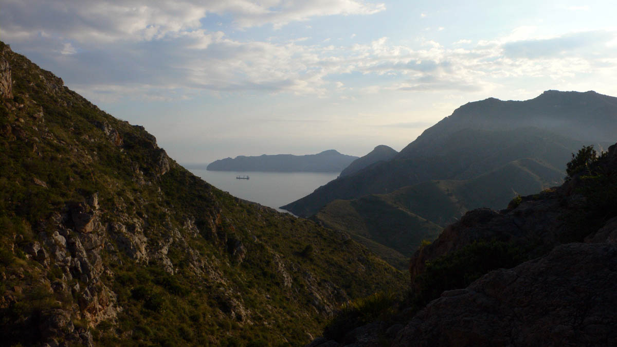
Carrascoy y el Valle is a regional park spanning the municipalities of Murcia, Fuente Álamo de Murcia and Alhama de Murcia, in the heart of Spain's Región de Murcia. It covers much of the Cordillera Sur mountain range and stretches across roughly 16,724 hectares, making it one of the largest protected areas in the region. Its highest point is the El Relojero peak, rising to 609 metres above sea level. Locals often call it the region's "green lung," a nod to the role the park plays in tempering the dry Mediterranean climate of the surrounding lowlands.
What kind of vegetation covers the park?
The landscape of Carrascoy y el Valle is dominated by extensive stands of Aleppo pine, a species particularly well suited to the long droughts and high temperatures typical of this part of Spain. While some of the forest is naturally occurring, a large share resulted from major reforestation efforts carried out in the late 19th and early 20th centuries, aimed at restoring tree cover after centuries of grazing and logging. Sixteen protected plant species have been catalogued within the park's boundaries, underlining its ecological value despite its proximity to the city of Murcia.
What wildlife can visitors expect to see?
The park is known for its rich birdlife. Species recorded here include the great tit, long-tailed tit, crested tit, European goldfinch, European serin, common crossbill, Sardinian warbler, green woodpecker, red-legged partridge, European bee-eater, crested lark, common buzzard and common kestrel. Among reptiles typical of this dry, rocky terrain are the Iberian wall lizard, large psammodromus and ocellated lizard. This variety makes the park a popular destination for birdwatchers and nature photographers alike.
Which trails can visitors follow?
One of the most accessible ways to explore the park is the Sendero Cultural de El Valle, a cultural trail connecting three visitor centres: the Centro de la Naturaleza, the Ermita de San Antonio el Pobre hermitage, and the Centro de Visitantes la Luz. Marked paths throughout the park are lined with interpretive panels, viewpoints and recreational areas, so a walk here combines contact with nature with insight into the area's local history and culture.
What is the history behind this protected area?
The site's conservation history dates back to 1917, when El Valle was officially included in Spain's National Catalogue of Natural Parks. A further milestone came on 7 September 1979, when the area was declared a Protected Natural Space. The mountain range's strategic position overlooking the valleys of the Segura and Guadalentín rivers made it an attractive settlement site for millennia. Archaeological remains found within the park span the Bronze Age and Argaric culture, as well as Iberian, Roman, Visigothic and Arab periods, making the area as significant archaeologically as it is ecologically.
Frequently asked questions
Where exactly is the park located? In the Región de Murcia, across the municipalities of Murcia, Fuente Álamo de Murcia and Alhama de Murcia, covering the Cordillera Sur range.
What is the park's highest peak? El Relojero, at 609 metres above sea level.
Since when has the area been protected? Protection dates back to 1917, with full Protected Natural Space status granted in 1979.
What should visitors prioritise seeing? The Sendero Cultural de El Valle trail linking the visitor centres, plus viewpoints and archaeological remains that testify to centuries of settlement in the area.
Nearby places

Earn badges for the places you visit
Download NextOnTrip, discover new places and check off your trails.