About this place
Buková is an 838-metre summit in the southern part of the Jizera Mountains, rising directly above the village of Jiřetín pod Bukovou at its eastern foot, roughly 3 km northwest of Tanvald. The village's name is no coincidence — "Jiřetín pod Bukovou" translates as "Jiřetín below Buková," and the peak dominates the skyline from almost anywhere in the settlement.
What will you find at the top?
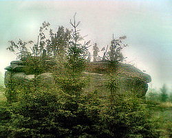
The summit and its immediate surroundings are scattered with rock formations left behind by the mountain's volcanic past. Buková ranks as the second most significant basalt outcrop in the entire Jizera range, surpassed only by the similarly named Bukovec. A quarry once operated just below the peak, extracting basalt — a hard volcanic rock long used for road building and foundations. The old workings have left visible traces in the terrain today, and the summit rocks themselves make for a rewarding stop for anyone interested in geology or landscape photography.
How do you get to Buková?
A yellow-marked hiking trail loops around the mountain on its eastern side. It starts north of the summit, where it meets a green trail heading to Dolní Maxov, then continues past the Záhoří junction all the way to the railway station in Jiřetín. That station makes the most convenient starting point — take the train to Jiřetín, then follow the trail uphill from there. At the highest point along the yellow trail, a roughly 100-metre side path branches off to the left and leads directly to the summit rocks — the only detour from the main route, which makes it easy to spot.
When is the best time to visit?
May through October is the best window, when the paths are dry and the views from the rocks are clearest. In autumn, the beech and spruce forests covering the slopes add extra colour to the walk, while winter can make the final approach to the rock formations trickier due to snow and ice on the steeper sections of path.
Who is this hike for?
This is a good pick for visitors after a calm, fairly short walk with a sense of discovery — without the crowds found on the Jizera Mountains' better-known peaks. The village of Jiřetín pod Bukovou itself, with a history stretching back more than 300 years (it is thought to have been founded around 1670), makes a natural starting point and a good spot to rest before or after the climb.
Frequently asked questions
How high is Buková? The peak reaches 838 metres above sea level and lies in the southern part of the Jizera Mountains.
Is there anything to see at the top besides the view? Yes — the summit and its surroundings hold numerous basalt rock formations, remnants of the quarry that once operated at the mountain's base.
Which trail is best for reaching Buková? The yellow trail that loops around the mountain from the east, with a short side path in its final stretch leading to the summit rocks; it can be combined with a visit to the railway station in Jiřetín.
Where does the village name Jiřetín pod Bukovou come from? It comes directly from the neighbouring Buková summit and means "Jiřetín below Buková" — the village sits on its eastern slopes, about 3 km from Tanvald.
Nearby places

Earn badges for the places you visit
Download NextOnTrip, discover new places and check off your trails.