About this place
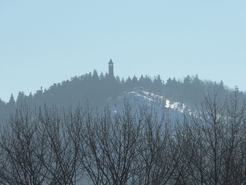
Hutní hora is a forested hill in the Jizera Mountains, within the town of Desná in northern Czechia. Its summit reaches 762 metres above sea level, and the hill sits inside the Jizera Mountains Protected Landscape Area — though geomorphologically part of the Jizera range, it actually marks the point where that range meets Hvězda, the westernmost peak of the Krkonoše (Giant Mountains). This is a spot for travellers who want something beyond the well-trodden Jizera trails: quiet forest, old stone remnants, and views that mostly locals know about.
Where exactly is Hutní hora?
The hill lies within Dolní Polubné, a district of the town of Desná. Desná itself sits at the confluence of the Bílá Desná and Černá Desná rivers, at an elevation between 490 and 780 metres, and was founded in 1691 by Count Albrecht Maximilian Desfours, who named the town after the river running through it. The slopes of Hutní hora are drained by that same Desná river, part of the wider Jizera river basin. The summit falls within an area called Pustiny — one of eight parts of the town and one of the oldest settlements now forming present-day Desná.
What will you find on the summit and slopes?
Both the summit and most of the slopes of Hutní hora are covered by continuous forest, with clearings appearing only near a mountain pass on the southern and eastern flanks. On the eastern slope stands a notable rock formation known as Sokolí kámen ("Falcon Rock"), a worthwhile stop for anyone interested in the rock formations typical of the Jizera Mountains. The summit area also preserves old stone piles and a stretch of low stone wall — remnants from a time when this land wasn't forested, when the surrounding slopes were used for farming or grazing. These traces make Hutní hora an interesting destination for anyone curious about how the region's landscape has changed over time.
How do you get to Hutní hora?
It's worth being upfront about this: only a rough forest path crosses the summit area, and no official, waymarked hiking trail leads over this peak. It's a destination for experienced hikers comfortable navigating off the main trail network, not a stop on a typical sightseeing route. The best starting point is Desná, from where you can head towards Dolní Polubné and continue along forest tracks toward the hill. Bring a topographic map of the Jizera Mountains, since on-site waymarking is essentially absent.
When is the best time to visit?
Late spring, summer, and early autumn are the best times for this trip, when forest paths are dry and easier to walk, and days are long enough to reach the summit and return without rushing. In winter, snow makes navigating this unmarked forest terrain considerably harder, so it's best left to experienced hikers with the right gear.
Frequently asked questions
Is there a waymarked hiking trail to Hutní hora? No. Only a rough forest path crosses the summit, and the official Czech tourist trail network (KČT) bypasses this peak entirely.
How high is Hutní hora? The summit reaches 762 metres above sea level, sitting right at the edge of the Jizera Mountains, where the range meets Hvězda in the Krkonoše.
What's worth seeing near the summit? The Sokolí kámen rock formation on the eastern slope, plus old stone piles and a fragment of stone wall preserved in the summit area, evidence of the land's former agricultural use.
Which town is the best starting point? Desná, specifically its Dolní Polubné district, is the natural base for reaching the hill, since it lies closest to the summit.
Nearby places

Earn badges for the places you visit
Download NextOnTrip, discover new places and check off your trails.