Monuments in Italy
A guide to 130 Monuments in Italy — with descriptions, photos and traveler visits from the NextOnTrip community. Locations spread across 104 cities and towns. Most visited by the community: Roman amphitheatre of Syracuse, Villa Quintilii, nuraghe Osala.
-
Guinigi Tower
Lukka
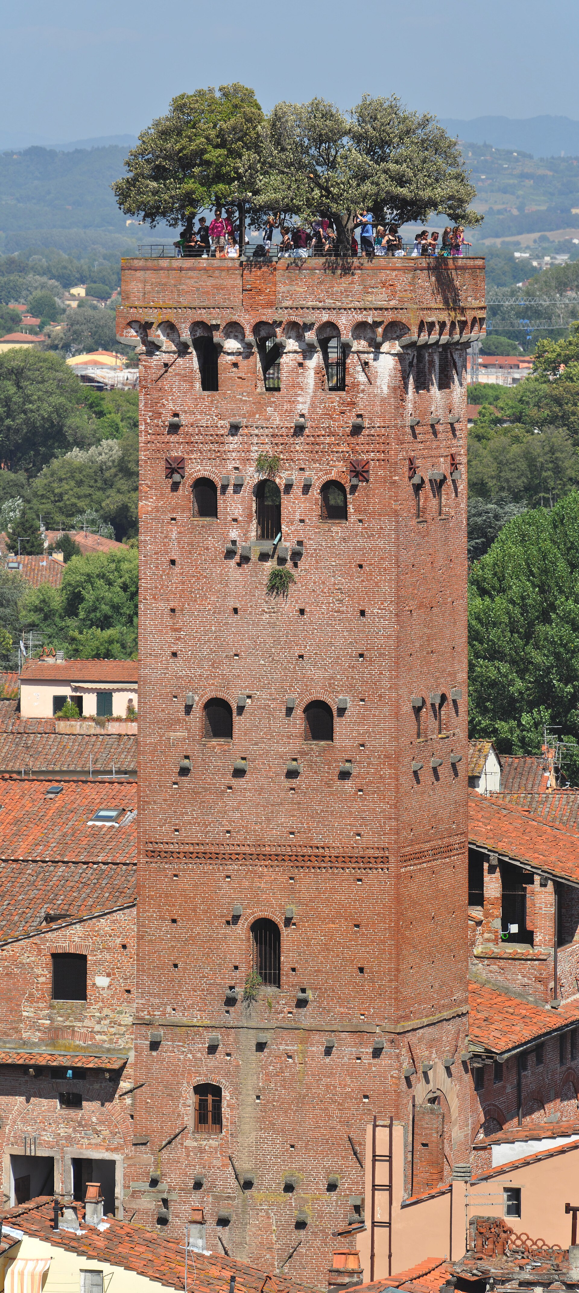
Guinigi Tower is the medieval landmark that rises above the rooftops of Lucca, one of the few surviving noble towers from a city that once counted them by the dozen. Built in the late 14th century by the wealthy Guinigi family of silk merchants, it remains the single most photographed structure in the historic centre and a near-mandatory stop for anyone visiting Lucca, even on a short day trip. What makes this tower different? Standing 45 metres tall, Guinigi Tower is a textbook example of the local Romanesque-Gothic style: a plain, sturdy brick structure built more for status and defence than decoration, typical of medieval Tuscan cityscapes. What sets it apart from the many towers that once crowded Lucca's skyline is visible only once you look up — a small grove of holm oak trees growing right on the rooftop terrace, their canopy poking above the tower's crown. Planting trees atop a tower was a medieval status symbol: the taller and more distinctive the structure, the higher the family's standing in the city. The Guinigi family made sure their tower would never be mistaken for another. How do you get to the top? Reaching the rooftop terrace means climbing 230 steps spread across 28 flights of stairs. It's a genuine workout, not a casual stroll — comfortable shoes and a bit of patience go a long way, especially in summer heat when the stairwell warms up quickly. The staircase is narrow and winds tightly, which slows the pace further during busy hours. Visitors with knee issues or limited stamina should expect to pause a few times along the way. What do you see once you're up there? The effort pays off. From the terrace, the view stretches across the entire historic centre of Lucca — terracotta rooftops, narrow lanes, church towers, and the Renaissance-era walls that still encircle the city. On clear days, the Apuan Alps are visible on the horizon. It's one of the very few spots in town where you can take in Lucca's whole urban layout at once, including the distinctive oval shape of Piazza dell'Anfiteatro, built over the footprint of the city's former Roman amphitheatre. When should you visit? The tower welcomes visitors on most days of the week, with morning and evening opening hours and Wednesday as a closing day. Because hours shift seasonally, it's worth checking the current schedule or calling ahead before your visit. The quietest moments are right after opening in the morning and during the evening slot, when the fading light adds extra warmth to the panorama. During peak season (July–August), expect a short queue to reach the entrance. Who is this attraction for? Guinigi Tower appeals broadly — to architecture and history enthusiasts as much as to anyone chasing a memorable photo over the Tuscan rooftops. That said, the steep, narrow staircase makes it a difficult climb for visitors with limited mobility, and it isn't stroller-friendly, so families with young children should plan accordingly. The tower sits right in the heart of the old town, within easy walking distance of Lucca's other major landmarks, making it simple to fold into a broader walking route through the historic centre. Frequently Asked Questions How many steps does it take to reach the top of Guinigi Tower? The rooftop terrace is reached via 230 steps across 28 flights of stairs. Why are there trees growing on top of the tower? Holm oak trees were planted on the terrace back in medieval times as a status symbol for the Guinigi family — the more striking the tower, the higher the family's social standing. How long does a visit take? Climbing up, taking in the view, and coming back down typically takes 30 to 45 minutes, depending on how busy it is. Is the tower accessible for visitors with limited mobility? No — the narrow, winding, steep staircase has no elevator, making the climb difficult for anyone with mobility issues and unsuitable for strollers.
-
Casa delle Forme di creta
Pompei
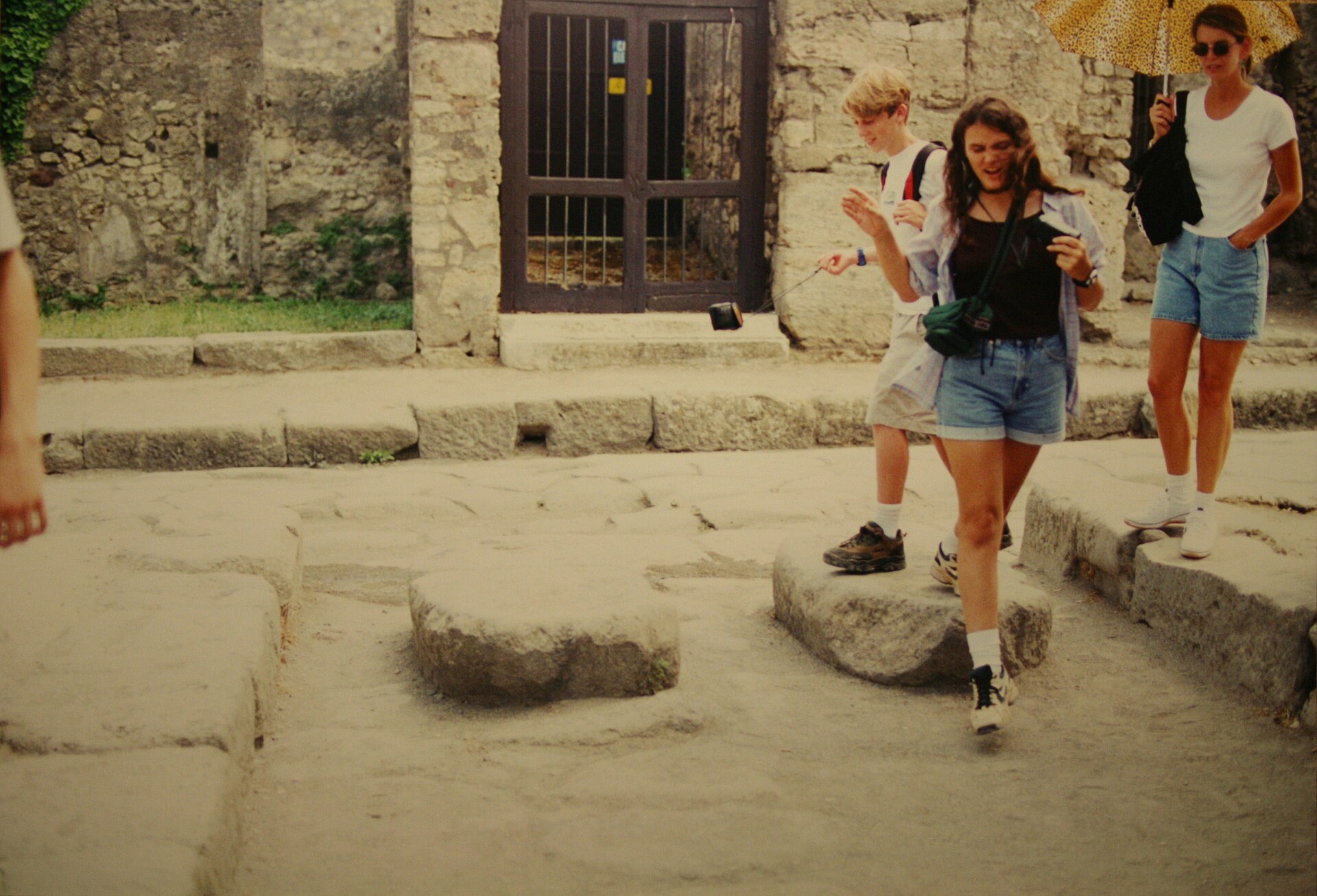
Casa delle Forme di Creta in Pompei is a museum and workshop space focused on clay forms and ceramics. It brings together traditional and contemporary approaches, showing how this material has been used both in everyday life and in artistic production. It is a good stop for a short visit that combines learning with a hands-on look at local craft. На miejscu można liczyć przede wszystkim na: displays of tools, objects, and finished ceramic works that show the full process from raw material to completed piece an introduction to traditional and contemporary techniques used in clay work and ceramics insight into local craft practices and the important place of clay in both practical and artistic production If you are planning a visit, it is worth allowing a little time to look closely at the exhibits, especially if you are interested in craftsmanship or material culture. Comfortable shoes are a sensible choice for a relaxed stop, and this is a good option for travelers who enjoy small-scale cultural visits with a local focus.
-
Walls of Timoleon
Gela
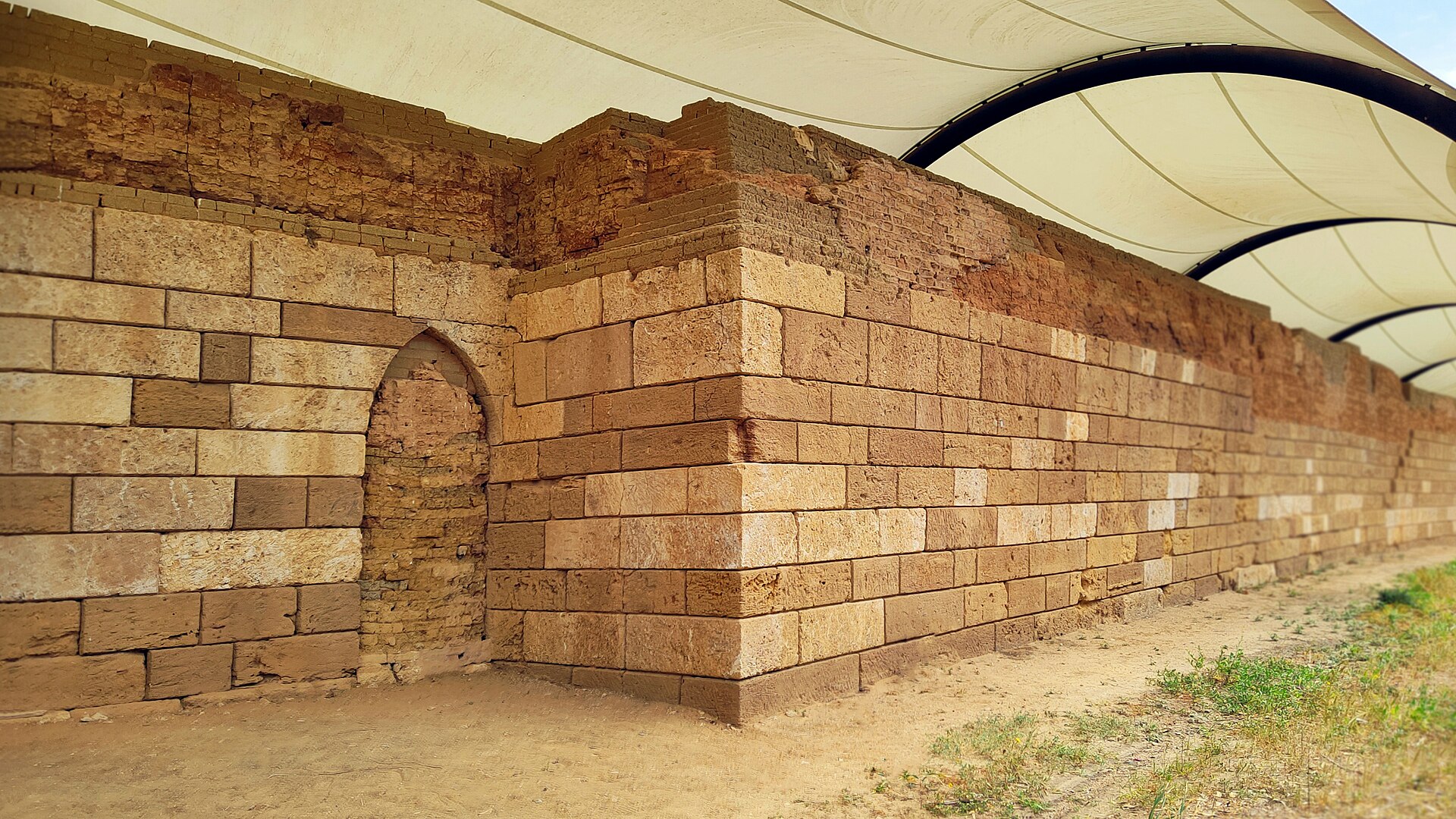
Walls of Timoleon are ancient Greek fortifications in Gela, Sicily, built by Timoleon in the 4th century BCE. They are closely tied to the Corinthian general and statesman Timoleon, whose work was central to the city’s restoration. For visitors, this is mainly a stop for a short historical walk and a look at Gela’s classical past. Na miejscu można liczyć przede wszystkim na: the remains of the ancient defensive walls, which show how Gela was protected in classical times a direct connection with Timoleon, the Corinthian general and statesman associated with the city’s restoration an opportunity to understand the strategic role of fortifications in ancient Sicily while exploring Gela’s archaeological heritage It is worth wearing comfortable shoes, as this is best visited as part of a relaxed sightseeing stop rather than a long outing. If you are interested in ancient history, Greek Sicily, or engineering monuments, this is a good choice for a quiet and focused visit.
-
Temple of Isis
Rzym
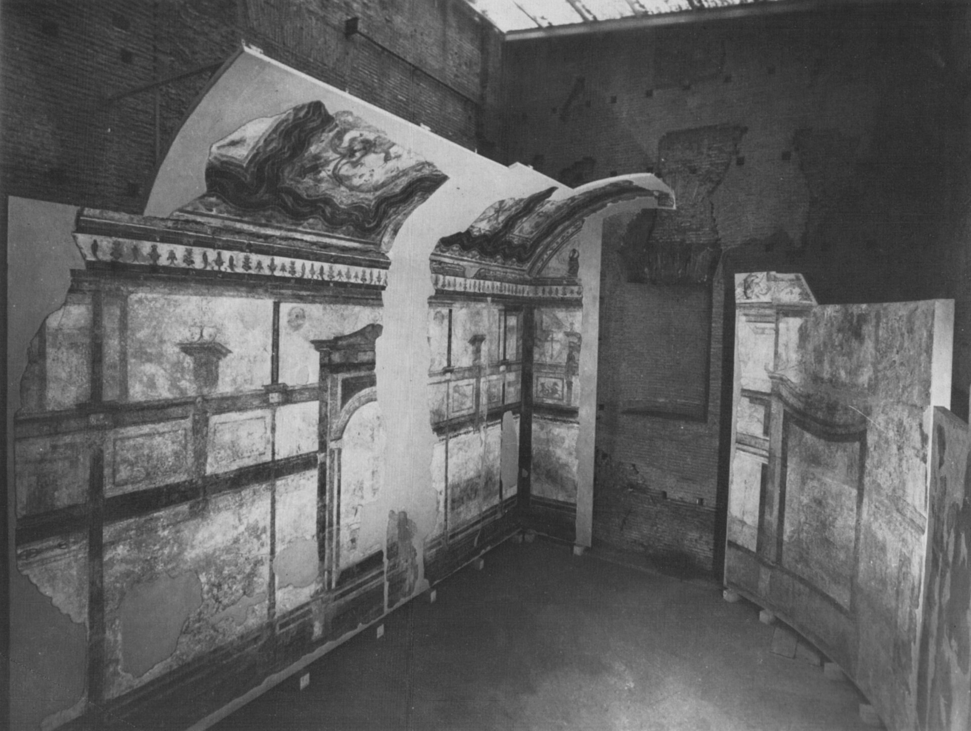
Temple of Isis is an ancient building in Rome that offers a window into the city’s mix of Roman and Egyptian religious history. It was once part of a larger sacred complex, and it still reflects the interest in the cult of Isis in imperial Rome. For visitors, it is a good stop for a short sightseeing visit focused on archaeology and classical antiquity. Na miejscu można liczyć przede wszystkim na: Traces of an ancient sacred complex that help show how the Temple of Isis functioned within a larger religious setting. A clear link to the cult of Isis, which was an important part of the spiritual landscape of imperial Rome. A chance to read the site as part of Rome’s layered past, where Roman and Egyptian traditions met in one city. If you plan to visit, it is worth pairing this stop with other archaeological sites in Rome, and comfortable shoes will make the walk easier. It is a good choice for travelers who enjoy history, archaeology, and places that reveal how many different beliefs shaped the ancient city.
-
Verona Arena
Werona
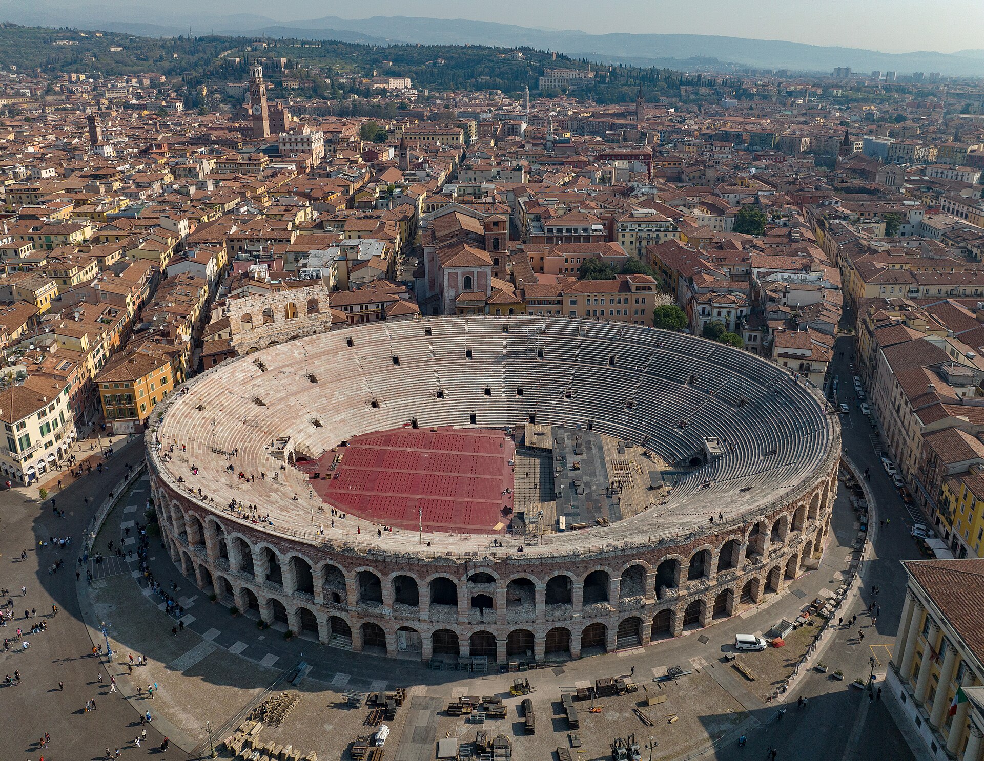
Verona Arena is a Roman amphitheatre in the historic center of Verona, Italy. It is among the best-preserved ancient amphitheatres that have survived into the modern era, and its present condition is largely the result of restoration work carried out systematically since the 16th century. It is a good place for sightseeing and for a short walk through the city’s historic core. Na miejscu można liczyć przede wszystkim na: A close look at a Roman amphitheatre that has stayed remarkably intact, so you can still get a strong sense of its original scale and construction. The chance to see how restoration efforts, begun in the 16th century, helped protect the monument for today’s visitors. A visit right in Verona’s historic center, which makes it easy to combine with nearby sights and a relaxed urban stroll. For the best experience, wear comfortable shoes and plan your visit as part of a broader walk through central Verona. It is a solid choice for travelers interested in Roman history, historic architecture, and an easy sightseeing stop in the city.
-
Castle of Santa Severina
Santa Severina
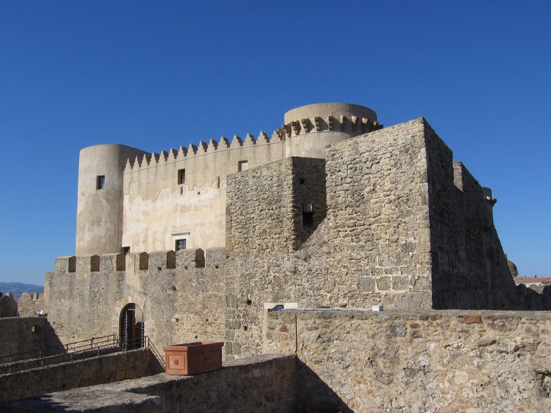
Castle of Santa Severina is a historic fortress in Santa Severina, Italy, set above the surrounding landscape and closely tied to the town’s long, layered past. It stands out as one of the area’s most recognizable landmarks, especially for visitors drawn to medieval architecture and wide views over the historic center. It makes a good stop for a short sightseeing walk. Na miejscu można liczyć przede wszystkim na: a solid medieval fortress setting, with an enduring stone structure that reflects the castle’s long history panoramic views from its elevated position, looking out over the town and the surrounding landscape a chance to explore one of Santa Severina’s key heritage sites and take photos in an atmospheric historic setting If you plan to visit, it is worth wearing comfortable shoes, since a stop here usually fits best into a walking tour of the historic center. Check the weather before you go so you can enjoy the views more comfortably. This is a good choice for travelers interested in history, architecture, and a quiet sightseeing break.
-
Rocca Borromeo di Angera
Angera
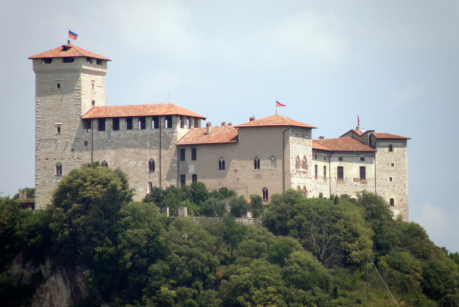
Rocca Borromeo di Angera is a hilltop rocca above the town of Angera, on the southern shore of Lago Maggiore in the Province of Varese. Also known as Rocca d'Angera and Borromeo Castle, it has medieval origins and has changed hands over time, first belonging to the Archbishop of Milan, then to the Visconti of Milan, and later to the Borromeo family, who still own it today. It is a good place for a short sightseeing stop with views and a sense of local history. A medieval fortress setting on a hill above Angera, with the castle’s position making it easy to understand why it was historically important. The site’s long ownership history, from the Milanese archbishop to the Visconti of Milan and then the Borromeos, which adds depth to a visit. Its location on the southern shore of Lago Maggiore, giving the visit a scenic lakeside context even before you go inside. If you plan to visit, wear comfortable shoes, as a hilltop site is best enjoyed with a bit of walking. It suits travelers looking for a compact cultural stop that combines history, a castle setting, and views over the lake.
-
Agliè Castle
Santa Maria
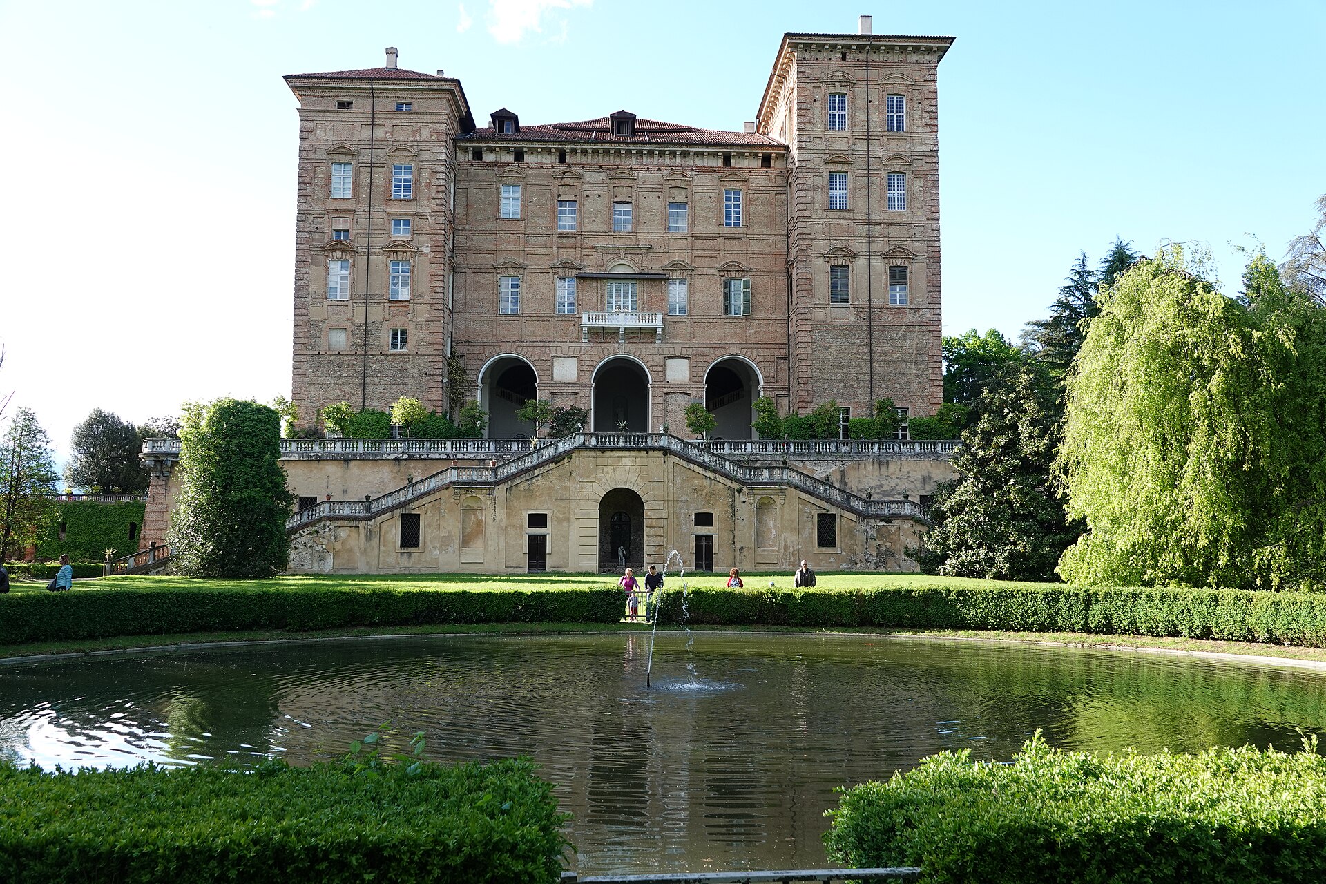
Agliè Castle is a historic castle in Agliè, in Piedmont in northern Italy. It sits in a pleasant town setting and is framed by elegant grounds, making it a fitting stop for anyone interested in architecture, history, and former royal residences. The castle gives a clear sense of the region’s aristocratic past and works well as a cultural stop on a wider trip through Piedmont. On site, you can count on above all: the castle itself, which is the main attraction and reflects the long history of a noble residence in Piedmont; the surrounding grounds, which add space and a more refined atmosphere to the visit; the chance to connect the stop with the broader cultural landscape of Piedmont, especially if you are touring historic towns and royal sites in the region. For the most comfortable visit, plan a relaxed stop and wear shoes suitable for walking around the grounds and the town streets. It is a good choice for travelers who enjoy history, architecture, and a quieter sightseeing break with a local cultural feel.
-
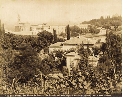
Villa Revedin
Bolonia
Villa Revedin is a historic villa in Bologna, Italy, and it offers a look at the city’s elegant residential heritage. Set in one of Italy’s most culturally rich destinations, it reflects the refined architecture and atmosphere typical of Bologna’s historic villas and noble estates. For travelers, it works well as a short stop while exploring the city. Na miejscu można liczyć przede wszystkim na: a chance to see a historic villa that represents Bologna’s more refined residential past an atmosphere shaped by the city’s tradition of historic villas and noble estates an easy addition to a day in Bologna, where you can also take in the famous porticoes, medieval towers, lively squares, and well-known food culture If you are planning a broader walk through Bologna, it is worth wearing comfortable shoes and leaving time to combine this stop with the city center. This is a good choice for visitors who enjoy architecture, urban history, and a quieter pause within a busy sightseeing day.
-
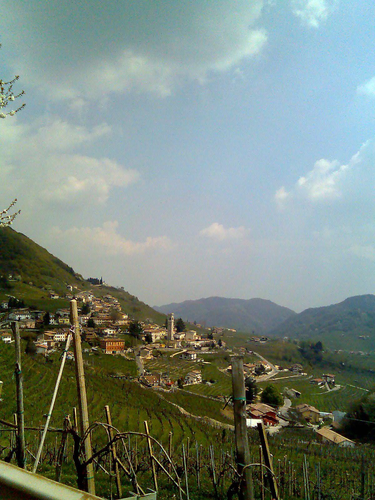
Le Colline del Prosecco di Conegliano e Valdobbiadene
Tarzo
Le Colline del Prosecco di Conegliano e Valdobbiadene is a UNESCO World Heritage site in northern Italy, and Tarzo lies within this celebrated wine landscape. The area is known for its rolling hills, steep terraces, and small villages, all shaped by a winemaking tradition that has been passed down for centuries. It is a place that suits a scenic outing with a relaxed pace. The hillside vineyards are the main draw, with layered terraces that show how closely the landscape is tied to local wine production. Scenic viewpoints open onto the distinctive countryside of the Conegliano and Valdobbiadene area, making it easy to appreciate the region’s broad, rural setting. The villages scattered through the hills add a historic, lived-in atmosphere and give visitors a chance to experience the area’s long winemaking heritage up close. If you visit, comfortable shoes are a good idea, especially if you plan to walk among the slopes or stop at several viewpoints. It is a strong choice for travelers who enjoy wine country, open scenery, and a calm trip through a landscape shaped by tradition.
-

Monument to the Fallen of Vega 10
Buti
The Monument to the Fallen of Vega 10 stands on the ridge of Monte Serra, in the municipality of Calci just above Buti in Tuscany, marking one of the deadliest military air disasters in Italian history. What happened here? On Thursday, March 3, 1977, a C-130H Hercules transport aircraft of the Italian Air Force's 46th Air Brigade, radio callsign "Vega 10", took off from Pisa-San Giusto airport at 15:05. On board were 38 first-year cadets from the Naval Academy of Livorno, their supervising officer Lieutenant Commander Emilio Attramini, and a five-member flight crew. About five minutes after takeoff, at roughly 15:10, the aircraft made an unexplained left turn and entered the Serra valley. Flying low in poor visibility, it struck the slopes of Monte Serra. All 44 people on board were killed. Two days later, on March 5, 1977, a funeral service was held at the grounds of the Naval Academy, attended by Italian President Giovanni Leone and an estimated 20,000 people. The surviving cadets — who had not been aboard that flight — later chose the name "Invicti" (unconquered, undivided) for their course while training aboard the sail ship Amerigo Vespucci that same year. What will you see at the monument? The memorial was built in 1978–79 directly on the mountain ridge where the crash occurred. Its distinctive form consists of two large reinforced-concrete wings stretching across the ridgeline, evoking both an aircraft's wings and a naval emblem. Inside a small chapel, four marble tablets list the names and ranks of all 44 victims, topped by a bronze inscription reading "una sors coniunxit" — "one fate joined them together". Crowning the structure is a rotating lighthouse beacon, built at the Arsenal of La Spezia and bearing the emblems of both the 46th Air Brigade and the Naval Academy. It is not a maritime lighthouse in the traditional sense, but on clear nights its beam — visible from roughly 15 miles away — can be seen from trains and roads between Livorno and Pisa, flashing three times for three seconds with nine-second pauses between sequences. Because of this beacon, families of the victims affectionately call the monument "Il Faro" — The Lighthouse. How do you get there? The monument sits along a hiking route on the Monte Serra ridge, within reasonable reach of Buti, and is a well-known stop for hikers and cyclists exploring the hills between Pisa and Livorno. Reaching it requires walking or cycling along mountain trails, so sturdy footwear and a check of weather conditions are advisable — visibility on the ridge can drop quickly, much as it did on the day of the crash. When is the best time to visit? Clear days offer the best experience, when the ridge opens onto wide views over the valley and toward the Tyrrhenian Sea. The site has a solemn, reflective character, so it is worth setting aside time to visit the chapel quietly and read the names on the tablets. Frequently Asked Questions What is the Monument to the Fallen of Vega 10? It is a memorial built on Monte Serra to honor the 44 people who died when the C-130 Hercules aircraft "Vega 10" crashed on March 3, 1977. How many people died in the crash? 44 people died: 38 cadets from the Naval Academy of Livorno, their supervising officer, and the aircraft's five-member crew. Why is the monument called "Il Faro"? Because of the rotating lighthouse beacon mounted on top of the structure, visible at night from nearby roads and railway lines; victims' families gave it this affectionate nickname. Is the monument easy to reach from Buti? Yes, it lies along a trail on the Monte Serra ridge accessible on foot or by bike from the Buti area, and it is a popular destination for hikers in the region.
-
Faro della Vittoria
Turyn
Faro della Vittoria is a monumental lighthouse-statue standing on the Colle della Maddalena hill in Turin, within the grounds of the Parco della Rimembranza. It combines a working navigational light with one of the city's most striking commemorative monuments. What exactly is it? The structure is a bronze figure of the Winged Victory, created by Turin sculptor Edoardo Rubino. The statue weighs 25 tonnes and stands 18.5 metres tall, resting on a stone pedestal that adds a further 8 metres of height. The lighthouse optics are housed inside the torch held aloft in the figure's hands, so the beam of light shines out from the flame itself and is visible after dark from much of Turin. The monument was erected in 1928 at the initiative of senator Giovanni Agnelli, who commissioned it and donated it to the city to mark the tenth anniversary of Italy's World War I victory over Austria and Germany. Since then, the Faro della Vittoria has become one of the most recognisable landmarks on the hills overlooking Turin. How do you get there? Colle della Maddalena rises on the eastern edge of Turin, across the Po river from the city centre. The hill is a popular destination for walkers and cyclists: the Parco della Rimembranza that covers it is wooded and crossed by paths that climb steadily toward the summit, where the monument stands. What will you see on site? At the top of the hill there is a gravel esplanade offering a wide panorama of the Western Alps. Next to the statue stands a granite orientation table topped with a brass plate marking the compass rose and pointing out the direction of the main Alpine peaks visible on clear days — a good spot to linger and pick out individual summits on the horizon. The monument itself is best appreciated up close: only standing directly at its base gives a real sense of the scale of both the statue and the pedestal beneath it. When should you visit? The lighthouse is most striking after dark, when the beam from the Victory's torch lights up the hill and can be seen from many parts of the city. During the day, a clear day is the best time to come, since the Alpine panorama is sharpest then and the orientation table makes it easy to identify individual peaks. The monument underwent a full restoration in 2013, which returned both the statue and its lighting mechanism to good condition. Frequently Asked Questions What does the Faro della Vittoria depict? It depicts the Winged Victory, a bronze statue by Edoardo Rubino, holding a torch that houses the optics of a working lighthouse. Who funded the monument and why was it built? It was commissioned and donated to Turin by senator Giovanni Agnelli to mark the tenth anniversary of Italy's World War I victory over Austria and Germany. Can you see the Alps from the Faro della Vittoria? Yes — the esplanade at the top of the hill offers a panorama of the Western Alps, and a granite orientation table with a brass plate helps identify the direction of individual peaks. When is the best time to see the lighthouse lit up? After dark, when the beam from the statue's torch is visible from many points across Turin.
-
Torre Branca
Mediolan
Torre Branca is a slender steel observation tower rising inside Parco Sempione, Milan's largest and most central city park. Its open, lattice-like steel frame makes it visible from across the park, and it remains one of the few spots in the city where visitors can look down on Milan from above. Who designed Torre Branca? The tower was designed by Giò Ponti, one of the most influential Italian architects and designers of the 20th century, and completed in 1933 as a lightweight steel-frame structure. That choice of material reflects the engineering ambitions of its era, when architects pushed for maximum height with minimal structural weight. The tower's simple, geometric silhouette has since become a recognizable feature of the Parco Sempione skyline, standing out against the greenery around it. What can you see from the top? The tower's upper platform functions as a panoramic viewpoint. On a clear day, the view extends well beyond Milan itself: visitors can pick out the outline of the Alps to the north, the Apennines, and part of the Po Valley, the plain on which the entire city sits. It's one of the few chances to see Milan in its wider geographic setting rather than at street level. Where exactly is the tower located? Torre Branca stands inside Parco Sempione, Milan's green lung and a favorite spot for both residents and visitors to walk and relax. Its coordinates place it roughly at 45.473 N, 9.173 E, in the central part of the park. Because of this location, a visit pairs naturally with a longer walk through the park rather than a quick, isolated stop. When should you visit? Opening hours Opening hours change depending on the day of the week and the season, so it's worth checking before heading over. On Wednesdays the tower opens in the late morning and again in the early evening; Saturdays have longer hours that stretch into the night; and Sundays it's open across most of the day. From mid-May to mid-September the schedule expands further, adding extra weekday openings and evening slots on weekends — a good opportunity to catch the view at sunset or after dark. Summer is clearly the best season to make the most of the tower's full opening schedule. Frequently asked questions Who designed Torre Branca? Giò Ponti designed the tower, which was completed in 1933 as a steel-frame observation structure. What can you see from the top? On clear days, the view takes in Milan itself along with the Alps, the Apennines, and part of the Po Valley. Where is the tower located? Inside Parco Sempione, Milan's main city park, roughly at its center. Are the opening hours the same all year? No — hours vary by day of the week, and from mid-May to mid-September the tower keeps an extended schedule with extra days and evening openings.
-
Torre Bennistra
Castellammare del Golfo
Torre Bennistra is a 16th-century watchtower perched above Scopello, a small hamlet within the municipality of Castellammare del Golfo in Sicily. Standing on a rocky outcrop roughly 202 meters above sea level, it commands one of the finest views over the entire Gulf of Castellammare. Where did the tower come from? The tower was built in the 16th century on older, pre-existing foundations, which is why its design departs from the usual layout of towers designed by Camillo Camilliani, the architect behind most of Sicily's coastal defense towers from that period. Also known as Bennisti, Torre Bennistra has a circular plan roughly 5.5 meters in diameter. It formed part of a chain of coastal watchtowers built to spot approaching Saracen ships and warn nearby settlements. It kept direct visual contact with the tower at Capo Rama and with Torre Alba in Terrasini, forming a signal network along the island's western coast. How do you get to Torre Bennistra? The tower sits at the edge of Scopello, a village that belongs administratively to Castellammare del Golfo, in the province of Trapani. Scopello is best reached by car — about an hour's drive from Palermo, and considerably less from Trapani or San Vito Lo Capo. From the village center, a short and scenic uphill walk leads to the tower. It's also a popular starting point for hikes toward the nearby Zingaro Nature Reserve, one of Sicily's most valuable protected areas. What is there to see on site? The tower itself, fully restored in 2015 by the municipality of Castellammare del Golfo with EU funding under the PO FESR 2007–2013 program, is in good condition today and now combines a scenic viewpoint with a hotel and restaurant. From its terrace, visitors look out over the famous Faraglioni di Scopello — the striking sea stacks rising straight out of the water — and the old tonnara, the historic tuna-fishing settlement below. Both the tonnara and the pebble beach beneath the cliffs are within a short walk. When is the best time to visit? Late spring and early autumn offer the most pleasant conditions, with milder temperatures than in peak summer and quieter trails and beaches. Summer afternoons can get hot, so it's worth timing the walk up to the tower for the morning. Sunset, when the light catches the cliffs and the bay's water, is one of the most photographed moments on this stretch of the Sicilian coast. What else can you explore nearby? Scopello and Torre Bennistra make an excellent base for exploring western Sicily. Within day-trip range are San Vito Lo Capo and its white beaches, hilltop Erice, the city of Trapani, and the ancient archaeological sites of Selinunte and Segesta. Palermo, the regional capital, with its rich culture and food scene, is also an easy trip away. Frequently asked questions Can you visit Torre Bennistra? The grounds around the tower and its viewing terrace are open to visitors, since the site now operates as a hotel and restaurant — it's worth checking current access on arrival. How long is the walk from Scopello? The walk from the village center usually takes about fifteen minutes, mostly uphill, but doesn't require special fitness. Are there beaches nearby? Yes, at the foot of the hill lies the pebble beach known for the Faraglioni rock formations, one of the most recognizable spots on this coast. Is this a good starting point for the Zingaro Reserve? Yes, Scopello sits right next to one of the entrances to the reserve, making the area around the tower a convenient trailhead for hikers.
-
Concordia 2000
Marèo - Enneberg - Marebbe
Concordia 2000 is a peace bell standing on the summit of Kronplatz (Plan de Corones) above Marebbe (Marèo, Enneberg) in South Tyrol, at an altitude of 2,275 metres. It ranks among the largest peace bells in the entire Alpine region and is one of the landmarks visitors rarely skip once they reach the top. Where does the bell come from? The monument was designed by Paul de Doss-Moroder, an artist from Val Gardena, and unveiled in 2003 to mark the 25th anniversary of the Kronplatz ski area. Including its supporting tower, the structure reaches roughly 22 metres in height, making it visible well before you actually step onto the summit plateau. The bell is dedicated to Saint Bernard of Menthon, patron saint of skiers and mountaineers, a fitting tribute given the setting. What is there to see? At the base of the bell sits a viewing platform fitted with a metal relief map of the surrounding peaks, letting visitors identify the various mountain groups visible from Kronplatz, including the Zillertal Alps, the Ortler group and the Sexten Dolomites. The spot combines a scenic overlook with a symbolic message of unity and peace — hence the name Concordia, meaning harmony. The bell is far more than decoration. It rings every day at noon, and — symbolically — whenever a country abolishes the death penalty or an ongoing war comes to an end. This tradition gives the location a meaning that goes beyond sightseeing, serving as a reminder of shared responsibility and the pursuit of peace. How do you get to the top of Kronplatz? The easiest way up is by one of the cable cars rising from the Val Pusteria valley floor, with stations in Brunico, Riscone, San Vigilio di Marebbe and Perca among others. The ride typically takes a little over ten minutes and lands directly on the summit plateau, from where a short walk along a paved path leads to the bell itself. In summer the peak is also reachable on foot or by mountain bike via numerous marked trails, while in winter it forms the hub of one of South Tyrol's largest ski areas. When is the best time to visit? Between June and September the views from the platform beside the bell are at their clearest, and the surrounding hiking and biking trails are fully open. During the ski season the summit is lively thanks to its proximity to the slopes, though visibility depends more on weather conditions in winter. It's worth timing a visit close to midday to catch the daily ringing of the bell — a moment many visitors remember long after leaving. Frequently asked questions How tall is the Concordia 2000 bell? Including its tower, the structure stands roughly 22 metres tall, and it sits on the Kronplatz summit at 2,275 metres above sea level. Who designed the bell? It was created by artist Paul de Doss-Moroder from Val Gardena and unveiled in 2003 for the 25th anniversary of the Kronplatz ski area. When does the bell ring? Every day at noon, and symbolically whenever a country abolishes the death penalty or a war comes to an end. How do you reach the summit without a car? The simplest option is the cable car from Brunico, Riscone, San Vigilio di Marebbe or Perca, which reaches the top in about ten to fifteen minutes.
-
San Giorgio Scarampi's tower
San Giorgio Scarampi
The tower of San Giorgio Scarampi rises above a small village in the province of Asti, in the heart of Piedmont's Langhe hills. Perched on a ridge with sweeping views over vineyard-covered slopes, it remains the defining landmark of the whole municipality. Where does the tower come from? The tower was built in 1323 at the initiative of brothers Alessandro and Bonifacio Asinari, who had fled Asti and sought new footing in the surrounding countryside. An inscription bearing the date MCCCXXIII still survives above the entrance, confirming the moment of construction. The wider castle complex, of which the tower formed part, took shape gradually between 1300 and 1382 — a typical pattern for feudal strongholds in the region, built up over several generations rather than in one campaign. Ownership of the fief changed hands repeatedly over the centuries. After the Asinari family, it passed in turn to the Sforza, Galeazzi, Salvati, Foresti, Scazzola, Gozani and Gambera families, before eventually coming under the House of Savoy. The name "Scarampi" only entered the records in 1518 — before that, the village was known simply as San Giorgio. The addition traces back to the Scarampi family, influential bankers from Asti who took control of the local estate and permanently attached their name to the place. What will you see there? The tower has six floors and a distinctive sloped base that widens toward the ground — a common defensive feature designed to make undermining the walls more difficult. The roof forms a terrace, originally ringed with battlements, from which visitors today can take in views across the Langhe countryside. Unusually, the entrance was set on the third floor, where the kitchen once stood, supplied with water from a cistern. Traces of a sink and a fireplace are still visible in that room, offering a glimpse of daily life inside the stronghold. Placing the entrance above ground level, originally reached by ladder or drawbridge, was a standard safeguard against assault. The building underwent a thorough restoration for the 2000 Jubilee, which preserved its authentic, legible form. It's now open to visitors as part of local historical trails through the area. How do you get there? San Giorgio Scarampi sits in the province of Asti, within the Langhe region known for its vineyards and rolling landscape. Arriving by car is the most practical option, as the village lies along the road connecting smaller Langhe settlements to the region's larger towns. The tower stands within the village itself, so once you arrive, it's just a short uphill walk from the center. When should you visit? Spring and early autumn offer the best conditions, with mild temperatures and the surrounding hills at their most scenic — green in spring, painted in harvest colors come autumn. Summers can get hot around midday, so it's worth planning a visit for the morning or late afternoon instead. Frequently asked questions When was the tower of San Giorgio Scarampi built? In 1323, commissioned by the Asinari brothers — a date confirmed by the inscription above the entrance. Where does the village's name come from? From the Scarampi family, Asti bankers who took over the local estate; the name first appears in records in 1518. How many floors does the tower have? Six, topped by a viewing terrace that was originally ringed with battlements. Can you visit the tower today? Yes — following its restoration for the 2000 Jubilee, it's accessible as part of local tourist routes through the Langhe.
-
Castello di Santa Maria Coghinas
Cuzina/Santa Maria Coghinas
Castello di Santa Maria Coghinas (also known as Castello Doria or Castello di Casteldoria) is a medieval fortress standing above the Coghinas river valley, right next to the town of Santa Maria Coghinas in northern Sardinia. When was the castle built? No founding documents survive, but historians place its construction around the 12th century, linking it to the Doria family — a Genoese dynasty that was building a network of defensive strongholds across northern Sardinia at the time to protect its political and commercial interests in the region. How did the castle end up tied to the Arborea judicate? Through the second half of the 13th century the fortress remained in Doria hands, and by 1370 it was still operational, caught up in the conflict between the Arborea judicate and the Crown of Aragon. A few years earlier, around 1367, the feuding Doria and Arborea families struck a deal sealed by political marriages — most notably between the celebrated giudicessa Eleonora d'Arborea and Brancaleone Doria. As part of that arrangement, Casteldoria became part of the Arborea dowry, a clear sign of how strategically important the stronghold was considered at the time. Why did the castle fall into ruin? Decline set in as early as the 15th century. Over the following centuries the fortress changed hands repeatedly, and by the 15th and 16th centuries its condition had deteriorated to the point that, in the early 1700s, Piedmontese settlers who had taken control of the island plundered it and tore down parts of the structure. What can visitors see today? The most striking survivor is the Doria tower, a pentagonal structure standing over twenty metres tall and visible from a distance — the single most recognisable feature of the ruins. Alongside it, you can make out sections of the old defensive walls, the remains of a chapel, and a cistern once used to store water. The site sits in the scenic Coghinas river valley, close to well-known thermal springs, making it an easy stop to combine with relaxation as well as sightseeing. How do you get there? The castle lies within the municipality of Santa Maria Coghinas, in the province of Sassari, northern Sardinia. The area is well connected to the main towns along the island's northern coast, and the village itself sits close to the Coghinas valley, famous for its hot springs. The ruins are visible from some distance thanks to the tower rising above the surrounding landscape, which makes finding the site straightforward even without local knowledge. When is the best time to visit? Spring and autumn offer the most comfortable conditions, with milder temperatures than the height of summer and good light for taking in the surrounding countryside. In summer, it's worth pairing a visit to the castle with a stop at the nearby thermal springs or the coast, and avoiding the hottest hours of the day, since the site itself offers little shade. Frequently Asked Questions Who built Castello di Santa Maria Coghinas? The fortress was most likely built in the 12th century by the Doria family, a Genoese dynasty that controlled part of northern Sardinia at the time. Why is the castle also called Casteldoria? The name comes directly from the Doria family, who ruled over the fortification and the surrounding Coghinas valley for centuries. What remains of the original structure? A pentagonal tower over twenty metres tall, sections of the walls, the remains of a chapel, and an old water cistern have all survived. Is there anything else worth seeing near the castle? Yes — the area is known for its thermal springs in the Coghinas river valley, allowing visitors to combine the ruins with a relaxing soak in hot water.
-
Torre di Su Puttu
Cùllieri/Cuglieri
Torre di Su Puttu is a Spanish watchtower perched on a rocky headland at Torre del Pozzo, a small coastal settlement within the municipality of Cuglieri, on Sardinia's western coast in the province of Oristano. What is this tower? Built in the 16th century, the tower was part of a chain of coastal fortifications erected to spot and defend against pirate raids along the Sardinian shoreline. It rises about 18 metres above sea level on the headland that closes the bay of S'Archittu to the south. From here you can pick out the neighbouring watchtowers of Capo Mannu, Sca'e Sai and Pittinuri, evidence that these structures once formed a coordinated visual-signalling network along the coast. Why is it called "Su Puttu"? The name means "the well" in Sardinian, and it refers to a natural feature beneath the headland: erosion has carved a vertical shaft and corridor through the rock that connects the surface directly to the open sea. This underwater tunnel is accessible to divers and is one of the more unusual geological features along this stretch of coast. What is there to see nearby? Right beside the tower lies Spiaggia della Balena, a compact beach roughly 100 metres long, made up of coarse, bronze-toned sand mixed with pebbles and gravel. It takes its name from a nearby rock formation shaped like a whale. About a kilometre further on sits the village of S'Archittu, famous for its natural rock arch and golden sandy beach, reached from the village by a paved seafront path running north of the houses. Within a short drive, the broad sandy beaches of the Sinis peninsula are also within reach. How do you get there? From Cuglieri, follow the SS292 road toward Torre del Pozzo — about 15 kilometres — and S'Archittu is just beyond it. Coming from Oristano, take the SS292 north; after passing through Riola Sardo the road leads straight to Torre del Pozzo, with S'Archittu about a kilometre further. The ARST bus line 703, running between Bosa and Oristano, stops at S'Archittu, from where the tower is an easy walk. The site sits roughly 20 kilometres from Oristano. When should you visit? Late spring and early autumn offer the mildest weather and far fewer crowds than the peak summer months. In summer the surrounding beaches draw plenty of visitors, so it's worth timing a walk out to the tower for the morning before the heat sets in. Frequently asked questions Can you go inside the tower? The tower today mainly serves as a scenic viewpoint over the coast — the surrounding headland is freely accessible, and the view takes in the chain of neighbouring watchtowers along the shoreline. What exactly is the "Su Puttu" well? It's a natural opening carved by erosion that forms an underwater corridor linking the headland to the open sea. The spot is popular with divers exploring the local rock formations. Are there swimmable beaches close by? Yes — Spiaggia della Balena sits right next to the tower, and about a kilometre away is the sandy S'Archittu beach with its well-known natural rock arch. What's the best way to get there without a car? Take the ARST bus line 703 between Bosa and Oristano to the S'Archittu stop, then walk the short distance to Torre del Pozzo.
-
Casatsch
Tisens - Tesimo
Casatsch (also known as Pfeffersburg or Casaccia) is a ruined medieval castle in the municipality of Tisens (Tesimo), perched on a rocky hill above the village of Nals in South Tyrol. It's not a grand, fully restored fortress — it's the kind of place you visit for the quiet and the view, which stretches across the Adige valley and the surrounding mountains. Where does the name come from, and what's the history? The castle was built starting in 1194 at the initiative of several local noble families. Permission came from the prince-bishop of Trento, Konrad II von Beseno, who granted a hill known as "Casac" — the origin of today's name Casatsch — to a group of noblemen: Ulrich Ruf, the brothers Heinrich and Friedrich von Pitzol, and Marquard, Hartwig and During of Tisens. The hill sat within the parish of Tisens, right above Nals, which is why the castle is sometimes associated with either place. Ownership shifted over the centuries. In the second half of the 14th century it belonged to the Lords von Greifenstein, and from 1390 onward — with a few interruptions, including a period under the Zwingenstein family — it stayed largely in the hands of the Botsch family. Around 1600 the building fell into disrepair and spent the following centuries as a picturesque but largely forgotten ruin. What will you actually see there? Today, parts of the donjon (the main defensive tower) and sections of the curtain wall survive. The ruin underwent a thorough restoration completed in 2002, initiated by its private owner, Verena Jordan — the work didn't rebuild the castle but stabilized and secured it, so visitors can now walk through the site safely and still read its layout. A small on-site exhibition covers the castle's history in more depth. Casatsch also has a cultural life beyond sightseeing: the grounds are occasionally used for open-air concerts and cultural events, which gives the ruin a different atmosphere outside the usual tourist season. How do you get to the Casatsch ruin? The castle sits on a hill above Nals, within the Tisens-Prissian municipality, roughly between Meran/Merano and Bolzano — a location that makes it easy to combine with a visit to either town. Access is usually via a local road leading toward the hill, with the final stretch covered on foot. Sturdy shoes are worth packing, since the terrain is rocky and gets steep near the top. When is the best time to visit? The ruin is open year-round, but spring, summer and early autumn offer the best views and the most pleasant walking conditions, when the Adige valley is green with vineyards and orchards. In summer, it's worth checking the local events calendar — open-air concerts held on the castle grounds are a chance to see the site in a completely different light. Frequently asked questions Is Casatsch the same castle as Pfeffersburg? Yes — it's the same structure, referred to in sources and on-site information under two (or sometimes three) names: Casatsch, Pfeffersburg, and occasionally Casaccia. Can you actually walk into the ruin? Yes. The site is open to visitors year-round, and thanks to the restoration work, the surviving parts of the donjon and walls can be viewed up close. How long does it take to reach the site? The final approach is uphill and requires a short but somewhat demanding walk — plan for anywhere from a few minutes to half an hour depending on where you start from. Is it worth combining with other sights in the area? Definitely. Sitting between Meran/Merano and Bolzano, Casatsch fits naturally into a route that includes other castles and villages in South Tyrol, such as the area around Nals or Tisens-Prissian itself.
-
Nuraghe Mereu
Orgòsolo/Orgosolo
Nuraghe Mereu is a Nuragic stone fortress hidden in the forests of the Supramonte, perched above the Gorropu canyon in the municipality of Orgosolo, Sardinia. The tower sits on a rocky outcrop at 835 metres above sea level, deep inside dense woodland. Locals from the Barbagia region call it "nuraghe intro 'e padente" – the nuraghe inside the forest. The name Mereu comes from the Sardinian word for "white" or "clear," a reference to the pale limestone blocks used to build it. That bright stone is exactly what makes the ruin stand out against the surrounding greenery. How do you get to Nuraghe Mereu? Reaching the site means hiking through the Supramonte di Orgosolo, one of the wildest and least accessible mountain areas in Sardinia. The path cuts through forest, with a final rocky scramble before the tower comes into view. Booking a local guide is a good idea, since trail markings here are sparser than on Sardinia's more popular routes and the thick woodland makes navigation tricky. Sturdy hiking boots and plenty of water are essential, especially in summer heat. What will you see there? The nuraghe has a complex trilobate layout: a central keep (mastio) flanked by two secondary towers, all linked by a curtain wall. The main tower still preserves its tholos vault and rises to roughly five metres — an impressive height for a structure several thousand years old. A bastion is visible on the western side, and traces of the surrounding settlement survive nearby, with the remains of huts tucked into the trees. Not far from the tower stand a group of Giant's tombs, believed to belong to the same Nuragic community. The real reward for the climb is the view. From the platform beside the nuraghe, the panorama opens onto the Gorropu canyon — one of the deepest gorges in Europe, carved into the limestone massifs of the Supramonte. The combination of prehistoric architecture and near-surreal landscape scale leaves an impression even on well-travelled visitors. When is the best time to visit? Spring (April to June) and early autumn (September to October) are ideal, when temperatures make multi-hour hikes comfortable and the Supramonte vegetation is lush but still passable. Summers in this part of Barbagia can be brutally hot, and forest shade alone isn't always enough — early-morning starts are strongly recommended. Winter makes the terrain more technically demanding, especially after rain, but the canyon and surrounding forests take on a strikingly raw character in the colder months. Frequently asked questions Can you drive to Nuraghe Mereu? No — the final stretch is on foot only, through forest and rocky ground. Parking is available some distance away, with a hiking trail covering the rest. How long does the hike to the nuraghe take? It depends on the route and starting point, but given the rugged terrain, it's worth allowing half a day for the outing, with enough buffer to return before dark. Is it worth hiking with a guide? Yes, especially for anyone unfamiliar with the Supramonte — the area is densely forested, poorly signposted, and easy to get turned around in without local knowledge. What else is worth seeing nearby? Close to the nuraghe you'll find Giant's tombs and remains of a Nuragic settlement, while the Gorropu canyon itself is one of Sardinia's iconic trekking destinations, worth a separate, longer excursion.
-
Torre di San Giovanni
Crabas/Cabras
Torre di San Giovanni is a Spanish coastal watchtower perched on a hilltop above the sea in Cabras, on the Sinis peninsula in the province of Oristano, western Sardinia. Standing roughly 50 metres above sea level, it overlooks the archaeological area of ancient Tharros and ranks among the most recognisable landmarks of this stretch of coast. Why was it built here? The tower was raised between the late 16th and early 17th century on the initiative of the Spanish Crown, as part of a chain of coastal defences meant to protect local communities from raids by Barbary corsairs from North Africa. Archaeological surveys suggest it was built on the remains of an earlier single-tower nuraghe and a Punic outpost, and that stone recycled from the ruins of nearby Tharros went into its walls. Its garrison consisted of a commander, an artilleryman and four soldiers, armed with cannons and muskets. What does the structure look like? Torre di San Giovanni is made of two overlapping cylindrical bodies, with a base diameter of 14 metres and a total height of 15 metres. The entrance sits about 8 metres above ground — originally reachable only by rope ladder, now via an external staircase added in the 19th century. Inside, a circular, dome-vaulted chamber is lit from above by a skylight; a trapdoor in the floor opens onto a cistern that collected rainwater, while a fireplace and the "santabarbara" — the gunpowder store — sit along the walls. What is there to see nearby? Thanks to its commanding position, the tower once controlled a stretch of coastline with a radius of about 28 kilometres and kept visual contact with the other Sardinian coastal towers of San Marco, Torre Grande, Marceddà, Capo Frasca, del Sevo and Mora. At the foot of the hill stands the small church of San Giovanni di Sinis, one of the oldest religious buildings on the island, and the sandy, dune-backed beach of San Giovanni di Sinis, which stretches for about two kilometres toward Funtana Meiga. The whole area lies within the Marine Protected Area "Penisola del Sinis — Isola di Mal di Ventre", known for its clear water and rich underwater life. How to get there? The tower stands in the municipality of Cabras, a short drive from the town centre, along the road leading to the Tharros archaeological site. A car is the most practical option — in summer, parking areas near the site serve visitors heading to both Tharros and the Sinis beaches. It pairs naturally with a visit to the Phoenician-Roman ruins and a swim on one of the nearby beaches. When is the best time to visit? Late spring and early summer (May–June) and September offer milder temperatures than the peak of July and August, along with quieter beaches. At sunset, the view from the hill over the Gulf of Oristano and the Sinis coastline is one of the finest on the island. Frequently asked questions Can you go inside the tower? Yes, the tower can be visited during set opening hours, usually linked to the Tharros archaeological site ticket — check the current schedule locally. How long does a visit take? The tower itself takes about 30–45 minutes, but it's worth setting aside half a day to combine it with Tharros and the beach of San Giovanni di Sinis. Is there a beach nearby? Yes, the sandy beach of San Giovanni di Sinis lies right at the foot of the hill, with clear water popular among visitors and locals from Cabras alike. Does the tower have historical significance beyond its defensive role? Yes — it stands on the site of earlier nuragic and Punic structures, and its stone came from the ancient city of Tharros, making it a physical record of several layers of Sardinian history in one place.
-
military shrine of Valli del Pasubio
Valli del Pasubio
The Pasubio Military Shrine (Sacello Ossario) is a monumental war memorial standing above Valli del Pasubio, one of the most significant World War I memorial sites in the Veneto region. Where is it and what does it look like? The monument sits on Colle Bellavista, just below the summit of Monte Cornetto, at roughly 1,217 meters above sea level, less than 2 km from the Pian delle Fugazze pass. From here the view stretches across the entire Val Leogra and the Pasubio massif, where some of the bloodiest fighting on the Italian front took place between 1916 and 1918. The tower itself rises about 35 meters, with a base 10.5 meters in diameter — a structure visible from a distance and a landmark for hikers on the Great War trails. What does the ossuary contain? The crypt at the base of the tower, together with two concentric galleries, holds the remains of 5,146 Italian soldiers and 40 Austrian soldiers who died fighting for control of Pasubio. Only 1,632 of them have been identified; the rest remain unnamed. The central crypt also contains the graves of 70 soldiers decorated for valor, along with General Guglielmo Pecori Giraldi, who commanded the Italian First Army from May 1916 until the war's victorious conclusion in November 1918. Where does the shrine come from? The story begins in 1917, when soldiers of the First Army who had survived the Austro-Hungarian Strafexpedition offensive decided to build a small chapel dedicated to the Immaculate Madonna. Bishop Ferdinando Rodolfi of Vicenza embraced the idea and pushed it forward. The architectural design was donated by Ferruccio Chemello, who worked without payment in memory of his son, an Alpine soldier killed on Ortigara. Construction ran from 1920 to 1926, and the shrine was formally inaugurated on August 29, 1926. How do you get there? The easiest access is via the Pian delle Fugazze pass, from where a short, well-marked footpath leads to the shrine — a popular stretch of the Alta Via della Grande Guerra, the network of historical trails tracing the old front line. From Valli del Pasubio, the drive takes only a few minutes, and the walk to the monument itself is easy, suitable for most visitors, including families with children. When should you visit? Late spring, summer, and early autumn (May to October) are the best months, when the high-altitude trails are fully accessible and views over the Alps and the Piccole Dolomiti are at their clearest. In winter the pass can be snow-covered, making the approach harder, though the monument takes on a stark, striking character in the snow. Morning visits are worth planning for — lighter foot traffic and better light for photographing the tower against the mountains. What else is worth seeing nearby? The Pasubio massif functions as an open-air museum of World War I — trenches, tunnels, and fortifications survive nearby, including the famous Strada delle 52 Gallerie, a military road carved through the rock with 52 tunnels. Hiking trails connect the shrine to other memorial sites across the massif, making it easy to combine a visit to the ossuary with a full day of exploring the former mountain front. Frequently asked questions Is entry to the shrine free? The grounds around the monument and the exterior of the crypt are freely accessible; no ticket is needed to visit the outside. How long is the walk from Pian delle Fugazze? The short, well-maintained trail usually takes 20 to 40 minutes one way, depending on pace. Is the site suitable for children? Yes, the trail is technically easy, though it's worth remembering this is a war cemetery, not an ordinary tourist attraction. Can you visit inside the crypt? Access to the interior can vary by season and opening hours — it's worth checking current information before visiting, since the site is a memorial managed by local institutions.
-
Torre dell'Orologio
Chioggia
Torre dell'Orologio is a medieval clock tower in Chioggia, a small fishing town at the southern edge of the Venetian Lagoon. It stands next to the Church of Sant'Andrea and houses a clock mechanism considered one of the oldest still-working tower clocks in the world. What's the history behind the tower? The tower itself has Roman-Byzantine roots — its oldest surviving structure probably dates back to around the year 950. It originally served as a lighthouse and watchtower guarding access to the lagoon. Today it stands roughly thirty metres tall, with walls at the base thicker than a metre and twenty centimetres, proportions typical of defensive buildings from that era. Where does the clock come from? The clock mechanism that now crowns the tower dates to the 14th century. It originally sat in the old Palazzo Pretorio before being moved to the top of the Sant'Andrea tower. Its creation is attributed to the Dondi family, renowned clockmakers of the period and creators of sophisticated astronomical mechanisms, including the famous Astrarium. The Dondi lived in Chioggia before relocating to Padua, where their work went on to earn Europe-wide recognition. What will you find inside? Starting in 1997, the tower was gradually adapted for visitors — additional floors were built and the structure was reinforced. The work led to its public opening on 16 September 2006 as a "vertical museum." Visits proceed floor by floor, with each level covering the history of the town, the neighbouring Church of Sant'Andrea, and the tower's own clock mechanism. It's one of the few attractions in the region where the story of clockmaking intersects directly with the history of local defensive architecture. How do you get to Torre dell'Orologio? Chioggia sits at the southern end of the Venetian Lagoon, well connected by road to Venice and Padua. The tower stands in the historic centre, right next to the Church of Sant'Andrea — an easy walk from the main squares and waterfronts where most visits to the town begin. Chioggia is often nicknamed "little Venice" because of the canals that cut through its old town, so reaching the tower is a natural part of a walk through the centre. When should you visit? The tower and its museum are best visited as part of a longer walk through Chioggia, combined with the fish market, the Vena canal waterfront, and the churches of the old town. Aim to visit outside peak tourist season, when the town is quieter and climbing the tower's floors doesn't mean queuing. It's worth checking the museum's current opening hours before your visit, since they can change seasonally. Frequently asked questions What is Torre dell'Orologio in Chioggia? A medieval tower next to the Church of Sant'Andrea, topped by a 14th-century clock attributed to the Dondi family — one of the oldest working clock mechanisms in the world. Can you visit the tower? Yes, it has operated as a vertical museum since 2006, with each floor presenting the history of the town, the church, and the clock mechanism itself. How old is the tower's structure? The oldest parts likely date to around the year 950 and have Roman-Byzantine origins — the tower originally served as a lighthouse and watchtower. What pairs well with a visit to the tower? A walk through Chioggia's old town, the Vena canal, the fish market, and the Church of Sant'Andrea, which stands right beside the tower — all within easy walking distance.
-
Campanile di San Giorgio Maggiore
Wenecja
Campanile di San Giorgio Maggiore rises on the island of San Giorgio Maggiore in Venice, directly across the water from Piazza San Marco. Overshadowed by its far more famous namesake on the main square, this bell tower quietly offers one of the finest panoramic views in the entire city. What is the history behind this tower? A first bell tower was built on this spot in 1467, part of the Benedictine monastery complex that once occupied the island. It stood for over three centuries before collapsing in 1774. The reconstruction, completed in 1791, was carried out in Neoclassical style, with proportions deliberately echoing the campanile on Piazza San Marco across the basin — a visual dialogue between the two towers that still defines the Venetian skyline today. The tower forms part of the Basilica di San Giorgio Maggiore, designed by Andrea Palladio, one of the most influential architects of the Renaissance. Construction of the basilica ran from 1566 to 1610, and its bright white marble facade remains one of the most recognizable silhouettes along the lagoon. How do you get to the island and the tower? San Giorgio Maggiore is a separate island, cut off from the rest of Venice by the waters of St Mark's Basin. The easiest way to reach it is by vaporetto line 2 from the San Zaccaria stop, a short walk from Piazza San Marco. The crossing takes only a few minutes, and a single ticket costs around €9.50 (valid for 75 minutes, including any connections within that window). Inside the basilica, a lift takes visitors straight to the top of the tower — a welcome contrast to many other Venetian towers, which require climbing narrow, steep staircases. Access to the top requires a separate ticket, typically a few euros (prices fluctuate, so it's worth checking the current rate on site). What will you see from the top? The tower stands roughly 63 metres tall. From the viewing platform, the panorama is widely considered among the best in Venice: Piazza San Marco with the Doge's Palace and the Basilica di San Marco sit in full view across the basin, gondolas and vaporetti crisscross the water below, and further out the lagoon islands unfold, including Giudecca. Unlike the often-crowded terrace of the Campanile di San Marco, this viewpoint tends to be noticeably quieter. When is the best time to visit? Early morning right after opening, or late afternoon before sunset, are the best windows — the light flatters the facades along the waterfront, and the island sees far fewer visitors than the opposite shore of the basin. Keep in mind that the basilica and tower can close temporarily during religious services, so it's worth checking opening hours before setting out. Frequently asked questions Can you visit the tower without long queues? San Giorgio Maggiore receives far fewer visitors than Piazza San Marco, so lift queues here are usually short, even during peak season. Do you have to climb stairs to reach the top? No — a lift carries visitors to the top, making this tower accessible even to those who cannot or prefer not to tackle the steep staircases typical of other Venetian bell towers. How much time should you set aside for the island and tower? Visiting the basilica and riding up the tower usually takes about an hour in total, including the round-trip vaporetto crossing. Is the view different from the one atop the Campanile on Piazza San Marco? Yes — from here you see Piazza San Marco itself from the outside, along with the Doge's Palace and the basin, a perspective impossible to get while standing on the campanile across the water.
Earn badges for the places you visit
Download NextOnTrip, discover new places and check off your trails.