Coast in Norway
A guide to 30 Coast in Norway — with descriptions, photos and traveler visits from the NextOnTrip community. Locations spread across 27 cities and towns. Most visited by the community: Lindesnes Lighthouse, Ulla Lighthouse, Skomvær Lighthouse.
-
Fulehuk Lighthouse
Færder
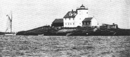
Fulehuk Lighthouse (Fulehuk fyr) is a former coastal lighthouse in Færder Municipality, Vestfold county, in south-eastern Norway. It was first lit in 1821 and taken out of service in 1989, when an automatic light took over its job. Today it is a piece of living Norwegian maritime history that you can visit, and even stay the night in. When was Fulehuk first lit? The light was first switched on on 1 November 1821. The original tower was a square stone structure. The station earned its place in national history as the first lighthouse in Norway to use an Argand oil lamp, which gave a clearer and steadier beam than earlier lamps. Why does it matter to Norway's coastal history? In 1841 a hand-operated fog bell was installed here, the first fog signal on the Norwegian coast. It was later superseded: a foghorn arrived in 1910 and a siren in 1956. For sailors working along a rocky, fog-prone coastline, such warnings were a serious safety measure. What was life like for the keepers? Fulehuk was set up as a family station, with keepers living here with their families and running a small farm, which explains the barn and outbuildings. The big problem was the lack of any landing place or harbour, which made getting ashore difficult. A boat hoist was added in 1850, and in 1857 a rope was strung across the sound to help people climb ashore. How did the station change in the 20th century? The station was electrified in 1938. In 1949 it stopped being a family station and operated without resident keepers. In 1955 it was rebuilt completely: the 134-year-old stone tower was demolished and a new one put up. In 1989 the lighthouse was decommissioned, and a fully automatic beacon on a nearby island took over. What is happening here today? Since 2006 the association Fulehuks Venner (Friends of Fulehuk) has worked to bring new life to the station. It has been restored and now offers accommodation for up to 30 people, making it an appealing base for groups, families, and anyone interested in the sea and maritime heritage. Frequently asked questions Is Fulehuk still an active lighthouse? No. It was taken out of service in 1989, and an automatic beacon on a nearby island now does the job. Can you stay overnight? Yes. After restoration, the station offers beds for up to 30 people. Where is it? In Færder Municipality, Vestfold county, on Norway's south-eastern coast. What makes Fulehuk stand out among Norwegian lighthouses? It was the first in Norway to use an Argand lamp and the first on the coast to have a fog signal, installed in 1841. Who looks after the site? Since 2006, the Fulehuks Venner association.
-
Langøytangen Lighthouse
Langesund
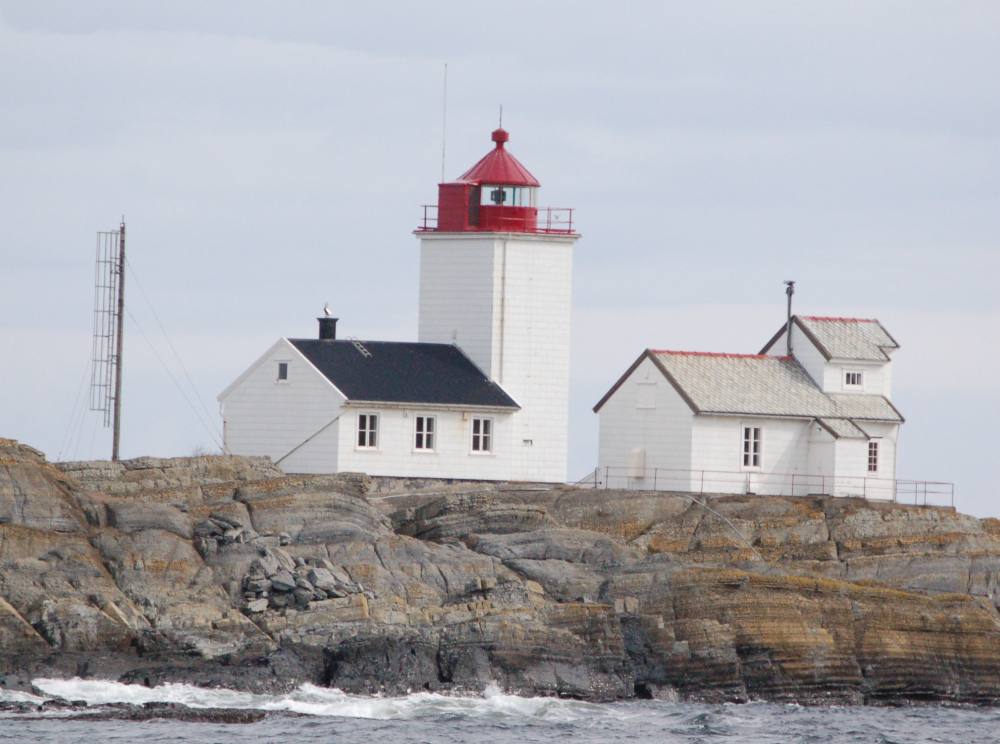
Langøytangen Lighthouse is a fully automated coastal lighthouse on the island of Langøya, just off the town of Langesund in Bamble municipality, southern Norway. It marks the southern point of the Langesund Sound, and today it is also a place where visitors can book an overnight stay. Where is Langøytangen Lighthouse? The lighthouse stands on the southern tip of Langøya, facing the town of Langesund. Its coordinates are roughly 58.99° N, 9.76° E. You can see it across the water from the mainland, and reaching it means a short trip by boat followed by a walk on the island. Its job has always been to mark the entrance to the sound, which ships used on their way to the ports of the region. How did the lighthouse come about? The idea of a light on the south of Langøya was put forward by a lighthouse committee in 1828. Funding came from the state budget, and construction began in 1837. The light was first lit on 1 October 1839, at the same time as the lighthouse on nearby Jomfruland. The original station had a wooden tower, a keeper's house, a jetty and a boathouse. It was a typical setup for Norwegian coastal stations, where daily life depended on the sea and on getting around by boat. What does the current tower look like? The present light was first lit in 1876. The tower is 12 metres tall, square and built of stone. It is attached to one end of a one-story keeper's house, so the light and the living quarters form a single compact building. This combination of tower and dwelling is common on many older lighthouses along the Norwegian coast. Keepers and later history A resident keeper lived at the station for 151 years, with eleven keepers in total over that time. From 1924 the Customs Service also ran a lookout post on the island, helping to keep watch over traffic in the sound. The lighthouse was automated in 1990, which ended the need for staff on site. Can you stay overnight? Yes. After automation the station buildings found a new use and are available to rent for overnight guests. It suits anyone who wants to spend time somewhere unusual, with views of the sea and the surrounding islands. Check availability and booking terms with the accommodation provider or the local tourist office. Frequently asked questions Is Langøytangen Lighthouse still active? Yes. It operates as a fully automated coastal lighthouse and marks the southern point of the Langesund Sound. When was the light first lit? On 1 October 1839. The present light dates from 1876. How tall is the tower? About 12 metres. It is a square stone tower attached to the keeper's house. When was it automated? In 1990. Before that, a resident keeper lived here for 151 years. Can you sleep there? Yes, the station is available to rent for overnight guests. Where is it? On the island of Langøya, just off the town of Langesund in Bamble municipality, Norway.
-
Træna Lighthouse
Træna
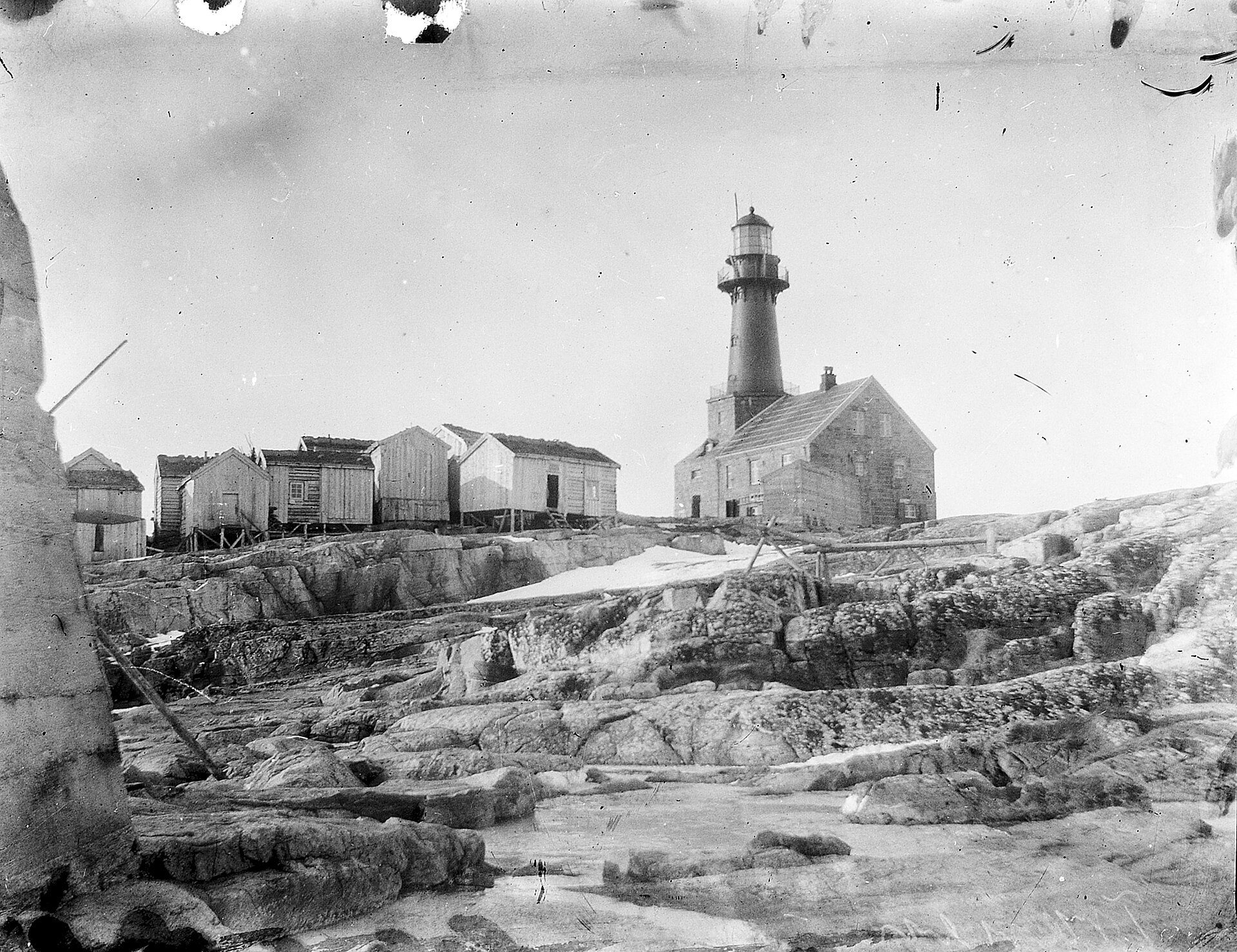
Træna Lighthouse (Træna fyr) stands on the islet of Sørholmen in Træna Municipality, Nordland county, Norway. A coastal light, it has guided ships since 1877 along one of the most exposed stretches of the Norwegian coast. Where is Træna Lighthouse? Sørholmen lies in the Trænfjorden, about 10 kilometres (6.2 mi) southwest of Husøya, the main island of the Træna archipelago. The village on the island of Lovund, part of Lurøy Municipality, is roughly 17 kilometres (11 mi) to the east. The coordinates are about 66.43° N, 11.97° E, just north of the Arctic Circle. The lighthouse sits at the very edge of the land, open to the full force of the sea. Why was it built here? In 1874 the Norwegian lighthouse director pointed out that a powerful light was missing on the stretch between Villa in Nord-Trøndelag and Andenes in Vesterålen, a distance of more than 330 nautical miles. By comparison, coastal lights in southern Norway stood on average 25 to 30 nautical miles apart. Træna Lighthouse was meant to close that gap and make navigation along the northern coast safer. What does it look like, and how was it built? Construction on the exposed rock took two years, and the station began operating in 1877. Builders laid a granite base and mounted a cast-iron tower about 18 metres high on top of it. Two granite keepers' houses were added, one on each side of the base. Sources give slightly different dimensions for the finished tower: Wikipedia lists a height of 21.1 metres and a focal height of 36.8 metres above sea level, while the Norwegian encyclopedia SNL gives 22.5 metres and 36.7 metres. How has the lighthouse changed over time? Storms damaged the station in 1884, 1889, 1898 and 1901. After the last of these, the station was converted and the dwelling was rebuilt. The light was strengthened in 1924, and in 1960 it was electrified, with power from diesel generators. In 1974 the lighthouse was automated and left unmanned. The lens and lantern were removed and replaced with a PRB lamp powered by a wind-driven generator. Frequently asked questions Where is Træna Lighthouse? On the island of Sørholmen in Træna Municipality, Nordland county, Norway, about 10 km southwest of Husøya. When was Træna Lighthouse built? Construction took two years, and the light entered service in 1877. What is it made of? The tower is cast iron, set on a granite base with two granite keepers' houses beside it. Is the lighthouse still staffed? No. It has been automated since 1974 and has no permanent crew. How tall is the tower? Depending on the source, between about 21 and 22.5 metres, with the light around 37 metres above sea level. Why build it on such a remote islet? The coast lacked a powerful light over more than 330 nautical miles between Villa and Andenes, and Træna Lighthouse was built to fill that gap.
-
Værøy Lighthouse
Sørland
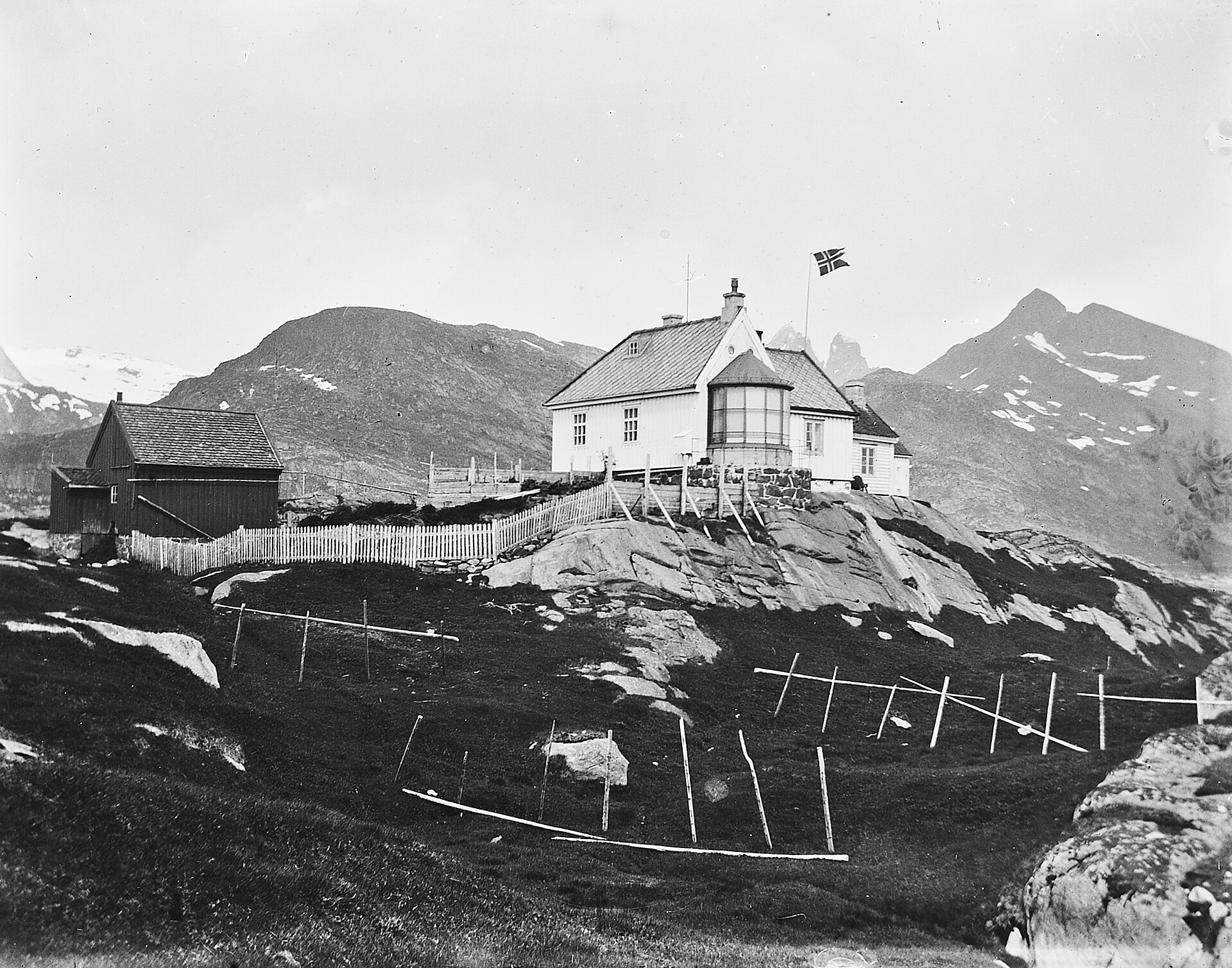
Værøy Lighthouse (Norwegian: Værøy fyr) stands on the southeastern point of the island of Værøya in Nordland county, Norway, close to the village of Sørland. It is one of the lights guarding the approach to the island's harbour, at the southern end of the Lofoten archipelago. Where is Værøy Lighthouse? The station sits on a small peninsula southeast of Sørland, near the bay of Røssnesvågen. Værøya belongs to Værøy Municipality in Nordland, northern Norway. The coordinates are roughly 67.65° N, 12.72° E. How was the lighthouse built? The Norwegian parliament funded the project in its 1879 budget. The station was built the following year and first lit on 20 October 1880. It was designed as a family station: besides the tower there was a keeper's house, outbuildings and a boathouse. The keeper and family lived here year-round, and life on an exposed headland meant being largely self-sufficient. How did it change over time? In 1905 the tower was raised and fitted with a fourth-order lantern, the size used at smaller coastal stations. In 1957 the station was connected to the local power grid, with diesel generators kept as backup. In 1984 the lighthouse was automated and no longer needed a resident crew. Is the lighthouse still in use? Sources differ on when it stopped working. English Wikipedia says it has not been used since 2008, while the Norwegian encyclopedia SNL says it was replaced by a new light in 2007. According to SNL the buildings stood empty until 2019, when they were restored with a view to opening the lighthouse to visitors. Check current access information before you go, as the status of the site may change. Where does the name come from? The name comes from the island. Its first element is linked to the Old Norse word for weather, a fitting origin for a place open to the wind and waves of the Norwegian Sea. Frequently asked questions When was Værøy Lighthouse built? The station was built in 1880 and first lit on 20 October of that year. Is the lighthouse automated? Yes, it was automated in 1984. No resident keeper has lived here since. Can you visit the lighthouse? The site was restored in 2019 with the aim of opening it to visitors. Current hours and access rules are best confirmed locally. Where exactly is it? On the southeastern point of Værøya island, near the village of Sørland in Værøy Municipality.
-

Slettnes Lighthouse
Gamvik
Slettnes Lighthouse is the northernmost lighthouse on the Norwegian mainland, standing on the Barents Sea coast in Gamvik Municipality, Finnmark. People come here for the simple feeling of standing at the edge of Europe. Where is Slettnes Lighthouse? The lighthouse stands about 3 km north of the village of Gamvik, on the northern coast of the Nordkinn Peninsula. It lies inside the Slettnes Nature Reserve, so the approach crosses open, treeless coastal land right beside the sea. The coordinates are roughly 71.09° N, 28.22° E, deep inside the Arctic Circle. What makes it special? The tower is 39 metres tall and is the only cast iron lighthouse in Finnmark county. The "northernmost" claim needs one clarification: the famous North Cape sits on the island of Magerøya, while Slettnes is the northernmost lighthouse on the continental mainland. How did it come to be? The station was first lit in 1905. Its purpose was to steer shipping away from the dangerous reefs of Korsbøan and Tørrbøan off the Nordkinn coast. Construction took two years. What happened during the Second World War? In autumn 1944, retreating German soldiers blew up almost the entire station. Only the lowest ten rings of the tower survived. After the war the lighthouse was rebuilt and put back into service in 1948. The taller tower seen today is therefore the result of reconstruction rather than the original structure. Sources disagree on the dates of automation, so it is safest to say that the station was staffed for decades and now runs without a crew. Can you visit? Yes. The station buildings are run by Gamvik Municipality as a visitor centre. Overnight accommodation is available in the station buildings from June to August, and guided tours of the tower run roughly from mid-June to mid-August. Outside the summer season, check with the local tourist office, as access can be limited. Frequently asked questions Is Slettnes the northernmost lighthouse in the world? Not in an absolute sense, but it is the northernmost on the mainland. Lighthouses on islands lie further north. What is the nearest village? Gamvik, about 3 km south of the lighthouse. When is the best time to go? Summer, when guided tours and lodging are available and the midnight sun lasts. In winter the northern lights are a draw, but services on site are limited. What else is nearby? The Slettnes Nature Reserve, which surrounds the lighthouse, and the rugged Barents Sea coast of the Nordkinn Peninsula. Is the lighthouse original? Not entirely. The station was built in 1905, destroyed in 1944 and rebuilt after the war.
-
Odderøya Lighthouse
Kristiansand
Odderøya Lighthouse stands on the southwestern shore of Odderøya island, right next to the centre of Kristiansand in southern Norway (Agder county). It is one of the oldest navigation points in the area, and today it is both a protected heritage site and a quiet walking destination with views over the approach to the harbour. How did a lighthouse come to stand on Odderøya? The light station was established in 1832. The decision followed the work of Norway's first lighthouse commission, whose priority was to secure the entrance to Kristiansand harbour. The coastal light on Oksøy was set up the same year, which shows how much weight shipping along this stretch of coast carried. What is the current tower? The historic tower dates from 1874. It replaced the first lighthouse and was built higher up the hill. That made its light easier to tell apart from the other lights of the town, which matters a great deal to captains approaching the port at night. Over the following decades the station was upgraded. A fog bell was added in 1896, a new lantern in 1914, electricity arrived in 1932, and a radio beacon followed around 1937. What was life like here during the war? During the Second World War the Germans took over the station. Throughout the five years of occupation the keeper and his assistant continued to look after the light, but the Germans decided when it was allowed to operate. What changed after 1984? In 1984 the station was automated and left unmanned. The historic tower was deactivated, and a new automatic light was built next to it, closer to the water. The old tower still stands and is protected by law by the Norwegian Directorate for Cultural Heritage (Riksantikvaren). In 2005 the county took over the site, and it is now run by the Vest-Agder Museum. Can you go inside? The grounds are open, but the lighthouse and tower are normally open to visitors only on Sundays. Hours can change, so check the museum's current information before you go. How do you get there? You can drive to the lighthouse, and there is parking. You can also walk from the city centre. The route begins as a road and then turns into a path that can be rocky and sometimes steep, so sturdy shoes are a good idea. What else is there to do nearby? The area is popular for its views of the sea approach to the city. Locals also use it for swimming and fishing. It makes a good stop on a walk around Odderøya, an island very close to central Kristiansand. Frequently asked questions When was Odderøya Lighthouse built? The first station was established in 1832, and the present tower was built in 1874. Is the lighthouse still in use? The historic tower was deactivated in 1984. The light moved to a new automatic lighthouse beside it. Is it protected? Yes, the 1874 tower is legally protected as a heritage site. Can you visit it? The grounds are open, and the interior is usually open on Sundays. Check the hours before travelling.
-
Struten Lighthouse
Fredrikstad
Struten Lighthouse – a small islet in the outer Oslofjord Struten Lighthouse (Norwegian: Struten fyr) is a coastal lighthouse on a tiny islet in the outer Oslofjord, in the municipality of Fredrikstad in Østfold, Norway. It sits south of the island of Hankø, a name well known to sailors for its regattas and summer trips on the fjord. The light has been in operation since 1907, and since 1985 the station has been automated, with no keeper living on the islet. Why was a lighthouse built on Struten? Before the lighthouse, the spot was marked in a different way. In 1901 a sound buoy, known locally as "Strutekua", was laid just north of the islet. It warned crews with an acoustic signal, but it was evidently not enough: a few years later, in 1907, a permanent navigation light was established on the islet. In the outer Oslofjord, where the route runs among rocks and small skerries, such a landmark mattered a great deal for shipping. What did the old station look like? The original structure was modest. The lighthouse was a square white wooden tower attached to the corner of the keeper's dwelling, topped by a red lantern. Combining home and tower in a single building was typical of small stations where the crew lived right beside the light. For almost eight decades people lived on the islet to tend the light, until automation in 1985. Is the light still active? Yes. It remains a working aid to navigation, operated by the Norwegian Coastal Administration, Kystverket. It now shines from a newer solar-powered tower, so no permanent human presence is required. Can you stay overnight? The old lighthouse building has been turned into accommodation. The Old Struten Lighthouse Association (Gamle Struten Fyr) has an agreement with the state and runs overnight stays there. For anyone who likes seclusion, it is a rare chance to spend time on a small island surrounded by open fjord. How do you get to the islet? Struten lies out at sea, so you need a boat. Transport is usually arranged privately, and in rough weather landing on the islet can be difficult. It is wise to leave some slack in your plans and agree the details with a boat operator or the association before you go. Frequently asked questions Where is Struten Lighthouse? On an islet in the outer Oslofjord, south of the island of Hankø, in the municipality of Fredrikstad in Østfold. When was it built? The light was established in 1907. Earlier, in 1901, a sound buoy was placed nearby. Does a keeper live there? No. The station was automated in 1985. Can you sleep in the lighthouse? Yes, through the association that runs overnight stays in the former lighthouse building. How do you get there? By boat, usually with privately arranged transport. Landing can be difficult in bad weather.
-
Ryvarden Lighthouse
Sveio
Ryvarden Lighthouse is a coastal lighthouse on the western shore of Sveio Municipality in Vestland county, Norway. Today it works as a regional cultural centre and museum, and it is also the reward at the end of a windswept coastal walk. Where is Ryvarden and what did it mark? The lighthouse stands about 8 kilometres southwest of Sveio's municipal centre. It was established in 1849 to mark the southern shore of the entrance to Bømlafjorden from the open sea. For skippers and fishermen heading into the fjord, it was an important navigational reference. What is the history of the lighthouse? The spot was significant long before the light. A stone cairn stood here, linked to the Viking-era seafarer Floke Vilgerdson, and it marked the old border between the districts of Ryfylke and Hordaland. In 1849 the Norwegian Lighthouse Directorate decided to build a light here. The first one was modest, aimed at fishing, and was to be lit in time for the spring herring season. Seafarers pushed for longer lighting, so the season was extended from 1852. A larger building went up in 1861, and the old cairn was removed. A fog signal and a taller tower arrived in 1935. The last major modernisation came in 1958, when electricity was installed and a bigger dwelling house was built. In 1984 the lighthouse was automated, ending the need for a resident keeper. What can you see today? In 2005 the municipality bought the buildings, which are now used as a regional cultural centre and museum. The site has a gallery and a café, and you can stay overnight in the former lighthouse keeper's house. The place has received the St. Olav's Rose, a Norwegian award for heritage preservation. Nearby stands a memorial to the 16 people who died in the 1999 Sleipner accident. How do you get there? From the car park at Mølstrevåg, a gravel path leads to the lighthouse, about a 30-minute walk. The route is part of the North Sea Trail between Mølstrevåg and Ryvarden. Bring a windproof jacket, as this stretch of coast is often breezy. Frequently asked questions When was Ryvarden Lighthouse built? It was established in 1849 to mark the southern side of the Bømlafjorden entrance. Is there still a lighthouse keeper? No. The lighthouse was automated in 1984. Can you eat or stay overnight here? Yes. There is a café and gallery, and the former keeper's house offers accommodation. Opening times vary by season, so check before you go. How far is the walk from the car park? Around 30 minutes on a gravel path from the car park at Mølstrevåg. Who owns the site? Sveio municipality, since 2005. Why visit? Ryvarden combines a rugged seascape, maritime history and well-kept historic buildings. It suits travellers exploring Norway's west coast who enjoy quiet places with a story and an open view over the sea.
-
Homlungen Lighthouse
Skjærhalden
Homlungen Lighthouse (Homlungen fyr) is a small wooden leading light on a skerry in the Hvaler archipelago, in south-eastern Norway, close to the fishing village of Skjærhalden on the island of Kirkøy. It is one of the best-preserved coastal stations in the Oslofjord region, and today visitors can see it up close and even stay in its old buildings. What is Homlungen Lighthouse? Homlungen is a fully automated leading lighthouse. Leading lights work in pairs or along a line to help ships hold a safe course through a narrow channel. This station was established in 1867 to guide vessels past Skjærhalden towards Halden and through the Løperen channel towards Fredrikstad. The tower is roughly 12 metres tall, and the light sits on a rocky islet together with a cluster of white-painted buildings. Why was it built, and who lived here? The station was designed as a family lighthouse. The keeper did not live alone: he moved out to the skerry with his wife and children and ran the light as part of daily life. The first family stayed for almost 40 years. The group of buildings reflects this, with residences, an outhouse, a well and an engine house gathered on a very small piece of rock. Lighting technology changed over time. For the first decades the light was a simple oil lamp. In 1894 a sixth-order lens apparatus was installed, and in 1915 the station received a new lantern house with a fourth-order lens. In 1952 the lighthouse was connected to the mainland by electric cable and automated, which ended the era of resident keepers. What happened after automation? From 1952 until 1997 the buildings served as a holiday home for employees of the Norwegian coastal administration. In 1997 the station was protected under the Cultural Heritage Act as a typical example of a wooden leading light. In 2008 the Oslofjord Outdoor Council took over the buildings and began to run them as a coastal cabin that visitors can rent. Is Homlungen Lighthouse part of a national park? Yes. The lighthouse and its surrounding buildings lie within the Ytre Hvaler National Park, a protected area of skerries, rocky shoreline and shallow sea. This makes the setting as interesting as the building itself: low granite islands, open water and the changing light of the Skagerrak coast. How do you get to Homlungen Lighthouse? Start in Skjærhalden on Kirkøy. From there, a coastal path of about one kilometre leads towards the shore opposite the skerry. The last stretch is a short crossing by rowboat, which is part of the experience and also the reason the place feels far more remote than the map suggests. Visitors staying overnight arrange the boat and access through the booking for the cabin. If you only want to see the lighthouse from the shore, the path itself offers good views. What can you do nearby? Walk along the Hvaler coastline and look for sea birds, seals and smooth rocks warmed by the sun. Visit Skjærhalden, one of the main harbour villages of the municipality, for a meal or a stroll along the quay. Explore other lighthouses and islands of the archipelago by boat in the summer season. Take photographs at sunrise or sunset, when the white buildings stand out against the sea. Frequently asked questions Is the lighthouse still working? Yes. It is automated and operates without a resident keeper. Can you sleep at Homlungen? Yes. The buildings are run as a coastal cabin by the Oslofjord Outdoor Council, so you can rent accommodation there. Is the lighthouse protected? Yes. It has been under heritage protection since 1997 and is located inside Ytre Hvaler National Park. Do I need a boat? You walk about a kilometre along the coast from Skjærhalden, then cross to the skerry in a rowboat. When is the best time to visit? Summer offers the easiest conditions for the boat crossing and the longest days, but the coast is atmospheric in other seasons too, provided the weather is calm.
-
Stavernsodden Lighthouse
Stavern
Stavernsodden Lighthouse (Stavernsodden fyr) is a coastal lighthouse at the southern tip of Stavernsøya, just off the town of Stavern in Larvik Municipality, Vestfold, Norway. It marks the entrance to the Larviksfjorden and is one of the best-known landmarks of the Vestfold coast. Where is Stavernsodden Lighthouse? The station stands on the outer edge of Stavernsøya, the island that shelters Stavern harbour. Its coordinates are roughly 58.9875° N, 10.0522° E. The setting is typical of the Oslofjord coast: smooth rock, low vegetation and open water to the south. It is a coastal beacon, so the point where it stands is exposed and bright, not hidden in a sheltered cove. What is the history of the lighthouse? Stavern owes its existence to the naval base of Fredriksvern, and the approach to the base needed a light long before the present station existed. From around 1750 a tilting light on Kikut, on the northern part of Stavernsøya, guided ships towards the yard. In 1848 the Storting granted money for a better entrance light at the southern end of the island, and the new station at Stavernsodden dates from the 1850s. The year 1855 is the date most often given for the first light. The first facilities were modest: a small guardhouse and the lantern. As the guardhouse became too cramped, a keeper's dwelling built of dressed granite was added in 1874. Keepers' families lived in the stone house until a wooden residence was built in 1954. Together these buildings show how a Norwegian lighthouse worked as a small community, with the keeper's family living beside the light. From keeper to automation The lighthouse was automated in 1984, which ended the era of resident keepers. The station did not fall silent, however. The Norwegian Meteorological Institute used the buildings after the light was unmanned, partly as a holiday home, until 2008. The lighthouse still works as an aid to navigation, showing its light to vessels passing the mouth of the Larviksfjorden. Protection and the friends' association In 1997 the lighthouse was listed as a protected site, together with the keeper's houses and outbuildings. This means the historic fabric of the station is meant to be preserved, not modernised away. Since 2008 a friends' association has leased the station from the Norwegian Coastal Administration and runs it as a visitor lighthouse. Opening times and events are set by the association, so check its current information before you plan a trip. What is there to see nearby? Stavern is a former naval town with a well-kept centre of wooden houses, a harbour and the remains of the Fredriksvern fortifications. The lighthouse fits naturally into a day on foot around Stavernsøya: the old naval history, the coastal views and the lighthouse itself make a compact itinerary. Bring sturdy shoes and a windproof layer, because the outer coast is often breezy even in summer. Frequently asked questions When was Stavernsodden Lighthouse built? The station was established in the 1850s, with 1855 the commonly cited year of the first light. The granite keeper's house followed in 1874. Is the lighthouse still in use? Yes. It was automated in 1984 and continues to serve as a navigation light at the entrance to the Larviksfjorden. Is it protected? Yes. It has been a listed protected site since 1997. Who runs it today? A friends' association leases it from the Norwegian Coastal Administration and operates it as a visitor lighthouse. Where exactly is it? At the southern end of Stavernsøya, just off the coast of Stavern in Larvik Municipality, Vestfold.
-
Kavringen fyr
Oslo
Kavringen fyr is a lighthouse on a small islet in the Oslofjord, just off Norway's capital. It stands on Søndre Kavringdynge at the western entrance to Oslo harbour (about 59.90°N, 10.72°E) and is still an active aid to navigation. From the shore it appears as a small white mark on the water, yet it is one of the most distinctive features of Oslo's maritime scenery. Why was Kavringen lighthouse built? Its story begins with an accident. In 1890 the steamship DS "Norway" struck the rocks of the Kavringen islet. The incident showed that the approach to the harbour was poorly marked and prompted calls for better lighting. Construction started in 1891, and the light first shone on 1 August 1892. Ships heading for the capital's port gained a clear landmark at a spot where collisions with underwater hazards had been all too easy. What does the lighthouse look like? The tower is a white octagonal wooden structure with a red band, easy to spot against water and rock. A wooden lighthouse in such an exposed position needs steady upkeep, so in 1992 it was rehabilitated, a thorough renovation that extended the building's life. How has the light changed? The lighthouse originally ran on gas. In 1932 it switched to electric power, a typical modernisation step for Norwegian lighthouses in the first half of the twentieth century. Sources describe the light differently: one gives the white light a range of around 10 nautical miles, while another notes white, red and green sectors that show mariners the safe line of approach. A time capsule for a thousand years A curiosity is hidden inside. In 2000, during celebrations of Oslo's 1000th anniversary, a sealed container of letters and objects was placed in the lighthouse. It is to be opened in the year 3000. Can you visit Kavringen fyr? No. The lighthouse is closed to the public, and the islet is a protected seabird reserve. From 15 April to 15 July all traffic around it is banned so the birds are not disturbed during nesting. The best way to see it is from a boat or ferry on the Oslofjord, keeping your distance. Frequently asked questions When was Kavringen lighthouse built? Construction began in 1891 and the light entered service on 1 August 1892. Is it still in use? Yes, it is an active navigation light at the entrance to Oslo harbour. Can I land on the islet? No. It is not open to the public, and traffic is banned from 15 April to 15 July to protect birds. What is inside the lighthouse? Among other things, a time capsule from 2000 meant to be opened in the year 3000. What is the tower made of? Wood. It is octagonal, painted white, with a red band. Who is this place for? Kavringen suits lovers of maritime history, photographers and anyone who enjoys spotting lighthouses from a boat deck. Bring binoculars on a fjord cruise: from a distance you can appreciate the proportions of the wooden tower and its contrast with the dark rocks. For visitors to Oslo it is also a reminder that Norway's capital is a port city, and that entering it safely has long depended on well-marked waters. Combine it with other waterfront sights, such as a walk along the quay or a visit to the islands of the Oslofjord.
-
Homborsund Lighthouse
Homborsund
Homborsund Lighthouse is a coastal lighthouse in southern Norway, in Grimstad Municipality, Agder county. It stands on the island of Store Grønningen, about 2 kilometres southeast of the village of Homborsund, which gave it its name. Today it is a protected cultural site, and visitors can stay overnight there. Where is Homborsund Lighthouse? The lighthouse sits on Store Grønningen, an island off the coast of Grimstad Municipality. It lies roughly 2 km (1.2 mi) southeast of the village of Homborsund. Because it stands on an island, it belongs to the rocky maritime coast of Agder rather than to a roadside stop. The village lent the station its name, even though the station itself is out at sea. When was it built and what does it look like? The light was established in 1879. Lyngør Lighthouse was constructed the same year, and the two stations share a similar design. If you are visiting several lighthouses along Norway's southern coast, comparing these two is worthwhile, since they come from the same period and the same architectural idea. What is part of the station? Besides the light itself, the complex includes: a living house for two families, an outhouse, a boathouse, a pier. This set of buildings shows that the station was once a permanent home. Keepers and their families lived here on the island alongside the equipment that served shipping. The boathouse and pier are a reminder that the only way to reach the island is by water. What changed after 1992? The light was automated in 1992 and the station was de-populated, meaning no one lived there permanently any more. Automation allowed the light to operate without staff. The buildings were not forgotten, though: the site is listed as a protected cultural site. Can you stay overnight? Yes. Today the station is open to the public for overnight stays and guidance. It is a rare chance to spend time in a former lighthouse keepers' home on an island surrounded by sea. Before you travel, check current booking rules and boat access with the operator of the site. Is the surrounding area protected? Yes. The area around the lighthouse is a protected bird sanctuary. During a visit, keep quiet, stay away from nests and follow the nature protection rules in force on the island. Frequently asked questions When was Homborsund Lighthouse built? In 1879, the same year as Lyngør Lighthouse. Where exactly is it? On the island of Store Grønningen in Grimstad Municipality, Agder county, Norway, about 2 km southeast of the village of Homborsund. Is anyone still living at the lighthouse? No. After automation in 1992 the station was de-populated, but today you can stay overnight. Is the site protected? Yes, it is a protected cultural site, and the surrounding area is a protected bird sanctuary. What else is on the island? A living house for two families, an outhouse, a boathouse and a pier. Who is this place for? Homborsund Lighthouse appeals to fans of maritime architecture, shipping history, quiet places and birdwatching. It combines a monument from 1879, the option of an overnight stay and contact with nature in a protected sanctuary. It suits travellers who want to see Norway's southern coast from a less obvious angle, and it pairs easily with Lyngør Lighthouse, built in the same year to a similar design.
-
Kaura Lighthouse
Åfjord
Kaura Lighthouse is a coastal lighthouse in Åfjord Municipality, in Trøndelag county, central Norway. Its 22-metre (72 ft) tower stands on the small island of Kaura, right at the mouth of the Brandsfjorden. It is one of those places on the Norwegian coast where a working landmark has slowly turned into a destination. Where is Kaura Lighthouse? The island lies at the entrance to the Brandsfjorden. The nearest villages on the mainland are Bessaker, about 9 kilometres (5.6 mi) to the east, and Roan, about 8 kilometres (5.0 mi) to the southeast. Because the lighthouse sits out on its own skerry, you see it from the water or from the outer coast rather than from a road. Åfjord itself is a coastal municipality on the Trøndelag shoreline, where the fjord country opens onto the open sea. When was it built, and why? The lighthouse was established in 1931 as a leading light. Its job was to guide ships along this stretch of coast, including traffic heading north and south across the Frohavet sea area. It was automated in 1959, which meant the keepers were no longer needed. It is often described as one of the last staffed lighthouses on the Norwegian coast to be built. What is the tower like? The tower is made of cast iron and rests on a concrete base. That choice of material makes sense for such an exposed position: the island has little shelter, and waves and weather reach it from the open sea. A crew of three lived at the station. Bad weather and difficult landing conditions could cut the station off from the mainland for periods of time. What happened after automation? After the lighthouse was unmanned, its light was switched to a gas lamp. In 1984 it was converted to solar power, so the light could run with very little human presence. In 2000 the station was protected as a cultural heritage site, recognising it as part of the history of Norwegian coastal navigation. Can you visit? Since 2012 a friends' association has leased the lighthouse and arranges day visits when conditions allow. Because the island is small and the sea can be rough, trips depend on weather, and it is worth checking the association's current information before planning a visit. Where does the name come from? The lighthouse takes its name from the skerry it stands on. The name is thought to derive from an old word meaning "to curl", which fits a place known for strong currents and waves. Frequently asked questions How tall is Kaura Lighthouse? The tower is 22 metres (72 ft) tall. When was it built? In 1931, and it was automated in 1959. Which county is it in? It is in Åfjord Municipality, Trøndelag county, Norway. Is it open to visitors? A friends' association runs day visits when conditions allow, so access depends on weather and the season. What is it made of? A cast-iron tower on a concrete base.
-
Eigerøy Lighthouse
Eigersund
Eigerøy Lighthouse is a coastal lighthouse in southwestern Norway, in Eigersund Municipality, Rogaland county. It stands on the small island of Midbrødøya, just west of the larger island of Eigerøya, at the approach to the town of Egersund. First lit in 1854 and automated in 1989, it is one of the most significant lighthouses in Norwegian maritime history. Why was Eigerøy Lighthouse built? Shipwrecks drove the decision. Between 1843 and 1851, four serious wrecks off Egersund claimed a combined total of 40 lives. Authorities concluded that vessels needed a clear landmark to steer them toward the town and to help with navigation along this stretch of coast. That led to the plan for a tower on Midbrødøya. What makes it special? Eigerøy is regarded as Norway's first cast iron lighthouse. The structure was made in modules at Bærums Verk, then shipped to the island and assembled on site. Because nobody was sure how a cast iron tower would handle the strong local winds, its interior was lined with bricks, about 70,000 of them. The success of the tower encouraged the building of further cast iron lighthouses along the Norwegian coast. The tower is 32.9 m tall, and the light sits 46.5 m above sea level. It shows three white flashes every 30 seconds. What happened after automation? After automation in 1989 the station stood vacant. In 1998 the lighthouse complex was protected under the Norwegian cultural heritage act. In 2001 the Midtbø family leased it from Kystverket, the Norwegian Coastal Administration. The keeper's house has been restored, and a café opens on Sundays during the summer season. The island also hosts a bird station, established at the lighthouse in 1991. Can you stay overnight? Norwegian tourism websites list the lighthouse both as a sight to visit and as accommodation. Check conditions, dates and access with the operator before you travel. Frequently asked questions Where is Eigerøy Lighthouse? On Midbrødøya island, immediately west of Eigerøya, in Eigersund Municipality, Rogaland, Norway. Its coordinates are roughly 58.431 N, 5.868 E. When was it built? It was established in 1854 and automated in 1989. What is it made of? Cast iron, in modules produced at Bærums Verk. The inside is lined with about 70,000 bricks for added strength. Is it protected? Yes. The lighthouse station has been under heritage protection since 1998. Is there a café? A café operates on Sundays in the summer season, in the keeper's house. How tall is the tower? It is 32.9 m tall, with the light 46.5 m above sea level. Who is it for? It suits anyone interested in engineering history, coastal photography or birdwatching, and travellers who want to see Norway's first cast iron lighthouse in its original seaside setting. Combine a visit with a walk around Egersund and the nearby islands.
-
Torbjørnskjær Lighthouse
Hvaler
Torbjørnskjær Lighthouse is a coastal lighthouse on a small skerry in the Hvaler archipelago, in the far south-east of Norway. It is one of the two landmarks that frame the entrance to the Oslofjord: Torbjørnskjær marks the eastern side, while Færder lighthouse marks the western side. Where is Torbjørnskjær Lighthouse? The lighthouse stands on an exposed rock in the municipality of Hvaler, at the mouth of the Oslofjord, around 59.0° N, 10.78° E. Ships heading into the fjord towards Oslo pass between this light and Færder, so the station has long served as a gateway marker for one of Norway's busiest sea routes. What is the history of the lighthouse? Construction began in the summer of 1869 and the light was first lit in 1872. The work was slow. The skerry is often swept by waves, and the local stone was not suitable for building, so materials had to be brought in from Hvaler and landed on a rock where unloading was difficult. The main building was made of granite and combined the keeper's residence with the tower. In 1895 the station grew: an engine house for the fog signal was added, together with a house for an assistant keeper. The fog signal later received upgrades and stayed in service until 1990. For many years the station was home to keeper families. Life on such a small, wind-battered rock was demanding, and few people stayed for long. Until 1949 it remained a family posting. How does the lighthouse work today? The lighthouse was automated and unmanned in 1990. Today it is fully automated and the light is powered by solar energy. Regular service visits are made by helicopter, because landing by boat is very difficult in most conditions. Is the lighthouse protected? Yes. The station was given cultural heritage protection in 1997. Besides the tower and main house, the complex includes residences, an outhouse, a well and the engine house, and the whole group of buildings is part of what is being protected as a national heritage site. Can you visit Torbjørnskjær Lighthouse? Landing on the skerry is hard, which is also why service crews rely on helicopters. Most visitors see the lighthouse from the water, from a boat trip in the Hvaler archipelago or from a vessel sailing in and out of the Oslofjord. Check weather and sea conditions before planning any trip, and do not count on being able to go ashore. Frequently asked questions Where is Torbjørnskjær Lighthouse? On a skerry in the Hvaler archipelago, marking the eastern entrance to the Oslofjord. When was it built? Work began in 1869 and the light was first lit in 1872. Is anyone living there? No. It was unmanned and automated in 1990 and runs on solar power. Is it protected? Yes, it has had heritage protection since 1997. Can I land there? Landing conditions are very difficult. Service visits are by helicopter, and most people view it from the sea.
-
Helnes Lighthouse
Nordkapp
Helnes Lighthouse stands on the northeastern coast of the island of Magerøya, in Nordkapp Municipality, Finnmark, Norway. It is not a headline sight in the guidebooks, yet it captures the character of Europe's northern edge: a bare shoreline, open sea, constant wind and a long history of shipping in Arctic waters. Where is Helnes Lighthouse? The lighthouse sits on the western side of the mouth of the large Porsangerfjorden. The village of Kamøyvær lies about 12 km to the west, and the town of Honningsvåg is roughly 13 km to the southwest, so the station is a natural stop for anyone exploring the island by car. The surroundings are thinly populated and there is little tourist infrastructure, so plan it as a short stop along a wider Magerøya trip rather than a half-day destination. What is the history of the lighthouse? The station was established in 1908 to guide vessels along the northern coast of Magerøya, where marine traffic was busy and the weather can turn quickly. During World War II, in 1944, the lighthouse was destroyed. The war hit the whole of Finnmark hard, and much of the coastal settlement was burned or demolished. After the war the navigation point was not abandoned. Reconstruction ran from 1946 to 1948, and the station returned to the system of marks along the Norwegian coast. In 2004 the lighthouse was automated, so it now operates without a permanent crew. What else sets Helnes apart? A radio beacon was added here in 1955. It also emits a racon signal, a radar response sent in Morse code as the letter N. For vessels with radar this is an extra way to identify the spot when visibility is poor, which happens often at these latitudes. Frequently asked questions Where is Helnes Lighthouse? On Magerøya island, in Nordkapp Municipality in Finnmark, on the western side of the entrance to Porsangerfjorden. When was it built? In 1908. After its destruction in 1944 it was rebuilt between 1946 and 1948. Does a keeper still live there? No. The lighthouse has been automated since 2004. How far is it from Honningsvåg? About 13 km in a straight line. What does the N signal from the beacon mean? It is the racon identifier in Morse code. It lets a ship's crew confirm that the radar return comes from this particular station. Who should visit? Helnes suits anyone interested in maritime history, landscape photography and off-the-beaten-path travel in the far north. If you are visiting Nordkapp, the lighthouse is a worthwhile addition to a Magerøya route: it shows what navigation work looked like, and still looks like, on one of the northernmost coastlines on the continent. Bring warm, windproof clothing, since conditions on the shore can change within an hour, and allow extra travel time, especially outside the summer months.
-
Skrova Lighthouse
Skrova
Skrova Lighthouse (Norwegian: Skrova fyr) is a coastal lighthouse in northern Norway, in Vågan Municipality, Nordland county. It stands on a small skerry off the southwest side of the island of Skrova, in the Vestfjorden, south of Austvågøya, the largest island of the Lofoten archipelago. It is one of the most photogenic navigation marks on this coast. Where is Skrova Lighthouse? The lighthouse sits on a tiny rocky islet southwest of Skrova island. Skrova itself is a small island in the Vestfjorden, the wide bay that separates Lofoten from the Norwegian mainland. There is no road to the lighthouse: it stands on its own islet, so it is best admired from the water, or from the shore of Skrova if you arrange boat transport in advance. What does it look like, and when was it built? The current tower is cast iron, painted red with two white bands that stand out clearly against the sea and mountains. The design dates from 1920 and the light entered service in 1922. It was built by local carpenters from the town of Volda, and the architect Carl Wiig is credited with the design. The light flashes white twice in a 45-second cycle and is visible from about 18 nautical miles. History and staffing The station was electrified in 1951. It was automated in 2005, and there has been no full-time resident crew since then. Before that it was the last fully manned light station in Nordland county. Foundation remains of an earlier, older lighthouse can still be seen on the islet. Heritage protection In 1999 the lighthouse, together with its surrounding buildings and natural area, was protected under Norway's Cultural Heritage Act. This preserves its historic character as an example of the maritime infrastructure of northern Norway. Frequently asked questions Can you go inside Skrova Lighthouse? It is automated and has no permanent staff. It stands on a separate islet, so reaching it requires a boat. Check local boat trip options and access rules before you go. Where is Skrova? In Vågan Municipality, in the Vestfjorden, south of the island of Austvågøya in the Lofoten archipelago. When was the lighthouse built? The design dates from 1920 and it began operating in 1922. Is the lighthouse still active? Yes, it serves as a navigation aid, but it has operated automatically since 2005. Why visit? It is a historic, distinctively painted lighthouse set against the dramatic backdrop of the fjord and the Lofoten mountains, a popular photo subject and a good target for fans of sailing and maritime architecture. Tips for visitors Clear days give the best views, when the red tower contrasts sharply with the water and rock. Conditions on the Vestfjorden can change quickly, so plan boat trips flexibly and dress in layers. You can combine a lighthouse visit with exploring Skrova island itself, a typical Lofoten fishing community with views of the northern coast.
-
Tvistein Lighthouse
Larvik
Tvistein Lighthouse (Norwegian: Tvistein fyr) stands on a small rocky island at the entrance to the Langesundsfjorden, in Larvik Municipality, Vestfold, Norway. For over a century its light has guided ships along the southern coast, and today it is also a destination for anyone who loves the sea, quiet and wide horizons. Where is Tvistein Lighthouse? The lighthouse sits on the island of Tvistein, about 5 kilometres southeast of the village of Nevlunghavn, close to the mouth of the Langesundsfjorden. Nevlunghavn is a small harbour village in Larvik Municipality and the natural starting point for a trip out to the island. The island lies in open water, so weather and swell strongly shape how a visit goes. What is the history of the lighthouse? The station was established in 1908. The light was first shown that autumn from a low tower on the roof of the keeper's house. The first keeper, Johan B. Nielsen, served from 1908 to 1913. Until 1951 the lantern room and the foghorn were placed on the roof of the machine house. The lighthouse was automated in 1988, after which it was no longer permanently staffed. What does it look like? The lighthouse is a masonry tower about 12 metres tall, with the light at a focal height of around 17 metres. The tower is white with a red lantern, which stands out clearly against rock and sea. Its light is described as Fl WRG 5s: a flash repeating every five seconds, shown in white, red or green depending on the sector. It remains an active aid to navigation. Can you stay overnight? Yes. After a long restoration effort involving many volunteers, the lighthouse has been renovated and opened for overnight stays and visitors. Staying in a former lighthouse station on an island is nothing like a regular hotel: around you there is only sea, rock and sky. How do you get there? Trips to the island run from the Laberget marina in Nevlunghavn during the summer season. Check the current schedule and booking rules with the operator before you go. Nevlunghavn can be reached by car from Larvik. Frequently asked questions Where exactly is Tvistein Lighthouse? On the island of Tvistein, about 5 km southeast of Nevlunghavn, at the entrance to the Langesundsfjorden in Larvik Municipality. When was it built? The station was established in 1908 and automated in 1988. Is the lighthouse still working? Yes, it is an active aid to navigation. Can you spend the night there? Yes, since its restoration it offers accommodation. Where do the boats depart from? From the Laberget marina in Nevlunghavn, in the summer season.
-
Bremstein Lighthouse
Vega
Bremstein Lighthouse is a remote coastal light station in Vega Municipality, Nordland county, Norway. It stands on the island of Geiterøya, roughly 22 kilometres west of the main island of Vega, where land is almost out of sight and open sea takes over. It is the kind of landmark best appreciated from the water. Where is Bremstein Lighthouse? The lighthouse sits on Geiterøya, a small island in the Steinan group at the western edge of the Vega archipelago. Some sources place the station within the Vegaøyan archipelago, a UNESCO World Heritage Site. Its coordinates are about 65.596° N, 11.286° E. Depending on the source, the distance from Vega island is given as 22 to 28 kilometres. What does it look like, and since when has it operated? The tower dates from 1925 and is about 27 metres tall. It was built as a cast-iron structure for the Norwegian Coastal Administration (Kystverket). The tower carries two separate optical apparatuses, each on its own gallery. The main light uses a French second-order flashing lens. Key dates in the station's history 1925 – the station is established. 1961 – the light is electrified. 1980 – the light is automated. 1982 – the last keepers leave. 1996 – a machinery shed beside the station burns down. 1999 – the station is protected under Norway's Cultural Heritage Act. One of the keepers' houses was later moved to Bodø, a small reminder of how the station changed once it no longer needed a resident crew. Who looks after it? The light station is operated by the Norwegian Coastal Administration, while the land on the island is privately owned. For visitors, that means checking current access rules in advance rather than assuming a landing is always possible. Can you reach the lighthouse? The island lies far from any ordinary hiking route, so getting there takes a boat and decent weather on the open sea off the Nordland coast. Most people see the lighthouse from a vessel rather than from land. Information about boat trips around the Vegaøyan area is best gathered locally on Vega. Why it is worth knowing Bremstein shows what the 20th-century Norwegian coastal lighting network looked like: a tall cast-iron tower, two galleries of optical equipment, housing for the crew and demanding island terrain. Today the light runs automatically and the station is a protected heritage site. For lighthouse enthusiasts, maritime photographers and fans of the far north, it is a worthwhile point to mark on a map of the region. Frequently asked questions Where exactly is Bremstein Lighthouse? On the island of Geiterøya, about 22 km west of the main island of Vega, in Vega Municipality, Nordland county. When was it built? In 1925. Is the lighthouse staffed? No. The light was automated in 1980 and the keepers left in 1982. Is it protected? Yes, the station has had heritage protection since 1999. Can you visit it? The island is privately owned and reachable only by sea, so check current access conditions before planning a trip.
-
Marstein Lighthouse
Austevoll
Marstein Lighthouse stands on the island of Store Marstein, at the western edge of the Austevoll archipelago in western Norway. For generations it guided ships toward Bergen, and today it combines its role as a working aid to navigation with a place where visitors can eat, hold meetings and stay overnight. Few lighthouses sit so close to the open sea. Where is Marstein Lighthouse? Store Marstein lies at the southern entrance to Krossfjorden, just west of the larger island of Storakalsøy. The coordinates are roughly 60.13° N, 5.01° E, and the site belongs to Austevoll municipality in Vestland county. Nothing shelters the island from the North Sea, so weather can change quickly, and wind and waves are part of everyday life here. What was the lighthouse for? The light was established in the second half of the 19th century to steer ships toward Bergen, one of Norway's most important ports. Construction took about two years, mainly because of the harsh weather on such an exposed island. Over the following decades the station grew: an early red flashing light was replaced by a stronger white one, a fog signal was added, and later a radio beacon, a transmitter that helps ships navigate when visibility is poor. The island's name, Marsteinen, is linked to an old Norse word for a boundary stone, which suits a place standing where land gives way to open water. What happened during and after the war? During the Second World War the station was bombed and destroyed. It was rebuilt afterwards, and the way it was run changed as well: instead of a family living on the island and tending the light, staff worked in rotation. The light was later automated and the station eventually ceased to be permanently manned. Sources give slightly different dates for these changes, so treat them as approximate. The station has also weathered later storms, including the severe storm Eowyn in January 2025. Can you visit Marstein Lighthouse? Yes. Austevoll municipality bought the lighthouse in 2005, and in 2010 it opened to guests as a venue with overnight accommodation. Since 2013 a conference hotel has rented it, while the Norwegian Coastal Administration (Kystverket) remains the owner and keeps the light running as an active navigation aid. That means you can see a working lighthouse and spend more than a few hours on the island. The island is reached by boat, so check current sailing and booking options before you travel, and keep your plans flexible because conditions at sea can be unpredictable. Frequently asked questions Where is Marstein Lighthouse? On Store Marstein in Austevoll municipality, west of Bergen, at the southern entrance to Krossfjorden. Is the lighthouse still working? Yes, the light remains an active aid to navigation maintained by Kystverket. Can you stay overnight? The site opened to guests in 2010 and offers accommodation. Check the operator for current booking rules. Does anyone live there permanently? No. After automation there is no permanent crew, and the site is used for tourism and conferences. When is the best time to go? Summer is usually calmest, but the island is exposed to wind all year, so dress warmly and check the forecast. Why is it worth seeing? It is a rare chance to see an active Norwegian lighthouse at the edge of the sea and learn about the history of navigation to Bergen.
-
Bøkfjord Lighthouse
South Varanki
Bøkfjord Lighthouse is a coastal light station at the mouth of Bøkfjorden in Finnmark county, in the far northeast of Norway. It sits in Sør-Varanger Municipality, not far from the Russian border, and offers a look at Norway's rugged Arctic coast far from the usual southern tourist trails. Where is Bøkfjord Lighthouse? The lighthouse stands about 20 kilometres (12 mi) north of Kirkenes, the region's main town. The border with Russia lies roughly 26 kilometres (16 mi) to the east. Its position at the entrance to the fjord explains its purpose: guiding ships into these waters. Why was it built? The station was established in 1910. Norwegian reference works describe it as a leading light for the iron-ore ships that sailed once shipping from Kirkenes got under way. On a northern coast with long winter darkness and fast-changing weather, a safe approach to the fjord mattered a great deal economically. What happened during the Second World War? The original station was destroyed in the war. Eastern Finnmark was among the areas hit hardest, and rebuilding the coast took years. The lighthouse was raised again in the second half of the 1940s, and the post-war buildings were designed by the Oslo architecture firm Blakstad and Munthe-Kaas. From keepers to automation For decades the station was home to a resident crew. It became unstaffed in 2006, and one architectural guide calls it the last Norwegian light station to be fully automated. Sources disagree on the year automation first began, so the safest summary is that the keeper era ended in the early 2000s. Heritage protection In 1998 the site was protected under Norway's Cultural Heritage Act. It is both a working aid to navigation and a valuable example of post-war lighthouse architecture in the high north. Frequently asked questions Where is Bøkfjord Lighthouse? At the mouth of Bøkfjorden in Sør-Varanger, Finnmark, about 20 km north of Kirkenes. When was it built? The station was established in 1910. The present buildings come from the rebuild after wartime destruction, in the late 1940s. Is it a protected site? Yes. It has been protected under the Norwegian Cultural Heritage Act since 1998. Do lighthouse keepers still live there? No. The station is automated and was left unstaffed in 2006. How far is it from the Russian border? About 26 kilometres (16 mi) to the west of the border, as the crow flies. Who should visit? The lighthouse suits lighthouse enthusiasts, readers of twentieth-century history and landscape photographers. Combine it with a stay in Kirkenes and a trip along the Varangerfjord coast. Check weather and road conditions before setting out, since they change quickly in the far north, especially outside summer. Bring warm, windproof clothing even in July, because the open coast is usually much windier than inland areas.
-
Jomfruland Lighthouse
Kragerø
Jomfruland Lighthouse (Jomfruland fyr) stands on the island of Jomfruland in Kragerø Municipality, Telemark, Norway. It is one of three lighthouses around Kragerø and the only one of them with two towers side by side: an older brick tower and a younger cast-iron one. The island lies off Norway's southern coast, and the lighthouse is its best-known landmark. What does the lighthouse look like? The station has two towers. The first, built of brick, was lit in 1839 and is about 22 metres tall. The second, made of cast iron, dates from the late 1930s. English Wikipedia gives 1939, while Norwegian local sources say 1938, so "late 1930s" is the safe description. The iron tower is about 31 metres high and uses a second-order Fresnel lens, a large multi-ringed lens that was once standard in coastal lighthouses. Is the old tower still standing? Yes. The 1839 brick tower survives, although it no longer has a lantern and no longer serves as a navigation light. The newer iron tower took over that role. As a result, one site shows two chapters of Norwegian maritime signalling: nineteenth-century brickwork and an interwar metal structure. What is the history of the station? For decades the lighthouse was staffed. It was automated and the permanent crew withdrawn in 1991. The station is protected as a cultural monument. Local sources also note that the Decca navigation system was built out on the island from 1965, which shows how long Jomfruland has mattered for shipping in this area. How do I tell it apart from other lighthouses in Kragerø? Kragerø has three lighthouses: Jomfruland, Strømtangen and Stavseng. The latter two were lit on 22 October 1874 and work as a range pair, so they are a different kind of installation. If you are looking for a tall tower with views over open sea, Jomfruland is the one. What else is notable about the island? Jomfruland is linked to the Norwegian painter Theodor Kittelsen, who made a series of 14 pictures of the island in 1893. According to local tradition, the lake Tårntjenna inspired his painting "Nøkken". For art lovers, that is one more reason to combine a visit to the lighthouse with a walk around the island. Frequently asked questions Where is Jomfruland Lighthouse? On the island of Jomfruland in Kragerø Municipality, Telemark, Norway, at roughly 58.865 N, 9.596 E. When was it built? The brick tower was first lit in 1839, and the iron tower was built in the late 1930s (sources say 1938 or 1939). Is it still staffed? No. The station was automated and the crew withdrawn in 1991. How many towers does it have? Two: the 1839 brick tower, without a lantern, and the taller cast-iron tower. Is the site protected? Yes, the station is protected as a cultural monument.
-
Songvår Lighthouse
Kristiansand
Songvår Lighthouse is a coastal lighthouse in Kristiansand Municipality, in Norway's Agder county. It stands on the island of Hellersøya, about 7 kilometres south of the village of Høllen, at the edge of the country's southern coastline. It pairs a stark landscape of rock and sea with a piece of local maritime history. Where is Songvår Lighthouse? The lighthouse sits on Hellersøya, along a stretch of the Skagerrak coast long considered dangerous for shipping. The nearest village is Høllen, roughly 7 km to the north. Administratively it belongs to Kristiansand Municipality in Agder, at about 58.015° N, 7.810° E. The island is exposed to the open sea, so the weather can change very quickly. Why was it built? The first lighthouse went up in 1888 as a small wooden structure. It was a response to repeated wrecks in the waters between Ryvingen and Oksøy, including the 1887 loss of the whaling vessel Vardøhus, which cost many lives. The light was meant to guide sailors through one of the busiest and trickiest parts of the coast. What is the building history? Only the foundation of the earliest lighthouse survives. The present functionalist building dates from 1955, although some sources give a slightly earlier year. In 2004 the lighthouse was closed and replaced by a smaller automated light tower just southeast of the older building. The old lighthouse no longer serves as the main navigation light, but it still stands and remains a clear landmark on the island. What happened here over the years? Life as a lighthouse keeper on a remote island was hard. In December 1900, the keeper and his eldest son drowned when their boat capsized on the way to the station. His widow, Johanne Pedersen, then took over for a time, making her one of the first women to hold such a post in Norway. A foghorn was added in 1950, and in 1955 the station changed from a family-run post to one staffed by rotating keepers. Can you stay overnight? The station is owned by the Norwegian Coastal Administration, Kystverket. The association Songvaar fyrs venner, the Friends of Songvår Lighthouse, rents and runs it, and visitors can stay overnight in the old keeper's house. For anyone who likes remote places, it is a chance to see Norway's southern coast the way the station's residents once did. It is worth checking access and booking details with the operator in advance. Frequently asked questions Where is Songvår Lighthouse? On the island of Hellersøya in Kristiansand Municipality, about 7 km south of Høllen, in Agder county. When was it built? The first lighthouse dates from 1888, and the current building from 1955. Is the lighthouse still in operation? The old lighthouse was closed in 2004, and a smaller automated tower nearby took over the light. Can I stay there overnight? Yes, guests can stay in the former keeper's house, run by Songvaar fyrs venner. Who owns it? Kystverket owns it, and the association looks after and operates it. Why was a lighthouse built here? Because of the many shipwrecks along this part of the coast, between Ryvingen and Oksøy.
-
Lyngør Lighthouse
Tvedestrand
Lyngør Lighthouse (Norwegian: Lyngør fyr) stands on the island of Kjeholmen in the Lyngør area of Tvedestrand Municipality, in Agder county on Norway's southern coast. Its white tower with a red top guides vessels through the archipelago and is one of the most recognisable landmarks on this stretch of coast. Where is Lyngør Lighthouse? The lighthouse sits on the southern tip of Kjeholmen, just east of the densely built, historic part of Lyngør. Administratively it belongs to Tvedestrand in Agder. The coordinates are roughly 58.636° N, 9.148° E. The site lies where rocky islets meet the open sea, which is why it has long served as a navigation mark for coastal shipping. What does it look like, and since when has it operated? The light was established in 1879, at the same time as the Homborsund lighthouse station, during a period of expansion of Norway's navigation network. The structure is a white, square concrete tower with a red top holding the lantern, attached to a keeper's house of two and a half storeys. The tower is 16.9 metres tall, and the light is placed 21.3 metres above sea level. The original third-order Fresnel lens is still in place, and the foghorn diaphone has also been preserved. Is there still a lighthouse keeper? No. The station has been automated and nobody is permanently stationed there. The light remains active as an aid to navigation for sailors. In 1997 the site was listed as a protected monument, which safeguards the historic station buildings. Can you stay overnight? Yes. The former keeper's residence has been converted into accommodation run by the Aust-Agder branch of the Norwegian Trekking Association (DNT). It is available all year round, so you can spend a night where lighthouse keepers once lived and worked. It offers a rare chance to see the archipelago from the viewpoint of the station's own staff. How do you get to Lyngør? There are no cars in the village of Lyngør. Most visitors arrive by boat from the Gjeving landing, or sail in on their own vessel. The village was a parish centre until 1960 and was named Europe's best preserved small town settlement in 1991. A walk along its narrow lanes between white wooden houses is a natural complement to a visit to the lighthouse. Frequently asked questions When was Lyngør Lighthouse built? The light has operated since 1879. Is the lighthouse protected? Yes, it was listed as a protected site in 1997. How tall is the tower? The tower is 16.9 metres tall, and the light shines from 21.3 metres above sea level. Can I stay overnight in the lighthouse? Yes. The keeper's house operates as DNT Aust-Agder accommodation and is open all year. Can I drive to Lyngør? No. The village has no cars, and access is by boat, for example from Gjeving.
Earn badges for the places you visit
Download NextOnTrip, discover new places and check off your trails.