Village in Croatia
A guide to 13 Village in Croatia — with descriptions, photos and traveler visits from the NextOnTrip community. Locations spread across 13 cities and towns. Most visited by the community: Kuterevo, Klokoč, Croatia, Šeganovac.
-
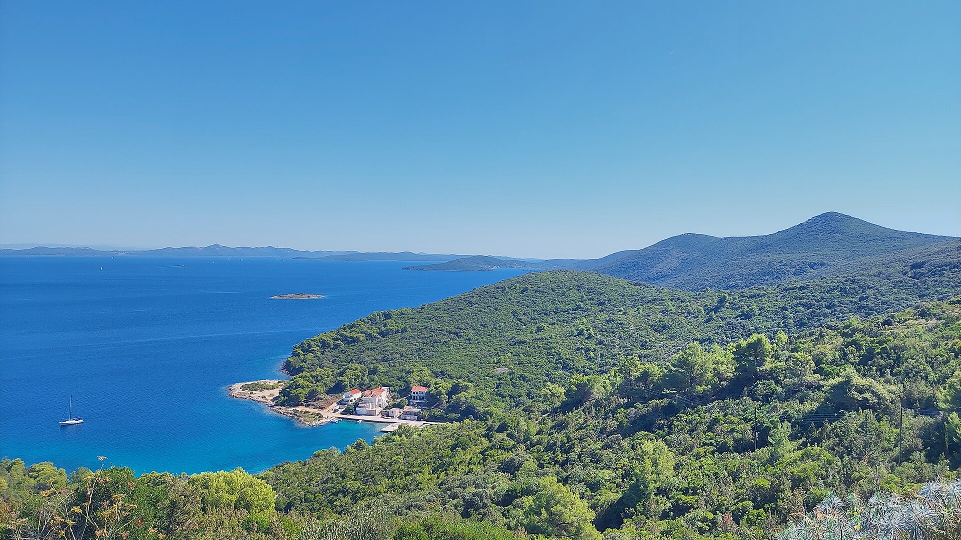
Zaglav
Dragove
Zaglav is a small port village in the Sali municipality on the island of Dugi Otok in Zadar County, Croatia, close to the neighbouring village of Dragove. The settlement sits on a plateau above the bay of Triluka and has around 170 residents, making it one of the quieter communities on the island. Despite its modest size, Zaglav plays an outsized role as a transport and supply hub for the whole of Dugi Otok. How do you get to Zaglav? Zaglav is reached via the D125 road, which links the village to the rest of the island and, through further connections, to the mainland. Ferry services also serve the wider Zadar area, offering an alternative for travellers without a car. Anyone driving should note that Zaglav is home to the only petrol station on the entire island, serving both cars and boats — a good reason to fuel up here before continuing further along Dugi Otok, where roads are modest and distances between settlements tend to be longer than a map suggests. What is there to see in Zaglav? The village's main landmark is the Franciscan monastery and the Church of St Michael, the settlement's patron saint, dating back to the 15th century. The monastery complex forms the spiritual and architectural heart of Zaglav, its plain stone structure blending naturally into the island scenery. It is also worth walking down to the bay of Triluka, above which the village is built — a calm, sheltered spot typical of the Dalmatian coast, where small fishing boats moor right against the stone quay. Though tiny, the village has kept the feel of a traditional island settlement: narrow lanes, stone houses and sea views create an atmosphere that is hard to find in Dalmatia's more touristy towns. What else is worth knowing about the area? Zaglav neighbours Dragove, a medieval village in the north-eastern part of Dugi Otok known for its 12th-century church and scenic position above a bay. Dugi Otok itself is one of the larger islands of the Zadar archipelago in northern Dalmatia, stretching roughly 50 km in length while never wider than 4.6 km. Around 1,700 people live on the island, spread across a dozen or so small settlements, and Zaglav counts among the more important ones thanks to its port and service functions. When is the best time to visit Zaglav? The best months to visit run from May to September, when the weather is warm enough for swimming in the bay of Triluka and exploring the island, and ferry connections run most frequently. July and August bring peak season and the warmest sea, while May, June and September offer a quieter atmosphere and less traffic on the roads — a real advantage on Dugi Otok, where infrastructure remains limited. Frequently asked questions Can you refuel a car or a boat in Zaglav? Yes, the village has the only petrol station on Dugi Otok, serving both vehicles and boats. What is the main landmark in Zaglav? The Franciscan monastery with the Church of St Michael, dating back to the 15th century. How far is Zaglav from Dragove? The two villages lie close together on Dugi Otok and are connected by the D125 road, with the drive normally taking just a few minutes. Can you reach Zaglav without a car? Yes, seasonal ferry services connect the wider Zadar region, though having your own transport makes exploring the rest of the island much easier.
-

Debelo brdo
Debelo Brdo I
Debelo Brdo I is a small village in Croatia, part of the town of Gospić in Lika-Senj County. Where is Debelo Brdo I located? The village lies in Lika-Senj County (Ličko-senjska županija), the largest county in Croatia by area yet also the least densely populated. Administratively, it belongs to Gospić, the main town of the Lika region. This is hilly, sparsely built-up terrain in eastern Croatia, close to the Velebit mountain range and not far from the wider area famous for national parks such as Plitvice Lakes. The village sits at roughly 44.54°N, 15.30°E. What does the name mean? The name comes from the Croatian word "brdo," meaning hill, while "debelo" translates loosely as "thick" or "broad." That connection is more than coincidence — geographic databases such as Wikidata actually describe the place itself as a hill within Lika-Senj County, rather than only as a settlement. This kind of naming is common across Lika, where villages frequently take their names from the surrounding terrain — hills, valleys, and ridges — around which the first houses were built. How many people live in Debelo Brdo I? According to the 2011 census, the village had 61 residents. It's a small community, typical of many settlements in the Lika region, where houses are scattered among fields and pastures and daily life still follows the rhythm of farming and herding common to Croatia's mountainous interior. How do you get to Debelo Brdo I? Gospić, the administrative center of the region, is the natural base for exploring this part of Lika, with local roads leading out toward the surrounding villages. Given its small size and rural character, the easiest way to reach Debelo Brdo I is by car, treating it as a stop while touring the quieter, less-visited corners of Lika — away from the crowds drawn to the region's better-known natural attractions. When is the best time to visit? Lika has a continental climate, with cold, snowy winters and warm summers. Spring and autumn are the best seasons to explore the area, when temperatures are milder and the landscape — fields, pastures, and the surrounding hills — looks its most attractive. Summer tends to bring heavier tourist traffic to the wider region, driven by its proximity to well-known natural sights. Frequently Asked Questions Where exactly is Debelo Brdo I located? In Lika-Senj County, within the town of Gospić, in eastern Croatia. How many people live in Debelo Brdo I? According to the 2011 census, the village had 61 residents. Where does the village's name come from? From the Croatian word "brdo," meaning hill — geographic sources also describe the location as a hill within the region. What's the best way to reach Debelo Brdo I? By car, using Gospić as a starting point for exploring the surrounding area.
-
Kurilo
Brotnice
Kurilo is a small hamlet within the village of Brotnice, in the Konavle municipality of Dubrovnik-Neretva County, southern Croatia. It's a quiet corner far from the coastal crowds, yet only a short drive from both Dubrovnik and Cavtat. Where is Kurilo located? Kurilo sits within Konavle, a rural region stretching southeast of Dubrovnik between the hills and the Adriatic coast. Brotnice, the parent village, has only a few dozen residents spread across scattered farmsteads amid fields and vineyards. The landscape here is classic Dalmatian countryside: stone houses, dry-stone walls separating small plots, and olive groves and vines tended by the same families for generations. What can you see nearby? The main draw of this part of Konavle is the graveyard at St Luke's Church in Brotnice, home to a medieval necropolis of stećci — the stone tombstones typical of the Western Balkans. The site holds 22 chest-shaped tombs, 9 slabs, and one gabled-roof stone. Five carry decorative carvings: rosettes, crosses, crescents, arcades, and a depiction of a female figure. The richest of them, the gabled stone, is covered on every side with friezes showing hunting scenes, circle dances, fantastical creatures, deer, and female figures. One tombstone even bears an inscription in Bosančica, the medieval Cyrillic script used in Dubrovnik's liturgical texts during the 15th and 16th centuries. About 200 metres north of the church lies Voznik, a former quarry where stonemasons once cut and shaped the rock later carved into stećci. It's a rare chance to see not just the finished tombstones but the very source of the stone they were made from. It's also worth knowing that another stećci graveyard stands nearby, at St Thomas's Church in Brotnice — according to some sources, the tombstone there is considered one of the finest examples of this craft in the entire region. How do you get to Kurilo? The easiest way is by car — the drive from Dubrovnik takes roughly 30–40 minutes along local roads through Konavle, and it's even closer from Cavtat. The area has no meaningful tourist infrastructure or regular bus service, so your own transport (a car or bicycle) is really the only practical way to reach it and to explore the scattered monuments across Konavle. When should you visit? Spring (April–June) and early autumn (September–October) are the best times, with mild temperatures and green hillsides. Summers in Konavle can be hot and dry, though the absence of coastal crowds is a plus for many visitors. Why is it worth a visit? Kurilo and neighbouring Brotnice appeal to travellers who want to see Konavle away from the tourist spotlight — an authentic Dalmatian village, history reaching back to the Middle Ages, and a farming landscape that has changed little over generations. The area also carries a more recent history: in July 1992, during Operation Tiger, and again during the Battle of Konavle that October, Croatian forces advanced through Brotnice while pushing enemy troops back toward the border. Frequently asked questions Are there any historic sites in Kurilo itself? Kurilo is a small hamlet without monuments of its own, but nearby Brotnice has two medieval stećci graveyards, at St Luke's and St Thomas's churches. How far is it from Dubrovnik? About 30–40 minutes by car, depending on the route through Konavle. Can you get there without a car? It's difficult — the region has no regular public transport, so your own vehicle is recommended. What are stećci? They are medieval stone tombstones typical of the Western Balkans, often decorated with reliefs — dozens of them survive at Brotnice.
-
Zagon
Grad Vrgorac
Zagon is a small, partly abandoned hamlet in the mountainous hinterland of Vrgorac, in Split-Dalmatia County. Sitting at around 872 metres above sea level within the Vrgorsko gorje range, it lies roughly 4–5 km east of the town of Vrgorac. It's a spot for travelers after quiet, views, and a touch of history away from the coastal crowds. How do you get to Zagon? The most practical way in is on foot, via the marked trail that runs from the village of Ravča (starting near the hamlet of Jelavići) up to the Zagon pass. It's a route used mainly by hillwalkers and hikers exploring the highlands behind Vrgorac. You can also start from Vrgorac itself, though that adds a few extra kilometres each way, so plan for the better part of a day if you want a round trip. A car will only get you close to the trailhead — the rest is on foot, over rocky terrain, so proper hiking shoes matter. What will you see there? Zagon is mostly about the landscape: sweeping views over the hills of Vrgorsko gorje and the Dalmatian hinterland, and on clear days a glimpse of the sea in the distance. Along the way, especially approaching from Ravča, hikers pass the ruins of the old abandoned hamlet that gives the area its name — stone house remains that show people were still living in these hills only a few generations ago before drifting toward the towns and the coast. Vrgorac itself, the natural base for exploring the area, sits at the foot of Mount Matokit, whose highest peak is Sveti Rok at 1,063 metres. The wider region, known as Vrgorska krajina, was historically tied more closely to the Makarska coast than to the so-called Dalmatinska zagora — worth knowing, since local identity here doesn't quite match the usual "zagora" stereotype. When is the best time to visit? Spring and autumn are the best seasons for the walk to Zagon, when mountain temperatures are milder than a summer day on the coast and visibility tends to be excellent. In summer, expect heat and little shade along most of the route, so an early start is worth it. In winter, the terrain can be harder going, with the wind and cold typical of the higher parts of Vrgorsko gorje. Who is this place for? Zagon suits hikers, landscape photographers, and anyone curious about abandoned mountain settlements. This isn't a drive-up sight — it takes some walking to reach — but in return it offers an authentic, uncrowded look at the Dalmatian hinterland, a world away from the buzz of the coast. Frequently asked questions Can you drive to Zagon? Not all the way — a car will only get you near the trailhead. The rest of the route, including the pass and the ruins of the old hamlet, has to be covered on foot. How long does the hike to Zagon take? Depending on your starting point (Ravča or Vrgorac), a round trip usually takes between 2 and 4 hours, plus extra time to rest at the ruins and viewpoints. What's worth seeing along the way? The ruins of the old Zagon hamlet and the panoramic views over Vrgorsko gorje and the Vrgorac area are the main highlights. Is the trail difficult? The path is rocky and runs through hilly terrain, so it calls for reasonable fitness and sturdy hiking shoes, though no climbing gear is needed.
-
Krvavac
Krvavac
Krvavac is a village in the Neretva Valley, in Dubrovnik-Neretva County, and the largest settlement of the Kula Norinska municipality. It sits on the right bank of the Neretva River between Metković and Opuzen, surrounded by citrus groves and vegetable fields in the middle of the river's fertile delta. How do you get to Krvavac? The village lies right on the road connecting Metković and Opuzen, so a car is the easiest way in — either town is only a few minutes' drive away. Metković, the valley's main hub, has bus links to Dubrovnik, Split and Zagreb, and from there local transport or a taxi covers the last stretch to Krvavac. Because the delta is completely flat, the area is also popular with cyclists, with riverside routes running through neighboring villages all the way to the Neretva's mouth. Why does the village sit where it does? Krvavac's location is a direct result of the river's turbulent past. Until the early 20th century, families in this part of the valley lived up in the surrounding hills to stay safe from pirate raids launched along the Neretva. Once that threat faded, people began moving back down toward the water in search of fertile soil and easier access to the river, founding a new settlement on the spot where Krvavac now stands. Over time it absorbed residents from the older hillside hamlets and grew into today's village. What keeps the local economy going? Farming is the backbone of Krvavac. Locals grow mandarins, lemons, grapefruit, plums, watermelons and vegetables, while olives, olive oil, figs and grapevines remain part of the traditional mix. The delta's fertility and the sheer scale of citrus farming have earned the wider area the nickname "Croatia's California" within Dubrovnik-Neretva County. Alongside agriculture, rural tourism has been growing in recent years, along with so-called safari tourism — boat trips through the delta's channels and backwaters. What is there to see nearby? Within the Kula Norinska municipality stands the 16th-century Kula Norinska fortress, built on the Neretva opposite the mouth of its tributary, the Norin, right next to the main road leading into Metković. It is one of the few surviving defensive structures from the era when the valley had to guard itself against attacks coming up the river. It's also worth simply walking among the citrus plantations and irrigation channels that define the delta's landscape. When is the best time to visit? Spring and early summer are ideal, before the summer heat sets in, and make for good conditions for cycling or a boat trip along the channels. Autumn, particularly November, is mandarin harvest season — the air smells of citrus, and local farms are happy to sell fruit straight from the field. Frequently asked questions Where exactly is Krvavac located? In the Neretva Valley, Dubrovnik-Neretva County, on the river's right bank between Metković and Opuzen, within the Kula Norinska municipality. How many people live in Krvavac? The 2011 census counted 577 residents, making it the largest village in the Kula Norinska municipality. What is Krvavac known for? Mandarin and citrus farming — the region is often called "Croatia's California" thanks to the scale and quality of its fruit production. Is there anything to visit in or around Krvavac? Yes, the 16th-century Kula Norinska fortress stands nearby on the Neretva, and the delta itself can be explored by boat as part of local safari tourism.
-
Cepeliš
Town of Petrinja
Cepeliš – a Village in the Town of Petrinja Cepeliš is a small village administratively part of the Town of Petrinja, located in Sisak-Moslavina County, Croatia, within the historical region of Banovina (Banija). It suits travelers looking for a quiet slice of inland Croatia away from the coastal crowds — a peaceful spot on the way between Petrinja and the wider region. Where Is Cepeliš Located? The village lies in central Croatia, within the municipal area of Petrinja, in Sisak-Moslavina County. This is Banovina (Banija) — a historical lowland region between the Kupa and Una rivers, known for its rural, agricultural character. Cepeliš sits at roughly 45.4°N, 16.27°E, a few kilometers from central Petrinja. How Do You Get to Cepeliš? The village is served by the D30 regional road, which connects it to the broader road network of the area. The most practical starting point is Petrinja itself, from which Cepeliš is reachable by local roads in under twenty minutes by car. Petrinja has road connections to Sisak and Zagreb, making it a natural base for anyone planning to explore the surrounding villages, Cepeliš included. Driving is essentially the only reliable way to get there, since public transport in such small settlements tends to be limited or nonexistent. What Should You Know About the Village? Cepeliš is genuinely small — the 2011 census recorded 59 residents. That scale is typical of many villages in Banovina, a region where historical demographic shifts have left numerous settlements with modest permanent populations today. The village itself is purely rural in character: scattered housing surrounded by fields and farmland, without the kind of tourist infrastructure found in larger destinations. What Can You See Nearby? The village doesn't offer museums or listed monuments — its appeal lies in the landscape and quiet rhythm characteristic of Banovina. It works well as a stop for anyone touring the villages of Sisak-Moslavina County or following a driving or cycling route connecting smaller settlements around Petrinja. Petrinja itself, as the nearest larger town, provides accommodation, dining, and services worth using as a base before or after visiting Cepeliš. When Is the Best Time to Visit? Banovina has a continental climate, so spring and autumn offer the most comfortable conditions for exploring, with moderate temperatures and the farmland scenery at its most attractive. Summers can get hot, while winters are cold and damp — worth factoring in when planning travel on local roads. Frequently Asked Questions Is Cepeliš a village or a town? It's a village — one of the settlements that make up the Town of Petrinja as an administrative unit, not a standalone urban center. How many people live in Cepeliš? According to the most recent available census (2011), the village had 59 residents. What's the best way to reach Cepeliš? By car, via the D30 road, using Petrinja as your starting point — the most practical option given the limited public transport in small settlements across the region. Are there hotels or restaurants in Cepeliš? Given the village's small size, local services are very limited or absent — visitors should rely on nearby Petrinja for accommodation and dining.
-
Šeganovac
Šeganovac
Šeganovac is a tiny hamlet in Croatia's Lika-Senj County, part of the Plitvička Jezera municipality — the very municipality that gives its name to the famous Plitvice Lakes National Park. It's one of the quiet, half-emptied villages typical of the Lika region, where population numbers have dwindled for decades: the 2011 census counted just 10 residents. For travelers, Šeganovac isn't a destination in itself but rather a glimpse of rural Croatia away from the crowds — and a curious footnote for anyone exploring the wider Plitvice area. Where is Šeganovac located? The hamlet sits within the Plitvička Jezera municipality in Lika-Senj County, the same administrative unit that contains Plitvice Lakes National Park — one of Croatia's most visited natural attractions. That means Šeganovac is geographically close to one of the country's biggest draws, even though the village itself sees virtually no tourist traffic. How do you get there? The easiest way to reach the area is by car via the A1 motorway connecting Zagreb and Split, exiting toward Plitvička Jezera and continuing on local roads into the surrounding villages of the municipality. The national park itself is the most useful landmark for orientation before heading further into the countryside. Services in these smaller Lika villages are minimal, so it's worth planning fuel, food, and route details in advance. What is there to see nearby? Šeganovac itself is mostly landscape: rolling hills, forest, and scattered smallholdings typical of the Lika countryside. It suits travelers who value quiet and open space over organized attractions. The main pull of the region remains the Plitvice Lakes themselves, with their terraced waterfalls and turquoise water — and staying near villages like Šeganovac can mean escaping the crowded parking lots at the park's main entrances. When is the best time to visit? Late spring and early autumn are the most comfortable times to explore Lika, with mild temperatures and lighter crowds at the nearby national park than during peak summer. Winters here are harsh, with regular snow and low temperatures — which some travelers actually seek out for a quieter, wintry version of the region. Frequently asked questions Is there accommodation in Šeganovac? The village is tiny and has been steadily losing population, so on-site lodging is scarce to nonexistent. Look for accommodation in larger settlements within the Plitvička Jezera municipality or closer to the national park's entrances. How far is it from Plitvice Lakes National Park? Šeganovac lies within the same municipality as the national park, so the distance is short by regional standards, making it a realistic quiet base for park visitors. Is it worth visiting such a small village? If you want an authentic, unhurried view of rural Lika away from tourist crowds, yes — it's a good spot to slow down. If you're after attractions and tourist infrastructure, focus on the national park itself. How many people live in Šeganovac? According to the 2011 census, the village had only 10 residents, making it one of the smallest settlements in the Plitvička Jezera municipality.
-
Golubinac
Šilješki
Golubinac is a small village near Šilješki, part of the Ravno municipality in the Herzegovina-Neretva Canton of the Federation of Bosnia and Herzegovina. You won't find it in mainstream guidebooks, but it's worth knowing about if you're drawn to the quiet, unpolished side of Herzegovina, far from tour buses and crowds. Where is Golubinac located? The village sits in the karst landscape of eastern Herzegovina, within Ravno — one of the smallest municipalities in Bosnia and Herzegovina by administration. Before the Bosnian war, Golubinac belonged to the Trebinje municipality; after the postwar territorial reorganization, it became part of Ravno. The area borders the hinterland of Croatia's Dubrovnik region, and that proximity shows in the scenery: dry-stone walls, terraced plots, and the sparse vegetation typical of limestone terrain. Who lives here? Golubinac is a very small settlement. The 1991 census recorded just 11 residents, all of them Croats. By the 2013 census, the population had grown to 79, again with Croats forming the large majority. Those figures say a lot about the place — this is a classic small Herzegovinian village, where daily life still follows an agricultural rhythm rather than a tourist one. What is there to see around Golubinac? The surrounding landscape is quintessential Herzegovinian karst: rocky hills, shallow valleys, and small cultivated plots enclosed by dry-stone walls. Ravno municipality lies off the main tourist routes, which has helped it keep its authentic, rural character. It's part of a wider stretch of southeastern Herzegovina where vines and olive trees have been cultivated for generations, and where everyday life remains closely tied to the land. When is the best time to visit? As elsewhere in Herzegovina, spring and autumn are the most pleasant seasons to explore — temperatures are milder than during the hot, dry summer, and the karst scenery looks its best. Summers here run hot and dry, typical of this part of the Balkans so close to the Adriatic coast. How do you get there? Golubinac lies well inland within Ravno municipality, away from any larger towns. A visit makes most sense as part of a longer route through eastern Herzegovina — combined, for example, with a stop in Trebinje or a trip along the border area with Croatia — rather than as a standalone destination. It suits travelers who value quiet, small-scale places and a genuine feel for local life over ready-made attractions. Frequently Asked Questions Where exactly is Golubinac located? Near Šilješki, within the Ravno municipality, in the Herzegovina-Neretva Canton of the Federation of Bosnia and Herzegovina. How many people live in Golubinac? The 2013 census counted 79 residents, mostly Croats. In 1991, the village had only 11 inhabitants. Which municipality did Golubinac belong to before the war? Before the Bosnian war, it was administratively part of the Trebinje municipality. Is Golubinac a popular tourist destination? No — it's a small, little-known village that appeals more to travelers seeking an authentic, quiet corner of rural Herzegovina than to those looking for built-up tourist infrastructure.
-
Strašnjik
Đurinići
Strašnjik is a small hamlet in the Konavle valley, in Dubrovnik-Neretva County in southern Croatia, sitting right next to the village of Đurinići (split into Gornji and Donji Đurinići). It's a classic example of a Konavle backwater — a handful of homesteads scattered among dry-stone walls, vineyards and olive groves, well away from the coastal crowds. Where is Strašnjik? Konavle is Croatia's southernmost region, a strip of land running between the mountains and the Adriatic from Cavtat down to the border with Montenegro. Strašnjik sits in the middle part of this valley, right beside Đurinići — only around 1.5 km from Gornji Đurinići and a bit more from Donji Đurinići. The area is served by the D516 road, which links the surrounding villages to the main coastal route. Đurinići itself counts just 61 residents (2021 census) and covers under 6 km², which gives a good sense of the whole area — sparsely populated, agricultural, with stone houses standing alone or in small clusters. The Konavle municipality has around 35 such settlements, and Strašnjik is one of the smaller ones. What is there to see nearby? Strašnjik itself doesn't offer sights in the museum-or-monument sense — its appeal is the landscape. Dry-stone walls (locally known as gromače), vineyards and olive trees form the terraced farmland pattern that has shaped life in the Konavle valley for centuries. It's a spot for travelers looking for authentic, rural Dalmatia rather than crowded resort towns. Within a short drive lie the region's larger towns: Gruda, the administrative center of Konavle; Cavtat, a seaside town with a historic old town and waterfront promenade; and Ljuta and Molunat, known for their crystal-clear water and traditional water mills. These are the natural base points for anyone exploring the Strašnjik area. How do you get to Strašnjik? The easiest way is by car — the D516 connects the surrounding villages to the main coastal road, putting Cavtat just a short drive away and Dubrovnik roughly 30–40 minutes away. The nearest airport is Dubrovnik Airport (Čilipi), only a few kilometers off, which makes Konavle one of the first regions travelers pass through when landing in this part of Croatia. When should you visit? Late spring (May–June) and early autumn (September–October) are the best windows — mild temperatures and the surrounding vineyards and orchards at their most scenic, green in spring and mid-harvest in autumn. Summer can get hot and the coast crowded, but the inland valleys of Konavle, including the area around Strašnjik, stay noticeably quieter than the seaside resorts. Frequently asked questions Is there accommodation in Strašnjik? Strašnjik itself is a small cluster of homesteads, so there's practically no lodging on-site. It's best to look for rooms in nearby Gruda or in coastal Cavtat, both a short drive from the area. Can you get there without a car? It's difficult — public transport inland in Konavle is limited. Traveling by your own or a rented car is by far the most practical option. What connects Strašnjik and Đurinići? Both are neighboring hamlets in the same stretch of the Konavle valley, functioning as small farming settlements within the same municipality. Is it worth staying here for several days? It's better suited to a short stop or a scenic drive-through than a multi-day stay — its draw is the quiet and the view of traditional Konavle farmland, not tourist infrastructure.
-
Kaštilac
Grad Kaštela
Kaštilac is a small waterfront settlement that forms part of the town of Kaštela in central Dalmatia, Croatia, located within the district of Kaštel Gomilica. Where is Kaštilac and how do you get there? Kaštilac sits on the Adriatic coast of Split-Dalmatia County, roughly halfway between Split and Trogir, the two largest towns in this stretch of Croatia. The easiest way to reach it is by car or by the local coastal bus that connects Split and Trogir; the ride from central Split typically takes well under half an hour. Split Airport is also nearby, which makes Kaštilac a convenient base for travelers flying into the region or staying anywhere along the Kaštela riviera. What can you see in Kaštilac? The settlement's name is no coincidence. Kaštela takes its name from seven "kaštel" fortifications built along this coast, and Kaštilac is the only one of the seven whose name still refers directly to the fortress itself rather than to the noble family that built it. Its origins go back to a fortified structure attached to a Benedictine monastery, built right at the water's edge. Walking along the seafront promenade today, you can still spot remnants of the old defensive walls, a reminder of a period when this part of the Dalmatian coast faced regular threats from the sea and local nobility and clergy responded by fortifying their residences and monasteries. Today Kaštilac functions mainly as a quiet seaside settlement, valued by visitors for its closeness to the water, its low-key character, and the chance to relax away from the busier resorts nearby. It's a pleasant spot for a walk along the shoreline, a swim in the clear Adriatic water, and for taking in architecture that blends medieval defensive remnants with the typical stone building style of the Dalmatian coast. How does Kaštilac compare to the other six Kaštela? Kaštela is a municipality made up of seven historic settlements, each named after a castle or fortress built by Split's nobility in the 15th and 16th centuries. What sets Kaštilac apart is that it is the only one whose name and identity refer directly to the fortress structure itself, rather than to a founding family or a local landmark. That makes it a particularly telling stop for anyone touring the whole Kaštela coastline with an interest in the area's history. When is the best time to visit? The season from May to September is the most rewarding time to visit — the Adriatic is warm enough for swimming, and long daylight hours make it easy to explore on foot or by bike. June and September offer a good balance between pleasant weather and lighter crowds than the peak of July and August, when the Kaštela coast gets busiest. Frequently asked questions Is Kaštilac its own town? No — formally, Kaštilac is a settlement within Kaštel Gomilica, one of the seven Kaštela that together make up the town of Kaštela in Split-Dalmatia County. Where does the name Kaštilac come from? It comes from a fortress built next to a Benedictine monastery on the Adriatic shore — the only one of the seven Kaštela castles whose name directly references the fortification itself. How do you get to Kaštilac from Split? The simplest way is by car or local bus along the coastal road toward Trogir; the trip from central Split usually takes about 20–30 minutes. Can you swim in Kaštilac? Yes — the settlement sits right on the Adriatic, and its seafront promenade and bathing spots are typical of this part of the Kaštela coast.
-
Klokoč, Croatia
Klokoč
Klokoč is a small village in central Croatia, part of the Vojnić municipality in Karlovac County. Home to only a few dozen residents, it carries a history stretching back to the Middle Ages, centered on one of the region's notable defensive strongholds. Where is Klokoč located? The village sits on elevated ground at the point where the Rabnica creek meets the Glina river, within the Vojnić municipality. This is quiet, rural central Croatia, well off the standard tourist circuit — a landscape of rolling hills, river valleys, and scattered hamlets typical of the Karlovac region. The nearest larger center is Vojnić itself, the municipal seat, with Karlovac, the county capital, a bit further beyond. How do you get to Klokoč? Klokoč is reached via local roads connecting Vojnić with the surrounding villages. Driving is by far the easiest option — from Karlovac, a road leads toward Vojnić, and from there local roads continue on to Klokoč. Travelers without a car should check bus connections to Vojnić and arrange a taxi or local transport for the final stretch, since direct public transport into the village itself is limited. What is there to see in Klokoč? The village's main draw is the ruins of the old fortified town of Klokoč. Built on a rise above the confluence of the Rabnica and the Glina, the fort had an irregular rectangular layout, a cylindrical tower at one corner, a moat surrounding the walls, and a dwelling house inside the fortifications. It was first recorded in 1334, with Juraj Sanković named as its first known owner. Over the following centuries the stronghold passed through various hands and served as a defensive outpost against Ottoman incursions — together with the nearby fortified towns of Otmić and Krstinja, it formed part of a defensive network protecting the Vojnić area from the 13th to the 16th century. Beyond the ruins themselves, the surroundings are worth taking in: the Glina river valley, the rural scenery of the Vojnić municipality, and the quiet of a place that for centuries stood on the front line of the Croatian-Ottoman military border. It's a destination for travelers drawn to authentic, lesser-known corners of Croatia rather than crowded attractions. When is the best time to visit Klokoč? Spring and summer (May–September) are the best months to visit, with long days and easy access to the grounds around the old fort. Autumn also has its charm, as the Glina valley turns colorful and makes for pleasant walks and photography. In winter, some local roads can be harder to access, and the ruins themselves are less photogenic without the surrounding greenery. Good to know before you go Klokoč will appeal most to visitors interested in the history of the Military Frontier (Vojna krajina) region and medieval defensive architecture in Croatia. The village has no significant tourist infrastructure, so it's best visited as part of a broader route through the Vojnić municipality, combined with the nearby historic fortified sites of Otmić and Krstinja. Frequently asked questions What is Klokoč? It's a village in the Vojnić municipality, Karlovac County, known for the ruins of a medieval fortified town first recorded in 1334. What can you see in Klokoč? Mainly the remains of the old defensive stronghold, with its cylindrical tower and moat, sitting above the confluence of the Rabnica creek and the Glina river, alongside the quiet scenery of the river valley. How do you get to Klokoč? Driving is the easiest way, via local roads through Vojnić — the nearest major transport hub is Karlovac, from which a road leads toward Vojnić. Is there tourist infrastructure in Klokoč? The village is small with no developed tourist facilities — it's best combined with a visit to the wider Vojnić municipality and its neighboring historic fortified sites.
-
bunja
Orlek
Bunja is a stone shepherd's hut standing in the karst landscape right next to the village of Orlek, in the Municipality of Sežana, in Slovenia's Kras (Karst) region, only a short drive from the Italian border and Trieste. The hut sits roughly a kilometre south of a distinctive rock formation known as Kamniti osamelec, and not far from Naravno okno, a natural rock arch popular with hikers exploring the Karst plateau. What exactly is a bunja? Bunja is the local Karst term for a simple stone shelter built using the dry-stone walling technique — no mortar, no binding material of any kind. Stones were gathered straight from the surrounding pastures and stacked in a way that lets the structure hold itself together, forming solid walls and a corbelled roof entirely through weight and geometry. Shelters like this one gave shepherds, farmers and stone-cutters somewhere to wait out sudden storms, rain, summer heat or the sharp winds that sweep across the exposed, rocky Karst plateau. The name itself comes from the pastures where these huts were most commonly built. It's worth noting that dry-stone walling as a craft — the exact technique behind this bunja — was inscribed on UNESCO's Representative List of the Intangible Cultural Heritage of Humanity in 2018. What looks like a modest, rustic structure is in fact a recognised piece of shared European heritage. How do you get to the bunja near Orlek? Orlek lies in the Municipality of Sežana, in Slovenia's Kras region, close to the Italian border — the drive from Trieste typically takes somewhere around fifteen to twenty-odd minutes. From the village, a short walking path leads to the hut through classic Karst terrain: dry, stony pastureland crossed by low dry-stone walls. Along the way you'll pass Kamniti osamelec, a useful landmark, since the bunja lies about a kilometre south of it. The walk itself needs no special preparation, though sturdy footwear is a good idea given the uneven, rocky ground. What will you actually see? The hut itself is striking for how simple and precise it looks at once — a round or oval base, thick stone walls narrowing as they rise, and a corbelled roof shaped without a single trace of mortar. That construction method is exactly why the structure has stayed solid and weatherproof for decades. Around 400 similar huts survive across the Karst region, most built between the second half of the 19th century and the first half of the 20th — the bunja near Orlek is one of them, set into the same stony landscape that defines this part of Slovenia. The surrounding area is an attraction in its own right: open pastures, kilometres of low dry-stone walls, and nearby rock formations such as Kamniti osamelec and Naravno okno all form the kind of karst landscape architecture also found elsewhere around the Mediterranean. When is the best time to visit? Spring and early autumn are the best windows — mild temperatures and lower vegetation make it easier to spot both the hut and the dry-stone walls running through the fields around it. In summer, expect strong heat with little shade on the open pastures, so bring water and start early in the day. Frequently asked questions What makes a bunja different from an ordinary shepherd's shed? The construction technique is the key difference — a bunja is built entirely from dry-stacked stone, with no mortar, wood or metal involved. The walls and roof hold together purely through the shape and weight of the stones. Is this the only structure of its kind in the area? No — around 400 similar huts survive across the Karst region, but this one stands out for its proximity to Kamniti osamelec and Naravno okno, making it a good stop on a short walking route. Is the walk to the bunja difficult? No, it's a short and undemanding path, though the ground can be stony and uneven, so comfortable walking shoes are recommended. Is it worth combining with other Karst attractions? Yes — Orlek sits close to the Italian border and Trieste, so a visit to the bunja pairs easily with other rock formations and villages around the Sežana area.
-
Kuterevo
Kuterevo
Kuterevo is a small village in Croatia's Lika-Senj County, part of the Otočac municipality. Nestled at the foot of the Velebit mountain range, it sits in the Lika region, an area defined by dense forests, rugged ridges, and a long shepherding tradition. Home to only a few hundred people, Kuterevo has nonetheless become known well beyond the region thanks to one remarkable place — a refuge for orphaned brown bear cubs. What is there to see in Kuterevo? The main draw for visitors is the Kuterevo Refuge for Orphaned Brown Bear Cubs, operating since 2002. The refuge takes in young bears that have lost their mothers in the wild — through accidents, poaching, or other misfortunes — as well as bears that came from zoos where they could not live a natural life. The grounds are split into two sections: one for the youngest cubs that need intensive care, and another for older bears that have already made it through the hardest early stage. The refuge is run by the Velebit Association of Kuterevo, and its daily operation relies almost entirely on volunteers — around 300 of them each year, coming not only from the village itself and Zagreb but from around the world. Entry is free, and the shelter is sustained by visitor donations. Roughly 20,000 people visit each year, and the brown bear has become an unofficial symbol of the entire village, appearing on signs, information boards, and souvenirs throughout Kuterevo. Beyond the refuge itself, the surrounding area is worth exploring. Kuterevo makes a convenient base for trips into the Velebit mountains, one of Croatia's wildest and least populated ranges, home to Northern Velebit National Park and numerous hiking and cycling trails. How do you get to Kuterevo? The village lies deep in Lika, away from the main coastal highways, so travelling by car is the most practical option — the drive from Zagreb typically takes around two hours, while it's somewhat shorter from Rijeka or Zadar. The nearest larger town is Otočac, reachable by regular bus service from several towns in the region; from there, reaching Kuterevo itself requires local transport or a taxi, as direct connections are limited. Travellers coming along the coast can use the proximity of Velebit and the road linking Lika with Gospić as a helpful landmark. When is the best time to visit? The refuge's visiting season generally runs from spring through autumn, when the bears are active and the centre is open to visitors for full hours. The summer months (June–August) bring the largest crowds but also the best weather for combining a visit with exploring Velebit. Spring and early autumn offer a quieter experience with fewer visitors, while still providing good conditions for hiking in the surrounding mountains. Frequently asked questions Is entry to the Kuterevo bear refuge free? Yes, admission is free. The refuge relies on visitor donations and volunteer work to operate. How many bears live at the refuge? The number of resident bears changes over time, depending on how many animals arrive and how many are eventually relocated to permanent sanctuaries elsewhere. Can you volunteer at Kuterevo for an extended stay? Yes, the Velebit Association regularly welcomes volunteers from Croatia and abroad — volunteer work is one of the main pillars keeping the refuge running. What else is there to do near Kuterevo? Take advantage of the nearby Velebit mountains for hiking toward Northern Velebit National Park, or explore other Lika towns such as Otočac and Gospić.
Earn badges for the places you visit
Download NextOnTrip, discover new places and check off your trails.