About this place
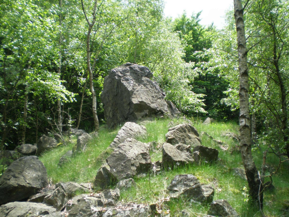
Žďár is a forested hill rising 629 meters above sea level near Pavlovsko, a village that belongs to the municipality of Dobřív in the Rokycany district of the Plzeň (Pilsen) Region, roughly 4.5 km east of the town of Rokycany. The hill towers 150–200 meters above the surrounding landscape and forms the dominant feature of the Trhoň nature park, with rocky, steep slopes especially on its northern side.
How do you get there?
The easiest approach is by car to Pavlovsko or the neighboring village of Dobřív, both of which give access to marked footpaths leading to the summit. Two waymarked hiking trails cross the top of Žďár: a red trail connecting Rokycany with Holoubkov, and a yellow trail running between Svojkovice and Dobřív. This makes it easy to combine a visit to the summit with a longer loop hike starting from any of these villages. The climb from Pavlovsko is the shortest option, though it follows the steeper, rockier northern flank.
What will you see at the top?
The summit and upper slopes of Žďár are protected as a nature reserve, safeguarding rocky terraces, scree fields, and the rare vegetation that has taken hold on these sun-exposed, hard-to-reach rock formations. That makes the walk up worthwhile for nature lovers as much as for the view.
The hilltop also holds an archaeological site — a prehistoric hillfort believed to have been fortified during the Late Bronze Age and later used through the Late Hallstatt period, and possibly into the La Tène period as well. The fortified settlement consists of an outer and an inner section (the acropolis), both originally enclosed by stone ramparts. The rampart around the smaller inner hillfort is better preserved, and its outline still lets visitors trace the shape of the ancient defensive settlement.
Near the very top, look for a small cairn of stones stacked around a tree trunk, as well as a box containing a summit logbook — a traditional feature on Czech hills and mountains where hikers record their visit after reaching the top.
When should you visit?
Žďár can be visited year-round, and reaching the summit is free and unrestricted. The best months for a hike are April through October, when the rocky terraces and scree fields are dry and safe to explore, and when the open sections of the slope offer the clearest views. In spring and autumn the summit is often wrapped in mist, adding an atmospheric touch, particularly around the old hillfort ramparts. In winter, the rocky northern approach can become slippery, so the gentler route from the Dobřív side is the safer choice.
Frequently asked questions
How high is Žďár? The hill reaches 629 meters above sea level and rises 150–200 meters above the surrounding terrain.
Is there an entrance fee for the summit? No, the summit is freely accessible year-round at no cost.
What is on top of the hill besides the viewpoint? A prehistoric hillfort with outer and inner defensive ramparts, plus a nature reserve protecting rocky terraces and scree fields.
Which trail is best for reaching the summit? A red trail (Rokycany–Holoubkov) and a yellow trail (Svojkovice–Dobřív) both cross the summit, making it easy to plan a longer hiking route through the area.
Nearby places

Earn badges for the places you visit
Download NextOnTrip, discover new places and check off your trails.